Clinton Chapel Cemetery
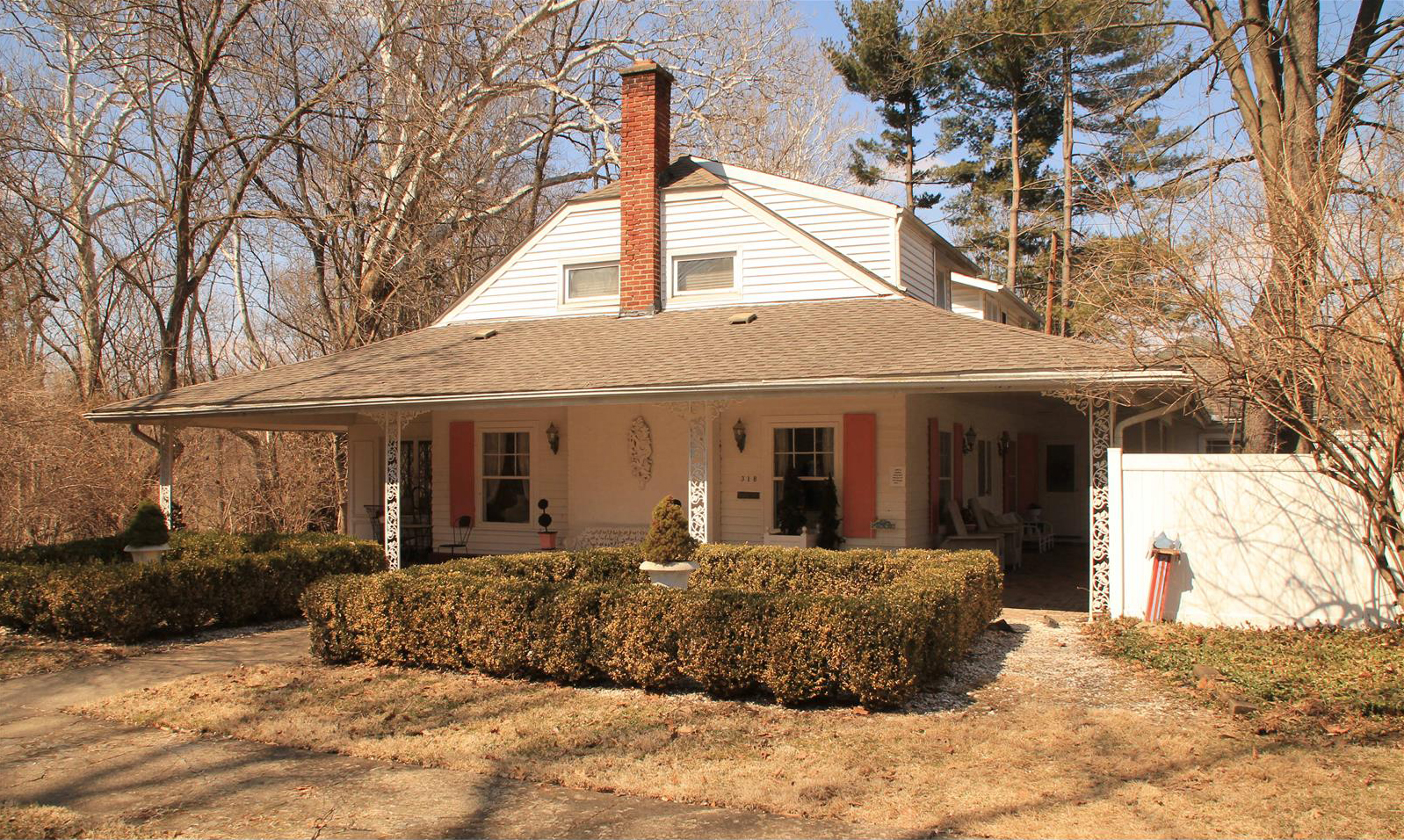
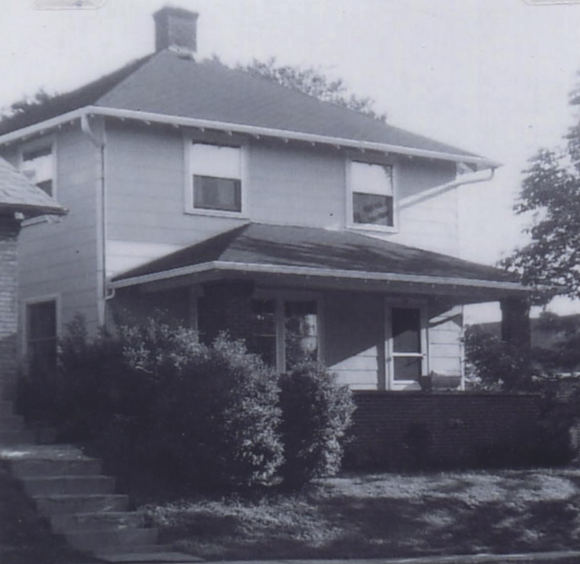
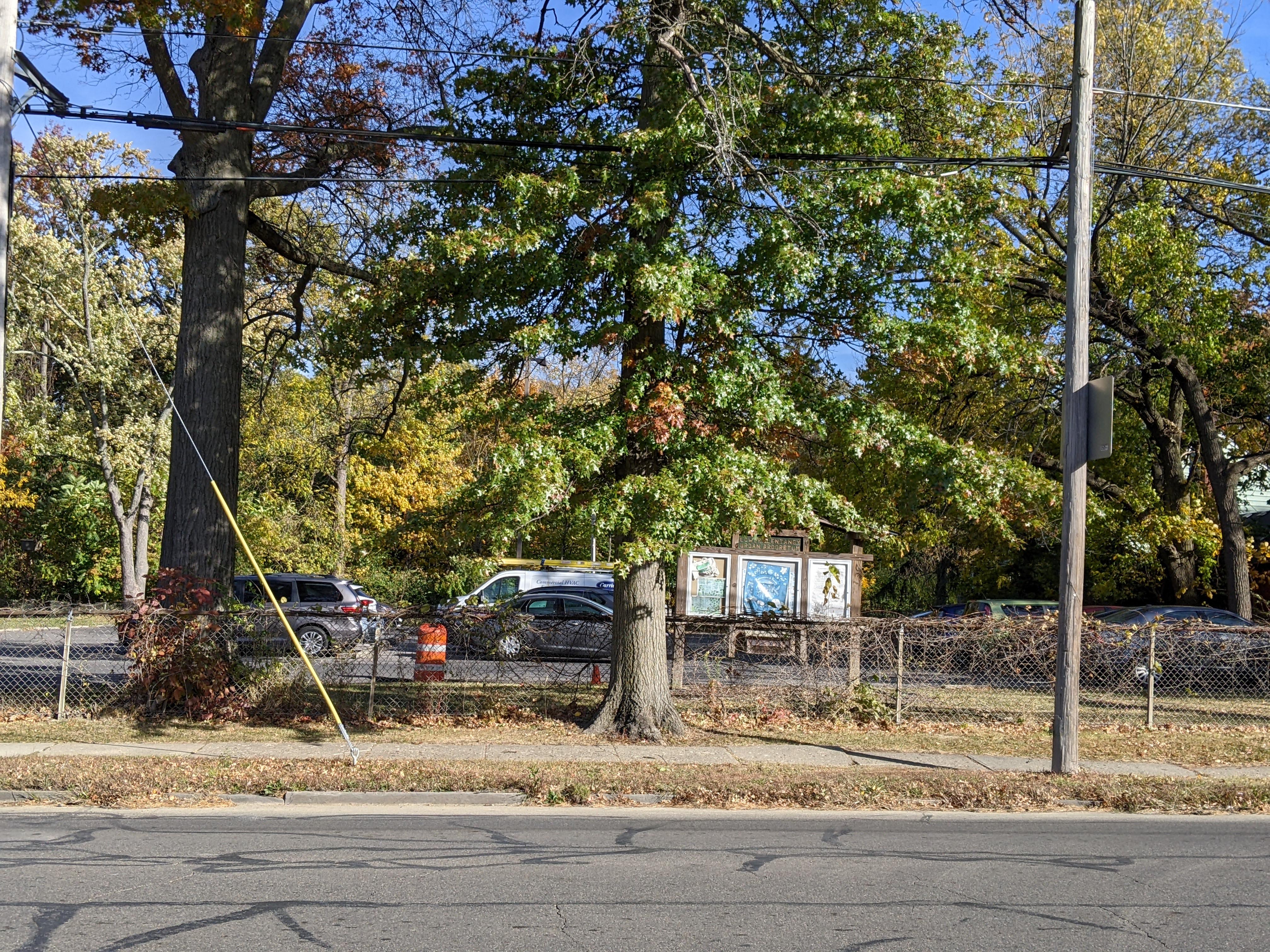
 Joe Smith alerted me that part of the Good home, at 45 East California, (just east of the former Southwick Good & Fortkamp Funeral Chapel) is on the market. You can see it here.
The photo accompanying this post is a recent satellite view with the 1910 Baist map overlaid. Joe has asked me to post the following message:
[Post courtesy of Joe Smith]For the first time in 80 years, the eastern half of the old Clinton Chapel Cemetery is for sale. (The rest of the former cemetery is under the BFA school parking lot.) I would love to buy the land (have the house moved) and give it back to Clintonville as a public-use memorial garden. But I need your help!
I am trying to connect with everyone I can who has relatives originally buried there (at least 14 of mine were!). Following is a list of those surnames as they appear on Lauren Clark’s Central Ohio Grave Search website:
Smith (12)
Bull (7)
Kiner (6)
Webster (5)
Loy (4)
Tripp (3)2 each for:
Bacon, Boyer, Cline, Coe, Ferguson (or Furguson), Field, Hunt, Mock, Moon, Sawyer, Weber, and Wilson1 each for:
Beckley, Brevoort, Cole, Crick, Crowhurst, Haddock, Johnson, Labur, Meteer, Moore, Newfer, Piatt, Price, Ramsey, and RottermanIf you or someone you know is related to anybody originally buried at Clinton Chapel Cemetery between 1823 and 1878, I would love to hear from you! Email me at jwsiv99 @ yahoo.com. I also have tons of additional historical information about these sacred grounds to share.
Beth Tikvah in Clintonville
I recently learned that Congregation Beth Tikvah–a synagogue currently located at 6121 Olentangy River Rd in Worthington–was once located at 3392 North High (southeast corner of North High and East North Broadway). The congregation met there from July 1962 until development plans for that corner required that they move. According to this February 1968 news article, they located a building to purchase after much hunting and just in time. In March they moved to 3199 Indianola until they built a new larger synagogue in 1981.
The 3392 N High assembly-house location was a house that was torn down to make way for an office building–this is the current white office building at 3400 N High. I do not have any pictures of the older Beth Tikvah building but would love one!
Here‘s a very nice history of Beth Tikvah written by one of its members and past presidents Marty Seltzer.
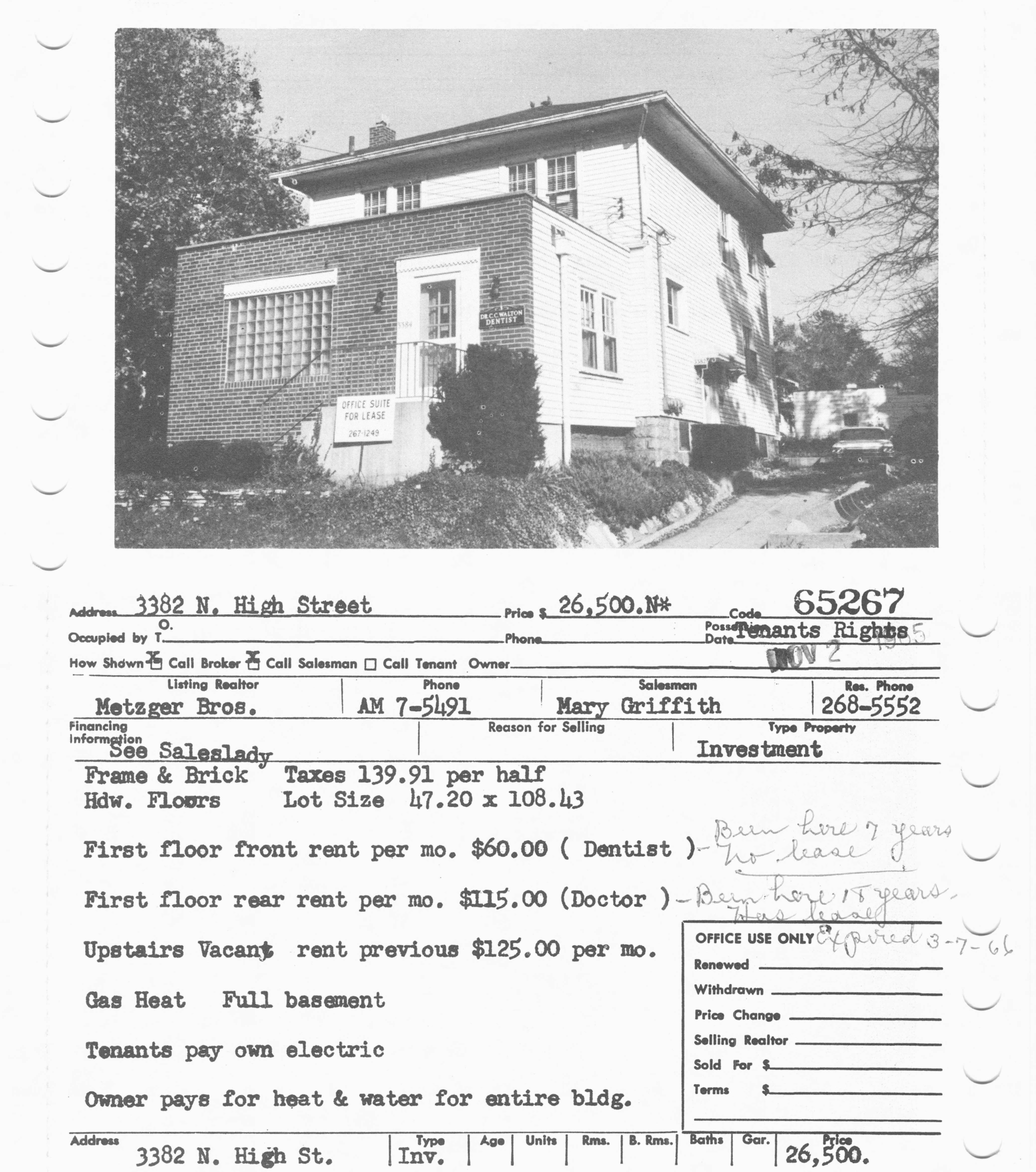 As a small sidenote: this is another location near that corner, probably also torn down to be replaced by the larger white brick building. This is a 1965 picture of a building at 3382-3384 North High, 1 or 2 doors south of the Beth Tikvah assembly house. It housed a dentist in the front, a doctor in the back, and also had space upstairs for another professional.
(Newspaper articles courtesy of the Columbus Dispatch and accessed from the Columbus Metropolitan Library’s NewsBank database. The 3384 N High photo is from the library’s MLS database. The synagogue shared their history with us.)
Tropicana Record Bar (3361 N High)
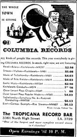 On November 10, 1945, Lloyd Hinton–the owner of Clintonville Electric–opened the Tropicana Record Bar at 3361 North High. It was described as having “a continental atmosphere… with four recording rooms each complete with custom-built high-fidelity sound equipment.” Another description called it a “tropical motif with cabana style wall settings and palm trees completing an atmospheric layout” with 5 listening rooms. The store sold records and record players, and hosted music celebrities for signings and photo ops.
Unfortunately in September 1953, a raging fire destroyed the Tropicana Record Bar and the restaurant next door. It began in the basement and became an intense fire, “felling” 15 firemen (all of whom survived). Lloyd Hinton owned the record business and said his loss was estimated to be $5000 (several thousand records). The owner of the buildings (Sam Spandos and his brother) stated the property was almost a total loss.
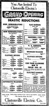 In March 1954, Hinton announced the opening of a new sales room for Clintonville Electric Appliances at 3361-3363, taking over the spaces after the fire destroyed the businesses at those addresses.
(Images courtesy of the Columbus Dispatch, accessed via the Columbus Metropolitan Library’s NewsBank database. Specific citations can be found by clicking through each link.)
Clintonville Electric
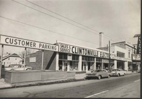 In my previous post, I described the progressive “takeover” of the addresses 3361 North High through 3367 North High, by the business Clintonville Electric [Appliance] Store. Lloyd Beaman Hinton owned that business.
From the library:
Lloyd Beaman Hinton (6/3/1904 – 4/18/1994) is said to have founded Clintonville Electric Company in 1939. Hinton was an appliance salesman in Springfield, Ohio before moving to Columbus and becoming manager of Clintonville Electric at 3367 North High. He ran and expanded the business for 20 years until his stepson, Phillip William Karshner (6/1/1934 – 7/9/2022) took over. Karshner retired in 2004 and sold the business to Paul Holmes, Scott Jester and Tom Cover. The store moved to 2136 Bethel Road the same year and was closed in 2008 due to bankruptcy.
Some very nice photos can be found on the Columbus Metropolitan Library’s web site here. You’ll see photos of the founder Lloyd Hinton, and employees, as well as some terrific pix of the interiors and exteriors of the business.
In 1945, Lloyd Hinton lived at 35 West North Broadway (but it seems he was renting that home) and later at 541 Walhalla (and eventually on Teteridge.)
(Link courtesy of The Columbus Metropolitan Library, Local History & Genealogy Dept.)
3361-3367 N High
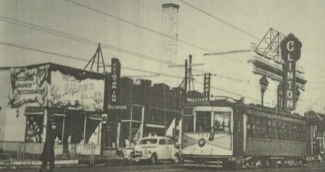
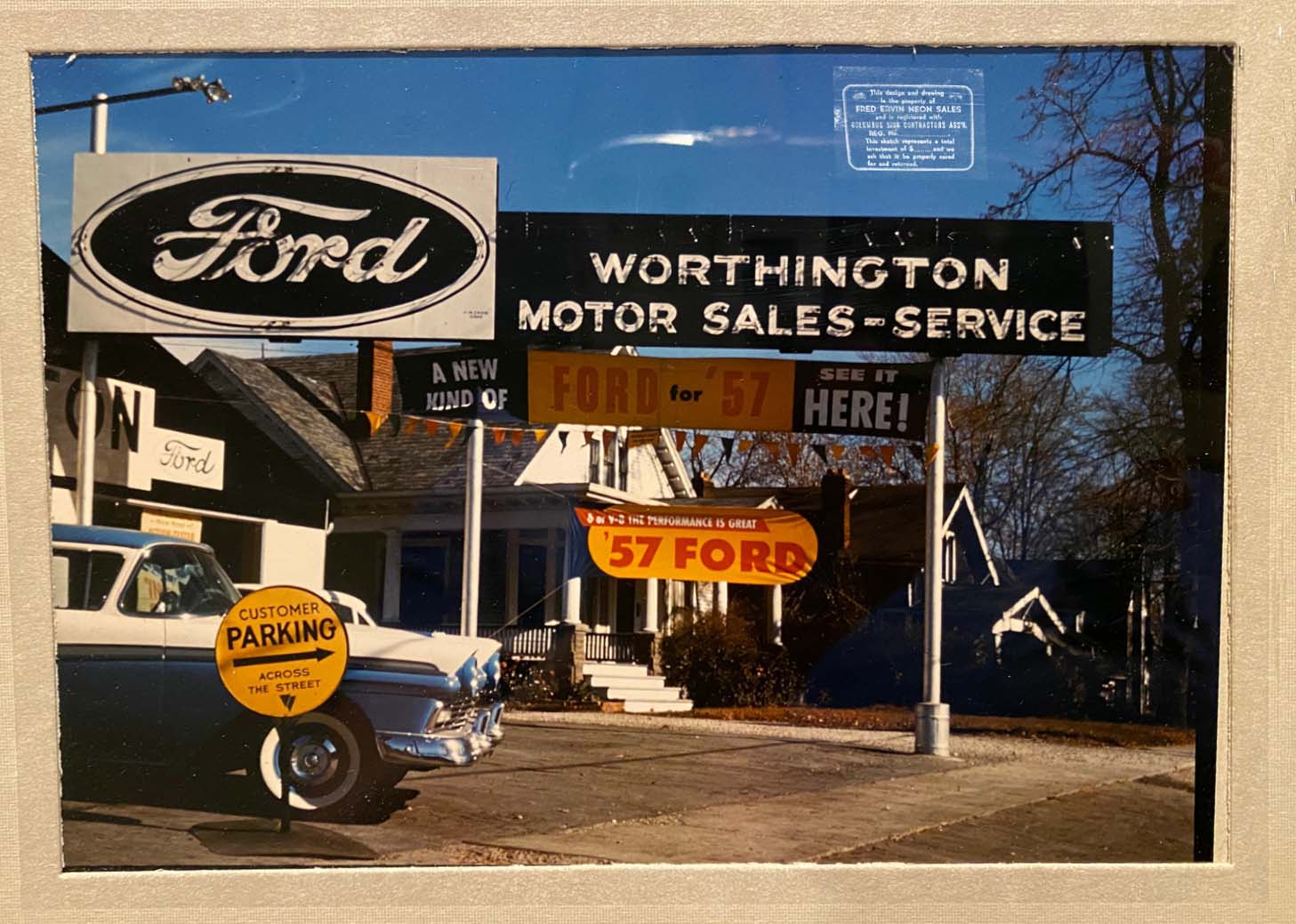
This is a terrific picture of the 3361-3379 block of North High Street. To the left (south), at 3361 N High, is the Tropicana Record Bar. Next to that at 3363 N High is the Clinton Inn Restaurant. 3365 N High was occupied by J. L Oelgoetz Plumber; 3367 N High by Clintonville Electric. Then there are 2 more addresses (hidden behind the streetcar) to the south of the Clinton Theatre; one was a real estate broker and the other a beauty shop during this era. The Tropicana Record Bar opened in 1948, as a branch of Clintonville Electric. It burned down in 1953, along with the Clinton Inn Restaurant next door. So, the photo was taken between 1948 and 1953.
Real estate-wise, 3361-3367 N High are part of the “Chesnut Addition” (platted in 1895); the theatre at 3379 N High is part of the “John R Dunlap North Broadway Extension.” The first building shows up at 3361 N High in 1920 according to the 1920 Baist Real Estate Atlas for Columbus, but no buildings at 3363 or 3365 do. I cannot determine exactly when the other buildings were put there but they are there by 1936.
There were originally 2 additional addresses immediately north of the Brighton Rd intersection, at 3355 and at 3357 North High. I think this was a bungalow house based on a glimpse of the edifice in a very old photo.
The ownership of the lots and businesses at 3361-3379 is complex. My short version is that as early as 1933, Frances Webb leased a building at 3361 N High to Sam Spandos (aka Spiros Spantithos). (I’ve written about Sam elsewhere.) Sam got a beer license for the place in April, 1933. In 1934, Sam, age 48, pleaded guilty to selling beer after 1:00 a.m., and he had some skirmishes with the law over dancing on Sunday, so that might give you some flavor of the 24-hour nightclub. In 1934 his restaurant was called the Oakland Park Restaurant. In 1935 Sam “took over the adjoining storeroom.” Upon Frances Webb’s death in ~1936, Sam purchased or inherited the property. (The value of the property went up in 1936, so I assume Sam improved the lot.) From 1936-42 the business at 3361 and 3363 N High was called the Sam Spandos restaurant; in 1944-45 the addresses were called Lee’s Restaurant; in 1946, 3361 N High was taken over by Clintonville Electric Appliance Store, and 3365 N High continued as a restaurant. By 1954, both addresses became Clintonville Electric.
3365 N High was occupied by J.L Oelgoetz Plumbers from 1924 to at least 1956; by 1967 it was Clintonville Electric.
3367 N High was M. Cupp & Sons Hardware from 1924-1929, and Metzger Electric Shop from 1929-1939. After that, it became Clintonville Electric.
I’ll write more about these businesses in subsequent posts.
(Loraine Wilmers, from the Local History & Genealogy desk of the Columbus Metropolitan Library, gave me considerable assistance with the research about this span of addresses.)
Spiros Spantithos
 I enjoy immigrant stories so thought I’d share the story of former Clintonville resident and business owner Spiros Spantithos, aka Sam Spandos. I’m piecing this story together from public records, so I may be wrong in the details and would be happy to be corrected or to receive more information!
Spantithos is the original owner of the building(s) that eventually housed Clintonville Electric.
Spantithos was born in Sparta, Greece, on Feb 15, 1884, and came to this country in 1902. In 1912 he returned to Greece and stayed until 1921, during which time he served 8 months (or perhaps 8 years, depending on the source) in the Greek army. Greece was involved in several wars during this time–the Balkan wars with Bulgaria, and a war with Turkey. I’m not sure when Spantithos married, but on this first trip home to Greece he fathered 2 sons and a daughter.
He returned to the States in 1921, and became a naturalized citizen around 1926, at age 42. Spiros names two boys on his 1926 naturalization papers—-George, age 8 [sic], and Demetros, age 6, both in Greece. His naturalization papers do not mention his wife, Nicoleta Sicaras, nor his daughter. Neither his wife nor his daughter seems to have come to the States. (Nicoleta does have a record in the Social Security Applications and Claims Index 1936-2007.) His son George came to the States in 1935 at the age of 19.
Spantithos’ U.S. draft card states he lived at 18 West Brighton (he lived there along with his brother James), and he purchased 3361 N High in November 1936. That is where he and his brother opened the Oakland Park Restaurant. (He got a beer license for his restaurant at 3361 N High in 1933, and he leased the space before he purchased it.) On occasion the 24-hour restaurant, or nightclub, had skirmishes with the law–notably for Sunday dancing (!!) and for serving alcohol after hours. He also leased an adjacent “storeroom.”
In 1938-39, Spantithos returned to Greece for a 7-month visit, and this was the first time he saw his daughter, who was by then 17 years old. I found Spiros’s name on a passenger list for a ship arriving in NY from Italy, 6-Jul 1939, and travelling back to Europe with son George and George’s wife Susan in 1951, but again, no mention of his wife. In the 1940 and 1950 censuses, he is listed as married but his wife Nicoleta isn’t listed in his household.
Spiros died in November 1970.
His son George (born Jan 25, 1920 [sic] in Sparta Greece) assumed ownership of 3361 N High, in 1972 after Spiros died. He and his wife Susan had purchased property at 4469 Rosemary Parkway in 1953 and lived there until George died in February 1994. I believe it was George and Susan who accumulated the additional properties in the Spantithos portfolio, including, for awhile, The Blue Dube.
(Newspaper clippings courtesy of the Columbus Dispatch, accessed through the Columbus Metropolitan Library’s NewsBank database. Detailed citations can be found on each clipping by clicking through their links.)
Holiday Greetings
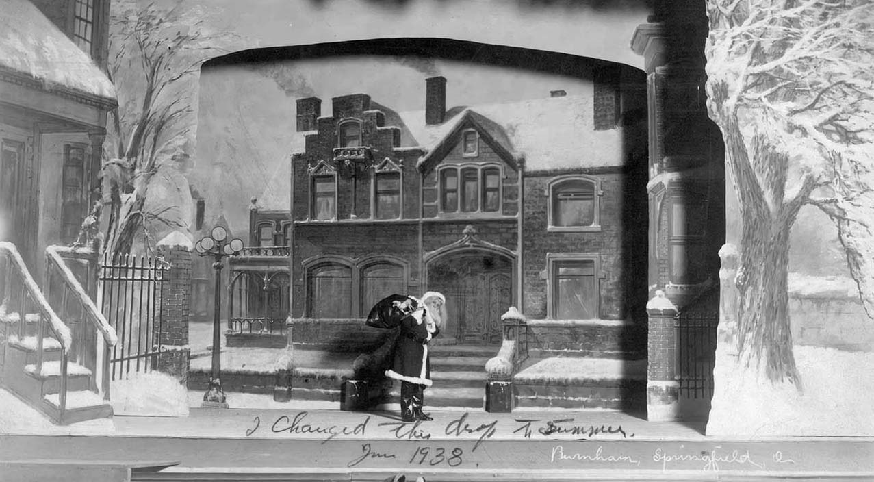
Painting by Mathias Armbruster, courtesy of the Mathias Armbruster Scenic Studio Collection at OSU, and taken from WOSU’s Broad and High clip about Mathias Armbruster’s studio.
Duffy’s Tavern
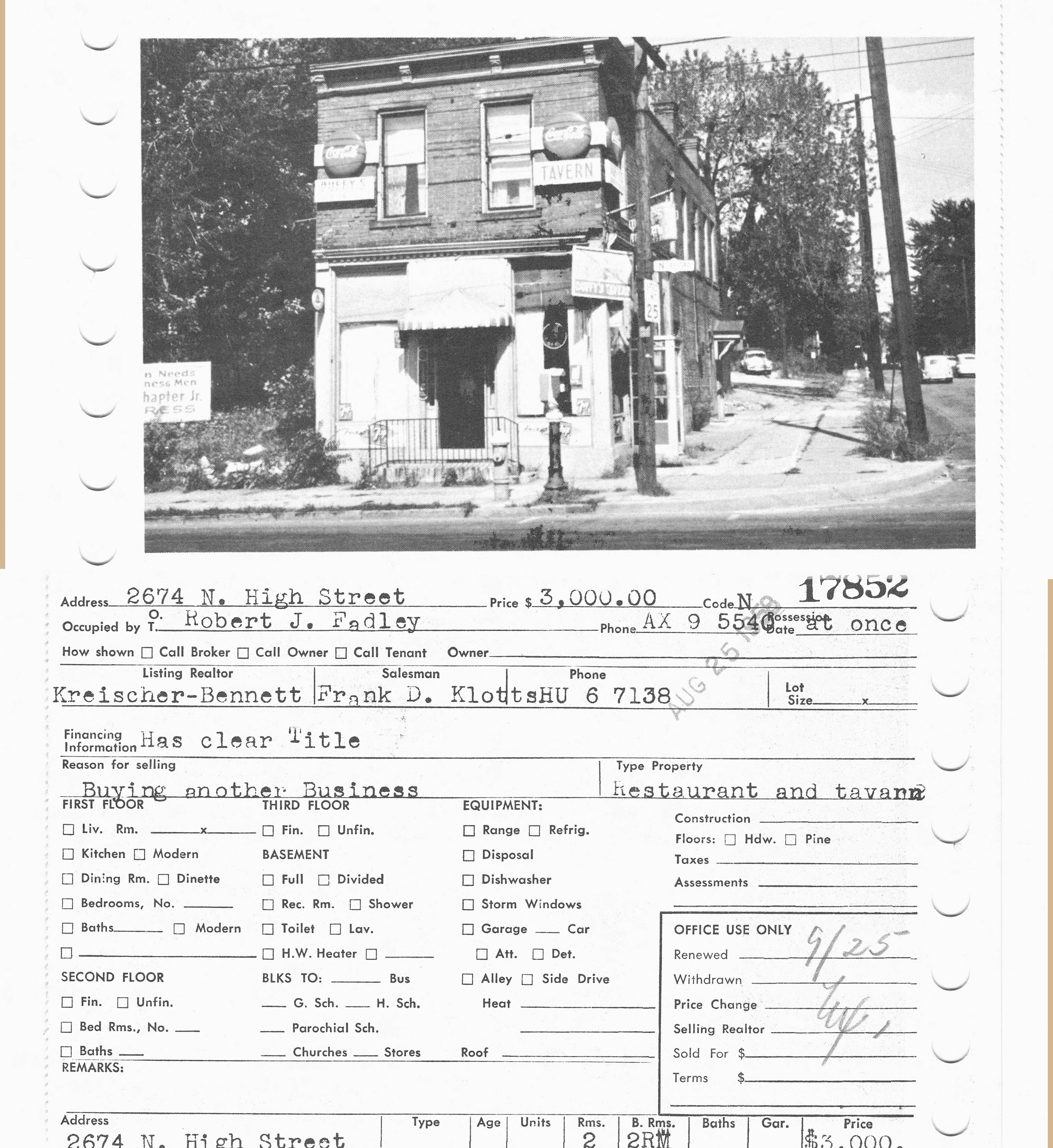
Wow, what a picture of the northeast corner of Dodridge and N High, where CVS Drugstore is today! This photo of 2674 North High was taken in 1959. Duffy’s Tavern had several owners over the years; in 1959 it was owned by Robert J Fadley and in 1947 it was owned by V. G. Hillon. In 1937 it was called Barney’s Grill. I believe it was a restaurant going back to at least 1924, as I found several “waitresses needed” ads in the Columbus Dispatch for the “Crouse American Restaurant” at 2674 North High, in 1924.
When Duffy’s Tavern was sold in 1959, it became a Coin-O-Wash.
I did find some classified ads in the Columbus Dispatch for horses from Kellar stables at this address as well between 1905 and 1911, so the stables probably occupied both east corners of Dodridge and North High.
(Photo courtesy of the Columbus Metropolitan Library’s MLS real estate collection.)
Oakland Park & N High, 1922
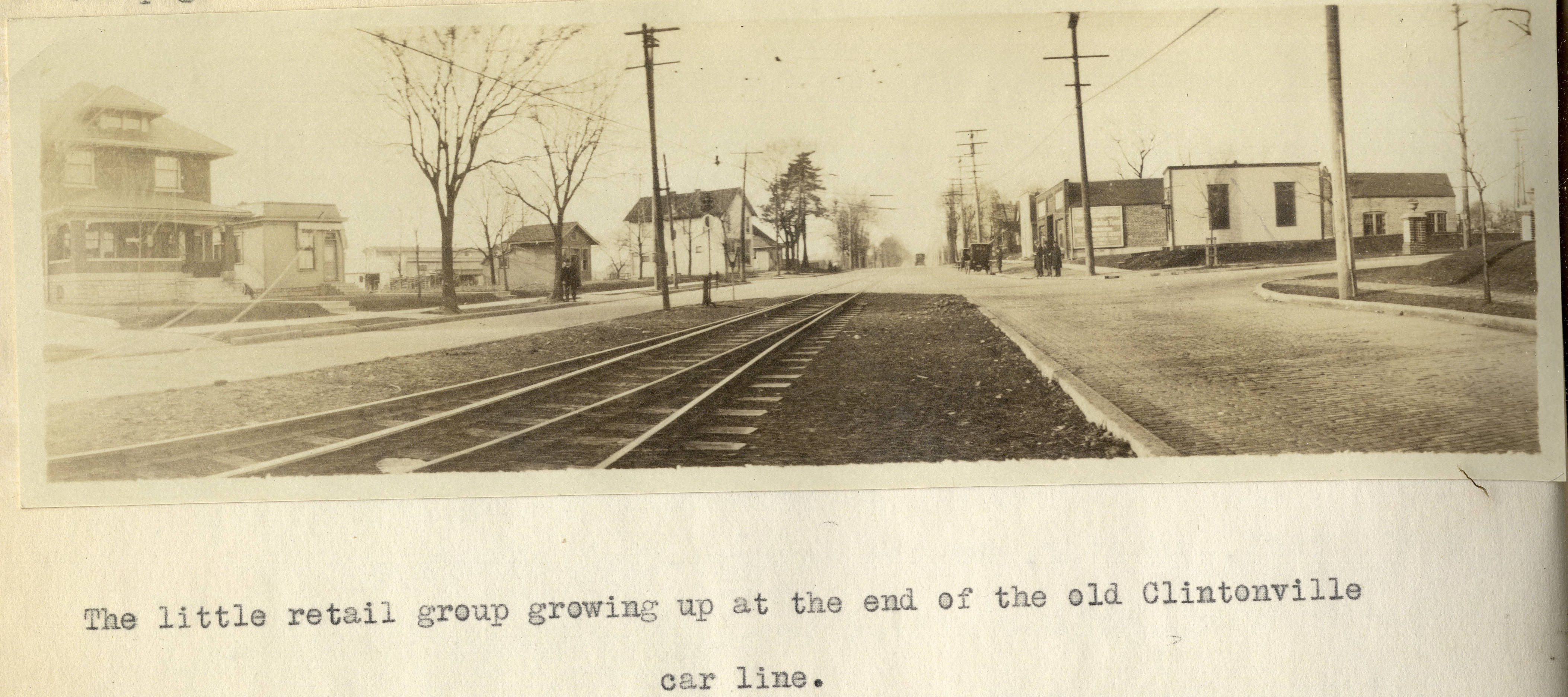
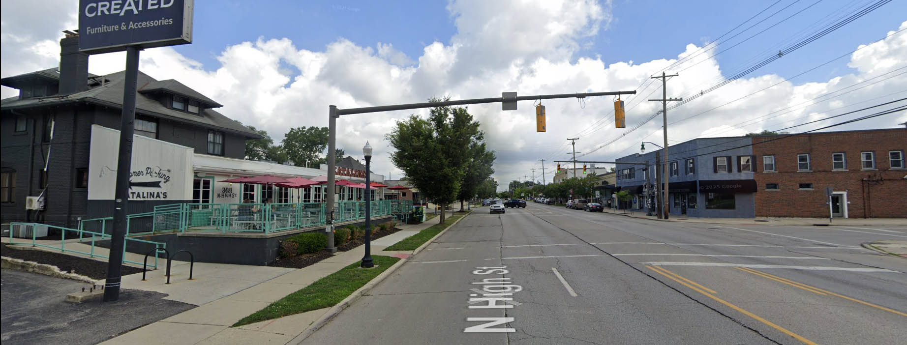
I’ve previously mentioned Forest Ira Blanchard’s wonderful master’s thesis, which is a treasure trove of photos of Columbus in 1922. It contains this old photo of Clintonville at the intersection of Oakland Park and North High in 1922. The house on the left, west, side of North High Street is still with us! Here’s that same intersection today.
Here’s Blanchard’s accompanying text:
Beyond Hudson Street to Arcadia Avenue, High Street is about solidly lined with small, but unattractive store rooms, this being the business section of the old, formerly outlying, hamlet of North Columbus. Here, at the corner of Arcadia and High is located the car barn and the end of the High Street car lines. Until recently, from this corner, through Clintonville, the Clintonville line and the Columbus, Delaware and Marion Interurban cars furnished the transportation service; now, the former line has been superseded by an extension of the Summit Street line. At the center of the former suburban village of Clintonville , where Clinton Heights Avenue joins High Street a small retail center has grown up, which is extending northward on High Street , a short distance . At the end of the Clintonville car service another little business center is coming into existence, incidentally the cross street here, Oakland Park Avenue , is a through one into the country to the east . This point not only ends the city car service out North High Street , but the retail stores as well , which is instructive as to the influence of such transport service upon the location of retail stores.
Such residences as are yet found along the High Street electric lines are not as good, on the whole, as those back of them away from the noise of the cars .
Alex Campbell has kindly provided a bit of background information on the transportation systems mentioned in Blanchard’s document:
When the line north of Arcadia was trackage for the CD&M, up to about 1922, it was single track from Arcadia to Tulane Rd than double track to Kenworth Ave. From Kenworth Ave north, it returned to single track with four passing sidings located between Kenworth Ave and Worthington. Between Tulane and Kenworth, the double track was in the center of High St. separated from the paved road. I’m not sure what you call that – a boulevard?? (I suspect you know all this. I just wanted to be on the same page.)
This drawing of the 1925 CRP&L Co. trackage by BJ Kern is what I am using to back up what I’m describing.
In Blanchard’s photo, the end of the double track is visible, which indicates that we are either at the north or south end of the double track. If it were the south end, you would expect to see more trees and maybe even Olentangy Park in the distance – it’s not the south end. That leaves the north end of the double-track.
Oakland Park tees into High Street from the east. The fancy and inviting brick columns suggest the developers have been busy. Kenworth would come from the west, slightly south of Oakland Park, if it even gets as far as High Street. In either case, it isn’t visible.
Blanchard refers to this photo location as “the end of the old Clintonville car line.” I think he is referring to the predecessor of the CD&M, the Columbus, Clintonville & Worthington Street Railway. The double track section must have been built by the predecessor, not the CD&M. The CC&W was itself the joining of two traction lines, and this is where the two joined.
Thank you Alex!
[Courtesy of Forest Ira Blanchard, An Introduction to the Economic and Social Geography of Columbus, Ohio. Thesis (M.A.), Ohio State University, 1922, page 38. Blanchard lived from 1886 to 1963.]How Clintonville Electric Has Changed!

The buildings along North High Street between Brighton and West North Broadway have engendered a lot of interest in recent years…and again recently as the final Clintonville Electric building is slated to come down. Joe Smith created a terrific animated GIF of photos showing how the span of buildings along 3361-3379 North High Street has changed. Click on the image above to watch. Thank you Joe!
[Recent photos courtesy of Google Street View; pre-1980 photos are from the Columbus Metropolitan Library. Animation and all the labor involved are courtesy of Joe Smith.]Whetstone Library Turns 40
 Preston Harmon had a very nice article about the Whetstone Library, in the July 2025 issue of the Clintonville Spotlight. Click here or on the photo above to read the article.
Our library is an exceptional community resource. Don’t forget to donate to it! Happy birthday, library!
[Photo and article courtesy of the Clintonville Spotlight.]3141 Silver Drive Looking North

This is a nice photo from a 1922 Ohio State University masters thesis by Forest Ira Blanchard. I believe, based on the metadata, that it was taken at 3141 Silver Drive and the panorama photo is captioned, “Possible industrial sites along C.A. and C.-looking north” [i.e. the Cleveland, Akron & Columbus Railway]. The houses that you see to the left (west) of the railway tracks may well be East North Broadway.
There is a white pole near the tracks on the right side. That would be the whistle sign letting the engineer know it’s time to start his whistling for the crossing ahead.
Blanchard, inspired by the Chicago School of Sociology, sought to study the racial and ethnic composition of the city of Columbus, with a particular focus on the role of transportation (railroads, roads) in shaping the urban landscape.
[Courtesy of Forest Ira Blanchard, An Introduction to the Economic and Social Geography of Columbus, Ohio. Thesis (M.A.), Ohio State University, 1922; digital version from City of Columbus Historic Map Collection.]Clintonville Electric Building, 3363 N High
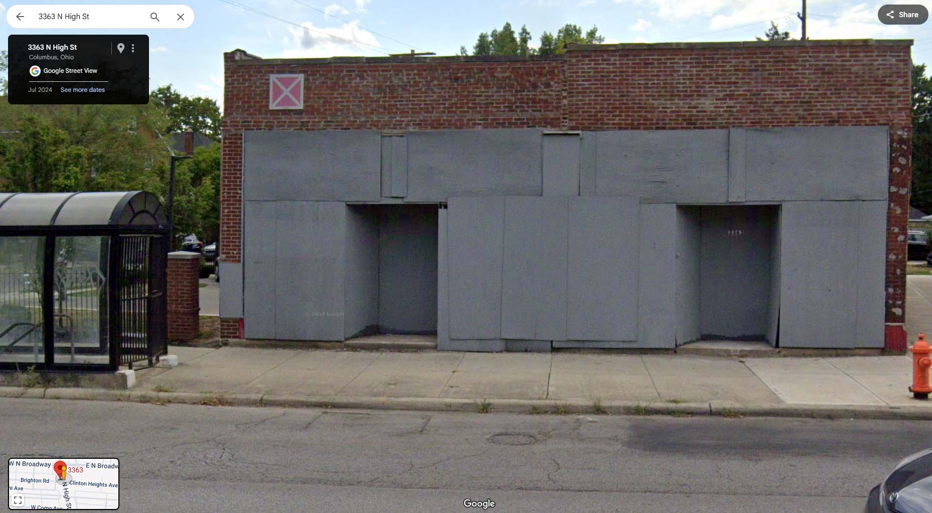 I’m delighted, and also sad, to learn that the derelict building that once housed Clintonville Electric is now in receivership. Why sad? The business most recently in that location was beloved by Clintonville residents; virtually everyone bought their appliances there. The original business owners were good citizens of their community. All that changed when the business changed hands and in 2004 left Clintonville (and subsequently went bankrupt, cheating half-dozen of its customers). Rumor has it that the property owners–who owned the properties from at least 1936 to the present day– simply declined to either sell or to fix up the buildings, yet kept the city from condemning it. I’ve heard that this building’s roof had a hole in it, and the water coming in caused the ground-level floor to collapse into the basement.
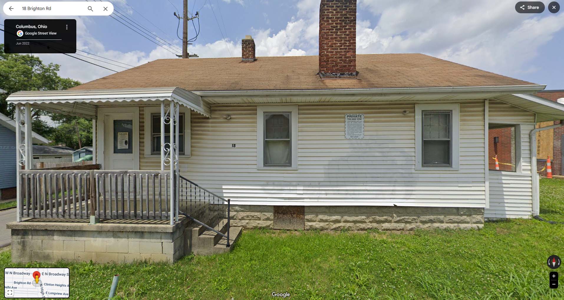
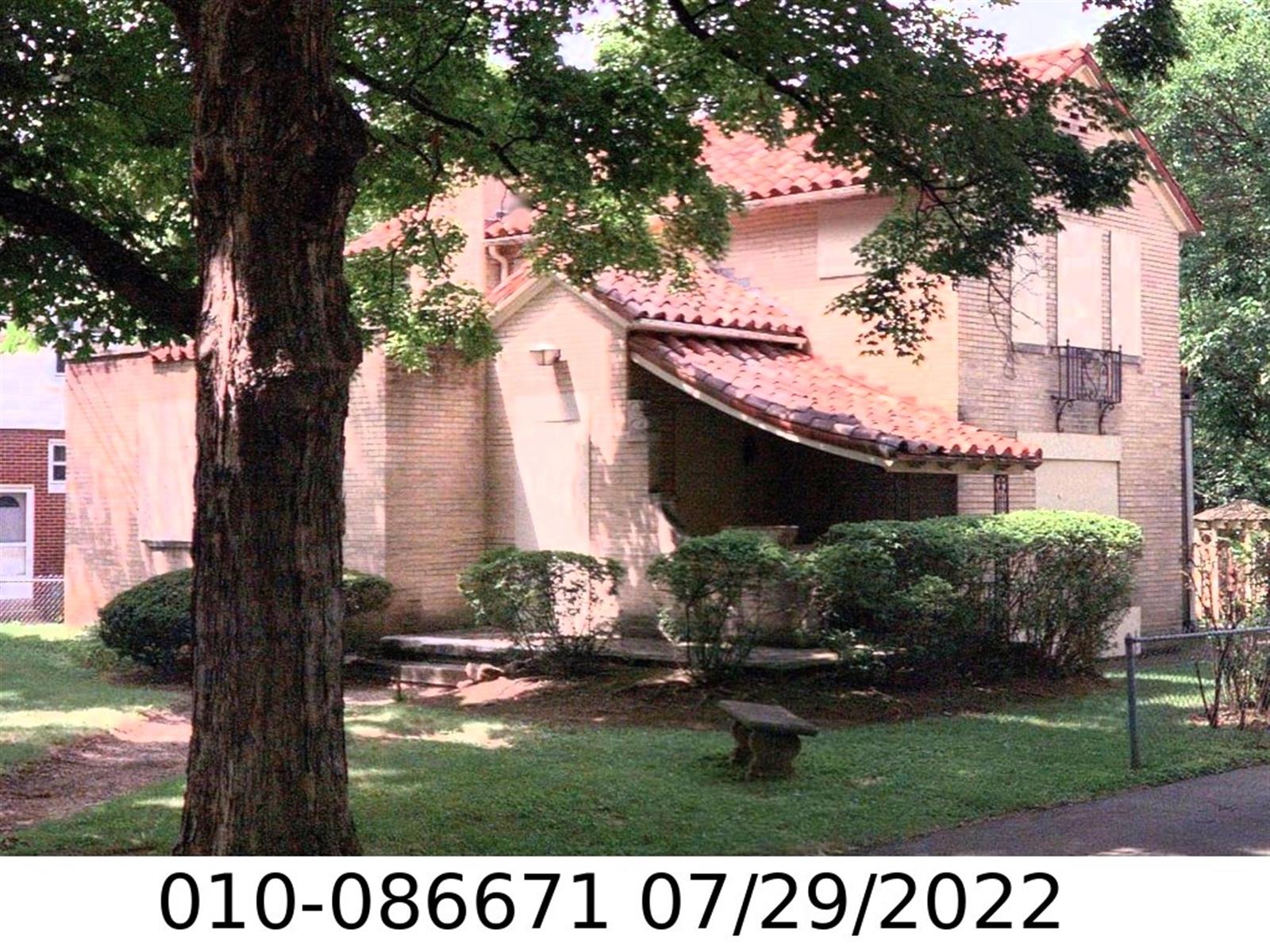
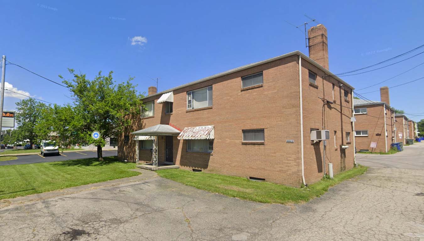
The family that owned the Clintonville Electric building owned a handful of other buildings that are so neglected that they affect the neighborhoods in which they are situated. The following Clintonville buildings have been put into receivership:
- 3361-3363 North High Street, Columbus, Ohio, Parcel No. 010-010845-00, shown above, which also includes
- 18 West Brighton;

- 4469 Rosemary Parkway, Columbus, Ohio, Parcel No. 010-086671-00–a lovely house that has also been allowed to go down hill;
- 4994 A North High Street;
These following buildings have also been put into receivership. I know nothing about their condition and some have business occupants unrelated to the landlords.
- 1101 Folkestone Road, Columbus, Ohio, Parcel No. 010-129831-00;
- 4480 Kenny Road, Columbus, Ohio, Parcel No. 010-136767-00;
- 4450-4454 Kenny Road, Columbus, Ohio, Parcel No. 010-129882-00;
- 4460 Kenny Road, Columbus, Ohio, Parcel No. 010-013993-00;
- 5701-5707 Maple Canyon Drive, Columbus, Ohio, Parcel No. 010-115253-00
Some legal documents about the case can be found on the Franklin County Court of Common Pleas. Two are linked here and here.
I’ll write about the businesses that occupied this space, in upcoming months.
Good News, Bad News
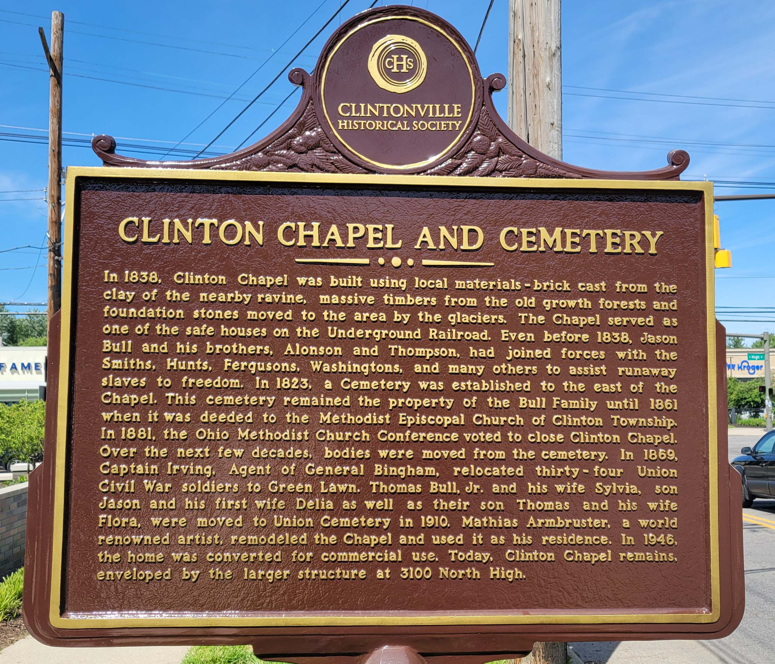
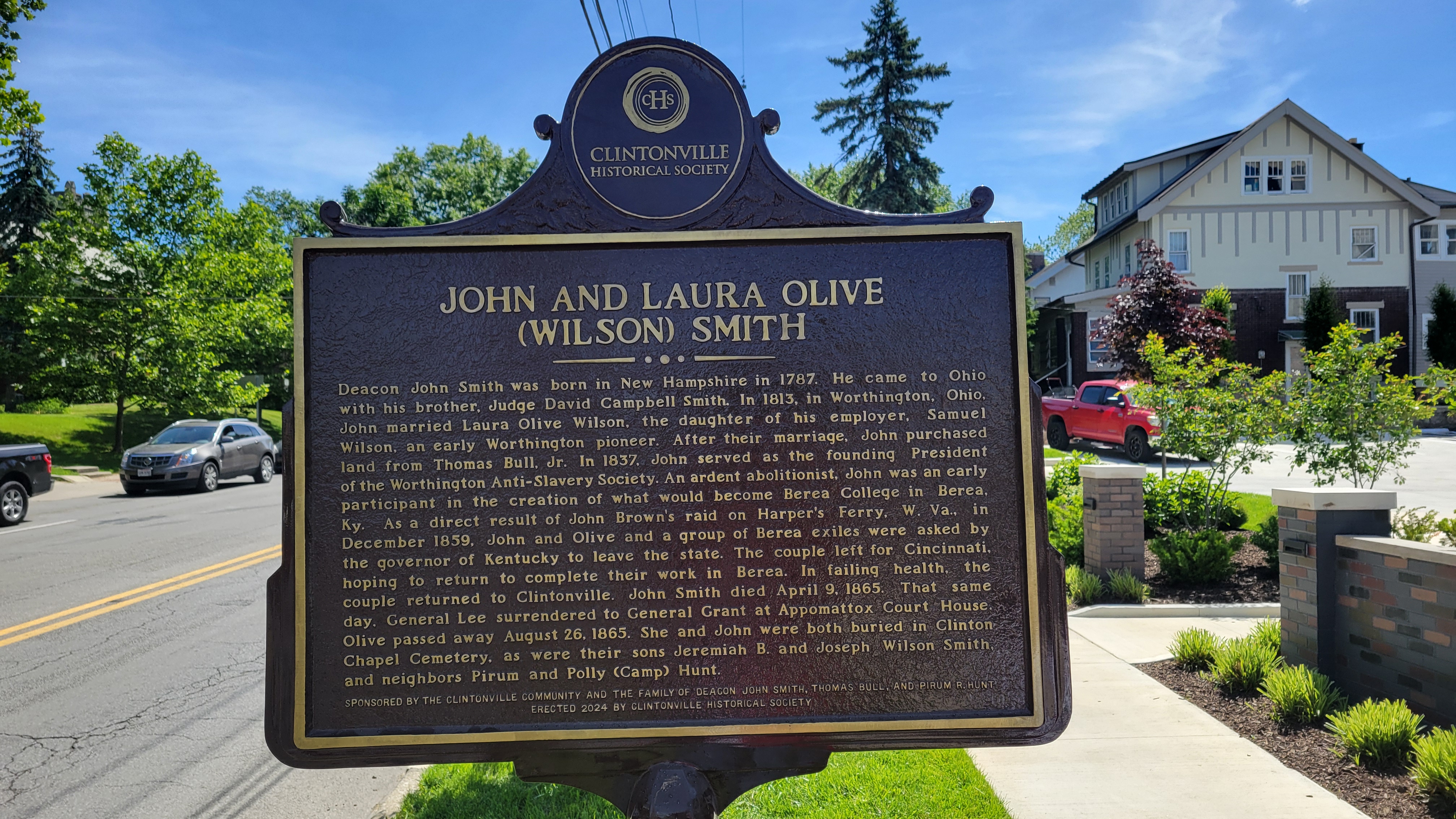
On the bright side: Clintonville Historical Society has erected a new plaque for the Clinton Chapel and for John and Laura Olive (Wilson) Smith near the corner of East North Broadway and North High. It gives us pause to remember slaves and slavery in the Unites States and to give thanks to the people who fought against it.
On the bad news side: it’s very unfortunate, from my perspective, that 12 staff were recently laid off from Ohio’s Historic Preservation Office. The federal government mandates that every state must have this sort of office, and to accompany that mandate they give the offices some money to fulfill their mission. That money was apparently withdrawn by DOGE and so Ohio History Connection had to terminate staff. Here’s a link to a newspaper article about the staff terminations.
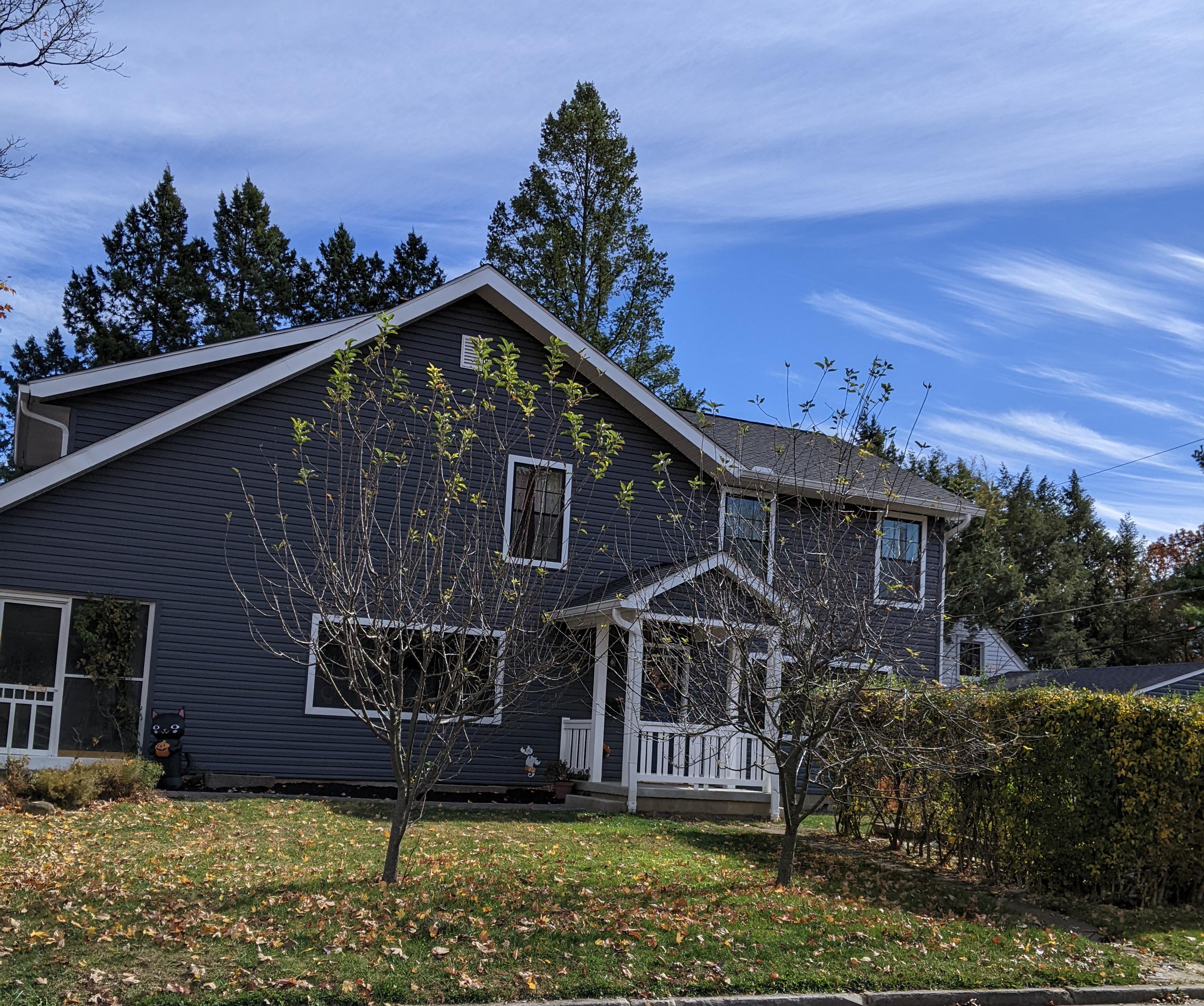
[Photos courtesy of Joe Smith.]Bill Good, 1946 – 2025
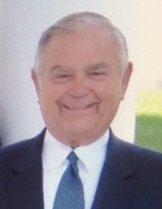 I was very sorry to recently learn of the death (in February 2025) of Bill Good, former owner of the Southwick-Good & Fortkamp Funeral Chapel. This funeral home, at 3100 N High, was located at the site of Clintonville’s Clinton Chapel, which later became the home of Mathias Armbruster, became a funeral home in 1938, and is currently a day care center.
I met Bill when I was working on my Clintonville and Beechwold book. He was a devoted caretaker of the building in which his funeral practice was located, knowledgeable about its architecture and history, and respectful of the entire property. He even made sure that expert wall builders were called in the rebuild the property’s perimeter wall, at considerable expense. He was always willing to share his knowledge, and was patient even as he had to explain to me what an “adze cut” is. He had civic pride and was pleased that the building served as a polling place each election day. More personally, he graciously advised me in planning for the funeral of my mother-in-law. I am grateful. I remember Bill fondly and extend my condolences to his wife and family.
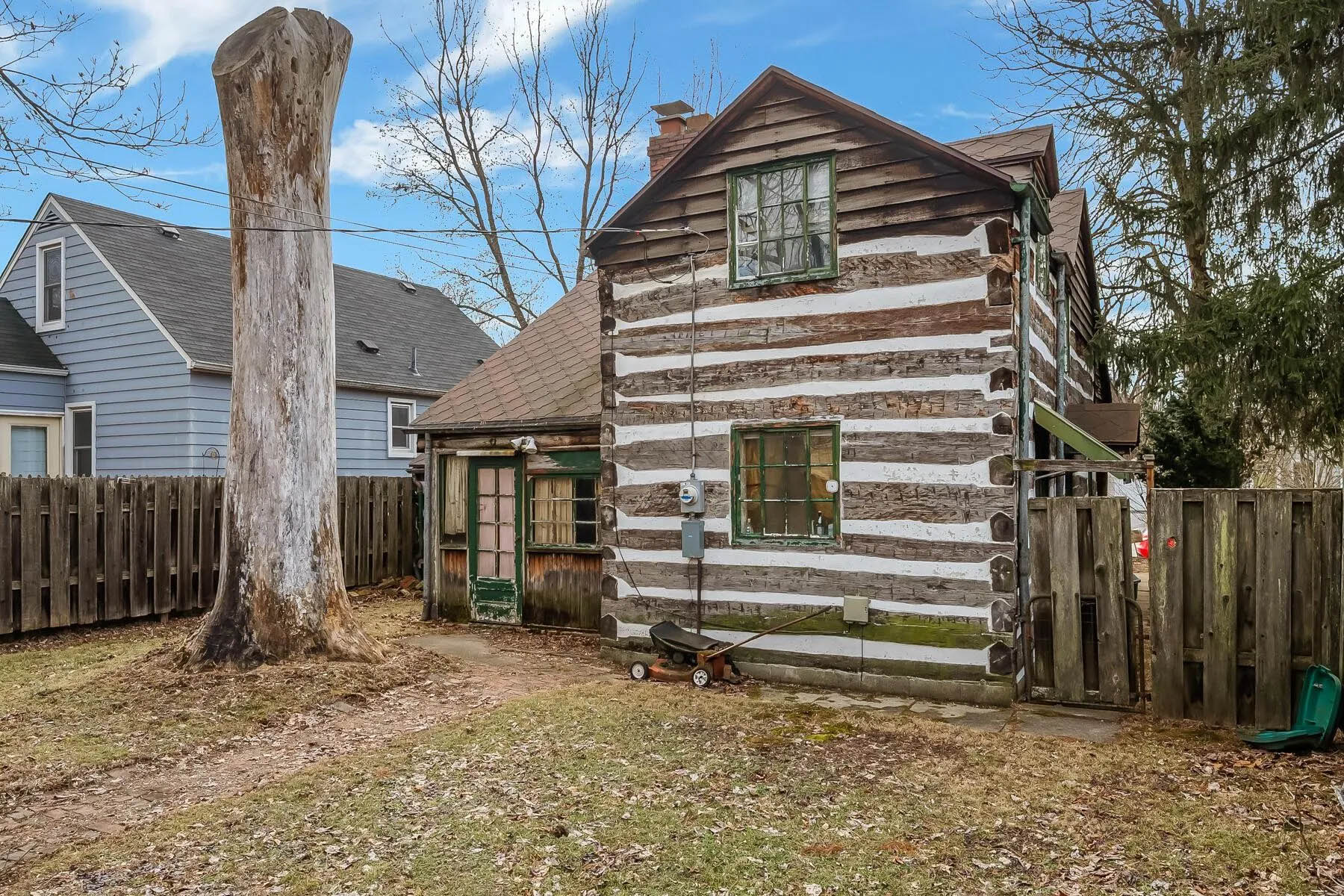
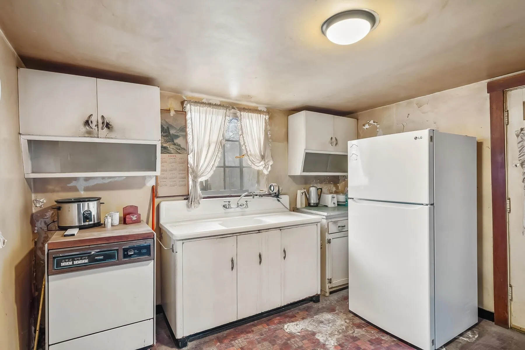
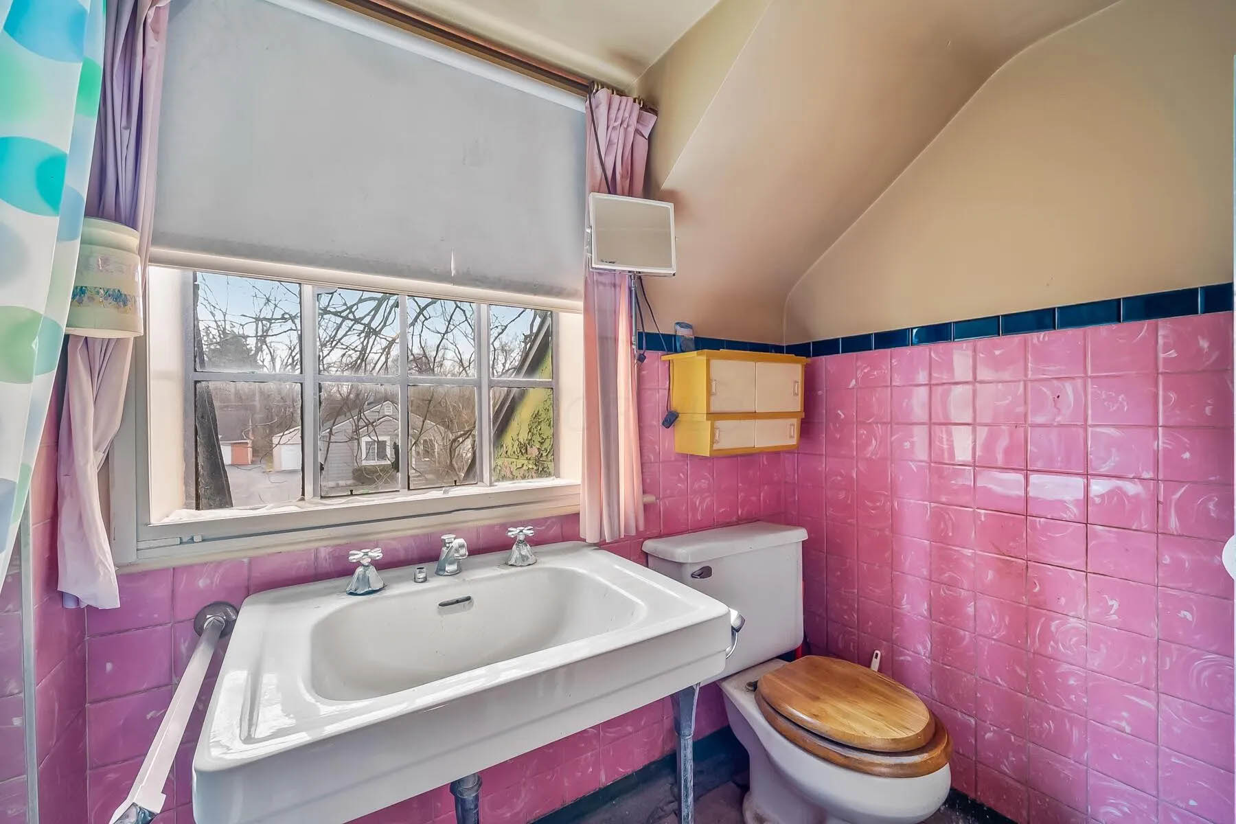
Open House at 314 W. Kanawha
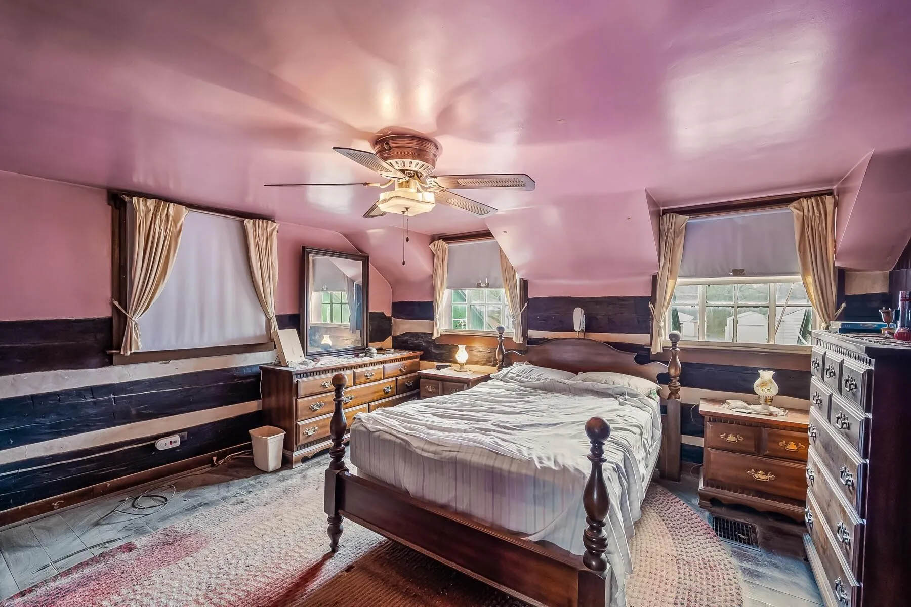
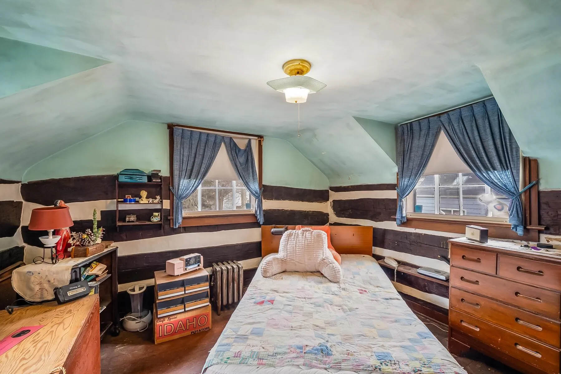
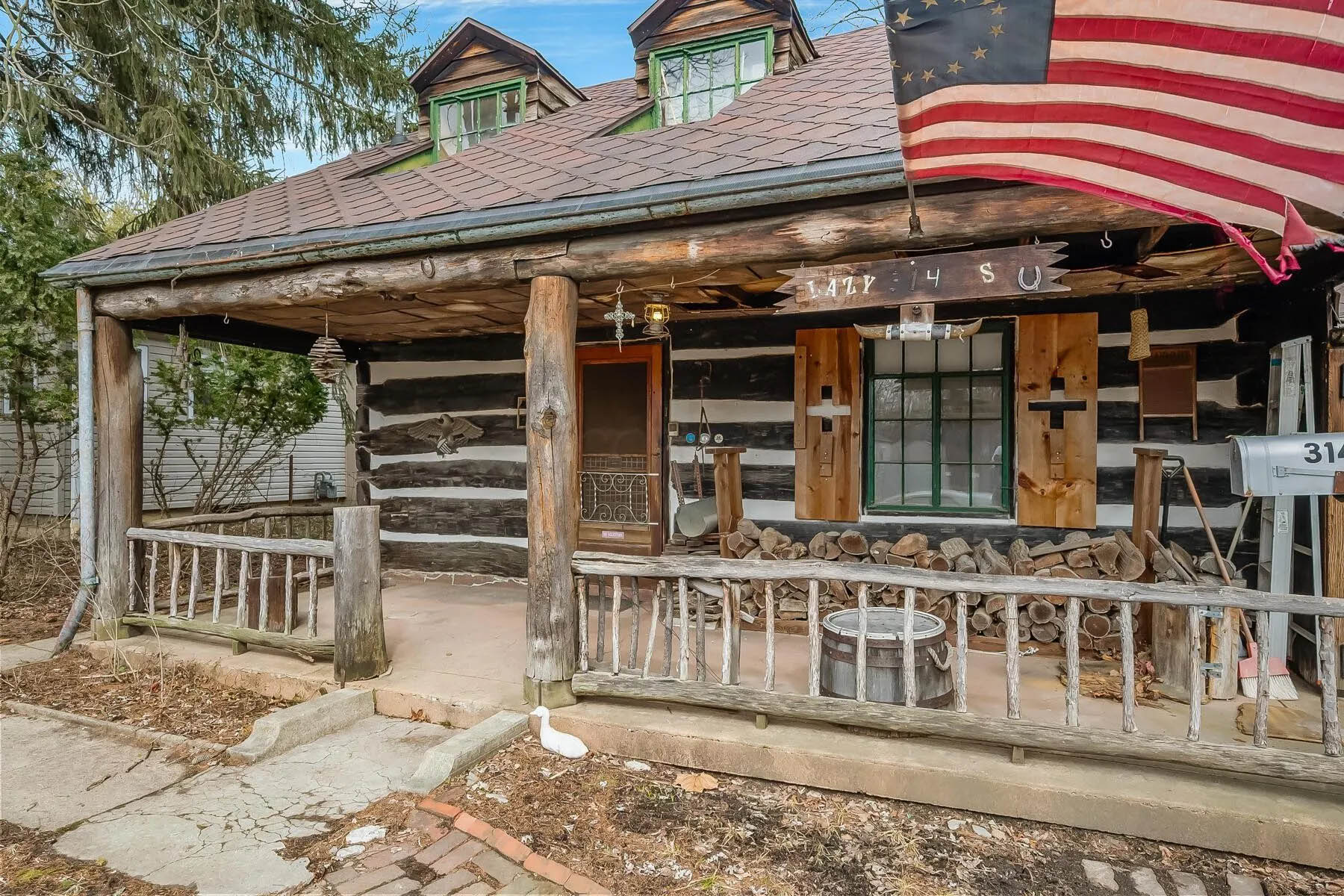 The log home at 314 West Kanawha is up for sale! Wendy Baker alerted us to this auction; the auction starts at $100,000.
Wendy had first told me about this property and the family who developed it; my post is here.
The house has had just 2 owners since the Rorers built it, and the most recent occupant purchased it in 1973. Here’s the current listing, with some pix of the houses’ internal rooms.
The Columbus Dispatch did a nice article about the auction, but does not seem to allow me to provide you with a gift link. Here is the article for those of you with a subscription.
If you’d like to see it, the home will be open from 5 p.m. to 6 p.m. Thursday March 27 and again on April 6, from 1 p.m. to 2 p.m. The auction will end 4 days later.
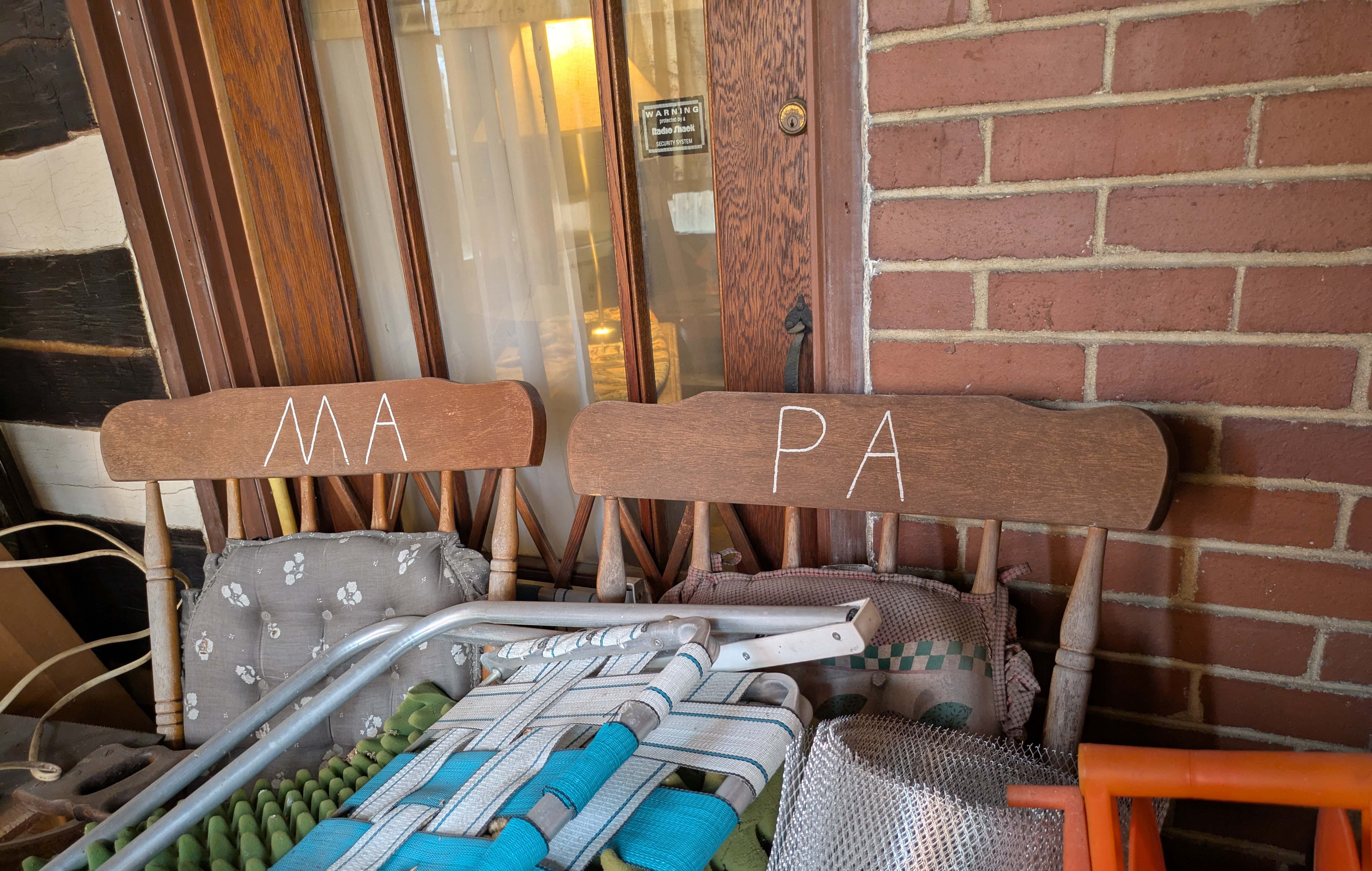
I went to the first open house this past week, and can attest that it needs some loving care. I certainly hope it’s not a “knock down.” And of course, I wonder who “Ma” and “Pa” are.
Here are a few more pix courtesy of the realtor’s web site.

Researching Your Address
 A fun tip for researching your address, from Clintonville Historical Society’s Jeffrey Carter:
–Go to the Columbus Library’s web site.
–Go to Research.
–Find Columbus Dispatch.
–Put in your library card and pin number.
–Enter keyword and search by date. {Shirley suggests: try using your street address in quotes.]
Jeffrey says, “I researched my address and found that during prohibition 3 people were arrested for bootlegging
at 265 Brevoort!”
Lust You Be Tempted…
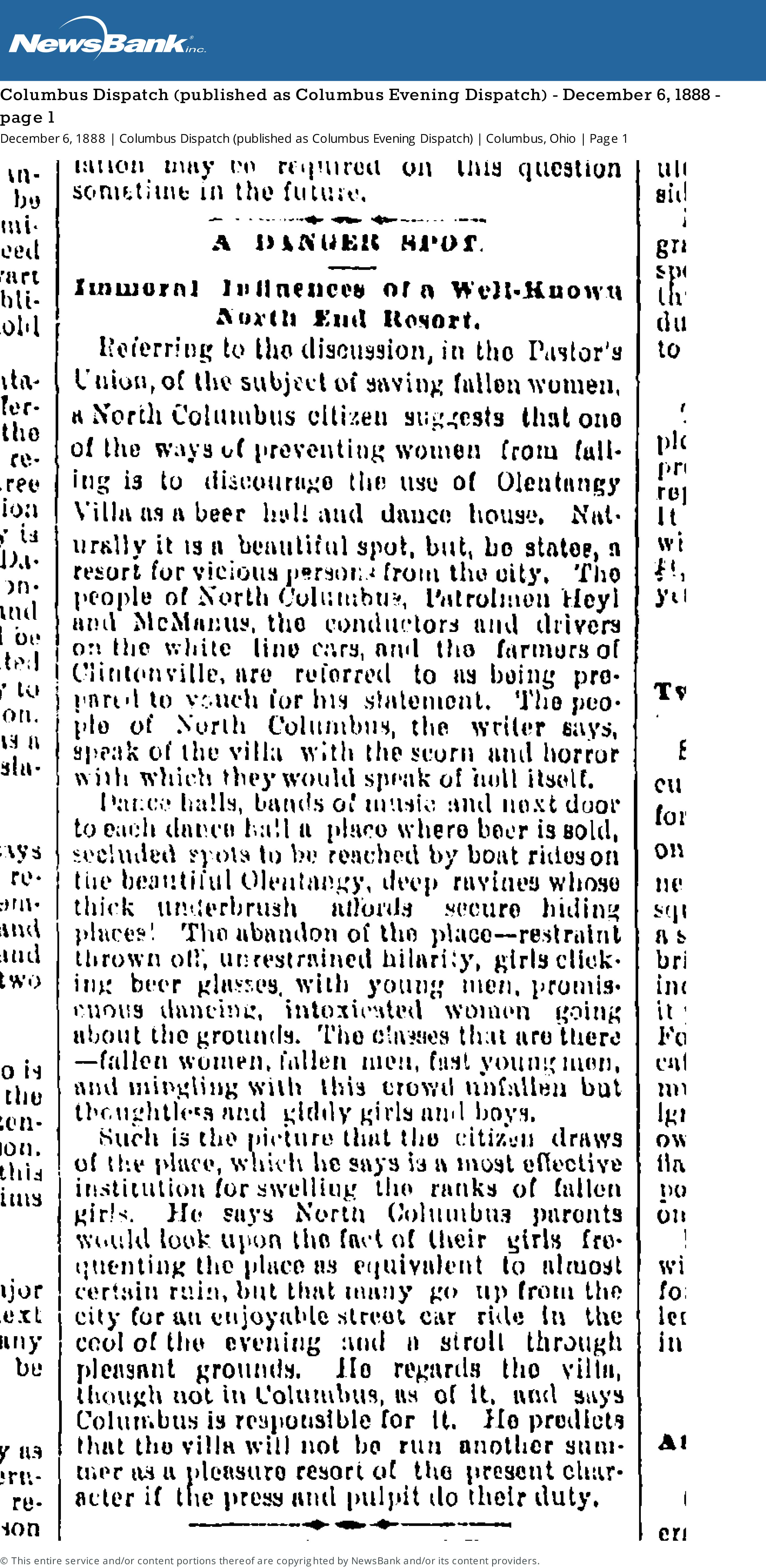
[From the Columbus Dispatch (published as Columbus Evening Dispatch) Thursday December 6, 1888 page 1]A danger Spot
Immoral Influences of a Well-Known North End Resort
Referring to the discussion, in the Pastor’s Union, of the subject of saving women, a North Columbus citizen suggests that one of the ways of preventing women from falling is to discourage the use of Olentangy Villa as a beer hall and dance house. Naturally it is a beautiful spot, but, he states, a resort for vicious persons from the city. The people of North Columbus, Patrolman Heyl and McManus, the conductors and drivers on the white line cars, and the farmers of Clintonville are referred to as being prepared to vouch for his statement. The people of North Columbus, the writer says, speak of the villa with scorn and horror with which they would speak of hell itself.Dance halls, bands of music and next door to each dance hall a place where beer is sold, secluded spots to be reached by boat rides on the beautiful Olentangy, deep ravines whose thick underbrush affords secure hiding places! The abandon of the place–restraint thrown off, unrestrained hilarity, girls clicking beer glasses, with young men, promiscuous dancing, intoxicated women going about the grounds. The classes that are there–fallen women, fallen men, fast young men, and mingling with this crowd unfallen but thoughtless and giddy girls and boys.
Such is the picture that the citizen draws of the place, which he says is a most effective institution for swelling the ranks of fallen girls. He says North Columbus parents would look upon the fact of their girls frequenting the place as equivalent to almost certain ruin, but that many go up from the city for an enjooyable street car ride in the cool of the evening and a stroll through pleasant grounds. He regards the villa, though not in Columbus, as of it, and says Columbus is responsible for it. He predicts that the villa will not be run another summer as a pleasure resort of the present character if the press and pulpit do their duty.
A History of the North Methodist Church, by Ruth Ellen (Grove) Rutherford
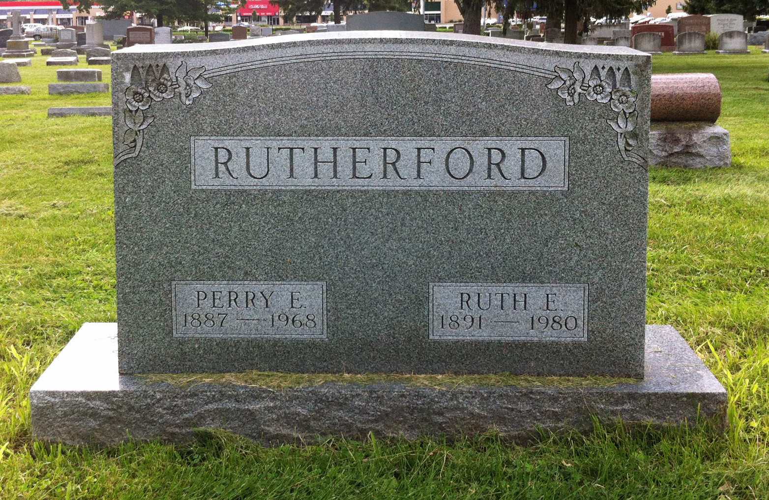
Joe Smith kindly shared this item with me, after discovering it at the Columbus Metropolitan Library. It’s A History of the North Methodist Church, Clinton Chapel, North Columbus by Ruth Ellen (Grove) Rutherford.
Ruth Ellen (Grove) Rutherford [1891-1980], a long-time area resident, wrote the history in 1970. The book includes both some history of the Clinton Chapel Cemetery, some information about the old Beers/Piatt log cabin and its move to 40 E. Norwich Ave, and info about the Underground Railroad activities of Pyrum and Polly Hunt. Joe was pleased to see mentions of his own ancestors including the Hunts–Joe’s grandfather Smith‘s maternal 2nd great-grandparents (page 16)–and his grandfather’s maternal grandparents, Horace and Sarah Theresa Young, and his mother, Minnie Belle Young, who are listed as members of North M.E. Church (page 24) in 1898. Minnie married Joe’s great-grandfather, Roy Ripley Smith, a year later, on 20 Sep 1899.
As Joe says, this is a poignant message how the Clintonville community came together and rallied around a greater cause. It’s a message of inspiration just as relevant 142 years later.
[Courtesy of Joe Smith, and the Rutherford family.]Log Home on Westwood Road
 Ann Conner allowed me to see the inside of her 168 Westwood Road home when I was working on my book. You can get a glimpse of it here, in a 1988 10tv item.
Or here, as an AirBnB listing.
Maps Maps Maps
Here are some cool links for old maps:
City of Columbus Planning Maps, Historic Maps.
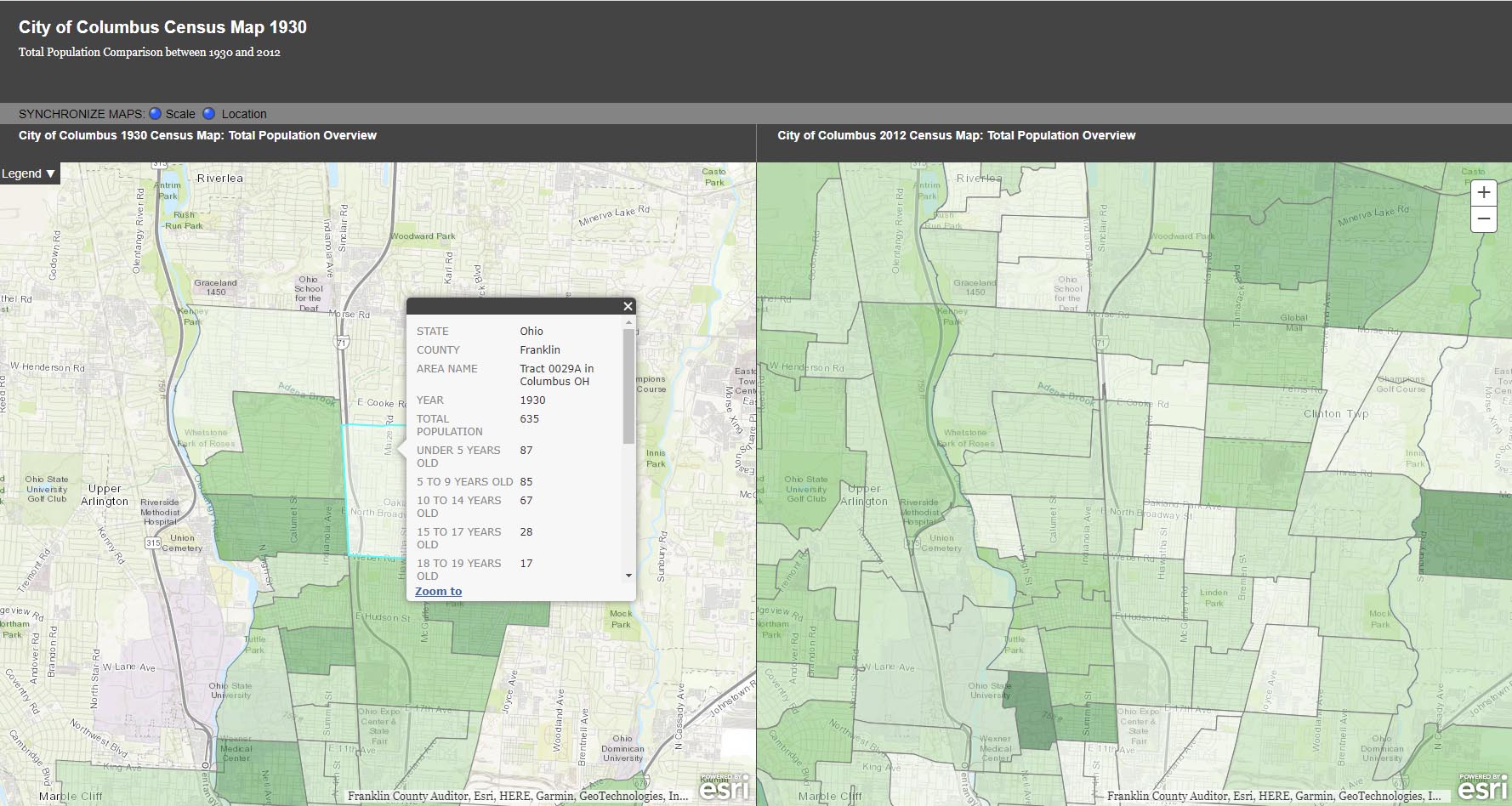
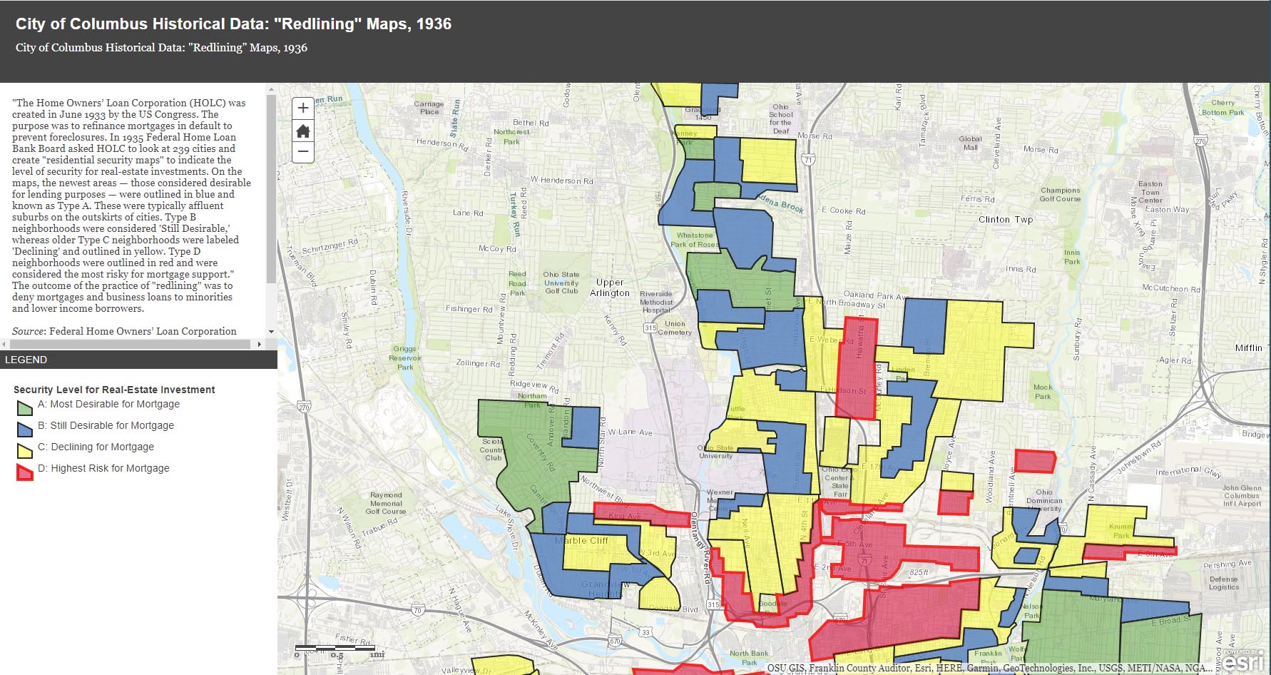
The City of Columbus’ web site gives us plenty of maps and data to play with, from Census demographic changes to despicable redlining and more. Check out especially the “City of Columbus Historic Panoramic Images, 1922,” which is based on a 1922 Ohio State University masters thesis by Forest Ira Blanchard. “Blanchard, inspired by the Chicago School of Sociology, sought to study the racial and ethnic composition of the city, with a particular focus on the role of transportation (railroads, roads) in shaping the urban landscape. Source: Forest Ira Blanchard, An Introduction to the Economic and Social Geography of Columbus, Ohio. Thesis (M.A.), Ohio State University, 1922.”
Columbus Metropolitan Library’s Columbus and Ohio Map Collection. If you haven’t donated to the library yet, now’s the time! It and and it’s staff are such great resources.
Sanborn Maps for Franklin County (scroll down to see Columbus). This is a Library of Congress site.
USGS Historical Topographic Map Explorer allows you to specify a place you want to explore, then click on a location to see its historical maps.
Prolific programmer Randy Majors has produced several products of interest, including his Historical U.S. Counties Map Tool and Auto-Checker Extension. He has also created a couple of video walkthroughs of a couple of the the software tools he has created. I recommend you view them in order, as understanding the Historical U.S. Counties map tool will help you have better success with using the Auto-Checker chrome extension.
Old Maps Online OldMapsOnline.org indexes over 400,000 maps, thanks to the archives and libraries that were open to the idea and provided their online content.
Do you know of other map resources? Let me know and I will add them to this post.
Glen Echo Beyond the Ravine

This is a nice photo from a 1922 Ohio State University masters thesis by Forest Ira Blanchard. I believe, based on the metadata, that it was taken at 2734 Indianola Ave. It is captioned, “Glen Echo section beyond the ravine.”
Blanchard, inspired by the Chicago School of Sociology, sought to study the racial and ethnic composition of the city of Columbus, with a particular focus on the role of transportation (railroads, roads) in shaping the urban landscape.
[Courtesy of Forest Ira Blanchard, An Introduction to the Economic and Social Geography of Columbus, Ohio. Thesis (M.A.), Ohio State University, 1922; digital version from City of Columbus Historic Map Collection.]Brick by Brick
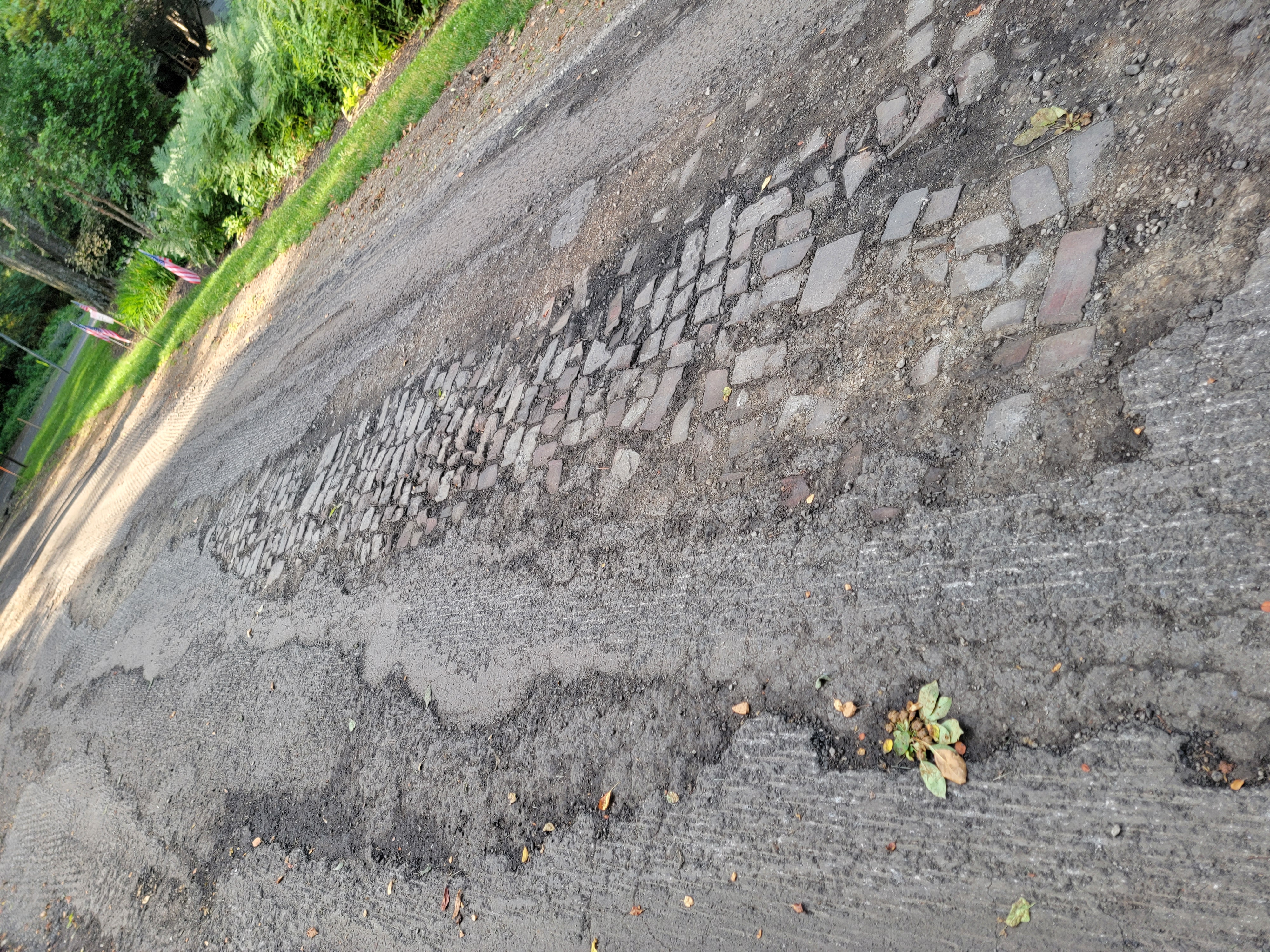
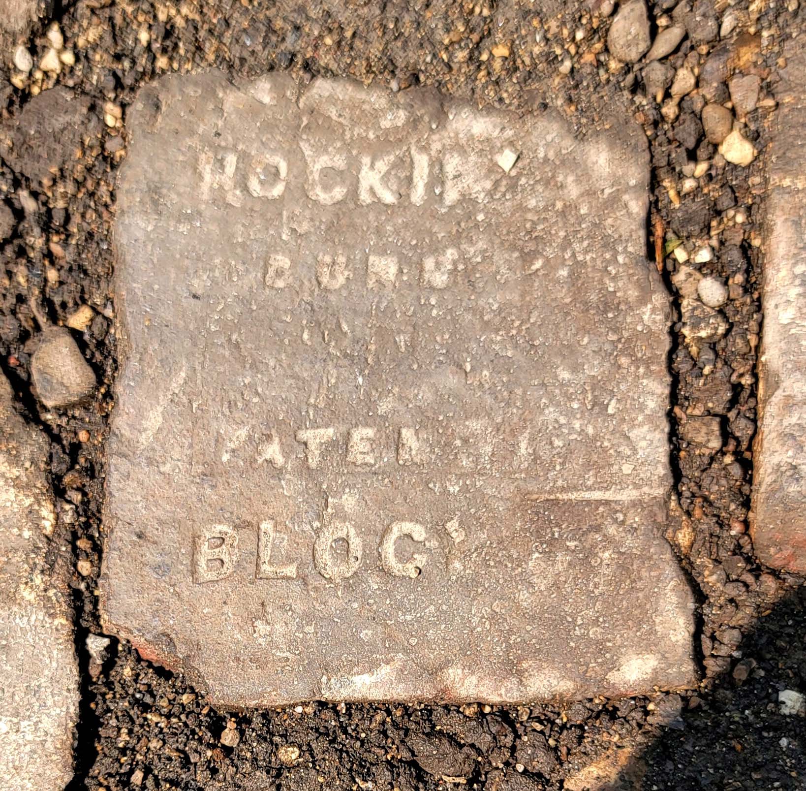
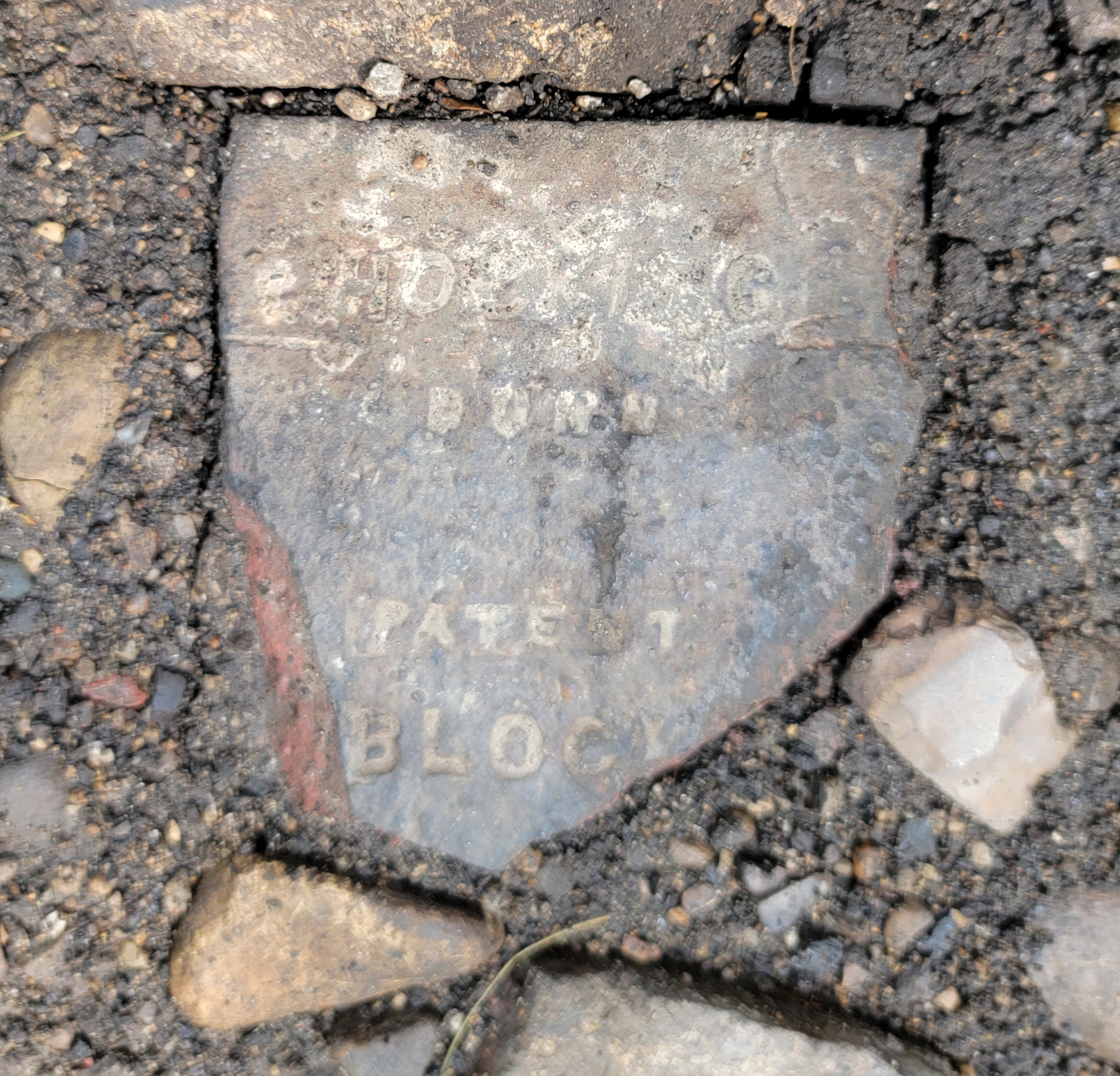
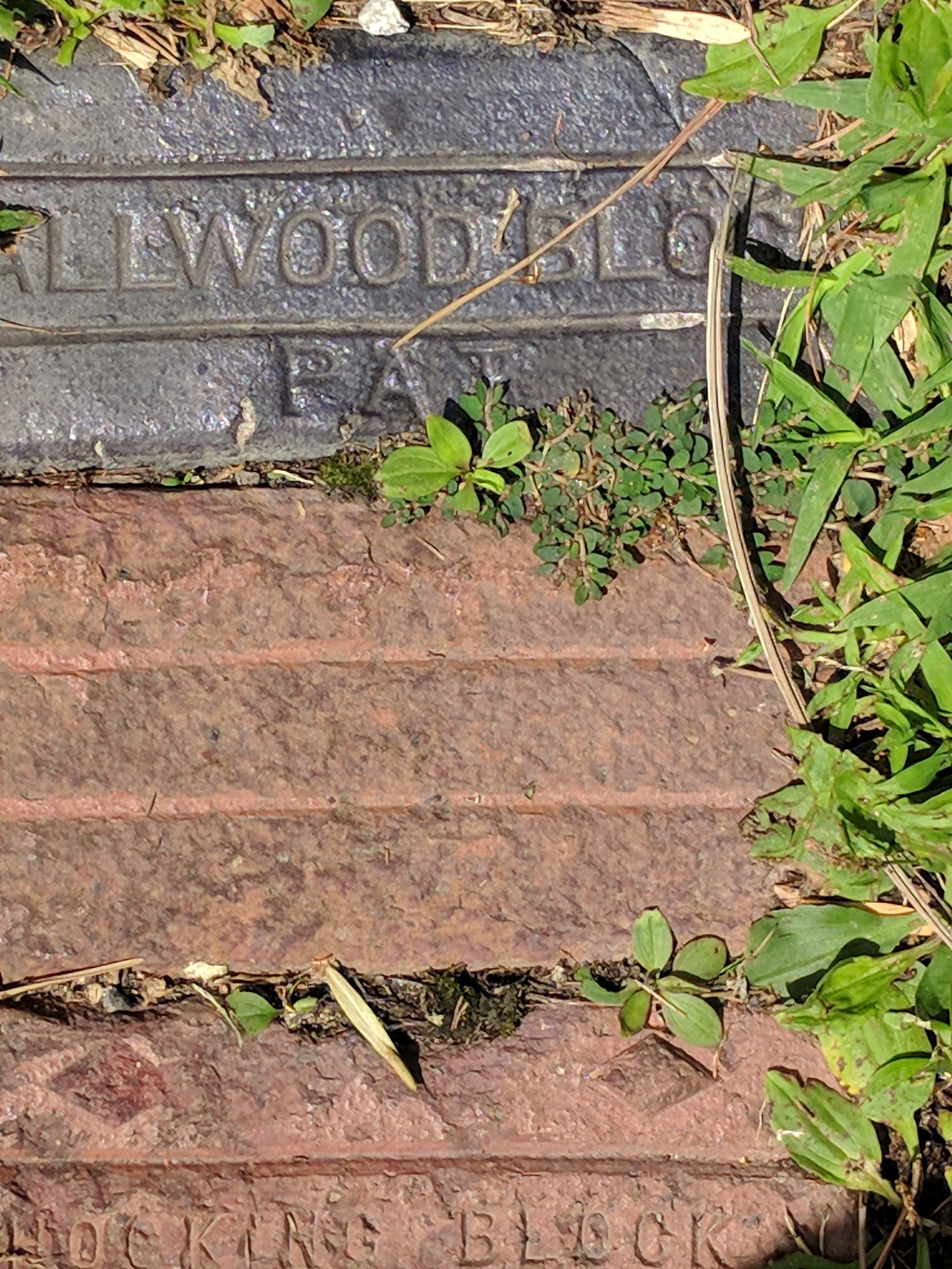
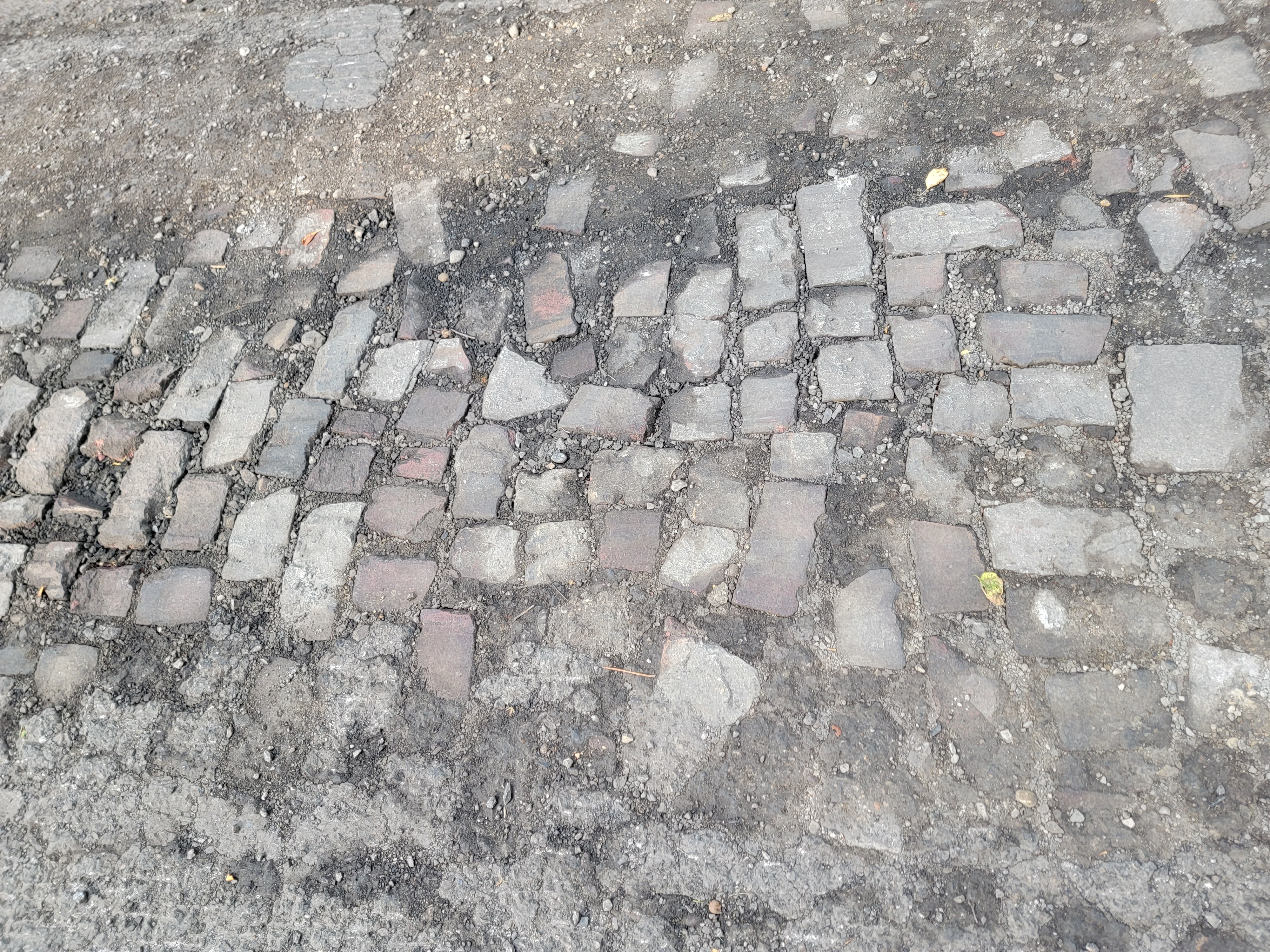 Katie Knostman has shared some photos of the old pavers on Olentangy Blvd at Rustic Place (near the driveway for 4783 Olentangy Blvd), exposed during the recent construction that the residents of Old Beechwold have been enduring.
On close inspection, two of the bricks say Hocking Dunn Patent):
And on the topic of bricks: Here is a photo of a brick that Clintonville Historical Society has in its archive.
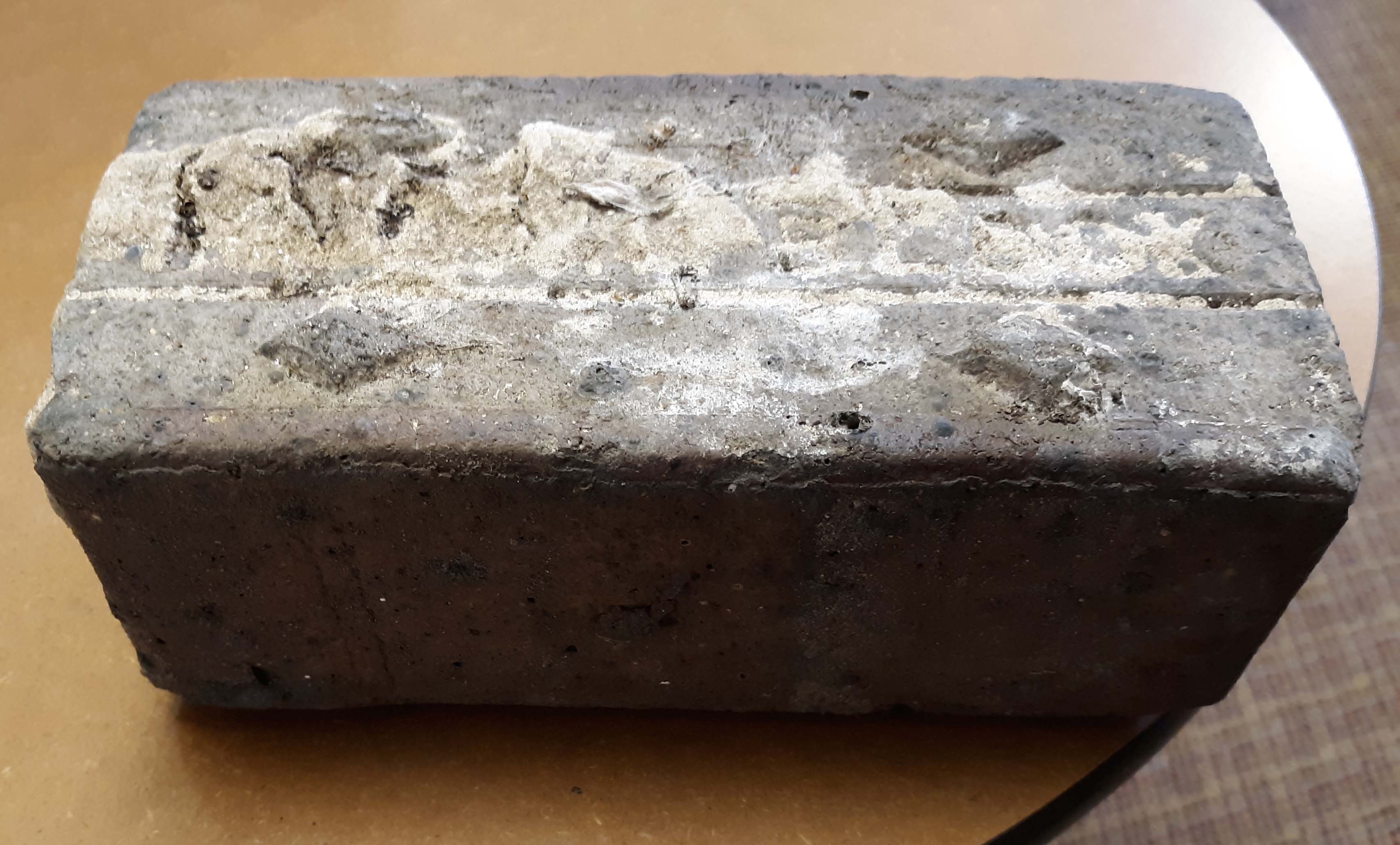
CHS actually has 2 bricks. According to Mary Rodgers: “These are the actual pavers from the street [near American Vitrified Products, which was located on the former site of North High School at Arcadia and Calumet]. The official name of the brick is covered in mortar. You can see the diamonds. Those keep the horses from slipping when the bricks are wet. We might try to remove the mortar from one. It is interesting. They are porous–lighter than I thought…I have seen some articles that are associated with the early use of site. William Wassell seems like an interesting character. They made pipe and bricks. Supposedly, this is one of their bricks. In the late 1800s, they made a fountain for the fairgrounds-all out of pipe. I would love to find a photo of that!” Here’s an article about the fountain.
And finally, a house on East North Broadway has many bricks lining the driveway. These may have come from that roadbed.
Joseph Wilton Smith & Ancestors
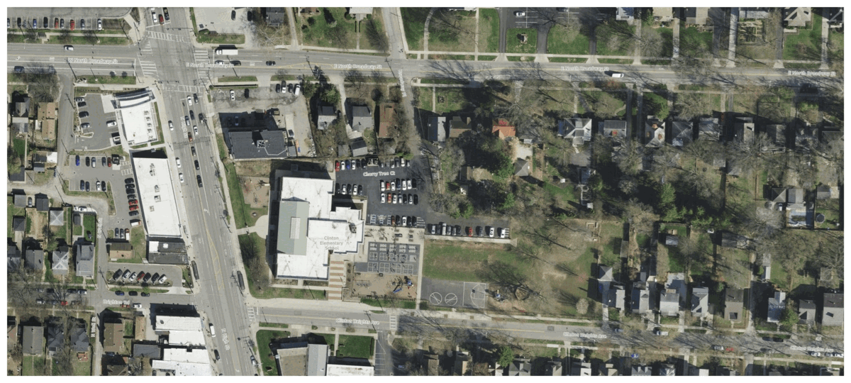
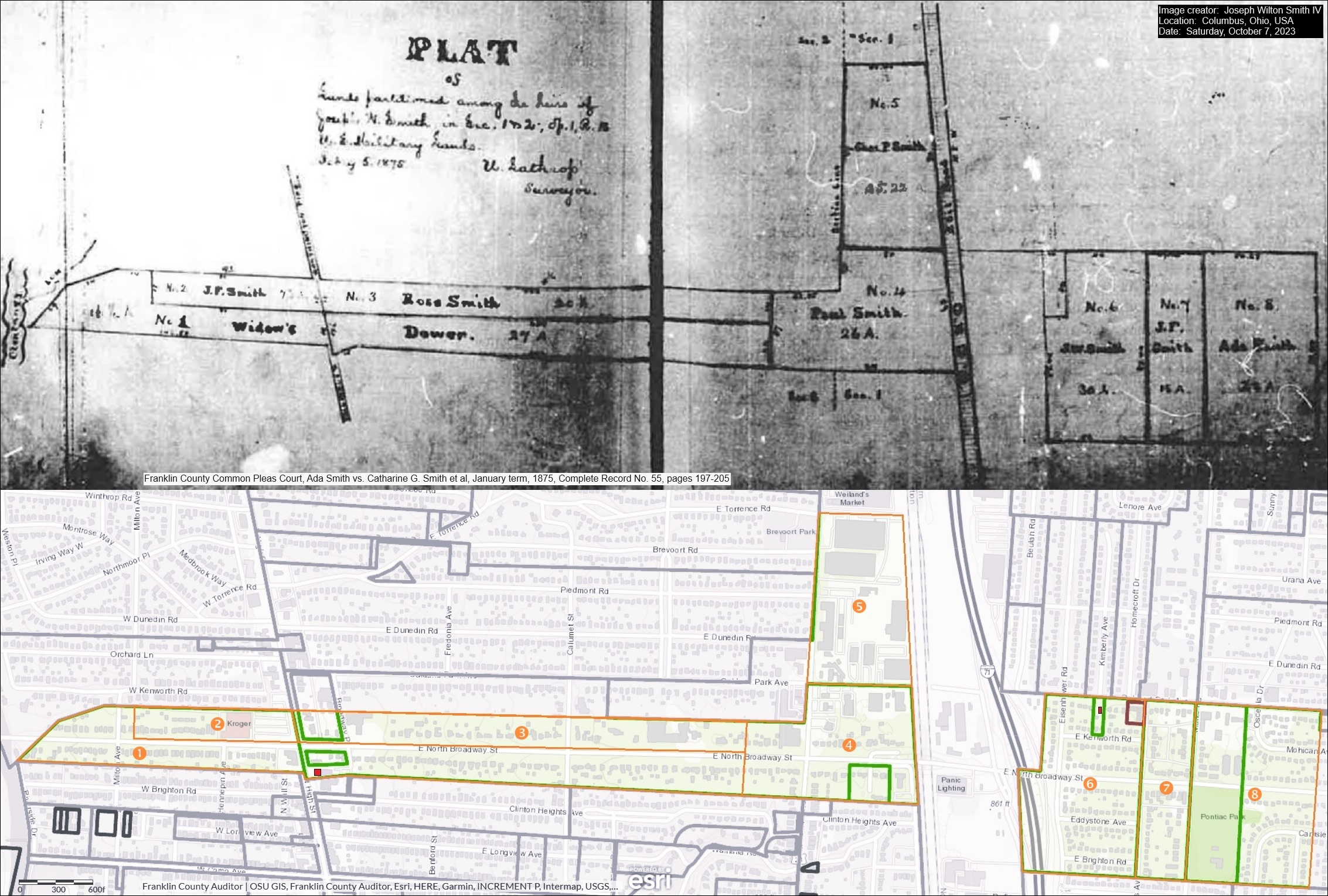 Joseph Wilton Smith IV recently contacted me. Joe’s ancestors owned a house at the southeast corner of East North Broadway and North High Streets, perhaps where the Cochran House was before it was demolished…or–as Mary Rodgers speculated in the May 2020 CHS Newsletter– possibly that very house. Joe has kindly sent along an image that includes several maps:
1) An 1875 map of the legal division of Joseph Wilson Smith’s farmland in Clintonville, Ohio to his heirs
2) A modern map extracted from the website of the Franklin County Auditor that outlines these lands in orange over the current Clintonville area streets. And,
3) The property lines from the 1910 Baist map superimposed on the 2023 satellite view of E.N Broadway and N High.
Joe writes:
I am a direct descendent of three early Clintonville settlers: Thomas Bull, Deacon John Smith, and Pirum Hunt.
I am named after my grandfather, who was named after his grandfather, who was named (sort of) after his father, Joseph Wilson Smith. His wife, Catharine Gray (Piatt) Smith was my third great-grandmother. For the past three months, I have been working closely with Mary Rodgers to sponsor a historical marker honoring my ancestors and their contributions to early Clintonville. My great-grandfather was Roy Ripley Smith, who lived at 145 W. Royal Forest Blvd. in Beechwold. My dad told me Roy also owned a farm that later became part of Highbanks Metro Park.
 In January 2024, Joe Smith gave a presentation to the Clintonville Historical Society about his ancestors, and most especially his ancestor Deacon John Smith. John was a churchman and also an abolitionist in our area. Joe’s presentation is also a great example of what you can do if you set about researching your family’s history.
Joe’s presentation can be found here. The handout for that presentation can be found here.
Thanks Joe!
[Thanks to Joe Smith for sharing his research and his presentation. He welcomes additional information and input on his research, and extends his thanks in advance. Contributors to his research include Sharon Hendershot, Nancy J. Pendleton, Mary Rodgers, Elizabeth Renker, and Kathie Smith Brzoska.]West Kanawha: A “Surcease from City Life”
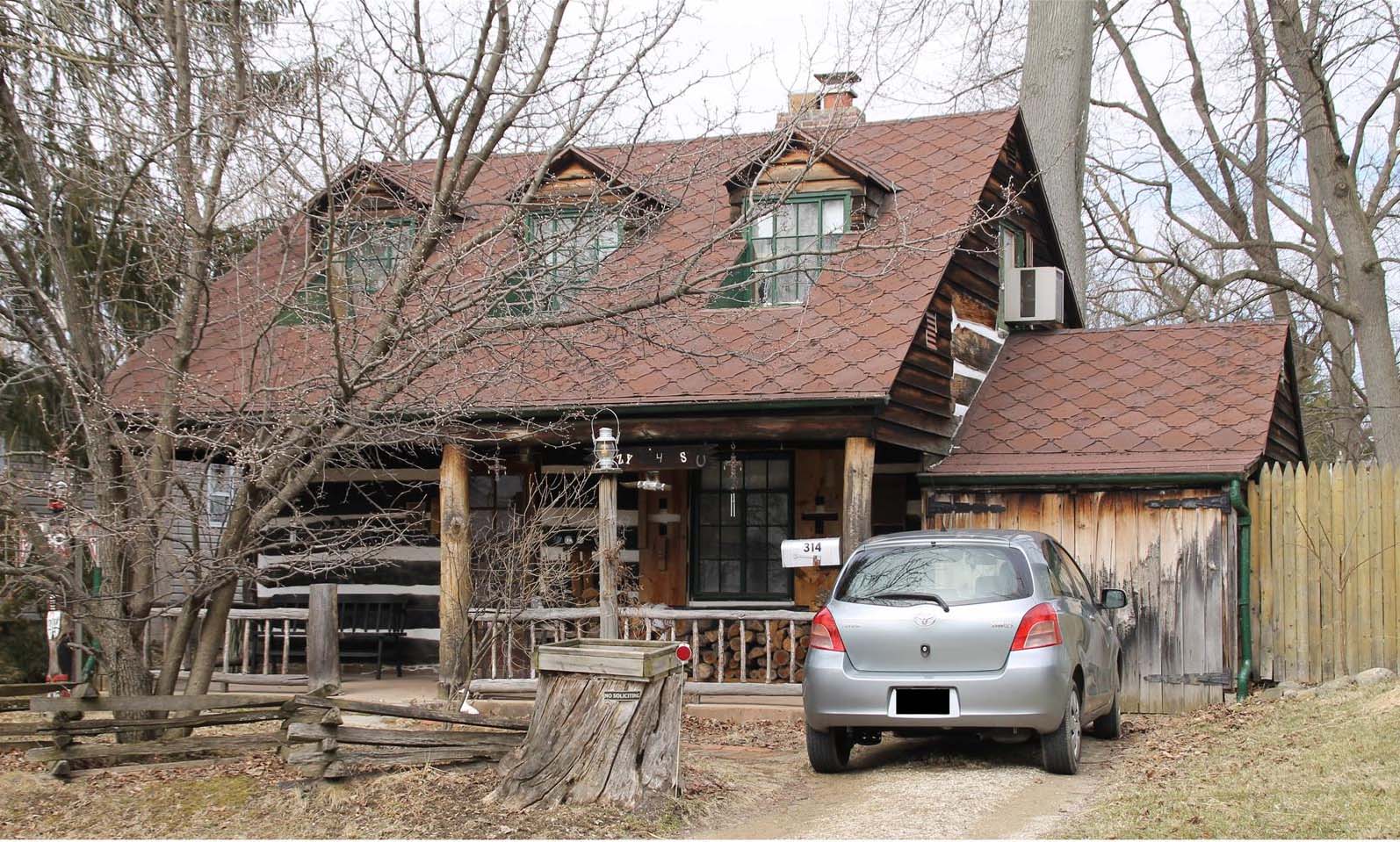
Sometimes a house tells the story of a person, right? In this case the story is about Frank and Bertha Rorer.
This story was sent to me by Wendy Bayer, who writes, “During COVID, I did quite a bit of walking around Clintonville and found myself on West Kanawha one afternoon…I noticed an intriguing house at 314 W Kanawha and did some research on it (naturally! My curiosity is so strong!) I found this great newspaper article from 1939 about the builders and residents; you might find them interesting, too.”
The Rorers bought a tract of undeveloped land on what is now West Kanawha. They took scout troops there, and hiked their property. Their first house on Kanawha was a tiny house constructed from washing machine crates. (Why? because Mr. Rorer was a plumber.) They also built a cave on the property for refrigeration. They initially used this tiny house as a weekend getaway, but Bertha spent more and more time there. Later they built a white clapboard house nearby, and then in the late 1930s they built their dream house at 314 West Kanawha from salvaged walnut-wood logs.
Today there are a cluster of properties along Kanawha formerly affiliated with the Rorers; here are some of their ownership histories:
290 W. Kanawha–nothing
300 W. Kanawha–1922-1937 Rorers owned it. This is where they lived in April 1931.
304 W. Kanawha–1923-1959 Rorers owned it, new house built 1959
310 W. Kanawha–1937-1959 Rorers owned it, new house built 1960
314 W. Kanawha–log home. Rorers owned it 1923?-59
320 W. Kanawha– nothing
Here’s the “Ohio Historic Inventory sheet” for 314 West Kanawha, from the Ohio Historic Preservation Office at Ohio History Connection.
Bertha Rorer died in 1974, her husband Frank Rorer died 1976 (You can click through to read their obituaries.)
[Research courtesy of Wendy Bauer, and inventory courtesy of Nancy Campbell/OHPO.]The John Moses Hess Jr. Homestead
 In April 2024 I wrote that Flora Hess sold her property, a flower shop at the intersection of Dodridge and Olentangy River Road, to the state in 1932. She lived in a house close by at 2637 Olentangy River Road; in 1968 Johnny Jones wrote an article about an antique sale at the Hess homestead.
I believe Flora lived in that house for many years. She ran the property as a trailer park from at least the 1930s until the late 1940s. I found several Columbus Dispatch articles that reported her conviction in 1946 of illegally operating a trailer camp on the property. The county had declined to issue her a permit because the property did not meet sanitary requirements. The trailers were mostly occupied by students. I also found many ads for sales of trailers, so the land may have been a dealership. I would love to have learned her side of this story.
The Ohio State University archives has some aerial photos of the old Hess farm with what Jones described as “part of an old windmill;” there’s a map in the collection’s finding aid and you can see the set of aerials here.
Now here’s the sad, sad, story about this homestead. According to a Hess family historian, Flora’s father John Moses Hess Jr. “received his education in the public schools of Franklin County and later attended Otterbein University. He was a farmer all his life. Uncle Moses was well over six feet tall, quiet and easy going. He always had a well groomed driving horse and took me on several Sunday afternoon drives in the north end of Franklin County, telling the history of the Dublin community. I never saw him when he was not wearing a stiff bosomed white shirt. This was one of his several oddities. Aunt Hannah was very opposite, being small and wiry and a human dynamo, and I always marveled how one so small could turn out so much work. Aunt Hannah died August 17, 1922, being murdered by an irresponsible farm hand who died from self-inflicted wounds the following day. Uncle Moses died December 15, 1923 and both are buried in Union Cemetery across the road from the farm home.” You can read the details of this sad tale of murder and suicide is the Columbus Dispatch here.
Flora died in 1962 (b. 06 Mar 1883, d. 06 Nov 1962) and is buried in Union Cemetery near her parents. Her sister Elizabeth died in 1968 at age 89 (b.30 Sep 1879 d. 5 Dec 1968) and is also buried there.
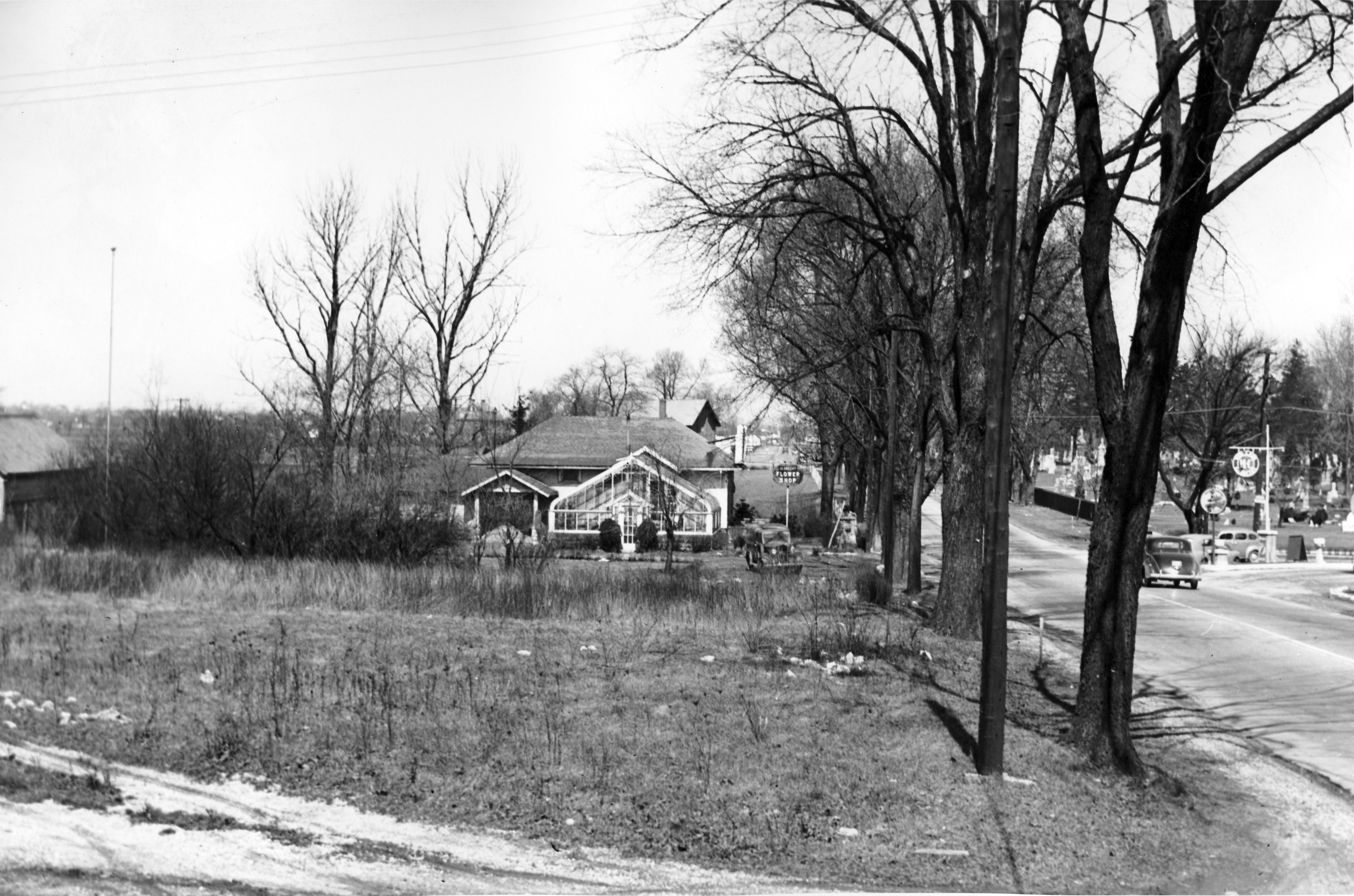
[Photos courtesy of The Ohio State University Archives. Research help courtesy of Harry Campbell.]Flower Power
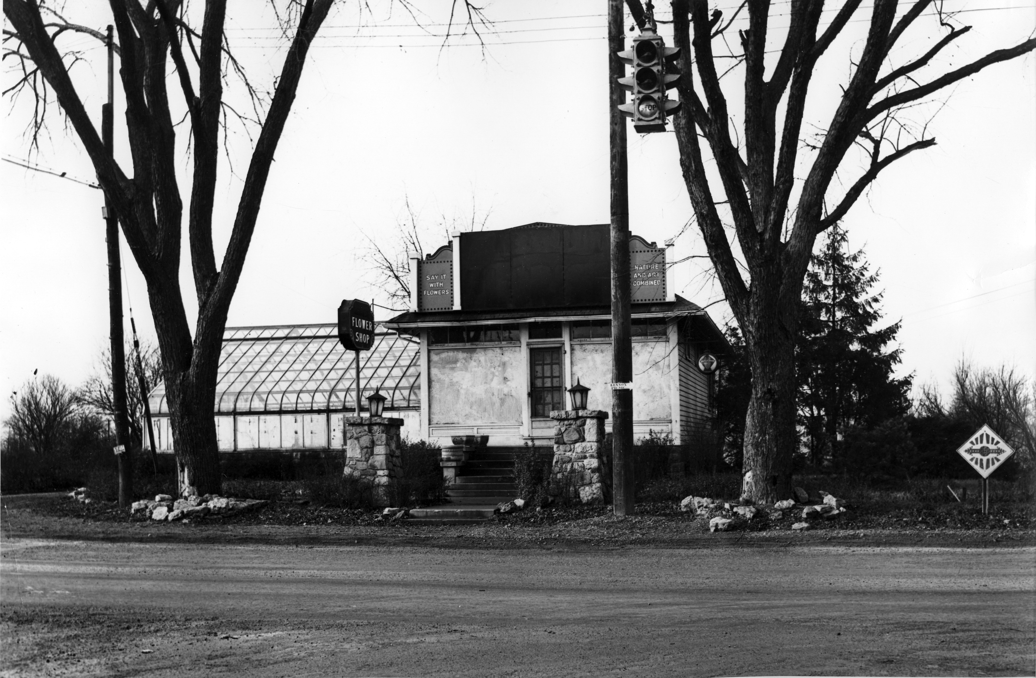 These lovely pictures are of the Albrecht Floral Shop at 2703 River (or Olentangy) Road–the intersection of Dodridge and Olentangy River Road, looking north.
According to librarian Cindy at the Columbus Metropolitan Library, the flower shop went through several hands in the 1930s.
Cindy found a parcel sheet for what she believes is the property in question. The parcel sheet shows the greenhouse listed as well as a brick building.
 There is an ad for Flora Louise Hess, Florist in a 1925 Columbus Women’s Club cookbook that features an illustration of the building matching these photos.
Flora Hess sold the property to the state in 1932. She lived in a house close by at 2637 Olentangy River Road, however. In 1968 Johnny Jones wrote an article about an antique sale at the Hess homestead.
 Across the street from the flower shop is a gas station. The Moosehead Filling Station and Moosehead Tavern was across the street at 2696 Olentangy Road as early as 1937. It advertised selling H-C gas; H-C was the first high-octane gasoline. In 1926, Sinclair leapt ahead of most of its competitors with H-C, the industry’s original high-octane premium gasoline for motorcars. The 72-octane auto fuel, developed at its Houston refinery, was better than anything then marketed (Lindbergh’s flight to Paris the following year was on 73-octane gasoline). H-C stood for “Houston Concentrate,” though some advertising men called it “High Compression.”
The Moosewood Tavern was apparently a trouble spot; this Columbus Dispatch newspaper article documents one incident of rowdiness.
[Photos courtesy of the Franklin County Engineers. Articles are from the Columbus Dispatch. Research on these photos and news items mostly came from Cindy at the Columbus Metropolitan Library Local History & Genealogy Desk; thank you Cindy! ]Buy a Steak…or a Steer! Smith’s Deli
Eric Hartzell has been helping Jack Smith–of Smith’s Deli fame at 3737 N. High Street–rewire parts of the deli, and with some repairs. Along the way, Eric has found some fabulous pictures related to the deli.
 First, the deli when it was a meat and frozen food center, and–get this–candle store! Eric estimates this picture is from around the mid-1960s.
 Here’s another picture courtesy of The Clintonville Spotlight October 01, 2020.
Eric writes, “The first picture above seems to be from late 1960s judging by the cars on the side lot….maybe 1968…or it could be early 70’s. But it is different from the pic in that ad or menu…It is 1961-62 because of the car out front. But the sign on the top of the building is much bigger and goes from end to end on the building….and has the added candle and candy shop on the right end. Since they didn’t discontinue the meat part till 1982…..hard to completely say.”
 In the early 1940s the site was Beem Motors, a Packard dealership; this ad is from a 1941 telephone book. There was an auto service station & filling station next door at 3729 N High Street at least as early as 1941 (but not before 1932). As Eric writes, “…[The car dealership] is the reason the 1920’s style garage/gas station is right next to it. There is even a garage door still inside Smith’s Deli right behind the pizza ovens. It was never removed, and infrastructure was just built around it.” By 1943, 3737 N High Street was a grocery, and by 1951 it had become Clintonville Lockers Frozen Food Lockers owned by Guy B. Harris. Jack Smith’s dad purchased the business in 1961.
Here’s a link to an aerial photo of that location from an unknown year. You can see the auto service center to the south of Smith’s.
 And about Smith’s arch and counter, Eric writes: “When I asked Jack if I could rewire the arch for safety sake..(it was still with the original 1907 wiring) I started to also do the research on it. All he could tell me was that it came from a Chillicothe drug store, named A.B. Howson’s Pharmacy in the famous Carisle Building. Didn’t take long to find a picture of it inside that drug store with the help of the historical society down there. Was like finding buried treasure, there it was from a picture taken in 1909. It was built in 1907. Now [the arch] has 100% LED lights….even used the new LED Edison style lamps that really gave it that old time look. The drug store closed in 1967….or was it 1969….anyway, that was when his father purchased it and moved it to the current store, marble and all. More about the drugstore, including the names of the boys staffing the counter here.
Thanks for sharing, Eric!
[Images courtesy of Eric and his original sources, and to Dave Wenger at Northend Wrench for the aerial photo.]James (Jerry) Welsh, Dairyman
Here’s a very sad story about one of our Clintonville residents from former times. James Welsh, commonly called Jerry, was a dairyman along High Street. His farm burned on January 27, 1897, and Jerry was himself badly burned in the fire. Jerry survived the fire, however, and he eventually died on Sept 5, 1905 at the age of 72 or 73 of dropsy (edema, or heart failure). He was originally from Ireland, was a Civil War veteran, and is buried in Mount Calvary Cemetery.
There’s no record of his having owned a farm on High Street or in Clinton Township, so perhaps he leased the farm land. When he died, Jerry lived at 34 Richards Road with his wife Bridget; I presume he lived close to his dairy farm. The couple also lived with a lad named Fay Osborn; Osborn is likely the 14-year old boy who was also at the scene of the 1897 fire and who was credited with saving the 20 cows.
Cows Saved With Difficulty From the Flames–Loss $900.The big dairy barn of Jerry Welsh on High street above Clintonville was totally destroyed by fire Tuesday afternoon, together with a stock of fodder. In the barn at the time the blaze was discovered were about 2[0] cows and some horses. All the animals were finally removed though Welsh and his neighbors had a lively time of it taking the frantic beasts from the fiery furnace.
Luckily there was little, if any, wind and the other outbuildings and the house were saved.
There was no means of fighting the fire, and all that could be done was to run to the neighbors’ for buckets of water to pour upon the house. About [6]00 tons of millet was burned. The loss on the property will be about $900.
Was Fire at Jerry Welch’s
Dairy BarnMr. Welch Himself Badly Burned And Narrowly Escaped Death
There came near being a tragedy at the fire above Clintonville Tuesday afternoon.
It will be remembered that Jerry Welch’s big dairy barn was totally destroyed, as stated in The Dispatch at the time.
It seems that Welch, who is quite an old man, was in the barn when the fire broke out, but became so excited that had it not been for the efforts of a 14-year-old boy who was in an adjoining field gathering fodder, over 20 cows would have been burned. The lad released the maddened animals just as the roof of the structure fell in.
All this time Welch was working heroically at the other end of the barn endeavoring to save the horses. In some way he slipped and fell right into the awful furnace. He was dragged therefrom by a neighbor who had hastened to the scene. Welch’s hair was singed, his hand and face badly scorched, and he would have burned to death had not the neighbor pulled him out and extinguished the fire by rolling the victim in the snow.
Cindy at the Columbus Metropolitan Library shared most of the above details about Mr. Welsh with us. She writes: “I was able to find a little more information about Jerry Welsh. First, I believe the name was actually Welsh, not Welch [as in the 2nd article above]…I am attaching Mr. Welsh’s obituary. I was able to find him on the 1900 census with his wife, and it looks like he was a veteran of the Civil War because I found a grave registration card that matches up with his grave information in Mount Calvary Cemetery. Unfortunately, I was not able to find that he owned any property in Clinton Township. I checked maps, including a 1895 plat map that has landowners names on it. I also checked deed indexes on the recorder’s site for that time frame for both grantors and grantees and still did not find anything. It is possible he was renting the land that the barn was on.”
I do love our Columbus Metropolitan Library System and especially appreciate the Local History and Genealogy staff. THANK YOU CINDY!
318 Orchard Lane (Columbus Canoe Club)
 The Columbus Canoe Club–which had been turned into a residence back in 1959–was currently on the market, and you can see the inside of this residence here. It has only had 4 owners since it was built, and long-time owner Donna Hickey had given me a tour of the house back in 2009. So sorry to learn that Donna passed away in 2021.
A bit more info here
(I doubt this link to the realtor post will be up long.)
In Honor of Armistice Day
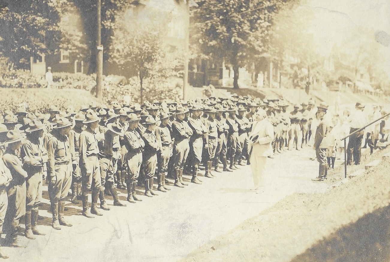 I have no World War I photos of soldiers in Clintonville. But in honor of Armistice Day aka Veterans Day, I am posting this photo of WW I soldiers, being addressed by Norman Barnes Thorp. This might be in front of 180 East Northwood, though I have been unable to confirm that location.
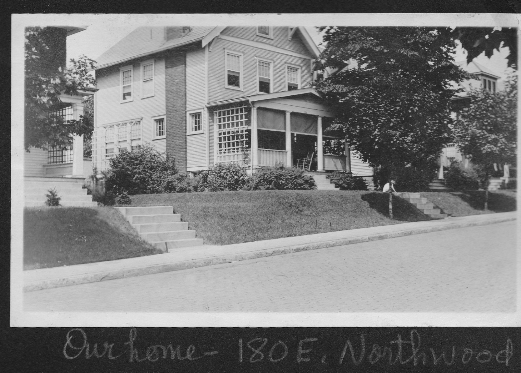 Margaret Nelson, a long time Clintonville resident who has shared many other family pix with us, shared the World War I photo with us. 180 East Northwood was built by Margaret’s grandparents, Johanna Gertrude (Edmondson) (1880-1967) and Norman Barnes Thorp (1867-1934) around 1909, and the house was subsequently owned by the Thorp’s daughter, Norma Thorp Van Ness.
Norman B. Thorp was active in the Northwood Flower and Garden Club, which in turn was active in various ways in the war effort. Of its 60 members, 9 men were in military service and 1 woman was an active nurse.
[Photos courtesy of Margaret Nelson.]School Mate? Or Soul Mate?
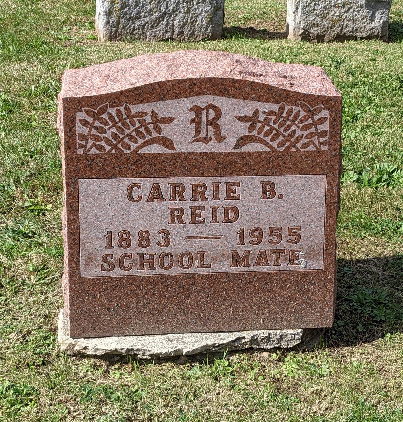
On one of my daily walks, I noticed this grave in Union Cemetery, which set me a wonderin’. “School Mate” is such a peculiar thing to put on a grave marker! I did a bit of research, and Wendy Ritter Bayer joined me in the effort.
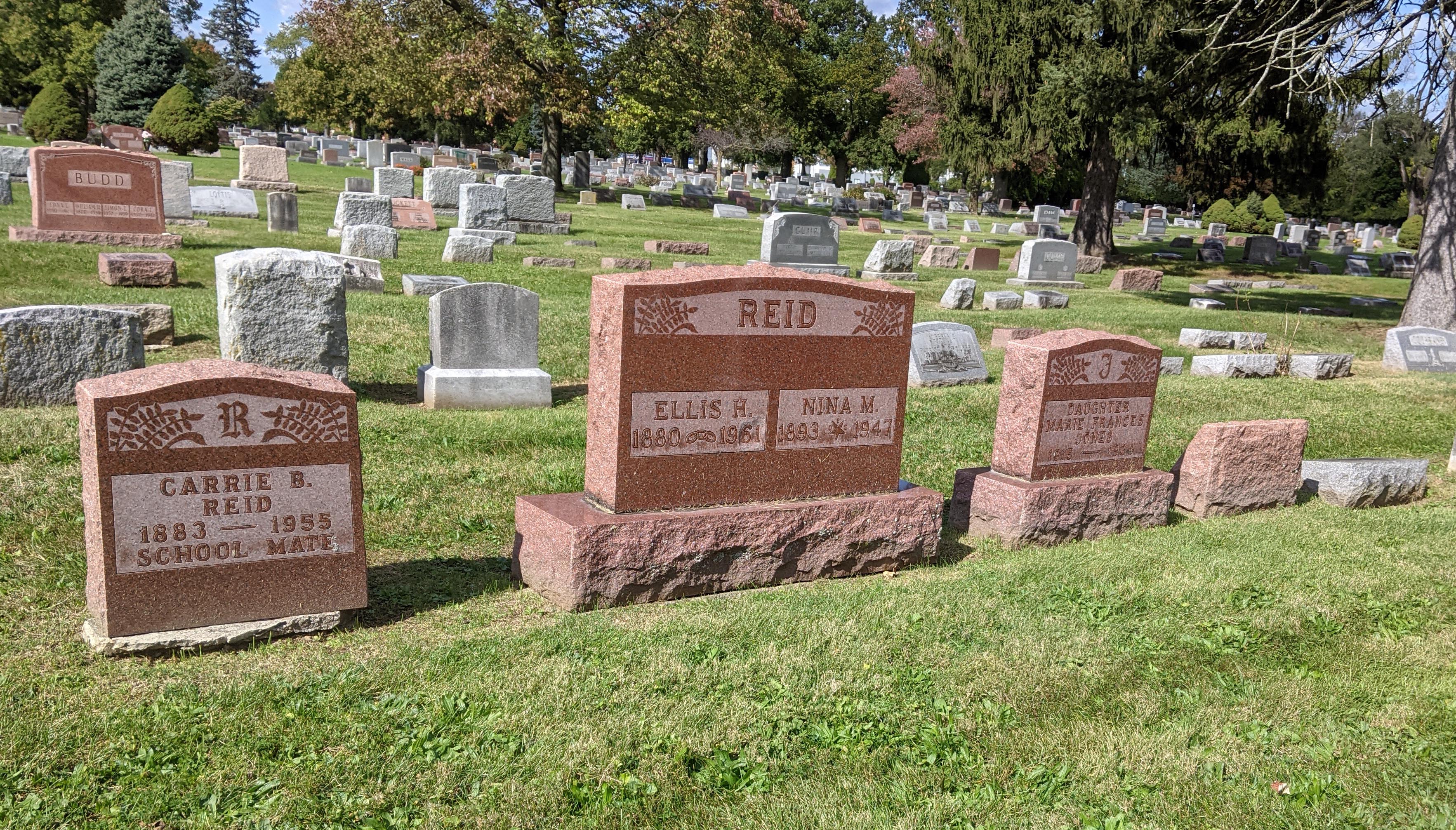 Here is the cluster of gravestones I was so curious about: Carrie Reid, Ellis & Nina Reid, Mary Frances Jones. Carrie Reid’s epitaph says “School Mate” but she shares a last name with Ellis and Nina Reid, and is their general age. Also, she died in her 70s, so it seemed unusual to hark back to her school friends.
Gravestones left to right are: Carrie Reid, Ellis & Nina Reid, Mary Frances Jones. Carrie Reid was Ellis’ 3rd and final wife. Nina married then was divorced from Ellis yet was buried alongside Ellis. Mary Frances is Nina’s child by a previous marriage.
(1) Ellis Harlen Reid was married 3 times:
–Flora Ellen Rice m. 1902. In 1903 he and Flora had 1 son, Russ, who died in 1991. Ellis and Flora presumably divorced.
–Nina Jones m. 1927. For some reason Ellis’ second wife Nina owed his first wife Flora $500 for a real estate matter which was paid in full by May 1937. Ellis Reid filed for divorce from Nina in May 1947, the same year Nina died–in September 1947–after a couple month’s illness “survived by her husband Ellis.”
–Carrie B Quinn m. 1950. Three years after divorcing Nina, Ellis married Carrie B. Quinn, who predeceased him.
(2) Nina was married 2 times:
–Thomas W Jones in West Virginia; he died in 1965 so presumably they divorced. They had a daughter, Marie Frances Jones; Marie died in 1934 and her stone is next to her mother’s.
–In 1927 she married Ellis Reid, divorced him in 1947, and died later that year. Her house at 524 Lincoln Ave was to be sold and proceeds paid “to my niece, Sylvia Cole, and my sister Ivy Robinson, share and share alike, or to the survivor of them.”
(3) Carrie was married 4 times:
–Oscar Bowman m. 1901; he died in 1954 so she must have divorced him. Carrie and Oscar had 2 living daughters: Bertha Leola, born 1903, and Helen E., b. 1906. Their address was 1268 1/2 N. High St. (Bertha married James Dolan in 1921 and Helen married Charles A. Taylor on 16 Aug 1927). Carrie and Oscar also had an infant daughter who died of “pre-mature birth” in 1909. Their address was 1181 Say Ave.
–Elmer Preston Buchanan m. 1918; he died in 1956 so presumably they divorced.
–Loren George Webster m. 1939; he died in 1940 from “barbital poisoning (addict).”
–Ellis Reid, m. 1950. He was 70, she was 67 when they married; she died 5 years after marrying him. He died in 1961.
I’m surprised at the sheer number of divorces–at least 4 between them. Ellis is buried alongside his second wife, rather than his 3rd and final wife, though that’s not all that uncommon; cemeteries and monument sellers often offer a “2 for one” price, so widowers ended up with a plot they might otherwise be unable to use. Also it wouldn’t surprise me if somehow Nina was instrumental in the choice, since her daughter by previous marriage is in the same plot and style stone.
Now, back to my original inquiry. Carrie was born and raised in Ohio, as was Ellis. Nina was born and raised in WV. So if Carrie was a “school mate,” it was with Ellis. I am unable to research whether that happened. But what kind of husband puts “school mate” on his newly deceased, current, wife’s stone? I’m wondering whether she was a SOUL Mate and the carvers got it wrong. If so, what a hoot.
Indian Springs 1922
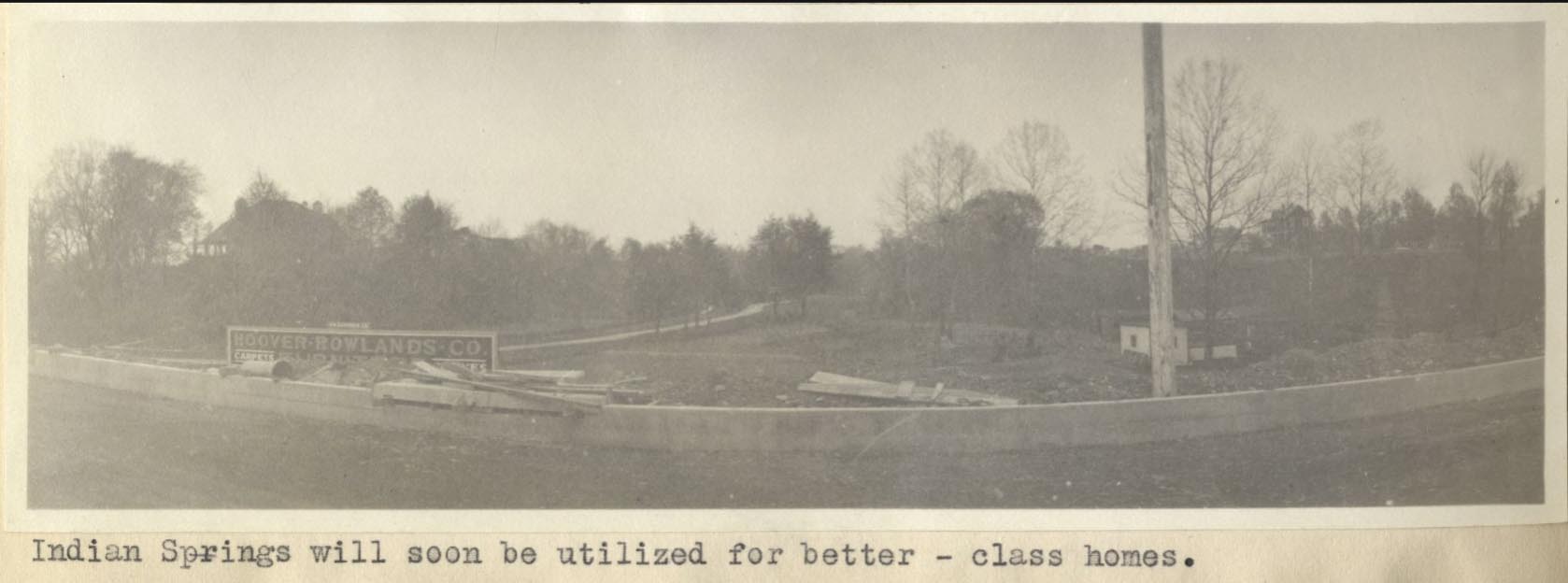
This is a nice photo from a 1922 Ohio State University masters thesis by Forest Ira Blanchard. I believe, based on the metadata, that it was taken at 70 E Henderson Rd. It is captioned, “Indian Springs will soon be utilized for better-class homes.”
It makes me curious about the “class of homes” about to be torn down.
Blanchard, inspired by the Chicago School of Sociology, sought to study the racial and ethnic composition of the city of Columbus, with a particular focus on the role of transportation (railroads, roads) in shaping the urban landscape.
[Courtesy of Forest Ira Blanchard, An Introduction to the Economic and Social Geography of Columbus, Ohio. Thesis (M.A.), Ohio State University, 1922; digital version from City of Columbus Historic Map Collection.]Rosemary & Rosemary South Plat Map 1923
 Here’s a nice plat map from 1923 of the Rosemary housing development.
138 East North Broadway
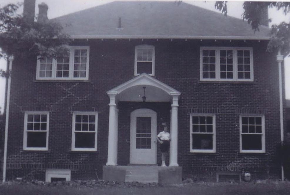
138 East North Broadway. Ralph Taylor Van Ness (1902-1989) and his wife Norma Thorp Van Ness (1910-2000) bought this house from North Broadway Methodist Church in 1960 and remodeled it.
Their daughter Margaret Van Ness (now Margaret Nelson) is shown on the porch.
Margaret writes,
Father dug out the basement and built his office downstairs. We lived next to the warden of the State Penitentiary. One time we bought a set of golf clubs from the warden’s sister. Another time, when my parents found an old safe in the attic of the garage, my father asked the trustees if there were any safe crackers amongst them. The answer: “No, Doc, but maybe next week.” My parents sent the safe to a company that could open it, so, we’ll never know if there was a treasure or a treasure map inside! Living on the other side of us was Arch Heck, a professor at Ohio State University, in charge of the Fulbright program, bringing students from abroad to study at OSU. Thus, my parents became hosts to several students, one from Nepal who, he told them, slept on the floor rather than messing up the bed.
The Van Nesses lived at this address until 1971. It has been significantly remodeled and expanded since the Van Ness time.
[Photos and narrative courtesy of Margaret Van Ness Nelson]Olentangy Park, from Alex Campbell
Transportation expert and collector Alex Campbell sent along some Olentangy Park pictures. Though you may or may not have already seen these pictures, Alex’ knowledge is invaluable. From Alex:
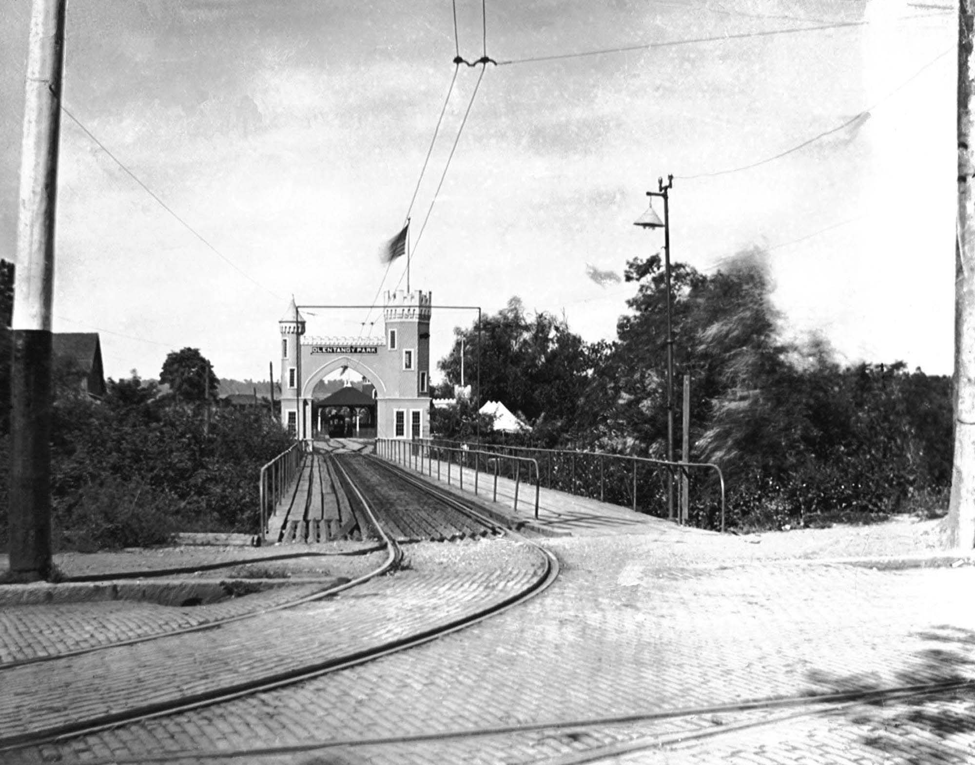
This is the streetcar and pedestrian entrance to Olentangy Park. Olentangy Park was purchased by the Columbus Railway & Light Co. in 1897 as a way to generate business. The high Street line ended at Arcadia. The North High Streetcar house was on the northeast corner of Arcadia and High Streets and directly across the street this park entrance. The Clintonville–Worthington streetcar line terminated at Arcadia as well hence the need for the pedestrian walkway.
Glenn Echo ravine runs east-west along the north side of the ravine. Crossing under the bridge is a north-south ravine that paralleled high Street. More on the north-south ravine on Wednesday.
The single track branches into two tracks, perhaps a loop. There is a loading platform beyond the arch. The single track into the park is going to be unsatisfactory as you will see on Wednesday.
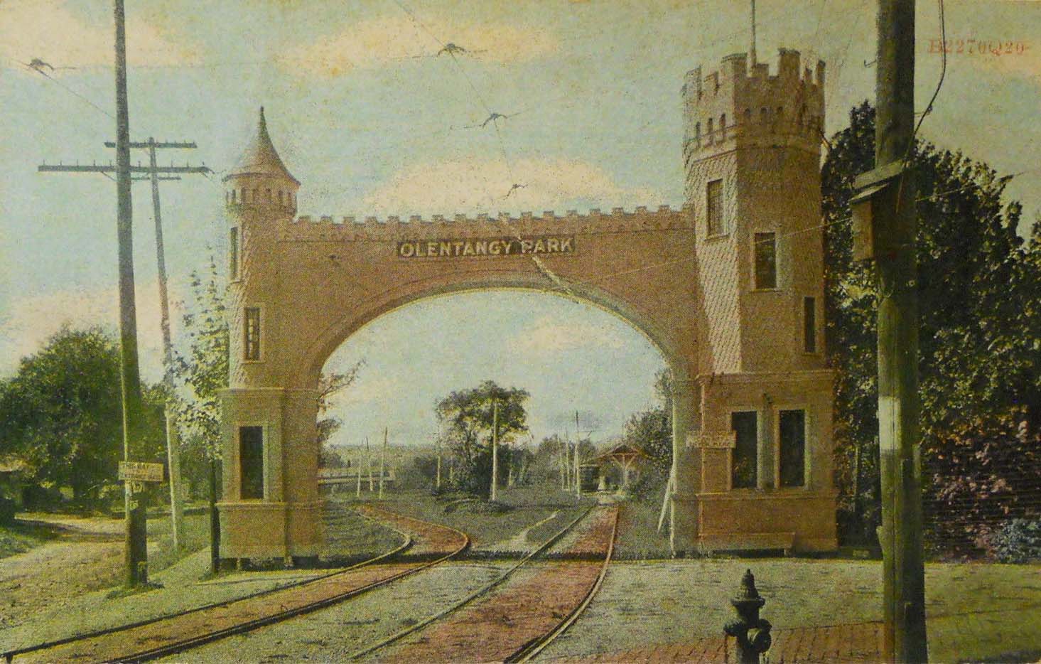
In 1907 the streetcar entrance to Olentangy Park was rebuilt. The ravine paralleling High Street was filled in eliminating the bridge. The inbound and outbound cars no longer had to share a single track. The Clintonville-Worthington visitors still had to walk in using the gravel path to the left of the entrance. (The CR&L Co was wide gauge and the Worthington line standard gauge.)
In 1899 the CR&L Co. sold the park to the Dusenbury brothers who transitioned it from a nature park to an amusement park. The brothers also built a 2248 seat theater.
When the theater let out the surge of streetcar customers must have required tens of streetcars. If they packed the cars with 60 riders each they would need 37 streetcars. That may be the reason the company made the improvements to the park streetcar loop and terminal.
At 5 cents a ride they would have collected $112, good money since they paid so little to their employees.
Alex also put together a super helpful Olentangy Park Chronology as an aid in dating all the Park photos that have shown up in the last few years. (Ohiomemory.org has a number of good Park photos.) Many of the chronology dates came from websites–so they are susceptible to error. Still it does give a sense of the life cycle of the park.
[ca1900 photo from the Christopher Trumbull Collection, by way of Alex Campbell. Postcard postmarked 1909 from the Alex Campbell Collection. Chronology courtesy of Alex Campbell]25 and 29 Tibet Road
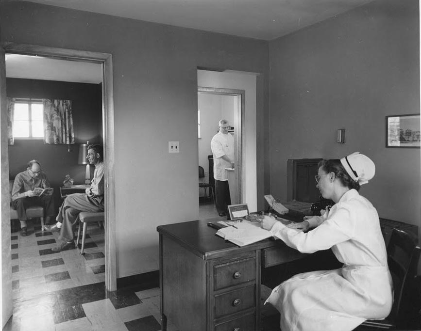
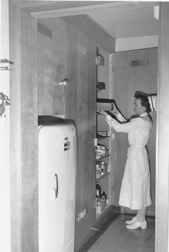
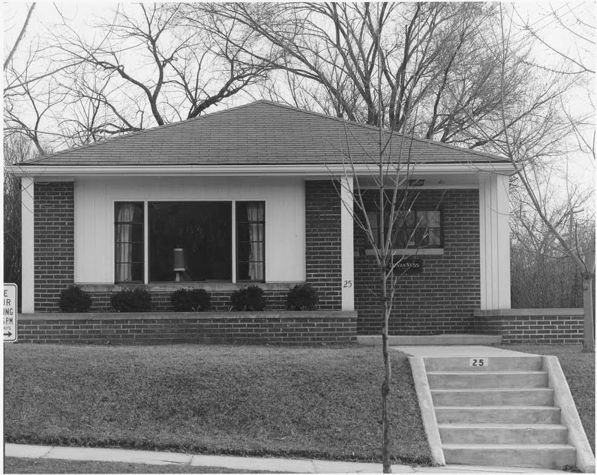 Margaret Nelson grew up in Clintonville and has kindly shared her treasure trove of pix of Clintonville with us. This is the medical office building her father, Dr. Ralph Taylor Van Ness, built in the 1950s at 25 Tibet Road.
Below is a view of the inside. You can see patients in the waiting room, the nurse, Margaret Deckard, at her desk, and Margaret’s father, Dr. Ralph Taylor Van Ness, in another room. The photo on the right shows Mrs. Deckard in the supply room.
 The Van Ness family lived next door to the medical office, at 29 Tibet Road.
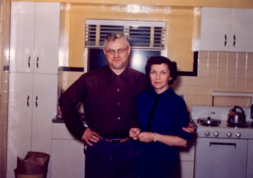 Here are Margaret’s parents in their 1950s kitchen. They sold to Dr. John Gardiner in 1959 and then moved to 138 East North Broadway.
310 East Weber Road
The Van Ness family lived at 310 East Weber from about 1947 to about 1950.
 This is the front of the house with Margaret Van Ness Nelson’s brother John Van Ness standing in front.
Though the house was on the north side of Weber, the building itself faced north toward a right-of-way that was never developed into a street. Or maybe the right of way was partially developed and is now “Iswald Road”?
There were 4 houses between 310 E Weber, and the corner of Weber and Calumet. The current house on that corner hadn’t been built yet when the Van Nesses lived there.
 This is a side view–the east side–of 310 E Weber.
Margaret writes, “Our front yard was a ditch that was supposed to be a street but was never built. We played in the woods. We called it the Hala [after ‘Walhalla’]. There was the first Hala and the second Hala, which is where the white Mooney house still stands. It was sort of scary so we didn’t go near it. On the other side of Hala #2 was where Darien and Jan Mooney lived in a one-story house, which intrigued us with the kitchen on the first floor.”
 The house at 310 Weber was eventually torn down to make a parking lot for Crestview School.
HouseNovel Hopes to Crowdsource Home Histories
According to an article in the TCB web site written by Dan Niepow:
…The idea came to fruition in the form of HouseNovel.com, a website that Zielike describes as one part Zillow and one part Ancestry.com. It essentially operates as a social media platform where users upload historical photos, personal anecdotes, construction dates, and other details about residential properties. It’s designed to show how properties have changed over the years. The site is free to use, but the two aim to generate revenue through a subscription-based advertising model. Advertisers pay a monthly fee starting at $349.
“We’re going after real estate professionals who care about home history, whether that’s real estate agents, architects, general contractors, or any other people in the real estate trade that focus on older homes,” Decker says. “We feel there’s a huge market for that and for those sorts of services.”
The couple worked with Square 1 Group, a California-based web developer focused on real estate websites. In addition to crowdsourced material, HouseNovel is sharing its platform with any interested local historical groups to supplement property information and partner on special projects; the company has already landed a partnership with Edina’s Heritage Preservation Commission and St. Paul-based historic preservation nonprofit Rethos.
As of August, Zielike says there have been more than 18,000 home profile records uploaded to the site, about 10,000 of those in Minnesota. For now, HouseNovel is focusing on residential properties, but eventually it aims to open it up more broadly to commercial real estate.
You can read more here.
The HouseNovel web site may be found here.
175 East Tibet Road
 Margaret Van Ness Nelson has shared many family photos with us; this is the house her parents lived in, at 175 East Tibet Road, from 1942-1947.
 And here’s a nice contemporaneous picture. Margaret writes, “My mother, Norma Thorp Van Ness, 10 April 1946, in our Dodge, parked across from our house at 175 Tibet, back when there was lots of room to park cars.”
[Photos Courtesy of Margaret Van Ness Nelson.]
Tipping the Scales, & Life on the Edge
Today is Martin Luther King Jr. Day, and so I thought I’d use this opportunity to write about my most recent “read”. It’s the book Tipping the Scales: One Man’s Freedom, by Stanley U Robinson with revisions and editing by his son David R Robinson. The book is available as an ebook and a print book.
As an historian wrote recently, heroism is neither being perfect, nor doing something spectacular. In fact, it’s just the opposite: it’s regular, flawed human beings, choosing to put others before themselves, even at great cost, even if no one will ever know, even as they realize the walls might be closing in around them. Such heroes did not wake up one morning and say to themselves that they were about to do something heroic. It’s that, when they had to, these people did what was right.
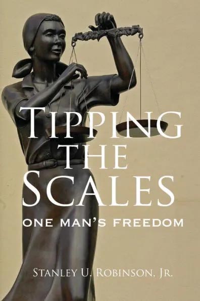 This book tells the story of some local people who were heroes. In 1954 a Columbus interracial family (Phyllis and Wilson Head and their 2 children) decided to move to an all-white neighborhood. In the racist real estate environment of the time, this was taboo. Though it was decidedly unconstitutional to discriminate on the basis of race, discrimination was rampant. The Heads were represented, for the real estate transaction, by attorney Stanley U. Robinson. They were able to conceal Wilson Head’s Black identity only because the seller, banks, and insurer never bothered to ask about race. Once the sale had gone through and the Heads moved into their new house at 2166 Indianola Avenue, all hell broke loose. Attorney Robinson faced the wrath of the banking and real estate agent community (including a threat of disbarment), and his family was deluged with crank telephone calls from the bigoted new neighbors of the Heads. The Heads themselves faced bigotry, but were physically protected by prearranged police presence and local church members’ vigilance. The Heads “stuck to their principles” and refused to be intimidated or bought out.
 Though this act of segregation-busting was successful, in 1959 the Head family moved to Windsor, Canada “to get [the] children away from a racist society.” Wilson Head had a PhD and was a respected sociologist and civil rights leader, and the Heads’ (understandable!) move was Columbus’ loss. You can read more about Wilson Head here.
Next up on my reading list: Wilson Head’s own book, A Life on the Edge: Experiences in Black and White in North America. University of Toronto Press. ISBN 978-0-9680066-0-3.
139 West Dunedin Road
Margaret Nelson (née Van Ness) grew up in Clintonville, and has shared some old family photos.
Her family lived at the following addresses:
-
139 W Dunedin, 1939-1941 or 1942
175 E Tibet, 1942-1947
310 E Weber, 1948-1950
29 and 25 Tibet, 1950-1959
138 E N Broadway, 1960-1971
I’ll be sharing these old house photos in the months to come.
This photo is 139 West Dunedin. Ralph Taylor Van Ness (1902-1989) and his wife Norma Thorp Van Ness (1910-2000) bought this house in 1939; it was their first house as a married couple. They lived here until August 1942, when they moved to 175 Tibet Road.
Here’s are some present-day photos; the house has since been screened in and added on to.
The Art of Fred M. Ervin
 Amy Ervin Smithson shared this wonderful web site that shows the range of signage created by sign vendor Fred M. Ervin Sign Service, 2447 Middlesex Rd, Upper Arlington OH.
A Little Bit of Sewage Goes a Long Way
Last month I provided a glimpse of James Chesnut, who lived at 3338 N. Wall Street. James Chesnut was involved in significant litigation with the North Broadway developers and neighbors. Though last month I said James appears to have been irascible, I’d certainly be that way too if this happened to me. From the Dispatch:
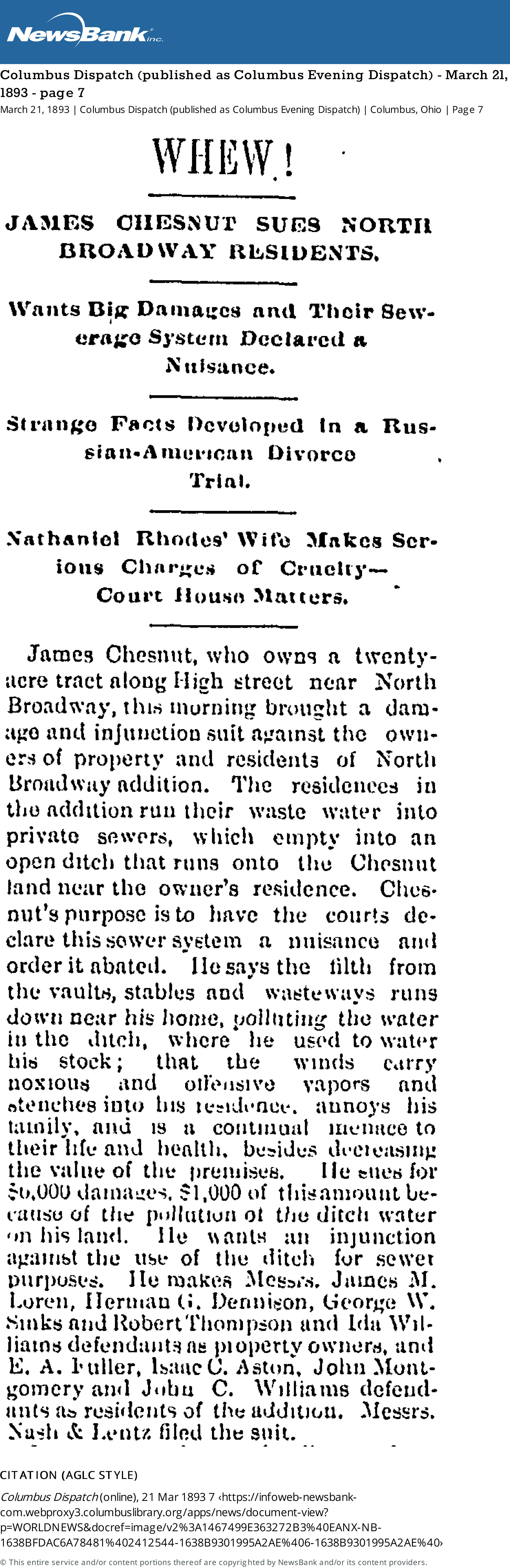
[From Columbus Dispatch (published as Columbus Evening Dispatch) March 21, 1883 page 7.]Whew!
James Chesnut Sues North Broadway Residents
Wants Big Damages and Their Sewerage System Declared a NuisanceJames Chesnut, who owns a 20-acre tract along High Street near North Broadway, this morning brought a damage and injunction suit against the owners of property and residents of North Broadway addition. The residences in the addition run their waste water into private sewers, which empty into an open ditch that runs onto the Chesnut land near the owner’s residence. Chesnut’s purpose is to have the courts declare this sewer system a nuisance and order it abated. He says the filth from the vaults, stables, and wasteways runs down near his house, polluting the water in the ditch, where he used to water his stock; that the winds carry noxious and offensive vapors and stenches into his residence, annoys his family, and is a continual menace to their life and health, besides decreasing the value of the premises. He sues for $6,000 damages, $1,000 of this amount because of the pollution of the ditch water on his land. He wants an injunction against the use of the ditch for sewer purposes…
A couple months later, the North Broadway developers issued a rejoinder:
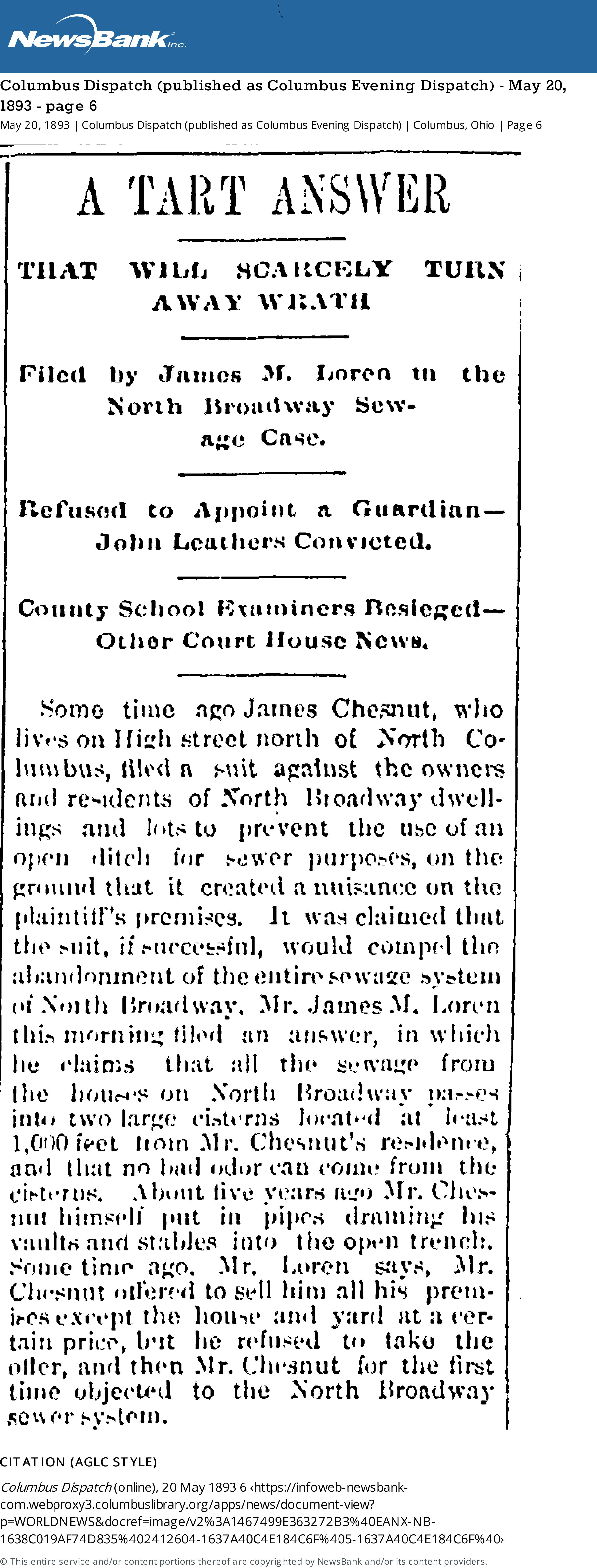
A Tart Answer
That Will Scarcely Turn Away Wrath
Filed by James M. Loren in the North Broadway Sewage CaseSome time ago James Chesnut, who lives on High Street north of North Columbus, filed a suit against the owners and residents of North Broadway dwellings and lots to prevent the use of an open ditch for sewer purposes, on the ground that it created a nuisance on the plaintiff’s premises. It was claimed that the suit, if successful, would compel the abandonment of the entire sewage system of North Broadway. Mr. James M. Loren this morning filed an answer, in which he claims that all the sewage from the houses on North Broadway passes into two large cisterns located at least 1,000 feet from Mr. Chesnut’s residence, and that no bad odor can come from the cisterns. About five years ago, Mr. Chesnut himself put in pipes draining his vaults and stables into the open trench. Some time ago, Mr. Loren says, Mr. Chesnut offered to sell him all his premises except the house and yard at a certain price, but he refused to take the offer, and then Mr. Chesnut for the first time objected to the North Broadway sewer system.
[From Columbus Dispatch (published as Columbus Evening Dispatch) May 20, 1883, page 6.]
Apparently Loren’s response was not accepted by the courts, for this article followed along in 1897:
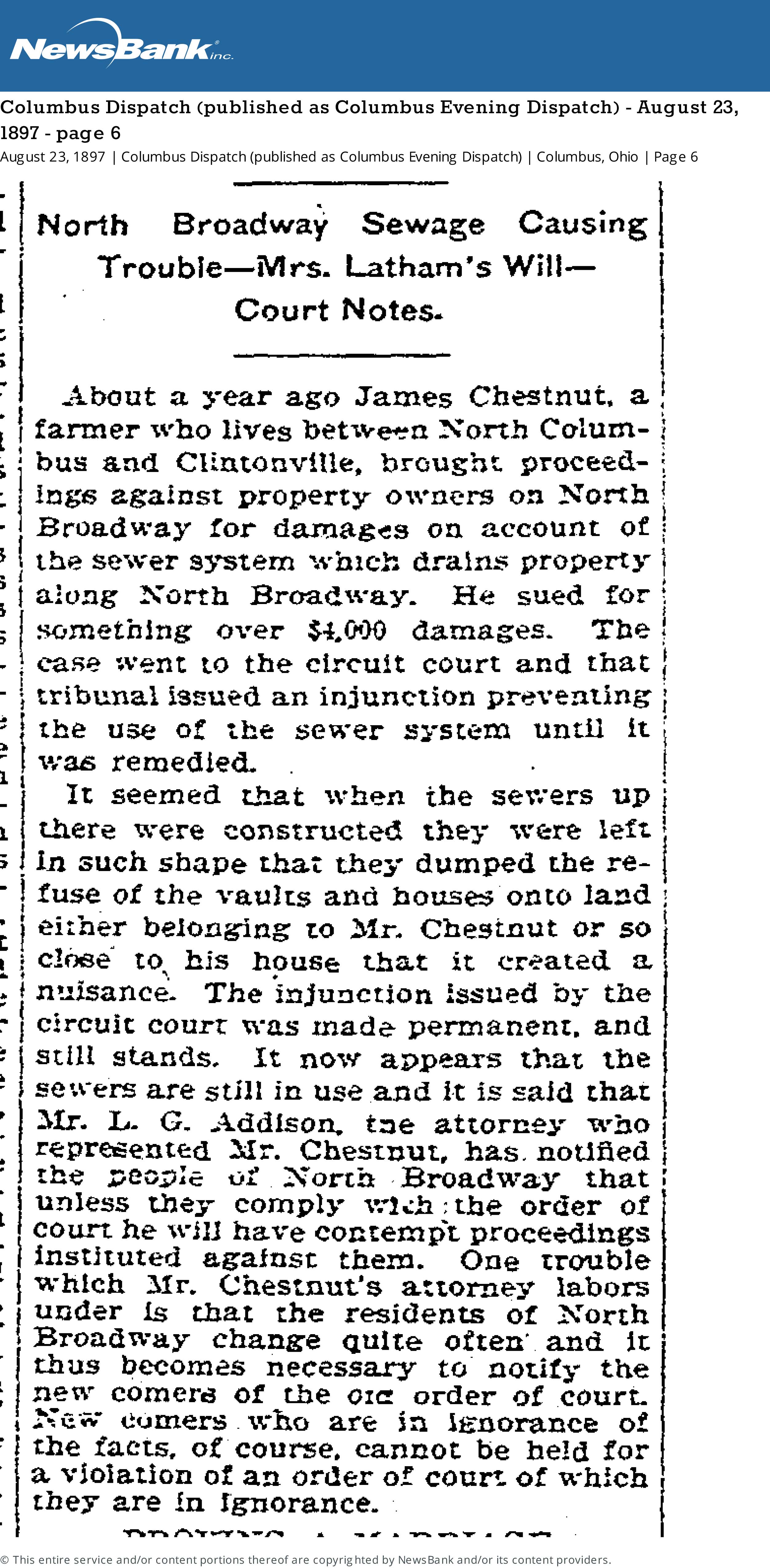
[From Columbus Dispatch (published as Columbus Evening Dispatch) Monday August 23, 1897 page 6.]North Broadway Sewage Causing Trouble
About a year ago James Chestnut, a farmer who lives between North Columbus and Clintonville, brought proceedings against property owners on North Broadway for damages on account of the sewer system which drains property along North Broadway. He sued for something over $4,000 damages. The case went to the circuit court and that tribunal issued an injunction preventing the use of the sewer system until it was remedied.
It seemed that when the sewers up there were constructed they were left in such shape that they dumped the refuse of the vaults and houses onto land either belonging to Mr. Chestnut or so close to his house that it created a nuisance. The injunction issued by the circuit court was made permanent and still stands. It now appears that the sewers are still in use and it is said that Mr. L. G. Addison, the attorney who represented Mr. Chestnut, has notified the people of North Broadway that unless they comply with the order of court he will have contempt proceedings instituted against them. One trouble which Mr. Chestnut’s attorney labors under is that the residents of North Broadway change quite often and it thus becomes necessary to notify the new comers of the […] order of court. New comers who are in ignorance of the facts, of course, cannot be held for a violation of an order of court of which they are in ignorance.
An Old Chestnut…or Rather, Chesnut
 Occasionally, the name of a local figure pops up with frequency, and one forms an image of, well may I say, an irascible neighbor? James Chesnut (often spelled “Chestnut”) is one of those guys; see other posts about him here.
Who was this guy, anyway? James Chesnut was born in Ireland on May 1, 1820, and he died at age 85 on May 26, 1905. Census records say James was a “machine sawyer,” “works in coal factory”, or “foreman and tool shop”. He seems to have owned 20 acres on North High Street. His wife was Christiana McEwan (b. Dec 24, 1825, d. Jul 14 1891). (One source says “Ewing” but I believe that’s wrong.) She is buried with James in Greenlawn Cemetery. Some census records say Christiana was born in England or Ireland, and there’s also a record that says her father lived in Ridgeway, PA.
James and Christiana had a daughter (one census record says “adopted daughter”), Fannie, who was born around 1854/55. She lived with her parents and seems to have remained single. She continued to live in the North High Street (now Wall Street) house through 1910, but by 1914 she’d moved to 2103 Summit Street. She lived there until her death in March 1932; she died at age 78 in University Hospital of injuries suffered when she was hit by a taxi the previous December. (Her obituary also names a sister, Jennie Reid, who lived in Bridgeport Connecticut.)
I love the Chesnut house, still in existence at 3338 N. Wall Street.
Clintonville Community Band
 The Clintonville Community Band is one of the Clintonville’s hidden gems. Their concerts are typically free for community events, and they charge a nominal fee for other concerts. Here’s some of its history.
Glenn Williams and Greg Weber convened an organizational meeting for the band on February 27, 1986. Glenn Williams, Greg Weber, Rick Burkhart, and Les Susi, Bob Robuck, and Tom Davenport attended, and so you could credit them with being founders. At the time, the plan was to recruit musicians from any of the local high schools, and to refuse no one.
The first rehearsal was held April 15, 1986 at Whetstone High School. North Columbus Civitan funded the band’s first year. The Band had a concert that summer, as well as a Christmas concert.
 On August 31, 1996, they renamed themselves The Clintonville Community Band (from the North Columbus Community Band). By then they’d decided to play at as many local events as possible, including the “Clintonville-on-High” festival, CURB Recycling Saturday, a Christmas concert, and a children’s concert; the goal was to put themselves on a firm financial footing through good community exposure and an increase in donations. At the time they had about 40 active members.
In 2004, they celebrated their 20th year by commissioning a piece by Barry Kopetz. Would you like to hear that song? Click here.
Now, if you’ve read this far, you know they depend on donations. Just do it!
[All the material here is courtesy of the Clintonville Community Band and based on a talk that Glenn Williams, Stuart Smith, and Rick Burkhart gave at the Clintonville Historical Soceity.]Great Sale of Live Stock
Last April 2021, I posted an article by Clintonville Historical Society President Mary Rodgers, about the Clintonville Woman’s Club. The club was built on land that was once owned by a “horse trader” named E. A. Fuller.
 I recently found some old advertisements for horses–bought, sold, stabled–at E.A. Fullers Farm. Here’s one of them from the Columbus Dispatch (published as Columbus Evening Dispatch) October 27, 1876, page 1.
(I’m glad it was not a sale of dead stock.)
There are many more ads; here’s one for stabling horses near E.A. Fulller’s farm from the Columbus Dispatch (published as Columbus Evening Dispatch) November 12, 1877 page 4.
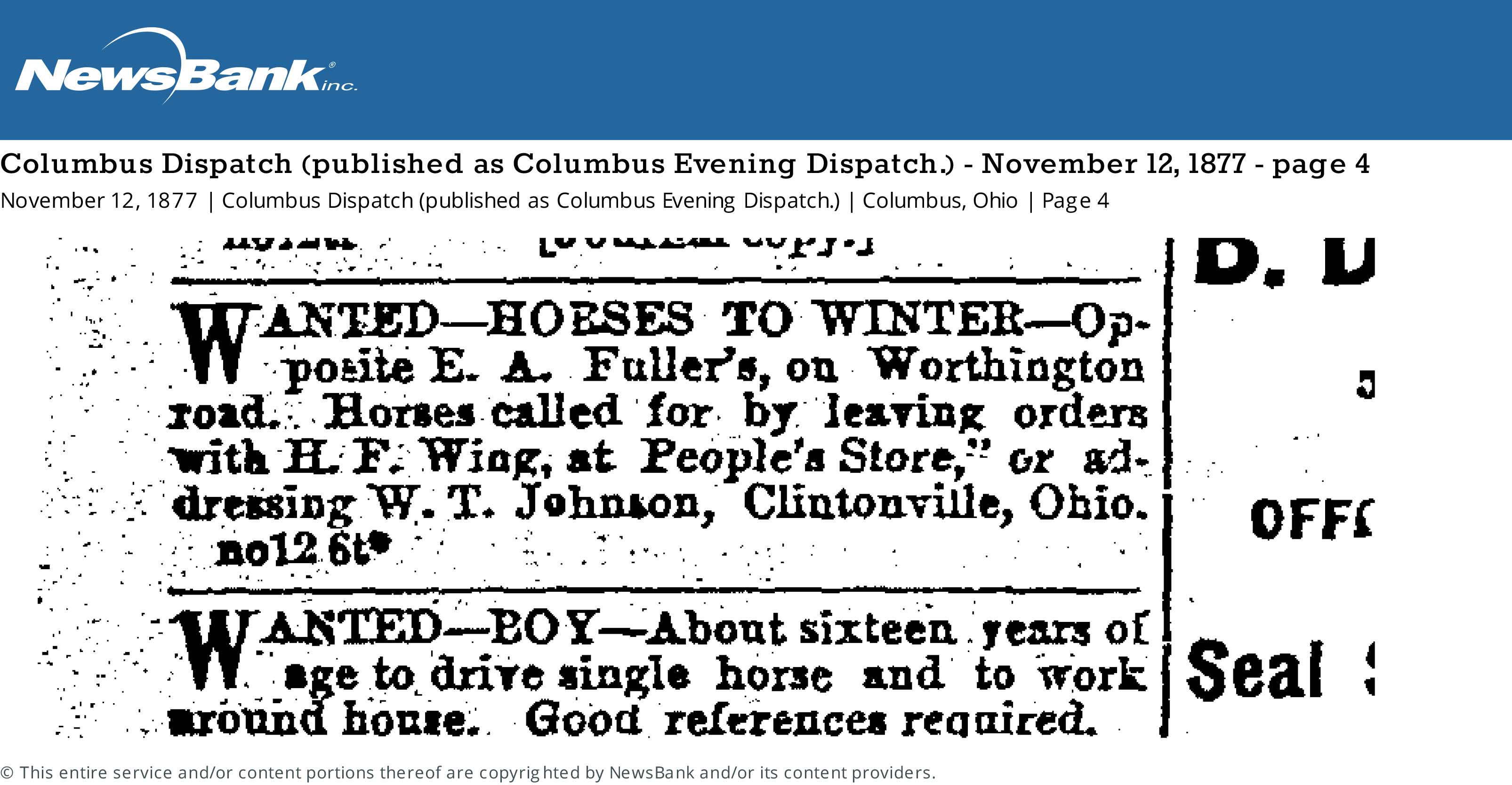
The Dispatch has lots of other ads as well, especially from 1902, for stabling horses at the Fuller farm. They’re great reminders of Clintonville’s agricultural past.
[Thanks to the Columbus Metropolitan Library for making the Digital Columbus Dispatch available and searchable online on CML’s web site.]Pierce Cleaners, Ford, & DQ
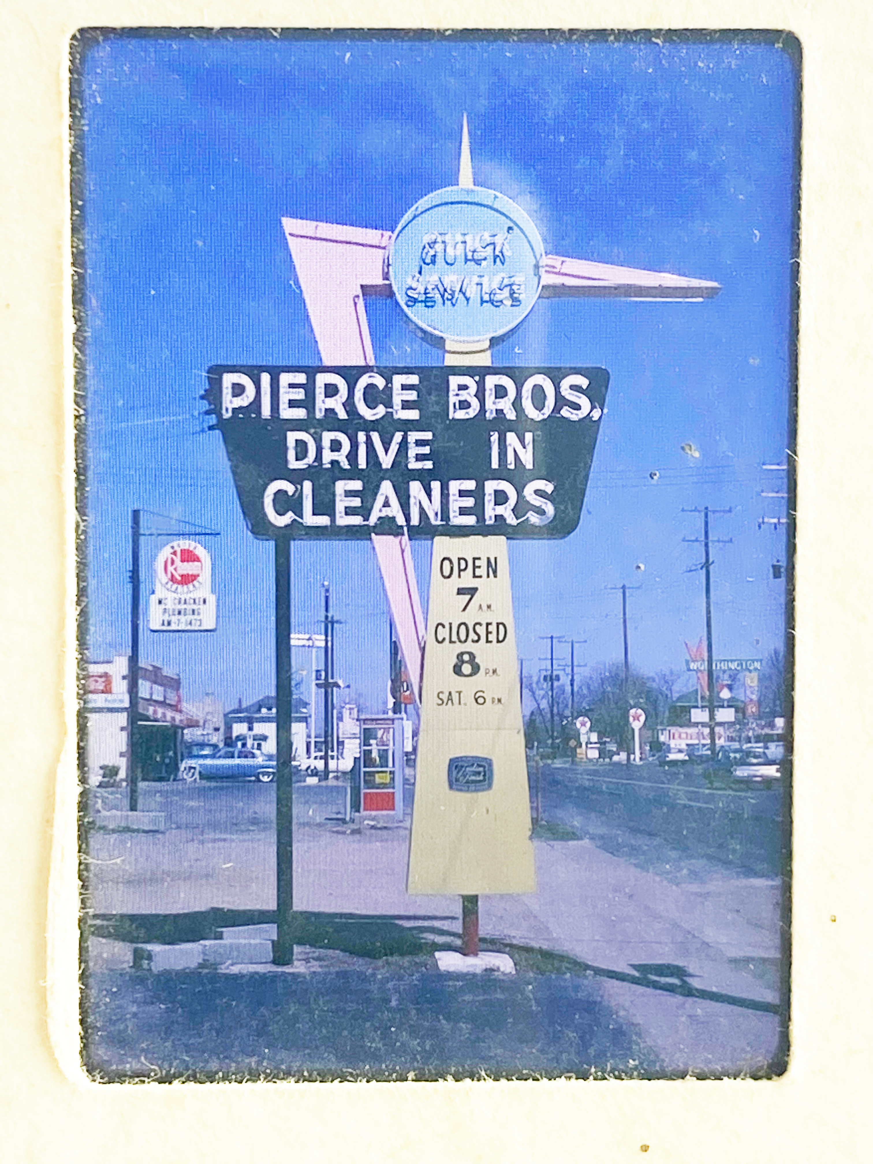 Pierce Cleaners was technically in Worthington, but here’s a great photo of its sign back in the day. This neon sign is by Fred Ervin–same company that created the Jerry’s/Sisters/Tee-Jaye’s sign at Morse and N High, and created around the same time.
If you click on that photo of Pierce Cleaners to enlarge it, you may also notice the Ford dealership just north, on the east side of North High. Another of Fred Ervin’s signs! His signs are everywhere. On the left, the older Ford sign; on the right, a newer version.
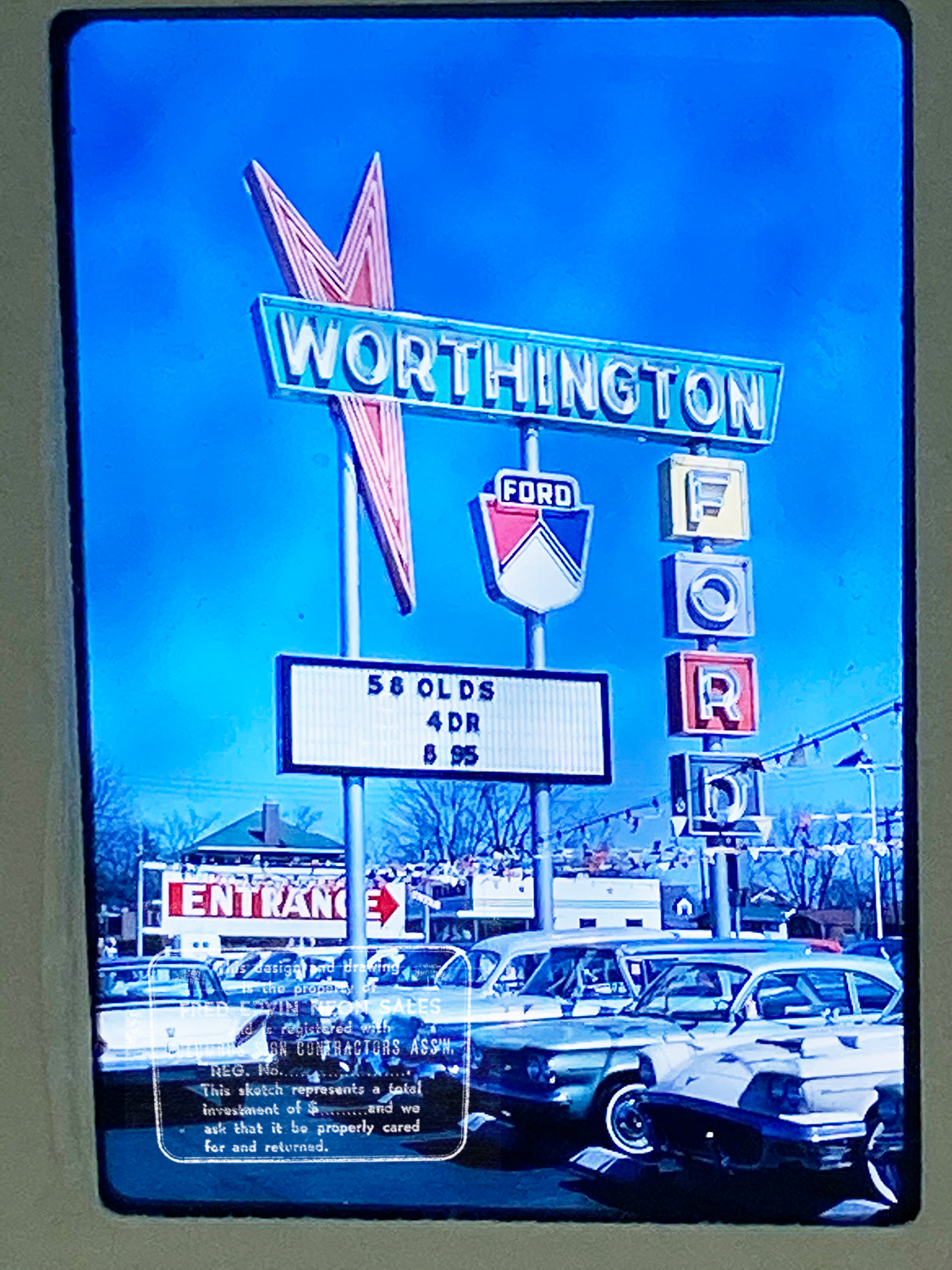
And while we’re pretending to be in Worthington, here’s an old photo of the Dairy Queen sign on North High Street just south of the Orange Johnson House Museum (which is itself worth a visit).
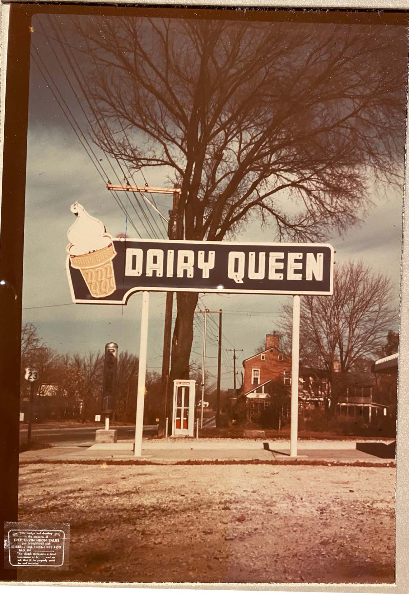
The First Post Office
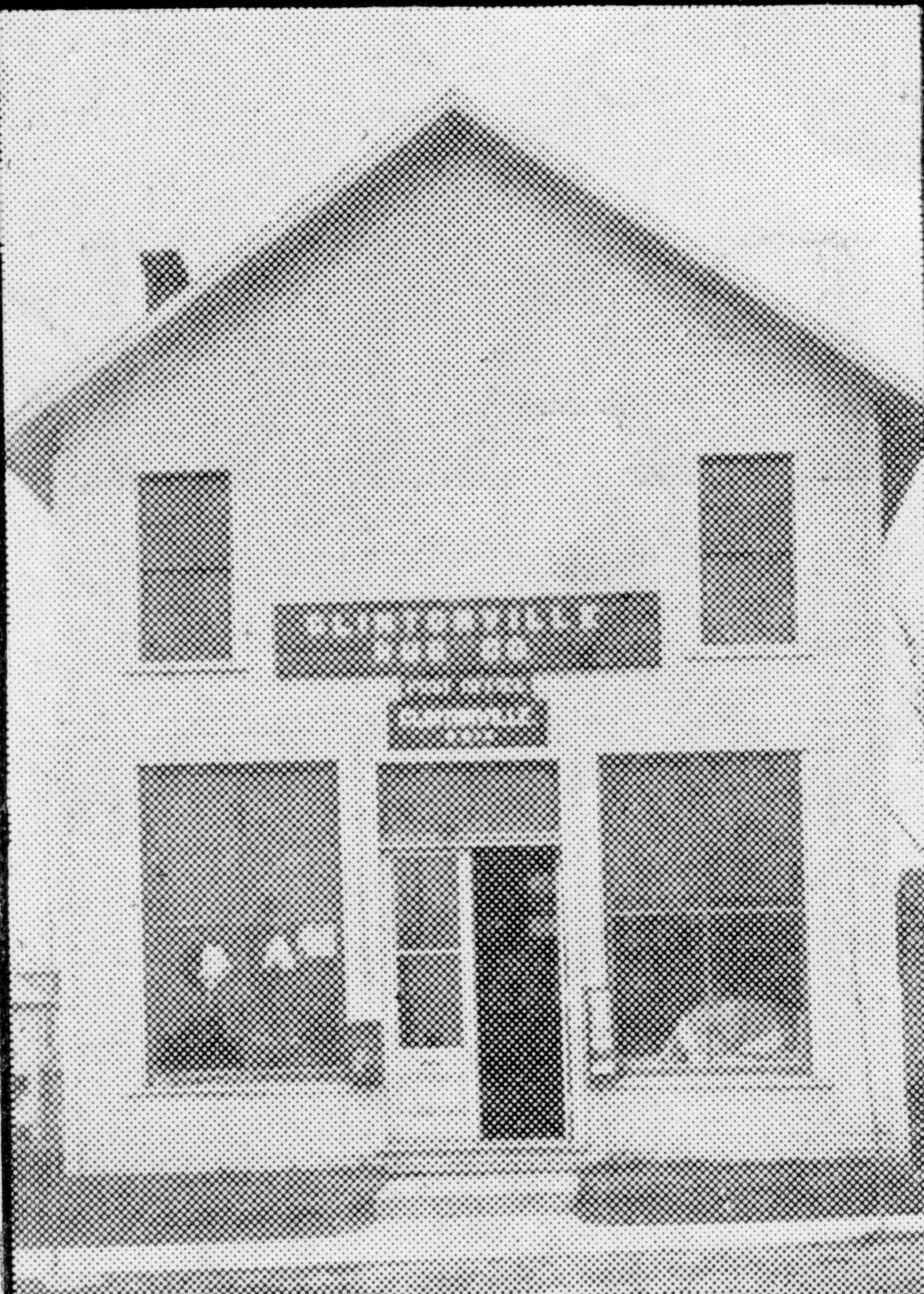 If you have not yet joined the Clintonville Historical Society, well, you ought to! Mary Rodgers sends out an interesting monthly newsletter that is chock-a-block full of good articles. In the October 2017 issue, she penned an article about Clintonville’s first post office.
Celebrating 170 years: The first Post Office
by Mary Rodgers
October 2017
We celebrate Clintonville’s birthday on September 13, 1847. That is the day that a post office opened using the name “Clintonville”. We know that the small town between Columbus and Worthington existed prior to the date but because the town was never formally platted, we do not have an alternative formal start date. On September 13, 1847, James Ferguson was appointed postmaster at the Clintonville Post Office. It was the practice at the time to locate the post office in a business operated by the postmaster. The names of the offices were determined by the postmaster and were usually associated with the area that they were located, the postmaster’s name or the postmaster’s business. In 1933, The Booster printed a photo of the post office. That photo is of a rug store! Mr. Ferguson was a blacksmith. Maybe he had a side operation?
Or, maybe this photo captured the building where Clintonville’s second postmaster set up operation? Harmon “Hammer” Houck was Clintonville’s second postmaster. He reigned from November of 1852 to April of 1854. The 1850 census lists him as a peddler. That might be consistent with a rag rug dealer.
James Ferguson reclaimed the position of postmaster in April of 1854. He and family originated in Lancaster Co. Pennsylvania. He was the son of John and Susanah (Hood) Ferguson. James was married to Hannah Murray around 1824. The Fergusons, at least three generations, came to Ohio in 1843. They arrived by wagon (note: Lancaster County, Pa is the birthplace of the Conestoga wagon!). Based on area maps, James purchased his Clintonville property from Alanson Bull. A question would be: How did Ferguson become aware of Bull’s interest in building a town? Did Bull run advertisements in Eastern newspapers of the time? That is a question for another day.
According to the 1850 Census, James Ferguson owned 5 acres of land, a home, two milk cows, a beef cow, five pigs, and 100 bushels of corn. His livestock was valued a $98, his machinery at $41 and his overall estate at $950. His estate was higher in value then his neighbors with more land. Perhaps that is an indication of its geographical position “in town”? Hannah Murray Ferguson, James’s wife, was a Quaker. Quakers were known to be involved in the Underground Railroad and the Fergusons are a part of the Clintonville Underground Railroad story. The Ferguson sons Joseph, John and Samuel all served in the Civil War. His son Joseph died in action in Perryville, KY. According to K. Haefner, 3rd great granddaughter of Hannah and James Ferguson, when sons John and Samuel returned from the war, the family moved to Findlay, OH. It would seem that John and Samuel met a number of men from Hancock County while serving. Those men told stories of the land and those tales impressed these young men. In Findlay, Samuel and John pursed wagon making. The shop they opened remained in operation beyond 1911.
Bourguignon House (193 East North Broadway)
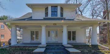
Paul-Henri Bourguignon was a talented visual artist, a prolific writer and journalist, a skillful photographer, and an avid observer of the human condition. His wife Erika was a world-renowned anthropologist. They lived at 193 East North Broadway until their deaths in 1988 and 2015 respectively.
Here’s a terrific house tour of their Clintonville home, showcasing their life and collections at 193 East North Broadway before the house was sold.
And here are some links to additional information about each of them:
About Paul-Henri Bourguignon
About Erika Bourguignon
Olentangy River ca 1957 & 1958
Two nice photos of the Olentangy River in the 1950s.
From Bill Pegues:
[These photos were taken by Frank Pegues and digitized by Jim Pegues, and came to us courtesy of Bill Pegues.]During 1954 my parents moved to Columbus, where my father taught history at Ohio State until 1997. A couple years ago my brother scanned my dad’s slide collection into digital format. My father had documented the location of the scenes in many of them but a fair number lacked any identity. Among these were two shots from an identical point on the Olentangy River in the late ’50s. I spent some time with these and on Google Earth trying to determine where exactly they were taken. Ultimately, I concluded with certainty (based on zooming in on the line of houses visible in the early 1958 photo, and comparing them with the Google Street View of the houses there today, as well as noting the curvature of the river) that they were shot on the west side of the Olentangy just downstream of the old Henderson Road bridge looking north. At the time my parents were renting a house on East Selby Blvd just over the Worthington-Columbus boundary. The preceding photos in the 1957 set were taken at an Ohio State football game that fall, and of the old Lane Avenue bridge as the leaves were beginning to turn. My parents would likely have driven up Olentangy River Road after these games and taken Henderson up to High before driving north to Selby.
The first feature in the 1957 photo that interested me is the parking lot at center-left, indicating that this was a popular spot for people to visit, and probably picnic and stroll around. At the time, SR-315 didn’t yet exist this far north (it wasn’t completed from Ackerman Road north to 270, if I recall correctly, until I was entering high school in 1980) so the only road running along the west side of the river was Olentangy River Road. The second feature of note is that the land on the east side of the river is, accordingly, the open field that would be the location of Whetstone High School (from which my brothers and I graduated in the late ’70s and early ’80s), constructed in 1960-61.
528 Acton Construction
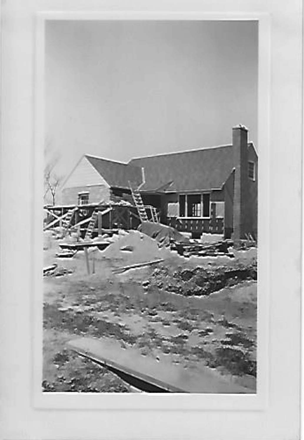
Scott Jones, a professor in the OSU School of Music, kindly shared some terrific photos of the 1947 construction of his house at 528 Acton Road.
The photos came to Scott from Sally Schock (Moore) who grew up in the house and whose father’s brother built the home in 1947.


 The house looks today very much like it did when finished in 1947.
Wilke’s Quality Market (3131 North High)
 Last month I mentioned the new Clintonville store, Re-Wash, owned by Samantha White. While Sam was renovating the space, she uncovered this wonderful sign from a previous era. It was on the wall–undoubtedly the exterior wall–of 3131 North High (now “Lucky 13 Salon”). In 1926, 3131 North High Street was occupied by Wilke’s Quality Market.
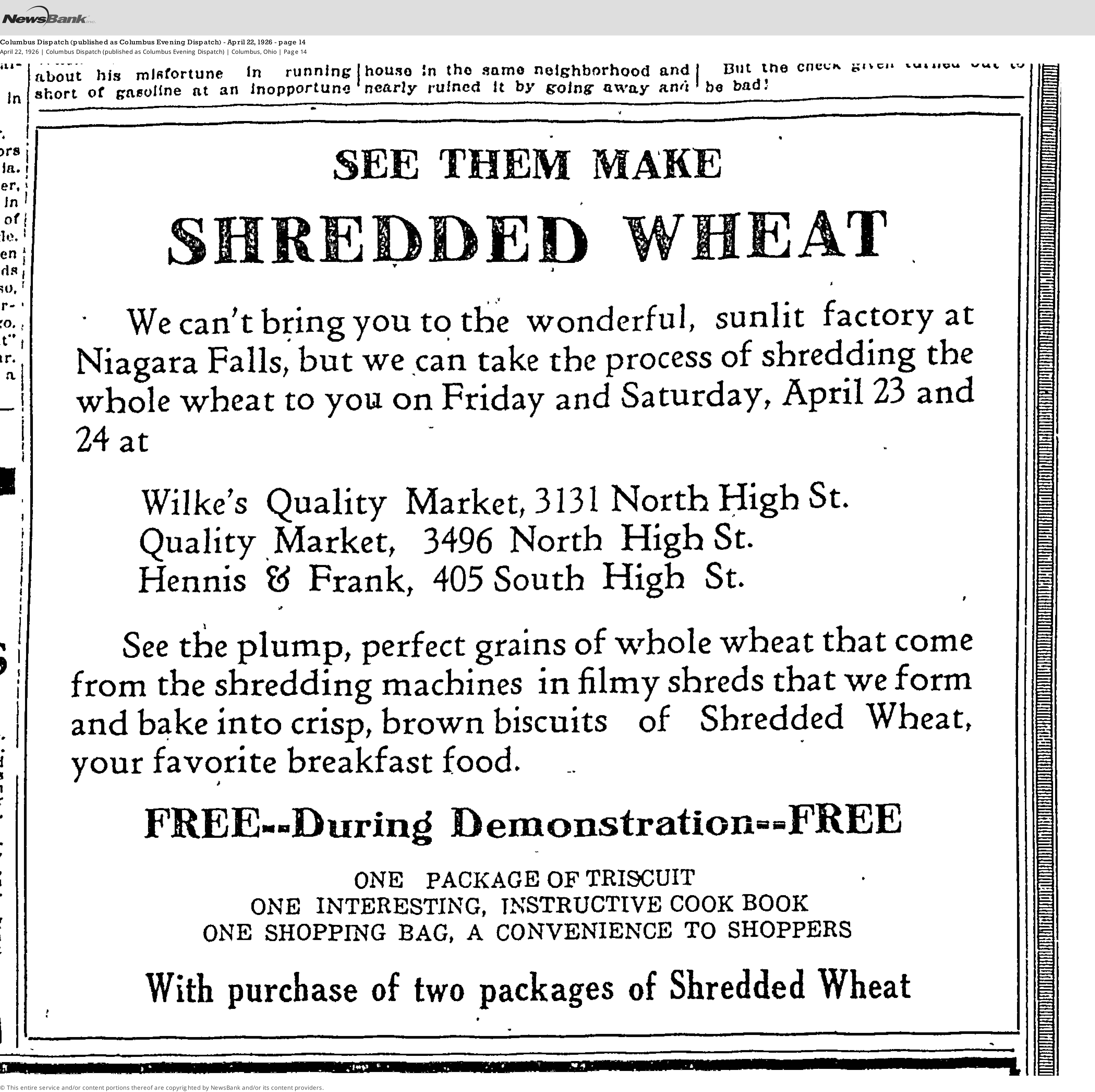 Here’s an ad from the Columbus Evening Dispatch on April 22, 1926. The Wilke family business–which eventually became Ohio Packing Company–lasted for some 107 years in Columbus. (The Wilke’s Quality Market in Clintonville seems to have been one of the Wilke family’s more minor locations.) The business was established in 1907 by Fritz Wilke as a neighborhood butcher shop in Columbus, eventually focusing on meat cutting and packing. Different aspects of the business were run by various family members–finally by 3rd and 4th generations of the family. Ohio Packing Company closed in April, 2014. There’s a little history of that business here and here though I myself cannot at the moment access the latter article.
In case you are wondering: that other Clintonville market mentioned in the Shredded Wheat ad, Quality Market at 3496 North High Street, was located where Seitan’s Realm is today.
And about that Dispatch ad: Yes, I would LOVE to see them making Shredded Wheat, back in the day; wouldn’t you? You can read more about Henry Perky, the inventor of Shredded Wheat, Triscuits, and the machine that made them, here.
[The ad was provided to me by Loraine of the Columbus Metropolitan Library–Local History and Genealogy Desk; it’s from the Columbus Dispatch published as Columbus Evening Dispatch, April 22, 1926, p14.]3133 North High Street (Re-Wash)
 There’s a new kid in town! Re-Wash Refillery has opened in the space formerly occupied by Nancy’s Restaurant at 3133 North High Street. Owner Samantha White has done a stunning job of making “adaptive reuse” of the space and we trust this business will become as much of a Clintonville icon as her predecessor was.
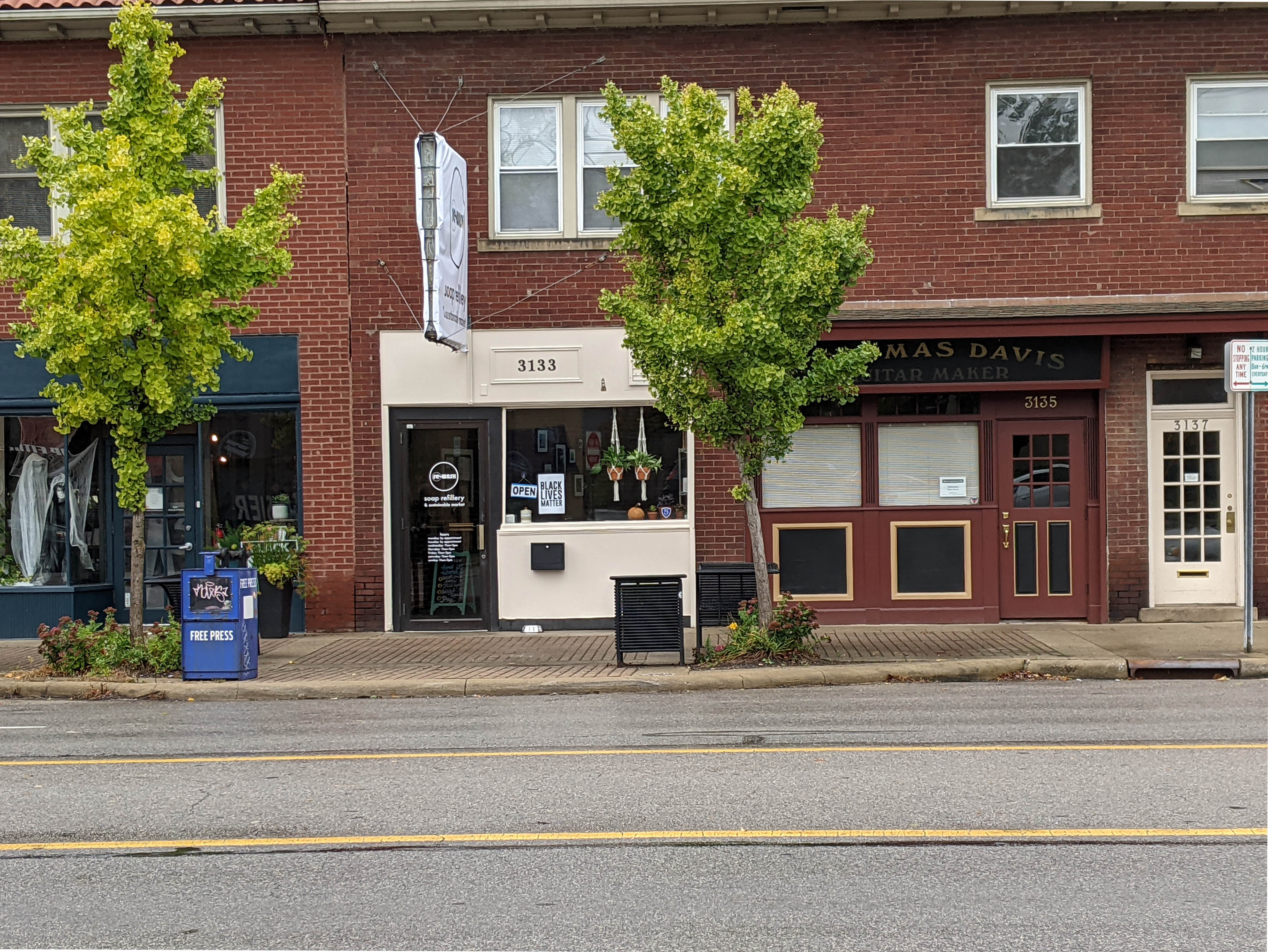 I looked at the history of 3133 North High Street. Here’s what I found.
- Prior to 1929, nothing was listed at that address.
- From 1929 to about 1932, 3133 N High was the Clinton Barber Shop, also variously listed as Clinton Beauty Shop, and F S & GD Port Beauty Shop. Floyd Port Sr and his wife were the managers.
Note: for several years, Hansen’s Bakery—a minor Columbus chain of bakeries—was located next door at 3135 N High, where J. Thomas Davis Guitar Maker is currently located.. It must have been nice to have those bakery smells!
- From 1933-1938, 3133-3135 N High was the Great A & P Tea Company, grocer. (The Great Atlantic & Pacific Tea Company, better known as A&P, was an American chain of grocery stores that operated from 1859 to 2015.) Note the combined address; they took over 3133 as well as Hansen’s Bakery next door. This is a picture of the store’s exterior, from an August 11, 1933 Dispatch page.
There is a Columbus Dispatch Aug 11 1933 newspaper ad for A&P’s opening day at this location. “One package of delicious Sparkle Gelatin Dessert with each 50¢ purchase of groceries or meats on opening days.” Yum Yum!
- From 1939 through 1947, 3133 N High was the Chas Lee Laundry. I found some Dispatch mentions of a Chan Lee Laundry; this may be the same but I am not sure.
- In October 1948 through 1949, 3133 N High was the Warner Appliance Sales and Service Co. An article about the store’s opening from the October 22, 1948 Dispatch is attached.
- 1950—the space was vacant.
- 1951-1955, 3133 N High was the Showboat Inn Restaurant, Gus Deonesos was listed as the manager. (From his obituary: “Gus P. Deonesos, 94, passed away on April 16, 2014. Gus was a United States Army and World War II veteran. He owned 2 restaurants in Columbus, OH before moving to St. Petersburg, FL in 1958.” His family were Greek and he belonged to the Greek Orthodox Church when he lived in Columbus.)
- 1956, it became Ron and Jerry’s Restaurant, Ron Kulwein, manager
- 1957 -1958, the space was Miller’s Restaurant, Walter G & Rosemary Miller, managers.
- 1959-1967, it was Fields Restaurant. Lawrence M. Fields and his wife Minnie lived at 53 Tibet. (Lawrence was listed as the owner from 1959 – 1961; from 1964 Mrs. Minnie Fields was the owner—so Lawrence had probably passed away between 1961 and 1964.)
- 1968 it became Nancy’s Restaurant. It was initially owned by Nancy Kemmerling, until 1971. By 1972, Cindy Moore was listed as the owner of Nancy’s Restaurant (so the sale occurred around 1971). Cindy’s father, Lawrence E. King Sr., was listed as a partner in the restaurant in his 1976 obituary. Cindy lived at 128 Crestview. I didn’t check when she changed her name from Moore to King (she was a widow) but it was after 1976. Cindy closed the restaurant briefly in 2009, then her niece Sheila Davis Hahn reopened it. Sheila died in 2012, and her husband took it over. From a 2006 interview with Cindy: “…I didn’t want to buy a new sign, so I bought Nancy’s name for $100, giving me the rights for 100 years. People call me Nancy all the time. It’s kind of funny.” A Dispatch article about Cindy with photograph is attached, along with another article that includes Cindy’s recipe for her famous meatloaf.

The Hollenback family—the people who started the Booster, lived across the street, and their press office was there as well. So here and here are some pictures taken by the Hollenbacks, of the area, taken from across the street, way before 3133 North High Street was built. See also pages 14, 15, 16, 52 in my book.
Broadway, ever controversial
 This is a political cartoon from the Clintonville Booster. The “Broadway Extension” involved extending North Broadway from Olentangy River Road westward to Kenny Road. It was a controversial and lightning-hot issue from about 1952 until the planned start of construction in October 1963, and well beyond.
Originally, residents of Upper Arlington objected to the extension, which traversed their city; and then it was realized that the extension would create traffic flow issues on Kenny and Fishinger both of which would need to be widened as a result. And eventually planning of the “Olentangy Freeway” (Rte 315) also entered the mix. It was on again, off again, with Upper Arlington approving then rescinding its approval several times. By the time the project got final approval, the designated federal funding had been tapped for other projects and so the extension was further delayed. I’m not sure what year this cartoon was published. I found an article that construction from Kenny Road to Clearview got underway in June 1966. In December 1968, there was a ribbon cutting ceremony for the extension.
It’s hard for many of us today to imagine North Broadway terminating at Olentangy River Road. Harder even to imagine Clintonville before the North Broadway bridge was built over the river in 1939! (In a nutshell: the bridge over the river was built 1939-40; United States involvement in World War II was 1941 – 1945, bringing most domestic construction to a halt; planning on this Broadway extension project resumes ca. 1952, ending well, I’m not sure when Route 315 was actually finished.)
[Image is from The Booster, and courtesy of the Hollenback Collection at the Clintonville Historical Society. I snapped a picture of the cartoon while it was still in the frame; apologies for the glare.]Gulf Station
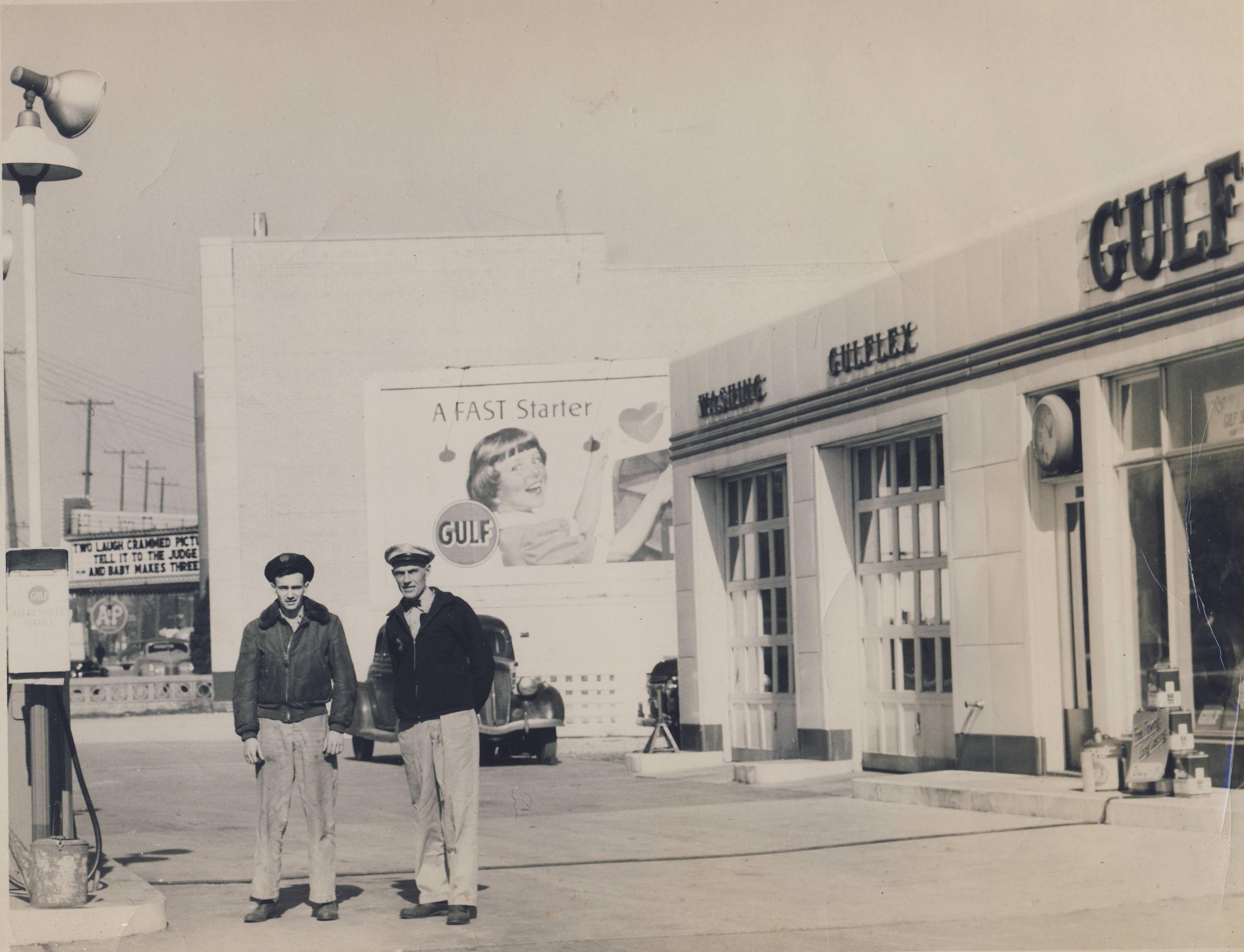 This gas and service station was located at the northeast corner of North High Street and Indian Springs Drive. The old building was renovated to transform it into a Fusian Restaurant. (Thanks to Bob O’Shaughnessy, who informed me that this is Fusion’s preferred method of developing new restaurants.) Can anyone out there name the men?
Note the “two laugh-crammed pictures” at the movie theater in the background.
[Image courtesy of the Hollenback Collection of the Clintonville Historical Society.]Remembering the Rosemary Neighborhood by Knopf & Near
David Penniman, a resident of the Rosemary neighborhood, sleuthed out a copy of a document penned in 1984-88 by Richard C Knopf and Miriam F Near. The document, entitled Reminiscences: Not Memoirs, is a free-wheeling remembrance of growing up in the neighborhood around Henderson and Rosemary Parkway in the 1920s, 1930s, and 1940s. Dave’s copy came from Ann and Keith Bossard of Dominion Blvd; Dave then digitized the 97 page book and shared it with us. Thanks, Dave!
Both Richard and Miriam are deceased; their obituaries are linked below.
Richard C Knopf, 1/4/1925 – 7/17/2002
Miriam Fowle Near, 6/28/1924 – 12/10/2009
I’m so appreciative of people who preserve local history, as Richard and Miriam, and Dave, have done.
[Digital version of the Knopf and Near typescript courtesy of David Penniman. Knopf obituary came courtesy of the Ashtabula Public Library System based on a search and tip from Nick Taggart, retired librarian par excellence at the Columbus Metropolitan Library.]Coasting Along

A roller coaster at Olentangy Amusement Park. [Photo courtesy of Galen Gonser]
Tee-Jaye’s Famous Sign
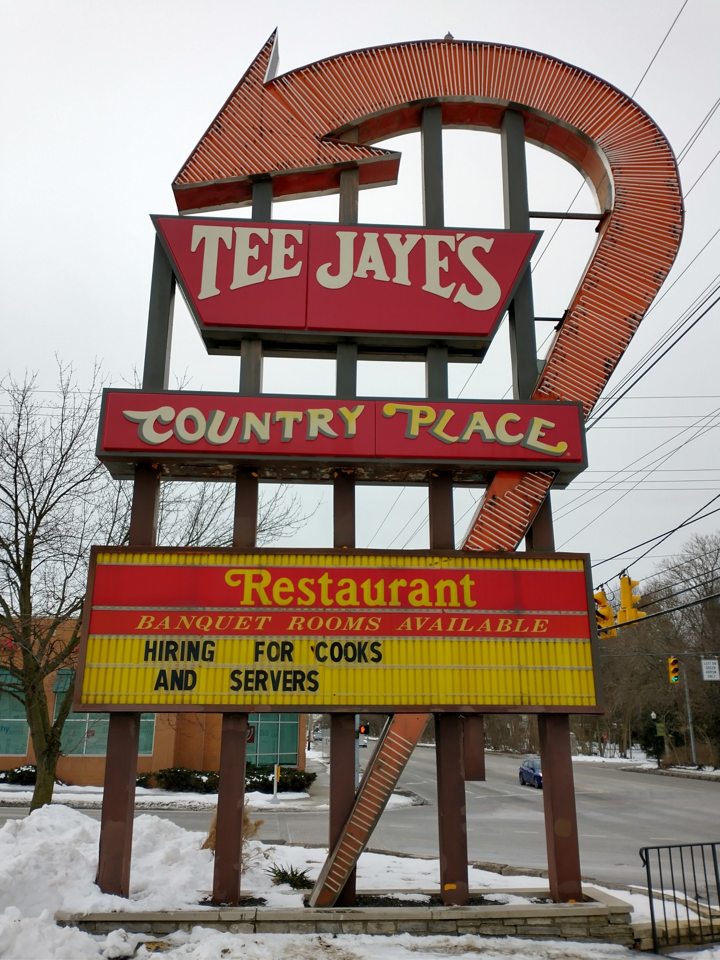 There’s been lots of news lately about the departure of Tee-Jaye’s Country Place Restaurant from the north east corner of North High and Morse Roads–and with that, much discussion of the neon sign on that corner. (I’m writing this in April 2021.)
Since 1960, the 4910 North High Street address has been a Jerry’s, then a Sisters’, then Tee-Jaye’s.
 Mary Rodgers found this wonderful ad for the opening of Jerry’s in the Columbus Dispatch, Sept 12, 1961. The original neon sign was designed by Fred M. Ervin (Fred I and Fred II), of Fred M. Ervin Sign Service, 2447 Middlesex Rd, Upper Arlington. That company was later operated by Fred M. Ervin III until his death in 2006 as FM Ervin Sign and Lighting.
(As an aside, I love the “Cigarettes and Music Systems provided by Charies” in that ad.)
When Sisters took over the site and sign in 1986, the building was redesigned by architect Jerry Shremshock. The company modified the sign somewhat; Jim Baxter, of the DaNite Sign Company updated the sign.
[Research courtesy of Mary Rodgers, Jim Garrison; Source material from the Columbus Dispatch.]80 West Cooke Avenue
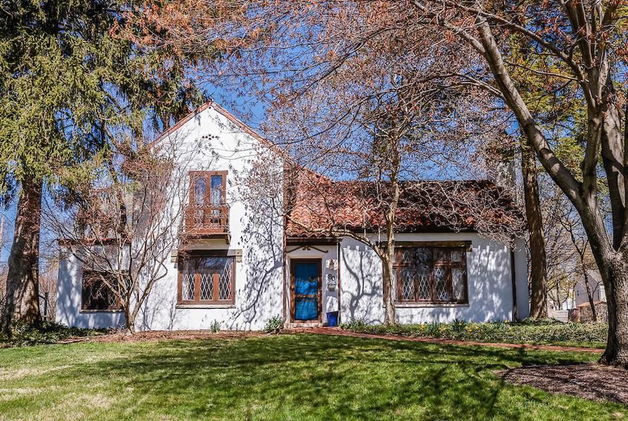 This lovely home at 80 West Cooke Rd was originally built in 1925 for Lulu & Carl Cooke. The Cookes owned it for 40 years, and the house has only had 4 owners since it was built. Fortunately the home’s original character and charm has been maintained throughout the years.
I believe I’ve passed the house many times without noticing it, and suspect its lines were obscured by foliage until recently. What a gem it is!
The house is in the Rosemary housing division, developed by Charles Johnson in 1923 and named after his mother.
As a side note, the Mediterranean Revival style–so unusual in Clintonville–reminds me of the old Zimmerman home that used to be located at the NW corner of Henderson and Olentangy River Roads.
There are also examples of that style at 44 West Jeffrey Place (left photo below) and 223 West Beechwold Blvd (right photo below) in Old Beechwold. An historic inventory for 44 West Jeffrey can be found here. 223 West Beechwold seems to have had the address “4923 West Beechwold” and may have been designed by architect Frank Kinzig, according to the Old Beechwold Historic District Nomination.
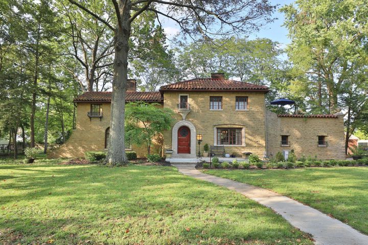
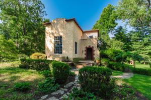
My friend Nancy Campbell tells me that in the 1920s, there was a lot of interest in exotic styles for houses, usually attributed to the young men who came back from WWI. Having seen more of the world, they were interested in Tudor, Mediterranean, Mission, Chateauesque (French) styles. The Sears and Aladdin kit houses, though offering predominantly Craftsman or “plain” styles, also offered the others. These three houses were more upscale versions of an interesting mix of styles. According to Virginia McAlester’s book, A Field Guide to American Houses: The Definitive Guide to Identifying and Understanding America’s Domestic Architecture, tile roofs were used in Spanish Eclectic, Mission, Italian Renaissance, and Prairie styles. The Cooke Rd. house seems somewhat Tudor, with the “musicians’ balcony” overlooking the living room.
[Real estate listing & photos courtesy of Judy Minister; historic architecture information from Nancy Campbell.]The Clintonville Woman’s Club: the women before the Clubhouse
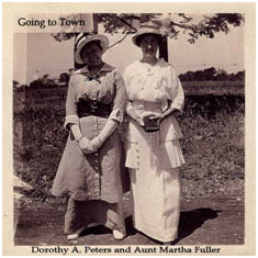 Mary Rodgers has written a very nice article about the Clintonville Woman’s Club.
The Clintonville Woman’s Club: The Women Before the Clubhouse
by Mary Rodgers
[Courtesy of Mary Rodgers]I was recently asked to speak at an evening meeting of the Clintonville Woman’s Club. Specifically, I was asked to speak on the subject of the history of the land that the Clubhouse occupies. I have always understood that the Clubhouse was located on land from the old Fuller Farm. I was surprised to learn more about the “Fuller” family.
In the 1820s, John Rathbone sold farm lot 5 to Edward Amaziah Stanley. Using today’s landmarks, that land would have been bounded on the east by Indianola Avenue, on the west by the river, on the south by roughly Torrence Road and on the north by roughly Overbrook Drive. When Mr. Stanley died in 1862, his land holdings were passed down to his children. Harriet Marie Stanley (aka Hattie) was one of those children. She was born in Connecticut in 1831. Based on the extensive land holdings throughout Ohio, I believe her father Edward was an Ohio land speculator. After acquiring several thousand acres, in 1829, he returned to Connecticut to marry Abagail Talcott Hooker. Sometime between 1831 and 1834, the family moved to the Clintonville area.
In 1856, Hattie married Erskine Asa Fuller, aka E. A. Fuller. E. A. was known as a dealer in stock animals. When her father passed away, Hattie inherited all of farm lot 5 in Clinton Township Ohio. The 1870 census shows a large extended family living together in Clintonville–the Fullers and their daughters, Hattie’s mother, brother, sister, and several farm hands and servants. The combined household value per that census was in excess of $25,000. Hattie passed away in 1879. E.A. passed away in 1894. After their deaths, the farm was transferred equally to the four Fuller daughters–Abby, Mary, Katherine and Martha.
Martha Fuller and her sister Katherine Fuller Peters lived all of their lives in Clintonville. They owned two brick homes along High Street–Katherine’s just south of where the Library sits today and Martha’s where the Christian Science church sits today. Martha Fuller passed away in 1938. She left half of her land holdings to long time farm hand Matthew McCallen and half to her niece (sister Mary’s daughter) Helen Osborn.
Eventually, all the land was sold off, some to the Christian Science Church, some to the Calvary Bible Church, and the balance to the City of Columbus.
The Clintonville Woman’s Club land was purchased by the Kiwanis Club of Northern Columbus. That Club loaned the ladies the funds needed to build the Clubhouse. In turn, they held a mortgage on the property. The Woman’s Club members worked tirelessly and retire their debt to the Kiwanis within five short years! They have owned the Club house and property ever since.
242 East North Broadway
 Gary Mean’s stunning restoration effort of 242 East North Broadway was included in Old House Journal, April-May 2011 issue.
Kelley Buick
 This is a very nice picture of Kelley Buick at 3415 North High Street (corner of North High and North Broadway Streets, where Kroger’s parking lot is today). Kelley Buick was at that location from 1936/37 until 1949, after which it became Bob Daniel Buick. (Before 1936/37 it was a Chevy dealership.)
Balser Hess Family Graves
 Mary Rodgers, President of the Clintonville Historical Society, did some wonderful research on the Balser Hess family graves at Union Cemetery, in response to a reader’s inquiry about this post. Apparently the reader believed that Balser Hess’s wife is not buried in this location despite the tombstone.
 From Mary Rodgers:
[Images courtesy of Mary Rodgers]There are lots of burials on the Hess property prior to the establishment of the Union Cemetery Association in 1847. The Association purchased the Hess burial ground in 1862. The only known records of the early burials are the tombstones. Unfortunately, there are lots of illegible and missing stones.
Union Cemetery and the Historical Society believe Balser to be the earliest burial. The family arrived in Ohio around 1799. They had a child (John) born in Hopetown in 1799. He lived to adulthood. Attached is a family history that was done many years ago by Frank Hess. It states that Balser was the first burial on the family farm. I confirmed that John was the last of George’s children; she didn’t find any grandchildren prior to his death in 1806.
Balser’s wife (Mary Eva) is represented on the tombstone. We have no reason to believe that she is not buried at Union. The property was still in the family’s control at the time of her death. The tombstone that is in the cemetery is not the original. It was lost to the test of time and replaced by the family.
John was the last child to be born to Balser and Mary Eve. No mention of “lost infants” for that couple.
The only child of Balser who married prior to his death was his daughter Mary Ann. She married Henry Cryder before the Hesses moved to Franklinton. She and Henry ultimately moved to Delaware, OH (then to Illinois) but I don’t see anything that would suggest they had a child that would have been buried on the family homestead in Franklin Co. prior to her father’s death. At that time, they lived in New Hope, OH.
Bob is Identified
 Last November, I posted a photo of a drugstore that carried a sign, “Bob is Home”. The photo spurred Clintonville Historical Society president Mary Rodgers to do some sleuthing. Here’s what she learned:
[Image is from The Booster, and courtesy of the Hollenback Collection at the Clintonville Historical Society. Mary’s article was published in the May 2020 CHS Newsletter.]We have a photo in the Clintonville Historical Society’s archive that shows a storefront door with a sign that reads: “Closed Today –Bob is home after 5 years and 21 days in the Army for prescriptions call LA.5462 or LA. 9170”. I thought I might try to find out more about veteran “Bob”. From the sign, I know his name is Bob and that is most likely short for Robert. I know he served for 5 years and 21 days in the Army. I know this photo appeared in the Booster, a local newspaper founded in 1933 (post WWI-pre WWII). I went to Ancestry.com and searched for first name “Robert”, lived in Clinton Twp., Franklin County, OH with military service from 1941-1945 (i.e. WWII). The sign also told me that someone close to Bob owned a pharmacy (“for prescriptions call…”). I added pharmacy to my search. The top search results included Robert Ranck. Could this be the right solider? I went to the Columbus Metropolitan Library’s research site and pulled up the Columbus Dispatch newspaper. I typed in “Bob Ranck”. I found a newspaper article from November 14, 1945 that read as follows: “Druggists Back From Service Are Honored–Seven druggists and the son of another druggist who recently returned from the service were honored by the Servall Druggists Alliance at a dinner-dance at the Beechwold Tavern . Sgt. Bob Ranck, son of Paul Ranck, Oakland Park Av and High St. came home after five years in the service and his father promptly closed his store for the day…”.
Mystery solved! Jesse Paul Ranck owned the Oakland Park Pharmacy–where Shim’s is today. The Ranck family lived at 234 Erie Road. Mr. Ranck was very involved in the Clintonville community. He loved nature and was an avid hunter and fisherman. In 1959, the Columbus Dispatch reported that then retired Pharmacist Ranck continued to visit the shop at Oakland Park and High. On one particular day, May 8, 1959, he told the story of a mother raccoon who had brought her babies down the chimney of his home. He was worried that the kits would become too heavy for her to remove. His son, Bob Ranck, returned from the war and attended The Ohio State University. He graduated from the School of Dentistry. For many years, his dental practice was above the Oakland Park Pharmacy. According to his 2012 obituary, he ultimately received the military rank of Captain and was awarded the Bronze Star for his heroic service to our country.
The ‘ville Is Alive, with the Sound of Music…
 At a recent CHS meeting, Glenn Williams and Stuart Smith shared a song commissioned by the Clintonville Community Band for its 20th anniversary. Snapshots of Clintonville premiered on Oct 1, 2005. It is 11-minute 47-second duration.
Snapshots of Clintonville‘s composer was Barry E. Kopetz, who was Director of Bands and Professor of Conducting at Capital University at that time. Richard Burkart was the Clintonville Community Band’s director. The band has kept a great archive of its history; the program for this concert is here and the announcement of the commissioning of the piece is here.
The individual movements are
1) Main Theme
2) Gothic Gateway Entrance
3) Glen Echo Ravine
4) Bill Moose – Last Of The Wyandots
5) Dance
6) From The Banks Of The Olentangy
7) Underground Railroad
8) Columbus and Worthington Plank Road
9) Weisheimer House
10) McKendree Cemetery
11) Main Theme
The band has made a huge contribution to the community, by providing concerts year after year for more than 30 years. That doesn't mean they don't need your support and donations! I recommend going to their web site and donating today.
Are you still reading this? what are you waiting for? Donate!
Big Tom’s Drive In @ 4850 N. High
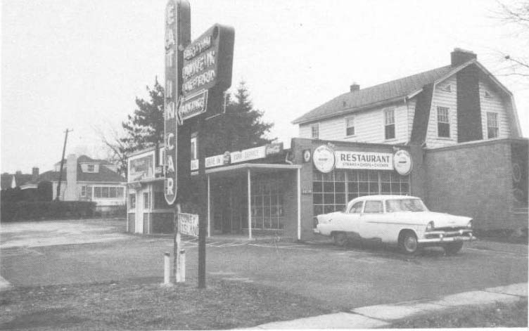 Wendy Bayer found these great photos and generously shared them with us. The photos show Big Tom’s Restaurant (or Big Tom’s Drive-In Restaurant), which occupied the southeast corner of North High and East Jeffrey from 1956 – 1959. Big Tom’s was owned by Thos H Fetty, who lived with his wife Ella M. at 353 Clinton St.
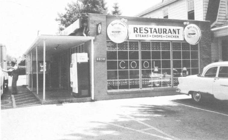
Here is Big Tom and his wife Ella’s marriage certificate:
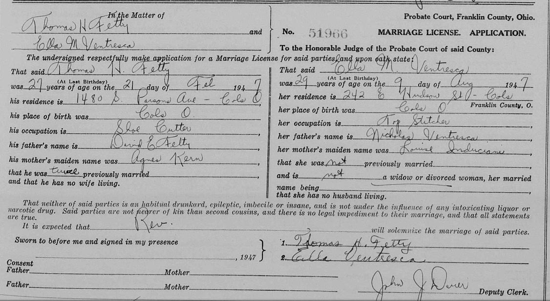
Tom Fetty died in 1995.
Here’s some history on the location, based on the Columbus Metropolitan Library’s collection of business directories:
- –In 1950 the address did not exist.
- –From 1953 until 1956 it was Hi-Jeffrey Sandwich Shop, owned by Pete Freemas. (In April 1954 it was called Hi-Jeffrey Sandwich Shop, presumably for its corner location. By June 1954 it was also called Pete’s Drive-In. Pete passed away from a heart attack in April 1955; here’s his obituary.)
- –From 1956 to 1959 it was Big Tom’s Restaurant. There’s an April 1959 Dispatch article about an attack on “the diner’s operator Donald Acree.”
- –In August 1957, January 1958, and July 1959, there were attempts by “owner Elizabeth F. Baker” to sell or auction the restaurant including furnishings and equipment. I’m not sure whether Elizabeth F. Baker had been Pete Freemas’s wife Betty, or whether she had some other connection to the property.
- –By 1960 it had become Chicken Delight Restaurant, owned by Richard A. Potts (& Forrest W. Womeldorff). It was still Chicken Delight in 1961, but I was unable to check additional years.
- –By 1966 it had become a Kut n’ Kurl Beauty Salon.

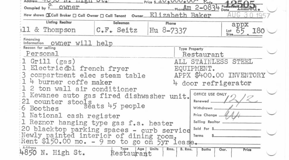
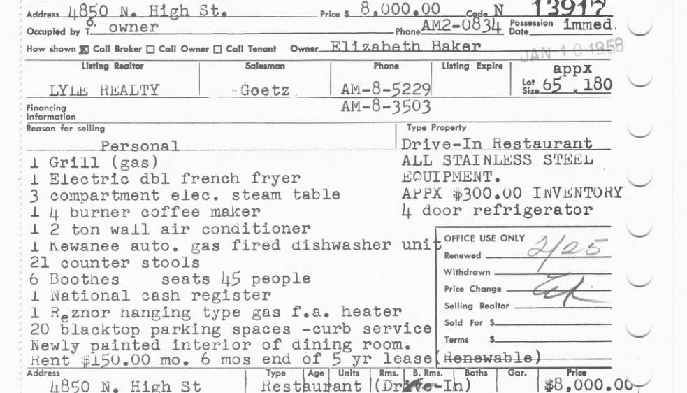

According to Wendy, Frank B. and Ola Faye Hyatt owned the parcel for a short time; they are buried in Walnut Grove Cemetery. Orr Zimmerman of Olympic Pool fame also owned the parcel… Some neighborhood folks say that it was called “Corky’s” at one time and that the “owner lived down on W. Jeffrey”; I didn’t find record of that. Someone else thought it became Ricardi’s Italian Restaurant, but my research says that Ricardi’s had an address of 4874 North High, just north of this.
Wendy Bayer found the photos on the MLS Real Estate Cards collection that Carriage Trade Realty and the Columbus Metropolitan library uploaded. Nick Taggart of the Columbus Metropolitan Library Local History and Genealogy Desk furnished the Dispatch articles.
[Images courtesy of Wendy Bayer, the Columbus Metropolitan Library, Nick Taggart at the Columbus Metropolitan Library, and The Columbus Dispatch.]Close Cover Before Striking
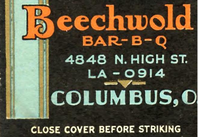 Wendy Bayer came across a matchbook for the Beechwold BBQ at 4848 N. High. Notice the address?
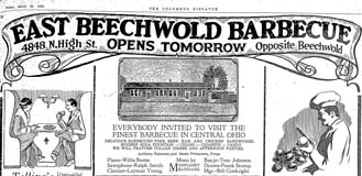
Beechwold Barbecue, owned by Anthony Delewese, was located at 4848 North High from the day it opened, March 27, 1926, until an overheated furnace caused a fire during the last week of January, 1934.

Four months after the fire (May 29, 1934), Mr Delewese reopened his restaurant as Beechwold Tavern, at 4784 North High, where Mozart’s is today. (He sold it to Henri Boyd in 1938, who in turn renamed it the Beechwold Restaurant.)

Mr. Delewese–assuming I have the right “Anthony Delewese”–died September 13, 1975.
Just to finish off the “fire” theme:

Oh and remember when we abbreviated Ohio as just “O.”? State abbreviations were standardized to 2 characters in 1963, to make room for zipcodes, as most addressing equipment at the time could accommodate only 23 characters (including spaces) in the bottom line of the address.
[Matchbook image courtesy of Wendy Bayer. Dispatch clippings researched by Nick Taggart, librarian par excellence of the Columbus Metropolitan Library’s Local History and Genealogy Desk. ]Olentangy Park Casino
 Admittedly, this is a not a great image of the casino at Olentangy Park! But it is the only one I have and so I’m glad to have it. It is from The Book of Ohio.
I do not know what the gambling consisted of at the park.
[Image courtesy of Galen Gonser]Creative Reuse of a Garden House
 This little gem was once the garden house at Edgewater, summer home of Harvey and Emma Legg Zinn. (Harvey was founder of the Zinn Lumber Company.) It dates to the 1920s. Zinn’s property at the west end of Kenworth was eventually subdivided and several years ago an additional new house was built on the property.
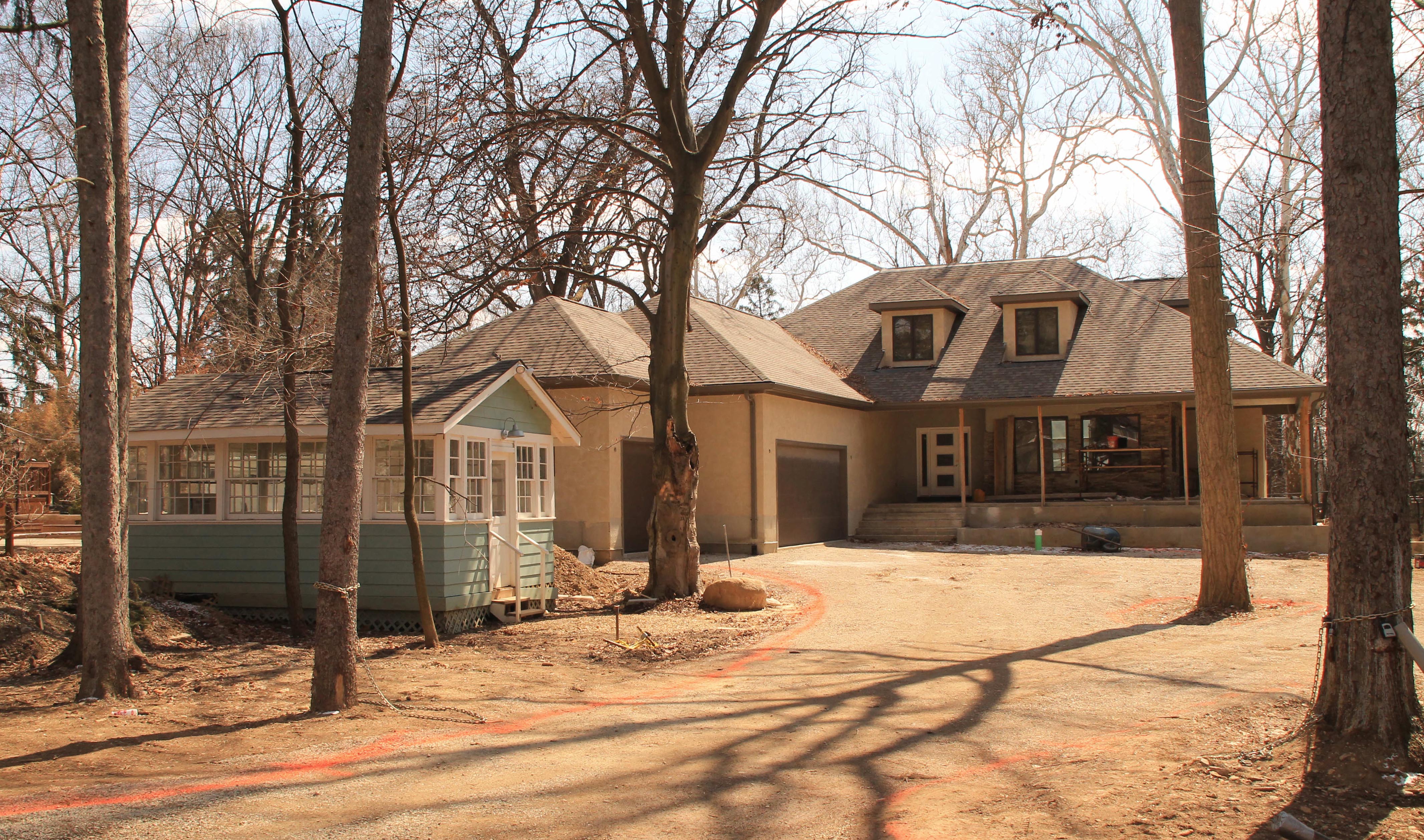 During construction of the new house, the builder, Kevin Clausen, used the garden house as an office for the building project (shown here in 2014).
Upon the house’s completion, the new homeowners, Gary and Kathy Flynn, donated this lovely shed to Clintonville Resource Center (CRC) instead of demolishing it. Thanks to the Clintonville Historical Society, the American Public Gardens Association, builder Kevin Clausen and some hearty volunteers, it was moved to its new home at the CRC Midgard Community Garden (aka Midgarden). The foundation work was completed in 2017 with the help of Tim Beachy and Anderson Concrete.
This building enables CRC staff and volunteers to collect rainwater for irrigation, start new plant seedlings on site, retrieve seeds for new plantings and provide a space for educational and informational gatherings. And of course, it adds a shedful of pretty to the landscape.
Calling Doctor Amy!
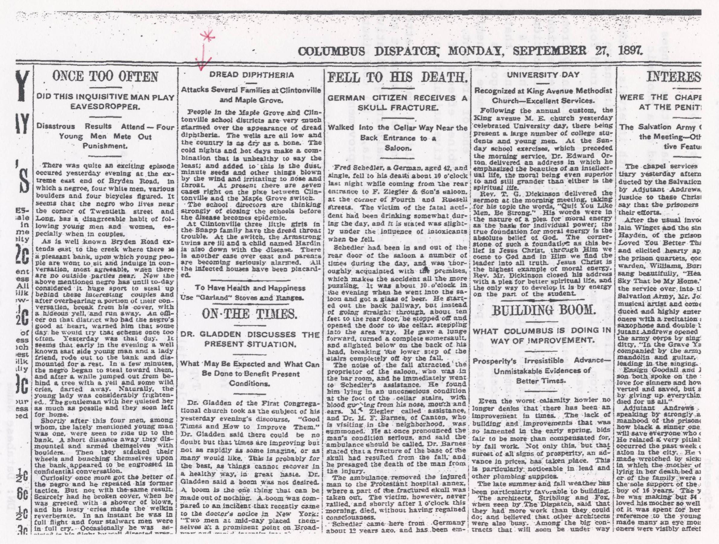 This is a Columbus Dispatch article, dated September 27, 1897, about an almost-epidemic of diphtheria. Though you can zoom in, the print is tiny, so I’m providing the text here:
“Dread Diphtheria Attacks Several Families in Clintonville.
“People in the Maple Grove and Clintonville school districts are very much alarmed over the appearance of dread diphtheria. The wells are all low and the country is as dry as a bone. The cold nights and hot days make a combination that is unhealthy to say the least; and added to this is the dust, minute seeds and other things blown by the wind and irritating to nose and throat. At present there are seven cases right on the pike between Clintonville and the Maple Grove switch.
“The school directors are thinking strongly of closing the schools before the disease becomes an epidemic.
“At Clintonville three little girls in the Snapp family have the dread throat trouble. At the switch, the Armstrong twins are ill and a child named Hardin is also down with the disease. There is another case over east and parents are becoming seriously alarmed. All the infected houses have been placarded.”
According to Wikipedia and the CDC, diphtheria is an infection caused by the bacterium Corynebacterium diphtheriae. Signs and symptoms vary from mild to severe. They usually start two to five days after exposure. Symptoms often come on fairly gradually, beginning with a sore throat and fever. In severe cases, a grey or white patch develops in the throat; this can block the airway and create a barking cough as in croup. The neck may swell in part due to enlarged lymph nodes. Complications may include myocarditis, inflammation of nerves, kidney problems, and bleeding problems due to low levels of platelets. Nowadays, children are vaccinated against diphtheria in combination with tetanus and pertussis.
The Perennial Parking Problem
 I really have no idea what this issue was all about! It’s an editorial cartoon from The Booster. Back in the late 1960s, Oakland Manor was the name of an apartment complex (with a swimming pool!) at 42-50 West Oakland Ave, 2 blocks north of Lane Ave. between North High and Neil Avenue. Currently I find an “Oakland Manor” on 1871 Oakland Park, in North Linden.
We may not know what the precise issue was, but we can guess that some scofflaw building owner tried to circumvent zoning regulations, and the community was not happy. Back in “the day”, The Booster played a very strong Clintonville advocacy role and this was undoubtedly an example.
[Image courtesy of the Hollenback Collection at the Clintonville Historical Society.]Gus Grener’s
 Gus Grener’s was located at 2189 North High Street (near the corner of North High and Norwich). According to the 1949 city directory, Augustus F. Grener sold “GE refrigerators, Bendix home laundry washers, radios, Sohio products, Willard batteries, and Goodyear tires.” What a marketing concept!
Soda Fountain Kids
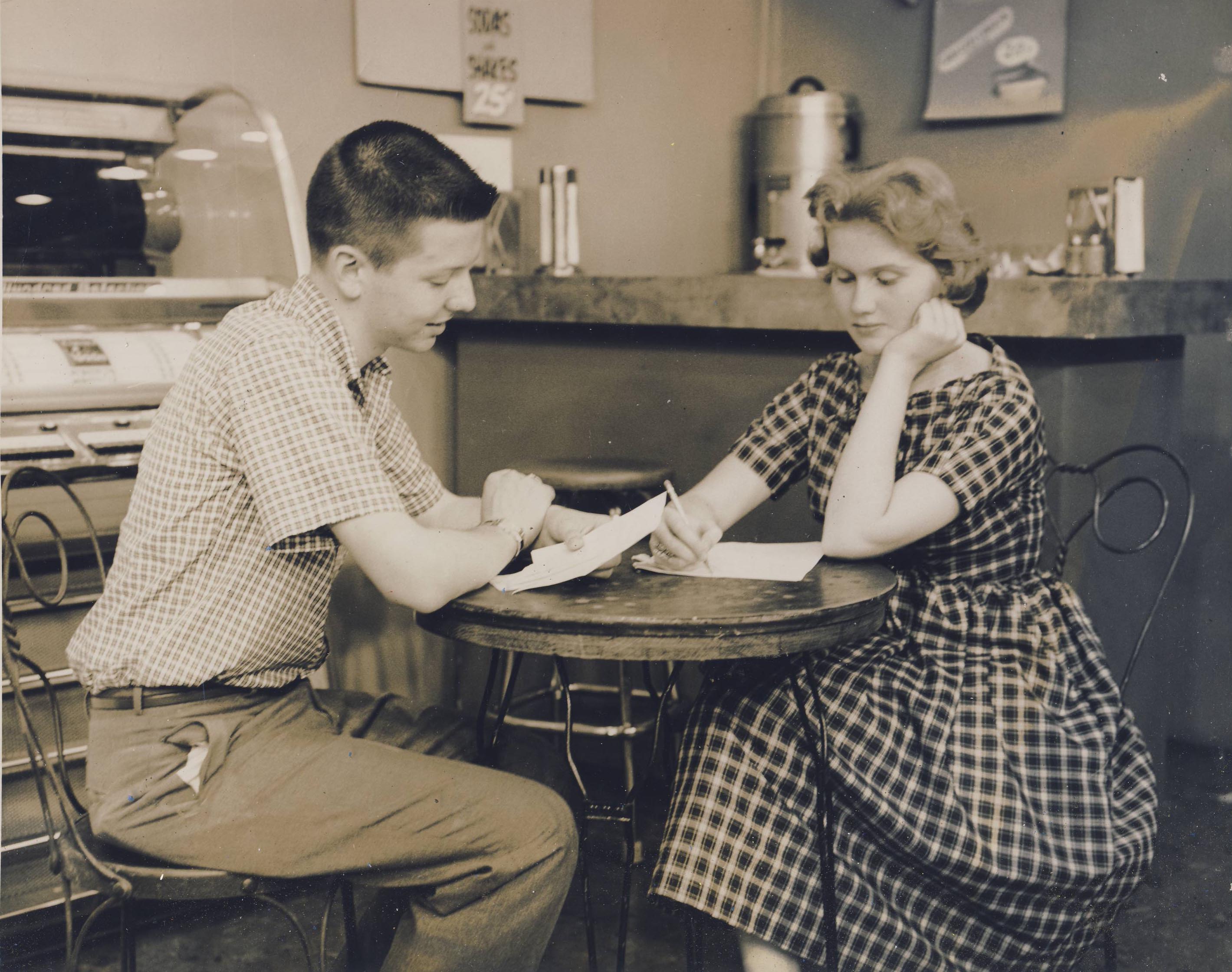 Some things never change–including people occupying tables without ordering any food or drinks!
John’s Drive In
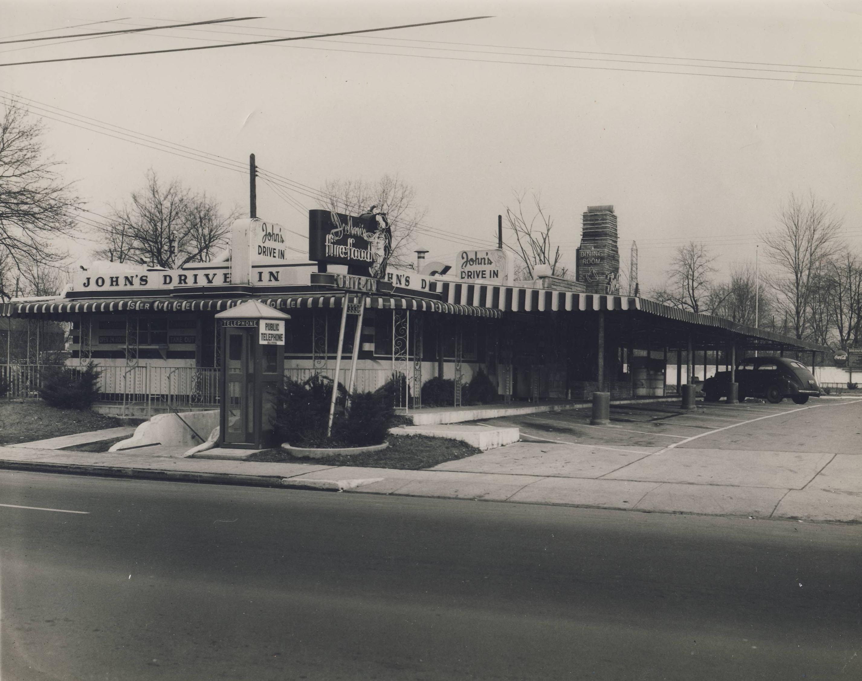 John’s Drive In was located at 3336 Indianola, where Burger King is today. John’s was not listed in the 1950 city directory, but was listed in the 1953 and 1955 directories. By 1956 it had become Beverlee Drive In.
Almost as noteworthy is the telephone booth in front of the restaurant–another relic of the past.
[Image courtesy of the Hollenback Collection at the Clintonville Historical Society.]Bob is Home
A nice homage to a veteran. I do not know who Bob is, but he certainly did his part. Thanks, Bob–and thanks to all the other vets out there.
Ghosts of Clintonville–Ghostbusted by Google Earth
There are several old residential buildings that have disappeared over the last 12 years–I wish we had photos of them.
![]() The old Hollenback home and The Booster building, located at California and North High Streets. I remember this building setting back over a slight rise from North high Street. This is a Google Earth image from 2004 of the roofs of these buildings.
The old Hollenback home and The Booster building, located at California and North High Streets. I remember this building setting back over a slight rise from North high Street. This is a Google Earth image from 2004 of the roofs of these buildings.
![]() A large Victorian house demolished to make way for the commercial building presently occupied by Lavash Restaurant. This is the Google image from 2004 of the rooftop.
A large Victorian house demolished to make way for the commercial building presently occupied by Lavash Restaurant. This is the Google image from 2004 of the rooftop.
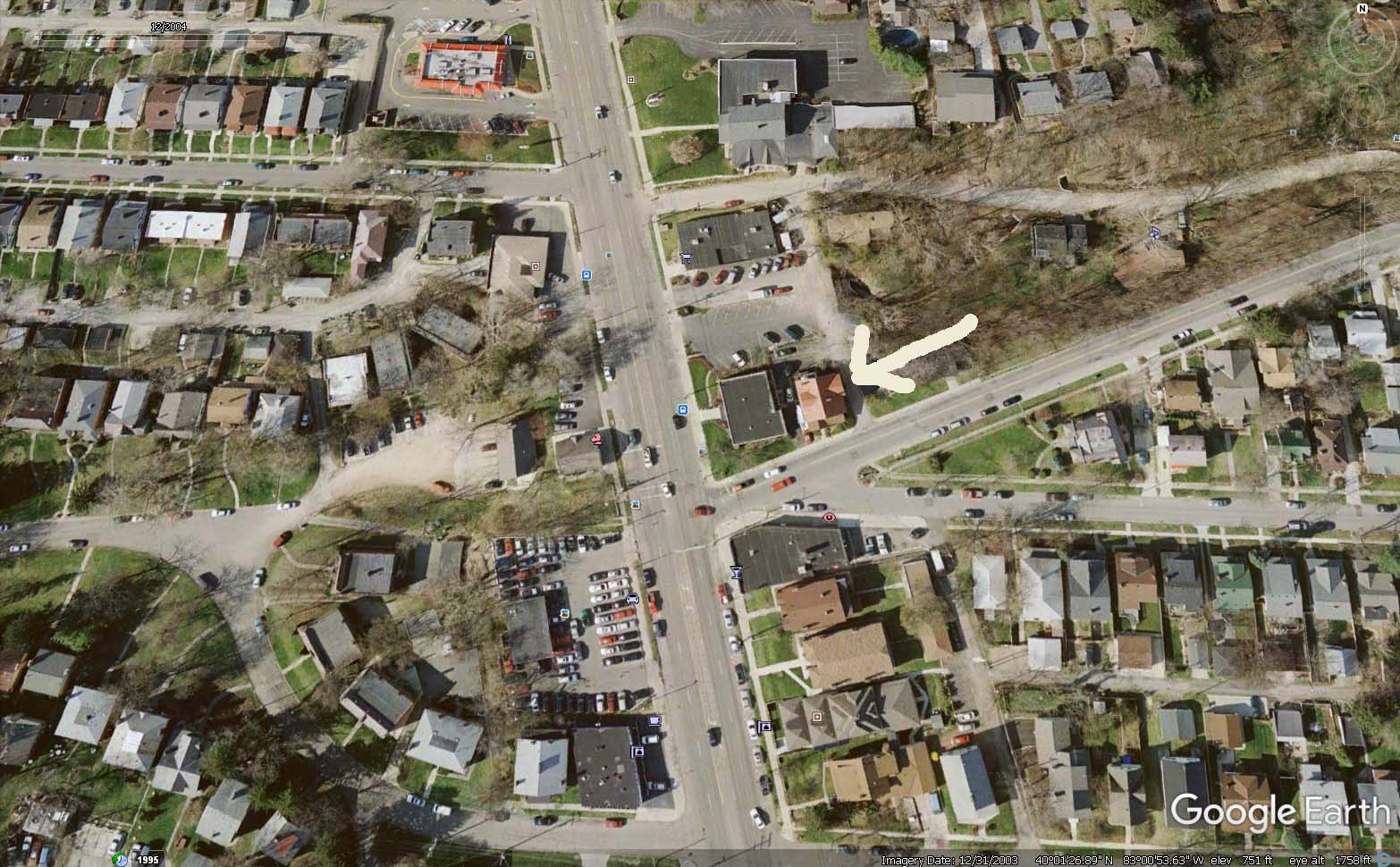 Another big old residential building, this one located on Weber, one building east from North High Street on the north side of Weber. (Another Google image from 2004.) I’m not sure but believe this building was built for and owned by a member of the Armbruster family, whose patriarch lived in what became Southwick-Good-Fortkamp funeral home. You will find lots of additional information about Mathias Armbruster on my web site.
Old Piatt Mill
 This lovely mill was located on the river, just north of the present Dodridge Street bridge. There is another photo of this, in my book.
The original dam and mill were constructed by David Beers in 1810. Beers owned the land on which the mill was located. Darius Wilcox built a sawmill adjacent to the flour mill. The mills later came to be owned by the John James Piatt family. The buildings burned down on June 13, 1902. The area just to the east and north is where Olentangy Amusement Park was located.
[Image courtesy of Galen Gonser]E. A. Fuller Farm
The Clintonville Historical Society October 2017 monthly newsletter contained an interesting article about the land at the Clintonville Women’s Club by Mary Rodgers.
________
The Clintonville Woman’s Club: The Women Before the Clubhouse
by Mary Rodgers
I was asked to speak at an evening meeting of the Clintonville Woman’s Club. Specifically, I was asked to speak on the subject of the history of the land that the Clubhouse occupies. I have always understood that the Clubhouse was located on land from the old Fuller Farm. I was surprised to learn more about the “Fuller” family.
In the 1820s, John Rathbone sold farm lot 5 to Edward Amaziah Stanley. Using today’s landmarks, that land would have been bounded on the east by Indianola Avenue, on the west by the river, on the south by roughly Torrence Road and on the north by roughly Overbrook Drive. When Mr. Stanley died in 1862, his land holdings were passed down to his children. Harriet Marie Stanley (aka Hattie) was one of those children. She was born in Connecticut in 1831. Based on the extensive land holdings throughout Ohio, I believe her father Edward was an Ohio land speculator. After acquiring several thousand acres, in 1829, he returned to Connecticut to marry Abagail Talcott Hooker. Sometime between 1831 and 1834, the family moved to the Clintonville area.
In 1856, Hattie married Erskine Asa Fuller, aka E. A. Fuller. E. A. has known as a dealer in stock animals. When her father passed away, Hattie inherited all of farm lot 5 in Clinton Township Ohio. The 1870 census shows a large extended family living together in Clintonville. The Fullers and their daughters, Hattie’s mother, brother, sister and several farm hands and servants. The combined household value per that census was in excess of $25,000. Hattie passed away in 1879. E.A. passed away in 1894. After their deaths, the farm was transferred equally to the four Fuller daughters–Abby, Mary, Katherine and Martha. Martha Fuller and her sister Katherine Fuller Peters lived all of their lives in Clintonville. They owned two brick homes along High Street; Katherine’s was just south of where the Library sits today and Martha’s was where the Christian Science church sits today. Martha Fuller passed away in 1938. She left half of her land holdings to long time farm hand Matthew McCallen and half to her niece (sister Mary’s daughter) Helen Osborn. Eventually, all the land was sold off, some to the Christian Science Church, and some to the Calvary Bible Church and the balance to the City of Columbus. The lane where the Clintonville Woman’s Club land is located was purchased by the Kiwanis Club of Northern Columbus. That Club loaned the ladies the funds needed to build the Clubhouse. In turn, they held a mortgage on the property. The Woman’s Club members worked tirelessly and retire their debt to the Kiwanis within five short years! They have owned the Club house and property ever since.
4 N Broadway Lane
Old House Journal, April-May 2011 issue, included pictures of 4 North Broadway Lane “then and now.” Beautiful!
Just Add Water
Here are some nice pix of the Olentangy Amusement Park’s swimming pool, without water. [Images Courtesy of Galen Gonser]
Looking South:

Looking East:

Looking Northwest:

As I write this, it’s easily 88 degrees and humid. I’d love to have access to an outdoor swimming pool right now…But one with water!
A Rose Is a Rose Is a Rose Is a Rose…
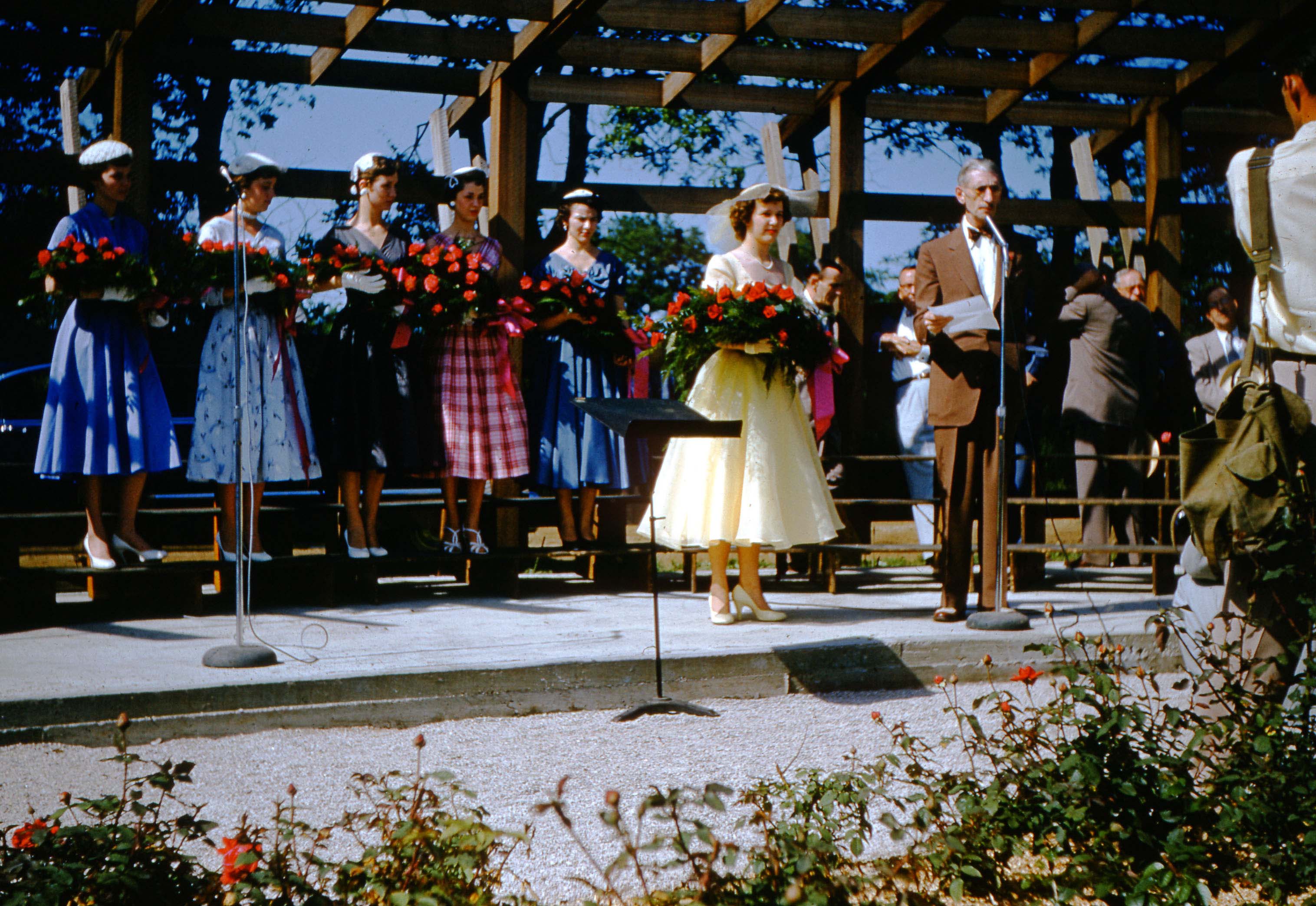 Joyce Ailes Schatz shared some wonderful Maiden of the Roses treasures with us. The photos were taken by her dad, Howard Ailes, on May 30, 1954, and they are of that year’s Maiden of the Roses pageant. The winner that year was Nancy Blanchard (later, Mrs. Clyde Graham). Nancy is Joyce’s cousin.
Nancy attended Mifflin High School, which in 1954 was a county school and located on Sunbury Road near Agler Road. Nancy was born April 23, 1938 in Columbus, and died May 10, 2018. [Images courtesy of Joyce Schatz]
You can read more about this pageant here.
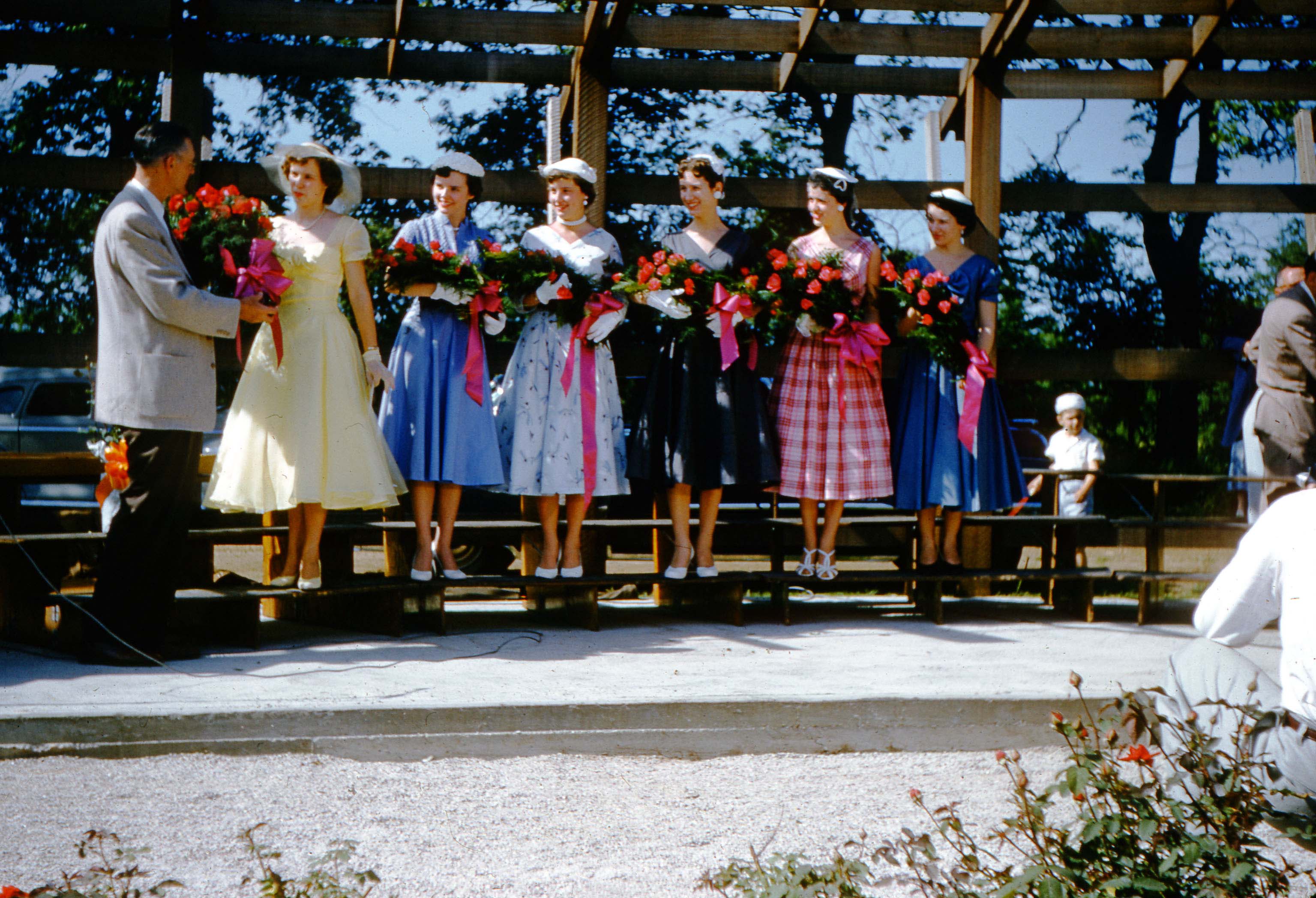 In these images, Queen Nancy is joined by her court, Ruthann Limotta, Carol Newhouse, Dorothy Corfee, Charlene McNair, & Louise Winzenreid (in unknown order). The court’s other member was Barbara Harder, but she does not appear in the picture. Does anyone know who the man is?
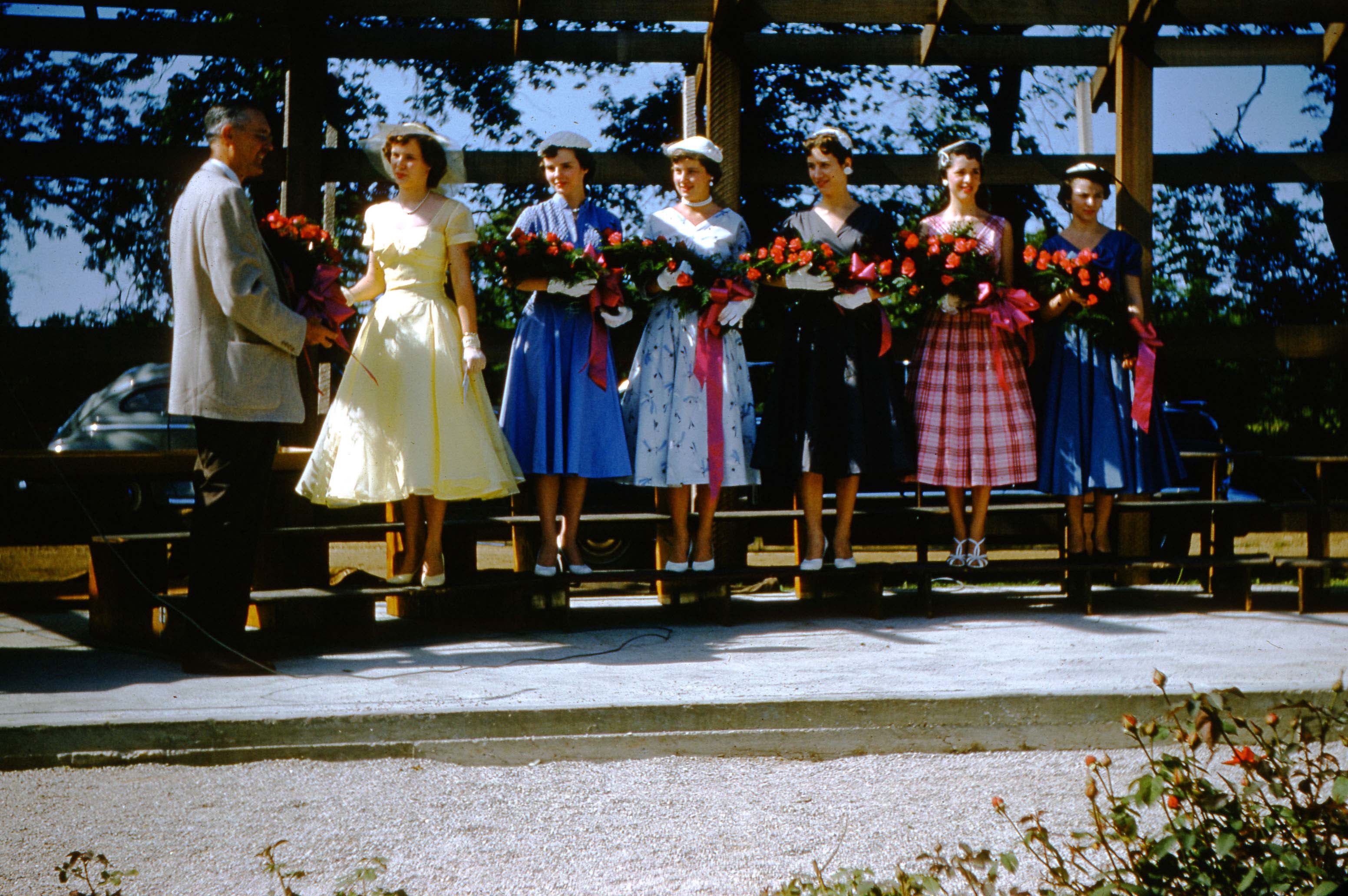
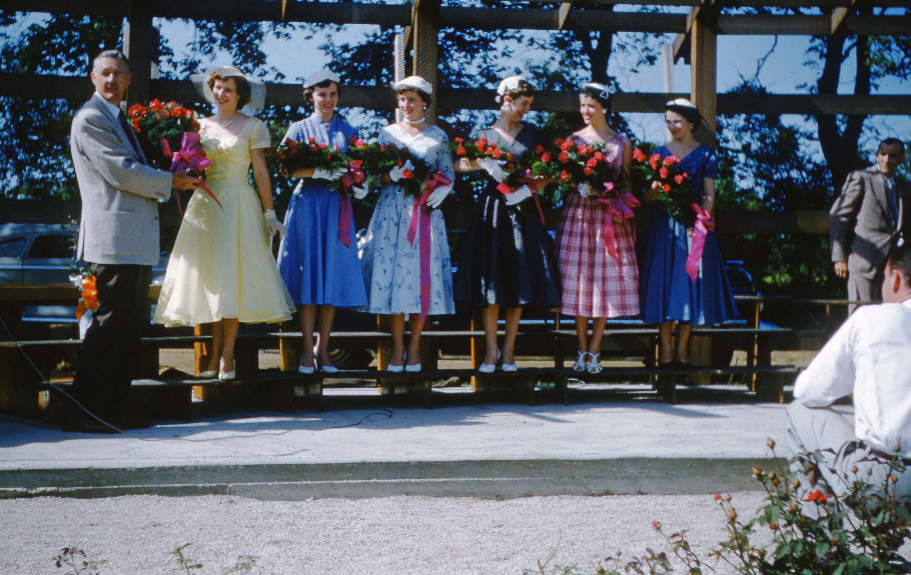
In the next two images of the queen and her court, we are not sure who the two extra women are.
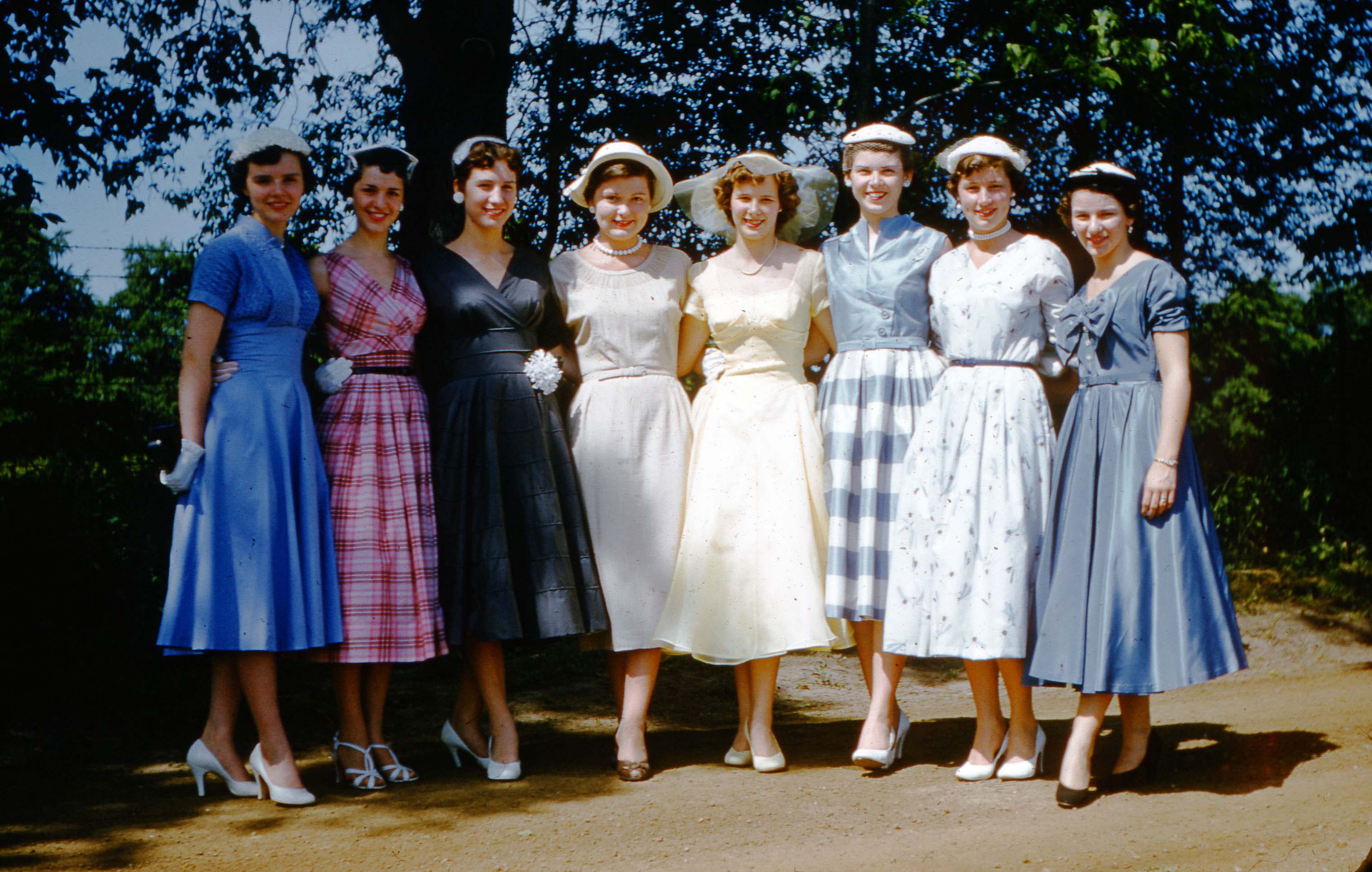
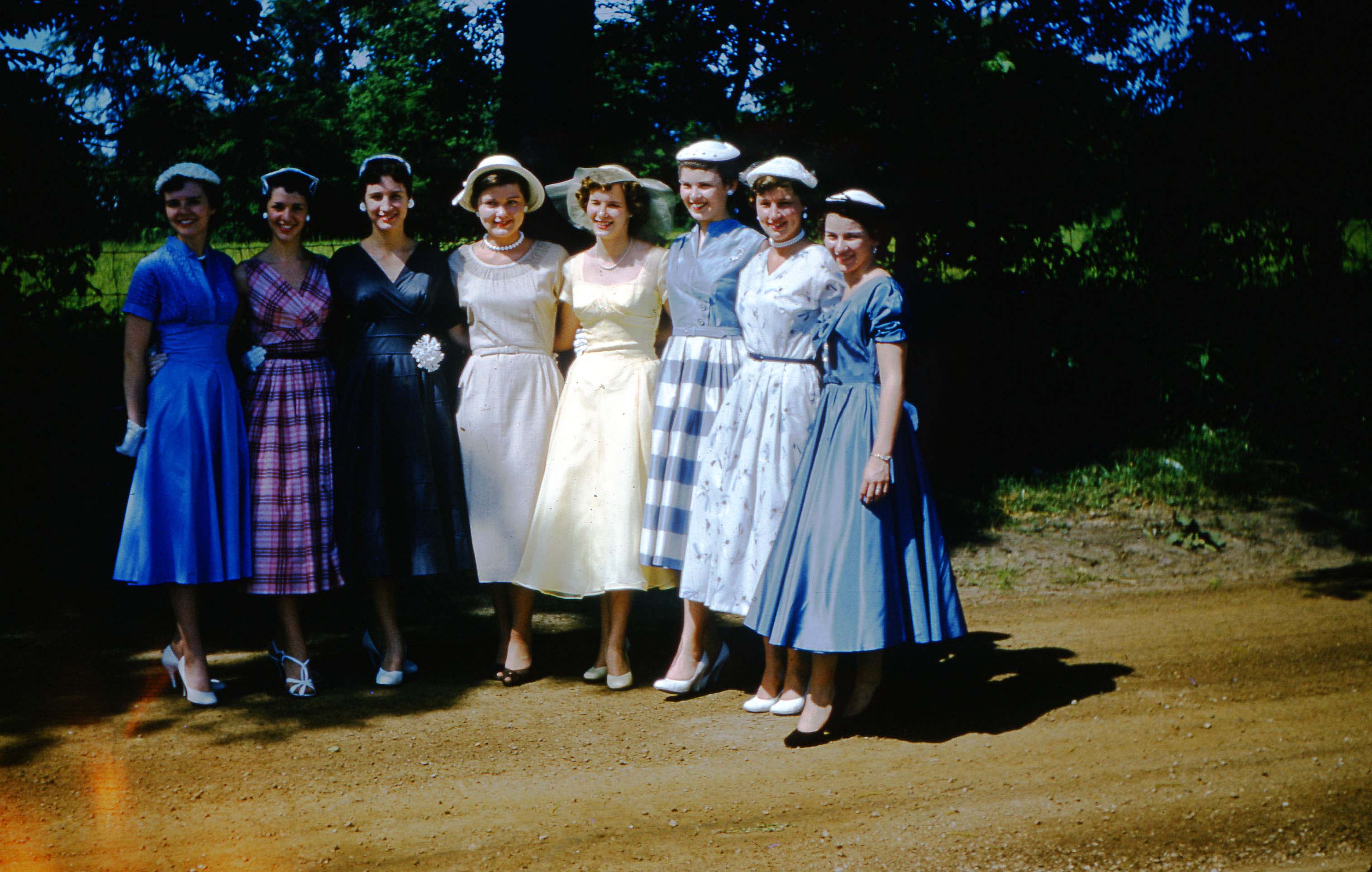
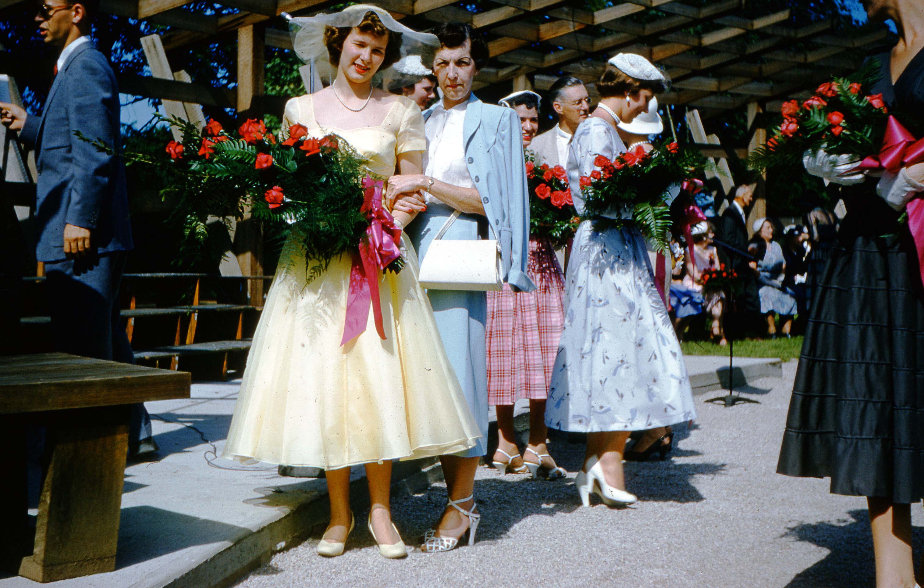 Nancy and her mother, Mrs. Bernice (Ailes) Blanchard. Bernice was the photographer’s sister.
In the next three images: Mayor of Columbus Jack Sensenbrenner, Mrs Jane Lausche (wife of Ohio Governor Frank Lausche), and Ray McNamara (Ohio Director of the American Rose Society)
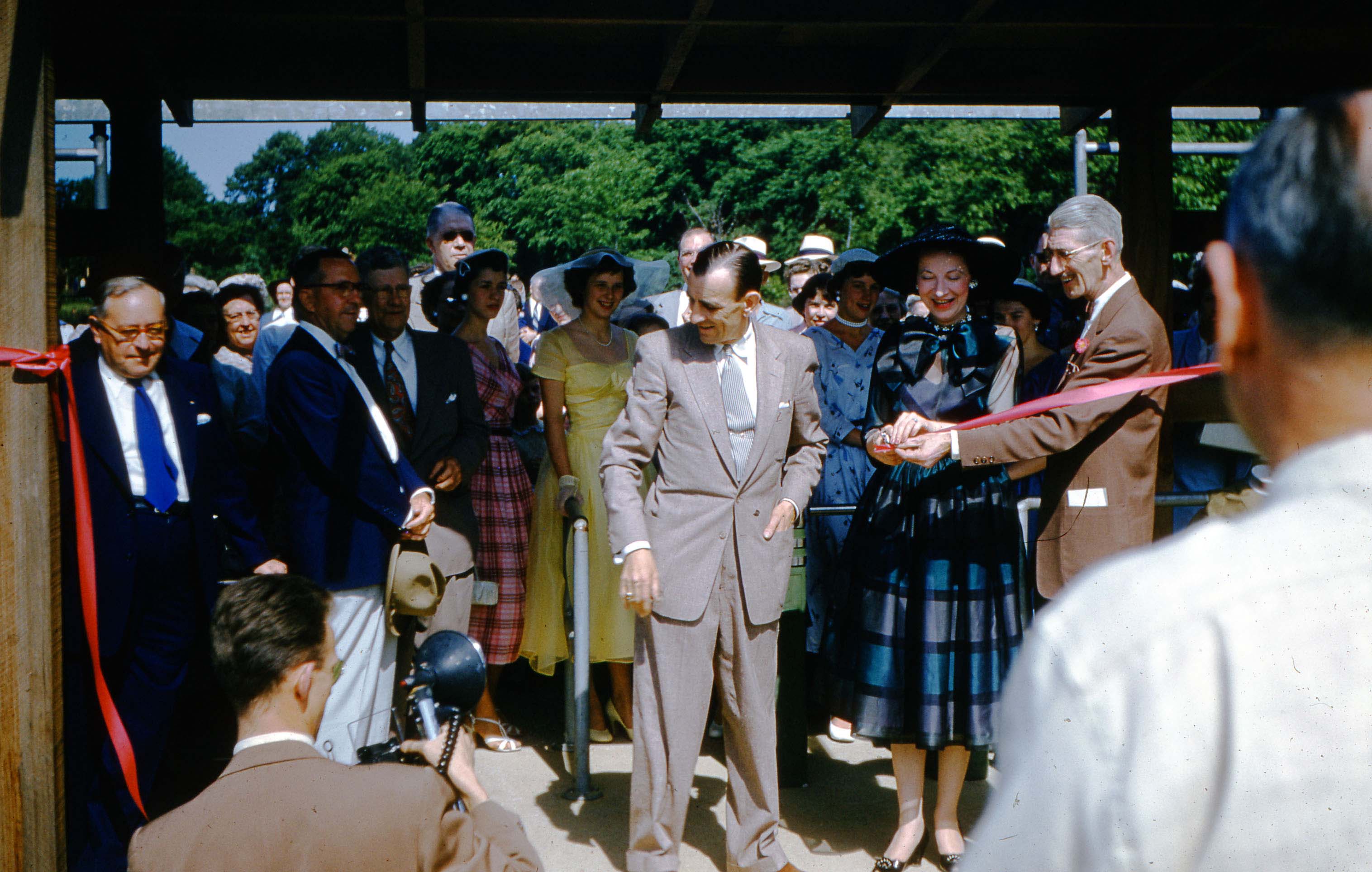
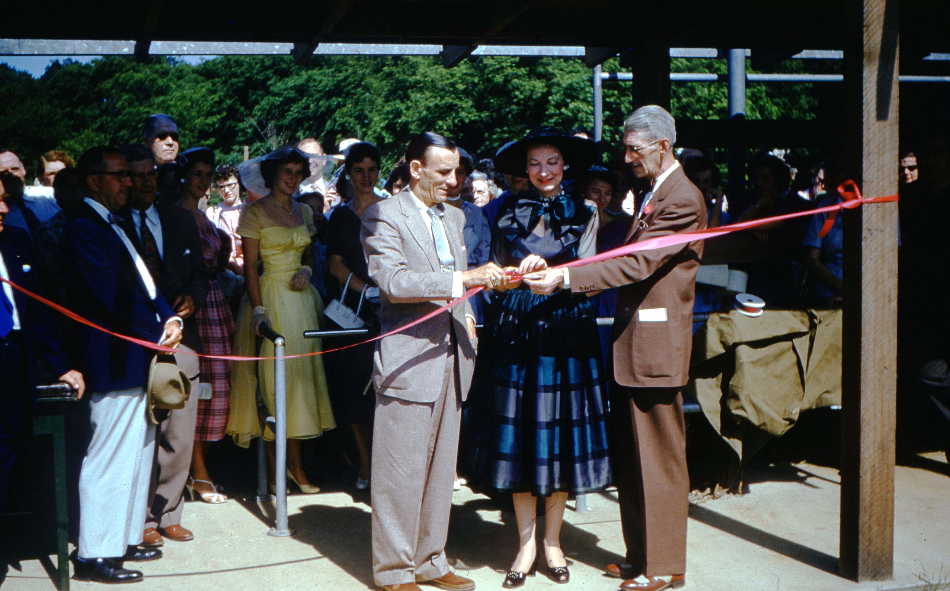
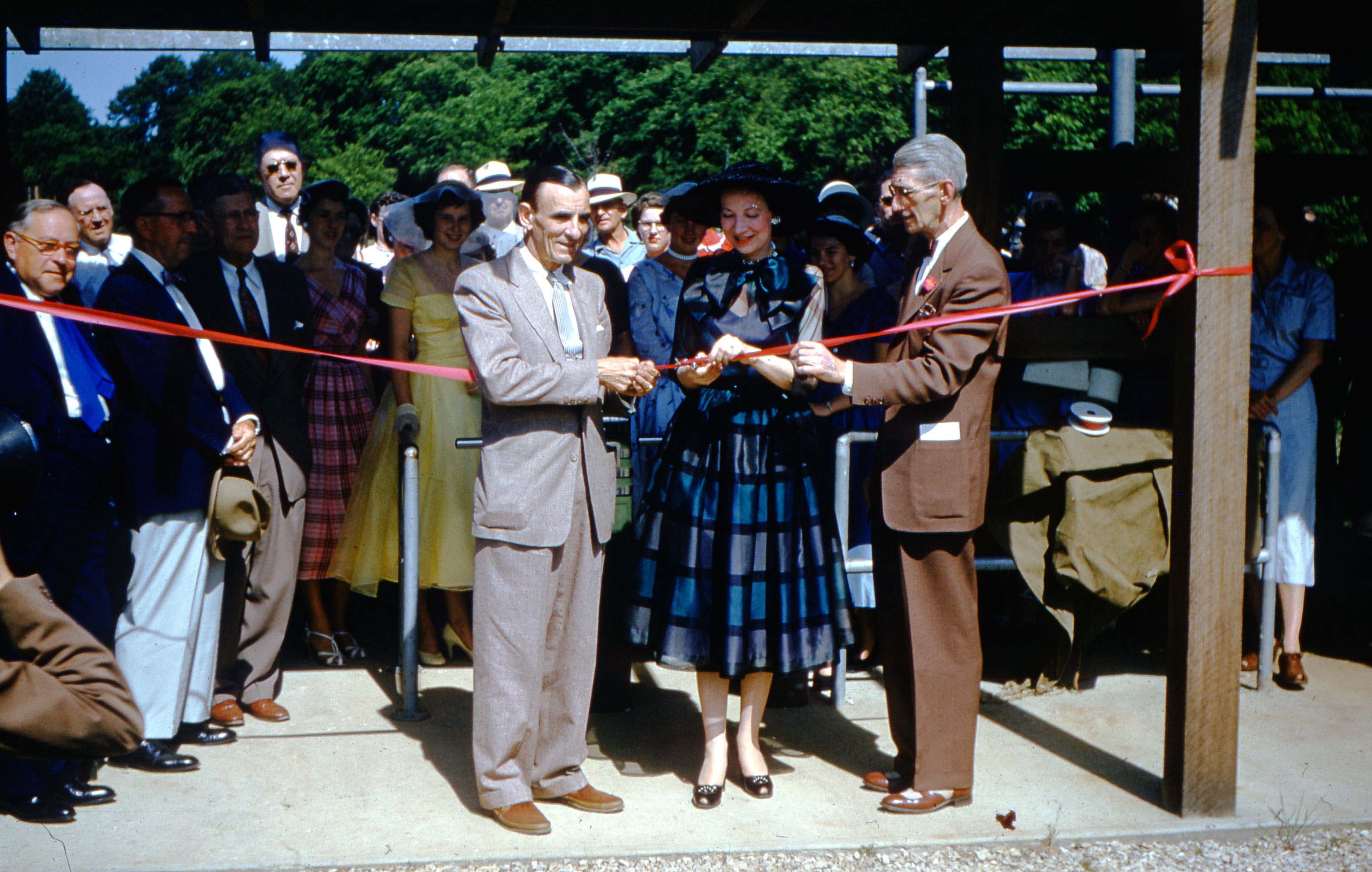
Nancy Blanchard and her court, and Ray McNamara, Ohio Director of the American Rose Society.
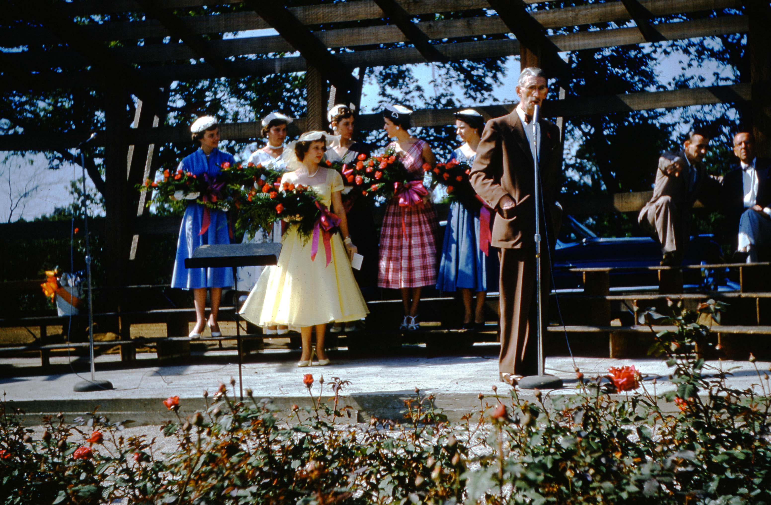
And a few more from Joyce’s treasure trove of pictures.
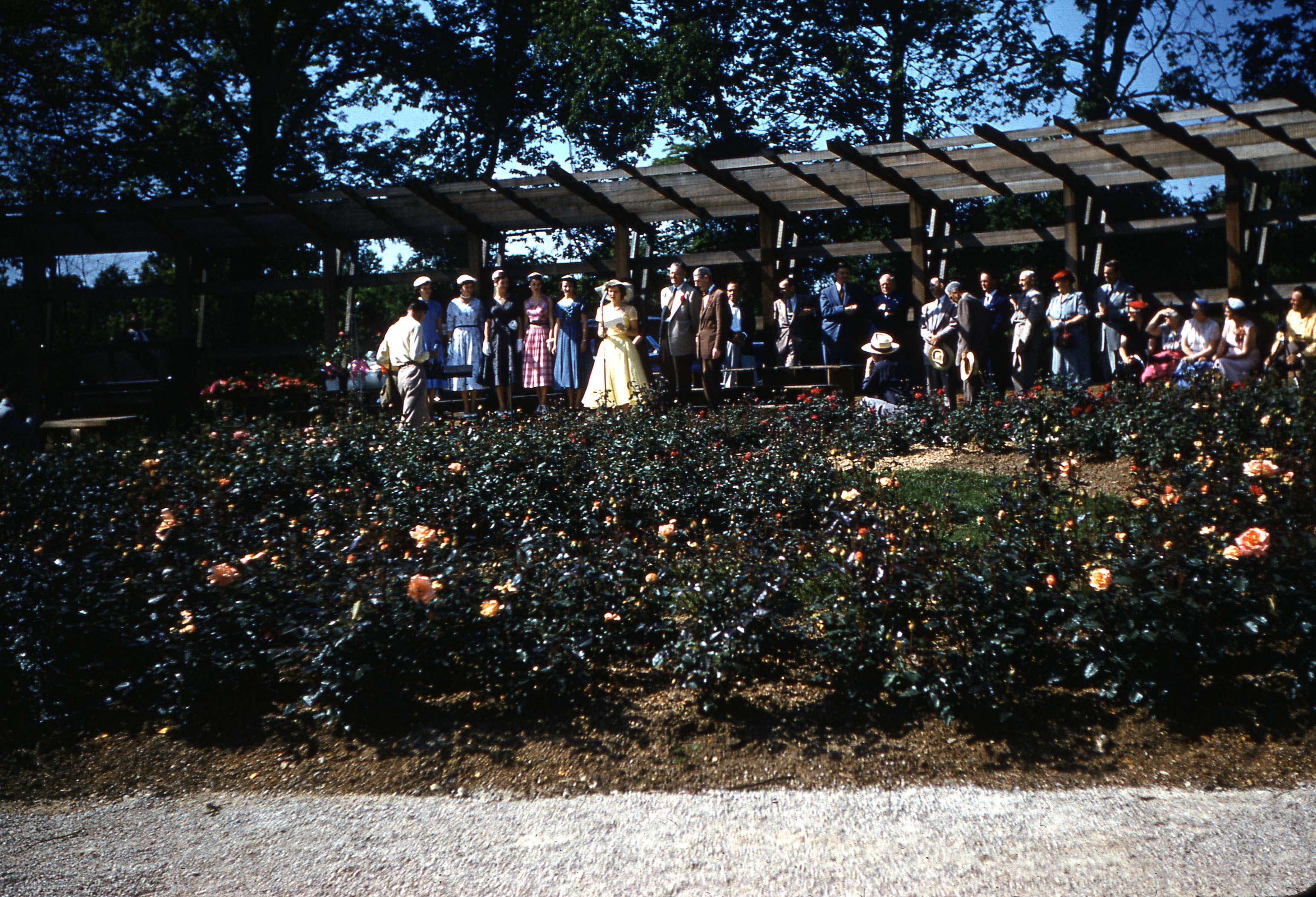
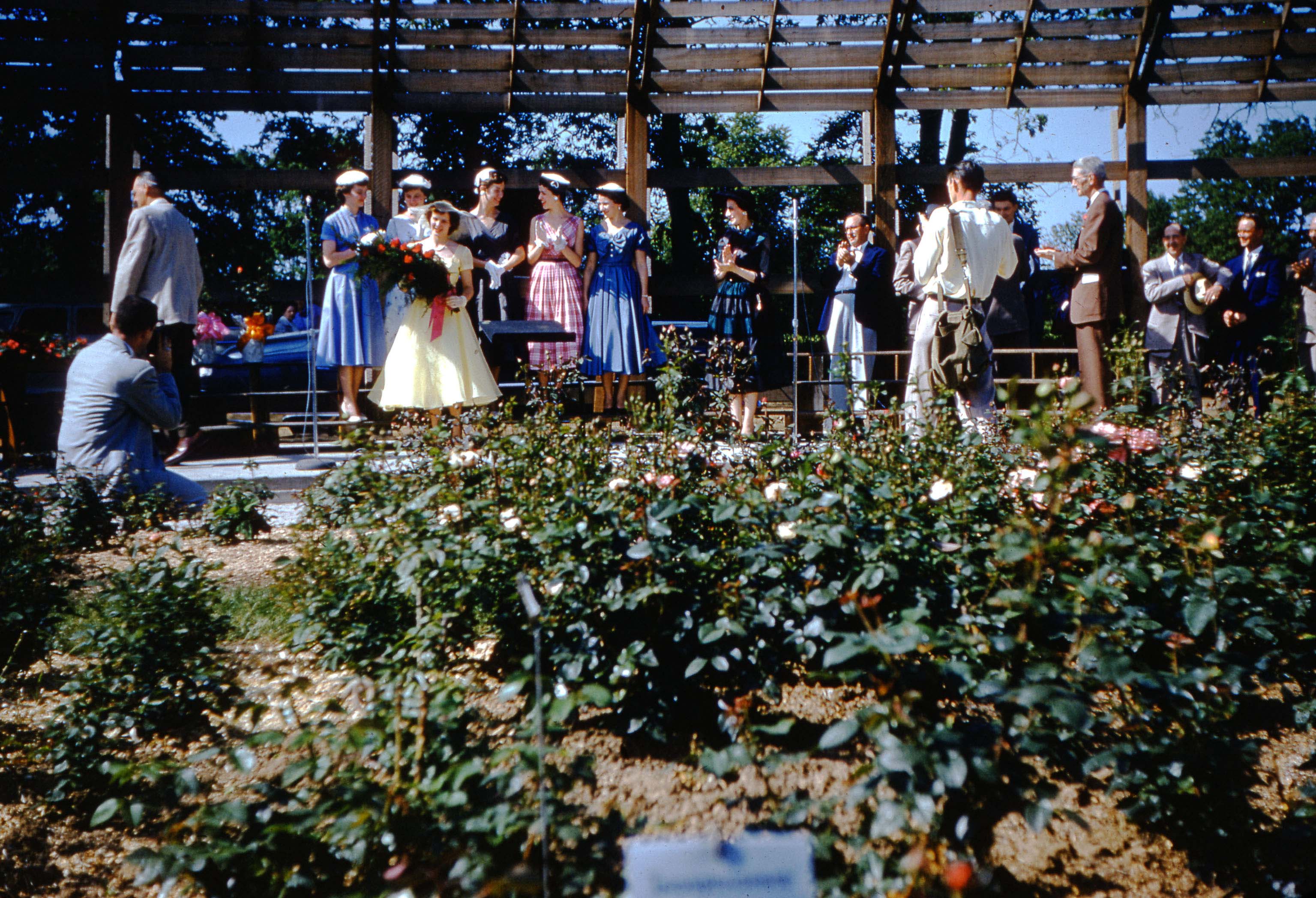
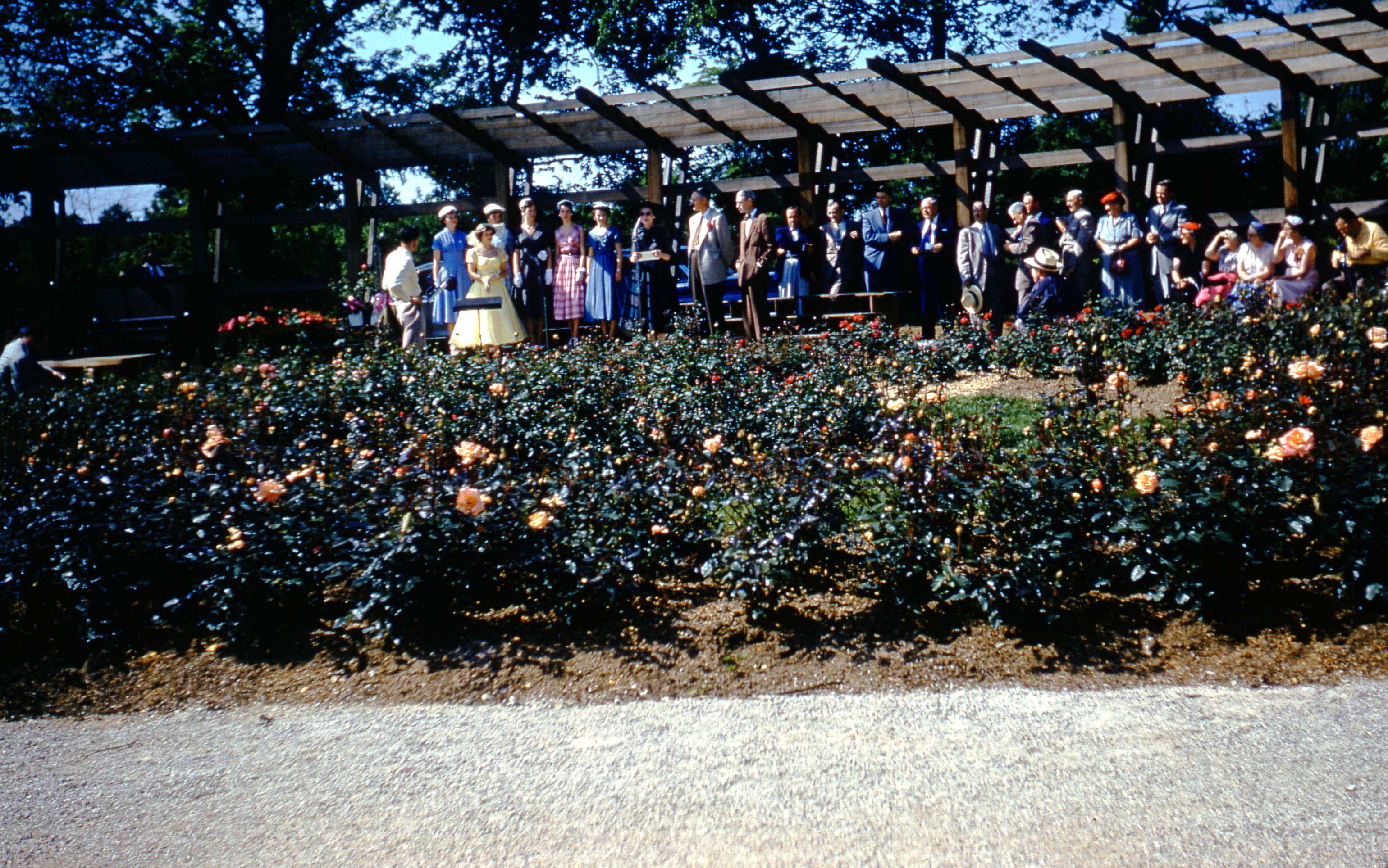
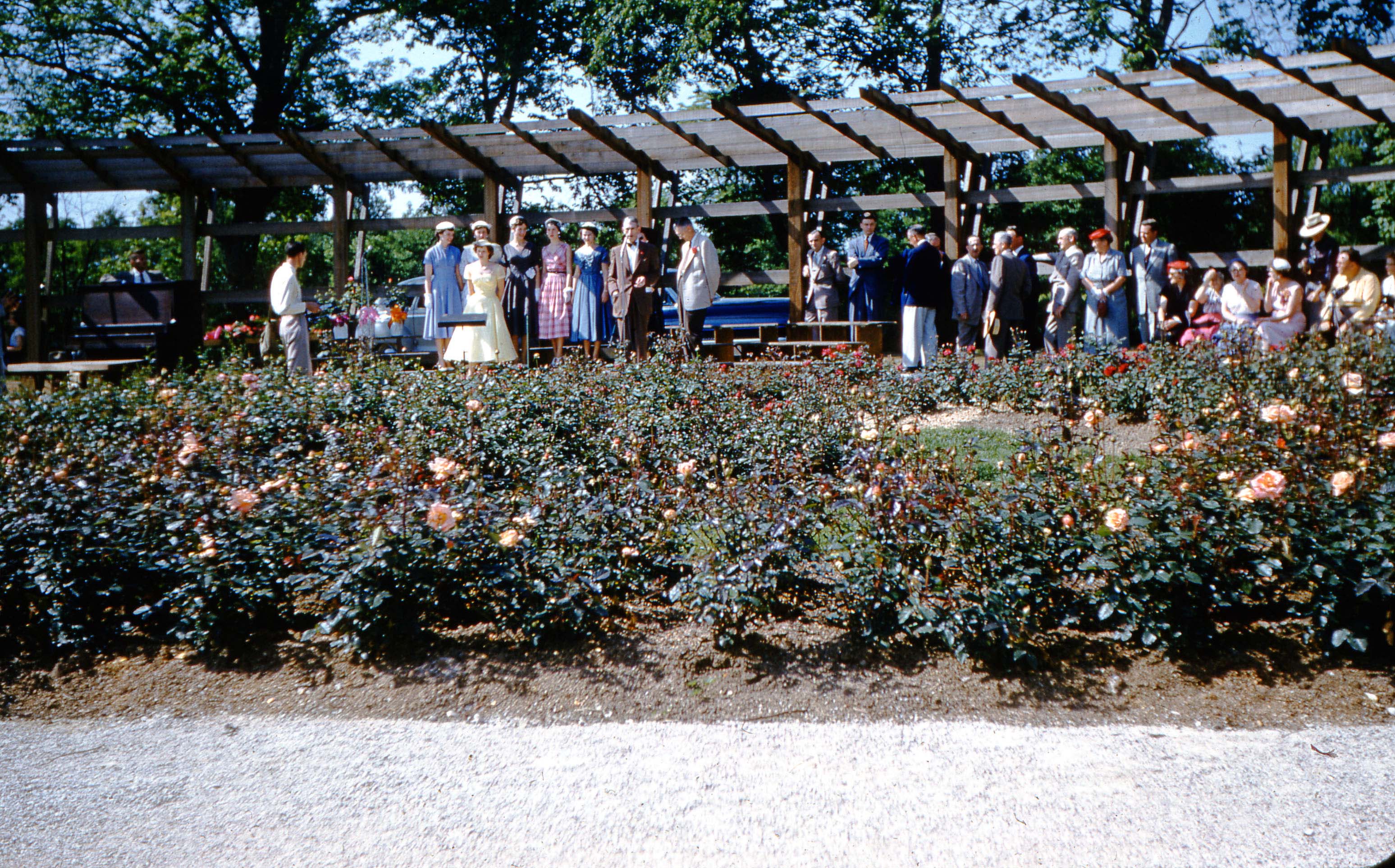
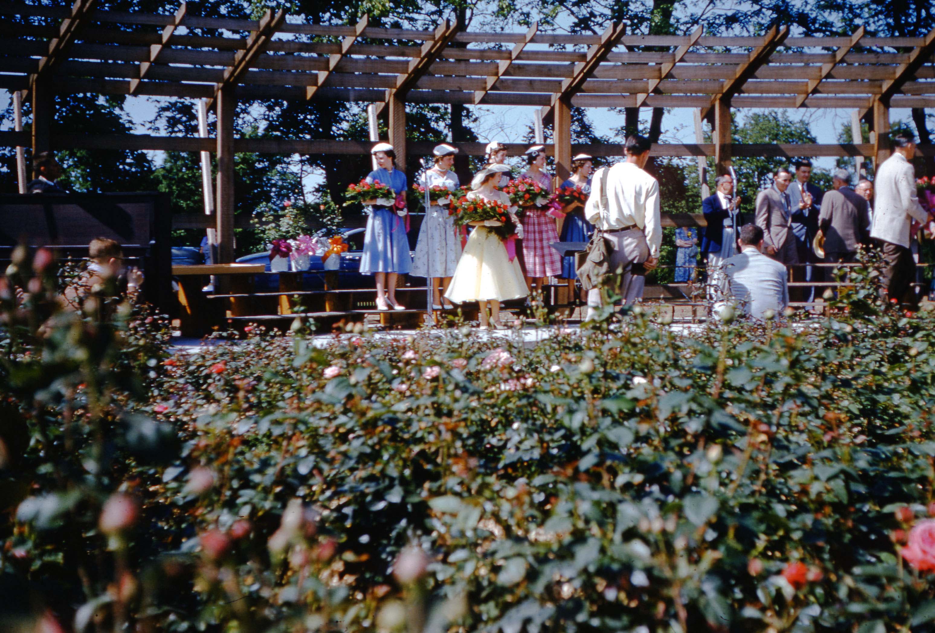
250 East North Broadway
 Another beautiful house on East North Broadway is on the market: 250 East North Broadway. Here, courtesy of realtor Judy Minister, is a video tour of the house.
According to Mary Rodgers, the house was built in 1927 at an original cost of $8,320. The first owner of the home was Vera Hults Benoy. Her husband Wilbur was an attorney. He graduated from Ohio State University and was admitted to the bar in 1910. He served as City Attorney, County Prosecutor, and as Special Assistant to the Ohio Supreme Court. He had some fairly large legal cases, including the 1926 prosecution of the Mayor of Grove City for race track betting. Later, he maintained an office in the AUI building (now the LeVeque Tower).
Wilbur was raised in Licking Co. His father owned a grocery in Croton. Wilbur’s mother died in a car accident in Columbus in 1921. Vera was born in Delaware, Ohio. Prior to her marriage in 1912, Vera was a school teacher.
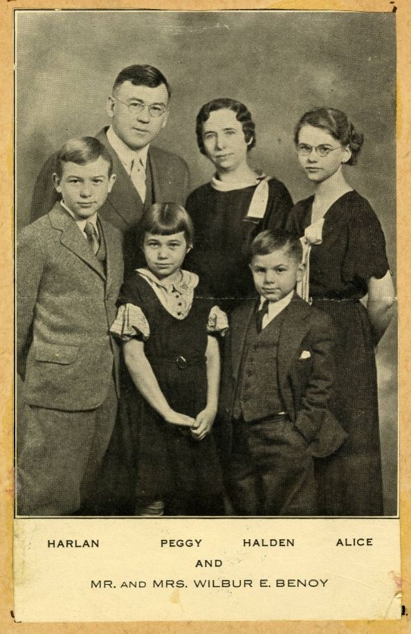 Wilbur and Vera had four children: Alice, Harlan, Ellen (aka Peggy) and Halden. Their daughter Alice was a music teacher.
Hudson & Cleveland, or Elsewhere (Updated)
 This picture was labelled, in cursive, “Looking North at the Corner of Hudson and Cleveland.” It was obviously taken April 22, 1948 on State Route 3. The buildings in the photograph, however, don’t match the buildings that are there today–I’m especially eyeing that two story pre-WW II brick building on the left–so I’m doubtful it is that intersection. Any ideas about its location [Image courtesy of Galen Gonser.]
Michael Leyshon believes the photo may be looking south from Weber, where Cleveland/Westerville Roads split (see his comment below). Perhaps so! That intersection has an interesting corner curve, but I’m not convinced. I drove up and down the street today, and am not seeing that brick building (with its distinctive roof line) to the left in the photo. Travelling northbound from Hudson, between Hudson and Weber, there IS an old brick 2-story building on the west side of the street, that is now clad in white. That very old, virtually decrepit, building has the only roof line close in appearance, though it seems short compared to the building in the photo. I continue to welcome ideas. Thanks Michael!
See comments below. John Williamson reposted Galen’s photo to the Vintage Columbus–Linden Area Facebook Page, and asked those folks for their expertise and/or memories. Bob Roehrer found a 1953 aerial, shown below, that seems to confirm the wide, rounded curb cut at Hudson & Cleveland, shown in Galen’s 1948 photo.
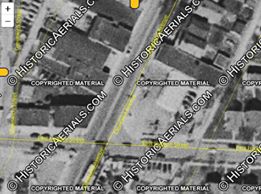
A Streetcar Named Desire? or “South High”
 There are many people in Clintonville who can remember riding the various forms of transportation running up and down High Street. Here’s one.
Local rail expert Alex Campbell says,
[Image courtesy of Galen Gonser]That photograph was taken in the storage yard across from the North High Car House (next to Arcadia). The destination sign reads “S. High St.”
This particular run would be north-south High St. The end of the line in 1947 was near Merrett St. on the south side to Blenheim Road.
American Vitrified Products

American Vitrified Products (formerly American Sewer Pipe) was located at 100 East Arcadia Avenue, at what we still tend to call the “Old North High School”. Here is an old advertisement for it, showing one style of tile made there.
In addition you can find some additional ads of the brickyard, and maps, at the web site of the Coalition United for Glen Echo.
Stable at 242 East North Broadway
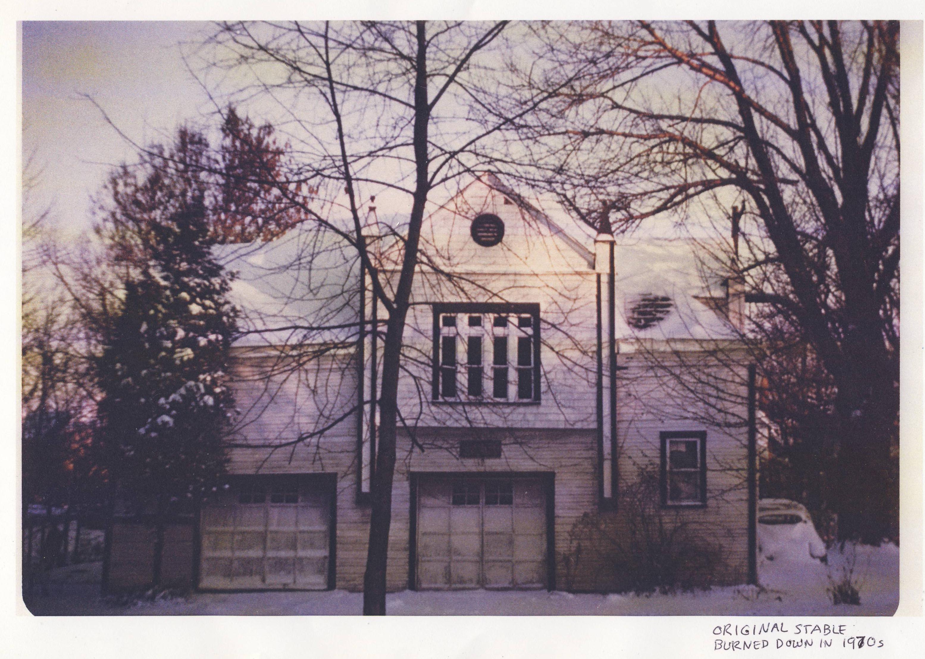
242 East North Broadway used to have a horse stable; it was located behind what is now the garage at that address. The stable stood until the early 1970s, when the then-owner accidentally burned it down.
The story goes that his wife told him not to burn the rubbage so close to the stable! You’ll burn that building down! But her husband did it anyway, and she earned the sad right to say, “I told you so.”
Luckily the current owners have a photograph of that original stable.
[Image courtesy of Gary Means and Jane Hoffelt]West Orchard Lane and North High Street
 A lovely picture of the street at the intersection of West Orchard Lane and North High Street, looking north by northwest, on January 14, 1947. A Sinclair Station was located at the location of the current Donato’s Pizza, and Moore’s Auto Parts was where Momentum Natural Health Store is today. Gray’s Cut Rate Drug Store was next to Moore’s.
Smith’s Skating Rink
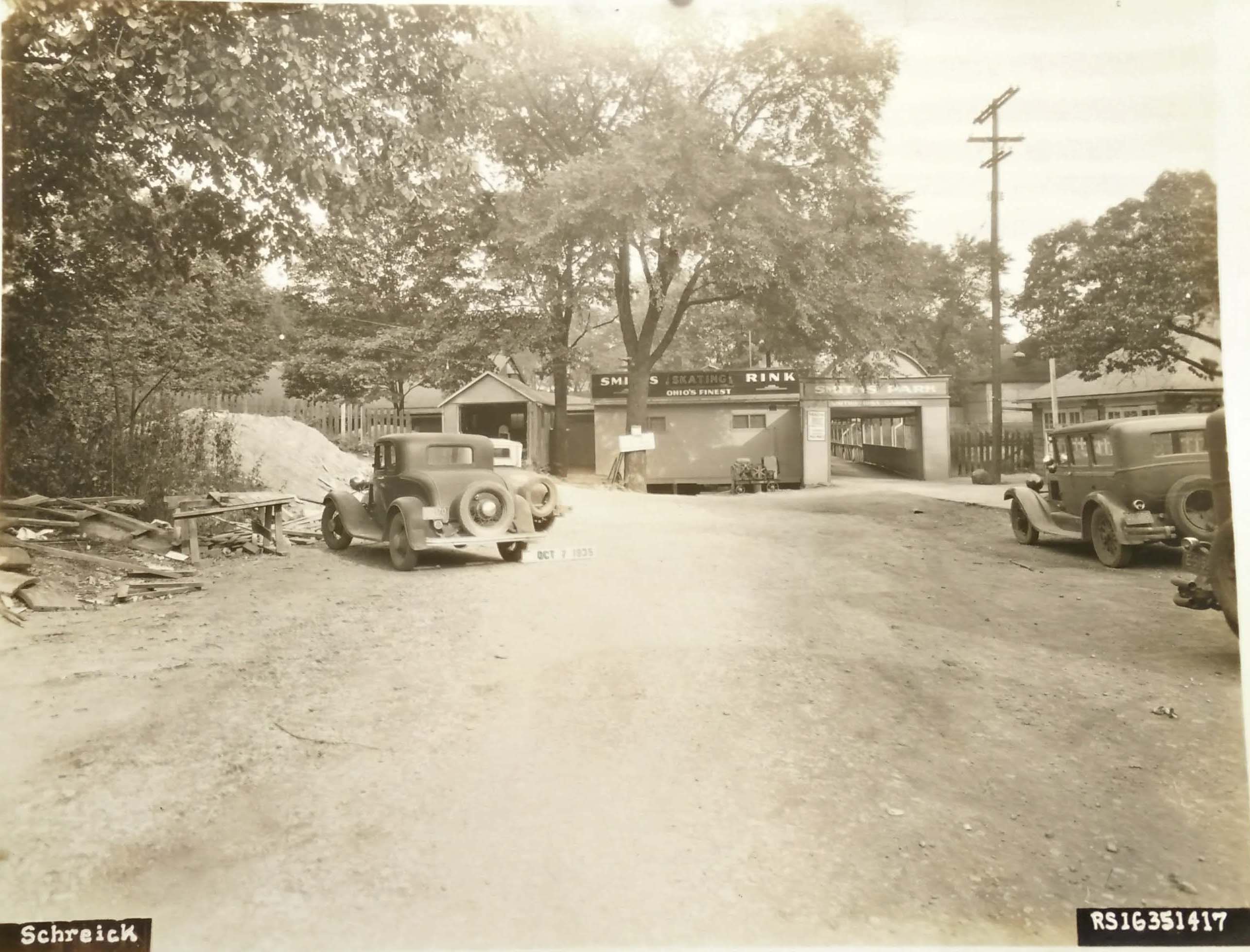 This is not Clintonville! But it is close enough that folks in the Clintonville neighborhood would surely have frequented it.
George W. Smith, a well-known Columbus dancing instructor, built Smith’s Iuka Dance Gardens around 1903. Two seasons later, Smith and his wife opened Smith’s Skating Rink, a roller skating rink.
Both establishments were located at 2150 North Fourth Street in Columbus, Ohio, until they closed in 1971.
George Willard Smith is interred in Greenlawn Abbey, and here is an excerpt about George and his wife Adele Green Smith from the Abbey’s web site:
[Image courtesy of Galen Gonser}Abbey resident George Willard Smith was known as the “King of the Outdoor Amusements” in the early days of the 20th century. He certainly didn’t start out that way. He was born on Christmas day, in 1860, in Syracuse, New York. His parents, John and Fannie Smith, were hard working blue collar kind of people. The family would make their way to Columbus in 1872 and John would find a job as a salesman. (The directories of the time list him as a “peddler”.) A few years later around 1875, George would join in with his father to help with rent and bills and they both would be carriage trimmers by the late 1870’s. Carriage trimmers were responsible for upholstering the seats, floors and roofs of buggies, and the Columbus Buggy Company was a large manufacturer in the city, employing well over 1,000 people by 1880. Work was so efficient, that they finished a buggy every 8 minutes on average. John would pass away in early 1882 at the age of 50, and which must’ve struck a chord in 22 year old George, with him not wanting to die young laboring away like his father did. It’s clear that George had another plan in mind. In those days it was very common to learn dance instruction by reading a book, as private lessons were expensive. Society minded people were getting waltz lessons and trying to be more genteel. George never spoke of any dance schools he attended, so the likely explanation as to how he learned and then taught dancing lessons was he got one of these books as well. (“The Universal Dancing Master,” written by Lucien Carpenter, was popular book published in the same year of John Smith’s death.) Although he was listed as still being a carriage trimmer until 1893, George started a “Home Academy of Dance” in 1894, giving himself the title of professor and calling himself a dancing master.
It’s not known how long Smith was courting Adele Green, daughter of William J. Green, a local Columbus physician. It’s possible that Adele, born in Knox county in 1880, was a student of George’s and he took a shine to her. George was 40 in 1900, Adele was 20, and they both shared an interest in dancing. It could also be that her father was a member of the Benevolent and Protective Order of the Elks, just like George was, and they were introduced to each other through that. Smith wasn’t an old man by any means, and even though it may look a little odd today, marrying a man many years older than her was a normal thing for a woman to do then. The age difference didn’t seem to matter to them much and they were married in 1902.
Smith actually had an article in the Columbus Dispatch claiming that he taught 26,000 people how to dance, and that he was going to officially retire from teaching his home dancing classes. He would still own them for several years, but would employ instructors. His big break was that he was able to lease some land from the Neil family in the area of Iuka Ravine where Northwood and 4th is today for a dance pavilion. A few years later, in 1905, there would also be a roller skating rink on the same property, which George named “Smith’s Iuka Park Gardens.” Roller skating competitions would be held in the rink, where the best skaters in the state would compete to see who could skate the fastest laps.1909 was the biggest year for such a competition.
George had enough money by this time to own and operate the B. F. Keith Theater on Gay Street, a vaudeville theater. His in laws lived in an apartment on the floors above the theater itself, and that’s also where Smith had his office…
As the teens waned and the 20’s came roaring, George and Adele would do less with the theater work and spend more time on their more profitable dance hall and skating rink ventures. Iuka Park Gardens became an institution for the community, even employing boys as young as 12 years old to help lace up the skate to the shoes of the patrons. Several people would meet their sweethearts for the first time at the rink, get their first kisses, and engagements there over the years. The Smith’s employees loved them and some would stay employed by them for decades. George’s brother in law Ivan would help run the business in 1938, and George would pass away in 1948. Adele would continue Iuka Park Gardens until her death in 1965, and it would remain open until Ivan had to close the business in 1971. The land was sold, the dance hall and rinks bulldozed, and the Iuka Park Commons apartments are there to this day. The Smiths had no children.
Winfield Scott & his House


Two more terrific pictures taken in the old old days of 242 East North Broadway‘s history.
This house was known as the Winfield Scott house, after the owner in the early part of the 1900s. The people in the first photo are Winfield Scott (1848-1934) and his wife Francis Anna Whipple. This homeowner bears no relation to the Civil War general. He is also not the son or brother or nephew of a former OSU President.
There were various Winfield Scotts living at the same time and in the same areas, and it makes for some confusion. There is a Winfield Scott (1846-1916) who was the brother to William Henry Scott, the OSU president; William Henry lived on North High Street a scant block from 242 East North Broadway. (This is confirmed with matching parents’ names, Alexander and Susan Scott, appearing on both of their death certificates, viewed on Familysearch.org.) This Winfield brother was married to someone named Josephine.
The Winfield Scott living at 242 E. N. Broadway was the son of Lancelot and Jane Scott, and he was married to Francis Anna Whipple. He also had a son named Winfield Kenath Scott (spelling based on his death certificate) who lived from 1876-1915. Winfield and Francis had a daughter named Florence May Scott who married Clarence B. Hoover; their daughter was Elizabeth Hoover and Elizabeth lived in the Rosemary Parkway neighborhood of Clintonville. In 1991 she sent a letter to the homeowners of 242 E. N. Broadway and you can find that letter here.
There is a mention on OhioMemory.org, that the Winfield Scott who lived at 242 E N Broadway was the son of the OSU president William Henry Scott. But that is not the case. This Winfield was of the same generation as William Henry Scott and Winfield Scott, so they may have been cousins.
By the way, both of these Scott lines lived in Athens County in the 19th Century, so that adds to the evidence that they may have been related (and also adds to the confusion!
[Thanks to Nick at the Columbus Metropolitan Library Local History and Genealogy Desk for this genealogy information. The photographs came from Elizabeth Hoover and are shared courtesy of Gary Means and Jane Hoffelt.]Tigers & Lions & Bears! Oh My!
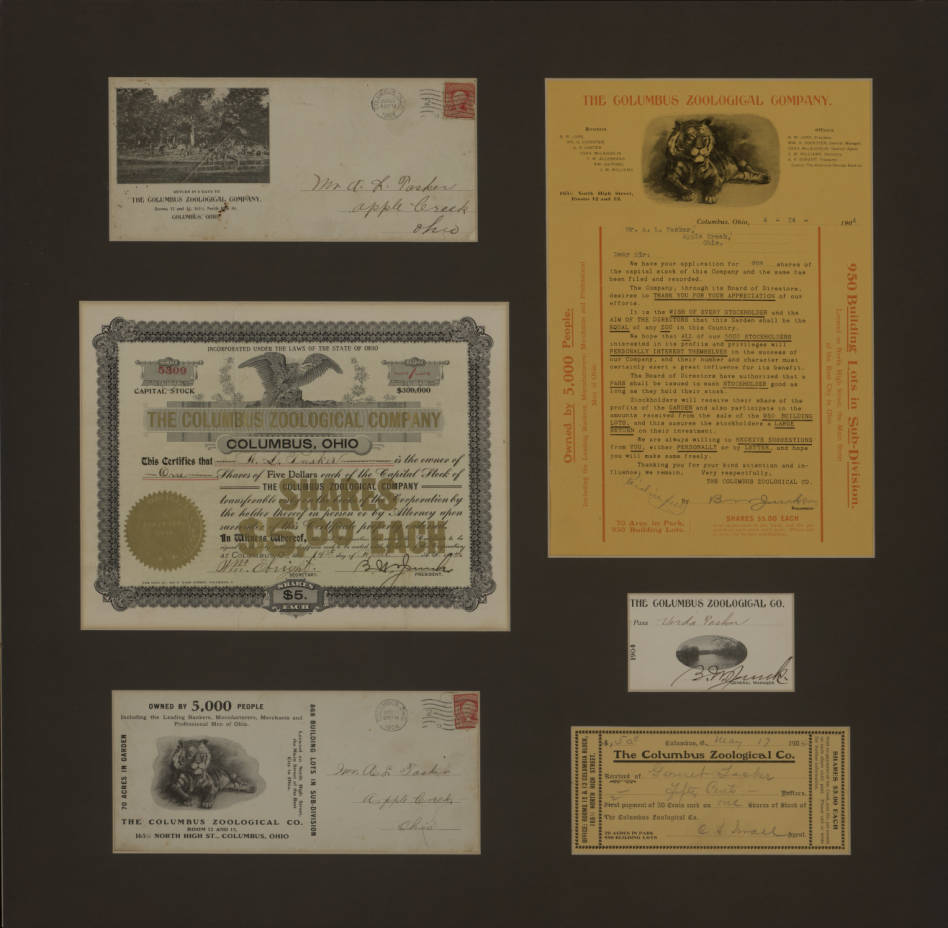 Wow-Alex D. Stanek has located some treasure! The Columbus Zoological Park was located south of Morse/Rathbone Road on the west side of High Street. The east side of High was the “Garden” which was divided into building lots. That neighborhood retains the name “Zooland”. The Zoo was established on land originally owned by John Rathbone. Rathbone died in 1853. That is when the land officially transferred to his daughter Eliza Wetmore and her heirs. Some of these documents feature a tiger. Prior research on the zoo revealed the existence of a meat eater in the animal collection but we’ve always assumed it to be a lion. One photo features a herd of white tail deer. Other animals included rattle snakes, a couple bear cubs, elk, and monkey imported from the Hagenbeck Zoo in Germany. Fabulous finds. [Text courtesy of the Clintonville Historical Society’s Newsletter. Pix courtesy of Alex D. Stranek and the Columbus Metropolitan Library.]
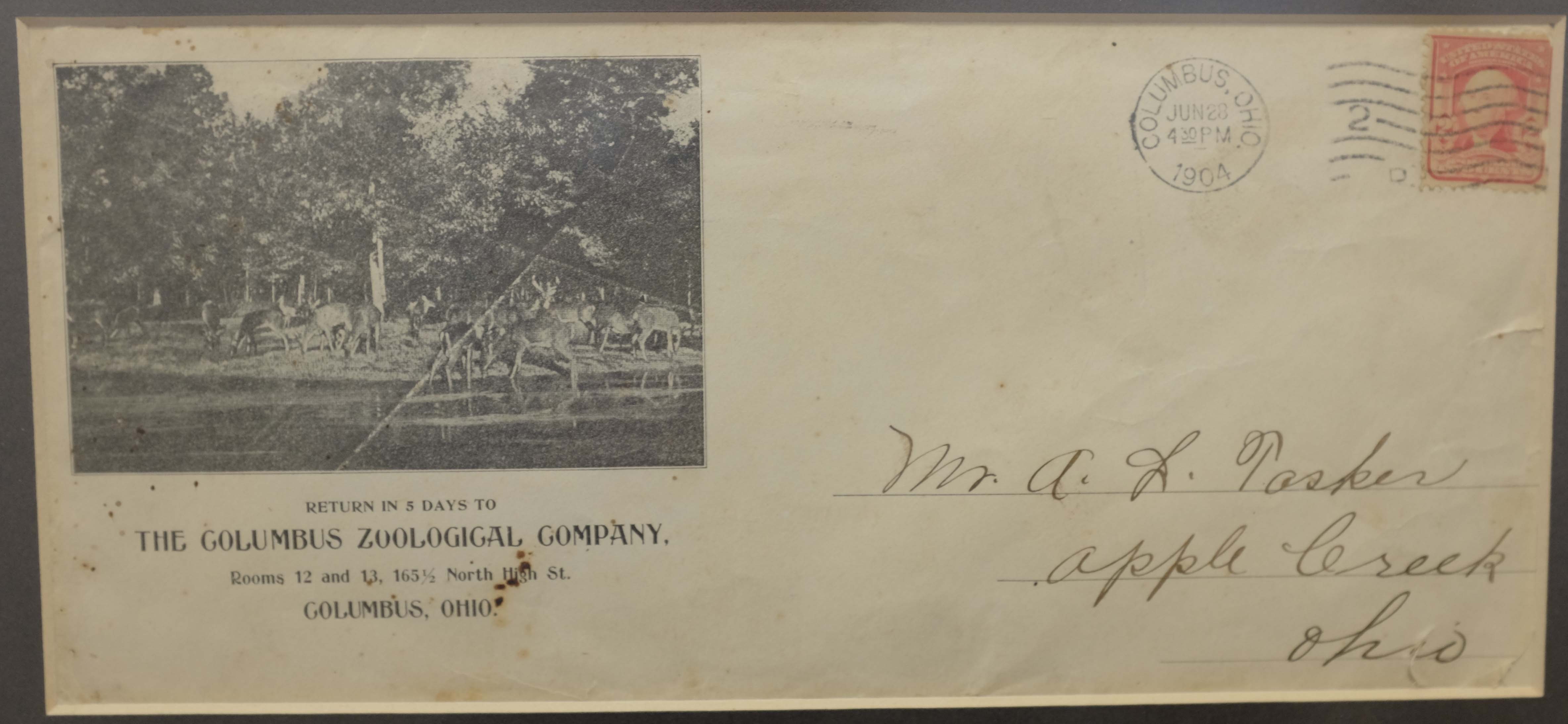
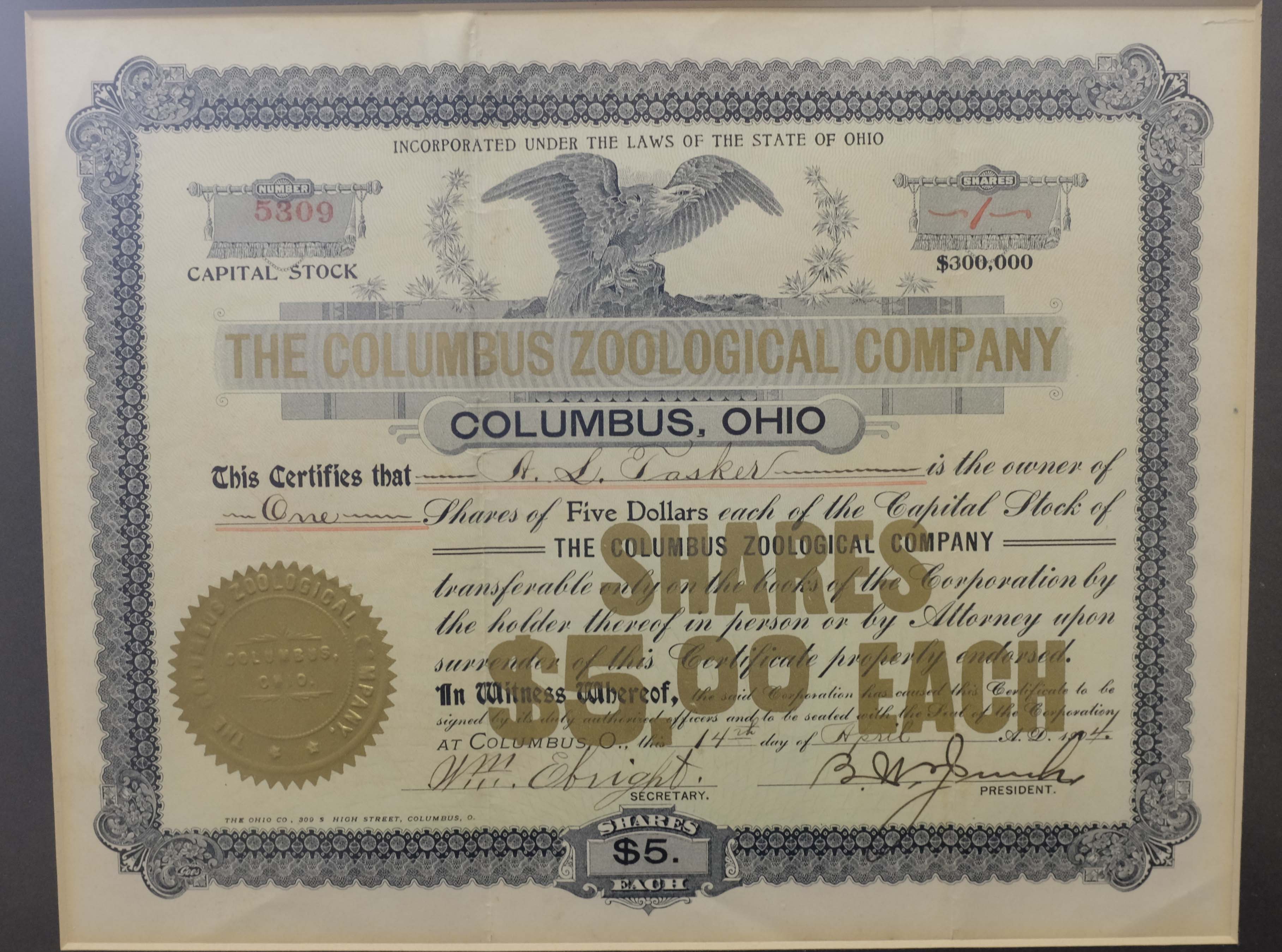
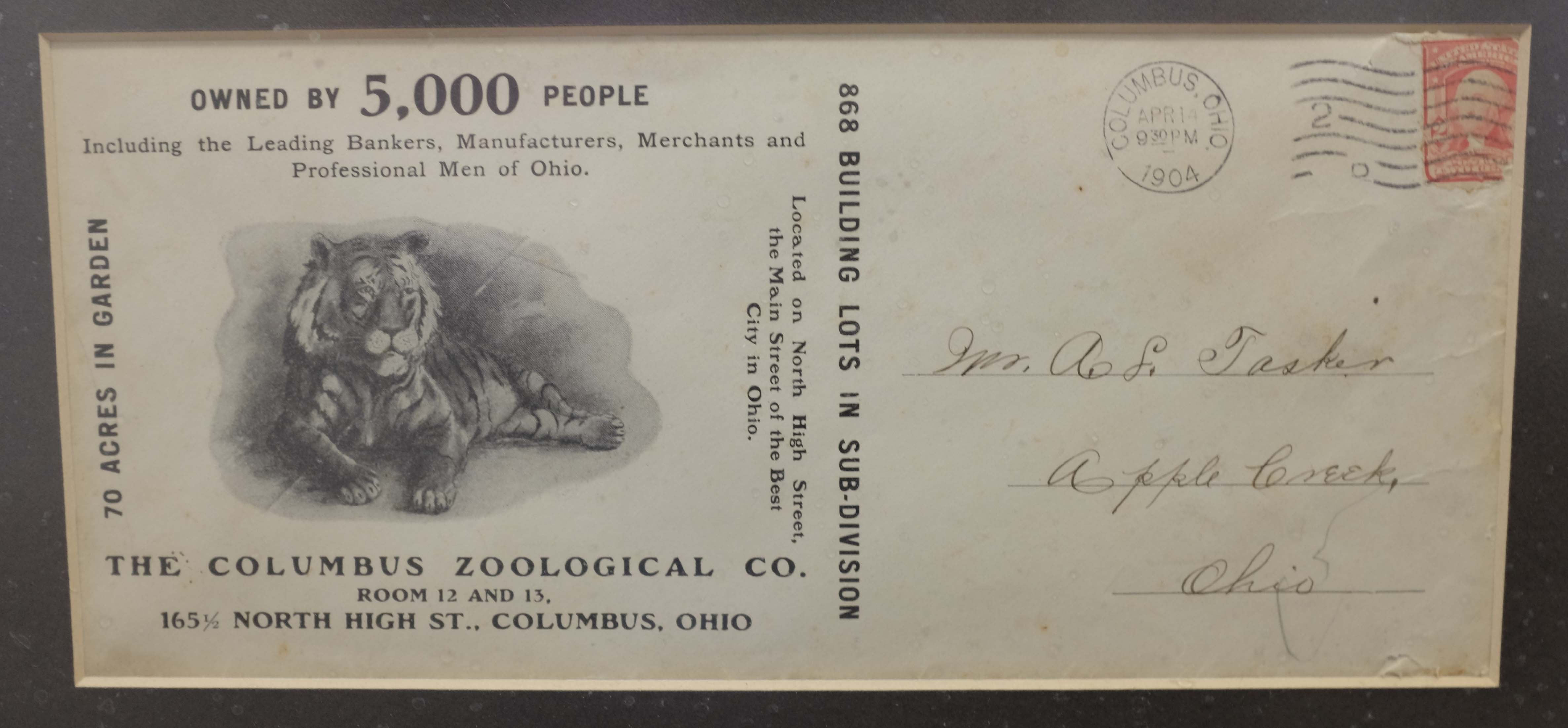
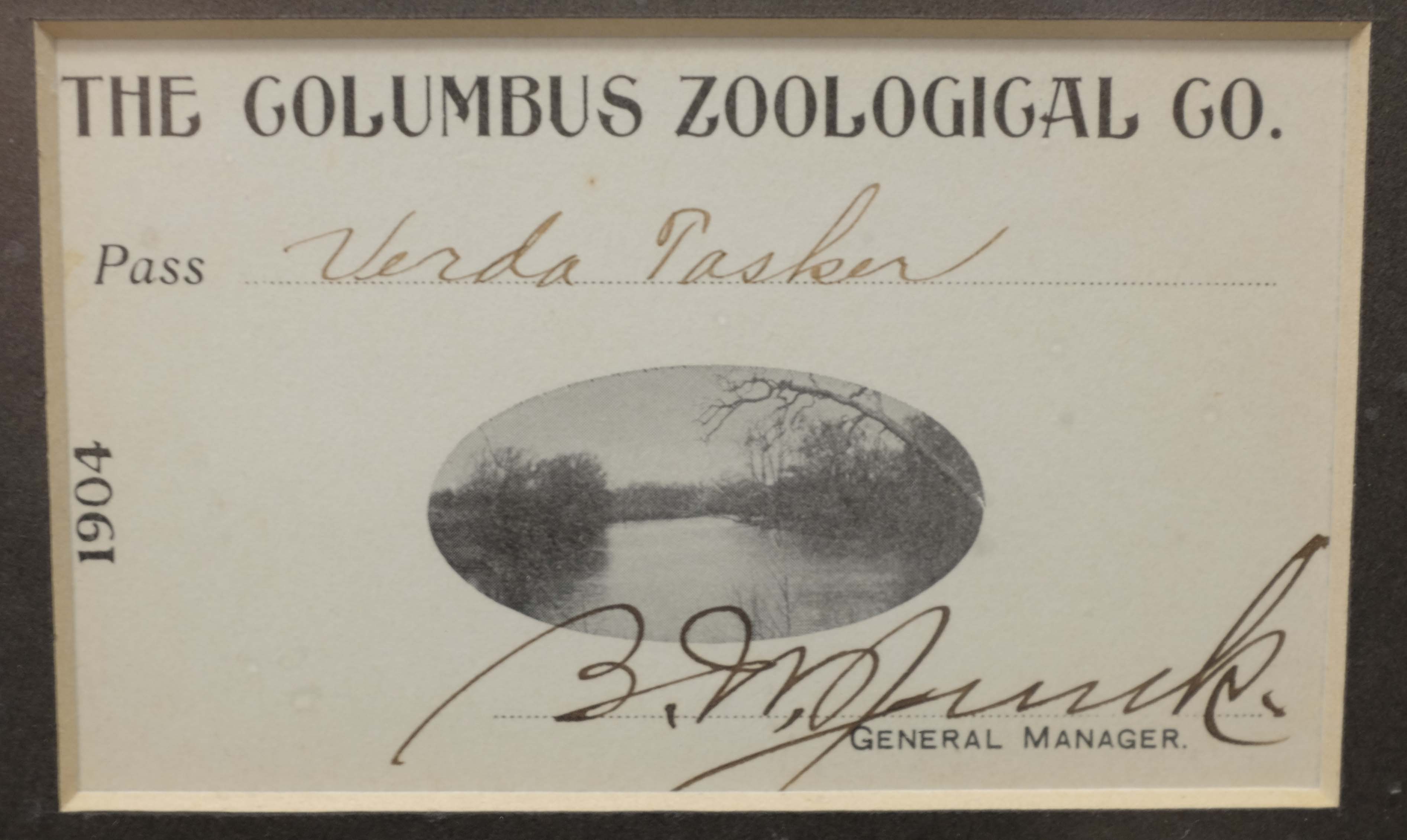
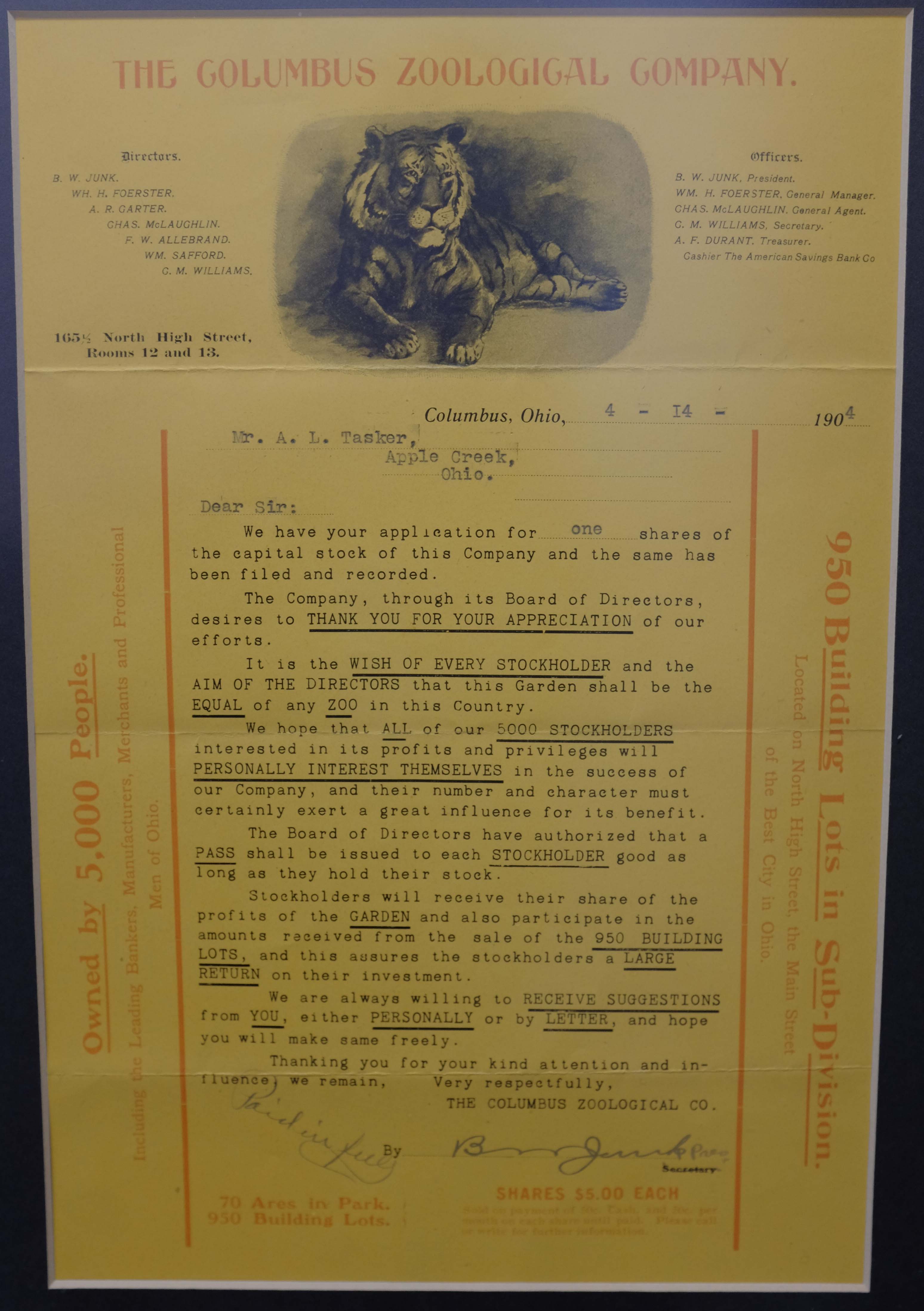
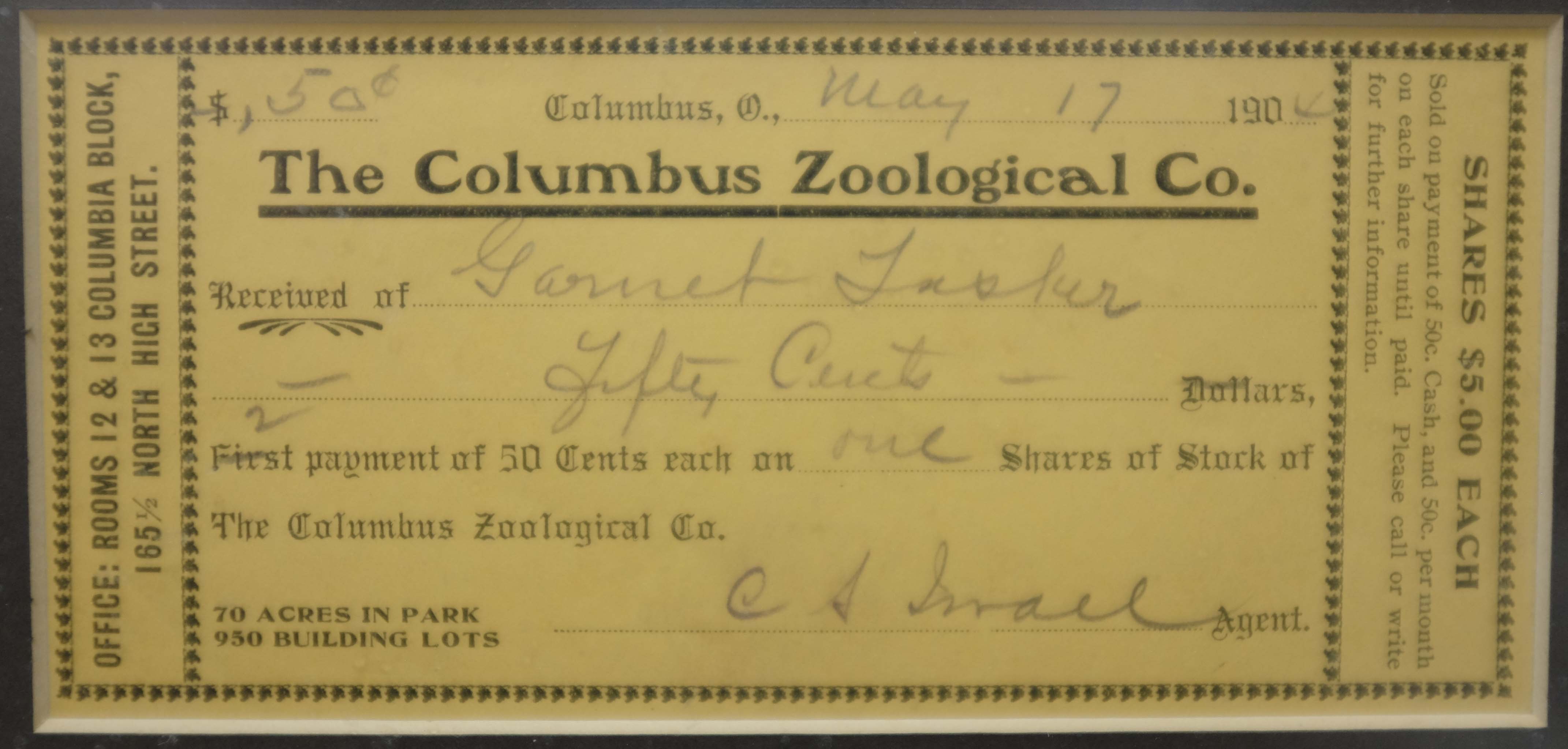
Take Me For a Ride In Your Car, Car..
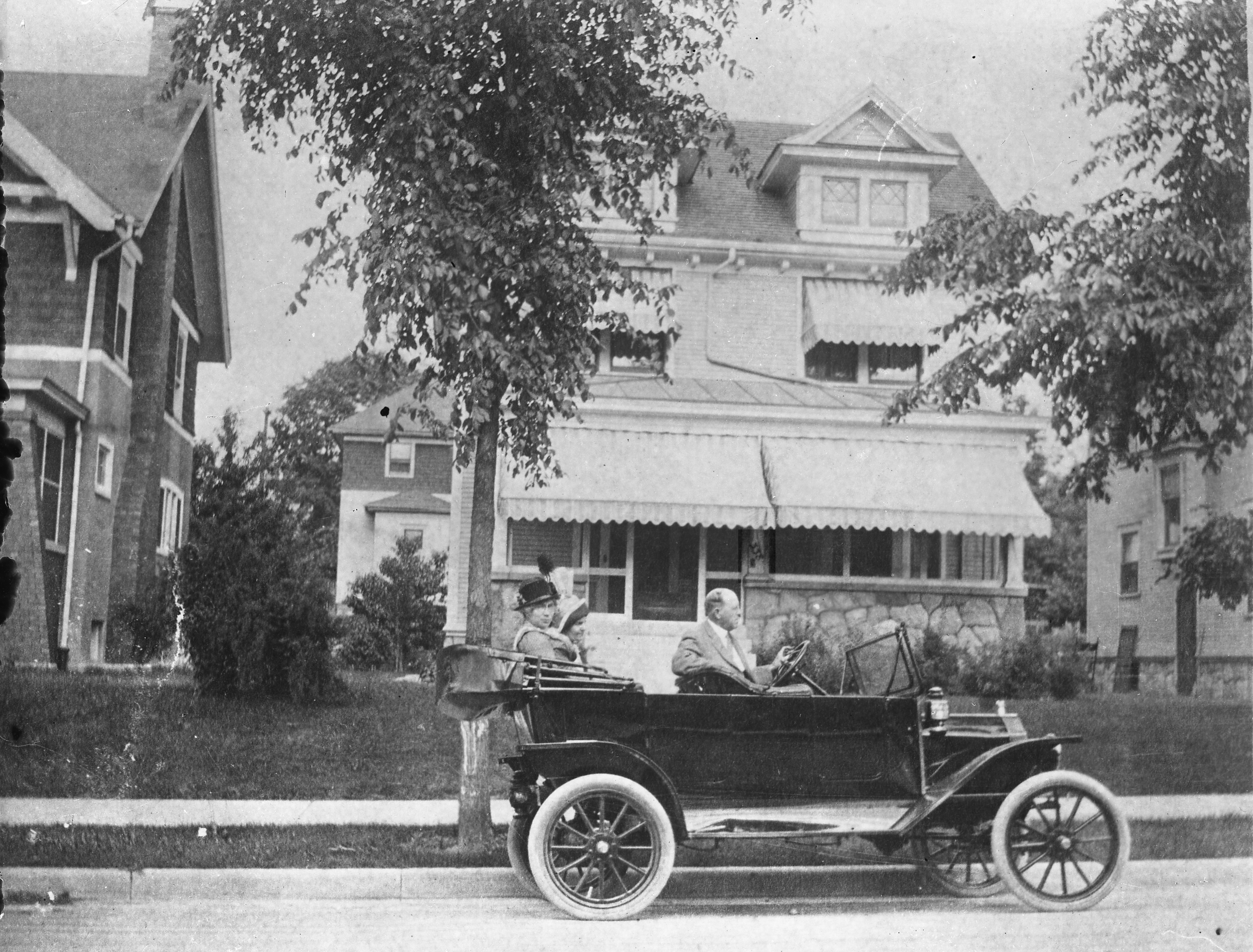 Ron Candage and Rick Lindner kindly identified the car in the photo that I use on my banner. It’s a 1914 Ford touring car.
From Rick:
The 1912 had no front doors (but did have an option to attach removable ones), the 1913 Ford had brass trim on the side lamps, and the 1915 Ford had curved rear fenders. So this pretty much sets the year at 1914.
From Ron:
Ford made 100s of thousands of these in each of these years and they had factories in other countries which produced right hand drive cars. The car in your picture could have been produced at the Ford Motor Company – Columbus Assembly Plant which was located at 427 Cleveland Ave. This factory started in 1914 and closed in 1939. The components arrived here by train and the automobiles were assembled at the plant for delivery to local dealers.
I’d love to also identify the house in the photo, which seems to be at the address “338 [something].” And check out those beautiful columns in the next-door neighbor’s house!
(I’ve rotated the photo since putting it in the banner.)
[Image by C.C. Hollenback, courtesy of the Dawson family.]I Scream, You Scream, We All Scream For Ice Cream!
 I wonder how many ice cream stands Clintonville has hosted over the years? Surely this one at Olentangy Amusement Park was among the earliest.
Indianola’s Rail

In response to John Krygier’s photos of Indianola’s substructure, Alex Campbell sent this lovely photo along.
He says,
There were streetcar tracks on Indianola Avenue from Glen Echo to Oakland Park. The Summit-Steelton standard gauge line was extended north from Glen Echo where the CD&M turned off to head for the private right of way of its Worthington Cutoff. I have conflicting information on just when the Indianola track was built; one date says early 1927 yet it shows up on a 1925 map. It was taken out of service in 1938 when the line was converted to a trolley coach line.
Here is a N. 4th St. photo from 1909 — Fourth Street and 17th Avenue view from southeast corner looking northwest from 17th and west of 4th looking east. Fourth Street north of Chittenden Ave. was the only streetcar line with side of the street right of way in Columbus.
The construction style used to reinforce Indianola (shown in John Krygier’s photos) appear to be similar to tracks used elsewhere in Columbus.
For good measure, Alex also sent along this picture of South 4th St. He says the school building in the left background can still be found on Google maps.

Under Indianola
John Krygier recently sent me the following photos (shown across then down), taken May 2018, with accompanying information:
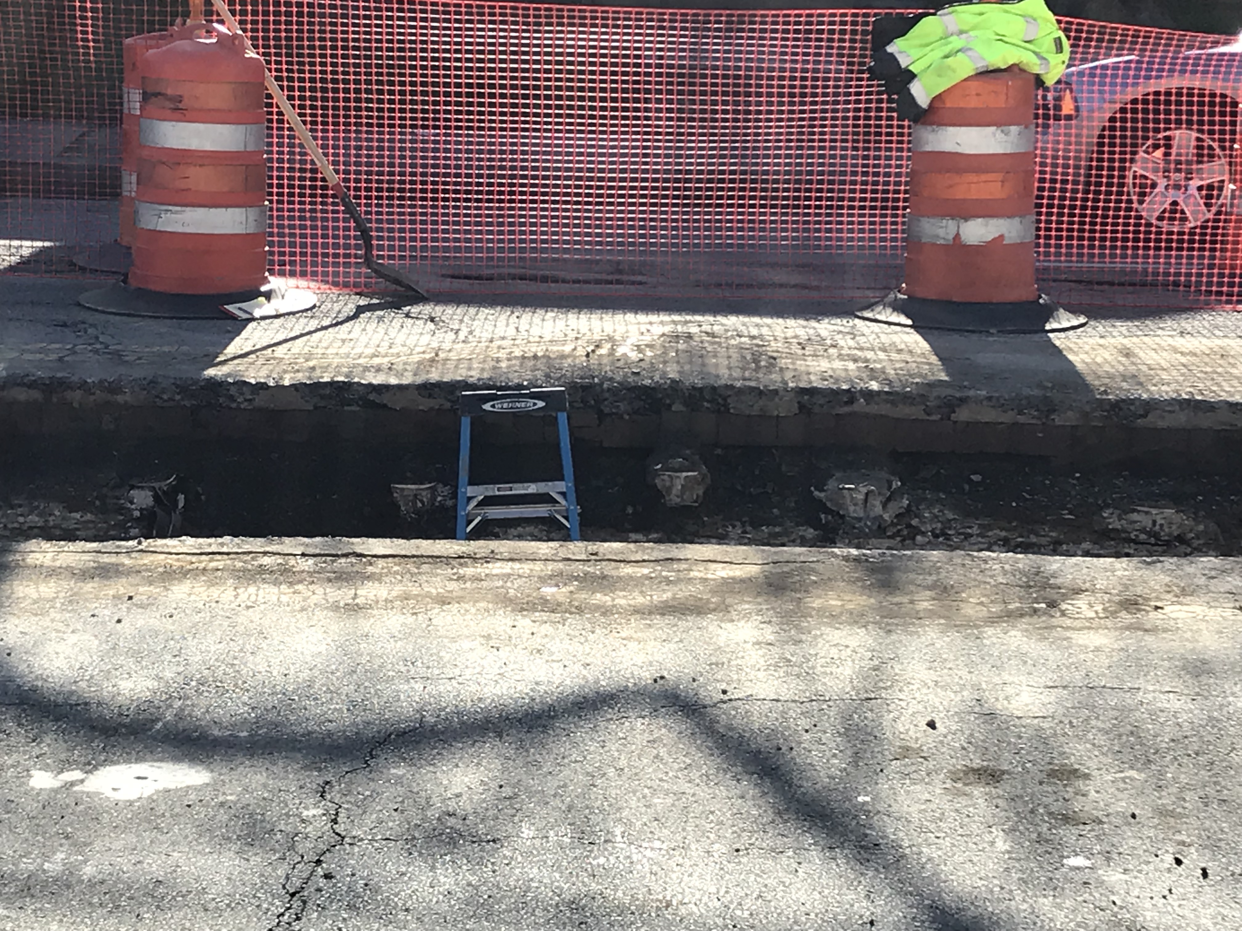
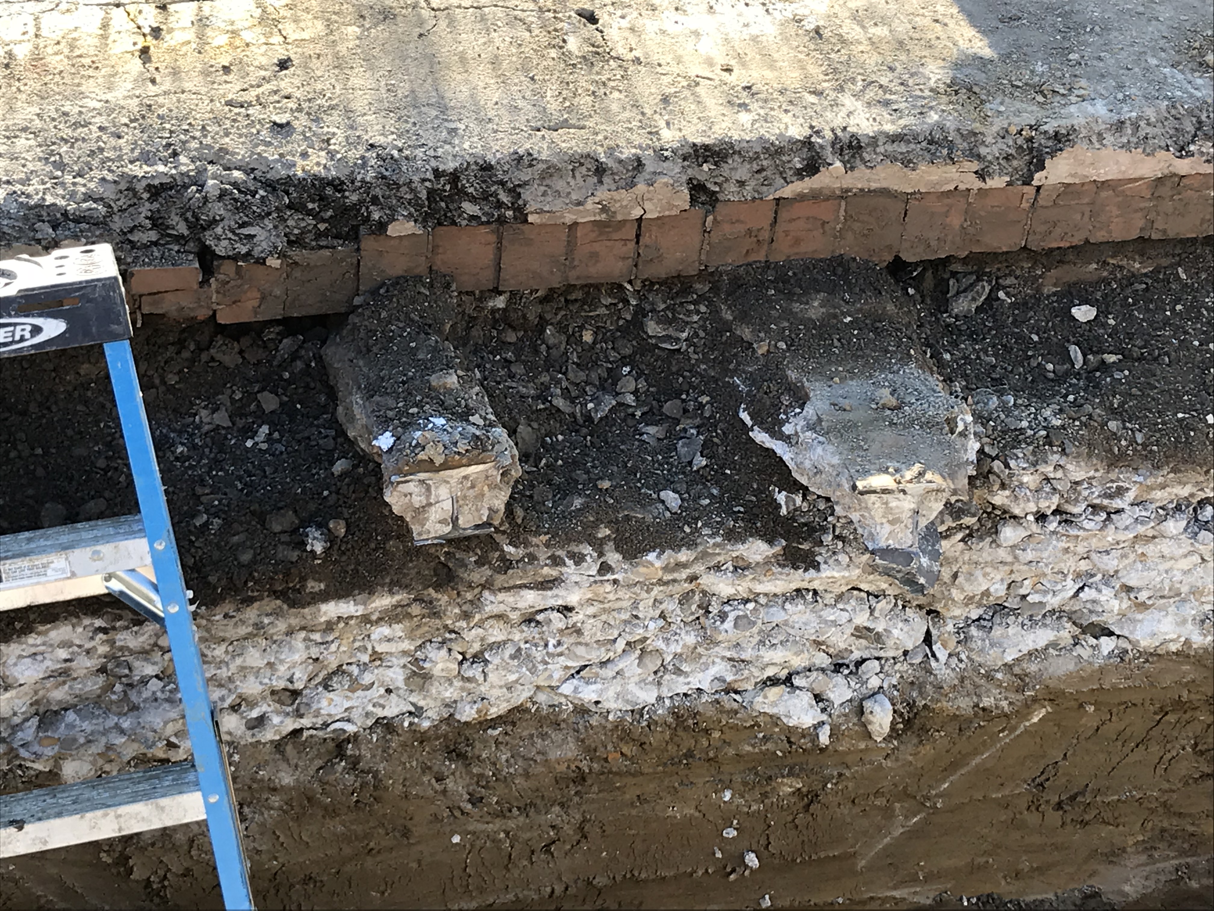
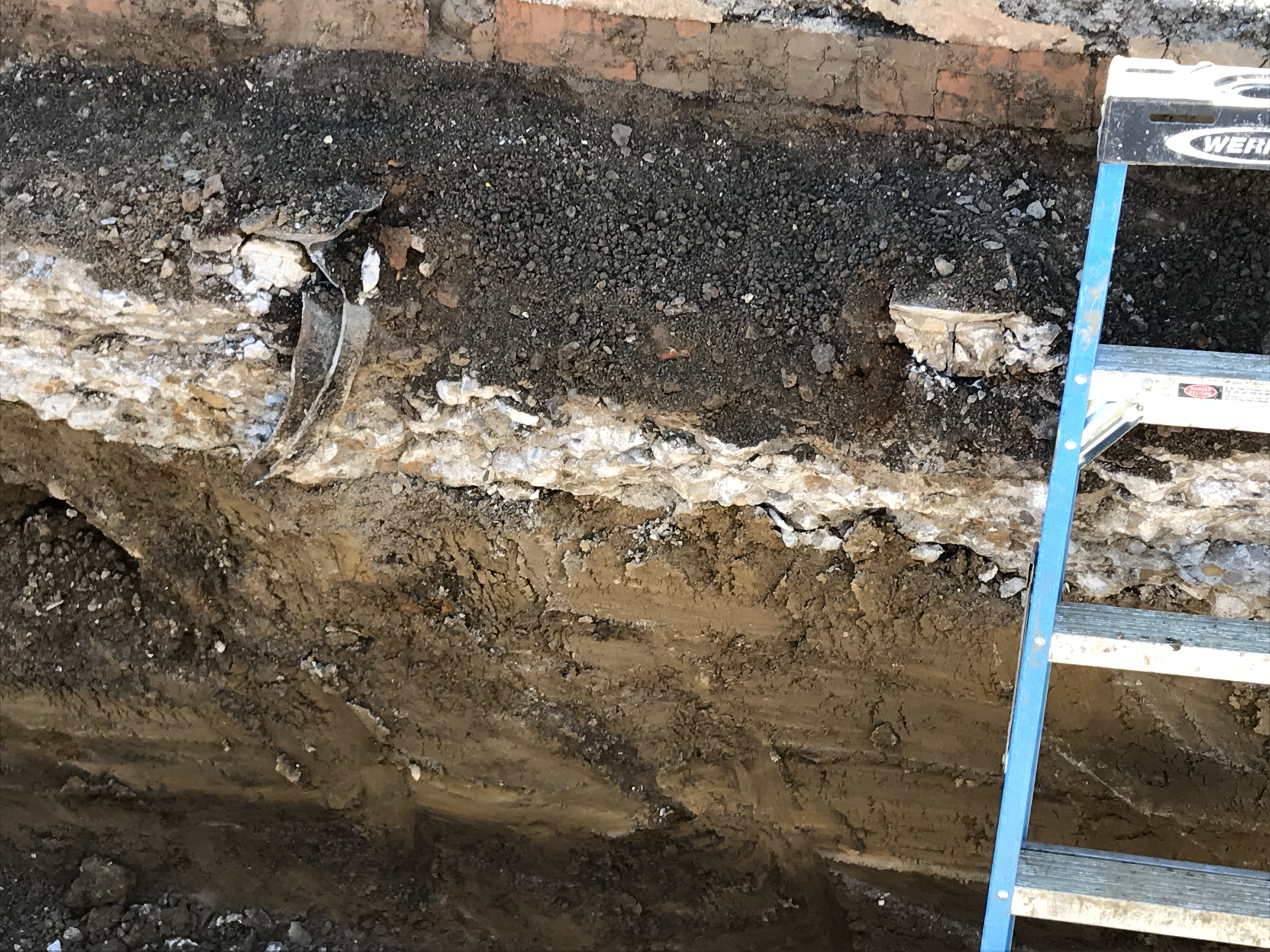
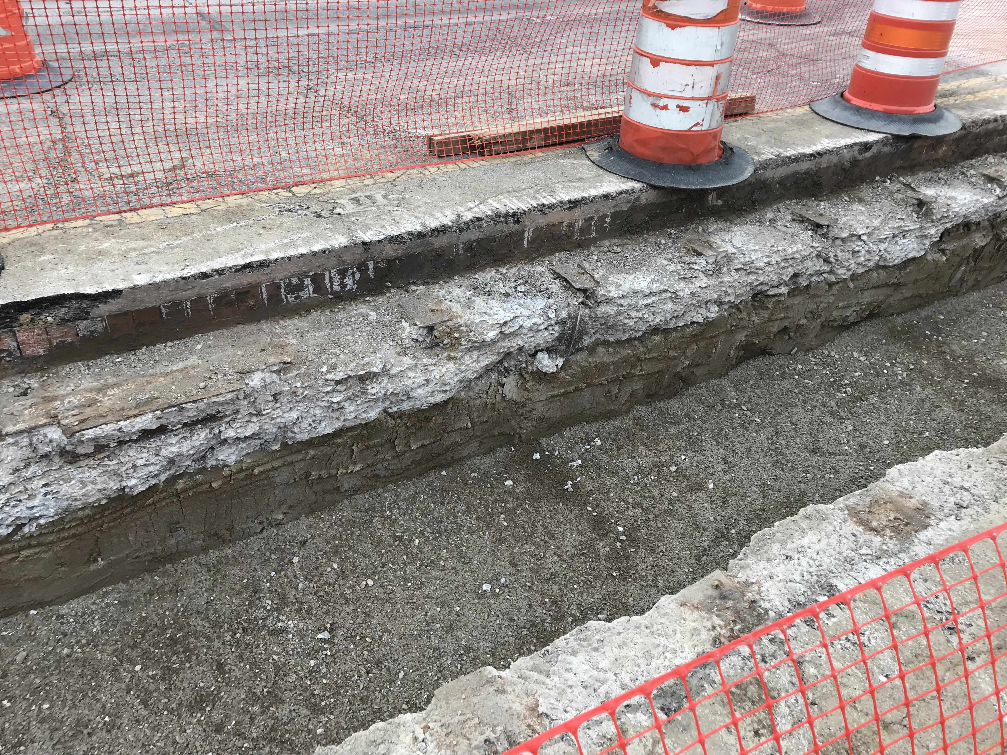
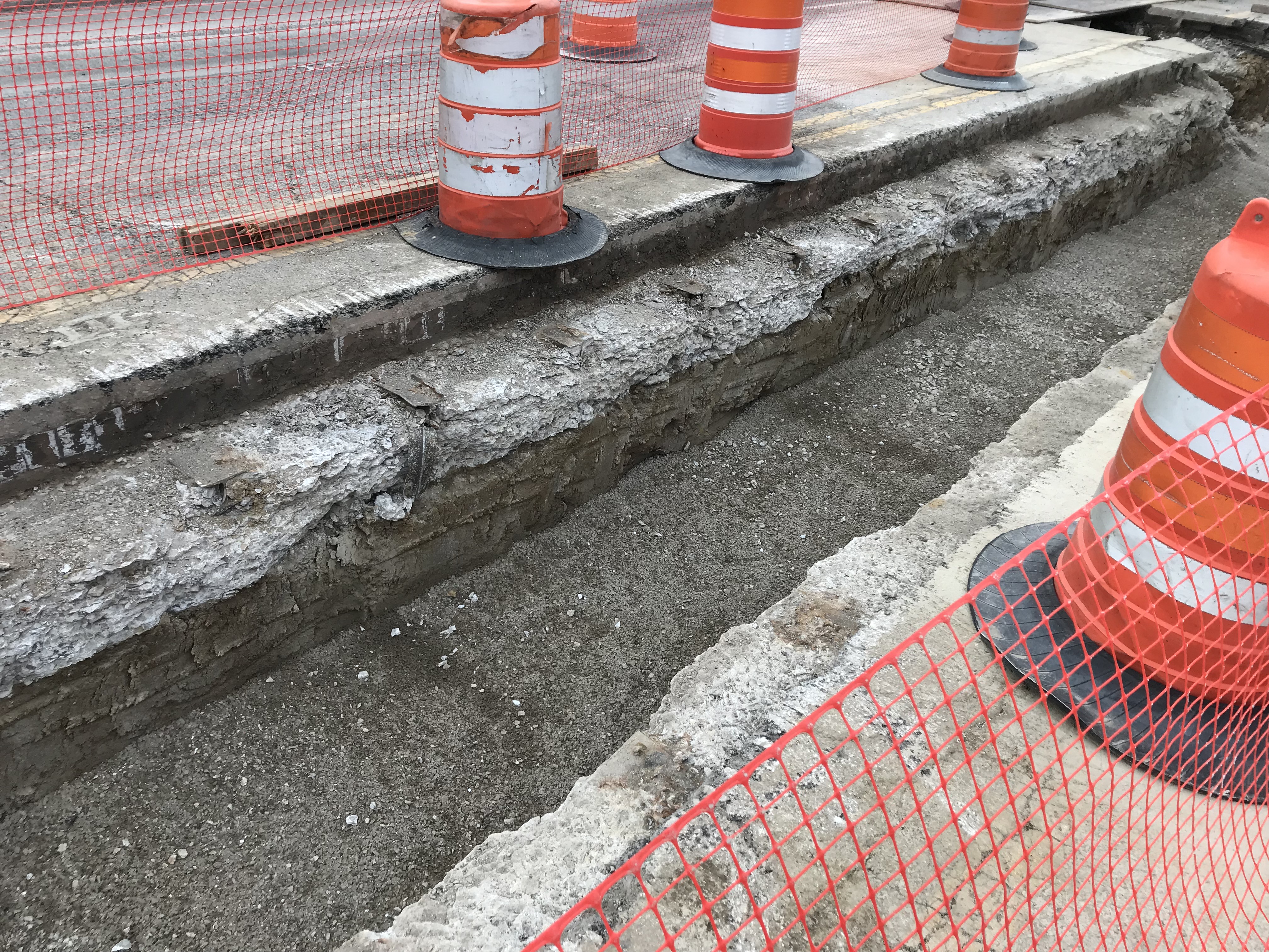
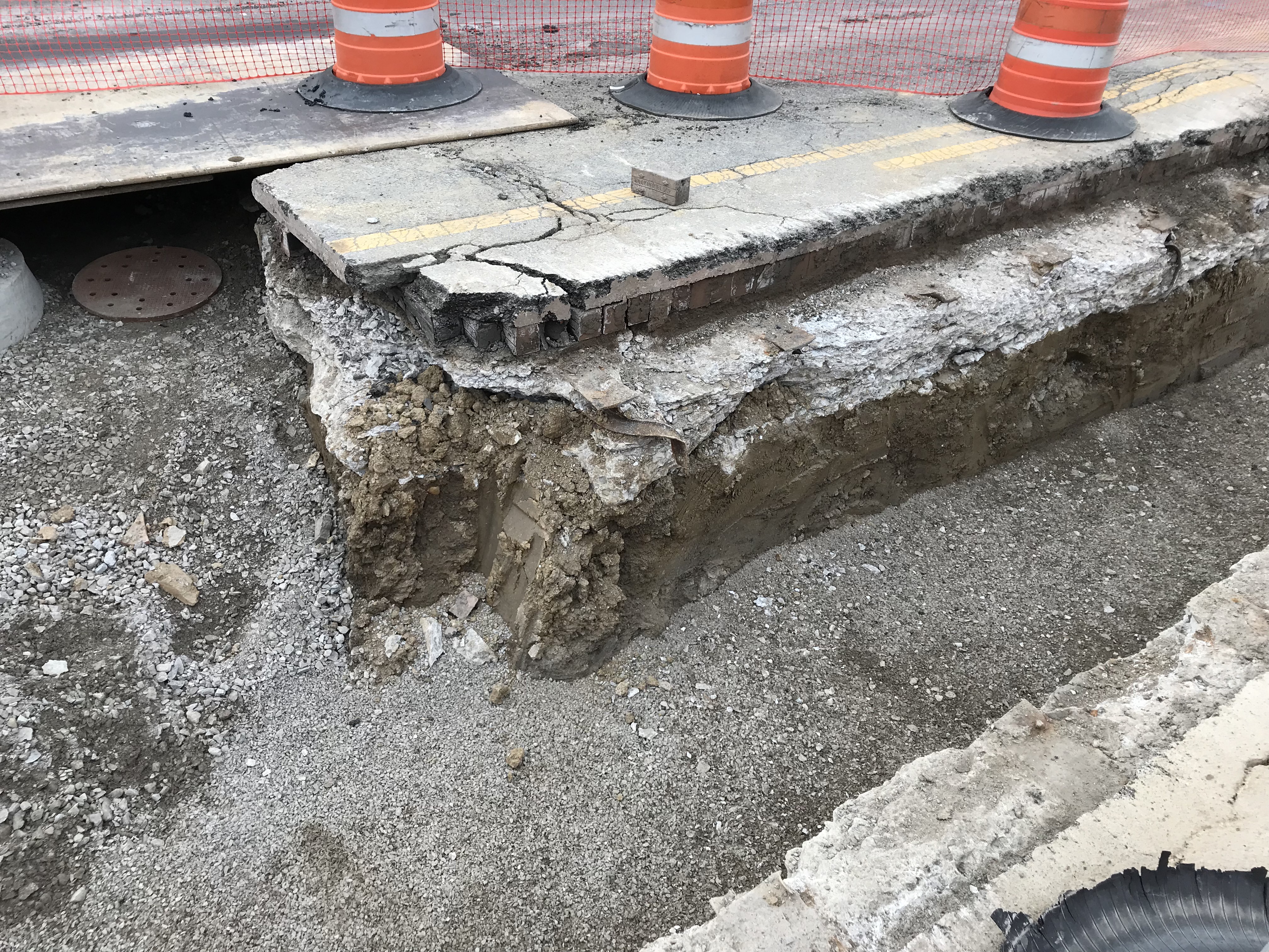
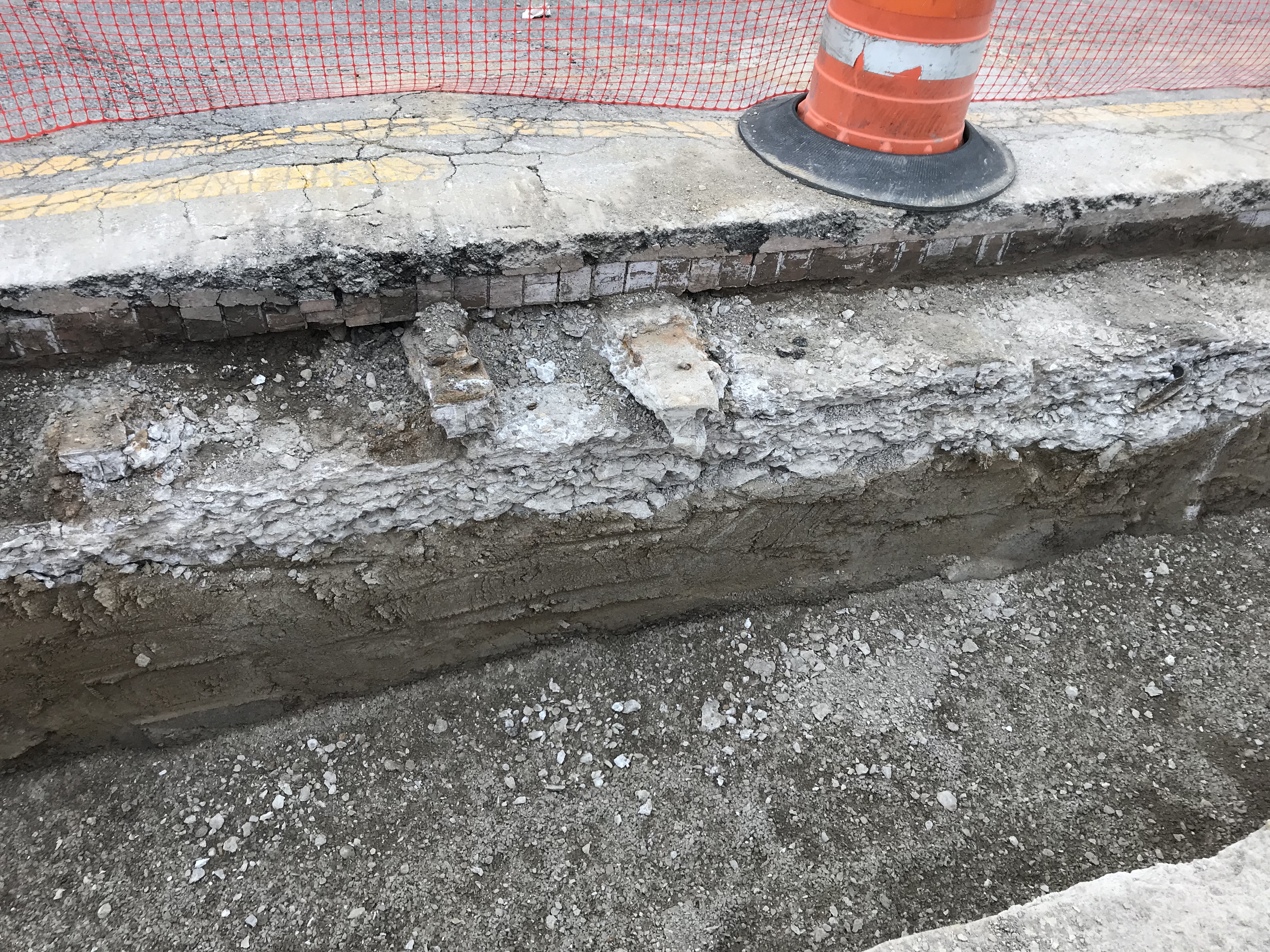
When the City contractor dug down to put the new median (with trees, plants) on Indianola Ave. by Studio35, I took a few photos of the road subsurface and they can be found here.
The construction of the road was rather interesting. Like many other Clintonville streets, Indianola has brick
pavers under the asphalt.If you look at the photos you will notice that train rails are running perpendicular to the road, and seem to have been used to reinforce the road from below…
I’m wondering if the rails were scrapped from the rail spur that came in from the main line, through Glen Echo (the north side of the ravine) to the old sewer pipe factory (now the site of Columbus International High School).
The cross-section of the roads seems to be (from top down):
Asphalt (newer)
Pavers
Concrete
SoilAlso, here is a PDF about early 20th century street construction in Cleveland, which seems similar to our city streets constructed at the time.
And here is an article about resurfacing roads in Columbus.
Thanks John!
242 East North Broadway
I’ve written in the past about this stunning house at 242 E. N. Broadway–a beautiful renovation job by the current owner.
This is the oldest existing house on E.N. Broadway. Here are some old and new pix.
Original house:

And today, after years of loving restoration:
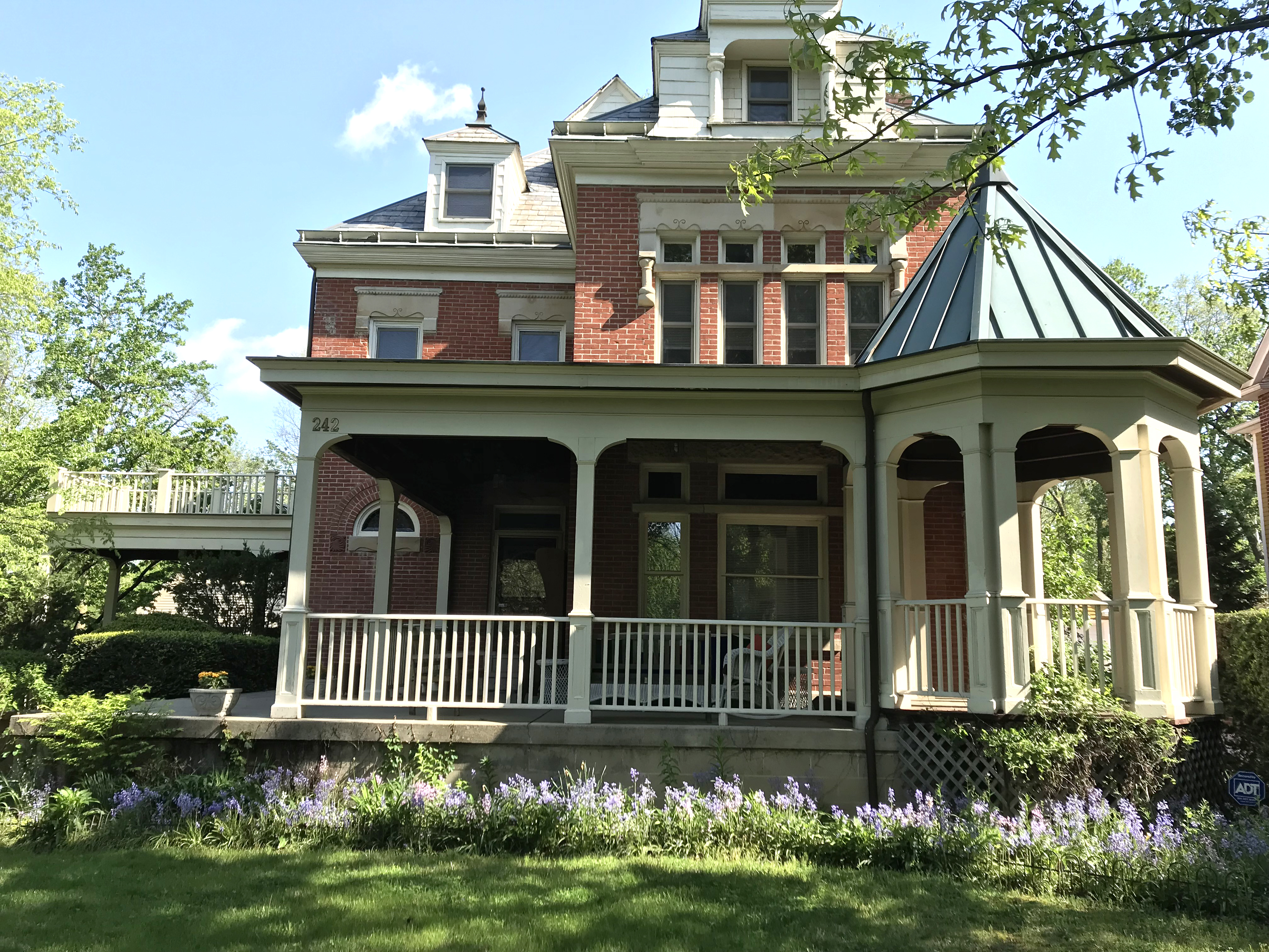
Elford Company Develops Beechwold

Elford Inc., a commercial construction company located near Grandview on Dublin Road, celebrated its 100th anniversary in 2010.
To mark the occasion, the company published a 70-page hardcover book detailing Elford’s history, from its founding by Edward “Pop” Elford in 1910 to today. It’s available as a PDF here. The book chronicles the company’s history decade by decade, focusing on the marquee projects of each decade.
From a Clintonville and Beechwold perspective, the following are standouts:
The Mastery of Frank Packard on Glen Echo, by Amanda Page
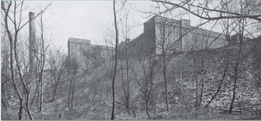 Amanda Page wrote a very nice article about Frank Packard, architect of the former North High School. The article is in Ravinia Spring/Summer 2014, pp 1,3.
Clinton Elementary School Deed
 Former Clintonville Area Commissioner Judy Minister furnished us with a copy of the deed for Clinton Elementary School. It’s attached as a PDF.
Calumet Street Viaduct
 A nice image of the Calumet Street Viaduct i.e. the Glen Echo / Calumet Street bridge. Elford Company built the bridge around 1924. The photo was taken from the area where the scoreboard on football field of the high school (formerly North High) is located. You can see some houses in the background, which are along Olentangy Street east of Calumet. [Thanks to John Krygier for sending this along to us.]
 And here is the view of those houses today, using September 2016 Google Streetview.
Presbyterian Synod
 From 1956 until 1975, the United Presbyterian Synod owned the building at 3040 North High Street, at the corner of Weber and North High Street. The building later served as the Capital Care Center, an adult health services clinic that provided, among many other health services, abortions, and as a consequence the building became known for the demonstrations held weekly at that corner for almost 20 years. The building has since been torn down, but this is a picture of the empty lot in 2007.
And here is a Google Earth image of the old building’s rooftop in 2004.![]()
More Zinn Memorabilia
 Some cool memorabilia from the Zinn Lumber Yard, courtesy of John Clark (great grandson of J. Harvey Zinn).
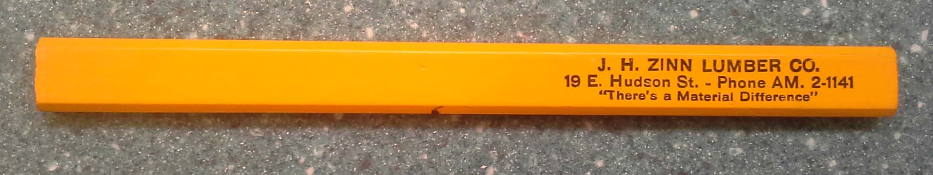
Leeann Faust Passes Away
 I just learned that Leeann Faust passed away. What a loss.
If I could describe Leeann in just one phrase, that phrase would be “all in”. When Leeann was enthusiastic about a person or cause, she was all in–whether it was an actress (Leeann was a long-standing president of the Carol Lawrence Fan Club) or the North High School Polar Bears (she was the historian/editor of the Alumni Association), or the history and legacy of her family (she was a descendant of Mathias Armbruster). Leeann was extremely generous with her time and her knowledge and her collection of articles, newspapers, & memorabilia. She was indefatigable in contributing to the community around her; she kept her friends close; and she was routinely cheerful.
Leeann, you will be missed.
Leeann’s obituaray can be found here.
Ghosts of Ads Past (3230-32 N. High)
When I first moved to Clintonville, there was a prominent vintage-looking advertisement painted on the south side of the brick wall at 3230 North High Street. (Today, this faces the parking lot for the Clintonville Resource Center’s North High Street location.) Today the paint has mostly been removed, and I don’t have a picture of the billboard back then. The attached picture is from Google Street View in 2011.
I thought I remembered the billboard as being for “Clintonvilla Pizza,” and containing an ad for a cola drink with a tag line such as “Relieves Fatigue”–something that hearkens back to the days when soda drinks contained some invigorating pharmaceutical ingredient such as coca (or maybe just caffeine). Actually, that’s the real reason that the ad stuck with me. But truly, today I can no longer remember it.
Here is the history of that business:
—1956-1970: that address, or 3232 North High Street, was occupied by Pizza Villa Restaurant. Pizza Villa was owned by Fred DiPietro and Rose Bucci (both Clintonville residents in 1970). You can find an online obituary for Fred R. DiPietro (born April 25 1934, died Jan 17, 2007 at age 72), “owner of Pizza Villa in Delaware and Columbus OH”) here.
I found a Rose C. Bucci (born 11 Jul 1932, died 14 Sep 1994, lived initially in Columbus but died in a nursing home in Delaware County) who had been a manager of an eating establishment, but really, I’m just fishing and have no idea if this Rose was one of the owners.
Fred DiPietro may have gotten divorced in 1974. Regardless:
—1971-1973: Nothing was listed for that address.
—1974-1981: 3230 North High became PJ Villa Restaurant. It was PJ Villa until 1981.
—1984-86: it was Jim’s Pizza. After 1989, it was no longer a pizza establishment.
Does anyone remember the exact wording of the sign, or have any pictures of the billboard?
J. Harvey Zinn & Family
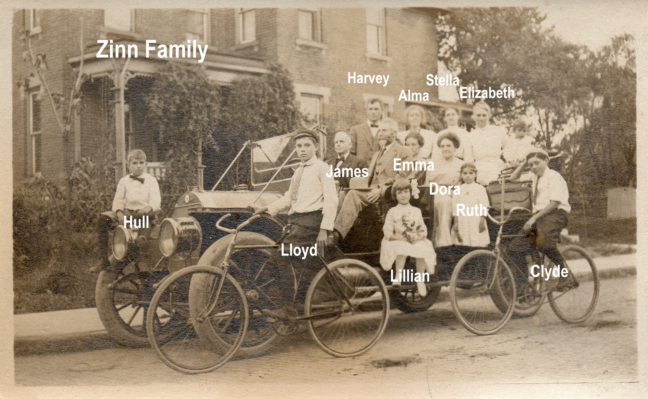 J. Harvey Zinn, owner of the Zinn lumber yard, lived in Clintonville and was a civic leader and philanthropist. Mr. Zinn was reported to be an ardent fisherman who followed his favorite sport in practically every part of Canada, as well as in Florida waters. His attractive estate “Edgewater,” was located at 285 Kenworth on the Olentangy River just north of West North Broadway. This estate still exists in Clintonville.
J. Harvey Zinn died in 1957.
Attached are some obituaries from The Columbus Dispatch and elsewhere.
The Zinns were very active in the North M. E. Church. Though the church is not, technically, in Clintonville, I’ve also posted some information about the church.
[Photos and clippings courtesy of John Clark]North M.E. Church
The North M.E. Church, located at East Ave and Tompkins, has a long history, which–thanks to John Clark, a descendant of the Zinn family–can be found here.
The church was located very close to the Zinn Lumber Yard (and the Zinn family residence), and the church was damaged in that business’ November 1925 fire. Then the church had its own fire in March 1928, which necessitated a complete rebuilding of the church. Scott Caputo at the Columbus Metropolitan Library, was kind to send us this article about the fire.
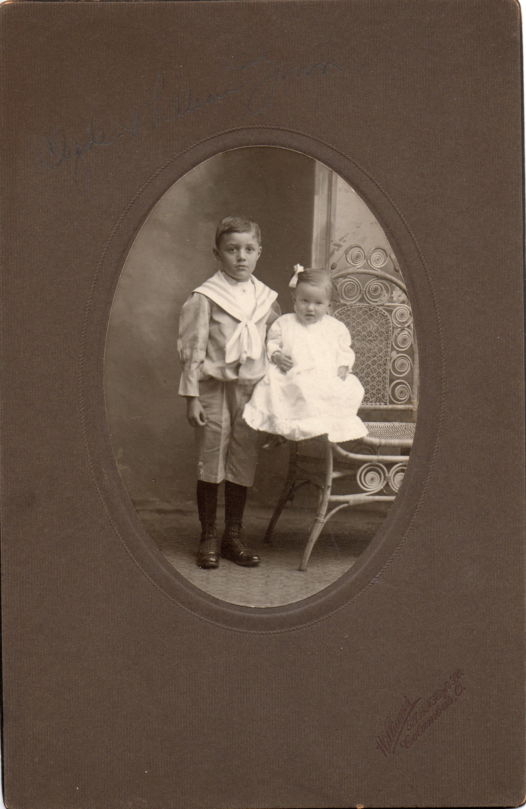 The church was slowly but surely rebuilt and enlarged and improved. J. H. Zinn paid to have a children’s wing built, dedicated in memory to his two boys (who died in their youth) in April, 1953. The sons in whose memory the wing was built were Clyde Webster Zinn (22 Oct 1895 – 07 Apr 1912) and Walter Curry Zinn (12 Jun 1898 – 30 Jan 1903). What you see here photo of Clyde Webster Zinn (with his sister Lillian Mae Zinn). The family does not have a photo that they are confident of, for Walter. Here is an article about that philanthropic contribution. [Photo courtesy of John Clark]
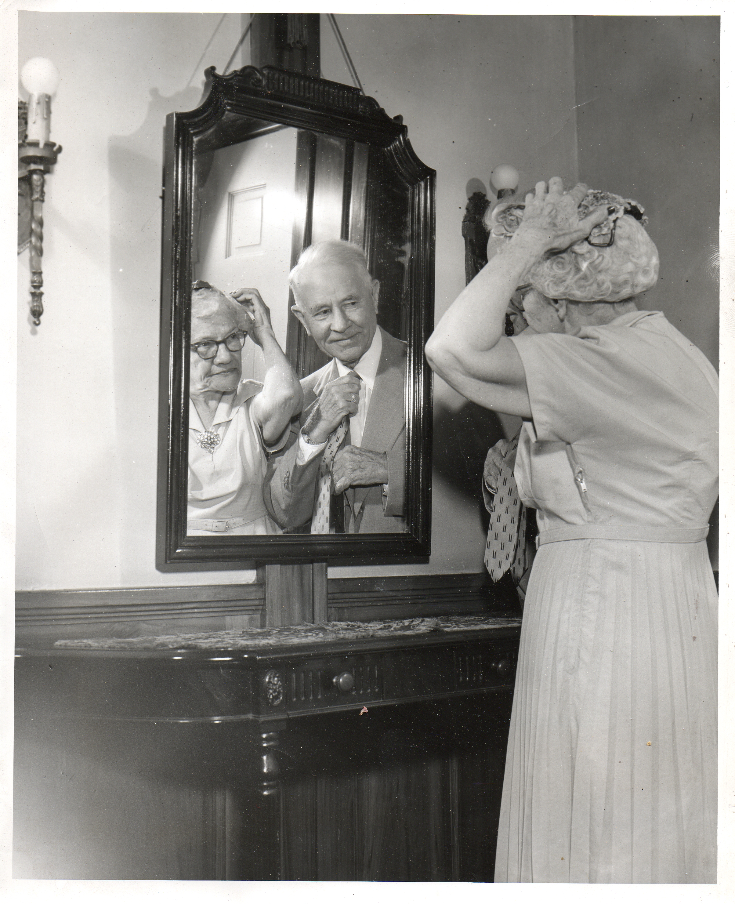 Around October 1956, North M. E. Church held a celebration of their “oldest members,” by which they meant those members who had belonged to the church at least 50 years. J. H. Zinn and his wife were among them. (See photo to the right.) You can read more about that event here and see some of the other members in the photos below. [Photos and news clippings courtesy of John Clark]
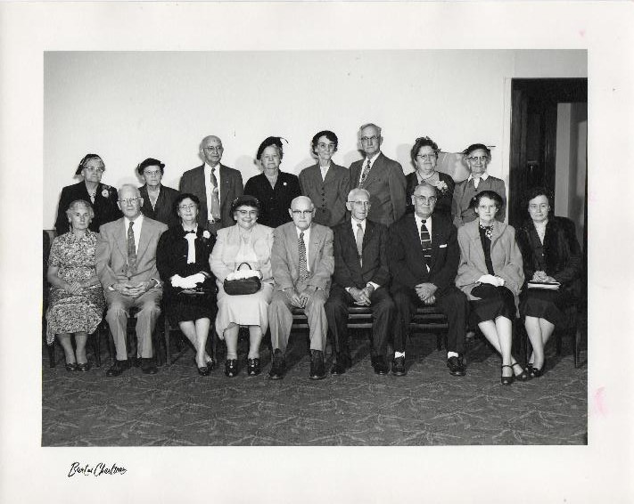
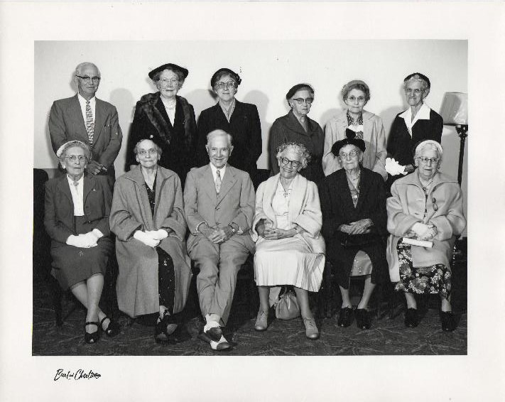

There’s more information about the Zinn family and the Zinn Lumber Yard elsewhere on this web site.
Zinn Lumber Company: Perfection Millwork
When I was working on my book, several old-timers remembered the Zinn Lumber Company at the corner of North High and Hudson. At last we have photos! Lauren Clark who is married to John Clark, the great grandson of J. Harvey Zinn, shared some of John’s family photos of the Zinn Lumber Company as well as other items related to J. Harvey Zinn. These show the lumber yard after it was rebuilt in 1926. I’ve tried to arrange the photos in geographic order from the Zinn Lumber Company’s showroom on North High Street, moving eastward along East Hudson Street to East Avenue. [Vintage photos courtesy of John Clark.]
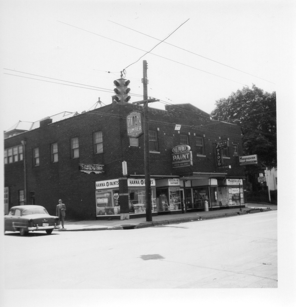
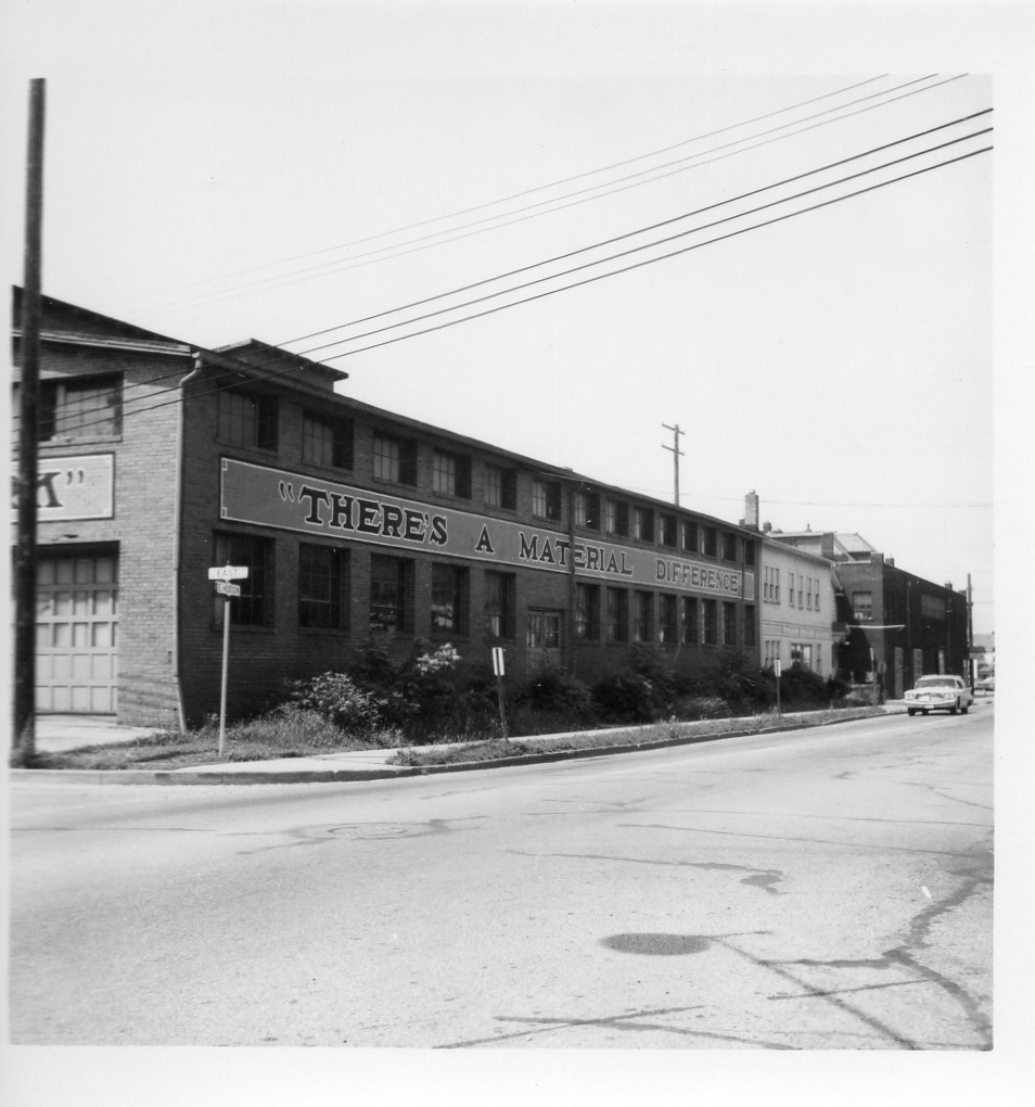
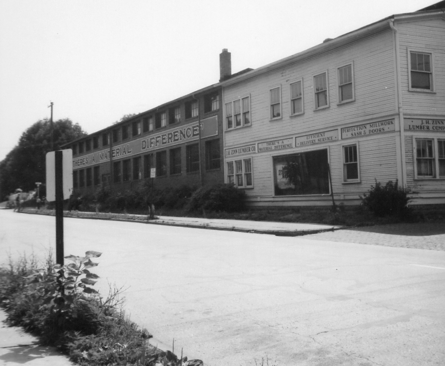

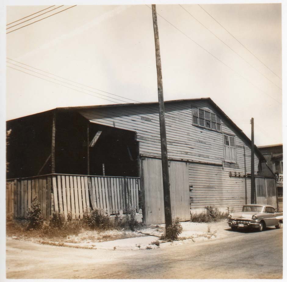
Some additional background information on the yard and the Zinn’s can be found here.
And here are some pix of that intersection today, taken by Terry Miller. Note the North M.E. Church in the background; it was damaged in the Zinn Lumber Yard fire of November 14, 1925, and then had its own fire in 1929.
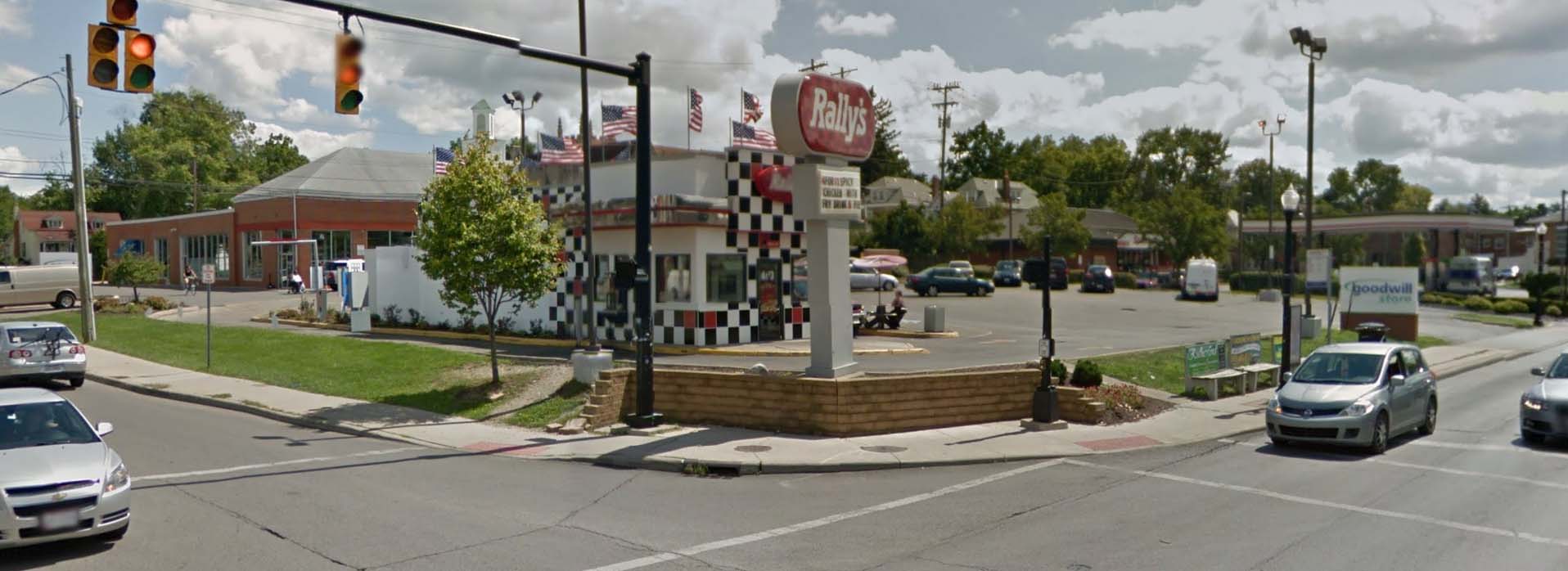

Fire at Zinn Lumber Yard
I’ve previously reported that the Zinn Lumber Yard, located at 19 East Hudson Street, burned down.
It burned down on November 8, 1925, and the fire destroyed the planning mill, storeroom and lumber supply. The fire also damaged several nearby homes and church. The lumber yard was rebuilt in the same location however, and Scott Caputo at the Local History and Genealogy Department of the Columbus Metropolitan Library was kind enough to send me several article about the business. The cause of the fire was not known. [Courtesy of Scott Caputo, Local History and Genealogy Department, Columbus Metropolitan Library]
The photo above shows the “new” showroom [Courtesy of John Clark, by way of his wife Lauren Clark].
Legg Family
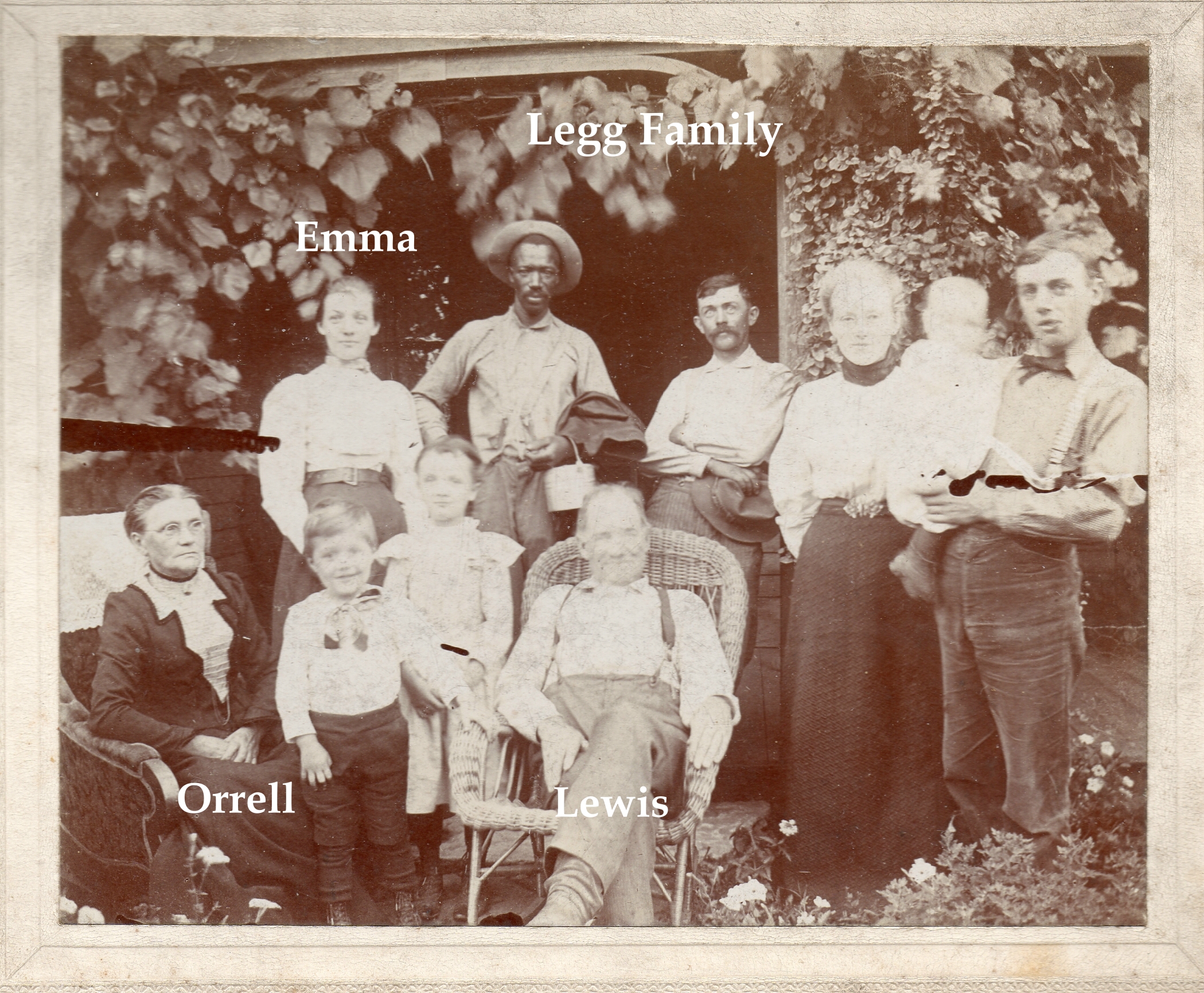
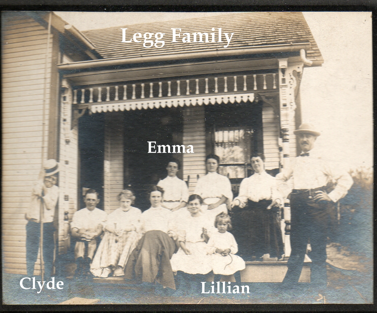
Here are two wonderful pictures of the Legg family. Emma Legg married James Harvey Zinn, born 1 October 1871 Ohio, in 1895. J. Harvey Zinn was the President of the Zinn Lumber Company located at Hudson and North High Streets. Emma and James lived at 285 Kenworth, located on the Olentangy River just north of West North Broadway. (Their house still exists in Clintonville.) [Photos courtesy of John Clark. Thanks also to his wife Lauren for sending them to me.]
For more information on the Leggs see here;
For more information on the Zinns see here;
and/or listen to Robert Ohaver’s oral history.
Elephants Lumbering Along N. High St.!
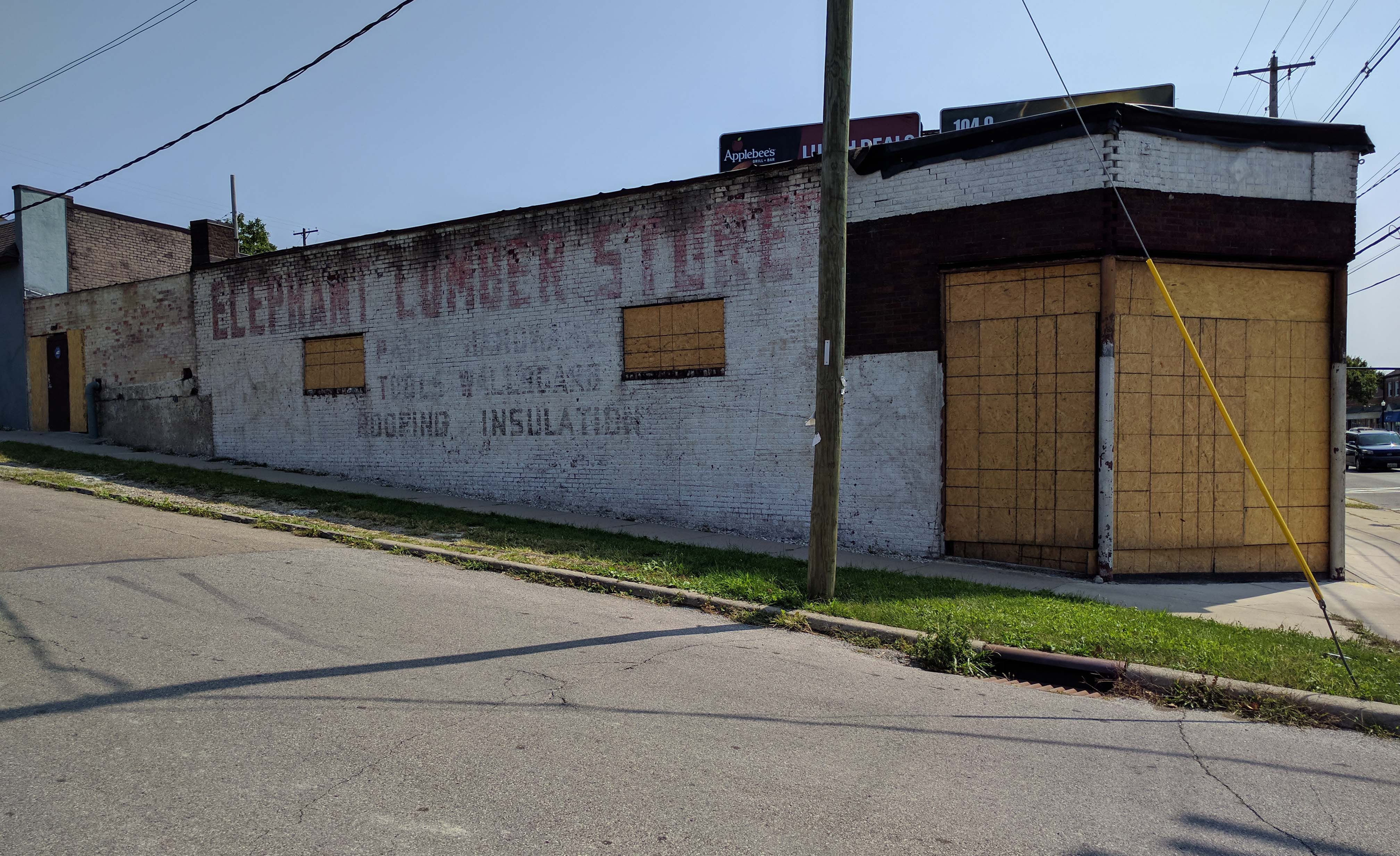
Several weeks ago I wrote about the ghost signage underneath the former Crestview Market’s facade (at the corner of Crestview and North High Streets, 2950 North High Street). From 1926 to 1945, the building held automobile-related businesses–but after that it was, from 1946-1967, the building served as the Elephant Lumber Store.
The lumber yard’s signage is now exposed:
ELEPHANT LUMBER STORE R[] Paint-Hardware-Tools-Wallboard-Roofing-Insulation.
One passer-by wondered whether it was named that because of the proximity to the Olentangy Park which had closed 10 years before. I have no idea but loved seeing the vestiges of the Elephant Lumber Store anyway.
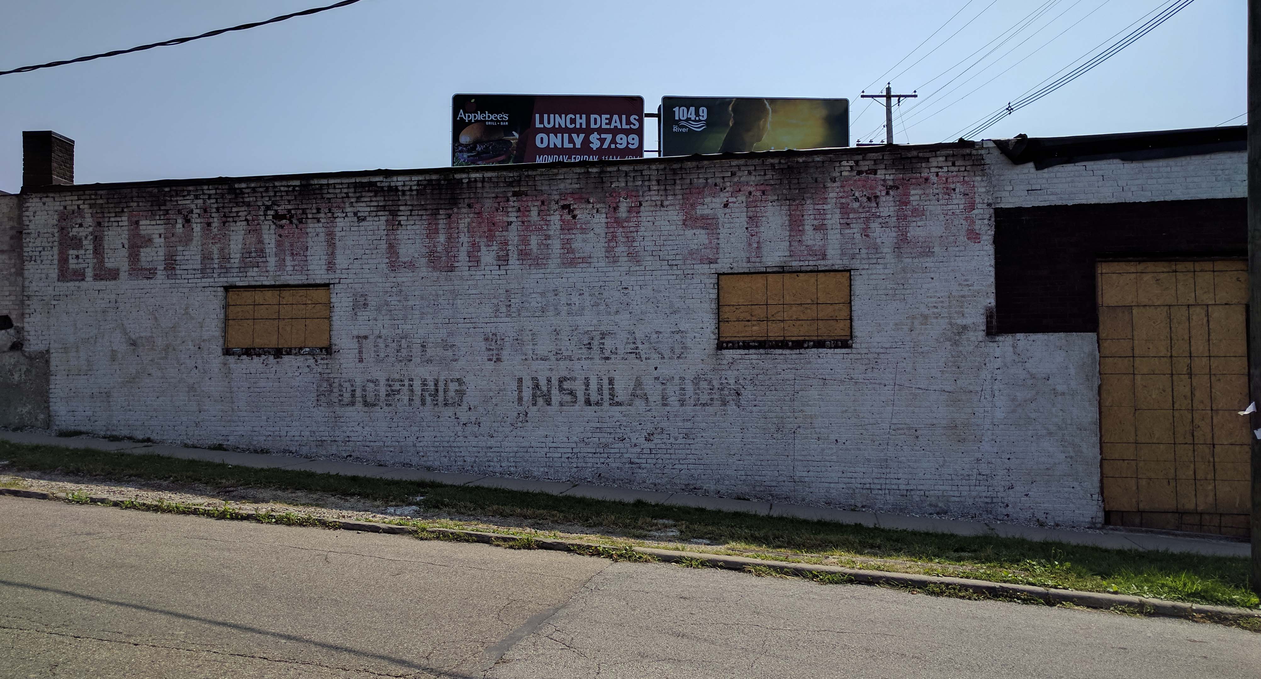
128 Crestview
 Isn’t it wonderful when you discover that your old house holds a treasure trove of old artifacts from previous owners!? Matt Earley recently found some very old documents in his attic from the original residents of his home at 128 Crestview Rd.
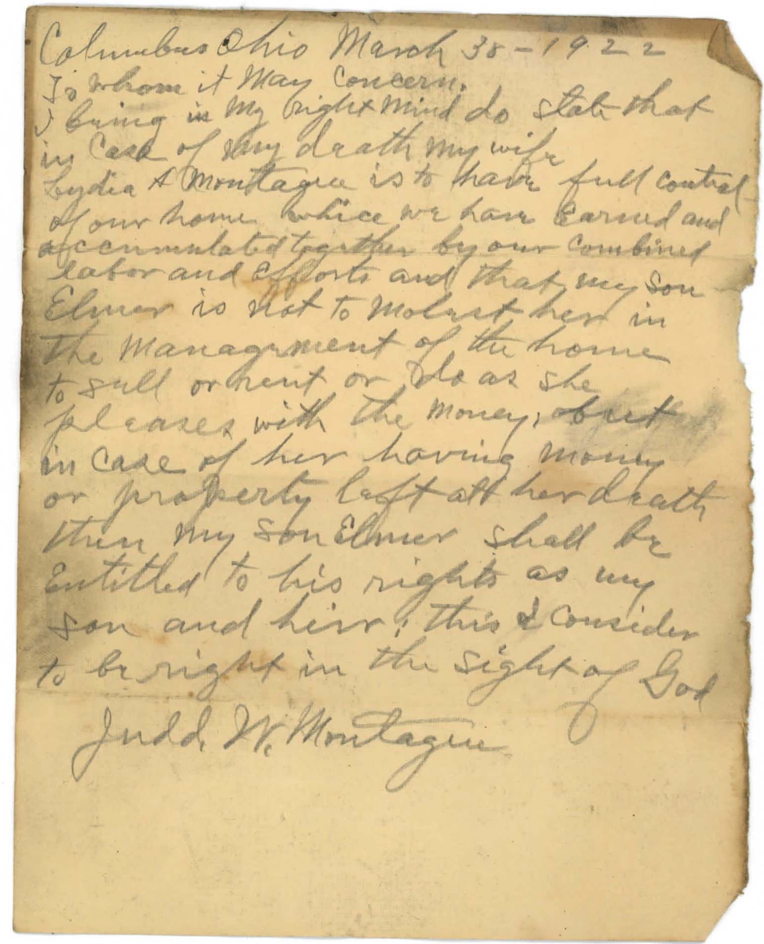 Probably the most interesting thing is this handwritten will directive from the original owner of the home, J.W. Montague. It was written in pencil, and found under a vent pipe in the attic of the house.
The Earleys also found several items from the family who rented the home during the 1930s and early 1940s, the H. R. Townsend Family. The home was a rental during this time period. Matt has spoken with a member of the family of he Townsend family, and she said that the Townsends lived in the home during the school year, but then moved back to a farm they owned near Hamilton, Ohio during the summer months. The gentleman, Horace Raymond (H.R.) Townsend, had been principal of the Hamilton High School until he assumed the full-time position of commissioner of the Ohio High School Athletic Association (OHSAA, which is currently located in Clintonville at 4080 Roselea Place, Columbus, OH 43214). He was the first commissioner of the organization, and held that post from 1925 until his death in 1944.
H.R.’s initials written on the inside of one of the attic walls:
Here is a 1939 Newspaper blurb about an event H.R. Townsend and his wife were hosting at 128 Crestview (“Entertain College Club”, 3rd column).
And, here is a 1936 article about their daughter Esther and her activities (“The Daily Grist”, Column 2).
Here are some Hamilton High School yearbook pages from 1925, the last year Townsend was principal:
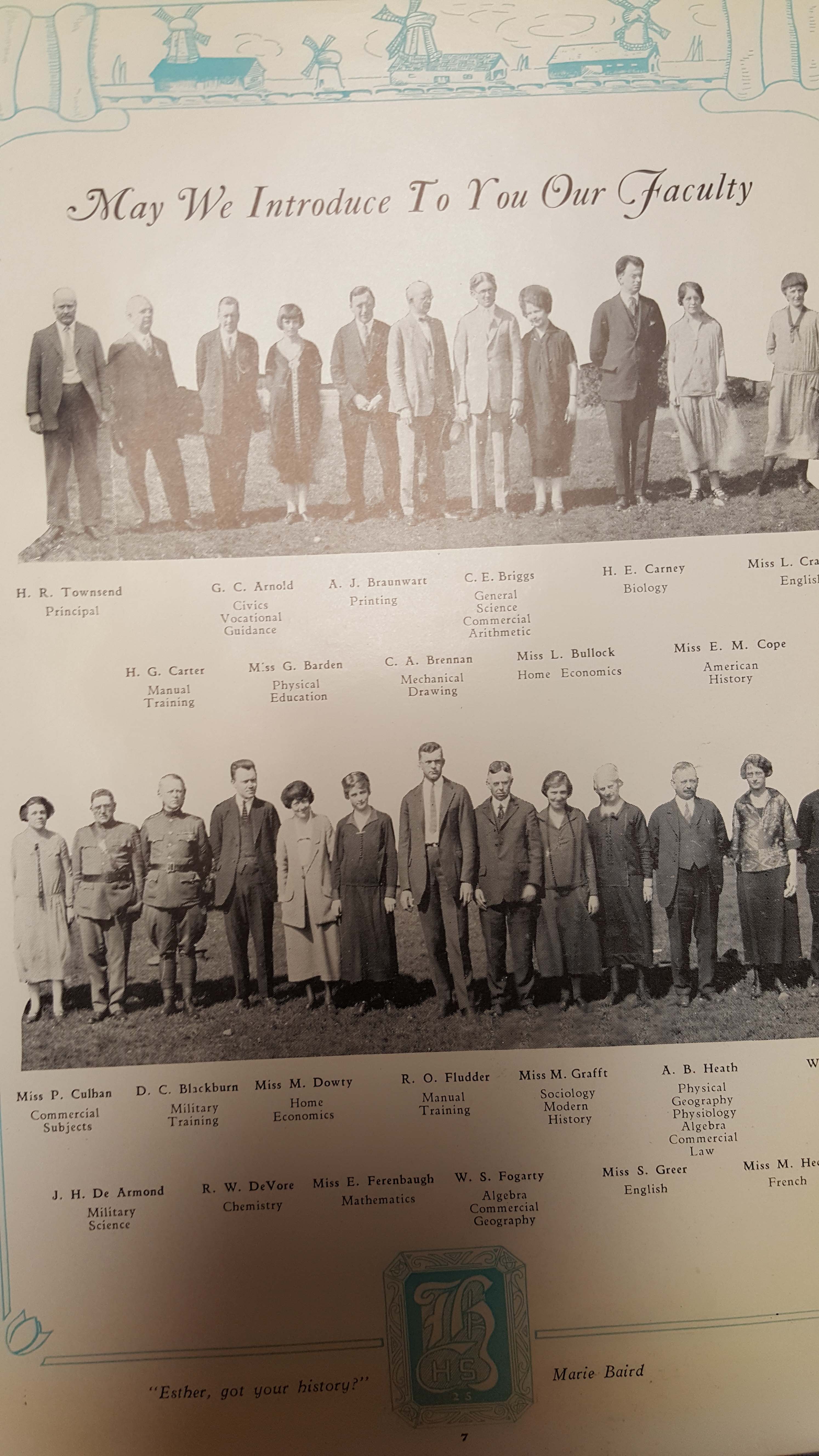
And a spread of the dedication to H.R. in the yearbook, along with his photo:
This was a photograph randomly inserted into one of the pages of the aforementioned yearbook. The Earleys are not sure who it is, but have confirmed that it is not Mrs. Townsend:
A children’s poetry book found in the attic:

The Earleys found some of their daughters’ (Elizabeth’s and possibly Esther’s) schoolwork in their attic as well, and you can see those here. (I sure hope no one finds my school work 75 years later!)
Matt has done extensive research on the history of the home and its owners, and has spoken with most of the previous owners or their extended families. He is still looking for any photographs of the home from before the 1980s (about the oldest he has been given to date). The King family (of Nancy King fame) was the longest resident of the home, but Matt has not yet obtained any photos of the home from when they lived in it (1957-1979). If anyone happens to stumble upon anything older than that around 1985 at some point, Matt would be very interested in seeing it.
Remembering Algy McBride
 Algy McBride, who died in 2015, was a long-time president of the Clintonville Historical Society. His dedication was felt throughout Clintonville and the Franklin County community. At his funeral, his family shared this article which I thought I’d re-share with you. [Article courtesy of the McBride family and reprinted from SeniorSource Winter 01/02.]
J. Harvey Zinn & his “Innocent Lamb” Lillian
The Zinn Lumberyard is always interesting; many people I met while researching my book remember it, yet I have never seen pictures of it. James Wells, long-time resident of the Olde North Columbus community has an abiding interest in it and has shared a couple items about the Zinns.
 The first is a business card for Mr. Zinn when he ran for the school board in 1921. We’re not sure if he won or not, but it would be interesting to find those records. Don’t you love the directive, “Investigation of my Personal and Business Record Invited.”
 The second is Mr. Zinn’s daughter Lillian’s graduation photo from North High school in 1920. She was described as an “innocent lamb in a cruel world.”
You’ll find more information on the Zinns here.
By the way, James says he is “always interested in anything to do with J.H. Zinn and would appreciate any info about him and his family (or related subjects like his lumberyard, the North United Methodist church, where the family members were life-long attendees) or the Herron/Thornton families who lived across Tompkins street from the Zinn’s.
[Thanks for sharing these images, James!]Grateful for Gatto’s
Very nice article about Columbus Pizza, including a shout-out to Gatto’s Pizza, in the March 15, 2017 issue of 614 Columbus Magazine. The article is by J.R. McMillan.
2950 North High, formerly Crestview Market
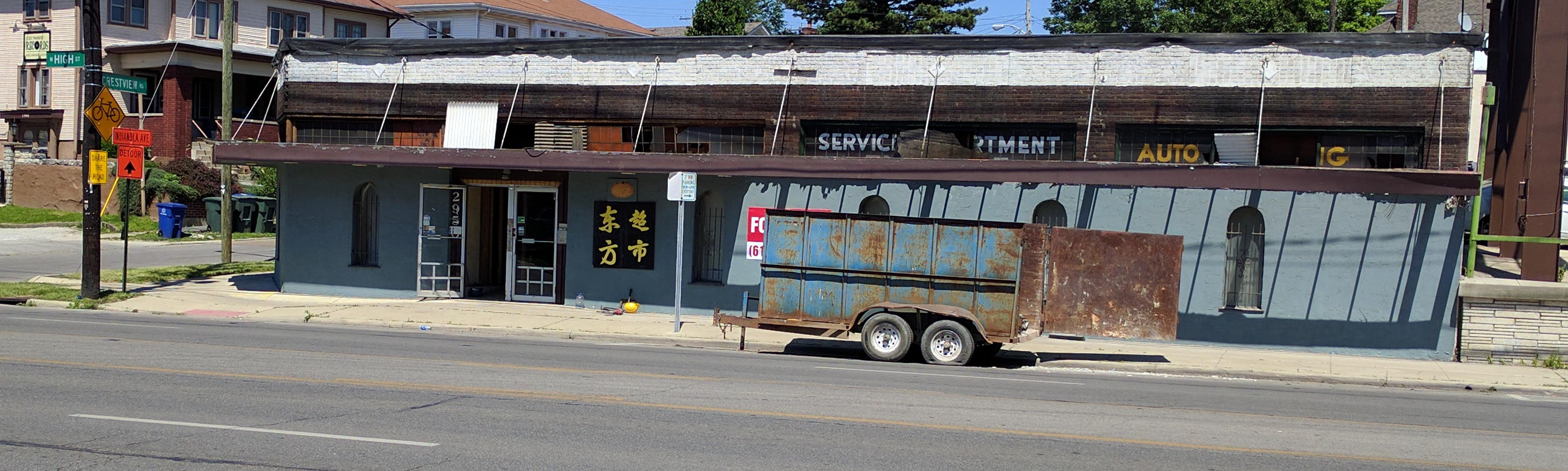 Crestview Market, the Asian/International grocery store that was for many years located at the corner of Crestview and North High Street, recently closed and the building’s owners, Gahanna-based craft brewer Kindred Beer, is looking for a lessee. As part of the building’s renovation, workers removed some of the facade, and I was surprised to see that it used to be an auto dealership.
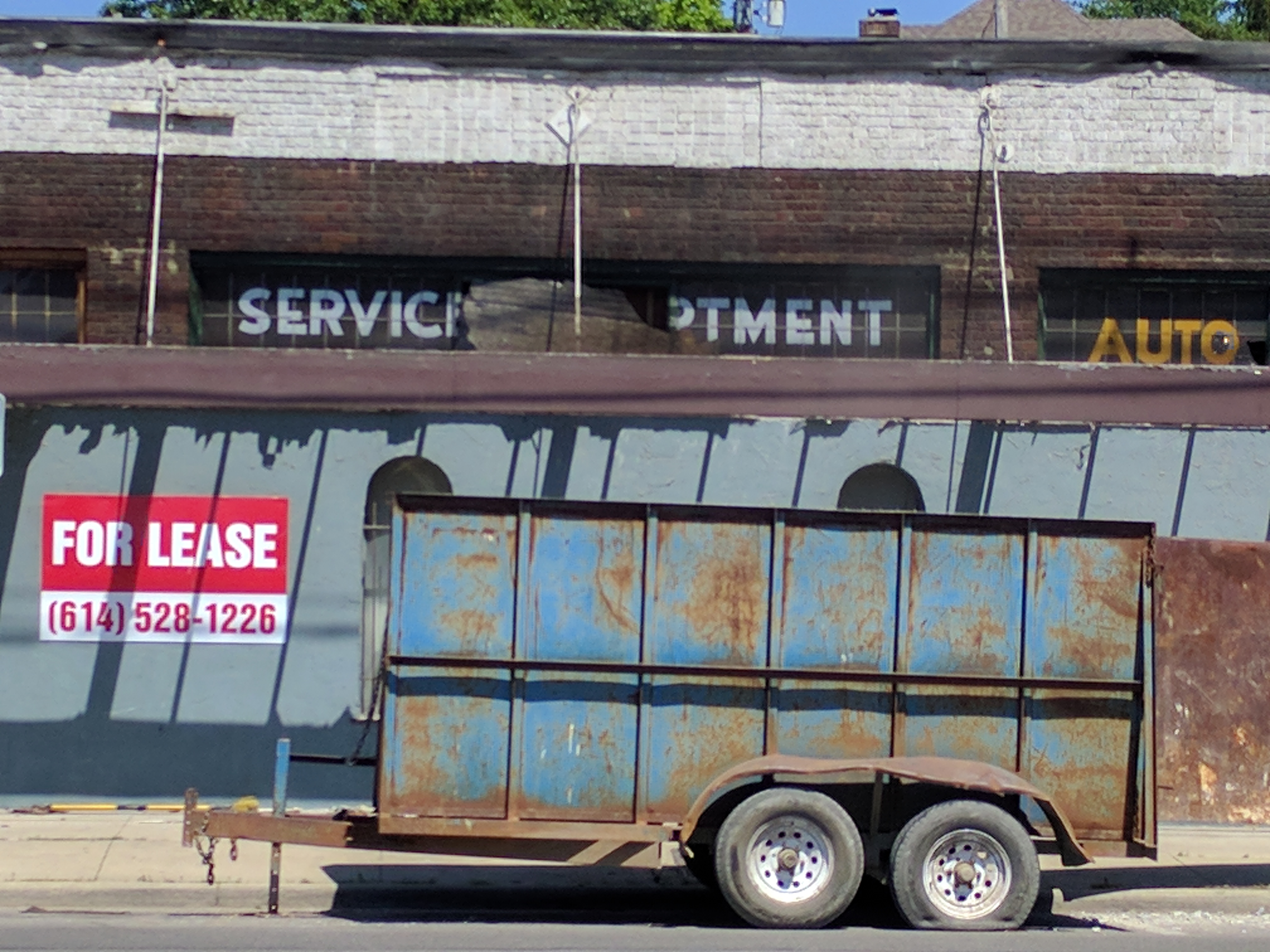
The picture below is the Crestview Market as it appeared in August 2007 (courtesy of Google Streetview), before the building was painted blue.
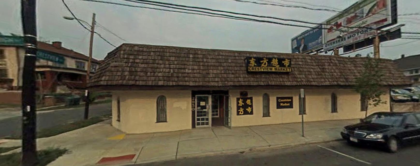
Nick Taggart of the Local History and Genealogy Department of the Columbus Metropolitan Library sent me the following information:
The history of the building at the corner of Crestview and North High looks to be quite varied. It has a history of auto sales businesses, under various names for various years. The earliest year I could find it in the Columbus City Directories was 1926 and at that time, the address was listed as 2952-2954. Here are the listings for the auto related businesses:
1926 – Tetlow Motor Sales Co.
1927 – Lindimore Motor Sales Co.
1928 – Hi-Crestview Garage
1929 – Vacant
1930 – VanHorns Motor Sales
1931 – Allen K Bentine auto pntr
1933 – Rufus B. Hay auto repr and Perl Mitchell auto repr
1936 – Orsborn Motors Inc. (the address was 2952-2958 and yes, it was “Orsborn” not “Osborn)
1937 – Same listing but it was spelled “Osborn)
1938 – Orsborn-Baynes Inc. auto (yes, it returned to the “Orsborn” spelling)
1939 – Vacant
1940 – Curtis B. Brown auto repair and Harley J. Arnold auto bodies (the address was just 2952)
1941 through 1945 – Curtis B. Brown auto repairThe auto-related businesses appear to have ceased at this point.
1946 through 1967 – Elephant Lumber Stores
1970 – Six different businesses are listed at this address and for the first time, it shows the 2950 addressI only spot-checked years after this; here is what I found:
1975 – Psychic Science Institute Science of Mind Center
First Church of Religious Science
1978 – Call Dean Inc. int. design school
Psychic Science Institute
1985 – Grid Publishing
1986 – Grid Publishing
1989 – Crestview Market (the first year I find it listed in the City Directory at this address)By the way, I found an article from a March 1, 1989 NeighborNews (accessible through the electronic edition of the Columbus Dispatch database in the Library’s Reference databases), that mentions Crestview Market’s move to the 2950 location. It reads: “Crestview Market relocated to a larger store in January, just a few blocks from its original location. Mei-Yu Yang Ting, who owns the store with her husband, Jui-I Ting, said the new location, at 2950 N. High St., is 1 1/2 times larger than the original at Crestview Road and Calumet Street.”
A big thanks to Nick and to the Columbus Metropolitan Library!
[Update: see also my subsequent post showing the Elephant Lumber Yard signage, on the side of this building.We All Love Weiland’s Market
 …and so we were delighted to see Weiland’s Market featured in Edible Columbus, Winter 2016, pp 58-61. Weiland’s Market, with its multiple generations of owners John Williams, Jennifer Williams and Scott Bowman, and its staff, have been exemplary and generous citizens of Clintonville and the community, and fed us all to-boot. [Booster ad courtesy of Jennifer Williams. Article courtesy of Edible Columbus with apologies in advance for not linking directly to their web site.]
We’re Going to the Zoo Zoo Zoo…
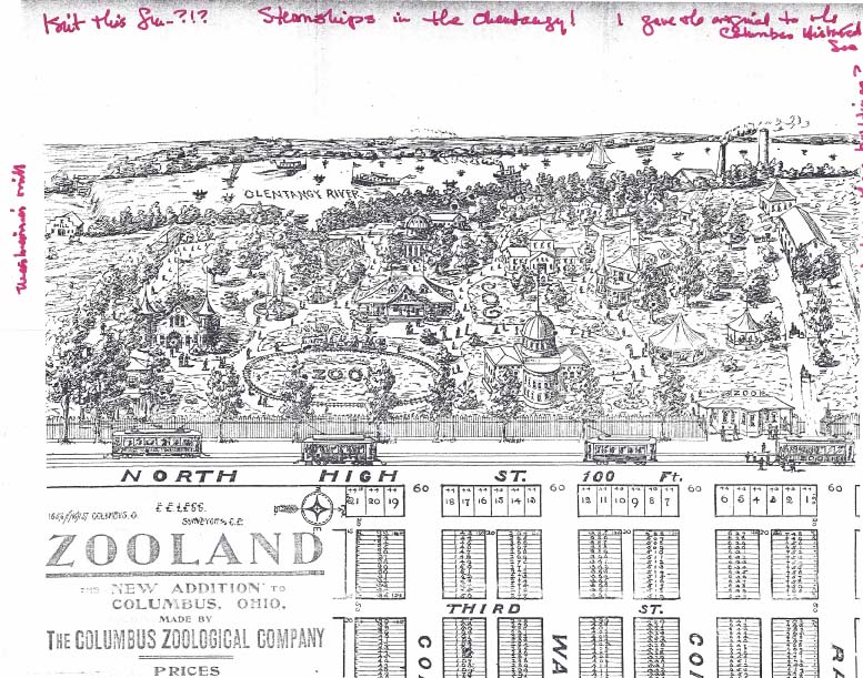 A great picture of the (Beechwold) zoo and partial image of the plat of Zooland, the subdivision on the west side of North High Street. Click on the image to enlarge it.
Steamships in the Olentangy! I guess the zoo picture was mostly, well, aspirational. Rumor has it that the Zooland housing lots were developed to raise funds for the zoo. You can read more about the zoo on my web site here. [Image courtesy of Wendy Bayer]
Moseying with Rick Pfeiffer through Clintonville
 Columbus City Attorney Rick Pfeiffer, who grew up in Clintonville, does a wonderful job giving an informal tour of the Clintonville community. (He has done this for the other neighborhoods of Columbus as well!) Thanks Rick! and we wish you well in your 2017 retirement.
Part One: https://bit.ly/CMosey1
Part Two: https://bit.ly/CMosey2
Solved: The Mystery of Grace Backenstoe
Thanks to Jeff Berichon, we now have a picture of Gracie! And he has agreed to share it with us. Thanks Jeff!
Two Theatres
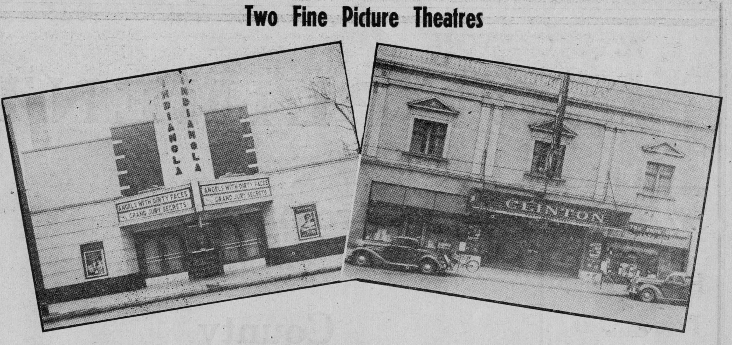 Nice images of Indianola Theatre and Clinton Theatre. The Indianola Theatre (now called Studio 35) was an independent theatre from the get-go; it opened at 3055 Indianola Avenue on February 17, 1938.
The Neth Clinton Theatre opened January 1, 1925 at 3379 North High Street.
Clinton House
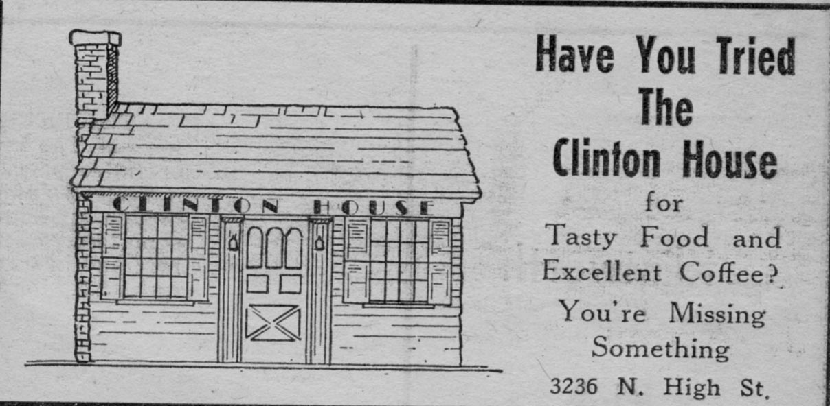 The Clinton House was located at 3236 North High Street in 1939, a building that now hosts a furniture refinishing business. In my book I show yet another generation of owners of this diminutive building.
Bob Meyer’s Standard Oil Station
I realize these are low-quality photos, but they are, alas, the only photos that I have of this topic. Bob Meyer’s Standard Oil Station was located on the southeast corner of Morse Road and North High Street. It closed in 1984 after doing business more than 48 years. The photo above was taken in December, 1944, and the one below was taken in 1984 upon Bob’s retirement. Click through that 1984 image for the article about the station’s closing. [Photos courtesy of the Clintonville Historical Society]


The Leggs
This is a reprint of an article by Mary Rodgers, originally appearing in the newsletter of The Clintonville Historical Society.
A brief history of Charles T and Sadie M. Legg–long time Clintonville residents–based on The Booster news article dated February 12, 1937, with additions
Charlie Legg was born on the Legg farm on April 23, 1871. This farm, a dairy, was located North of Clintonville. The lane leading to the Legg homestead would have been near where Webster Park Avenue is today.
Charlie’s mother was Orell E. Webster, daughter of Amazon Webster and a direct descendant of Noah Webster of American Dictionary fame. His father was Lewis Legg, believed to be the son (or grandson) of Elijah Legg, a revolutionary war soldier from Massachusetts who settled in Ohio in 1815.
In 1937, Charlie reported that when his grandfather, Amazon Webster, moved to Clinton Township, Indians lived in the section now known as Indian Springs. Those Indians raised cranberries. Amazon told his grandchildren that the Indians would walk to Chillicothe to sell their berries.
Charlie’s grandmother was Mary Pinney of Worthington. She was the daughter of Levi Pinney and Charlotte Beach. Levi and Charlotte were the first couple to be married in Worthington, Ohio. That was 1839.
Sadie Mitchell was born on January 27, 1874 in Circleville. Her father was a builder. She became Charlie’s blushing bride on Thanksgiving Day, November 24, 1892. When she heard of the upcoming wedding, Sadie’s grandmother exclaimed, “Oh that name!” Sadie’s response was that it was no worse than the last four letters of her present name!
The Leggs were married by Rev. Louis Postle and their first home was behind Dr. Burbacher’s Offices, which were located on the Southeast corner of Oakland Park and High. The Mennonite Church stands here today. It was reported that after a year, in 1894, they moved to into a building that had been a church at the Northeast corner of Walhalla and High street (Clinton Chapel–now Southwick-Good and Fortkamp Funeral Home). They started a dairy farm. After a year, they moved to property located west of the Olentangy River near what is now Lane Avenue. Here they set up a “business” farm including the sale of corn to the Sells Circus. Today, if you are driving north on Kenny Road from Lane Avenue, you will see a road called Legg.
When Charlie’s father could no longer care for his farm, Sadie and Charlie combined their operation with his and moved to the North Clintonville homestead. In 1907, the Leggs sold the farm to developers Thompson, Johnson and Thompson. The neighborhood called the Webster Park Addition was platted. The Leggs built and sold three homes in this development. Orell Webster Legg, Charlie’s mother, retain the portion of the farm closest to the river. In 1909, a portion of her property was set aside for a bird sanctuary. We call this area the Delta.
According to the 1914 records, 346 families, a population of 1,190, represented Clintonville. The Clinton League Memory Book reports:
In 1913, a new two story brick building was erected on the corner of Dunedin Road and High Street. It was haled with delight by residents of the neighborhood for at this place Mr. Legg opened a grocery store and Mrs. Legg had a department for notions-live-savers they were where you lived five miles from town. There were two business rooms in this building so the post-office was moved to the one adjoining the store. It remained there until 1917 when rural mail delivery was established.” Today, this building houses Shim’s tailor and Melissa’s Incredible Edibles.
On July 4, 1916, Sadie’s dry goods business moved to 3339 North High. That building was built in 1910 by J. C. Loren. The Booster reported him as a well known contractor at the time. He may have built some of the early homes on East North Broadway. In fact, the home that was located at 615 East North Broadway, the carriage house for that home still stands and is know the Fisher home, was referred to as the Loren home in the Clinton Memory Book. We know that the developer of North Broadway, James M. Loren, never lived on North Broadway, so perhaps 615 was J. C. Loren’s home. Before Sadie, the 3339 North High building was occupied by Swope’s Grocery and Bilikam’s Grocery. Bilikam’s later moved to North Columbus. In 1918, the Leggs bought the building and Sadie operated her dry goods store at the site until February of 1937. Later in life, Sadie lived in the apartment above the store.
Mr. Legg, after selling his grocery, was a city salesman for the E. E. Shedd Mercantile Company and then worked for the L. E. and C. W. Medick Co., Ford Dealers in the Clintonville community. In fact, at her retirement in 1939, Sadie said that to get full enjoyment from her upcoming vacation, she would need a new V8 Model Ford. Charlie commented that he wouldn’t be receiving a commission on the upcoming sale.
The Leggs told The Booster that they recalled when a saloon existed at what would now be the southwest corner of Orchard Lane and High Street (the Kroger parking lot). The story is that while there were a dozen saloons in North Columbus, there were none in Clintonville. Then a man was elected mayor of Columbus who closed the saloons on Sunday. This drove the liquor dealers to move outside the city. In those days there was a “one-mile limit” law which meant that city police could arrest people within one mile of the city limits. So the new saloons were set up, including the one here. The local place did a “land-office business. ” The mayor found out however that the Clintonville saloon was a few feet inside the one mile limit. (The city limit at the time was Mock Rd–now Arcadia Ave.) So, on a Sunday morning he sent the “Black Maria,” as it was called in those days, to get the drunkards and the proprietor. A new mayor reopened the City saloons on Sunday and the Clintonville establishment failed.
When interviewed by The Booster in 1937, the Leggs recalled the tollgate that used to block High Street just north of Arcadia. The gate had a 3 cent per rig fee. They also recalled when “…there was no such a thing in those days as cross streets coming into High Street, except North Broadway. So the cars stopped at numbered stops…a pleasant memory when one thinks again of Stop 6 (now Pacemont–once known as Jason Avenue); Stop 7, (now Como); Stop 8 (North Broadway); Stop 9 Clintonville (Oakland Park). And then the stops were farther apart, and little used until one reached Cooke’s Corners (Cooke Road).”
Charlie and Sadie are buried in Walnut Grove cemetery on the south side of Worthington. Charlie passed in October of 1946 and Sadie in November of 1957.
Side note: One of Charlie’s sisters, Emma, married James Harvey Zinn, born 1 October 1871 Ohio, in 1895. J. Harvey Zinn was the President of the J. H. Zinn Lumber Company of Columbus, Ohio. Mr. Zinn was reported to be an ardent fisherman who followed his favorite sport in practically every part of Canada, as well as in Florida waters. His attractive estate “Edgewater,” was located on the Olentangy River just north of West North Broadway. This estate still exists in Clintonville; for more information listen to Robert Ohaver’s oral history.
[Article courtesy of Mary Rodgers and the Clintonville Historical Society]Indian Springs & Wyandot Golf Courses–Aerial
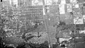 I’ve received several inquiries about whether I’ve ever encountered a map of the Indian Springs Golf Course. I haven’t, but would be interested in posting a digital copy of one on this web site.
Any former caddies out there with maps or golf course photos?
Bill Case, golf-course historian, sent me this 1938 aerial photograph of the land that is Wyandot Golf Club (top left corner, under the “1938”; you can see the ravine bisecting the course) and Indian Springs Golf Course is in the bottom left corner.
Bill says, “The attached is an aerial photo of Wyandot Country Club that I obtained from the county auditor’s office. The course is a couple of inches [i.e. inches on the original photo] directly below the June 15, 1938 notation on the photo. If you zoom in, you can make out pretty good detail of the holes. Morse Road is the lowest (or southern) boundary of the property. The driveway that winds its way straight north from Morse and then curves right or east toward the clubhouse is still there in use at the Deaf School. The trees and ravine divided the two area of the golf course.”
Between 1937 and 1980, the U.S. government–typically the USGS, BLM, or military–regularly took these aerial photos. They are impressively high resolution and lots of historic land-use information can be gleened from them. Original paper copies are available at the Office of the Franklin County Engineers, the Franklin County Auditor, and elsewhere.
The Mysterious Grace Backenstoe
 There is a new gastropub at Graceland Shopping Center, cutely named Pat and Gracie’s. The tavern is named after the early 20th century gambler who owned the land upon which Graceland Shopping Center was built: Pat Murnan and his wife Grace Backenstoe. The restaurant owners are on a quest to find an image of Grace Backenstoe. (They already have pictures of Pat.) Does anyone out there have one? Let me know and I’ll post it here as well as forward it to the restaurateurs. And thanks!
[Update: my update on this topic at here.]
The River
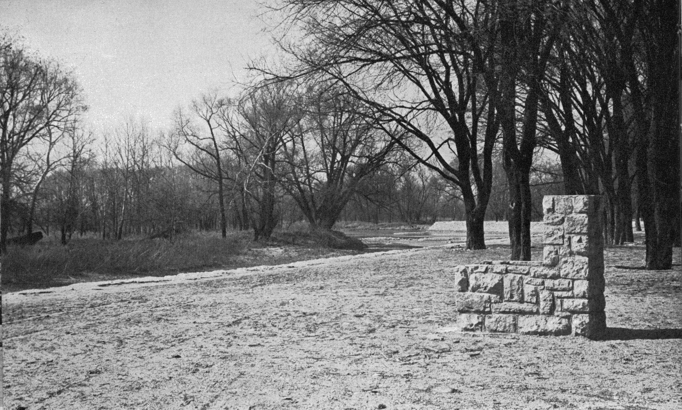 I assume this late 1930s picture was taken somewhere along the Olentangy River in the area of Clintonville. Note that both the trees and the stone structure are actually in the water. Does anyone out there recognize the location? [From a North High Memory Book]
The Zimmerman Family & the Olympic Swim Club

Libby Wetherholt recently gave this presentation about the Zimmerman family to the Clintonville Historical Society, and has kindly agreed to share it with us.
Plat of Old Beechwold
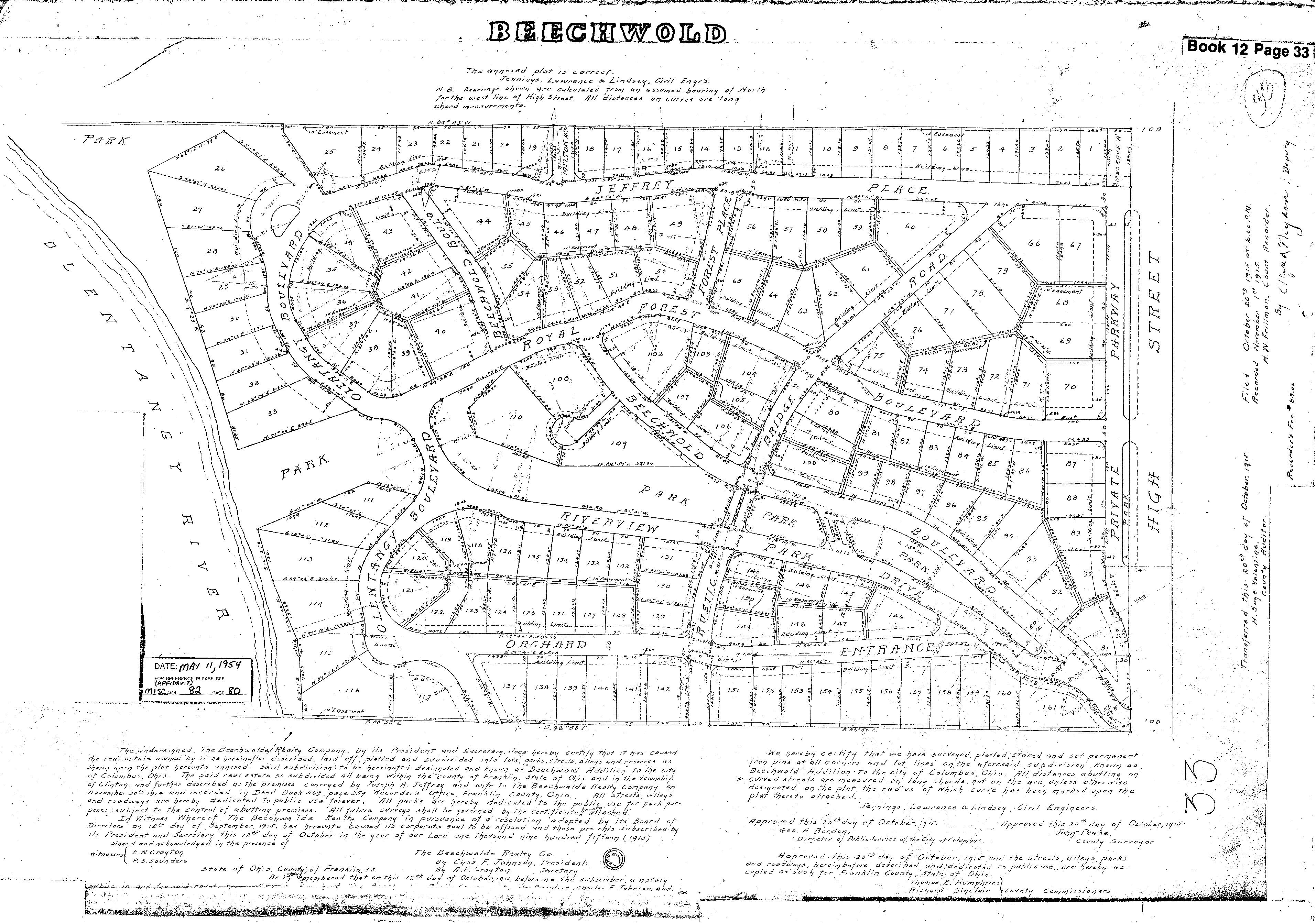 Wendy Bayer sent us this wonderful plat map of Old Beechwold. Plats are maps, usually drawn to scale, of the subdivisions of a piece of land. with lot numbers. [Map courtesy of Franklin County Records via Wendy Bayer]
And More Markers!
Ron Irick recently alerted me to the Historic Marker Data Base. In it are photographs of several additional markers covering Clintonville’s notable people, places and events. The database includes the marker for Rand Hollenback, on Hollenback Drive at Whetstone Park, the Nat’l Register of Historic Places marker for East North Broadway Historic District, and the marker (currently in Powell) for the Grand Carousel which was formerly at Olentangy Olentangy Park.
Ron recently posted the Clinton Township/Clintonville Historic Marker.
Though not in this database, there is also a marker for the Old Beechwold Historical District. I believe there is also some sort of marker for the former home of the Republican Glee Club at 57 Weber Road.
Arcadia Ave. Apartments

I love this picture of the Arcadia Ave. Apartments, located at 73-93 Arcadia Avenue. The building still exists. When they were first advertised, they were described as a two-story brick building of Georgian type, housing up to 8 families. Each apartment consists of a living room, dining room and kitchen on the first floor, to bedrooms and bath on the second, and a basement laundry. The building was constructed by Galbreath and Leonard, Inc. in 1927. [Image courtesy of Stu Koblentz.]
KKK
 In November, 1977, the Klu Klux Klan held a rally in Columbus, and met at the Howard Johnson Columbus North Motor Lodge. I’m glad for freedom of speech, sad and mad for what that speech consists of. (Post update: I previously thought this motor lodge was in Clintonville, now I believe it was on Rte 161.)
A. B. Graham House
 A. B. Graham (Albert Belmont Graham) was one of the key founders of the 4-H Club, and was also a leader in developing the nation’s county extension services that are still so helpful to farmers and gardeners and cooks. In his retirement years Mr. Graham lived at 159 Clinton Heights Avenue in Clintonville. (His son lived in Clintonville as well.) The Clinton Heights house is the last surviving house known to be associated with Mr. Graham, and on this basis the house has recently been put on the Register of Historic Places.
You can find more information elsewhere on this web site
Newspaper Boys
 Bob Henry (North High School Class of 1957) was kind enough to share this photograph of himself in the days when he was a Columbus Dispatch carrier.
The Dispatch sub-station he was posted from was located in the alley behind the Clinton Theater on High Street. This picture was taken circa 1950 and shows a bunch of Dispatch carriers in front of the station. Earl McBlain, shown in the doorway, was the station manager. From Bob:
[Photo courtesy of Bob Henry]In those days, the carriers, ages 10 to 15, would ride their bikes to the station after school, where Earl would count out our papers to us. The station had a bench along the walls, which we used to fold and bag our papers. In the center of the room was a pot-belly stove that burned yesterdays papers to keep us warm in the winter. Once we had bagged our papers, we rode to our routes throughout Clintonville. Mine was on West Dunedin, along Olentangy Blvd, Winthrop and Weston Place, about 70 houses. Carrying papers took a couple of hours each day, including Sat and Sun morning; on Thurs, and Fri nights we collected money from each house on the route, which required another couple of hours. I believe the cost was 40 cents per week for a seven-day subscription. The Weds Star cost another 15 cents. When my mom learned I was carrying the Star, which was a risqué paper in those days, she called Earl to complain, but he could not do anything about it.
On Saturdays before noon we had to go to the station to pay our paper bill of about $20 and kept the rest, about $8.
Defense Center
At a presentation I gave on the History of Clintonville, someone handed my husband this news item about the opening of the Defense Center in a former filling station at 4070 North High Street at the corner of Glenmont and North High Street in 1942.
 The Clintonville Community Council, a group of members representing every organization in Clintonville, sponsored the center. It was to be a center for air raid services, a headquarters for Boy Scouts, a Red Cross distribution point, a center for salvage collection, a precinct station for auxiliary police and eventually a USO clubroom. It included a first aid corner, and a canteen offering coffee and cookies.
In this picture, Mrs. William McCoy, Marilyn Peters, and Joe Miller are getting the place ready.

There is another photo here.
Underground Railroad in Clintonville
 Debbie Shaw, retired CML librarian, recently provided some local resources about the Underground Railrooad in Clintonville and surrounding area. Thanks for agreeing to share this information, Debbie!
Here’s Debbie’s summary:
-
This link has a short video as well as text below it from WOSU’s Columbus Neighborhood series on Clintonville; both discuss the Underground Railroad.
and this video from the same series on Downtown/Franklinton shows another area involved in the Underground Railroad here in Columbus.
This link is from the Clintonville History site by Shirley Hyatt. The October 2008 issue discusses Thomas Bull and his family and includes a brief section about the Underground Railroad. [Shirley adds: see my book Clintonville and Beechwold here (to buy it) or here (to borrow it) for a smidgen more information.]
Article from the OSU Lantern Feb. 7, 1999.
Historic Marker on OSU Campus.
Another historical marker.
Excerpt from the book The Underground Railroad: An Encyclopedia of People, Places and Operations by Mary Ellen Snodgrass.
For a broader look at the Underground Railroad in Ohio, you can read the full text draft of The Mysteries of Ohio’s Underground Railroad by Wilbur H. Siebert here.
And of course, the Columbus Metropolitan Library has a lot of this history. You can also access a lot online at the here.
Debbie also notes, “This material was easily Googled. As a former librarian, I know that there is a lot of info that is not online. By the way, if you do an advanced book search on books.google.com and limit to full text only and content = books, there are quite a few. I put underground railroad in the ‘with the exact phrase’ field and Ohio underground railroad in the ‘with all of the words’ field. Laws, history, etc. come up, including Ohio Before 1850 and Ohio History Sketches. Of course, some of it is a very brief part of the book. If you add Ohio into the search’s ‘subject’ field, this narrows it a lot.”
The Grand Carousel–Request for Information
Carousel expert and author Eric Pahlke recently emailed me with a question. The question is about the Grand Carousel that currently operates at the Columbus Zoo & Aquarium.
Eric is trying to resolve some conflicting information about the history of the carousel. He writes,
The oft-repeated story is that the carousel came to Olentangy Park in 1914, and was moved to Scioto Ranch Park in 1937-38 after Olentangy closed. Scioto later became Zoo Park, which became Wyandot Lake Park, which is now a combination of Zoombezi Bay and Jungle Jack’s Landing. I have a source that says the city of Columbus bought the carousel in 1981. The carousel apparently operated at Wyandot Lake until 1999 and has been running at the Zoo since 2000.
The problem is that I have some photographic evidence that says the carousel started on Coney Island and didn’t come to Ohio until the mid-1920s. This alternative story doesn’t distinguish between the carousel then coming to Olentangy Park and then to Scioto, or directly to Scioto.
I’m hoping that someone has materials in their archives that would help solve this dilemma. The primary question is whether the carousel came to Olentangy Park in 1914 or sometime in the 1920s. After that is solved, the other issues probably follow.
Does anyone have any information that could shed light on the issue? Eric is the author of Treasures from the Golden Age: West Coast Carousels, and Treasures from the Golden Age: East Coast Carousels.
Bower & Co. General Store & Family
Jim Drake recently contributed these wonderful photos and family histories of the Bower (Weber) family.
 Eda Weber Bower and her spouse, Henry G. Bower owned and operated the Bower & Company General Store at 2643 North High St. The photo to the left shows the store’s delivery wagon and, at the right of the image, a section of the Bower family home at 26 East Duncan Street.
 This photo is the 1901 wedding portrait of Eda Weber (1869-1951), of the historic Frederick Weber family, and Henry Bower (1856-1935). They were married on January 1, 1901.
 This photo was taken of the Bowers in 1934. In addition to his civic activities, Henry Bower was a founder and principal stockholder in the Northern Savings Bank (which eventually became part of the Huntington Bank system).
John J. Bower, one of Henry Bower’s brothers, was initially a partner in the general store, but eventually opened a hardware store on the southeast corner of Duncan and High streets. The Bower brothers are shown in this photo (left to right): Ernest E. Bower, Henry G. Bower, Owen Bower (son of Ernest E.), John J. Bower, his son Everett Bower, and Charles Bower.

Although Henry Bower had hoped to have at least one son to inherit the general store, he fathered five daughters instead. After his first daughter, Anna, was born, he pre-selected a male name for each successive child, but in every instance he had to opt for a female form of the name.
Consequently, “Albert Bower” became “Alice Bower,” “George” became “Georgia” Bower, “Henry” became “Henrietta,” and “Wilbur” became “Wilda” Bower.  In this 1960 snapshot, the five daughters are arranged in their birth order from left to right: Anna Bower Mylander, Alice Bower Jesson, Georgia Bower O’Brien, Henrietta Bower Kuntz, and Wilda Bower Drake.
Of the five Bower daughters, Alice (Mrs. Frederick) Jesson had a long and successful career as Director of Restaurants and Cafeterias of the F. & R. Lazarus Company.
(Photos and write-up courtesy of Jim Drake) Note: there is one more image of the Bowers’ cart here.
Algy Strayer McBride, 1932-2015
 There is no doubt that my book Clintonville & Beechwold, and this dev.clintonvillehistory.org/ web site, would not exist if it had not been for the support and encouragement of Algy McBride.
I first met Algy in 2007, when I thought I “might” write a history of Clintonville. He was the long-standing president of the Clintonville Historical Society at the time, and enthusiastic about getting the book written. We were strangers, but he opened his house and the wealth of his library and history collection to me. He was an indefatigable source of information about people I should call and stories I should look into.
Algy was intellectually rich and curious, and so active and involved…with the local genealogical society, with the local senior center, with civil war discussion groups, even with the annual Clintonville Fourth of July flag raising ceremony. It takes my breath away even now, thinking back on Algy, his support of his community, his support of me.
Algy’s obituary can be found here
and Southwick-Good’s video tribute can be found here
Algy, we’ll all miss you.
Notable Clintonvillites
 I enjoy the attached article by Don Hollenback originally published in a 1997 Booster. It enumerates some of the residents who made their mark on the community–Doc Rymer, Bill Taylor, Cookie Stevens, Ted Barclay and many others who formed Clintonville Boy Association, Boy Scout and Girl Scout troops, and more.
Stop 18
 In my book, I have a wonderful photo of the inside of Stop 18, an interurban stop containing a mom-and-pop grocery store. Located at approximately 5534 North High Street, it reopened in 1934 as the Stop 18 Inn, owned by Jacque Criticos. The tavern continued to operate until it was sold to Hudson Oil in 1968.
According to the Dispatch‘s Johnny Jones, canoeists from the Olentangy Canoe Club (presumably the one located in Olentangy Park) used to row their canoes from their clubhouse up the river to Stop 18. That location on the river also served as a popular skinny-dipping location.
Three fun articles are attached:
An announcement of its opening, in the Columbus Star June 10 1934, p.28
An article about its closing in the Columbus Dispatch January 28, 1968, p.21a
An article about its naming and history in the Columbus Dispatch, January 29, 1968 p.3b
Have a Bash
 From Unforgettable Columbus, volume 2: “Although Herb Bash is not considered a pro, he did give lessons and was considered a pretty fair golfer. [Early on, he leased Indian Springs Golf Course.] In 1948 he opened a unique golfing complex on W. Dodridge St. between Olentangy River and the Olentangy River Rd. These 60 acres consisted of an 18-hole golf course and a large driving range. He sold the land in 1962 to Chemical Abstracts and moved his entire operation to just beyond Rte 161 on Dublin Road…The driving range on Dodridge was a place where many a Columbus duffer sharpened his game. Bash died in 1979 at the age of 86.”
According to Bill Case’s web site, “former South High coach Herb Bash … made his living in the golf industry. Herb and his wife owned the Berwick Golf Course, a public facility located on the city’s southeast side. Herb helped grow the game at Berwick by conducting numerous golf clinics for the city’s youths. Shortly after joining The Elks’ in 1928, Bash, in partnership with Bugs Raymond, opened another golf course- Indian Springs, opposite Henderson Road on the east side of High Street. Herb later added the “Bash Driving Range” in Dublin to his collection of entrepreneurial golf activities. Like many of his compatriots at Elks’-Wyandot, Herb Bash could golf his ball. Prior to joining The Elks’, he won Dublin Road’s club championship. Herb was also a mainstay of the 1932 Wyandot golf team which won the inter-club championship.” [Image courtesy of Bill Case.]
Olentangy Park Redux
 I never tire of seeing old images of Clintonville. Collector Galen Gonser shared these 1920 images with us. Admittedly they are taken with a simple box camera, but still, what’s not to like? (Photos courtesy of Galen Gonser.)
The first image below is Chute the Chutes at Olentangy Park.


We don’t know who these gentlemen are.


These images are taken looking north from Dodridge Bridge up the Olentangy River toward Olentangy Park–the second of the pair is a close-up.


For additional photos, search “Olentangy Park” on this web site.
Finding Nelson Evans (blog)
 Clintonville resident Tom Thacker has been researching former Clintonville resident Nelson Evans, who lived at the end of East North Broadway near the railroad tracks between 1891 and 1910. The Evans family evenutally moved to Hollywood, and Mr. Evans became a notable photographer. Check out Tom’s blog detailing his search for Mr. Evans here.
Maple Syruping in Clintonville
 I can’t help loving this photo! Bob Fowle, left; Bob Scott, second from left; and Richard Knopf, third from right, around a kettle of sap in the old Clintonville neighborhood. (Photo courtesy of William Dunning)
92 Walhalla
 After reading the entry on this web site about 100 Walhalla, Sarah Ellis contacted me with some information about her own house, 92 Walhalla. She shared the following:
An interesting article from the OSU website, and
An article that appeared in the This Week newspaper in 2009 when 92 Walhalla was on the homes tour.
Thanks Sarah!
Bill Case’s New Book about the Wyandot Golf Club
 William R. Case has published a book about the Elks / Wyandot Golf Course. The book’s title is Golf in Columbus at Wyandot Country Club. As of this posting, The Book Loft in German Village (Columbus, OH) or Barnes and Noble at Easton Town Center have it in stock. If, like me, you are a prolific library user, you can also locate the book in a library near you here.
Bill has collected lots of great photos and researched this golf course (now the location of the Ohio State School for the Blind and the Ohio School for the Deaf) extensively. You will enjoy his book! [Images courtesy of Bill Case]
Clintonville Looking West at Pacemont and North High
 Looking west from Pacemont and North High in 1904, in the direction where Riverside Hospital is now located. The dairy shown in my book is to the left of this camera angle. [Photo by Clinton Hollenback]
Mathias Armbruster
 Two articles are often mentioned as sources for information about Mathias Armbruster. I thought I’d archive them here.
Leeann Faust wrote this wonderful article about her great grandfather Mathias Armbruster. It was originally published in the Polar Bear ROARS Alumni Association (=North High School) newsletter.
Karl Pauly wrote this column way-back-when, about Walhalla ravine–which Armbruster was instrumental in designing, or at the very least, naming. (First article of Leeann Faust; second article courtesy of the Clintonville Historical Society)
Little Rand
 Rand Hollenback in 1904, at age 4, at the Hollenback’s 3134 North High Street address. Rand grew up to found the Clintonville Booster, and to become a major force in the community. Note the street car lines in the background.
Looking East from 3124 North High St, ca 1904
 This is what the Hollenback homsestead at 3134 North High Street looked like, looking east/southeast.
Can You Canoe?
 The Olentangy Park Canoe Club, ca. 1906. I’m told that at one time, Clintonville had at least 4 canoe clubs.
Beechwold Theatre
 This is an ad that just happens to show the signage of the old Beechwold Theatre at 4250 N. High (aka Camelot North and Drexel North, and currently an athletic club).
The theatre was built by the F & Y Building Service (aka F & Y Construction Company). Mark Fontana informs me that the “Y” in this name is Yassenoff, and the first manager of the Beechwold Theatre was Milton Yassenoff, adopted son of Leo Yassenoff.
If anyone out there is aware of the whereabouts of blueprints, construction photos and high-res b/w photos of the finished theater, please let us know! The ad was shared with me by Mark Fontana, former manager of the Drexel North (aka Camelot North and Beechwold Theater) Mark is a collector. In another place on this web site I link to his web site.
Somebody Please Say “Cheese!”
 First graders at the Clinton Township School on Clinton Heights Avenue (also called the “1904 Building”). Presumably Rand Hollenback is somewhere in this photograph. As of this web posting, the building is still there, though its fate is uncertain.
Donald Ross, and the Elks / Wyandot Golf Course
 Bill Case has done a wonderful job of researching and writing the history of Donald Ross’ design of the Elks/Wyandot County Club. Check out his web site here. It’s a work in progress so check Bill’s site frequently.
The first picture (to the left) is, of course, Donald Ross. In the left-hand image below, Harold J. Kaufman, John W. Kaufman, Arthur Shannon, Donald Ross, and J.V. Taylor peruse a topo map.
The right-hand image below is the 5th hole–308 yards–par 4. See Bill’s web site for the history and for more image gems.


(Images courtesy of Bill Case and Betty Huber)
Baseball at the Zoo
 The zoo in Beechwold may have been one of the earliest sites of the Columbus Clippers!
According to Joe Santry, Historian at The Columbus Clippers, “In 1895 the Columbus Statesmen opened the season playing at The Zoo Baseball Grounds. The grounds were owned by the Zoological Garden company. Could this be the old zoo grounds in Clintonville? …The team played at the Zoo Grounds for a couple of months before moving to Recreation Park in German Village…
“In 1895, according to the local papers, Columbus played at ‘the Zoo Grounds’ (May 21), ‘Zoo Baseball Park’ (May 4), ‘Zoo Park’ (May 5). There are stories about temporary grandstands, then a ‘new grandstand’ (May 12).
“By June 1, however, the OSJ reports that the club now ‘holds the lease on the Schiller street grounds’ and the club ‘will play the last game on the Zoo grounds this afternoon and the work of removing the grandstand, bleachers, and fences to Recreation Park’ will follow.
“The problem is how inconsistently the papers reported the games that season. The more I research this the more I think the Zoo Grounds park was in or near some type of amphitheatre on the zoo grounds. The park had other smaller attractions prior to 1905.”
Scott Caputo, librarian at the Columbus Metropolitan Library, found this article in the 8-8-1904 Ohio State Journal. It mentions a drill field and a ball game used by several masonic groups at the Zoo. This, shortly before it closed down.
Also linked here is a image/map of the old zoo, courtesy of Mary Rodgers of the Clintonville Historical Society.
Sewer pipe factory, and The Mystery of the Pond
 John Krygier found a few maps that he was kind enough to share with us: 3 Sanborn maps of the sewer pipe factory (and later, brick yard) formerly occupying the area where old North High currently sits at 100 Arcadia. Interestingly, the ravine behind the factory was apparently dammed, making a significant (and the only?) pond in Clintonville (not sure if the one in Whetstone counts). John requests that if anyone knows of any other sources documenting this pond, to let him know. You can do that by commenting on this post and I will send it along to John.
John also found a map showing the rail grade that connected the sewer pipe factory to the main RR line to the east. The interurban (Columbus, Marion and Delaware) used part of that spur (north of Glen Echo Park) as a bypass.
This Worthington Bypass went from Indianola Ave, east along the top of Glen Echo, then north up what is now the alley along the RR track, then curved west at North Broadway over to and running parallel along Indianola. This curve is preserved in some of the lots around Oakland Park–in particular, the odd orientation of the IndiaOak Tavern is the result of it being built on a curved parcel, part of the old RR right of way. A map of current parcels (with the approximate route of the RR grade) is also attached.
There are 7 photos of this Worthington bypass around the time it was built, showing the eastern end of C-ville at the time, at this web site.
Thanks, John!


(Photos courtesy of John Krygier)
Flora Armbruster
 Leeann Faust has graciously shared an additional photograph of her family. This photo is of Rosa, Pauline and Flora Armbruster.
Leeann and her cousin David believe the photo was most likely taken at the house at 3100 North High Street but where and what the building–which looks the be rather rough construction–is, is not known. Leeann ponders, “Could it be the barn? That was where the house is that faces California stands today (on the east side of the side driveway). It could also be a storage building. We were looking at the things in the background. If it is the barn it might have been what was north of the house or if they were at the ends east or west. We know the barn faced the house so it couldn’t have be what was south. If it’s not the barn, we don’t know it’s position.”
If anyone has any guesses, please pass them on!
For additional photos, search “3100 North High” or “Armbruster” on this web site.
Graveyard at Armbruster home, AKA Clinton Chapel
 More fabulous pix from Leeann Faust of her ancestors’ home at 3100 North High Street. This was originally the site of Clinton Chapel, subsequently modified to make a residence for Mathias Armbruster; the building then became a funeral home and at the time of this update, the building is a day-care center. These photos show the old graveyard which was behind the house, as well as the lion with Olentangy Park in the distance. The graves were eventually moved, predominately to Union Cemetery.


For additional photos, search “3100 North High” or “Armbruster” on this web site.
(Photos courtesy of Leeann Faust)
Old Olentangy Park picture
 What a terrific picture of Olentangy park, courtesy of Peg Steigerwald. She would like to know what the ride is
at the top left corner of the photo is–not the larger slide water ride, but more of a love canal type covered ride. Anyone know? (Photo courtesy of Peg Steigerwald)
Clintonville Community Market
It’s always fun to research the history of your home or building, using the Franklin County Auditor’s web site to look at the “transfer history” aka assessment history. John Krygier recently shared the history of the building occupied by the Clintonville Community Market and you’ll find it here. (Courtesy John Krygier)
North Broadway Methodist Church
 A lovely contemporary picture of North Broadway Methodist Church, by Marty Cottrill. Marty has recently published a book entitled The Beers, Brown, and Grove families of North Columbus, Ohio, available at the Columbus Metropolitan Libraries. (Photo courtesy of Marty Cottrill)
Weisheimer Mill
 Another great image of Weisheimer Mill! The verso of this photograph says, “Looking east across the Olentangy River at the Weisheimer Mill N. of Henderson Rd Columbus, Ohio. House and shed are still there at end of Weisheimer Road. (Photo courtesy of Galen Gonser)
Beginnings
 Balser Hess, a cordwainer, tanner and Revolutionary War veteran, was one of the first pioneers to arrive in Clinton Township. Hess came to Ohio with his family and bought 320 acres of land along the west bank of the Olentangy River. His first house, a log structure, was a common stopping place with travelers. Balser died in 1806 and was the first to be buried on the grounds that became Union Cemetery. (Photo courtesy of Terry Miller.)
David Beers
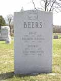 David Beers was another early pioneer with an exciting life story of having been captured and released by the Native Americans. Beers came to Ohio in 1802. Descendents of David Beers still live in the area to the present day. (Photo courtesy of Terry Miller)
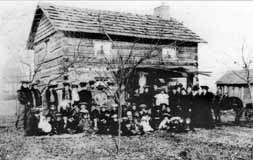 Beers had a log house near the intersection of Dodridge and North High Street. The cabin still exists but has been moved to Norwich Avenue. This photo appeared in the December 29, 1904 Dispatch, on the house’s centennial. The people included friends, relatives, and associates of the cabin’s next owner, Conn Baker, and they were reminiscing with him about early Columbus and marking the 100th anniversary of the cabin after the its move and reassembly to E. Norwich.
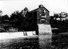 The Beers family operated a mill which existed until the early twentieth century. For many years the father of the well-known poet John James Piatt operated it. The future poet spent his boyhood days playing about the mill, and some say that the impressions made by its surroundings found expression in his work. The mill was considered to be one of the most picturesque spots in Ohio. Built around 1810, the mill burned in 1902.
There are still vestiges of the mill (foundation stones) below North Street, at the river.
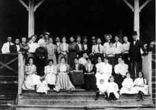 The reason for this gathering is unknown, but it includes several Beers descendants (and likely many who are not related) and was taken about 1905, probably at Olentangy Park. (Photos courtesy of Marty Cottrill)
Eliza Rathbone Wetmore, 1791-1853
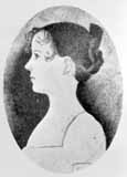 Eliza Rathbone Wetmore’s father, John Rathbone, acquired 4000 military land grant acres including all of Beechwold and much of Clintonville. John Rathbone gave Ohio a loan to build the Ohio canal and bequeathed 262 acres of land to his daughter Eliza. Eliza married Charles H. Wetmore, a physician, and the young couple settled in Clinton Township in 1819. Her land would eventually be purchased by the Columbus Zoological Company and would eventually become Old Beechwold. Some say that the stone pillars are the remains of the Wetmore driveway. (Courtesy of Columbus Metropolitan Libraries.)
A Lot of Bull
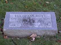 People like to say that the story of Clintonville starts with the story of Thomas Bull Jr., who came to this area in 1812 with his family from Vermont, by way of Worthington. Bull purchased about 680 acres in Clinton Township, and bequeathed land to his children when he died in 1823. Bull and his family were Methodists and abolitionists. The family graves were moved in March 1910 to Union Cemetery, section “new”, lot 176, across from the flagpole. (Despite the section name, this is in the old area of Union Cemetery on the east side of Olentangy River Road.)
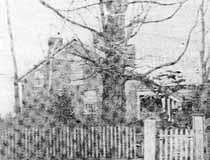 This is the Thomas Bull residence which stood on the east side of High Street between Dunedin and Piedmont. Some of the information about the house is conflicting, but Nancy Pendleton states that Alonson Bull helped to build the house around 1821 and lived there until the mid-1860s. The local Methodist congregation held services in this house until Thomas Bull’s death in 1823. Elias Pegg purchased it, along with its farm, in 1862 and raised his children there. The house was torn down in August 1931. This photo is from the Sunday edition of Cols Dispatch March 5, 1950.
Brevoort & Bull Graves
Thomas Bull’s daughter Chloe came to the area with her husband Isaac Brevoort and son Henry around 1812. Isaac Brevoort was helping build a barn across the Olentangy River and was crossing the flood-swollen river in February 1814 when his boat was swamped and he drowned. He was 23 years old, and was buried just 100 yards from the river. That grave is now someone’s back yard. Some say the grave is behind 247 Kenworth; some sources say it’s behind 253 Kenworth; some sources say that Isaac Brevoort is buried behind 253, and Thomas Bull Senior (father of Thomas Bull Junior) is behind either 247, or 253, or 257.
 Henry Brevoort’s house was built at 3620 North High Street, behind the original Brevoort cabin. The house continued to exist until around the 1970s, when it was torn down. The Brevoorts had an 80 acre farm; Developer Charles Johnson purchased the farm in 1909, and planned the Northmoor neighborhood carefully. He had the idea that vacant space induced people to build a nice house. Accordingly, he platted Northmoor Park and gave it to the city. He also did this with the bird sanctuary that today is known as “the Delta,” at the west end of Webster Park.
An early 1970s article stated that “stones still mark the [Brevoort] cabin” and that “once past the field stone gateposts [which were just wide enough for a carriage], the ancient barn where Frank Brevoort once operated a dairy still stands.” Does any of this still exist?
Underground Railroad
Alonson Bull and his brother Jason were abolitionists, Jason serving as a “conductor” on the Underground Railroad from Clinton Chapel at 3100 North High Street. Jason’s photograph is in the Wilbur H. Siebert Collection at the Ohio Historical Society.
Edward L. Sebring (1839?-1905) worked with Jason Bull to aid fugitive slaves escaping to freedom in Canada from Columbus, Franklin County, Ohio, to the next safe station. His photograph is in the Wilbur H. Siebert Collection of the Ohio Historical Society.
James G. Bull
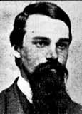 James G. Bull (1838-1927) was a grandson of Thomas Bull. James served as Columbus Mayor from 1865 to 1868 and from 1871 to 1875. His grandfather, Thomas Bull, was the first white settler of the area and James’ father, Alonson Bull, founded Clintonville in 1846. (Photo courtesy of Columbus Metropolitan Libraries)
Other early settlers…
include the Smiths, Websters, Coes, Whipps, Hunts, Wilsons, Bucks, and the Cookes. John Buck acquired land around Henderson and High early on, and then sold some of the land to Chauncey Cooke. Cooke in turn donated the land to the Clinton Township in 1842 to be used as a school.
Bishop Philander Chase
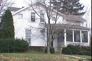 … is credited with starting Kenyon College somewhere near North High Street and Selby Roads, in a house that has since been razed. An earlier home of Chase still stands at 62 Lincoln Avenue.
The Webers
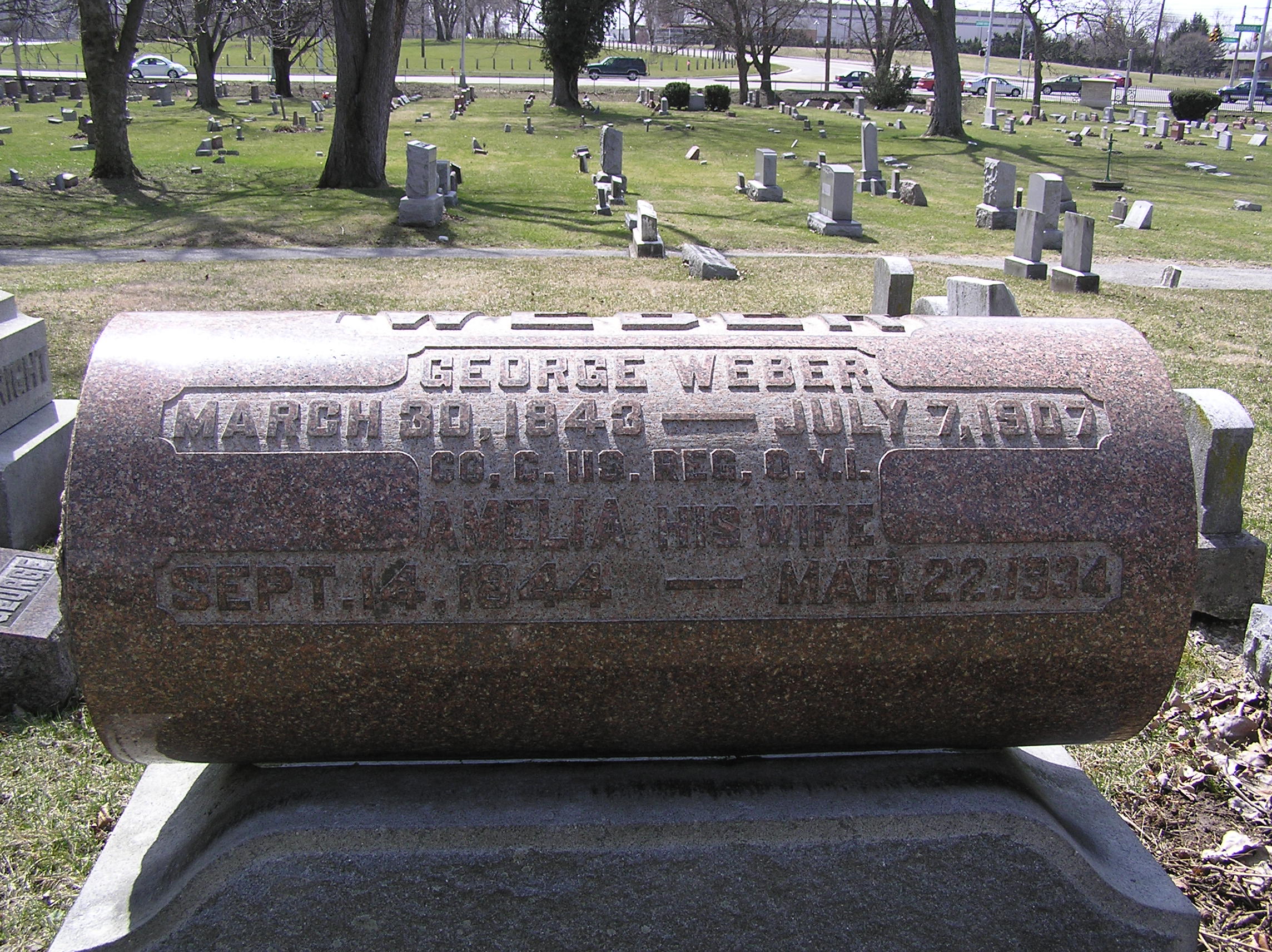 I found this little biography about Frederick Weber (1806-1885) and his son George (b. 1843) in A Centennial Biographical History of the City of Columbus and Franklin County Ohio (Chicago: The Lewis Publishing Company, 1901) pp. 278-280. I admit I have done little research on this Clinton Township family and have not even researched where their farm was located.
Barnabas Phinney (1813-1899)
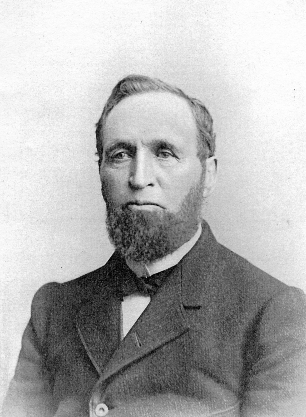 Barnabas Phinney (ca. 1813-1899) came to the area in 1838, and purchased 60 acres of land near the northwest corner of today’s Henderson Road and North High Street. In addition to farming, Phinney was an investor in the toll road running from Columbus to Worthington, and in the electric streetcar company. His house was said to be majestic. He and his wife had no children, and after his death most of the property was sold. A bit more biographical information can be found in A Centennial Biographical History of the City of Columbus and Franklin County Ohio (Chicago: The Lewis Publishing Company, 1901) p. 872 excerpted here. His obituary from the Columbus Dispatch January 30, 1899 is here.
Cooke family
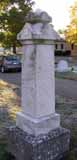 Another one of the first families of Clintonville was the Cooke family. According to the family’s history, Roswell Cooke (1764-1827) came to Ohio with his wife and five children in 1800 from Connecticut. His two eldest sons, Rodney and Chauncey, took up land 6 miles north of the state house, their farms adjoining (in the vicinity of Cooke Road and North High Street). They cleared the land and both erected “houses out of round, unhewn logs, with puncheon floors and primitive fire places, with mud-and-stick chimneys.” The brothers lived the rest of their lives on these farms. Family history states that in 1827 they constructed one of the first grist and saw mills on the Olentangy River, which later became known as the Whipp and then as the Weisheimer Mill. They also operated a distillery. (Photo courtesy of Terry Miller.)
 Rodney’s son, H.C. Cooke, was born in 1825, and took up residence on the old Cooke homestead at 4243 North High Street. Over time H.C. amassed 300 acres. He was a successful businessman, including in the stock business, and then owned the firm Cooke, Grant & Cooke, contractors in the construction of heavy masonry for railroad and other bridges. He was one of the officers of the Worthington & Columbus streetcar line. (You can click on this map to enlarge it.) (Photo courtesy of Carl Cooke.)
Just a bit more background information. The current name of the company Henry C. Cooke founded is the Fritz-Rumer-Cooke Co., Inc. They are still in business. The Secretary of State’s website states that one of their prior names was the Fritz Rumer Cooke Grant Company, changed to Fritz-Rumer-Cooke Co., Inc. in 1918. The company’s website states that it was founded in 1879 and incorporated in Ohio in 1911, and is still managed by descendants of the Cooke family. (This information courtesy of the Columbus Metropolitan Library.)
Rodney Romoaldo Cooke (1832-1866), brother of Henry C.
Roswell Cooke came to Ohio from Connecticut in 1800 with his wife and five children. The two oldest sons, Chauncey and Rodney, took up adjoining land in the vicinity of today’s Henderson Road and North High Street. Son Rodney (1793-1833) married Laura Cowles and together they had nine children: Esther (married to L. J. Weaver), Roswell (m. Lorinda Skeels), Helen (m. John Good), Rosalia (m. John Webster), Rachel (m. William Buck), Laura (m. Lester Roberts), Rodney Romoaldo (m. Chloe Williams), Demon, and Henry C. (m. Abigail Taylor).
Rodney’s son Rodney was a teacher and a farmer, and he served in the Civil War (Company G, 57th OVI). He was honorably discharged but returned from the war an invalid. Broken down in health, he was largely incapacitated for performing manual labor on his farm. He died in 1886, having been confined to his bed 11 years. A bit more biographical information can be found in A Centennial Biographical History of the City of Columbus and Franklin County Ohio (Chicago: The Lewis Publishing Company, 1901) pp. 248-252, excerpted here.
Maple Grove School
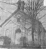 In 1842, Clinton Township School District 1 acquired land at Henderson and High Street from Chauncey Cooke, and in 1878, built a brick school building on the southwest corner. The building was used both as a school and for worship services by various denominations. In 1920, the district deeded the school to the Methodist Church, and the Maple Grove Methodist Episcopal Church was organized. It was at the time the only church between Clintonville and Worthington. (Photo courtesy of the Ron Ohsner family)
Never too many Cookes in the kitchen…
 Cooke family members married Buck, Armstrong, Hess, Maize, Webster, and Brown family members. The Cooke family held a series of family reunions from the late 1890s through the first decade of the 1910s, and maintained a log and minutes of their get-together. (Photo courtesy of Carl Cooke)
Armstrong family
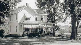 Another noted family in the vicinity of Henderson and High Street was the Armstrong family. Henry C. Cooke’s daughter Flora had married Llewellyn Armstrong. This is their house on the corner of Cooke Lane and High Street. A caption by Lulu Pearle Browne (Ohsner) also states “Clem Cooke [a son of Albert C. Cooke] born here—when first built Al and Lulu Cooke lived here.” (Photo courtesy of the Ron Ohsner family)
Alice Cooke

Alice Cooke Hess was the daughter of Henry C. Cooke, and worked for some years as a school teacher at the Clinton Heights Avenue School. She married Charles Hess, the great grandson of pioneer, Balser Hess. (The Hess family land formed Union Cemetery.) Alice and her husband eventually lived in the large house built by Henry Cooke at Deland and North High Street shown in my book and on this web site. This is her grave stone in Union Cemetery. (Photo courtesy of Terry W. Miller.)
Hess Barn
 Alice Cooke (daughter of Henry C. Cooke) married Charles Hess, a great grandson of Clinton Township pioneer Balser Hess. Alice had been a teacher at Clinton School. The Cooke-Hess house and farm were located just south of the corner of Henderson and High between Deland and West Cooke Roads on the west side of High Street, opposite the Ed Cooke home. The house was originally the home of Henry and Abigail Cooke. (Photo courtesy of the Ron Ohsner family)
 The bottom photo is a picture of the Hess family on their farm; Henry is supposedly in the middle. (Photo courtesy of Carl Cooke.)
Orlando Aldrich (b.1840)
 Orlando Aldrich was a prominent lawyer and OSU law professor. Aldrich was the first president of the Worthington, Clintonville & Columbus Street Railway Company and served in this position from 1891 to 1898; he subsequently held an office of the Columbus, Delaware, & Marion Electric Railway. Aldrich had purchased 23 acres of land on the southwest corner of Henderson and North High in 1882; it was a fruit farm called Maple Grove Farm. Aldrich had three great hobbies: horticulture, collecting great art, and collecting rare books about archaeology, and he engaged in these avocations from his lovely house located about where Maple Grove Church parking lot is located today. A bit more biographical information can be found in A Centennial Biographical History of the City of Columbus and Franklin County Ohio (Chicago: The Lewis Publishing Company, 1901) pp. 280-282, excerpted here.
Aldrich home
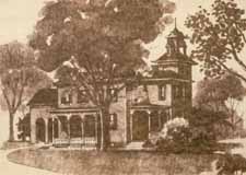 The land just south of Henderson and High was originally owned by Asa L. Parker, and was called Maple Grove Farm. Parker had purchased the land at sheriff’s sale in 1875 for $3,144. Judge Orlando W. Aldrich acquired the land from Parker in 1882, for the sum of $10,000. The old Aldrich home was charming, with a tower jutting two stories above the roof of the house. Judge Aldrich had used the tower as a study and a personal art gallery. From it one got a very good view of the Ohio State University buildings and the river valley. (Drawing by Bill Arter)
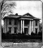 The farm remained in the Aldrich family until 1923, when Charles F. Johnson purchased it and sold it in turn to Frank Sweigart. Sweigart remodeled the house, converted it into what has been variably called “Southern Colonial” or “Greek Revival”, and moved it so that it would face Aldrich Road instead of High Street. The house was later demolished to make way for a parking lot.
Frank Sweigart
 Frank Sweigart worked for Charles F. Johnson for eight years. Sweigart was a sales manager, treasurer and then advertising manager under Johnson. He was also on the educational committee of the Columbus real estate board for two years. and a member of the state educational committee. He eventually resigned from Charles Johnson’s employ to become vice president and general manager of J. E. Martindill Inc., and was in charge of Marburn, a country estate development on Olentangy River Rd. This is a picture of him in 1923, given to me by his granddaughter Karen.
 He eventually owned the house which stood just south of the southwest corner of Henderson and High Street. Here’s a picture of his wife, Anna Sweigart, and six of her children on the porch of that house at 22 Aldrich Rd. Her sister is also in the picture. Frank Sweigart is the one taking the photo. (Photos courtesy of Karen Sweigart Longava.)
Maple Grove
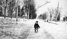 Here’s a picture of High Street looking north. Lulu Pearle Browne (Ohsner) and her dog are at the entrance to the driveway dividing the Browne and Al Cooke homes—presently the corner of West Cooke Road. The Aldrich house is on the left and Maple Grove church is in the center left. (Photo courtesy of the Ron Ohsner family)
Lulu Browne Remembers
 Elsewhere on this web site, I’ve praised Lulu Pearle Browne, who in 1992 gave a presentation to her church, Maple Grove United Methodist Church, and in so doing preserved some wonderful Clintonville history. Her son Ron and the church allowed me to copy some of the materials that she prepared for these presentations, as I wrote my book. Some of the material can also be found elsewhere on this web site.
Just for the archival record, I’m also including PDFs of the some of the material Lulu wrote.
She wrote her memories of some of the plays the Maple Grove community produced, up to and including the 1950s (29 pages); and she gave a presentation on changes in the neighborhood (24 pages).
(Documents courtesy of the Ron Ohsner family)
“Civilized man cannot live without Cook[e]s” –Owen Meredith
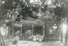 Ed Cooke was one of the sons of H. C. Cooke. This was the house of Ed Cooke; it was located on the east side of High Street where the Beechwold Theatre building—now the Columbus Sports Connection– now stands.
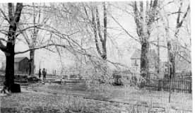 This is a picture taken from Ed Cooke’s yard, looking northwest toward the Webster and Browne homes. According to the picture caption written by Lulu Pearle Browne (Ohsner), the fence at the right divided Ed Cooke’s “dooryard” and “barnyard;” and a hollowed stone watering trough stood under the big tree at the corner of the picket fence to water horses going and coming from the barnyard. The larger figure standing in High Street looking north is Al Cooke. The barn across High Street is the Hess barn. (Photos courtesy of the Ron Ohsner family)
Albert Clement Cooke
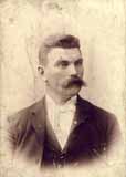 Albert Clement Cooke (shown here) was one of the sons of H. C. Cooke. To the right is a picture of Albert’s house.
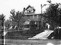
Albert’s land was in modern times rented for a Sandy’s restaurant, which later became a G.D. Ritzy’s ice cream parlor. Albert’s son was the first OSU athlete to participate in the Olympics; he ran in the 1912 Olympics in Stockholm. Albert’s grandsons Carl and Grant Cooke still live in central Ohio (Photos courtesy of Carl Cooke)
Treasure Map
 A handwritten map of the neighborhood, created by Lulu Pearle Browne (Ohsner), helps to clarify who lived where in the Maple Grove neighborhood in the early 1900s. You can click on this thumbnail and zoom in for a better view. (Photo courtesy of the Ron Ohsner family)
Cooke Cemetery
The Cooke family cemetery was located near the southeast corner of Cooke Road and High Street. According to genealogy records, the earliest headstone dated to 1817. Most of the graves were moved to Greenlawn or Union Cemeteries when Bishop Watterson High School was built in 1958. A few headstones were later discovered on a lot on Lenappe Drive. I would love to have some pictures of this cemetery.
There was also a John Rathbone Cemetery at the intersection of Morse and High.
George P. Whipp (b. 1817)
George Whipp came to the area with his wife and two sons from Maryland in 1833. His son George P. was 16 years at the time, and initially worked as a carpenter. Son George married Lucinda Smiley, and they had 10 children one of whom was also named George. The family farmed and had two truck stands along North High Street. (Note: Sometimes the family spells its name with one “p”.) A bit more biographical information can be found in A Centennial Biographical History of the City of Columbus and Franklin County Ohio (Chicago: The Lewis Publishing Company, 1901) p. 770 excerpted here.
Whip family
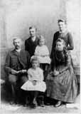 One of the oldest families in Clintonville is the Whipp Family (sometimes spelled Whip). They owned a farm, and a couple of stands along High Street that had big large orange signs advertising a refreshing drink consisting of freshly squeezed orange juice. The Whipps may have been the first owners of the mill located just north of Henderson Road and the Olentangy River. Here is a picture of the Whipp family circa 1889: George, Oscar, Everett, Laura, Cora, and Mabel. (Photo courtesy of Sue Gallogly)
The Whips lived at 73 East Weisheimer.
Schreyer house
How I would love to acquire a picture of the old Schreyer House. This was described as being one of the first high-class homes in its neighborhood. The property was 50 acres, from High Street to the Olentangy River, bounded by Henderson to the south and the “Stewart and Weisheimer farms to the north.” The grand house was built by Barney Phinney (one of the owners of the Worthington Pike) about 1893, and was subsequently sold to G. Schreyer, a Columbus stove and furnace manufacturer.
Two excellent orchards grew on the place. A windbrake of splendid walnut trees protected one orchard and a row of fine maples formed the windbrake for the other. There was also a very good spring just west of what is now Rosemary Parkway. Surrounded by rose gardens and shrubbery, the house was an imposing structure with pointed gables and the interior finished throughout with solid walnut.
Mr. Schreyer died in 1901, and his wife (Ernestine Zeller, after whom Zeller Road was named) moved elsewhere. The old Schreyer house was eventually subdivided into apartments. The house burned down in 1913; the Columbus Fire Department had been called but could not respond, because there were no water lines in that vicinity at the time. The land was purchased by Charles Johnson in 1923 and subdivided into the Rosemary Development.
And as a side note: “Rosemary” was the name of Charles Johnson’s mother.
Train Wreck
 This is a train wreck that occurred in 1880 north of Hudson, at the Big Four Railroad tracks. (Photo courtesy of Judy Cohen)
Dodridge Bridge
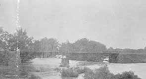 As my book shows, there was once a covered bridge over the Olentangy River at Dodridge Road. The Dodridge covered bridge was replaced by a truss bridge built by the Columbus Bridge Company. This picture shows the replacement bridge in 1890. Fishing from the bridge was a favorite activity for many 20th century Clintonville residents. It was a lovely river, and crappy and small mouth bass abounded. (Photo courtesy of Columbus Metropolitan Libraries)
Full of Glee
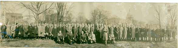 I love the story of the Republican Glee Club. Here it is: It was 1872, shortly after the nomination of Ulysses S. Grant for his second term of President. Some men were enjoying a convivial evening in one of the rear rooms of the Old Ambos Restaurant and Café on South High Street, and discovered that they all liked to sing and all were Republicans. Henry W. Frillman, one of the group, had just returned from Chicago and reported on the activities of a political glee club he heard sing there. The men decided to start a Republican singing and marching club, and called themselves the Grant and Wilson Glee Club. They rehearsed rigorously and became much in demand at rallies around the state. They were even invited to take part in the inaugural festivities in D.C. After the election, the group disbanded but in 1876 reconvened as the Hayes and Wheeler Glee Club. Members participated in four successive campaigns, and participated in state and local campaigns as well. In 1895 they incorporated as “The Republican Glee Club of Columbus Ohio.”
In the late-1920s, they moved their headquarters to 57 Weber Road and remained there until about 2000. The building is now a private residence. (Photo courtesy of Tom Atzberger)
Broadway House No. 1
 North Broadway was developed by the Loren and Dennison company in 1897; it was intended to be the place to live, and it was. James Loren originally planned to call it the Oakland Addition, but the post office requested he change the name to avoid confusion with another neighborhood. It had a small railroad depot and post office at North Broadway’s east end at the Big Four Railroad track. This house at 510 North Broadway Street was the first house built in the subdivision. It was built around 1890. It was sometimes called Acton Place, for reasons I was unable to discover. By 1894 it was owned by a man named E. Howard Gilkey. The William W. Daniel family purchased it in 1896, and the house remained in that family’s hands until 1961. It burned down in 1966. My Clintonville and Beechwold book has a photograph of the original house; this photograph shows the fire. The spot is now occupied by Columbus Speech and Hearing Center. (Photo from an unnamed newspaper clipping)
The Loren House
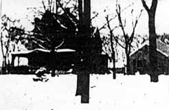 I also found a handwritten history that said that this was the first house built on North Broadway and was lived in, or owned by, someone named Loren. I do not recognize the house—do you? (This very poor image was taken from a photocopy of a microfilm.)
According to the 1896-97 city directory, there was also a Jeremiah C. Loren (motorman) living 1 building north of North Broadway on the east side of North High Street.
Mary Rodgers (resident of East North Broadway who has been researching the houses along East North Broadway) believes this is a picture of 625 East North Broadway, a house which was in the Broadway Villa subdivision and which I have written about here. It was lived in by the MacIntosh family.
Broadway House No. 2
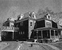 East North Broadway was developed by the Loren and Dennison company in 1897; it was designed to be a posh neighborhood, each house on a 1-acre plot of land. It had a small railroad depot and post office at North Broadway’s east end at the Big Four Railroad track. This house at 242 North Broadway Avenue was the second house built in the subdivision. (From Business First magazine)
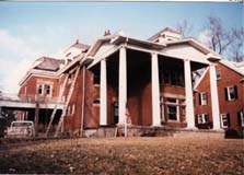 242 East North Broadway was renovated beautifully by owner Gary Means. The care with which he selected materials and kept true to the house’s original design takes my breath away. The house has not always been so lovely. For several years–prior to the present owner–this (to the right) is what it looked like.
On Broadway (…on Broadway)
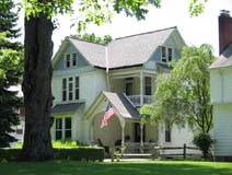 My book, Clintonville and Beechwold, page 19, shows an image of East North Broadway, looking east toward Indianola Avenue in the late 1800s The large house to the right of the photograph (south side of North Broadway) still exists at 489 East North Broadway (top photo).
The building just to the left of 489 in the photograph still exists as well, as a private residence; it was originally the carriage house of the large house on the south side of North Broadway in the distance (bottom photo). That large house was formerly 625 East North Broadway in the Broadway Villa subdivision.
East North Broadway
According to a 1999 Booster article by Anne Barry, in 1923, East North Broadway was the only paved street north of Fifth Avenue. It was paved with Hallwood Block, and the sidewalks were paved with brick as well. Old maps show a traffic circle at the intersection of East North Broadway and Beech Hill Avenue/Calumet Street, which appears to have been put there for aesthetic reasons. I believe half of this circle remained as late as 1985.
St. James in the Woods
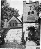 All the literature for St. James Episcopal Church states that it was organized in 1881, and that church members met in local schools before they had their own church building. I admit to being skeptical of that date and believe 1891—when James Loren began developing East North Broadway and donated a lot on Beech Hill Avenue (now called Calumet Street) for the church–is nearer to the mark. Some sundry facts about this, the oldest continually running Clintonville church:
• The original exterior was a Tudor Revival Style. The cornerstone was laid in 1894, and the mission was consecrated in 1896.
• The church was enlarged to a seating capacity of 200 in 1927; that was also when the church building got indoor toilets.
• The original church was traditionally covered with ivy. The ivy growing on the church grew from a shoot brought from Kenyon College in Gambier, Ohio, which in turn got its ivy from somewhere in “old England.”
(Photo courtesy of St. James Episcopal Church)
Who were Loren and Dennison?
 James M. Loren (b. 11/30/1849, d. 2/13/1931) was an attorney who loved real estate. He lived at the corner of King Avenue and North High Street (1371 North High Street) from the time of his marriage to Miss Annabel McMillen in 1878, until his death. He was closely identified with the family of former Ohio governor William Dennison, and handled their real estate affairs; he shared a suite of offices with William’s son Herman G. Dennison. Loren laid out, platted, and sold not only East North Broadway but also Dennison Place, Dennison Park, Dennison Summit, and a few other subdivision in northern Columbus and Worthington. Loren’s daughter married Joseph Walter Jeffrey. James Loren’s mausoleum is in Greenlawn Cemetery, lot 41, section 56. For more information you can read his obituary from the Columbus Dispatch Feb 13, 1936, p. 6A, and his biography from Osman Hooper’s 1920 book, History of the City of Columbus, Ohio, pp 453-454.
Herman G Dennison died in 1912 at age 59 in an automobile accident. More information here.
This information came to me courtesy of staff at the Genealogy, History, and Travel Department of the Columbus Metropolitan Library System.
Wondering who these people are?
The people at the top of my banner, I mean. Well, I am wondering too. I believe this is the Hollenback family (the family that started The Booster, and who lived on High Street) but I have been unable to confirm who the pictures are of, or where the photos were taken.


Looking West from 3134 North High St, 1896
 This photograph was labeled, “Looking west from 3134 N. High, 1896”. It’s an exciting glimpse of how Clintonville used to look. (Photo courtesy of the Dawson family.)
Bottled water back then?
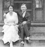 Pearl Fisher lived at 129 West Pacemont for nearly 70 years until her death in 1970 at age 82. [The house has since been torn down.] She moved there as a young girl, when Pacemont (then called Jason Avenue), was a gravel road with houses far apart and the mailman traveled his route in a buggy. There was a spring on the West Pacemont farm which her parents, Mr. and Mrs. Joseph Fisher, owned. They sold this spring water in bottles to residents all over Clintonville, delivering it by horse-drawn wagon. They stored the bottles in a little shed attached to the house. –from The Booster, January 4, 1978.
The Jones’ of North Columbus
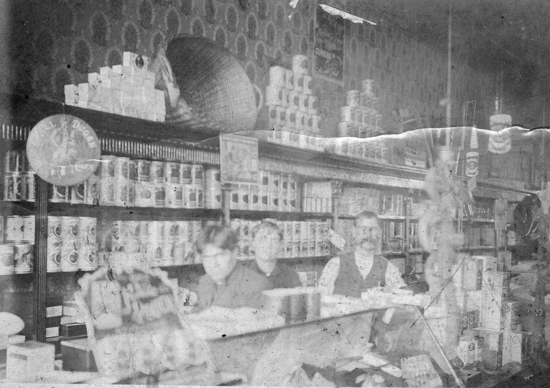 C. F. Jones Grocer used to be located at 2581 North High Street, where Schreiner’s Hardware Store is now. This image was taken around 1904 inside of the Jones Grocery Store. Shown are sons Charles and Clarence with their father Frank Jones.
.
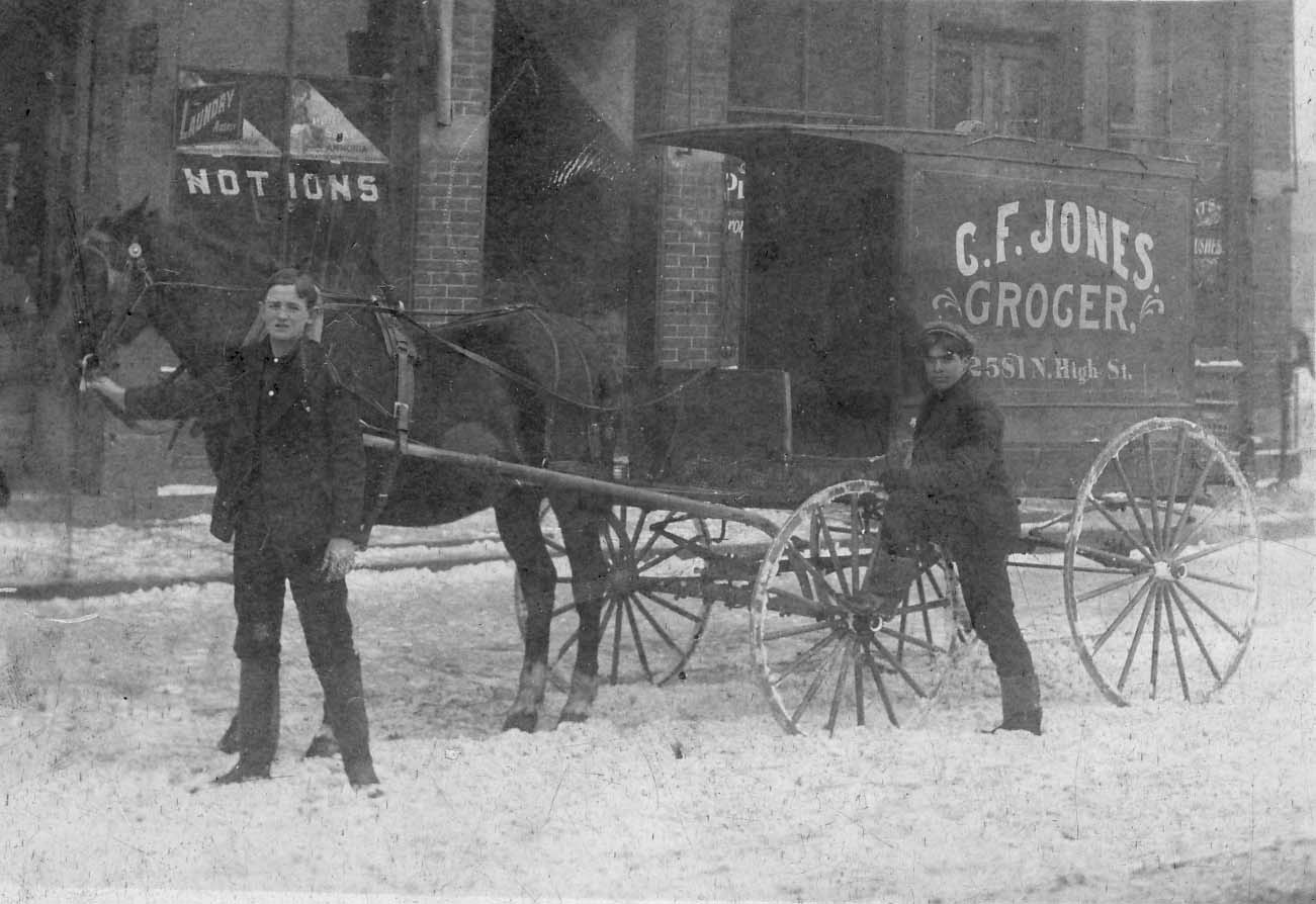 This image of their delivery wagon dates from 1909. Charles Jones is besides the wagon and the young man holding the horse is unknown. They are standing in front of their store.
.
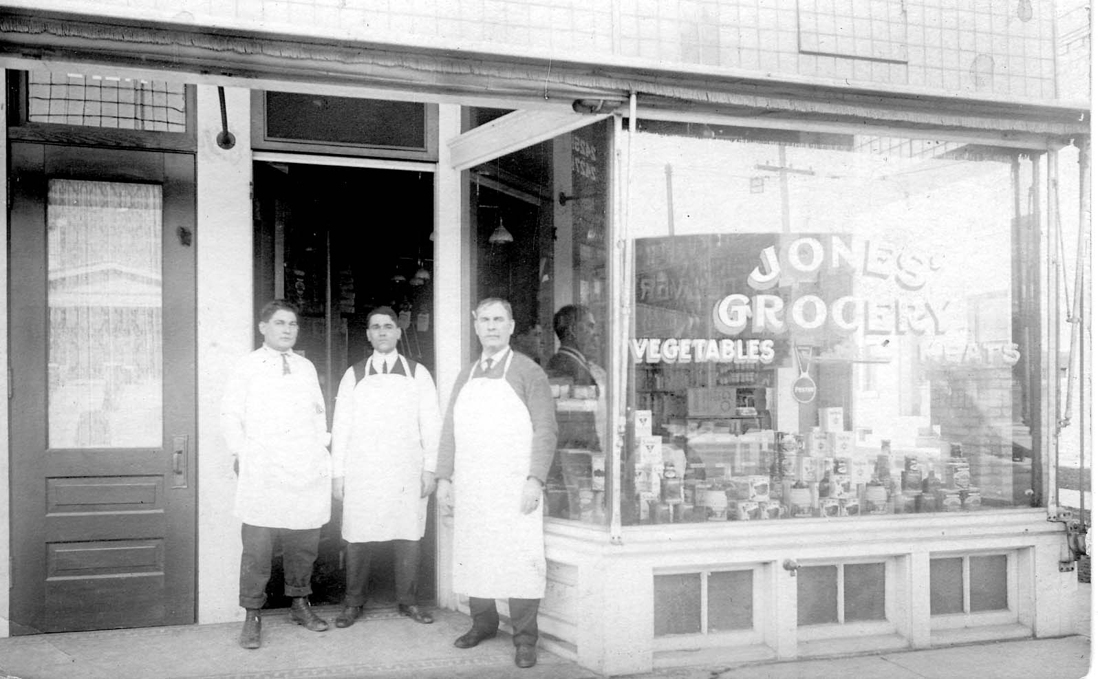 This photo of the C. F. Jones Grocer Co. was taken around 1916. Shown are Charles, Clarence, and their father Frank Jones.
.
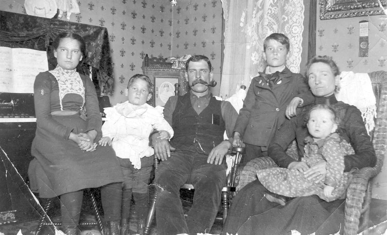 This is a picture of the C. Frank Jones family in their home at 2665 Adams Avenue, Columbus, circa 1900. Bertha May Jones Aurand (1889-1934), Charles M. Jones (1895-1956), C. Frank Jones (1861-1937), Clarence A. Jones (1891-1950), Miriam Tozer Jones (1869-1941), Gladys A. Jones Reiger (1899-1930). (Photos courtesy of Frank Jones.)
J. T. Herrick Saloon
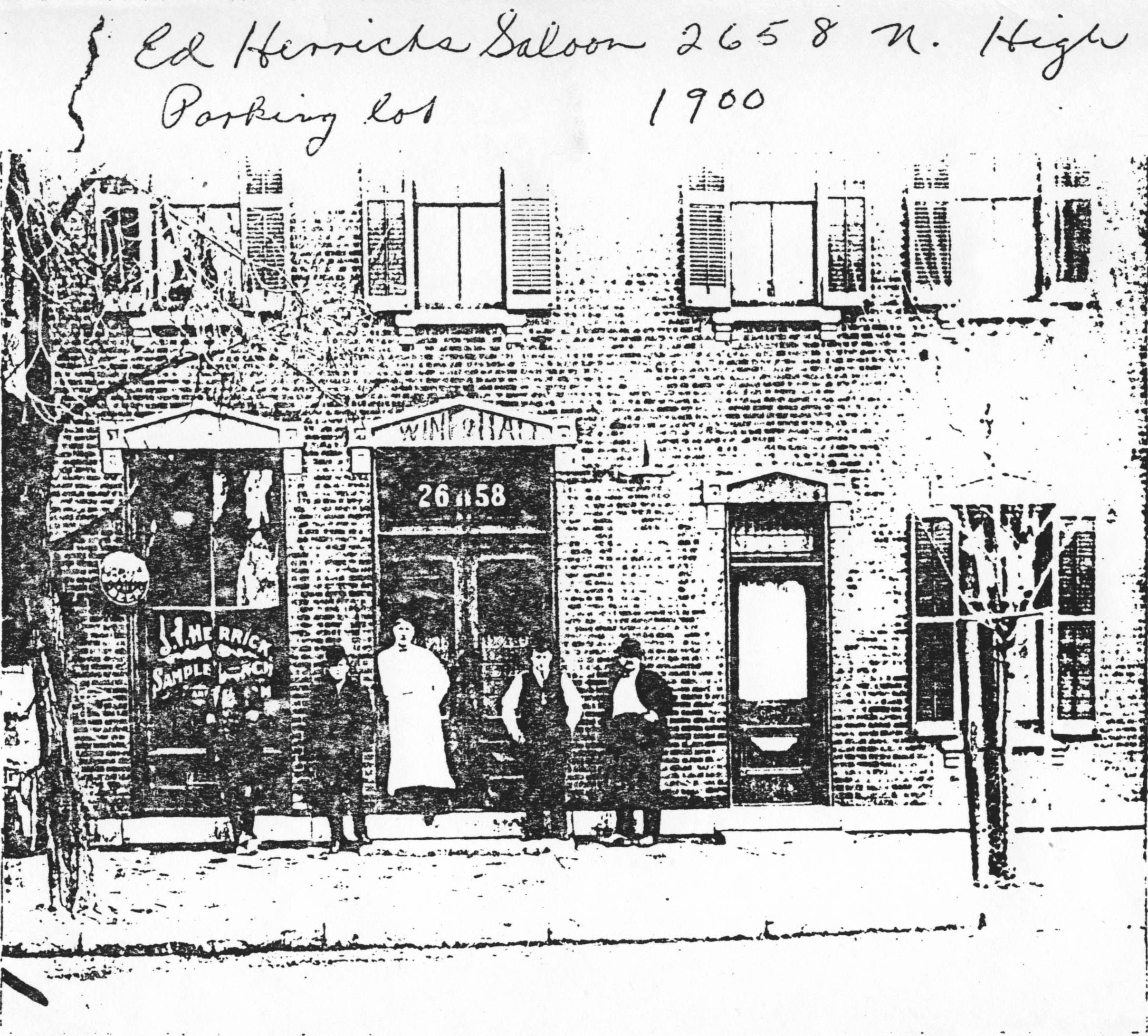 Ed Herrick’s saloon, at 2568 North High Street in 1900. (Photo courtesy of Frank Jones.)
Kellar Barns & Livery Stable
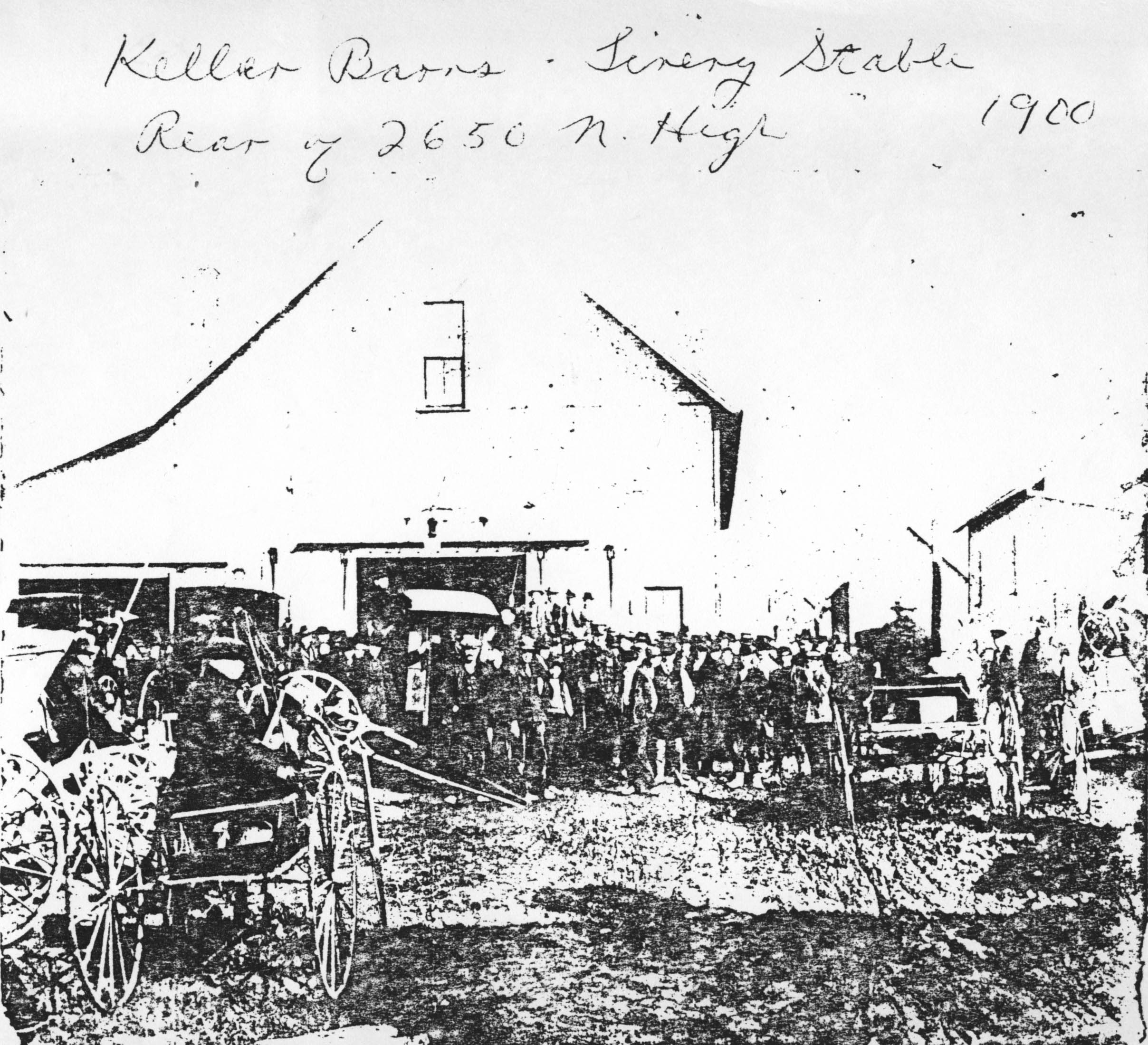 Kellar Barns & Livery Stable, rear of 2650 North High Street, in 1900. (Photocopy courtesy of Frank Jones.)
Let’s Go Krogering!
 The second business north from the northwest corner of Hudson and North High Street, at 2579 North High Street, was Kroger’s. Look at the books lining the north side of the store! Frank Jones was the butcher and manager of the store. (Photo courtesy of Frank Jones.)
Are You Ready for the Football?
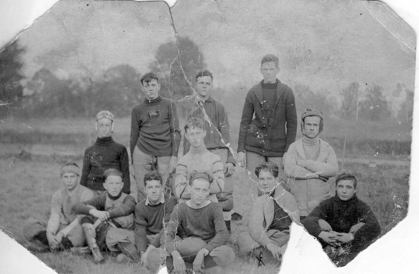
Here’s the 1908 Old North Columbus Boy’s Football Team. Top row: Lee Billing, Pick, Bud Campbell. Center Row: Daygo Matthews, Art Rodes, Harold Caine. Also in picture: Nate McCoy, Charles M. Jones, Gazaway Moccabee. (Photo courtesy of Frank Jones.)
“One Look Means a Lot”
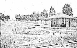
Fallis Road in the Dominion Park Addition, in 1913, showing office, sidewalks and forms set ready for curb and gutter. –from Dominion Land Company Columbus Home News July 1913, Volume 1 Number 4.
Gatekeeper’s House
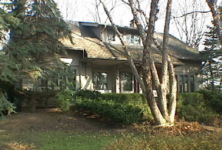
This wonderful arts and crafts-styled home on West Beechwold Boulevard was the gatekeeper’s house for the Columbus Zoo, originally located where Old Beechwold is today. It was renovated in the 1990s in the Arts and Crafts style and still has the original cistern.
Joseph Jeffrey House
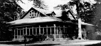
Joseph A. Jeffrey, a Columbus manufacturer, built this house around 1906 as a summer home. The land had previously been a zoo. Jeffrey’s wife called their estate Beechwalde, meaning “beech forest.” Jeffrey sold his property in 1914 to Charles H. Johnson, a Columbus land developer, who changed the name to Beechwold (because it was easier to spell) and sold plots for $1200. (Photo courtesy of the Columbus Metropolitan Libraries)
Jeffrey Outbuilding
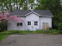 The old barn, an outbuilding of the Columbus Zoo, and eventually the Jeffrey summer home in Beechwalde, still stands and was remodeled, on the request of the homeowners, by students at the Interior Design Institute in 1983 for use as a guest house. (Photo courtesy of Terry Miller)
Beechwalde
The photos you are seeing here are lovely images of the Beechwold area (west side of High Street) before, or as, the land was being developed into the housing subdivision we know today as “Old Beechwold.” Some of these photos were later used in a promotional brochure–a lovely brochure called “Beechwold the Beautiful,” with a dark green heavy paper cover tied with dark green string with engravings by the Bucher Engraving Co., illustrations and text by Stacy G. Taylor, and printed by the Stoneman Press Company. This same brochure has recently been reprinted by the TWIG organization for use as a fundraiser.
Why the spelling change? Previous owners Joseph Jeffrey had named his country estate “Beechwalde,” and it was changed to “Beechwold” for marketing purposes (=easier to spell) when the land was subdivided and sold for housing units by Charles Johnson.
These photographs were given to me by the granddaughter of Frank Sweigart; Frank worked for Charles F. Johnson for eight years. I am mounting the Beechwold photos in several postings to facilitate some comparisons.
(Images courtesy of Karen Sweigart Longava)


Beechwalde Cont’d #1


Compare these two images–a photo (albeit reversed) from the collection of Karen Longava Sweigart (granddaughter of Frank Sweigart), and a watercolor print from the promotional brochure from the early days of Old Beechwold. Did the photo inspire the watercolor? (Images courtesy of Karen Sweigart Longava)
Beechwalde Cont’d #2
Compare these two images of this wooden structure located somewhere on Beechwold property as the property was being subdivided into a housing development. You can click on the thumbnails to see them in a larger format.
 The first photograph shows tire tracks driving right up to the opening between the two sections of the structure. In that photo there are window panes in the windows, and the structure is surrounded by brush and foliage.
 In the second photo, the windows and the foliage are gone. A different photo of the structure during this era is found in my book, Clintonville and Beechwold.
I have been unable to find anyone who remembers the structure first-hand. (The first photo is courtesy of Karen Sweigart Longava; the second photo courtesy of Amy Westervelt.)
Beechwalde Cont’d #3
Compare this watercolor from the promotional brochure for Beechwold, Beechwold the Beautiful, to the image found in my book, Clintonville and Beechwold, on page 26. (Image courtesy of Karen Sweigart Longava.)

Topographic Map, 1903
This 1903 topographic map shows the road configuration of the intersection of East North Broadway and High Streets. To orient yourself, remember that there were no bridges across the Olentangy River between Dodridge and Henderson, so Dodridge is the southern bridge and Henderson next bridge north of that. Calumet Street did not exist, and many other side streets had as yet to be developed, or were called by different names than they are today.
Toll House
The Worthington Pike, now called High Street, was supported by funds collected from a toll gate which was located opposite from Olentangy Park. The gate was operated by the Applican family, parents of Mrs. N. E. McCoy. The pole was let down each night and not opened until 4:00 a.m. Dr. Albert Cooper was the North Columbus physician at that time. If he had gone north on a call. the toll keeper always waited up for him or else was roused from his sleep in the night to raise the pole and let the doctor pass through on his homeward trip. –from an old undated newspaper clipping
The answer to today’s hard economic times
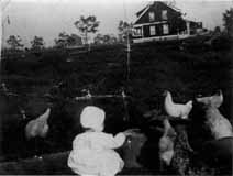
“The Dominion Land Company has purchased the Whipp and Ingham farm containing 90 acres of land, Stop 15 C.D. & M. on North High Street. The ground was purchased by the company to supply numerous customers with large lots where the soil is rich. It is to be platted into extremely large lots and will be sold on easy terms so as to enable a great number of people to follow their regular work in the City and at the same time, have lands where they can have a nice garden and keep a few chickens and thus help the problem of the high cost of living…The name of this sub-division will be Highland Gardens.” –from The Dominion Land Company Columbus Home News, May 1913, Volume 1 Number 2.
(This photo is Louise Corp on Tulane Road, but I’m sure the chickens of Highland Gardens looked much the same. Photo courtesy of the Clintonville Historical Society.)
Who wouldn’t want to live here?
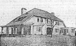 “The natural beauty of these lands would inspire even one not familiar with the business of platting of allotments. The elevation of this tract is nearly 920 feet above sea level. The middle section of these lands slope both east and west and to the south, thus giving the sunny side of the hill in winter and the shady side in Summer. The view from the top of the hill is the most magnificent and inspiring sight in or around Columbus. The rolling valley of the Olentangy River, dotted with beautiful forest trees, bungalows and other types of homes, show a real masterpiece of Nature’s Handiwork. Back of the beautiful valley the rising hills continue for miles and miles. The view in any direction from this beautiful location is almost without bounds…This new tract will be known as the Dominion Park Addition.” –from The Dominion Land Company Columbus Home News, May 1913, Volume 1 Number 2.
Caption: Dr. D.G. Sanor residence at the entrance to the Indian Springs Addition
Voting
According to a transcript of a WBNS-Radio broadcast salute to Clintonville on May 27, 1959 and reprinted in The Clintonville Historical Society’s January 2009 issue of its newsletter, Clintonville Heritage, Clintonville’s first voting booth was located at the corner of Weber and High, and on Election Day, the Ladies Aid Societies would work all day, serving hot dinners to the farmers who came to vote.
On Como
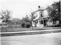 Como has a venerable history. The house of one of the Bull family members was located on Como; the oldest house in Clintonville is reputed to be there; Howard Westervelt (founder of North Broadway Methodist Church) lived there.
This charming house is located at 57 West Como and was built around 1903. The picture was taken sometime before 1926. (Photo courtesy of Verna Rogers)
“It’s Great Fun”
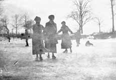 The river was a favorite skating spot in the early part of the century. Children also sledded on East North Broadway, and on “Mooney hill” at 259 Walhalla Road. In the summertime, there was a swimming hole colloquially called Bare-ass Beach in what is now Whetstone Park plus a legendary skinny-dipping spot in the river at the “Holt farm” near the C.D.& M. Interurban line’s Stop 18 around Lincoln and High. (Photo courtesy of Amy Westervelt)
Longview Barber Shop
 In 1918, after serving in WWI, Tom Pletcher came to Columbus hoping to find a job as a barber. Jimmy Kinnaird, a pharmacist at the corner of Brighton and North High Street, rented Pletcher a store room at the rear of the pharmacy. Pletcher ran the barbershop on Brighton (above) from 1919, and in 1921 moved to larger space at 3311 North High Street. After becoming ill, he sold the business in 1943 to a long-time employee named Bill Morgan. The barber shop moved again, in 1980 to 3325 North High Street. (Photo courtesy of the Clintonville Historical Society)
In 1945 Pletcher recovered and purchased a red brick building at the southeast corner of Beechwold and High, and opened another barber shop. Pletcher died in 1963, and that barbering business was subsequently sold.
Overcrowding–always
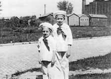 We tend to think of the use of prefabricated buildings for temporary quarters a new idea, but it seems to be as old as our township schools. I have found pictures of old World War I military barracks, and also portable voting booths, used for schools all over Clintonville. Our Lady of Peace used both types of buildings. Glenmont Elementary School began life as a cluster of portable schools. Clinton Elementary School handled overcrowding with temporary buildings. Shown here are some portable voting booths at the old tile factory along Arcadia (where North High School presently stands). (Photo courtesy of Wallie Palmer)
Mathias Armbruster
Mathias Armbruster was born in Wurtenburg Germany in 1839 and came to the U.S.A. in 1858. He operated Armbruster Scenic Studios in Columbus—he painted scenic theatrical stage sets. Armbruster purchased the area around what is now known as Walhalla Ravine, and converted Clinton Chapel at 3100 North High Street into his private residence. His son Albert’s house was just north of Mathias’ home, where the parking lot for Southwick-Good-Fortkamp funeral home now is. Mathias eventually sold most of the acreage to a real estate developer, and helped name the streets after his beloved Wagner Ring Operas.
Mathias died in Columbus in 1920. Here he is shown looking west from the cupola on his roof. (Photo courtesy of Leeann Faust)
In the center, a view of High Street taken from Armbruster’s cupola; Olentangy Park is in the background. (Photo courtesy of Leeann Faust)
The photo on the right shows Albert Armbruster’s house. (Photo courtesy of Leeann Faust)


Floor Plan–3100 North High Street
The building at 3100 North High Street, originally Clinton Chapel and presently a funeral home, was converted into a residence in the late 1800s by Mathias Armbruster. Leeann Faust’s mother–a descendent of Armbruster–sketched out “before and after” floor plans for 3100 North High Street, from memory. “Before” represents the floor plan when Mathias Armbruster lived there. “After” is the floor plan as modified by subsequent resident Uncle Jack Sullivan ca. 1920. The second floor was converted into apartments. I’m including both Leeann’s mother’s first draft, and her “cleaned up” versions.


These are the floor plans after Jack Sullivan modified the residence. The 2nd story had been converted into apartments and aren’t shown here.


(Photos courtesy of Leeann Faust.)
You can search this site for “3100 North High Street” or “Armbruster” for more pictures of this building.
More Armbruster Photos
Leeann Faust gave me some additional images of the Mathias Armbruster home at 3100 North High Street.
 This photo shows the north side, kitchen door, and the house’s well below the arch. The verso of the photo says “Aunt Flora Armbruster Neilson”.
 The verso of this photo says, “Back of 3100 North High Street [home of Mathias Armbruster] / Steps from Walhalla to Pergola”
 Pauline and Katrina facing west from the kitchen door at 3100 North High Street.
 “Garden and Pergola / North side of [3100 North High Street].”
 This picture shows Albert’s house, located just to the north of 3100 North High Street.
 Another view of Albert’s house taken from the north window of 3100 North High Street.
(Photos courtesy of Leeann Faust.)
North Congregational Church
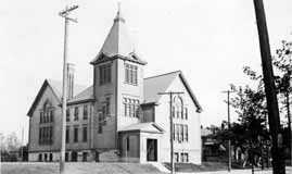 This church is not in Clintonville, but because it is so close to Clintonville I could not resist including North Congregational Church located at East Blake and East Avenues, on this website. The photograph was taken in 1900. (Photo courtesy of Judy Cohen)
Crestview House

This is a wonderful picture of the house that still stands at 253 Crestview. Despite what has been scribbled on the photo, the picture was probably taken around 1908 when the house is estimated to have been built. The people in the photo are standing on the east side of the house; the front is to the right (the side with the dormer). You can click on the image to enlarge it; there is something behind the house looks like a cemetery but is more likely an orchard which would have been in the vicinity of Kelso and Calumet. (Courtesy of Chris Althof)
Duncan & High
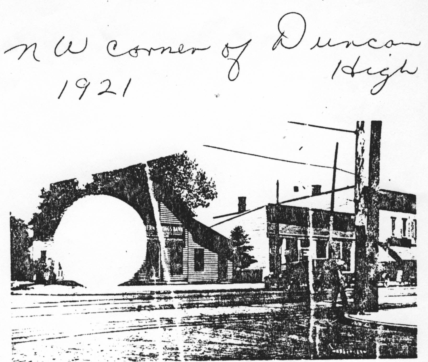 Northwest corner of Duncan and High Street, 1921. (Photocopy courtesy of Frank Jones.)
1916 Football
 This is the championship Clinton Township High School football team of 1916, with Rand Hollenback (the one whose teammate has his hands on Rand’s shoulders).
Virginia Walcutt Gay
 I tell the story of Virginia Walcutt Gay in my book, Clintonville and Beechwold. She was born May 9, 1831, and passed away on May 8, 1914. Mrs. Gay was a member of a Columbus pioneer family–daughter of John Macey and Muriel Brodrick Walcutt–and a sister of General C. C. Walcutt, once Columbus mayor. Her husband, Harvey D. Gay, died in 1878. This is Virginia’s private mausoleum at Greenlawn cemetery, section 32, lot no. 35.
Orphanage at 218 Jason Avenue / 56 West Pacemont
 Back in 1910, this address served as a home for children.
First of all, in case you are wondering, there is currently no 218 Jason Avenue or 218 W. Pacemont. Pacemont Avenue was originally called Jason Avenue. The area where the orphanage stands was outside of the Columbus City limits in 1910 & 1920, during many of the years when it operated as an orphanage. When the western end of Jason/Pacemont was added as the “the Aldrich’s Riverside addition,” the house numbers were adjusted to compensate for all the new lots. The current address is 56 West Pacemont.
The boarding house/orphanage/nursery was run by Judiah & Mary Ella Throps (sometimes spelled Throp or Throop). Judiah was born in 1844, served in the Civil War, and died in 1913. (His occupation was listed as “Painter” and also, in 1910, as “Nursery.” Mary Ella was born in 1865, and died in 1933. (Her occupation was listed as “Housekeeper” and occasionally “Nurse”.) Both are buried in Union Cemetery.
According to the 1910 Census, the Throps had one 7 year old son living with them (son Ernest Throps). Mary was at the time 45 years old. They also had 12 young boarders living with them, all under the age of 6 and many just babies.
By the 1920 Census, Judiah had passed away. The 1920 census states that Mary (by this time, age 55) had 3 children living with in her household: Earnest Throps (age 16); William Throps (age 9), Mabel Leonard (a servant, age 29) and Glendus Leonard (age 5, listed as a boarder). (I can’t help wondering whether there were additional boarders, not listed by the census taker.)
By the 1930 Census, Mary was 64. By this time she had quite a few extra living companions: William Throps (son, age 19), Richard Throps (adopted son, age 4), Helen Gatewood (servant, age 22), Jeanne Paden (8), Oswin Poletzie (7), Shirley Poletzie (3), Elva Waton (18), Marie Obrien (6), Charles Jordan (6), Mick Tudor (3), Virginia Adkins (2), and Algie Donaldson (2).
This research was conducted by Scott Caputo of the Columbus Metropolitan Library, Main branch, Geneaology, History, & Travel Desk. We are so glad he discovered this history. Scott had a library client who knew that their grandmother had a child out of wedlock in 1910. The grandmother had put the infant in an “orphanage” located at 218 Jason Avenue, where he died shortly afterward. The infant was Harry White and is included in the 1910 census in a list of around a dozen “boarders” at this address. All are under 5 years old.
Here’s a directory of the source material used for the above information, and also linked to above:
Sanborn Maps
Censuses
Business Directories
Death and Civil War Records
Tozer Sisters
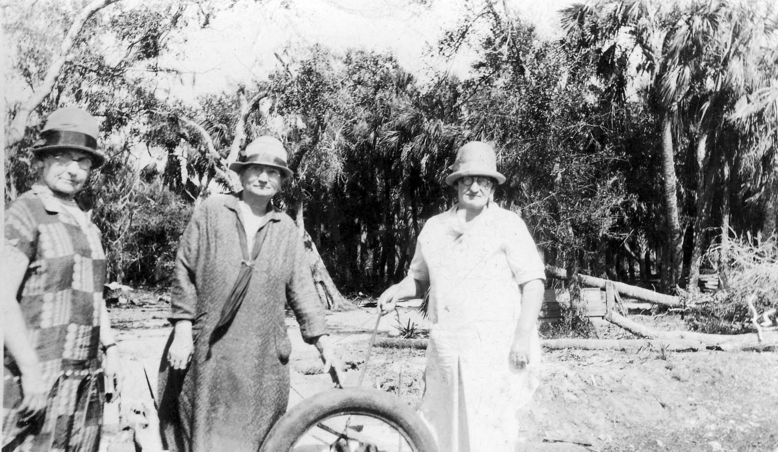 The three Tozer sisters, photo taken in an unknown location. Josie Tozer Kissinger (1875-1947), Miriam Tozer Jones (1869-1941), and Jennie Tozer Hopkins (1864-1951). Miriam Jones is Frank Jones’ wife and the grandmother of Frank Jones. The Jones’ lived at 2665 Adams. (Photo courtesy of Frank Jones.)
As Mike LeMay has pointed out in his comment, this photo does not appear to have been taken in Ohio.
Ankroms
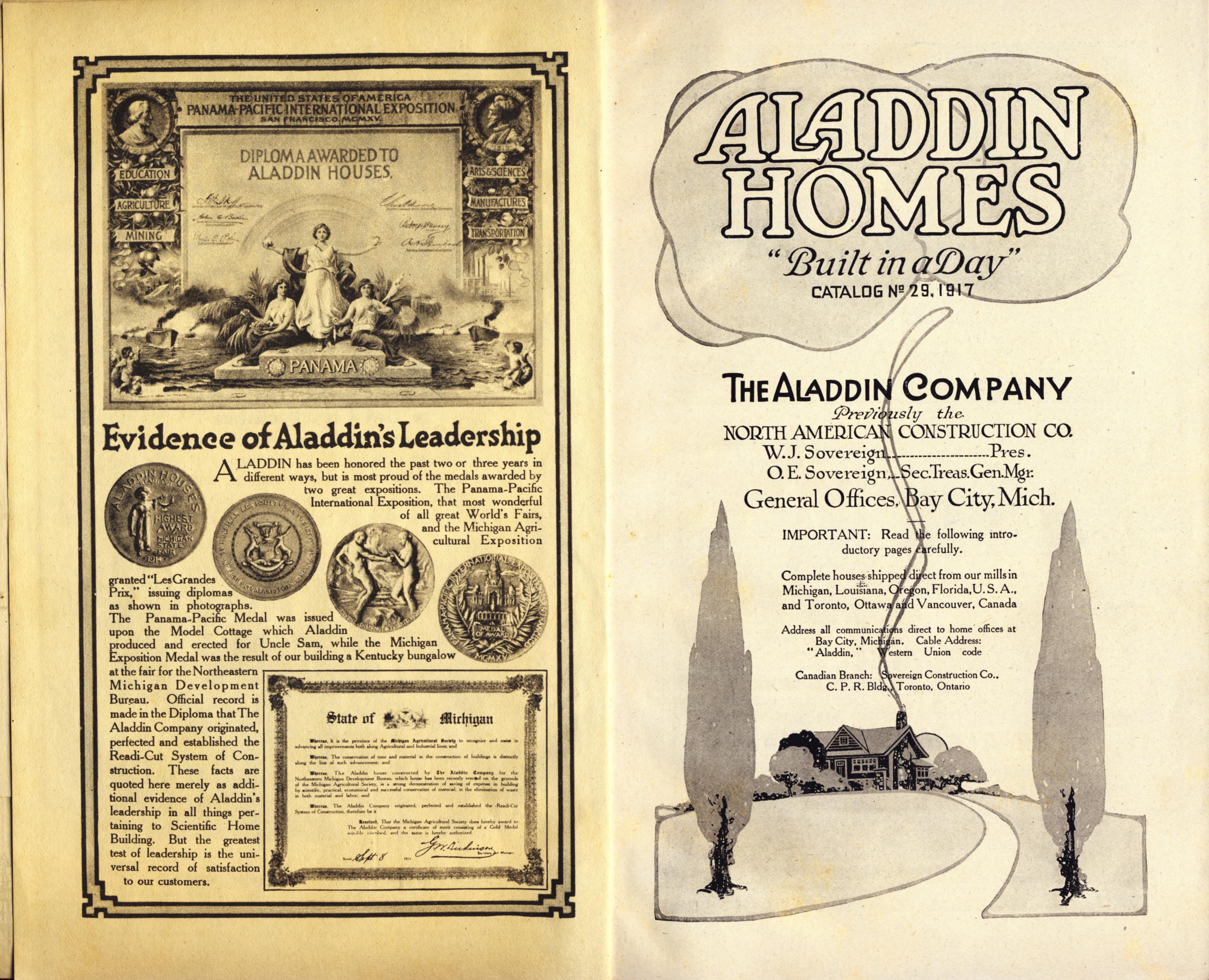
The house at 105 Weber was built around 1915, and current residents Tom and Margo Thacker have been researching the house and the family who lived there until 1965, the Ankrom family. The house itself is an Aladdin kit house; the images above are the Aladdin listing. In 1918 Charles Cornell, a machinist, lived in the house.
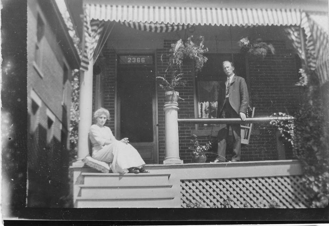 Solomon and Lydia Ankrom (shown to the left), their son Lindsey and their daughter Estella lived at 2366 North High Street in early 1918.
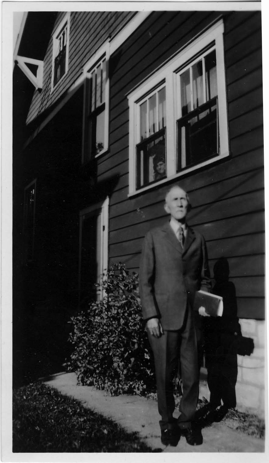
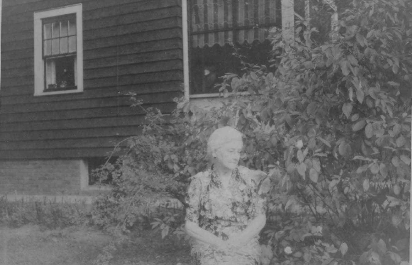 The Ankroms moved to 105 East Weber (shown in the photo on the right) around 1918/19. Solomon (1857-1935) was possibly a blacksmith, and may have been retired by the time he moved to Weber Road. Lydia Dixon Ankrom (1861-1948) was his wife. The family originally hailed from McArthur Ohio. Solomon and the rest of his family are buried in Sunset Cemetery.
After his marriage, son Lindsey (1884-1971) lived with his wife Grace Hafford Ankrom nearby at 100 Walhalla. In the wintertime the two households could probably wave at each other across the ravine. In 1918 he worked at the McDonald Steube Company Grocer Co., located at 60 East Gay Street. He married Grace Hafford Ankrom (1894-1975) in 1927. Prior to marrying Lindsey, Grace lived in the Hafford house at 100 Walhalla with her sister (and, I think, her brother). Grace was a teacher at Clinton School. For a bit more about this family, check my 100 Walhalla entry on this web site.
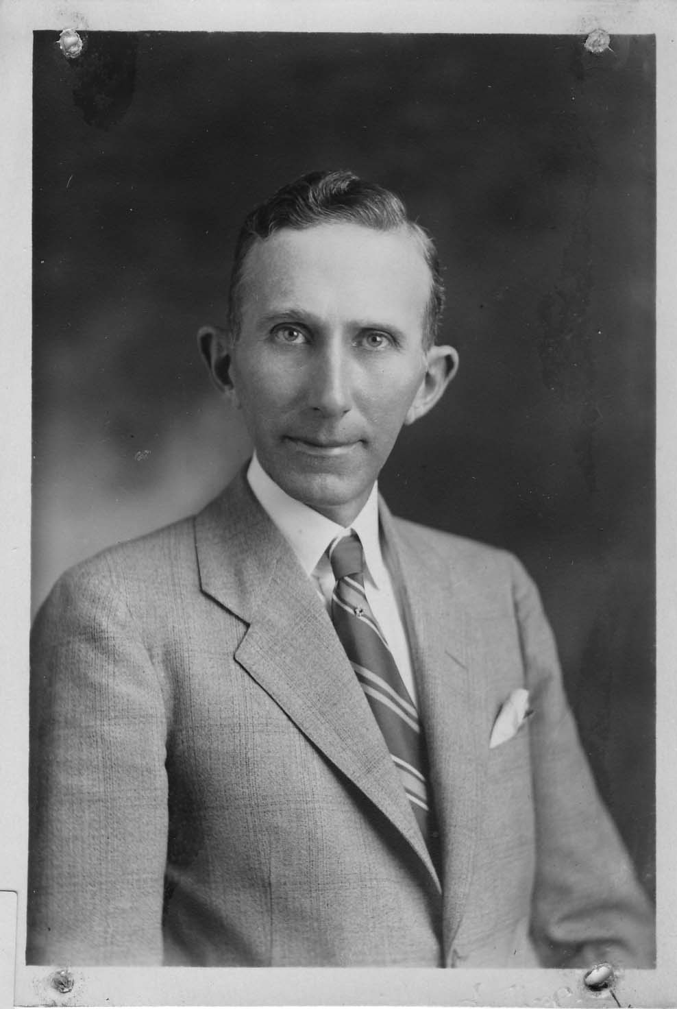
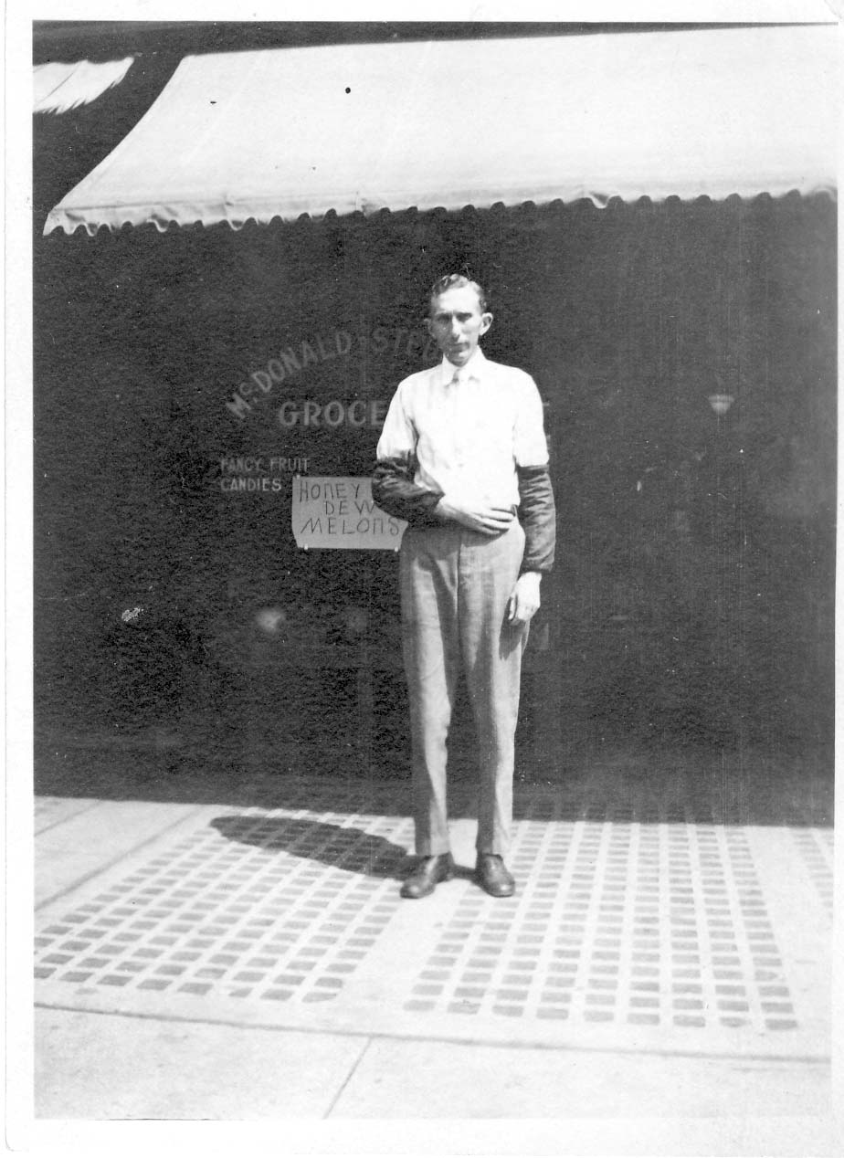
After his marriage, son Lindsey (1884-1971) lived with his wife Grace Hafford Ankrom nearby at 100 Walhalla. In the wintertime the two households could probably wave at each other across the ravine.
Estella (1888-1987) was Solomon and Lydia’s daughter. Estella never married, and probably lived in the 105 East Weber house until her death in 1987. She worked as a bookkeeper for Columbus Pharmacal on 326-336 Oak Street.
The final member of the Ankrom household was Sunny the cat, life dates unrecorded. Here’s Sunny enjoying Lydia’s lap with Lindsey and possibly Estella.
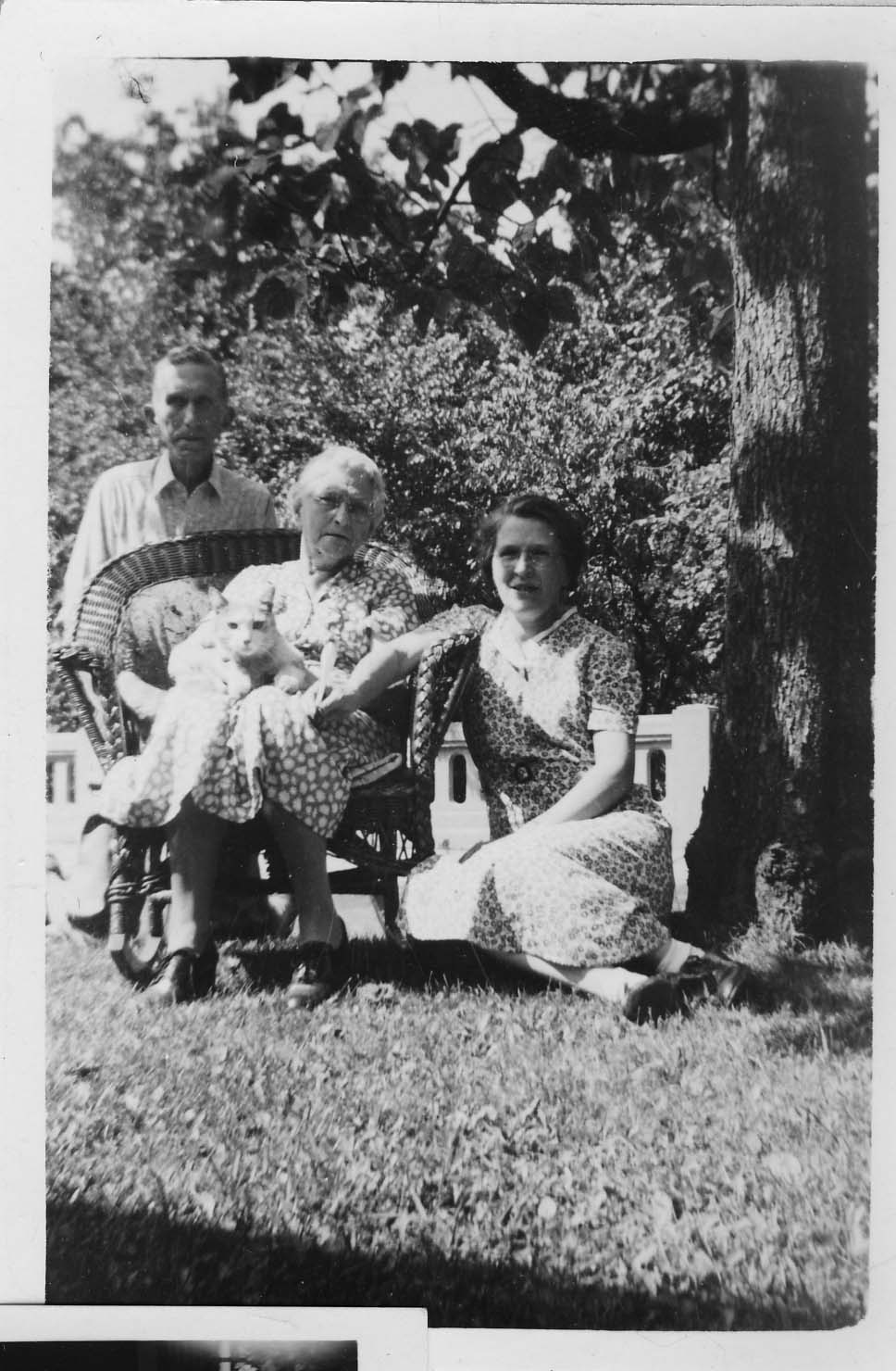
(Photos courtesy of Tom and Margo Thacker.)
100 Walhalla
In another entry on this web site, I mentioned that Lindsey and Grace Hafford Ankrom lived at 100 Walhalla with Grace’s sister Helen. Scott Hawley subsequently sent me some additional photos of the family and their home. Grace Hafford is Scott’s grandfather’s (Howard E. Hawley Jr.’s) aunt.
 This studio picture is Helen Hafford, in 1901. Like her sister Grace, Helen was a school teacher. (Photo courtesy of Scott Hawley.)
 This studio picture of Grace Greenwood Hafford (1883-1975) was taken in Chicago, Illinois in Jan 1909. (Photo courtesy of Albert Muth, Livonia, Michigan.)
 Lindsey and Grace after their wedding, with niece Genevieve Hawley (later Genevieve Muth) serving as flower girl, at 100 Walhalla. (Photo courtesy of Albert Muth, Livonia, Michigan.)

Lindsey in front of 100 Walhalla. (Photo courtesy of Scott Hawley.)

Another picture of Lindsey and Grace, taken in September 1965 at the Howard Hawley Sr farm on Miller-Paul Road in Harlem Township, Delaware, Ohio. (Photo courtesy of Albert Muth, Livonia, Michigan.)

Grace and Lindsey on one of their birthdays, taken in the Hawley home on Piedmont Road. (Photo courtesy of Scott Hawley.)

This photo of the house at 100 Walhalla was taken in 1975 and was used in the advertisement for the sale of the home. (Photo courtesy of Scott Hawley.)

And one more of 100 Walhalla presumably in the 1930s or 1940s. (Photo courtesy of Scott Hawley.)
Bower & Company General Store
 In 1914 the Bower & Company General Store was located at 2643 North High Street. (This address is currently a liquor store.) This is their delivery wagon around 1914. Standing on the wagon is Ott Helf, a friend of Charles Jones, standing next to the wagon. (Photo courtesy of Frank Jones.)
Never Too Many Cookes…(the article)
I wrote this article for the Clintonville Historical Society newsletter and am reproducing it here for your convenience…
Never Too Many Cookes…
by Shirley Hyatt
© Shirley Hyatt
We often think of Clintonville as having been established in 1847 near the intersection of Orchard Lane and North High Street on Bull family land, but we mustn’t forget that today’s Clintonville extends north to Worthington, and that other families contributed significantly to the development of Clintonville’s northern reaches.
One of the most vibrant little communities was centered near the intersection of today’s Henderson Road and North High Street (or more precisely, Cooke Road and North High Street). In streetcar days this was known as Cooke’s Corners, because it was established by the extended Cooke family.
Roswell Cooke came to Ohio from Connecticut in 1800 with his wife and five children. The two oldest sons, Chauncey and Rodney, took up adjoining land in the vicinity of today’s Henderson Road and North High Street. At the time the land was densely wooded, and the Cookes had to clear the land to establish their farms. By 1827 they operated large productive farms, had built grist and saw mills along the Olentangy River (near Weisheimer Road), and also operated a distillery.
Roswell died in 1827 at the age of 63. Son Rodney (1793-1833), a veteran of the War of 1812, married Laura Cowles and together they had nine children: Esther (married to L. J. Weaver), Roswell (m. Lorinda Skeels), Helen (m. John Good), Rosalia (m. John Webster), Rachel (m. William Buck), Laura (m. Lester Roberts), Rodney Romoaldo (m. Chloe Williams), Demon, and Henry C. (m. Abigail Taylor). Sadly, Rodney died when his youngest child was just 3 months old; wife Laura supported the family by working as a tailor. She herself lived until she was 73 years old.

Genealogies state that Henry C. was born “near Olentangy Park in 1825.” After his marriage to Abigail in 1852, he moved back to the old Cooke family homestead and gradually purchased property from the other Cooke heirs. Eventually he consolidated 300 acres of good productive farmland. Henry and Abigail had seven children: Clara (married to Wellington Webster of Findlay OH), Flora (m. J. L. Armstrong), Albert Clement (m. Lulu Brown), Edwin (m. Ella Haines), Mary (m. David Maize), Alice (m. Charles Hess), and Harry Lester.
Henry C. Cooke worked for awhile as a teacher, then as a farmer. He also went into the stock business (i.e. shipping stock). In 1879 he went into business with A. G. Grant to form Cooke, Grant, and Cooke, which constructed heavy masonry bridges. (This company’s projects may include the present Henderson Road bridge and a few others in the area.) Henry was one of the promoters of the Worthington and Columbus streetcar line. He was prosperous, and built a magnificent house along present-day North High Street at Deland Avenue. (You can see its photo in my book.)

I named the spouses of Henry’s children above to show how tightly knit the community was. The Webster’s family farm was south of the Cookes’ along today’s North High Street. The Armstrongs, the Maizes, and the Bucks, and Albert Clement Cooke, all lived a very short distance from Henry. Daughter Alice—a schoolteacher at the Clinton Heights school—had married one of the great-grandsons of Balser Hess and they lived in Henry’s grand home.
John Buck was one of the early pioneers who received a military land grant in the area; some records state that he sold the original Cookes their land. Descendents of John Buck had a market on North High Street; long-time residents still remember Buck’s market today, and short-time residents may still recall the Buck residence, an Italianate-style house just north of the northeast corner of Henderson and North High. The Bucks were related to the Cookes by marriage.
George Whipp came to the area with his wife and two sons from Maryland in 1833. Whipp had received 160 acres of land in return for military service, and he also purchased the mill property that had been built by the Cookes. (At some point in time the old mill on the river was called “Whipps Mill” and Henderson Road bridge was known as “Whipps Bridge.”) His son George (b. 1817) was initially a carpenter, and was credited with building many of the houses of Clinton Township. Son George married a neighbor named Lucinda Smiley in 1838, and they had 10 children (one of whom was also named George). The family farmed, and though much of the acreage was eventually sold off, the Whipp family continued to own a truck farm in the area. Old timers can still recall the big orange sign for Whipp’s Orange Mill, a fruit stand located at 4588 North High Street featuring fresh squeezed orange or pineapple juice. The Whipps were related by marriage to the Bucks. (Note: sometimes the family spells its name with one “p”.)
An article about this tightly-knit community warrants mention of two other families, the Aldrich family and the Phinney family. Orlando Aldrich (b. 1840) was a prominent judge, lawyer and OSU law professor. Aldrich was the first president of the Worthington, Clintonville & Columbus Street Railway Company and served in this position from 1891 to 1898; he subsequently held an office of the Columbus, Delaware, & Marion Electric Railway. Aldrich had purchased 23 acres of land on the southwest corner of Henderson and North High in 1882; it was a fruit farm called Maple Grove Farm. Aldrich had three great hobbies: horticulture, collecting great art, and collecting rare books about archaeology. He engaged in these avocations from his lovely house located about where Maple Grove Church parking lot is located today. According to artist and local historian Bill Arter, Aldrich had a magnificent view of the river and OSU campus from the turret of his house. This house was moved slightly, rotated, and completely revamped in the 1920s by subsequent resident Frank Sweigart. (For more information, see my web site, www.clintonvillehistory.com.) It’s from this farm that the area around Henderson Road and North High Street and the church get their names today.
Barnabas Phinney (ca. 1813-1899) came to the area in 1838, and purchased 60 acres of land near the northwest corner of today’s Henderson Road and North High Street. In addition to farming, Phinney was an investor in the toll road running from Columbus to Worthington, and in the electric streetcar company. He married Mary Smiley and was probably brother-in-law to George Whip. Their house was said to be majestic. They had no children, and after his death most of the property was sold. At some point (circa 1893) the house was sold to the Schreyer family, and then chopped into apartments. I would love to see a picture of this grand old home. In 1913 a fire broke out; the city fire department was called but there were no water lines that far from the city, and so the building burned to the ground. (Luckily, no one died in the blaze.)

By the early 1900s, this was a tight and thriving community. The houses were handsome. The Cooke family held annual reunions at the Cooke house—old photos show the family eating at long tables arranged in the shape of a “C,” and they kept an ongoing register with names of attendees and minutes. The community held plays to entertain each other, went sledding on today’s North High Street, went horseback riding along Indian Springs Drive, worked and had fun, and worshipped.
The original Cookes were said to be Universalists, but somewhere along the way most of them became Methodists. In 1842 Chauncey Cooke had leased a 32-foot by 99-foot portion of his land on the corner of Henderson and North High to the Clinton Township School district to be used for both education and religious purposes. A school house was built in 1878, and it was used by the Clinton Township School District as well as by local Christian worshippers. When Orlando Aldrich purchased his beloved Maple Grove fruit farm, his tract surrounded the school and church property, and Aldrich expanded the land dedicated for school and church purposes to three-quarters of an acre. In 1919, when the school district had ceased using the building for educational purposes, ownership of the building and land reverted to the Cookes. Family members agreed to sign quit claims, and the property was put into the hands of the Como Avenue Methodist Church until a neighborhood church could be formalized. In 1920 Maple Grove Methodist Episcopal Church officially organized and assumed ownership of the church they had probably long worshipped in.
The Cooke family had a family cemetery located on the southeast corner of Cooke and High. When Bishop Watterson High School was built in 1958, the graves were disinterred and moved to Union or Greenlawn Cemeteries.
Luckily the activities of the neighborhood were documented by Lulu Brown Ohsner–a Cooke family member, neighborhood resident and parishioner of Maple Grove Church who has since passed away—in some presentations to Maple Grove Church about 15 years ago. And, many Cooke and Whipp family members still live in the Columbus area, and have family photos and memorabilia. Henry C. Cooke’s contracting company Cooke, Grant, Cooke is still in existence; the current name of this company is the Fritz-Rumer-Cooke Co., Inc. It incorporated in Ohio in 1911, and still specializes in railroads and other general contracting. Sadly, most (though not all!) of the lovely homes owned by the Cooke family members have been torn down.
Clinton Heights Avenue Trivia
 I recently had the benefit of reading an abstract from one of the north-side-of-Clinton-Heights-Avenue residents.
A couple interesting things from the abstract:
Calumet Street, according to the abstract, used to be called “Oak Hill” before the name was changed to “Beech Hill,” and then changed to “Calumet.”
The alley along the north side of Clinton Heights traversed through the school property and then to North Broadway. I have often wondered about this vacated alley, which runs behind the properties along the north side of Clinton Heights Avenue and the south side of East North Broadway. It’s a recessed, ravine-like greenspace that doubtless has many city services running along its banks. You can see this alley in the 1910 and 1920 maps on my web site. The rumor passed to me by former Clinton Heights neighbors was that the North Broadway residents had petitioned the city to vacate this alley, but when the city approved the request, they gave the alley property to the residents of Clinton Heights Avenue instead of splitting it between the residents of the two streets.
The abstract gave me specifics of the vacating. By ordinance No. 38053 duly passed by the Council of the City of Columbus, Ohio, on May 2, 1927, the first alley north of Clinton Heights Avenue “from Beech Hill Avenue to the west line of lot 68,” 12 feet, wide, was vacated. (No indication in City Council minutes of who actually submitted the petition, and I have not bothered to look.) The City Council minutes are attached <here>.
More about the land that became Clinton Heights Avenue…
Henry Cooke once owned part of the property that was later developed into the Clinton Land Company addition.
I have often read an old anecdote that James Chesnut (sometimes spelled “Chestnut”), who owned the house on Wall Street, had blocked the improvement of North High Street along his property near Brighton and North High Street, because a beloved locust tree would be damaged or removed by the paving. The abstract bore some of this out. In the abstract (relevant pages linked here), the property developers were assessed $5400 for improvements in the Worthington and Columbus Plank Road, but, they said, these improvements were never made, because James Chesnut (and others) “were defendants procuring an injunction perpetually enjoining the making of said improvements along his premises.” The Clinton Land Company owners sued, or perhaps countersued, stating that they had been assessed conditional on improvement of North High Street, which improvements had not been made. Who won: You can read the attached excerpts of the abstract and decide for yourself.
The First Clintonville Library
 In my book, I wrote that the first Clintonville Library was at 3317 North High Street, near the corner of Longview and North High Street. What an intriguing fact! The Columbus Metropolitan Library Biography, History, and Travel Desk had brought this to my attention, and even sent me copies of minutes from old Board meetings where this was discussed. I’ve scanned them and you can read them here:
February 11, 1929 minutes
May 24, 1929 minutes
Tax Assessment List for 14 W. Lakeview, where the “new” library was built.
I’ve subsequently found an article in The Booster that told the same library story.
Patrick Murnan
Patrick Murnan lived from 1866-1937, and owned about 700 acres along North High Street north of Morse Road. I’m not going to repeat the story of Murnan here; it’s in my book. But, here’s a photo of the man himself.
Clinton Elementary School
 I would love to find a photograph of the original school at Clinton Heights and North High Street. According to one or two accounts, a Brevoort family member living in Michigan has one. The school pictured here ca. 1905 was the second Clinton Heights school building. It was yellow brick, contained 4 rooms, and faced High Street. Since students attended from all over Clinton Township in those days, many rode horses to school; the barn at the back was probably used for horses. According to the photo caption, most of the school moved into High Street for the picture. An interurban rail went up the center of High Street at the time, and the photographer probably stood on the tracks to take this picture. (Photo courtesy of Amy Westervelt)
 This is a picture of children in the classroom of the Clinton Heights school. (Photo courtesy of Amy Westervelt)
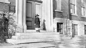 The second Clinton School was built in 1895 at 10 Clinton Heights Avenue. At the time, it housed both a grammar school and a high school. In 1904, the Clinton Township High School Building was built (pictured); it remains today as the Clinton Elementary East Building. A successor to the original building—still used–was built in 1922. (Photo courtesy of Amy Westervelt)
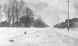 Overcrowding has been a chronic problem for schools. This photograph, looking east up Clinton Heights Avenue, shows some of the portable school buildings that were used as classrooms until newer school buildings could be erected. (Photo courtesy of Amy Westervelt)
3070 N High Street

Here is an amazing photograph of High Street, given to me by Stu Koblentz, who found this image in an old student thesis by Forest Ira Blanchard. The photo looks north, taken around 3070 North High. On the right (east) side of High Street I believe is the house of Mathias Armbruster, which later became the Southwick Good Fortkamp Funeral Chapel at 3100 North High Street at Weber and High. I’m told that some gravestones from the old burial ground are visible on the right. Check my book, Clintonville and Beechwold, for a better photo of this house. You can click on the image to see it in more detail.
[Citation: Blanchard, Forest Ira. 1922. An introduction to the economic and social geography of Columbus, Ohio. Thesis (M.A.)–Ohio State University, 1922. On January 16, I replaced the grainy version of this image on this web site with a higher quality photo after Joe Smith alerted me to its existence.]Chesnut House

And another amazing old photo of North High Street from Stu Koblentz. This photo also looks north, and was taken just south of the intersection of High and North Broadway. The house on the west (left) behind the little shack (marked “ice”) is the Chesnut house (aka Chestnut house), described in this web site’s “Water for Cookies” entry and also found in my book. The school on the east (right) side of High Street is the old Clinton Township school building, a picture of which is also in my book. You can click on the image to see it in more detail.
Stu’s theory about the Chesnut house is as follows:
The image shows the Chesnut house, facing North High Street, about where it currently stands. The facade that faces Wall Street today is the facade facing High Street. This is verifiable in the chimney placements.
So I went through Joe Testa’s web site and I think I know what happened to the house.
As far as I can tell the house stood approximately at 3327-29 North High Street. In the 1910s, when the house (which appears to have been built in the 1860s or 70s) is pictured, the house had been moved on a pivot to its current location, with its northeast corner remaining close to its original placement. This would account for the front lot build out, the twist in the alley and the sudden reemergence of Wall Street as well as the placement of the house in the picture, and the current location of the house.
What is interesting to me is why did they go to all that trouble, when its fairly common in urban settings to build a street facade onto a house and call it a commercial building. I think that part of the reason is that the house sat further back from High Street, making it too far away to convert to a commercial space commonly found in that era.
Update 2025-08-25 by Shirley–Another possible reason for reorienting this house might be found here.
Water for cookies
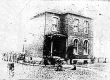 The township school located at Clinton Heights Avenue and North High Street did not, originally, have running water. Every day a child was designated to carry one bucket and dipper across High Street to the Chesnut house (see page 12 in my book, Clintonville and Beechwold) to fetch water that would be shared by the students. Legend has it that there were no lack of volunteers for water duty, as Mrs. Chesnut (or perhaps it was her daughter Fannie) always had cookies for the volunteer. This is a bad, yet significantly older, image of the Chesnut house.
Clinton El West
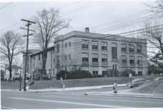 Overcrowded schools were a chronic problem, and the schools supplemented their brick-and-mortar ediifices with portable buildings. In response to the overcrowding of the east building, Clinton Elementary School’s west building was constructed in 1922. Both the east and west buildings have been in use for elementary and kindergarten grades since that time. (Photo courtesy of Columbus City Schools)
Sears houses


From 1908–1940, Sears, Roebuck and Co. sold “kit” homes through their mail order catalog. Customers chose a house from the catalog, and all the materials–precut lumber, carved staircase, nails, varnish, and instructions–would be shipped by railroad for homeowners to build themselves. The craftsman-style house at 149 Kelso was offered between 1911-1921 as “The Elmwood” in Sears’ catalog. (Photo courtesy of Lynn McNish)
Almost another Calvary Church…
As early as 1819, Methodists in Clintonville worshipped in people’s homes—the home of Eber Wilson has been mentioned– with circuit riders as preachers. Methodism was, in those days, a young and evangelical sect. When Thomas Bull, one of Clintonville’s early settlers, died in 1823, he left land in his will to build a church for the members, and that church was erected 15 years later at 3100 North High Street near Walhalla Road & High Street. Southwick Good Fortkamp Funeral Chapel occupies that building today.
The church membership decided in 1881 to sell the chapel and move the church to the thriving community of North Columbus, and they built a new church on East Tompkins. Several members dissented from this decision and, under the leadership of Eli Batterson, met at homes and at the Clinton School. In 1905 Howard Westervelt—great-grandson of Thomas Bull—reorganized a Methodist Sunday School, and church members worshipped in the home of Frank Dankworth at 70 West Lakeview. They founded Como Avenue Methodist Church in 1910. By 1924 they had outgrown that church and decided to build a new church edifice at North Broadway Avenue and Broadway Court. There were three candidates for the new church’s name: St. Paul, Calvary, and North Broadway; North Broadway was chosen.
Behind every successful man…
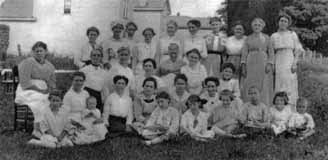
In my book I mentioned that the women of Clintonville were instrumental in building the community of Clintonville. According to North Broadway Methodist Church records, in 1906, the Ladies Aid Society was organized at Como Methodist Church. They pledged to earn $3000 a year for 5 years. They held bake sales and dinners, quilting parties and luncheons, and they met their goal. Their efforts were indispensable to construction of the Como Avenue Church Building and the Broadway Church. (Photo courtesy of North Broadway Methodist Church)
James Boyd Martin
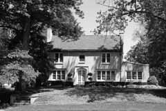 The North Broadway Methodist Church (built 1924) was designed by architect James Boyd Martin, who also designed his own house at 190 East North Broadway. His home is complete with an architecturally-consistent play house to the rear. Martin’s house was made of Indiana Limestone with green roofing tiles. (The original plans for the church called for limestone as well, but changed to brick for budget reasons.) Martin also built the house at 155 North Broadway as a wedding gift for his daughter. His son, Boyd Gibson Martin, eventually joined the architectural firm (Martin, Orr & Martin) and designed his own house at 256 East North Broadway as well as the Worthington Presbyterian Church (in 1927) and the Worthington and Westerville Libraries. Sadly, the Great Depression put the architectural firm out of business. (Photo courtesy of Lynn McNish)
The play’s the thing


In 1925, members of Maple Grove Church presented a play at the church. The play was Friendly Helpers Class. It was a success and was taken on the road to the Linworth and King Avenue Methodist Churches. The left photo shows cast members Katherine Cooke (Barbee) and Lulu Browne (Ohsner), Dorothy Cooke (Hambleton) and a neighbor playacting for the camera in 1925. The photo on the right is the program for the June production. (Photo courtesy of the Ron Ohsner Family)
Crestview Presbyterian
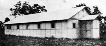
Crestview and Overbrook Presbyterian Churches were organized by the Reverends Walter Houston and Harry Barr, and both claim this “tin church” as their first home. In 1915 the Crestview congregation purchased five lots at Tulane and Esmond. They met in the tin church until 1918, when a more permanent structure was erected. In 1922 a larger church was built; the first brick structure was converted to a manse. (Photo courtesy of Overbrook Presbyterian Church)
Crestview Presbyterian grows
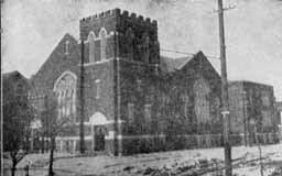 This is the newer Crestview Presbyterian Church, built in 1922 at Tulane and Esmond. (Photo courtesy of the Clintonville Historical Society)
The Park
Around 1880, Robert Turner founded the Olentangy Villa Tavern. It was a small picnic grounds and offered boating and swimming, perhaps a couple rides. By 1895 the park came to be owned by the Columbus Railway, Power and Light Company; enabling the electric company to earn money from both its electric streetcars and from electricity at the park, and ensuring streetcar traffic (with its use of electricity) not only during weekdays when commuters traveled to their jobs in the city, but also on weekends when residents traveled by streetcar to the park. In 1899, brothers Joe and Will Dusenbury purchased about 100 acres of the park and built it up into a state-of-the-art amusement park with nationally renowned entertainment in a lovely, picturesque setting. They offered rides, a pool, bowling alley, canoeing, an amphitheatre, even a Japanese Village purchased from the St. Louis Exposition. Many long-time residents recall happy and exciting days spent at the park.

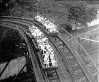
Eventually the park began to decline, and was eventually sold, and then sold a couple more times. In 1937 L.L. Leveque purchased the park and in 1939, built the Olentangy Village Apartment Community in the park’s place. (Photo courtesy of the Clintonville Historical Society)
South Glen Bridge
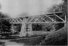 The streetcar came right to the entrance of the park, and from there attendees walked over a pedestrian bridge to get into the main park. This is a picture of the “South Glen Bridge.” (Photo courtesy of Chris Bourne)
Loop-the-loop
 Loop-the-loop and Shoot-the-Chutes were among the favorite rides at the park. Loop the Loop took riders on a 360-degree vertical loop. The unruffled gentleman appears unconcerned about gravity in this well-known image of the ride. The ride was said to be accident prone and was eventually torn down. (Photo courtesy of Galen Gonser)
Shoot the Chutes
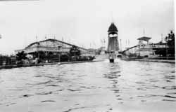 This photo shows, left to right, the Whirl Wind, Shoot-the-Chutes, and the Racer. Shoot-the-Chutes involved a long slow boat ride to the top, followed by a creaky turn, and then a steep descent, hitting water and wetting the riders to their unabashed delight. It was one of the favorite rides in the park. (Photo courtesy of Chris Bourne)
Fun at the Park
 Anyce Milam, a Columbus resident, shared these two postcards of the Olentangy Park with me for use on this web site. The first is a color picture of the ride, Loop-the-Loop, which had quite a few accidents and therefore did not last long in the park.
 The second postcard image was taken on the river near the Park’s canoe livery. The postcard was dated 1917. (Courtesy of Anyce Milam)
Clinton-Como Park…
 was originally called the American Legion Park Playground, presumably because Post 82 owned it or gave it as a gift to the community. Today there is a conical mound at the park. The mound was “built” sometime in the 1960s (tentative date) from the dirt displaced by sewer line construction.
Columbus Canoe Club
The house that currently stands on the north side of Orchard Lane at the river was once the Columbus Canoe Club. It has had only 4 owners in its lifetime, and the present owner had to do considerable renovation on the building. The club originally had tennis courts; the space is now a swimming pool. Sadly I know of just one photo of the club, which is located at the Ohio Historical Society. The current home owner told me that Bill Arter, an artist who drew and researched Columbus buildings in a Dispatch column called “Columbus Vignettes,” was in the process of writing a column about the club when he passed away.
Tennis
 The Clinton League created a community tennis club and tennis courts on Dunedin near Calumet Street, using two vacant lots owned by J. E. Pierson.
North High School
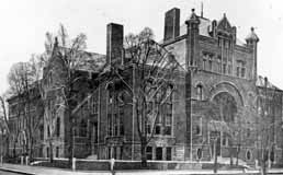 The original North High School, located at 100 West 4th Street at the corner of 4th Avenue and Dennison Avenue, had opened its doors on February 3, 1893 with eight teachers and 300 students. The student body quickly outgrew the building and an annex was constructed in 1902. That, too, became overcrowded.
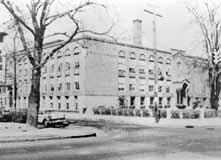 After a new high school was completed, the old building became Everett Junior High School, named after the first North High School principal C. D. Everett. This first building—designed by Frank Packard and built at a cost of $14,000—is still in use. As shown in the lower photograph, the turrets and other elaborate structures have since been removed from the school. (Photo courtesy of Columbus Metropolitan Libraries)
In 1921, the Columbus Board of Education purchased 13.15 acres for $35,000 to build a new high school. The property had been owned by the American Vitrified Products Company. The land bordered on a deep ravine; the ravine was considered to be an asset for science classes, as was the proximity of the property to the streetcar tracks. Many other sites had been considered, including somewhere on the campus of Ohio State University. Discarded bricks and baked clay shards had to be removed from the old brick yard before construction of the school could begin.
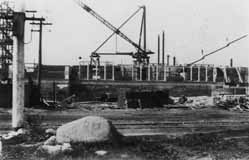
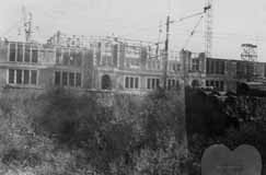
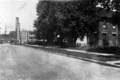
The new building was designed by architect Frank Packard and cost $1,000,000. Construction began in 1923 and the building opened on September 2, 1924. It graduated its first class in January of 1925. For a brief time, the new high school was named Edward Orton High School. It served as an anchor for the community; often three generations of Clintonville families attended the school. It was one of the city’s top college-preparation schools; between 90 and 95 percent of the students went on to higher education. North High School was closed in 1979 as part of the city’s desegregation plan and subsequently became an adult education center and has also served as temporary quarters for schools undergoing renovations. (Photos courtesy of Leeann Faust)
Pure Oil at Hudson & Indianola
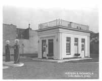 This diminutive Pure Oil gas station was located at the corner of Hudson and Indianola. It had an outdoor lift instead of service bays. The pump globes say Purol and Detonox, indicating the photograph is from the 1920s. Service bays were added to the station later in the decade. Union 76 purchased Pure Oil in 1965, and completely refashioned the station.
Bartlett’s Garage
Tom Bartlett was a leading Clintonville businessman. His garage at Kelso and High existed for many years. (Photo courtesy of the Clintonville Historical Society)


Mooney house
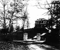
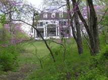
The white house visible from Calumet Street over the Walhalla Ravine bridge has such strong neighborhood presence. It was one of the first houses built along the ravine. It’s now known colloquially as the “Mooney House” after a physician who lived there for many years. Though rumored to have been the site of a tragedy and to be subsequently haunted, the rumor is most definitely false.
Crestview Foodtown
In my book I wrote about Crestview Foodtown, presently the Clintonville Community Market. The building has had many lives: at one time it was a Red & White (market), a Piggly Wiggly, and a Kroger’s. At one time there was a barber shop downstairs; and in the late 1920s the corner was a drugstore.
Sarah Breunig, community leader
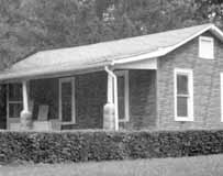 This house at 200 Glenmont is now gone, but it originally belonged to Sarah Breunig and her husband. Sarah moved to Clintonville as a young wife, before Glenmont was paved and before indoor plumbing. Sarah became one of the original community leaders of the Overbrook area. Sarah was a founding and active member in the Maple Grove Methodist Church, the Glenmont Community Club, Navy Mothers, and the Clintonville Women’s Club. She became the first female president of the Glenmont Community Club in 1968. (Photo courtesy of the Kerchner family)
Stella Wilson house
 The Glenmont Community Club first met on March 2, 1921 at 45 Glenmont to “discuss improvements pertinent to the community.” It met at the Stella Wilson home; Stella was head of the science department of the old High School of Commerce (later known as Central High School) and had purchased the house in 1920 at the age of 58. Miss Wilson served as secretary and remained a primary force in the Glenmont Community Club until her death. Stella’s sister Ida was a physician; Ida acquired the house in the 1930s after Stella died. (Photo courtesy of the Kerchner family)
Lehman Machine
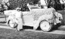 During Clintonville’s early years, it had many parades and this is one of the floats. The back of the photograph is labeled the “Lehman Machine” (machine was another name for automobile). According to the 1923 city directory, there was a David and Hattie Lehman living at 47 West Brighton Road. David was a sales manager for the Iron Clay Brick Company, and Hattie was a hemstitcher. (Photo courtesy of Amy Westervelt)
Brighton Road wins in parade for second time!
“Several thousand residents take part in North Side Field Day Celebration! Enthusiasm high!
“On a hot and sunny Saturday, June 2, 1923, the North Civic Association sponsored its annual celebration. Brighton Road, owner of the previous year’s wreath, captured first honors in the parade for the second time, while Longview Avenue challenged for second place. Brighton Road received $50 and Longview, $25.00. The impersonation of a number of historical and present prominent men was the feature of Brighton’s representation. The first prize for the best decorated automobile also went to this street, which produced a car encased in pink roses…”—from the Columbus Dispatch Sunday June 3, 1924
Patterson House
Novak Funeral Home is today a handsome presence along High Street. The house was built in 1927 by a man named B. F. Patterson, who also built two other near-identical houses on East Dominion for his children—one of brick, and the other a frame colonial house. (Florence Patterson Ruine lived at 27 E Dominion, a Dutch Colonial.) The house’s architect was V.S. Julian. Patterson was politically active and at one time ran for mayor of Columbus. The house was at one time surrounded by a wrought-iron fence. In 1953 the building became Beechwold Nursing Home, an enterprise which was closed in 1980. The building sat empty for 7 years. Novak purchased it and rehabbed the building, an effort requiring 13 months and who-knows-how-much money.
Korn family
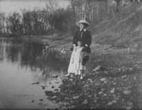 David and Alta Korn built a home at 4891 High Street, in old Beechwold, in 1920. They had an adopted son named William. The family was adversely affected by the Great Depression and lost their Old Beechwold house in 1932. This photo shows Alta and a child along the river. William raised his family in Clintonville and died in 1986. (Photo courtesy of the Clintonville Historical Society)
Gordon Brevoort’s Chickentown
 Several years back, Gordon Brevoort gave a wonderful presentation to the Clintonville Historical Society about he and his family’s life in Clintonville. The Brevoorts are one of Clintonville’s oldest families, and some still live in the neighborhood.
Gordon told the listeners about Chicktown, the fantasy land he and his friends played in.

The old Brevoort homestead has been torn down but I liked the old image of it. (There is a picture of it on page 12 of my book). More from or about the Brevoorts here.
(Documents and photo courtesy of Gordon Brevoort)
Playing on the railroad
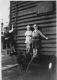 Brevoort brothers Frank Jr., Gordon, and Dale play on a railroad box in or near Worthington, in 1931. (Photo courtesy of Gordon Brevoort)
Gordon Brevoort’s Clintonville
 In another post, I mentioned that Gordon Brevoort had given a presentation to the Clintonville Historical Society on the history of Clintonville. He also made a map of the community as he remembers it in the 1930s.
You’ll find other information on this web site about the Brevoorts by clicking here.
(Map courtesy of Gordon Brevoort and the Clintonville Historical Society)
Sherman Private School
The Sherman Private School existed at 30 Webster Park Avenue in the early 1920s. Webster Park was a King-Thompson housing development and the school may have been an inducement to purchase houses in the area. (Advertisement courtesy of North Broadway Methodist Church)

East Como
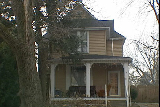 Perhaps the first house to be built on East Como was this house at 71 East Como. The owner from 1908-1926 said he recalled a little brook that ran near the house and a footbridge leading to High Street.
The Zimmerman Family and Olympic Swim Club
Libby Wetherholt recently gave this presentation about the Zimmerman family to the Clintonville Historical Society, and has kindly agreed to share it with us.
—
The Zimmerman Family and Olympic Swim Club
by Libby Weatherholt, March 8, 2016
The History of the Olympic Swim Club starts with Orr Samuel Zimmerman. (Photo courtesy of the Upper Arlington Historical Society)
Orr S. Zimmerman was born in Oakwood, Ohio in 1890 but moved to Columbus with his family when he was a child. He was educated in engineering at Ohio University and transferred his interest in mechanics to a career in the family automobile business.
In 1913, Zimmerman married Ethyle Cather, a native of Athens, Ohio. They moved to this house at 645 Dennison. (Photo courtesy of the Franklin County Auditor’s web site, property ID 010-044708 4/27/2014)

By 1916 the Zimmermans had begun building the house below at 1790 Cambridge Boulevard. (Photo courtesy of the Franklin County Auditor’s web site, property ID 070-000571 4/18/2014)

An historical picture can also be found on the Upper Arlington Historical Society web site.
The birth of their sons Robert Orr Zimmerman and Richard S. Zimmerman followed in 1918 and 1922, respectively.
By 1930, Audrey Ethyle Zimmerman had passed away and Orr had married Alice M. Zimmerman. The family had moved to 4497 Olentangy River Road—a house that remained an important part of the family history. (Photo courtesy of the Franklin County Auditor’s web site, property ID 010-006577 3/17/2014)

Zimmerman built the house in 1929 on what was then a 52-acre estate; at the time, Henderson was a country gravel road and Olentangy a narrow two-lane street. The architect was Thomas Tulley. Interior walls were decorated by a New York artist, with beautiful wooded scenes in both the trophy room and the living room. Two Canadian bear cubs, captured on a hunting trip, were raised in a small house on the property. In 1977 the house was a Decorators’ Show House. The house was destroyed in January, 2016.
Mr. Zimmerman had a special interest in outdoor sports, particularly hunting and fishing. Zimmerman’s hunting expedition in the Canadian Rockies with Upper Arlington founder and resident Ben Thompson was detailed in a November 1920 issue of the Norwester, complete with descriptions of the large game seen and hunted by the pair in British Columbia. Zimmerman submitted his own account of the trip to the Norwester, documenting the geography and vegetation of the region. (The Norwester magazine, published November 1917 through March 1922, chronicled early suburban life in the Upper Arlington, Grandview Heights, and Marble Cliff areas.)
Zimmerman also enjoyed pitching horseshoes and playing baseball. In 1920, he served as captain of the Upper Arlington “Lobsters” who battled the rival “Crabs” in the village baseball tournament. Mr. Zimmerman personally donated the “Zimmerman Cup,” the trophy awarded to the winning baseball team. He was also a member of the Upper Arlington Fishing Club and the president of the Upper Arlington Gymnasium Club, which oversaw the organization of indoor sports such as hand ball and volley ball. He was active in the Kiwanis and Athletic Clubs, and served as director of the Columbus Auto Trade Association.
The 1915 City Directory documents that Orr S. Zimmerman and Walter B. Charles owned Ohio Auto Sales Co. at 772-774-776 North High Street.

On June 30, 1941, Thomas Tully and Orr Zimmerman filed for a patent titled Means for producing formed strips of plastic materials, US 2323862 A. The patent was granted on July 6, 1943.
Richard Zimmerman married Dorothy Rupp, his high school sweetheart. They were parents of three children: Lynda, Ric, and Dan
Richard S. Zimmerman and his father, Orr Zimmerman, purchased the Olympic Beach from Frank Hauf in 1938, the same year it was built. The pool remained under ownership by members of the family until it closed in 2014.
Newt Jones, one of Richard’s grandchildren, purchased the Olympic Swim Club from his grandfather for $325,000 in 2002. Richard died shortly after on October 23, 2002 at the age of 81.
In 2014, Columbus Monthly Magazine staff picked Olympic Swim Pool as Columbus’ “best pool for athletes”:
For athletes: Olympic Swim Club
Built in 1938 and originally known as Olympic Beach, the Olympic Swim Club is a Columbus classic. Ohio State divers and swimmers practiced here in the ’70s and ’80s. Even Buckeyes football players would spend their off days at the club. After 76 summers, though, this is the Olympic’s last. “It was a business decision, but a very emotional and very sad one,” says third-generation owner Newt Jones, who has owned the Olympic for the past 13 years. Don’t miss your last chance to dive off the club’s rare 16-foot diving platform and experience a piece of Columbus history firsthand. “We just want people to come out for the last summer and enjoy it,” Jones says.
The following item comes from Shirley Hyatt’s Clintonville History web site:
Will You Swim in Pure Water?
Here, someone does a kamikaze dive off the tallest tower.
(Photos courtesy of the Zimmerman family)
 One of the early reasons for Olympic Pool’s notoriety and draw was its double platform diving board and its dive pool. The double platform survived into the 1990s, at which time the higher platform was removed.
The following images are from the Olympic Swim Club’s Facebook page.


Gilbert Hamilton House
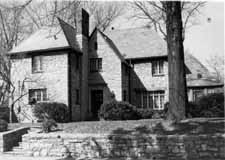 This house was built by Gilbert Hamilton, a real estate developer, in 1927. It sits on Glen Echo Ravine. The Gilbert Hamilton House is a lovely example of a Tudor Revival house, and displays old construction methods and design. The house is on the National Register of Historic Places. (Photo courtesy of the homeowner)
Zimmerman House
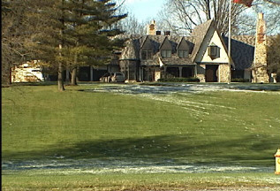 Orr Zimmerman, who owned the Olympic Swimming Pool, owned the Tudor-style house that still stands on the northwest corner of Henderson and Olentangy River Road. Zimmerman built the house in 1929 on what was then a 52-acre estate; at the time, Henderson was a country gravel road and Olentangy a narrow two-lane street. The architect was Thomas Tulley. Interior walls were decorated by a New York artist, with beautiful wooded scenes in both the trophy room and the living room. Two Canadian bear cubs, captured on a hunting trip, were raised in a small house on the property. In 1977 the house was a Decorators’ Show House.
Log houses, log cabins
Don Hutslar, in his book Log Construction in the Ohio Country 1750–1850, differentiates between log cabins, which were intended to be temporary, and log houses, which were intended to serve as a home and were consequently sturdier, larger, perhaps taller. I wonder how many log homes there are in Clintonville, covered by contemporary siding. I have been told that there is one at 232 West North Broadway, on the north side of West North Broadway, east of the river.
Minstrel shows
 In the early part of the twentieth century, many Clintonville organizations and churches held minstrel shows, as fundraisers and for entertainment. I chose not to sanitize minstrel shows from my book, because they were an authentic part of Clintonville’s history, albeit the part we are all glad we’ve done away with. I regret any offense or hurt caused by these pictures.
Standard Oil Station is Outstanding!
 This cute gas station was located at the northern end of the Olentangy Village shopping area in 1939. Today, it is Oldskool restaurant. Is today’s restaurant the same (original) building? I think so. (Photo courtesy of Melissa Goodrich)
Gratziano’s
 Joe Gratziano owned this market on the corner of North Broadway and High Street. It was a one-story brick building. Until quite recently, this building was still there but covered up. Note the house to the south of Gratziano’s, which exists today. Clinton Theatre had not yet been built.
Gratziano—or his descendants—eventually moved the market farther south on North High Street. One of the residents on West Como told me that the Gratziano family also operated a market in a building along what is now an alley between Como and Lakeview, north of Milton.
A & P
There were A&P’s located at several locations in Clintonville. An A&P used to be located where Blockbuster at Hudson and High Street is today. The Great American Tea Company began in the mid-1800s selling tea, coffee and spices at value prices in New York City. In 1870 the company was renamed the Great Atlantic & Pacific Tea Company, in honor of the first transcontinental railroad and hopes of expanding across the continent. It was the first national supermarket chain in the United States; by 1930 it had 16,000 stores. The company pioneered “frequent customer” programs; one of its most popular programs was plaid stamps. I remember saving up stamps and pasting them into coupon books to redeem them for things like Lazy Susans. In 1980 the company underwent a restructuring and the Tengelmann Group owns controlling interest.
Dallas Dupre
Dallas Dupre, whose son still lives in Greater Columbus, was a landscape architect. He had an office located on the west side of North High Street near Weber Road (3073 North High Street), and is reputed to have been the founder of the early roadside park system throughout the U.S. The Dupre family lived in old Beechwold.
Elks Country Club
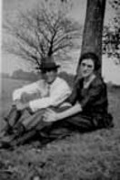 I loved the story of Lawrence Huber (1893-1958) and his wife Eunice Louise Dougherty (1900-1986). Lawrence had applied for a job at the Elks Country Club. They told him they wanted the incumbent to be married, so he asked his girlfriend Eunice to marry him. She accepted and they married in 1922–and remained married the rest of thier lives.
Huber, under the direction of Donald Ross, helped to construct the Elks Country Club golf course, which was located north of Morse Road and east of High Street to Indianola Road. Huber eventually took 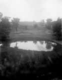 over the position of groundskeeper when the course opened the following year. Lawrence and Eunice, and their three children, lived in a residence on the Elks Country Club property while Lawrence was employed there. Huber was extremely innovative, and invented equipment as needed to cultivate and care for the greens. (Photo courtesy of Betty Huber)
Bank
The Citizen’s Trust & Savings Bank, Clintonville Branch, was located in 1926 at 3296 North High Street. Left to right are Fred Horch, manager; Earl Buchler, manager, Steelton Office; Karl Kegelmeyer, manager produce exchange office; and Hershel Hill, assistant. It later became the Ohio National Bank, then Banc Ohio National Bank.


Zinn’s Lumber Yard
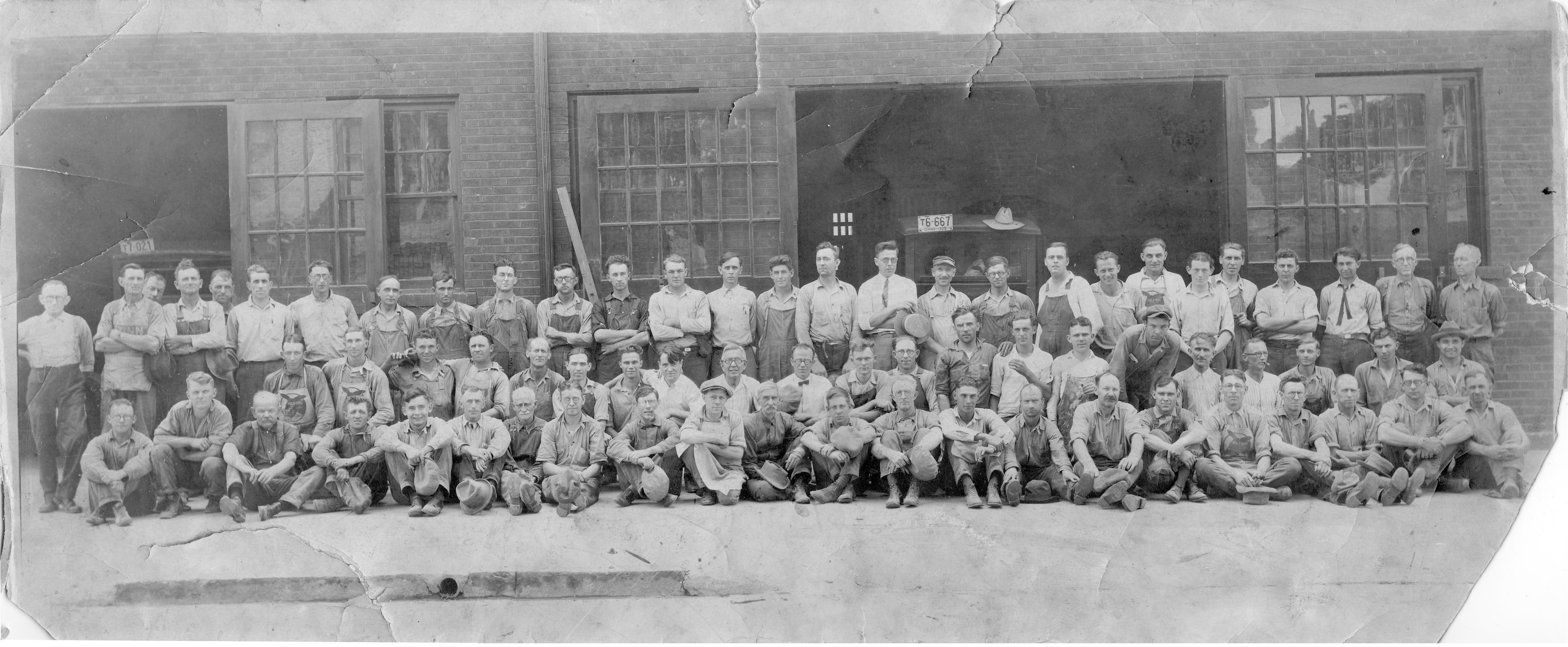
In 1892 at the age of 21, Mr. J. Harvey Zinn opened the lumber company at 19 East Hudson Street in partnership with Mr. S. M. Coe. Four years later he bought out Mr. Coe’s interest and built up the largest lumber yard in the city, both from the standpoint of size and from the amount of business done per year. This is a picture of Zinn’s Lumber Yard and workers. In November 1924 the Zinn Lumber Company caught fire and burned to a loss of $141,000. It was the largest fire in the city for that year. In 1931 Zinn was made vice-president of the Northern Savings Bank located at 2619 North High Street, and soon was promoted to President. Zinn divided his time between the two businesses.
As Bob Ohaver’s oral history explains, Zinn owned land along the Olentangy River from North Broadway to Kenworth Road, and in 1926 he built a residence at 285 Kenworth Road.
Zinn was one of the 4 people who cut the ribbon when the North Broadway bridge was dedicated in 1939.
North Broadway bridge
These photos, from the Franklin County Engineers Office, show the construction of the North Broadway Bridge in 1939. Construction began on March 16, 1939, but was hampered by flood waters on May 23rd. Two shifts of men were used for a period of four of the 8-1/2 months the bridge was under construction, to bring the project to completion on time. The stone facing of the bridge is natural Columbus limestone in various colors.
Note the temporary bridge in the first couple photographs. (Photos courtesy of Franklin County Engineers)


Please note, this post was revised on 2021-10-17 to provide full-size photos when you click through a photo.
Another kind of bridge
Does anyone out there have a picture of the Clintonville Bridge Club, which met in the basement of the Olentangy Village Tavern for perhaps 50 years until the 1970s/1980s?
J. F. Oelgoetz Company
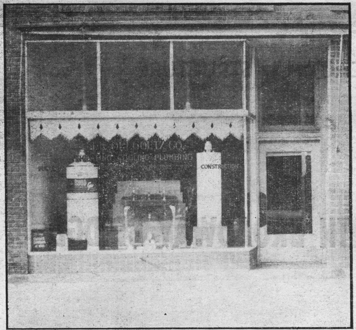 J. F. Oelgoetz Company specialized in heating, ventilating, air conditioning, and plumbing. It was established in Clintonville in 1915. In 1939, Oelgoetz Company was located at 3365 North High Street
Agricultural Laboratory Inc
 In my book and on this web page I wrote about Agricultural Laboratory Inc, located at 3415 Milton Avenue.
Here’s an ad for it showing the types of products it produced in 1939. [Advertisement from a 1939 North High Memory Book.]
All about the barn
I love the story of the concrete block building near Brighton and Milton just south of West North Broadway. Miles Elmers owned AGI, a business that he situated in this concrete barn during the 1930s. Elmers contracted with Monsanto to test and package a low-sudsing detergent. When Monsanto decided to discontinue the product, Elmers purchased all rights to it, renamed, repackaged and remarketed it…and “All” detergent was born.
There are rumors that the building was once a candy factory, that the owners gave out candy from this location, but I was unable to confirm this. It is presently a private residence.
When the Elmers family owned All, they had to travel to the various plants around the country, and so they worked with the Flexible Bus Company to customize a bus to make their travels more comfortable. People along the way asked them where they got the bus/RV, and asked them to replicate it. The result was a new business for the Elmers family: Custom Coach.
Will you swim in pure water?
 I love this ad for Olympic Beach in 1939. “Of interest to the ‘bathers’ of Northern Columbus is the care and precaution the management of the Olympic Pool is taking so that our families may swim in perfectly safe water, free from impurities and its dangers…“ Shortly after the pool was built, the Olympic Amusement Corporation, headed by Orr Zimmerman, assumed ownership of the pool. For many years the O.S.U. swimming and diving teams practiced there and many contestants for the summer Olympics came from all over the United States to train at the pool. Several national championships have been held there. Early on, only male lifeguards worked at the pool.
 Here, someone does a kamikaze dive off the tallest tower. (Photos courtesy of the Zimmerman family)
Clintonville Woman’s Club
On February 4, 1939, six Clintonville ladies met at the house of Mrs. Frank Hiatt to discuss the need for a cultural, charitable, and civic group in Clintonville.  The women were Mrs. Walter H. Ives, Mrs. Herman O. Williams, Mrs. Frank Hiatt, Mrs. Russell Kennett, Mrs. Harry Mesloh, and Mrs. Rand P. Hollenback. Each woman made a list of representatives of all the local organizations and churches, and recruited them. The result was a list of 40 charter members. Their objective was “to encourage wholesome community life, to promote acquaintance among women of varied interests; and to secure cooperation in social, educational, civic, and welfare work in Clintonville.” They met in small groups, rotating the meetings between member’s houses. They also had 18 special interest groups. The annual dues were $3, $1 of which was set aside to build a club house. They achieved that goal through the generosity of the Kiwanis Club, which in 1951 gave the women’s club land on which to build at 3951 North High Street. Ground was broken in 1964, and in 1965 the building was dedicated. The club is still vibrant and the clubhouse can be rented special events. (Photo courtesy of the Kerchner family)
First Free Methodist Church
One of the oldest churches associated with Clintonville is surely the First Free Methodist Church, named so because they did not believe in charging members for pews. The church is over 100 years old (started 1906) and in the 1920s was located at 57 Weber Road. In recent times the church changed its name to Church of Living Hope and is presently located at 4147 Westerville Road.
Hansen Bakery
During the course of researching my book, I encountered what surely must have been one of the earliest chain bakeries in Columbus. Hansen’s Bakery Company outlets were located at 3358 Indianola, 1404 Cleveland Avenue, 3135 North High Street, 3387 North High Street, and 3514 North High Street, in the 1920s. Peter A. Hansen lived at 207 West North Broadway from 1923 to 1957. I was unable to unearth additional information about this bakery.
Bolon Diaries
The diaries of M. Gladys Bolon Cooper written from age 40, in 1939, until her death in 1989, are held by Ohio State University archives and have been transcribed and posted to the web. The writer was a Clintonville resident.
Indian Springs Golf Course Trophy
 As the author of a book on the History of Clintonville, I often get fun calls from people who own a tiny bit of Clintonville history and want a bit more. This morning was one of those days. Ian Crowe called me from Utah. He’d purchased a trophy at a local estate sale, and was wondering where the trophy was from and who won it.
The trophy was for an Indian Springs Golf Club, in 1931. Could it be Clintonville’s own Indian Springs Golf Club?
Apparently Ian had called quite a few golf clubs by the same name, until he found my web site.
I referred the question to Scott Caputo at the Columbus Metropolitan Library. His research can be found here. He learned that the golf course did exist in 1931–Indian Springs Golf Club was listed in the telephone directory as early as 1929, and had been issued a building permit for a new clubhouse in 1931. He learned that there was a Norman I. Blanchard living on 385 Wyandotte, just 3-1/2 miles from the course. According to census records, Norman would have been about 23 or 24 at the time of the tournament.


So, the trophy is extremely likely to have come from the Clintonville golf course.
When I exclaimed that the trophy was really a martini shaker, I was informed that this was a very common form of golf trophy back then.
Great job, Scott!
Indian Springs Golf Course
 In a previous post, I mentioned getting a call about a golf trophy for Indian Springs Golf Club.
That same day, I happened upon this history of Indian Springs Golf Course, from The Booster, Friday, December 1, 1939, page 9-B.
In a nutshell:
–The land was originally part of the Dyer estate;
–Golf Course was laid out with 152 acres in 1926;
–Ground was leased by Herb Bash (who, I should add, later opened a driving range called Bash Golf on Dodridge–which he later sold to Chem Abstracts–and then opened a driving range in Dublin on Riverside Road);
–In 1938 the golf club became Overbrook Country Club;
–The first clubhouse was on North High at Cooke Road
–By 1939 the club was open year-round, catering to parties and dances.
Indian Springs Golf Club
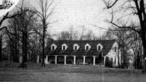 The 46-acre Indian Springs Golf Course extended east of High Street to Indianola, north of East Cooke Rd and south of Schreyer. It opened as a 18-hole course in 1931 and closed circa 1947 as a 9-hole course. The Indian Springs Village subdivision was built in this location around 1947. (Photo courtesy of Columbus Metropolitan Libraries)
Immaculate Conception
 Immaculate Conception has been stabilizing force in my neighborhood since it began in 1915. In this picture the old rectory is demolished to make way for a new construction. Over the years, the school, the convent, the rectory and the church have been expanded, and a community center have been added. (Photos courtesy of Immaculate Conception)


Beechwold BBQ
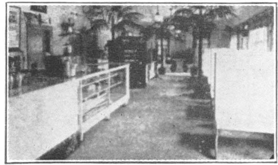 Beechwold Barbecue, 4784 North High Street. “The home of choice barbecue & toasted sandwiches, special Italian Spaghetti dinner. After the theatre or after a dance, drive out to the most popular barbecue in Columbus. Auto parking space. Come hear the wonderful Violano Virtuoso.” [Photo from a 1939 North High Memory Book advertisement]
Jimmie’s
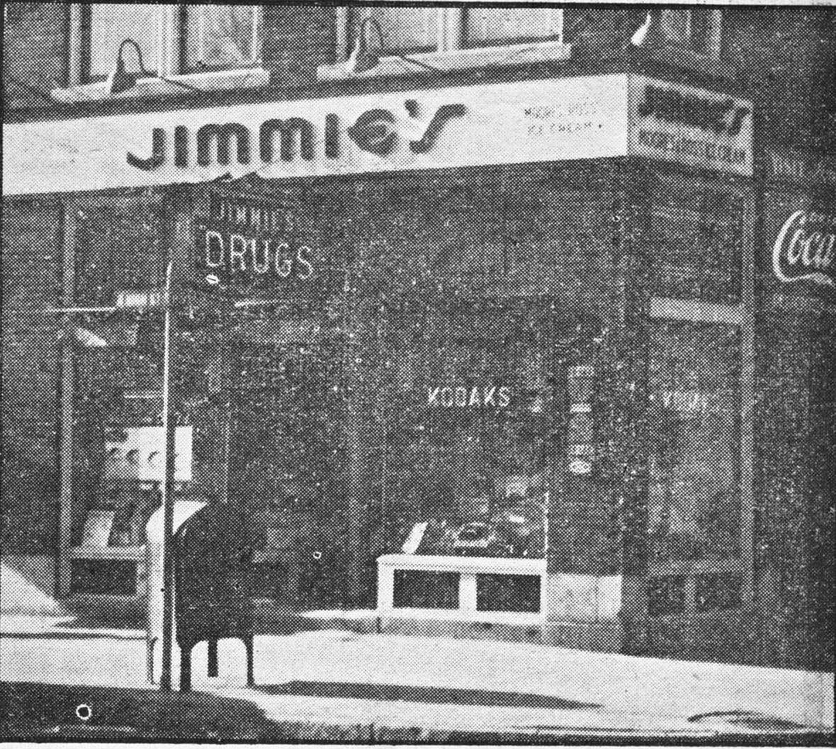 Oh how hard I searched for a good photo for my book of Jimmie’s Drug Store, a legendary community landmark! I located this one after my book had been published. Jimmy D. Kinnaird lived at 63 East Longview from 1920 on, and in 1924 he founded Jimmie’s Drug Store at 3347 North High Street on the corner of Brighton and North High. He sold pharmacal goods, cosmetics, newspapers and magazines, candy, school supplies, toys, and had a lending library. Perhaps most memorably, Jimmie’s also had a soda fountain This photo was taken in 1939.
Maple Grove Church
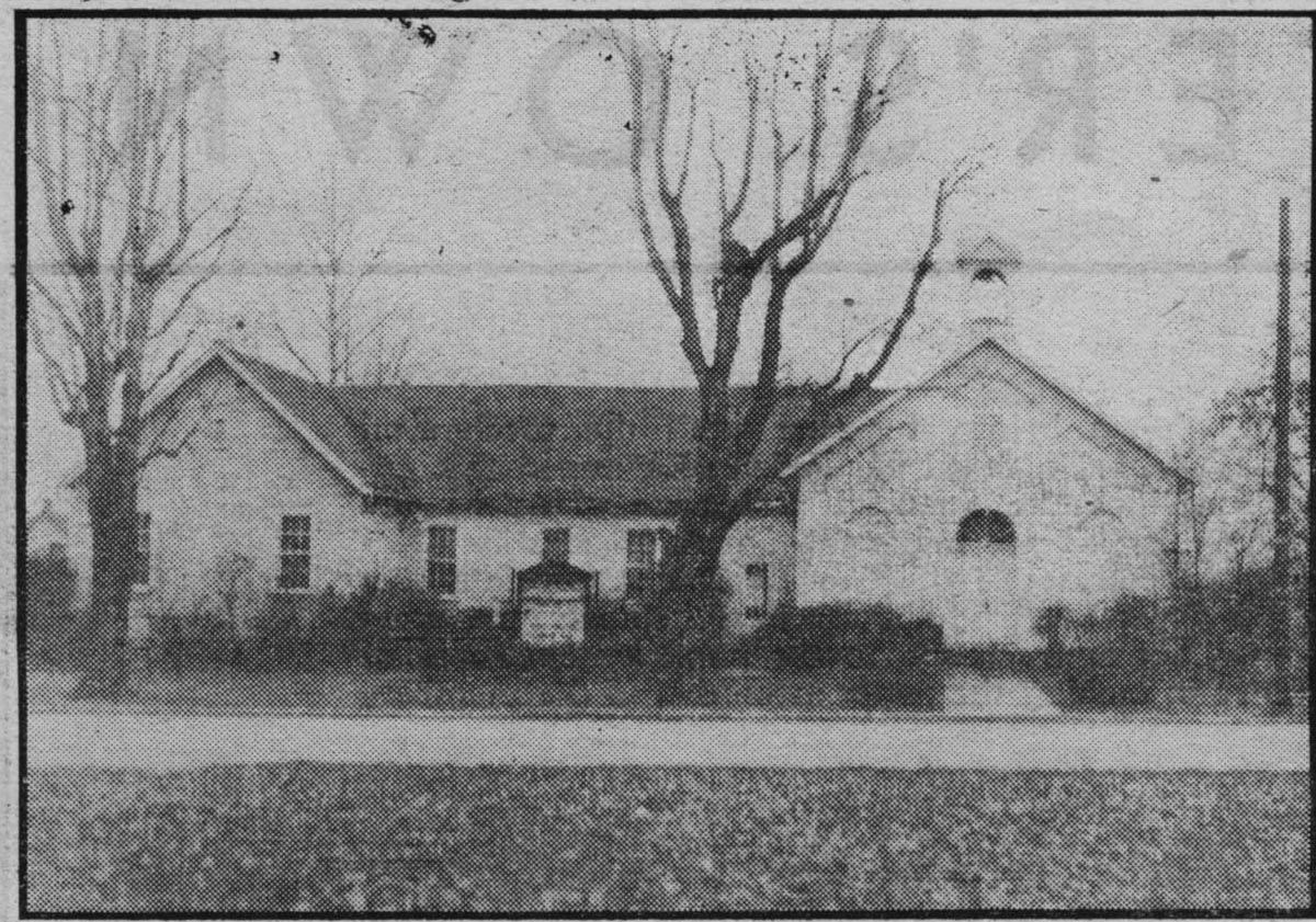 Maple Grove Church in 1939. Originally owned by John Buck, by 1842 the property on the southwest corner of today’s Henderson Road and North High Street was owned by Chauncey Cooke. Chauncey leased the lot to the directors of Clinton Township School District No 1, and the lease contained the clause “to have and to hold said demised premises as long as they shall be used for school purposes.” A clause was also added “that the lot and building to be erected thereon shall be used for Public Worship by any Christian denomination for the accommodation of the neighborhood.” Lore has it that the lease was not recorded but was held by the Clinton township clerk for a number of years, and the late Mr. L. L. Pegg found it in the corn crib of the township clerk in the year 1919.
Merrick Funeral Home
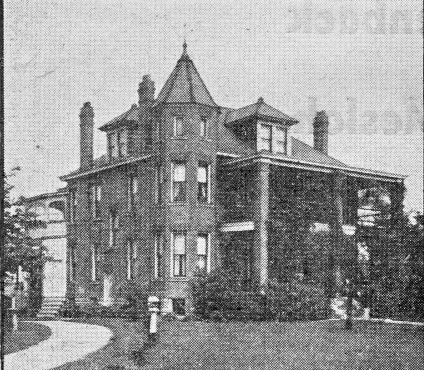 Merrick Funeral Home was located at 3099 North High Street, approximately across the street from Clinton Chapel a.k.a. the Armbruster home. I believe you can see this fine building in other images of that section of North High Street on this web site.
IC KP

I don’t know who these Immaculate Conception people are (email me if you recognize anyone here). But it is a wonderful and classic picture of kitchen workers of some function held by the church, don’t you agree? (Photo courtesy of Immaculate Conception)
 An IC fashion show. (Photograph courtesy of Immaculate Conception)
Glen Echo Bridge
Three lovely views of Glen Echo bridge near North High School, were taken in the later 1920s or early 1930s. [From North High Memory books.]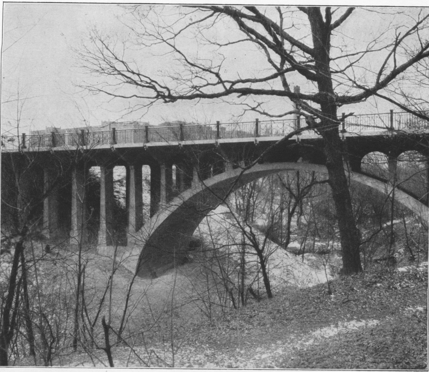
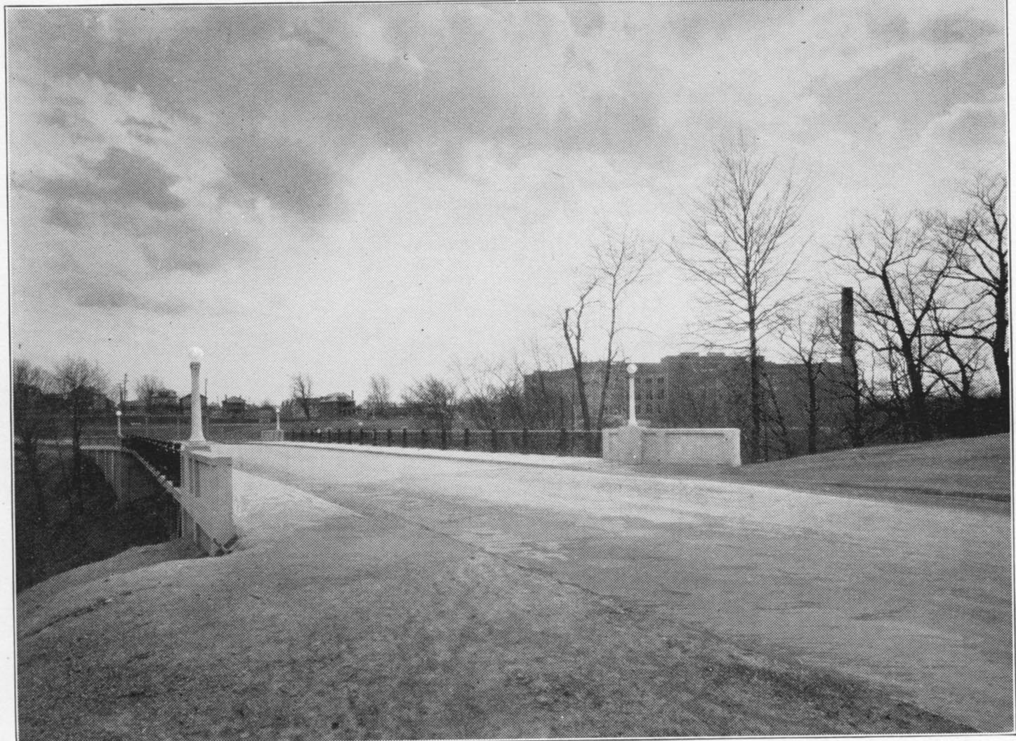
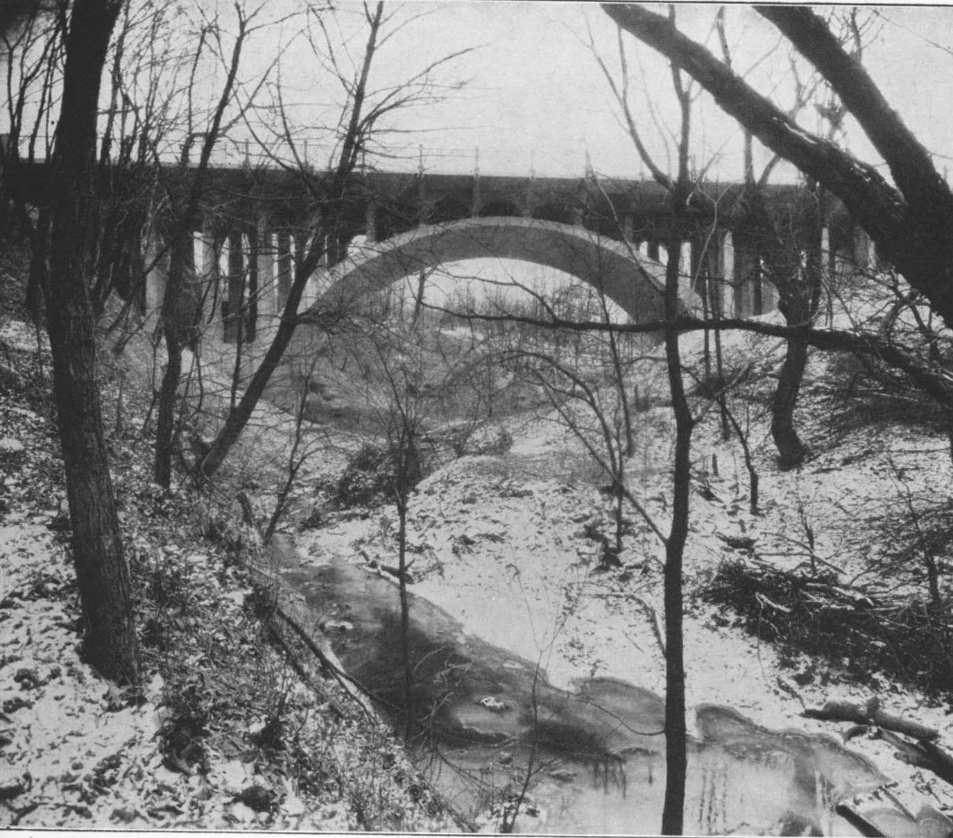
Glenmont Elementary School
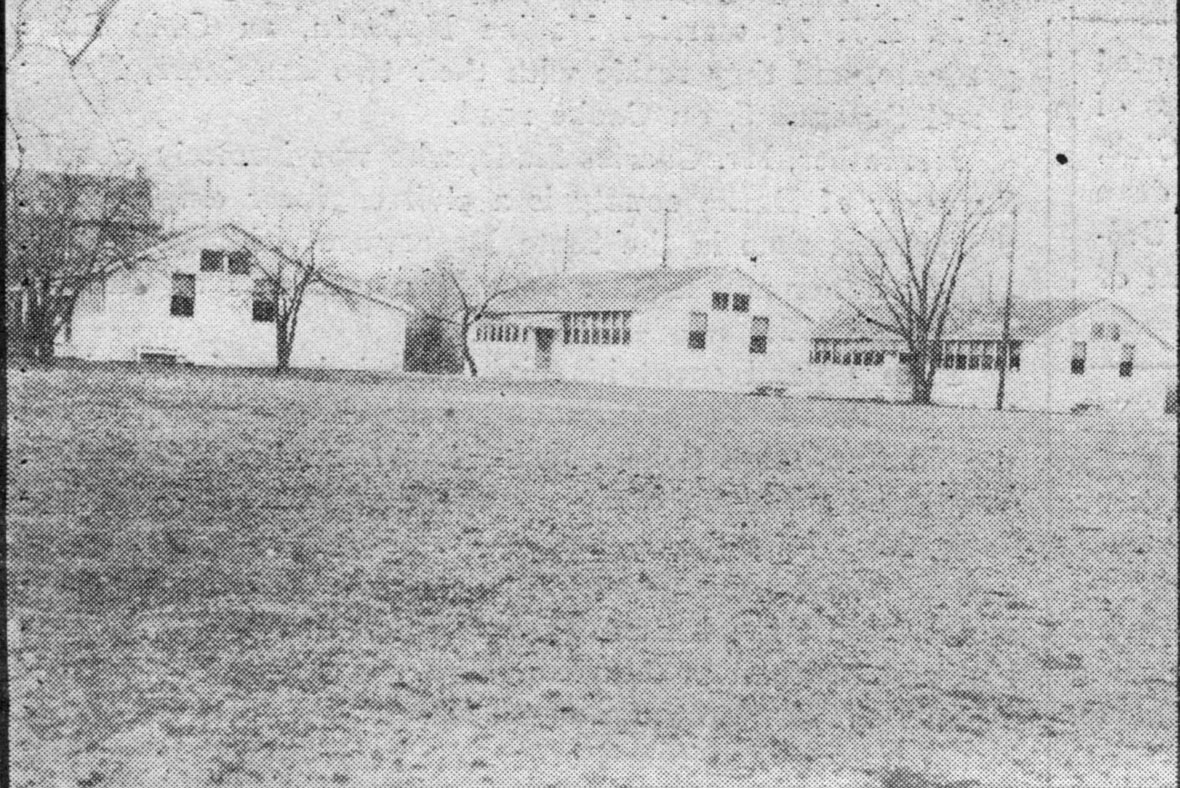 In the spring of 1929, the first portable building at Glenmont was erected and about 6 weeks of school were held in the new building before the summer vacation. Celia Vanderiff was the principal and the first grade teacher was Elsie Elliott. Frances Jones taught the 2nd grade. In February 1930, the third grade was added but no new teacher employed. During the summer of 1930, the second double portable was added. The third double portable was built during the first semester of 1930-31.
Buy ‘em by the Sack
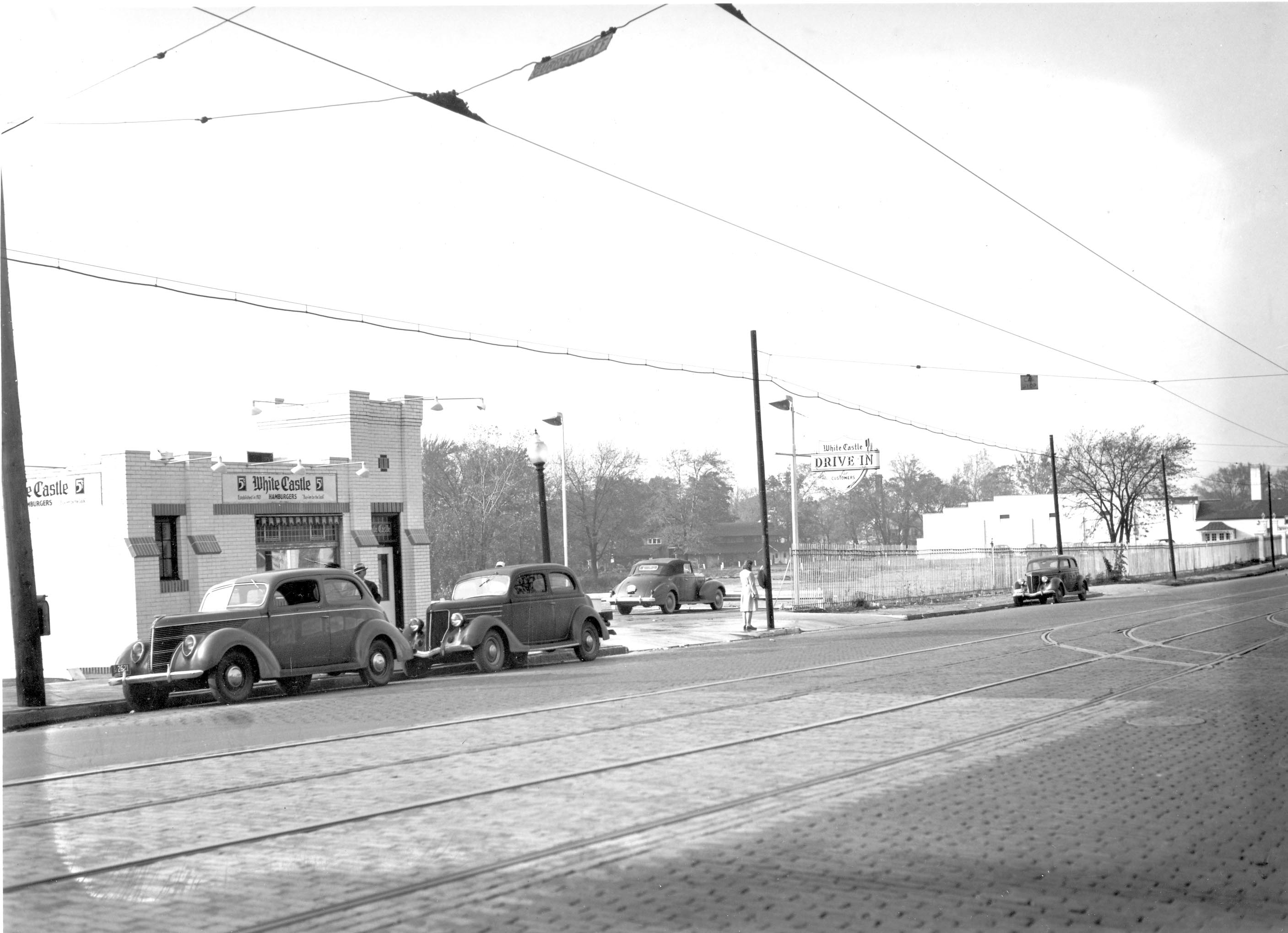 The Clintonville White Castle, 1941. Note the tracks in the middle of North High Street, and also the buildings to the north and northwest of the 5-cent hamburger joint! Sadly, the Clintonville White Castle closed on Christmas Eve this past December 2010.
Here is one of the many newspaper articles announcing the closure.
On Top of the World…or at least Arcadia (Street)
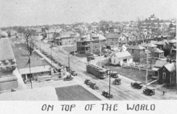 I previously stated that I was unsure where this photos was taken. A reader named James wrote in that it’s “the view from atop the school, facing South East. You can see the edge of the football field along the fence line in the middle left of the pic. The white house in the middle right is still there, at the corner of Adams and Arcadia. That large apt building on the other corner is still there, too.” Thanks, James! The photo was in one of the North High School Memory Books (their yearbook).
[From a North High School Memory Book]
Flora Ohaver
 Flora Ohaver was one of the oldest residents of West North Broadway, and so she was selected to be one of 4 people to cut the ribbon dedicating the new Broadway bridge on December 1, 1939. She and her husband built their house at 263 West North Broadway in 1908. Her nephew Bob returned to live at this address on West North Broadway as well; his oral history is located on this web site. Bob passed away in June 2009.
Robert Ohaver (1937-2009)
Robert Ohaver (b. 1920) lived most of his life in Clintonville and on West North Broadway. He had many stories of old Clintonville to share with us. On September 12, 2003, several community members (Ann and Alan Woods, Barbara Hotchkiss, Nancy Kuhel) interviewed him and preserved the conversation on tape. Now you, too, can listen to Mr. Ohaver’s oral history.
Sadly, Bob Ohaver passed away on June 11, 2009. You can find his obituary here. There is another small entry about his aunt on this web site here.
Bob mother was Laura Ohaver and his father was Walter Harvey Ohaver. Bob also had an older brother named Jack Ohaver who lived in Clintonville at 116 E. Dunedin with his wife Clara Ohaver. Clara passed away May 24, 1993, and Jack passed away on June 14, 2000. Jack and Clara had two daughters. Sue Bowman was born May 8, 1940; she passed away January 4, 2000. Sandra Urban born July 30, 1945. [This family information came to me from Jack’s granddaughter and Sandy’s daughter, Lisa Adkins. Thanks, Lisa!]
Each file is about 30 minutes long.
Contents
Track 1.
Brief Ohaver biography; origins of his family moving to West North Broadway; his World War II years; Clinton Theatre; businesses and homes at the interesection of North Broadway and North High Streets; drugstores and candy stores in Clintonville; the house behind 3391 North High Street; Dispatch carrier’s substation; Olentangy Park; the streetcar storage barn at Arcadia.
Track 2.
Olentangy Park cont’d; street fair at North Broadway and High to celebrate Clinton Theatre, the opening of Clinton School pedestrain subway, and the paving of North High Street after a new sewer line had been installed; the Olentangy River; 3 canoe clubs; development of West North Broadway (“the Broadway Extension”) and the Scott farm; development of the area along the adjoining river bank; the Herron [spelling uncertain]/Zinn home at 285 West Kenworth; Bill Moose AKA “Indian Bill”; Chief Leatherlips.
Note: the “Dr. John Scott” is William H. Scott, president of OSU 1883-1895. See my book, page 17, for a photo of his house.
Track 3.
Chief Leatherlips cont’d; house at 273 Erie Road and excavation of nearby gravel pit; the Fuller farm/Whetstone Park; rambling through the woods; Indian Springs golf course; Bill Moose AKA “Indian Bill”; Olentangy Park; North Columbus including the Ramlow Building; Picadilly Theatre; streetcars and interurbans.
Track 4.
Southwick funeral home; Joy Hunt home; Graceland Shopper’s Mart and Patrick Murnan; Clinton Theatre; the Great Depression; Ohaver family; Brighton Road development; Ohaver’s WWII and postwar years.
Track 5.
Ohaver’s return to Columbus from California in 1962; bombing of the Clinton Theatre in the 1930s.
Hudson & High 1930
Some lovely pictures of the northwest corner of Hudson and North High, in 1930. This corner looks about the same today! (Photos courtesy of Frank Jones.)
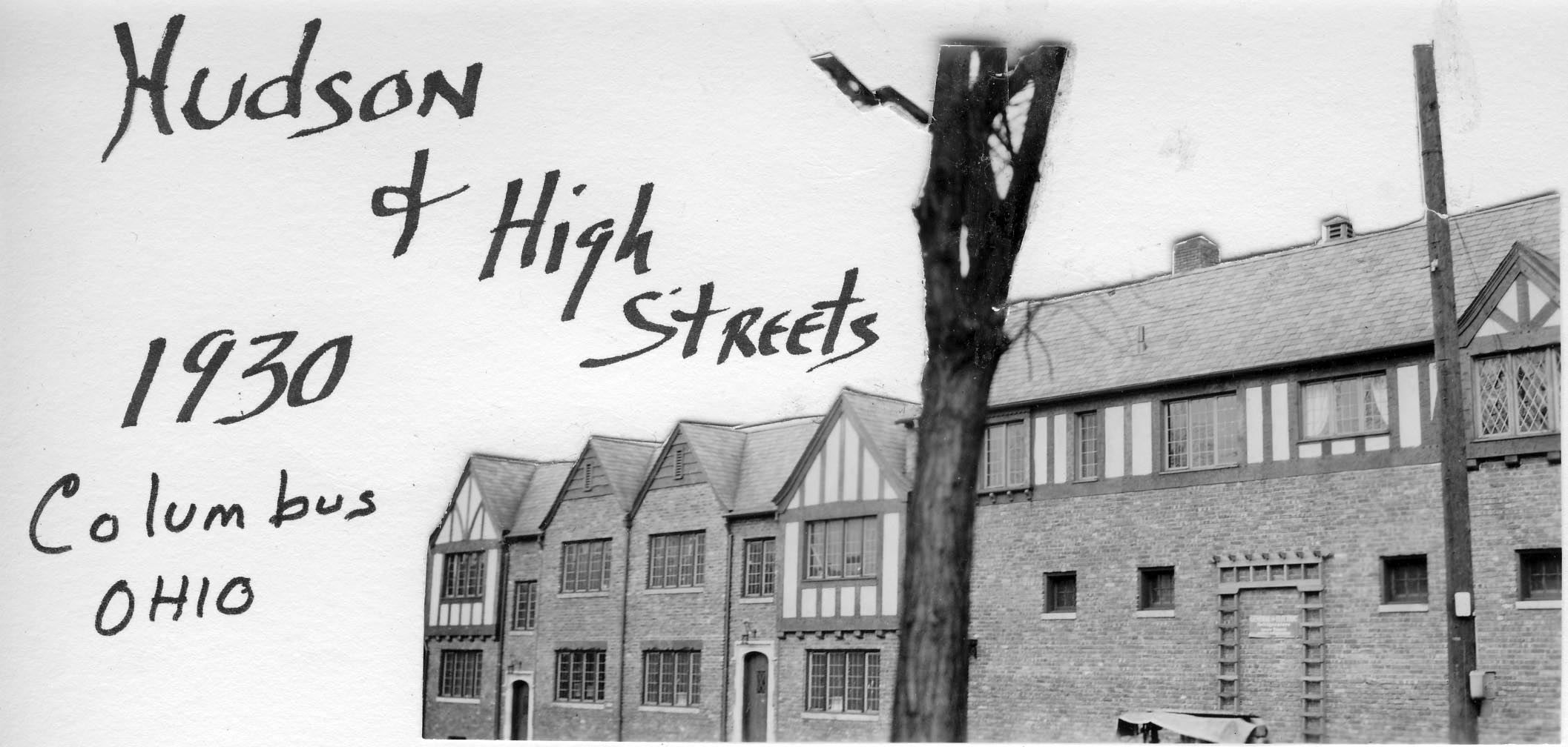
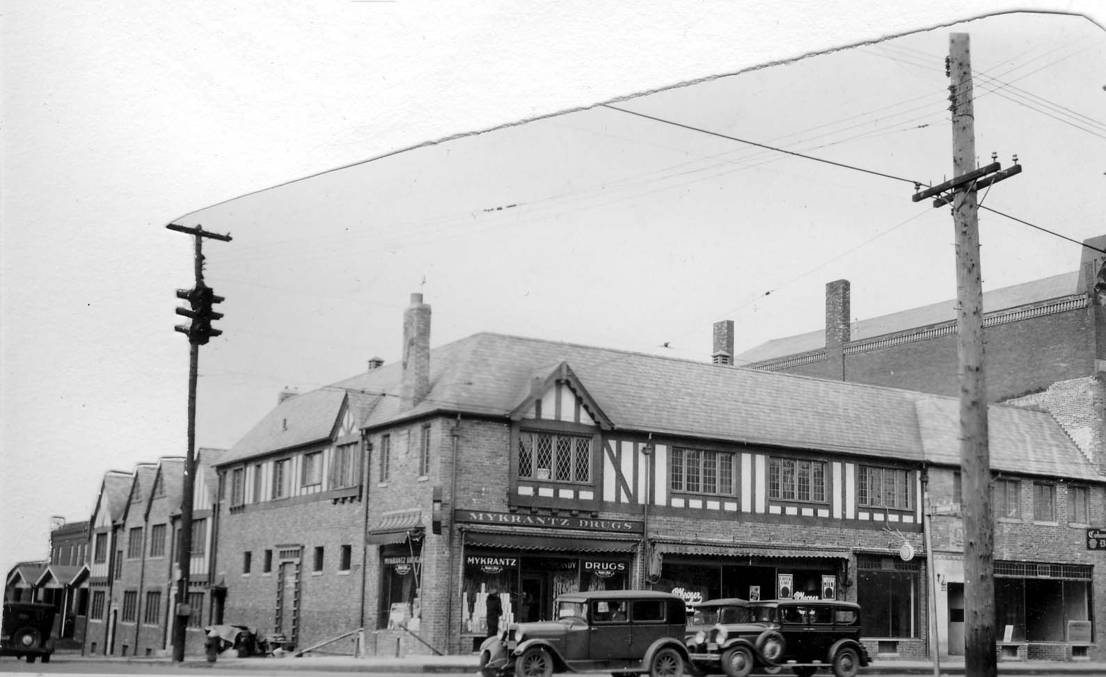
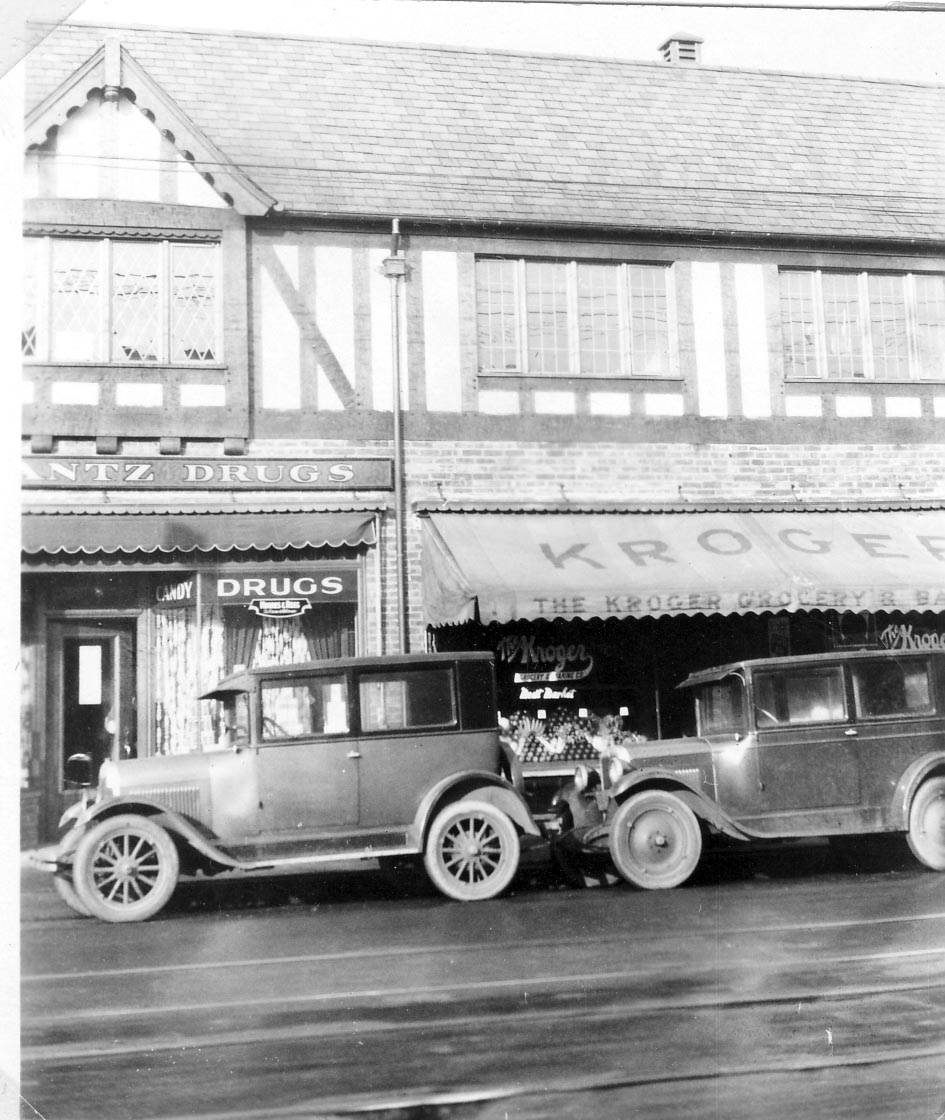
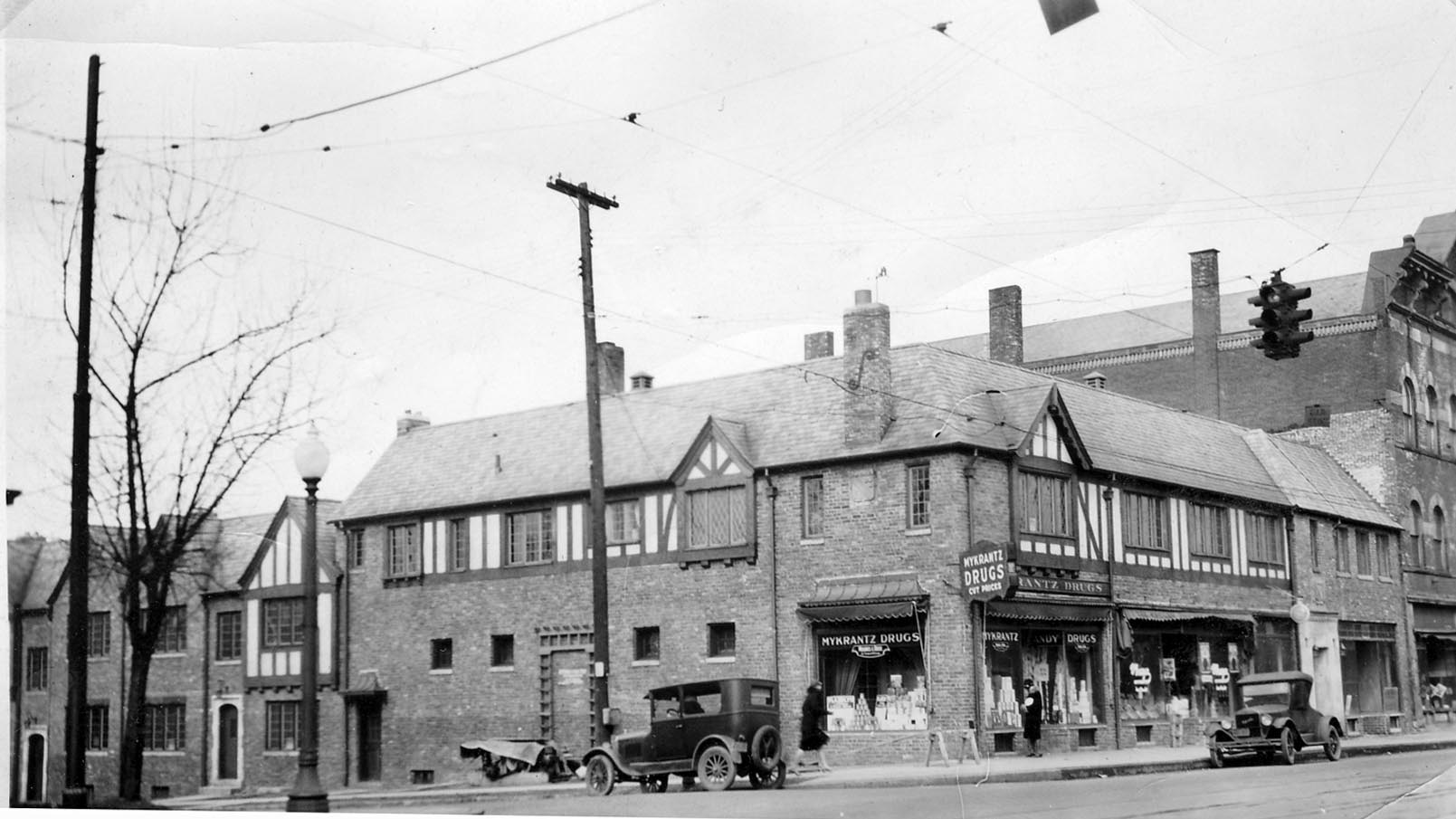
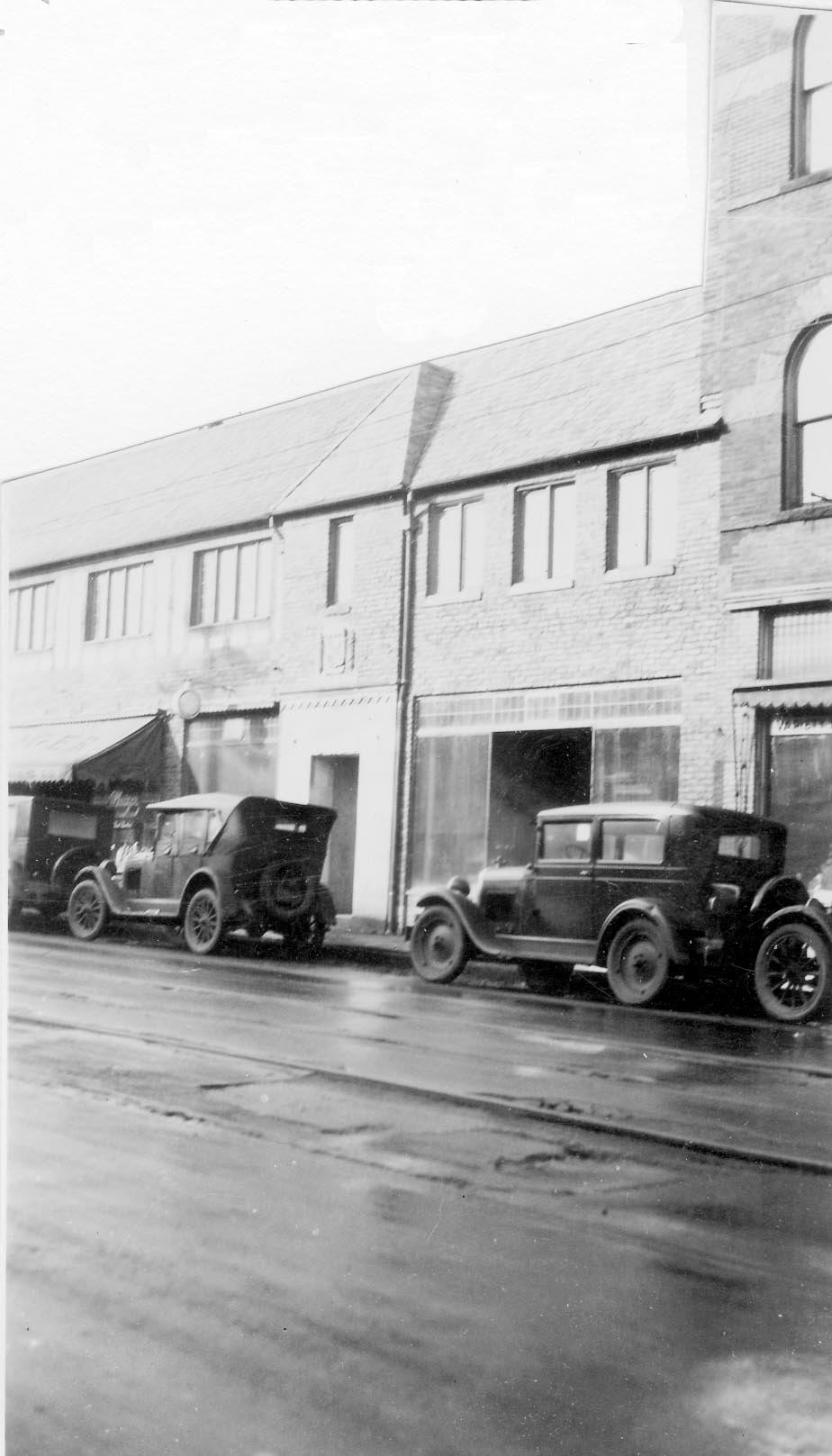
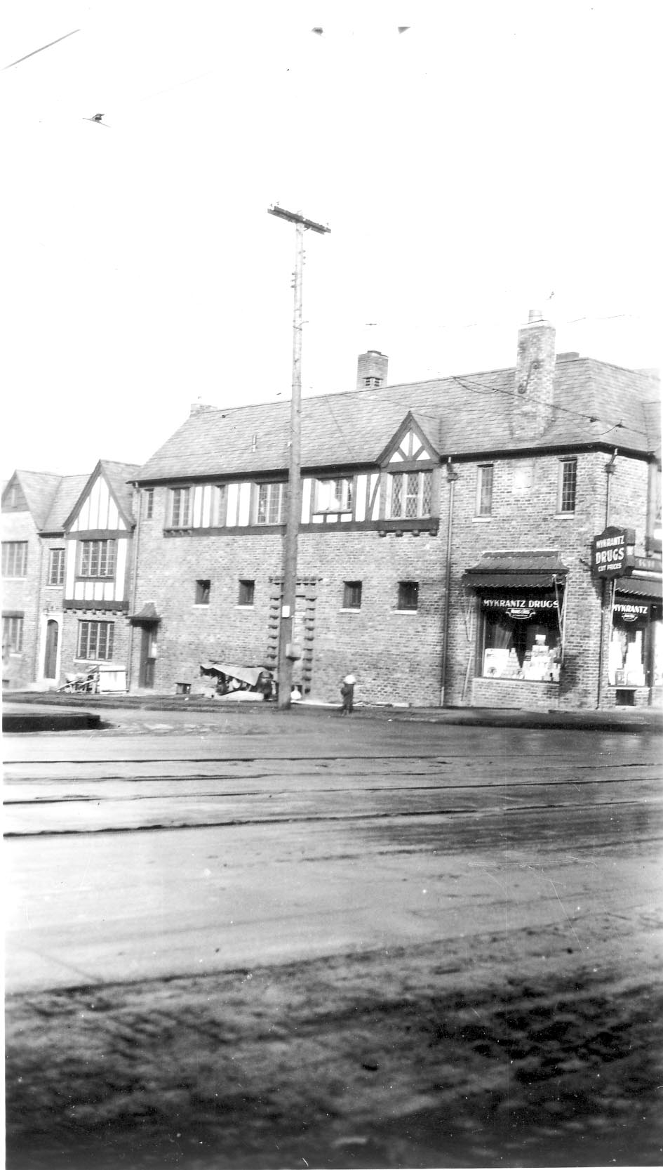
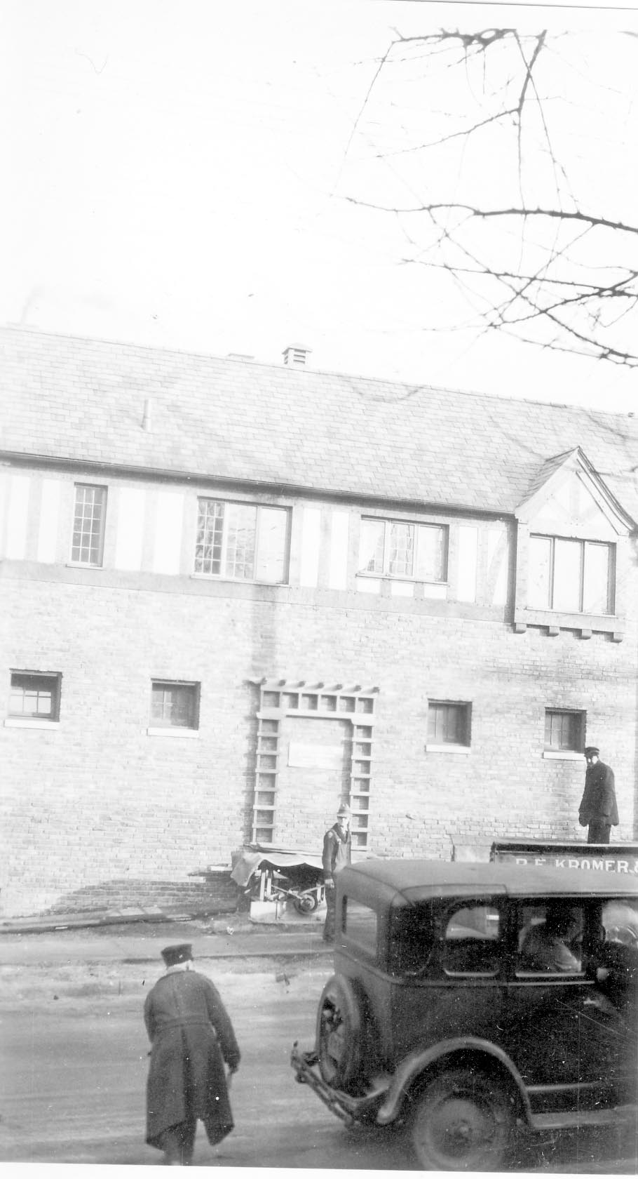
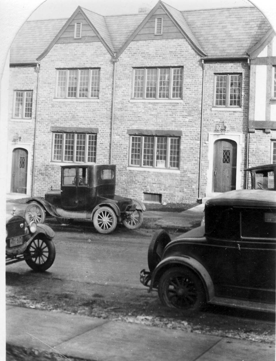
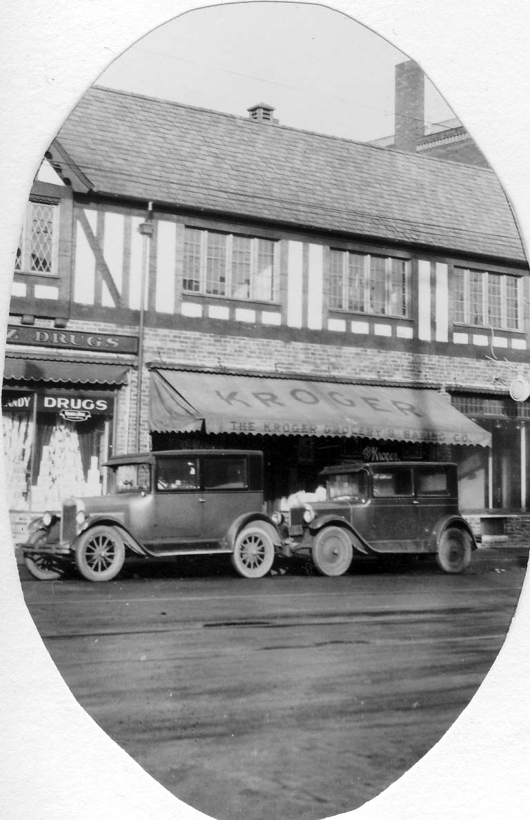
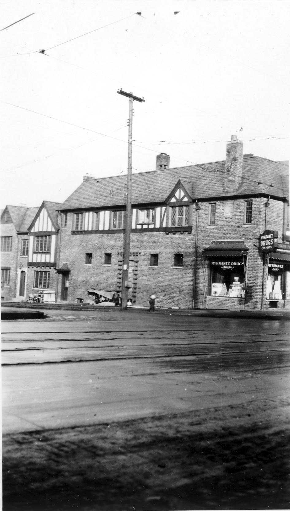
McDowell’s Garage
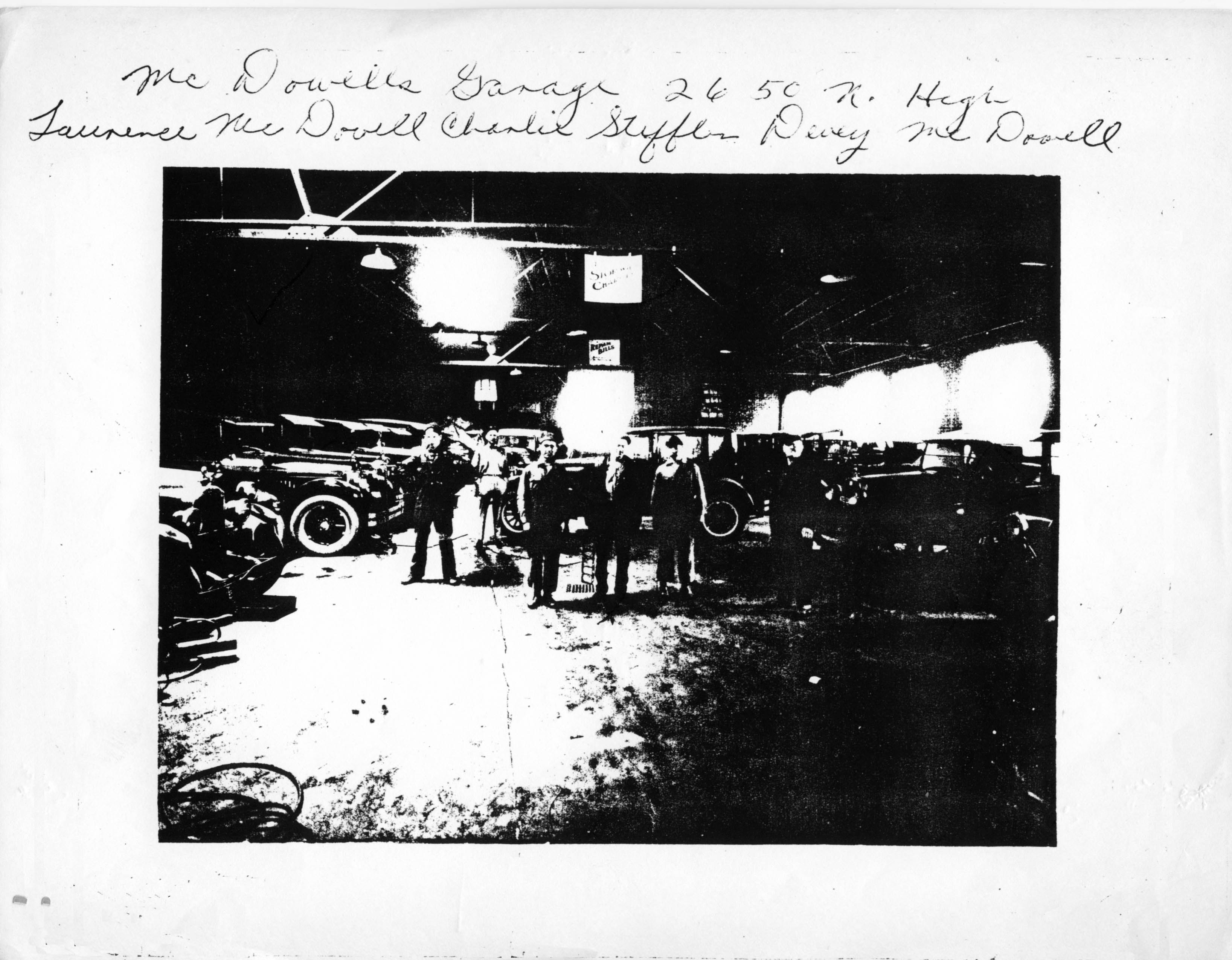 McDowell’s Garage at 2650 North High Street. (Photocopy courtesy of Frank Jones.)
Turkey Bowl Tickets
 My book contains a photograph of the annual Turkey Bowl, a football game held in a local park on Thanksgiving day. Attached is a picture of some actual tickets to the event, for 1944! Betty Daniels gave these to the Clintonville Historical Society. [Photo courtesy of the Clintonville Historical Society]
Jones Upholstery Store
 The North Columbus Kroger location at 2579 North High Street became Jone’s Upholstery business. Charles M. Jones moved here in 1943 while his son W. Frank Jones was overseas serving in WWII. When Frank came home in 1946, he worked as a partner with his father until his father’s death. (Charles and Frank are the son and grandson of C. F. Jones.) This photograph was taken in 1945.
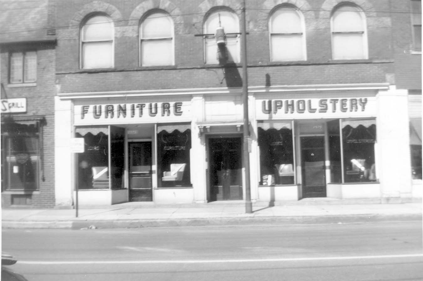 Frank continued the business until 1977 when Neocacia Masonic Lodge (which occupied the 2nd story of the building) sold the building. This photo was taken in 1951.
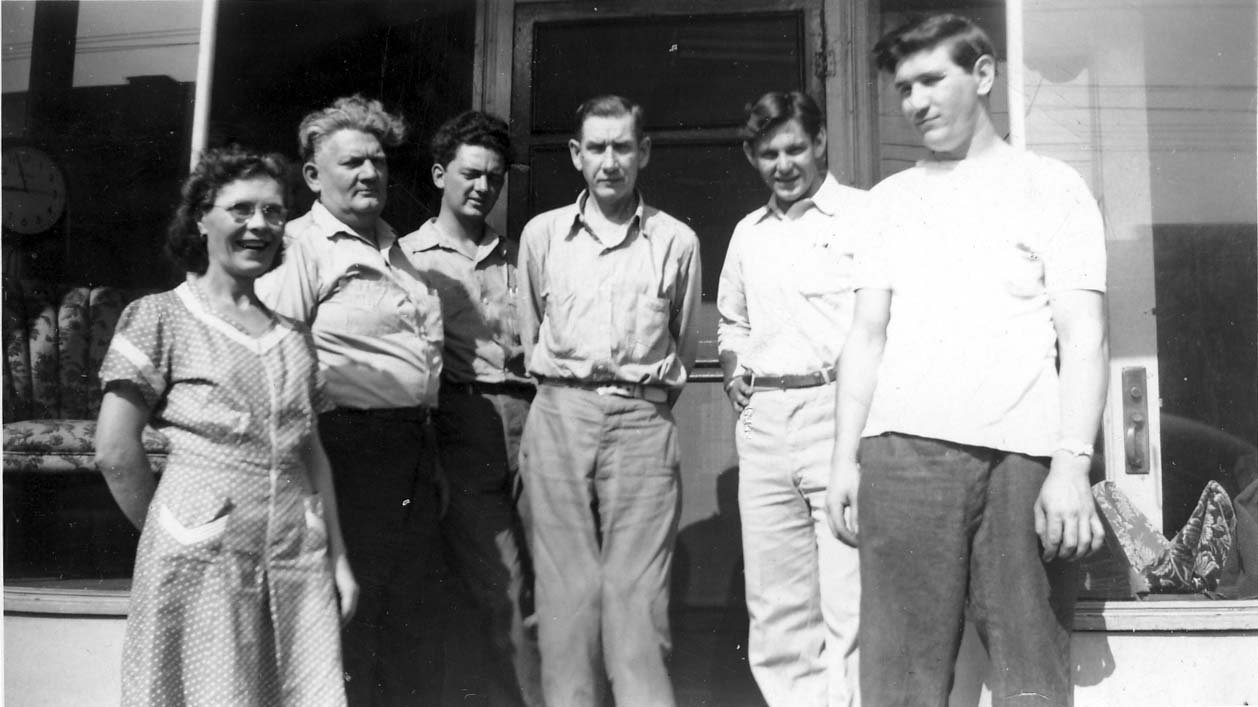 In 1947, here are: Jenny Mocabee, Charles M. Jones, Frank Jones, Ray Bennett, Dick Schaeffer, Bob Hill.
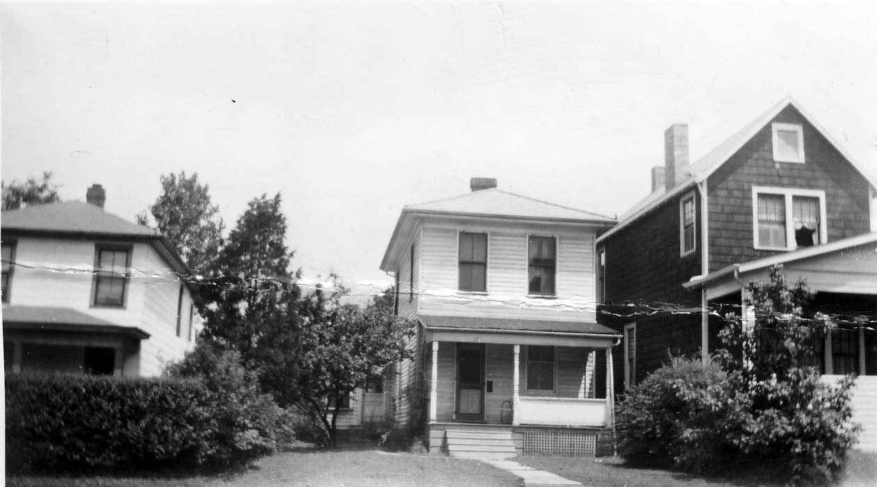
66 East Duncan Street, a house owned by Frank Jones, owner of Jones Upholstery. This house has since been torn down. (Photos courtesy of Frank Jones.)
Weisheimer Mill
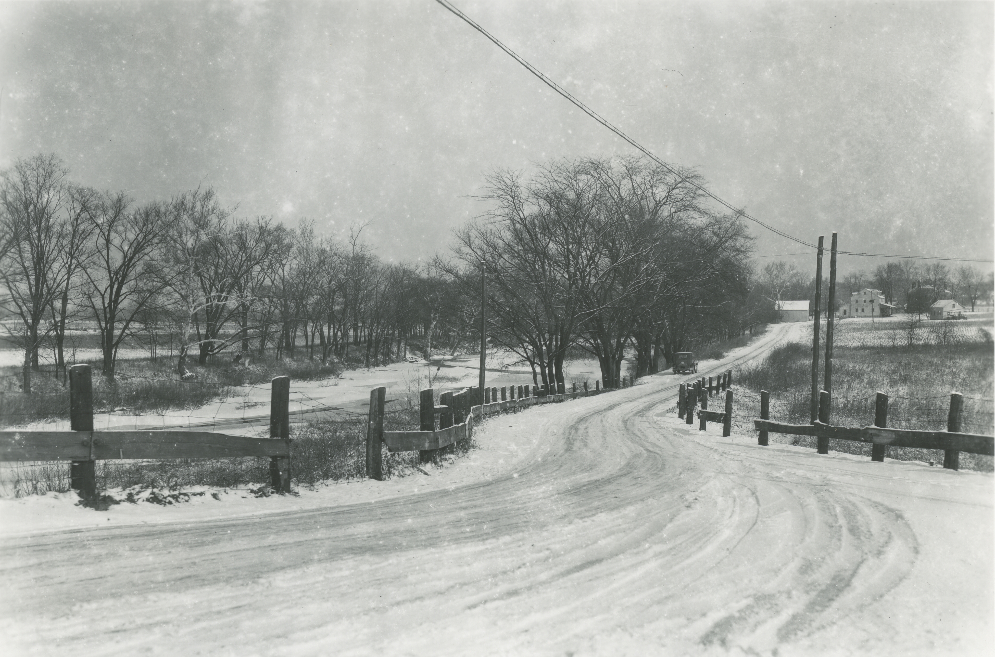 A wonderful picture of the Weisheimer Mill including the Jacob Weisheimer home (which still exists) and other buildings at the mill complex. The photographer would be looking north up Starrett Road to Weisheimer Road. You can click on this image to see the distant details. I show some other images of the mill and Weisheimer homes on pages 21-22 of my book. (Photo courtesy of the Columbus Metropolitan Library.)
Union Cemetery
 A view of Union Cemetery from Olentangy River Road, in the late 1930s. (Photo courtesy of the Franklin County Engineers)
Maple Grove Methodist Church
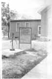 The old brick school house which became the foundational building of Maple Grove Church was originally built in 1878. The church was organized around 1919, and began meeting in the abandoned school around 1920. In 1923 a frame addition was dedicated and this served as their parish hall for many years. In 1929 the lot was further expanded, and a campaign for new construction began shortly thereafter. (Photo courtesy of the Maple Grove Methodist Church)
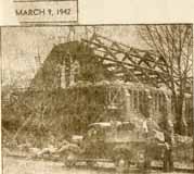 The cornerstone was laid on Pearl Harbor Day in 1941. A stop light was installed at the corner of Henderson and High in 1940—a real sign of growth and “progress.”
(Photo courtesy of the Maple Grove Methodist Church)
Civil Defense Center
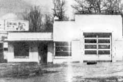 Because of gas rationing during World War II, many gas stations closed. In 1942, Clintonville Community Council (an umbrella group of Clintonville’s organizations) transformed this vacant gas station at 4070 North High Street to be a civil defense center and canteen for soldiers. It was furnished with first aid station, chairs, and a piano, and light refreshments were served. (Photo courtesy of the Kerchner Family)
There are a couple more pictures here.
Downtown Clintonville 1945
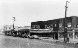 This is another view of downtown Clintonville at High Street and Oakland Park Avenue, showing Miller’s Market, Alber’s supermarket, and Oakland Park Pharmacy. The pharmacy had a soda fountain and was undoubtedly a favorite ice cream stop during hot summer evenings. (Photo courtesy of Leeann Faust)
Hudson & High
 This is a view of North High Street looking northwest from Hudson Street during the mid-1940s. The picture shows Hudson-High Pharmacy, Kroger, Minnie Metzgers Grill, and Neoacacia Hall (a Masonic lodge). The tallest building, the Ramlow Building, was built in the late 1800s by Catherine (Seeger) Volk Ramlow. (Photo courtesy of Columbus Metropolitan Libraries)
Mayor George Sidney Marshall
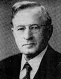 One of Clintonville’s notables was George Sidney Marshall (869-1956). He was raised on a farm in Perry County and attended Ohio State University. He graduated from OSU in 1894 and then from its law school in 1897. He was active in local politics, and became mayor in 1910 on the Republican ticket. After his term of mayor, he returned to the practice of Law and retired in 1946. He and his wife had a longstanding interest in music, and formed the Clintonville Music Study Club. In his retirement (and after the death of his wife), Marshall wrote a history of music in Columbus, a thorough account of all the local nonprofit musical organizations across the city. His book, called The History of Music in Columbus, Ohio, covers the period from February 14, 1812 to July 1, 1953 and was published by the Franklin County Genealogical Society.
George Sidney Marshall’s son, George B. Marshall, was also an attorney and served as a Franklin County Common Pleas Court Judge for 26 years. He retired in 1980 and died in 1981.
Kerchner Garage
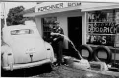 In 1948, the garage on the northeast corner of Glenmont and High that had been used as a World War II Civilian Defense Center was purchased by Joseph Kerchner. His brother George soon joined him. The brothers ran the Sohio Kerchner Brothers garage and filling station from until 1950. (Photo courtesy of the Kerchner family)
Our Lady of Peace Church
Our Lady of Peace is another church that met in the Beechwold Theatre before their building was erected.
The new parish was decreed on January 17, 1946. In the earliest days, weekday masses were said in the apartment of the new pastor, Father George H. Foley. Sunday mass was held in the Beechwold Theatre and later, at the A.A. Schroyer funeral home (now Weir Arendt). The church purchased land on the northeast corner of Dominion Boulevard and N. High Street, which at the time contained two buildings: an old farm house that was torn down, and a second building that served as a rectory and convent. The first church consisted of a barracks (side view of which is shown above) obtained from the Army Supply Depot at Marion. Prisoners of War constructed the kneelers. A double barracks was used for the first school, which opened September 3, 1947. An old mobile voting booth was used by the nuns as a kitchenette.
It’s customary for Catholic churches to build a permanent school first, followed by the church. Cornerstone rites were held in 1951 and the school opened in 1952. The present church was built in the late 1960s. (Photo from Our Lady of Peace dedication brochure)
Our Lady of Peace School
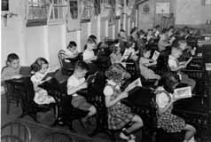 These children are a little stiff, and obviously no one told them to “say cheese”. But the children are cute and some of my readers may be in this photo. These are Our Lady of Peace students in the late 1940s, taken by photographer Ken Hauer. (Photo courtesy of Marge Hauer)
Lustron Houses
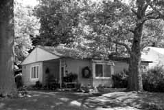 Between 1948 and 1950, the Columbus-based Lustron Company made 2,500 all-steel, prefabricated houses and shipped them nationwide. Unlike the more traditional architecture of Sears homes, Lustron houses offered a sleek, modern aesthetic. They were easy to maintain, and affordable. Despite a backlog of orders, the company went bankrupt in 1950. There are 4 porcelain-steel Lustron homes in Clintonville; this one is located at 272 East Weisheimer. (Photo courtesy of Lynn McNish)
Fuller Farm & Whetstone Park
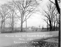 E.A. Fuller was a prominent Clinton Township horse trader at the turn of the century. I found the Clinton Township records for the late 1800s and early 1900s, and his name was frequently mentioned as buying or selling horses. I assume that the so-called “Fuller Farm”—where Calvary Bible Church, Whetstone Park, Clintonville Women’s Club, and The Church of Christ, Scientist are today—once belonged to this man. (Photo courtesy of Calvary Bible Church)
The vacant farm has been put to many uses. During World War II, the land used for victory gardens. (There were also victory gardens near Riverside Hospital.) Children put the area to their own purposes, scrambling through the undergrowth and playing by the river.  Many long-time residents recall a family that lived in the farm house—some have called it a log cabin, others say it was a chicken coop–of the old Fuller Farm. Some say the family was partly Native American; others say partly Romani; in any case, the family’s race added to their mystique and exoticism in the minds of the Clintonville children of the time. The family’s surname was Windsor; Mr. Windsor was a professor at OSU, and many of the people fondly recall daughter Zolithia [or Zelitha] (back row, 4th from left) and her brother Romanus (3rd rw, 2nd from right).
During or shortly after World War II, Rand Hollenback (founder of The Booster) lobbied for remaining land to be converted into a park, and the City of Columbus purchased the 161 acre farm. It became Whetstone Park. From early on the park has included a casting pond, softball diamond, tennis, picnic and playground, and archery field.
North Community Lutheran Church
North Community Lutheran Church, when it first opened on Morse Road in 1949, was described as a “modified Colonial” made of cement block with light green stucco, sandfinished Colonial Brick, and white wood trim. When they opened they had plans for a baseball diamond, outdoor basketball and volleyball courts, tennis courts, horseshoe pits, and a variety of other sports. (Photos courtesy of North Community Lutheran Church)
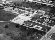
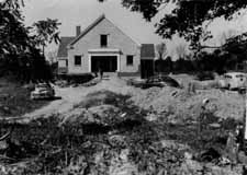
Ken Hauer Photography
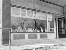 In the late 1940s, photographer Ken Hauer’s studio was located at 4139 North High Street, where a pet grooming studio is now. Hauer took quite a few photographs of the community, including catholic churches and schools. (Photo courtesy of Marge Hauer)
Accident at Overbrook and High Summit and Maynard, 1948
Revised post!
These two photographs were found among the papers of Kenneth Hauer, a local photographer who had a studio on North High Street. The photos were taken in 1948 at the intersections of Summit and Maynard.
 The first photo is taken from the west side of the accident, looking toward the businesses on the northeast corner of the intersection of Summit and Maynard. The building’s address is 2336 Summit Street.
 The second photo is taken from in front of that business building, looking west/northwest.
Now to be clear, in my original post I got it all wrong! Larry L Lower was instrumental in discovering the location of Kenneth Hauer’s accident pictures. (Previously, I’d placed the accident at 4139-4147 North High–though admittedly the buildings there today have significant differences from the old photos–because I couldn’t find any other location and Kenneth Hauer’s studio was at 4139 North High.)
I do not how many hours Larry worked on this but he deserves some sort of prize! He said,
The storefront property in your photo matches an existing building on the northeast corner of Summit and Maynard. Across the street on the northwest corner are two buildings that match the two buildings in your second photo.
The storefront photo shows First National Cleaners in the far left store front. The 1947 Polk city directory showed a business of the same name in the same position of the building at Summit and Maynard, which is 2340 Summit.
Summit and Maynard are one-way in 2012. They were two-way in 1948. That would explain the direction of all of the automobiles in your photos.
Larry undoubtedly got it right; both the building and the houses across from this building match the photos that Kenneth Hauer took exactly. Thanks, Larry! (Note: you can compare the 1948 pictures with the intersection today using Google’s Street View.)
Other readers: Charles (Coryn), Nina, Bob, Terry (Seidel), and Genie (Hoster) also contributed critiques and/or theories of how to solve the puzzle. Without doubt my original post, wrong as it was, garnered more comments than any other post on my web site.
You can click on the photos to see them in more detail. (Photos courtesy of Marge Hauer.)
Original post:
These two photographs were found among the papers of Kenneth Hauer, a local photographer who had a studio on High Street. The photos were taken in 1948 at the intersections of Westwood and Overbrook and North High Street. I have compared the photos with the same location today, and remain puzzled (Note: you can do this online using Google’s Street View.
The first photo is taken from the east side of the accident, looking toward the businesses on the southwest corner of the intersection of Westwood and North High Street.
The second photo is taken from in front of that business building, looking east/southeast. I’m amazed at the houses that are shown on the east side of High Street. Today, these houses are no longer there—and the land where the houses sat does not exist anymore, either. Today, the land falls away steeply into Overbrook Road and Ravine.
Could the land have changed this much?
Another snippet: I’m told that there used to be a “party house”—i.e. a building that could be rented for parties–just south of this location.
You can click on the photos to see them in more detail. (Photos courtesy of Marge Hauer.)
Calvary Church
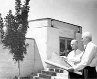 This is a great image of Calvary Bible Church, in its first phase of construction. The church’s original pastor, William A. Ashbrook, was pastor of Glen Echo Presbyterian Church. He resigned and founded an independent, non-sectarian church in 1940, after a lengthy disagreement with the Presbyterian hierarchy. 114 members withdrew from Glen Echo with him. For awhile they met at Medary Elementary School, and in 1941 they purchased the southeast corner of the old Fuller farm, at 3939 North High Street. The war interrupted construction—no building permits were being issued due to the shortage of materials–but in July 1949 the church broke ground. Ashbrook had been a resident of Clintonville for 13 years at the time of the land purchase and lived on North Broadway. In 1950 the new church—a basement and a ground floor–was dedicated. That’s the phase shown in this photo. In 1954 the church was expanded to include an auditorium for 450, classrooms, choir loft, and baptistery; in 1958 it was expanded again to include a parking lot. (Photo courtesy of Calvary Bible Church)
Ackerman Floral
 I cannot resist including this photograph of the Gus Ackerman Floral Company, even though it is most definitely NOT in Clintonville. It was located at 1794 Olentangy Road on the east side of Olentangy River Road, near Kinnear. (Photo courtesy of the Franklin County Engineers)
Indianola Business Corridor
Joe Motil has shared the following memories of Clintonville with us:
I haven’t noticed any historical information on the Indianola Business Corridor so I thought I would give you my recollections of what I remember. Located at the south east corner of Oakland Park & Indianola was a Sinclair gas station. The family which operated it lived just east of the Wonder Bread store and their last name was Cotter. South of the gas station was Broady’s Drug Store (I am not sure if the spelling is correct). I believe Mr. Broady lived on East North Broadway between Indianola and the railroad tracks. It was pretty much your typical drug store during the 50’s and 60’s. There was a soda fountain, pharmacy, comic books, etc. As kids we would scour the bushes and roadways for pop bottles and cash in on deposit money and buy candy and pop from the drug store. There was also a phone booth nearby that had a missing coin box cover that you could jingle your finger inside of to get the coins to come out of. Hey, we were just kids. We would then head to the comic book section of the store, grab something to read, sit on the floor and eat our candy and drink our pop. Mr. Broady never had a problem with this. I believe there was also a dry cleaning store named Nash Cleaners that was south of the drug store. I know there was another store in that strip but I can’t remember the name. Where the Burger King now stands was the Beverly (hamburger restaurant Big Boy). These were somewhat popular in Columbus during this time.
Across from the Sinclair gas station at the south west corner was a Shell gas station. It later became a little Greek restaurant. I am sure you have heard of the lumber yard that was located at the north east corner of Oakland Park and the railroad tracks. We used to take our red wagons there and load them up with scrap lumber that was placed in a big bin and use the wood to make tree forts. A Lawson’s convenience store was located next to the current United Dairy Farmers. My father used to buy milk and bread there on occasion especially when the bread was on sale for a dime a loaf. And I am pretty certain that there was a gas station on every corner of the intersection of Oakland Park and Indianola around the late or middle 60’s. And the A & P grocery store was just east of the India Oak (car wash).
Joe Motil
Metzger’s Grill
 Metzger’s Grill was located at 2571 North High Street. The photos were taken in 1948. Employees (left to right) were Thurm Buckholtz, Bob Grady, ?, Min Metzger, Charley Redd, Jim Walker, ?, ?, Erma Young, Ruth Thomas, Opal Holly.
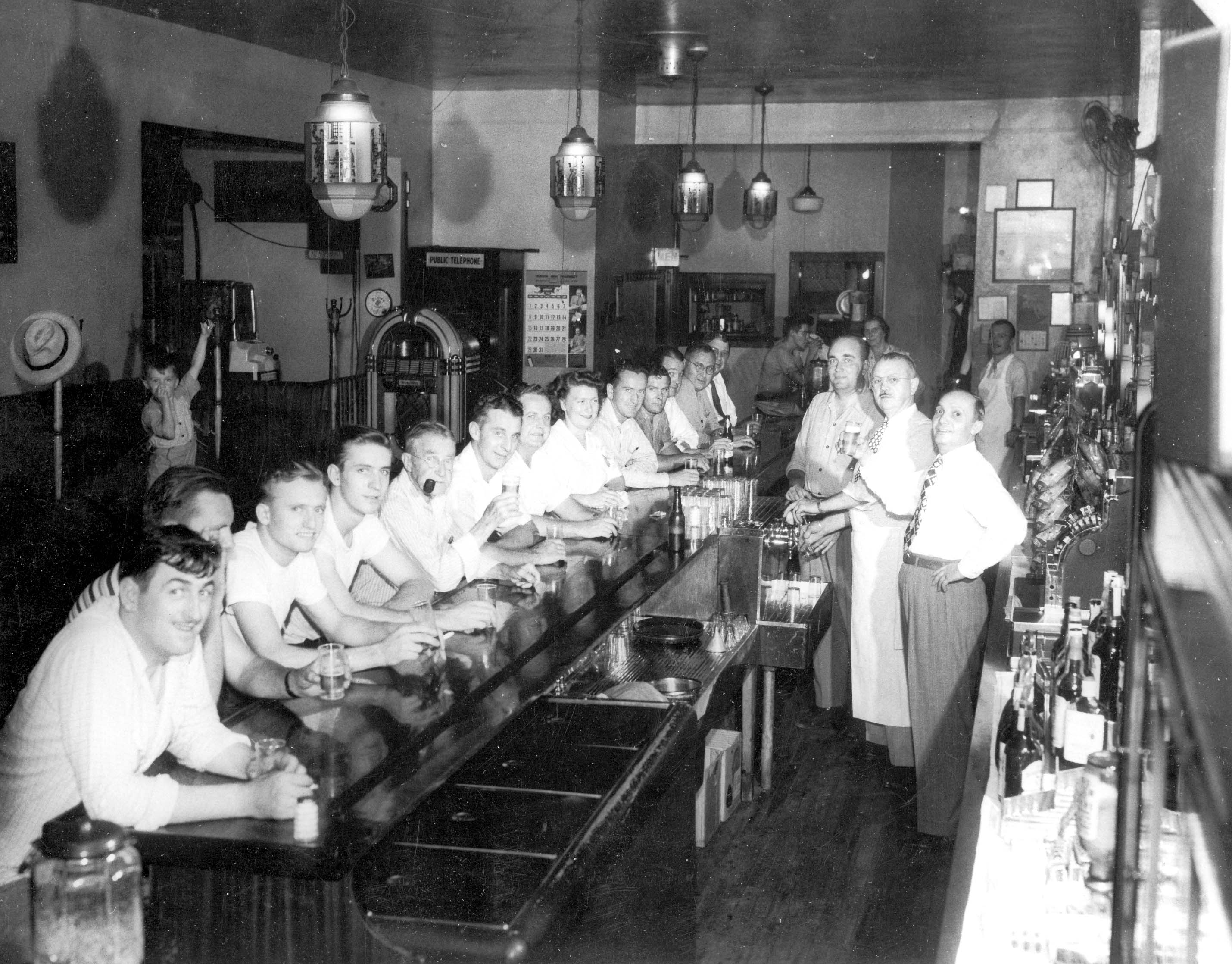 Some customers at the grill, front to back: #8 Ruth Thomas, #10 Eddie Thomas, #12 Thurm Buckholtz, #13 Doc Sly. Behind the bar: Charley Redd, Harvey Edgar, Jim Walker, Min Metzger.
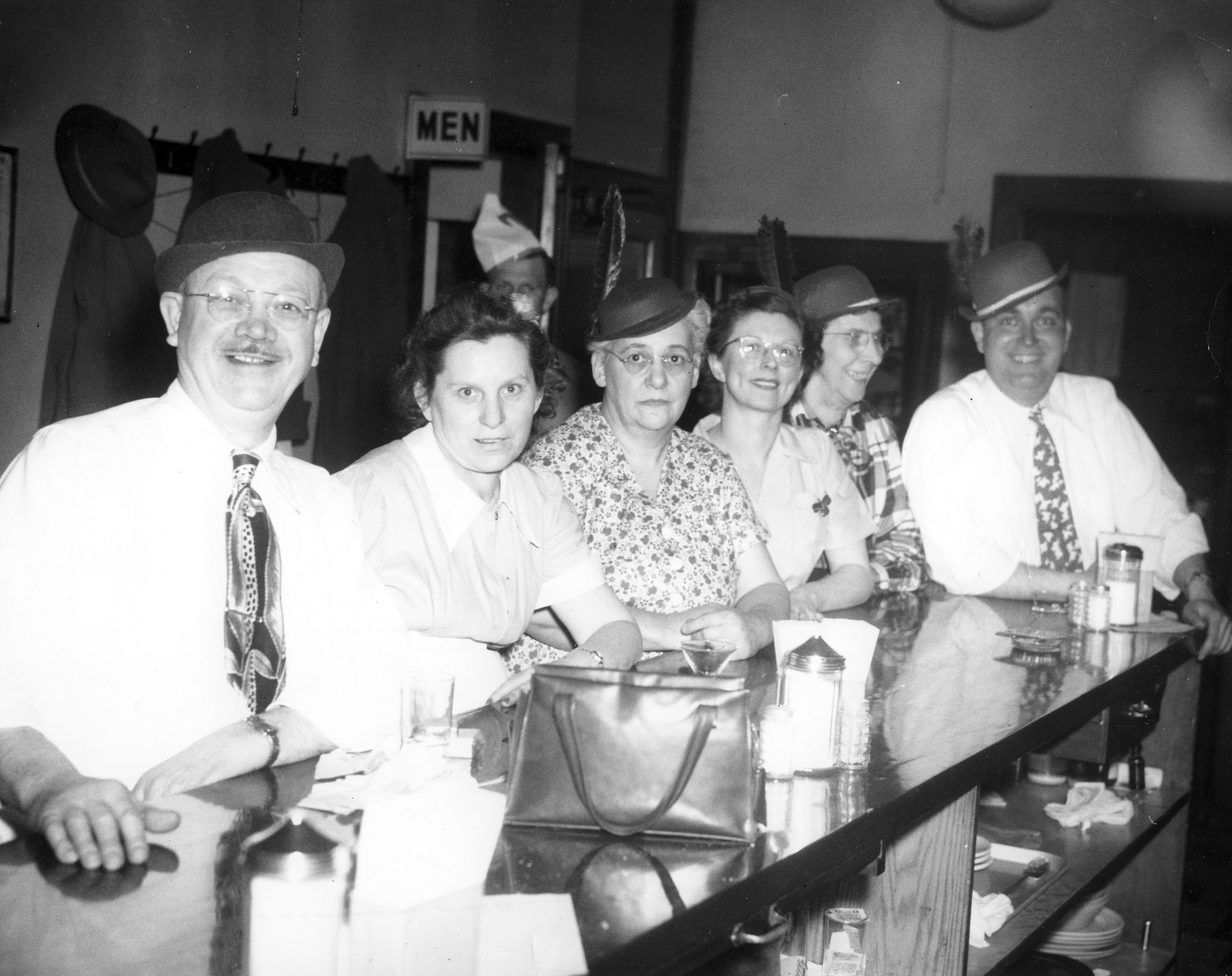 Here’s a picture of Harvey Edgar, ?, Ma Berwill, ?, Min Metzger, Jim Walker. (Photos courtesy of Frank Jones.)
Nicodemus’s Feats of Clay
 Here’s a very nice Columbus Dispatch article about Chester Nicodemus.
Chester Nicodemus’s Price List
 Chester Nicodemus is a favorite Clintonville person of mine, in part because he lived on my street. I was delighted when Joe Motil shared an old 1978 Nicodemus Pottery price list with me. The pottery was dear, even back then! (Document courtesy of Joe Motil)
D. H. Bradley, Veterinarian
Jan Bradley Zenisek shared these two family pictures with me. Her father, Dr. D. H. Bradley, operated his veterinary clinic on the ground floor of the home originally built by Henry Cooke and shown in my book and here. The Bradley family lived upstairs.
 The photo on the left shows Jan’s mother, Ellen May Bradley, with Jan in 1941.
 The picture on the right shows Jan’s father (Dr. Bradley) holding Jan’s cousin Neal Cooper, and Jan’s grandfather George Cooper with Jan, outside the clinic/house in 1943. (Photos courtesy of Jan Bradley Zenisek.)
The house was later destroyed to make way for a car dealership. Jan salvaged the lovely arched windows and they now adorn her Riverlea home.
Beverlee Drive-in

Many North High grads recall the Isaly’s ice cream plant that was located at 2800 North High Street until the early 1950s. In 1956 the building served as corporate headquarters for Beverlee Drive In but was torn down by the Schottenstein Company around 1966 to make way for a strip mall. This is an advertising picture when the building was occupied by Beverlee.
Drexel Theater
 Mark Fontana is a former manager of the Beechwold Drexel North Theater, and he has started a Facebook page devoted to preserving the history of this theater. Also known as Beechwold Theater or Camelot North, it was located at 4250 North High Street and the building currently hosts the Columbus Sports Connection. When the building was a theater, it also served as temporary worship space for several churches in the area while the churches were being enlarged or rebuilt. Check out Mark’s web site!
A.B. Graham (1868–1960)


A. B. Graham (Albert Belmont Graham) was an educator from Springfield OH. He had an idea: to get young people together to learn about agriculture and develop skills for farm living. He formed an organization to enable such practical learning. He originally called it the Boys and Girls Experimental Club, and then, the Boys and Girls Agricultural Club. By 1905 there were over 2,000 young people in sixteen Ohio counties participating in Agricultural Clubs. Graham was named Superintendent of Extension of the Ohio Cooperative Extension Service and the clubs were expanded nationwide. In 1916 the Boys and Girls Clubs officially became the 4-H Clubs.
 A.B. Graham eventually worked for the USDA in Washington DC. After his retirement in 1938 he moved back to Columbus. He lived in his home on Clinton Heights Avenue until his death at the age of 91 in January 14, 1960. These photos show him at his Clintonville home. Happily, today I live in that very same house.
What do the 4 H’s stand for? Well, originally, there were only 3 H’s and the insignia was a 3-leafed clover. The H’s stood for head, hearts, hands. Then a 4th H was added and the organization’s clover became 4-leafed. That last H stood for hustle. But “hustle” didn’t stand up to the test of time and was eventually replaced by a tamer “H,” that is, health.
(Photos courtesy of OSU Photo Archives, Drawer #213.)
Clinton Heights Lutheran Church
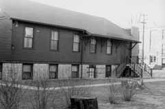 During the 1900s, the history of Clintonville churches is always a story of growth and overcrowding. Here are some pictures of the Clinton Heights Lutheran Church. The original church, a white frame mission chapel shown in my book, was build around 1922.
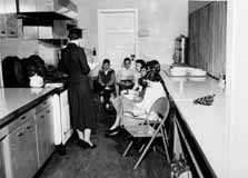 Their Sunday School grew quickly, and by the late 1940s classes were held in adjacent houses and in the church kitchen (shown). Members voted to start a sister congregation on Morse Road (North Community Lutheran Church) to serve the burgeoning population in that area. A new church on Clinton Heights was dedicated in 1951 to serve the legacy members’ needs.
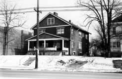 In 1971, the double house located to the south of the church was razed and the parking lot developed. In the 1990s an additional house to the east was torn down to supplement their parking. (Photos courtesy of Clinton Heights Lutheran Church)
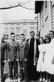 This photo shows the Catechism class on 1941, left to right: Gordon Brevoort, Fred Gardner, James Hagely, Rev. Harold Moench, Norma Montague, Helen Marshall, and Patty Allard. (Photo courtesy of Gordon Brevoort)
Adena Earthwork
 It breaks my heart to learn about the Overbrook Ravine Earthwork (an Indian Mound) located at the southeast corner of Yaronia and Wynding Drive. The earthwork consisted of two earthen mounds surrounded by a 400-foot diameter circular earthen embankment, built over 2500 years ago. Though the city and developers were glad to build a park around the mounds, residents worried about traffic such a park would draw. In 1953 the mound was destroyed to make way for housing construction. (Map courtesy of Franklin County Engineers)
Park of Roses
 Members of the Columbus Rose Club & The Central Ohio Rose Society had long dreamed about a municipal rose garden for Columbus. Late in 1951 a committee was formed, consisting of members from both rose clubs, meeting several times with Mayor James A. Rhodes. The result being on April 19, 1952 Columbus City Council passed an ordinance and issued bonds for the Park of Roses. At the same time the Mayor created an advisory council known as the Columbus Rose Commission, administered by the Columbus Recreation & Parks Department, whose duties were to plan and execute a rose garden to be located in Whetstone Park. George B. Tobey, landscape architect, joined the efforts for park design and development. (Photo courtesy of the Clintonville Historical Society)
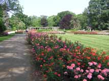 Construction began June 1952. Minimal grading was necessary as the gentle slope of the meadow was ideal for drainage and air circulation. The entire area of 13 acres had sandy loam topsoil to a depth of 11-15 inches, which was indeed fortunate. All beds were excavated to a depth of 24 inches. The existing soil was removed and mixed with imported peat moss and commercial fertilizer. The materials were mixed four times before returning to the beds. The beds were allowed to settle before any planting was begun. (Photo courtesy of Terry Miller)
Bowling
 There were at least 3 bowling alleys in Clintonville: Olentangy Bowling Center (shown here), where Giant Eagle is today; at Graceland (northwest end), and also on the east side of High Street between Oakland Park and Dunedin. Hanging out at bowling alleys was a big deal for many teenagers—whether you bowled or not was immaterial. (Photo courtesy of Galen Gonser)
Library Activities
 Reading has always been a popular Clintonville activity, in part because of its great library programs. The children above are planning the activities for the 1954 National Book Week. (Photo courtesy of the Clintonville Historical Society)
Fourth
 Clintonville’s Fourth of July celebration goes back at least as far as the 1930s, when The Booster and local business association sponsored an annual summer or fall community picnic at Olentangy Amusement Park. (The annual get-together may well be older yet.) Much like today, the early events had pet parades, bike parades, and fireworks. After the amusement park closed, the annual event was held at the Columbus Zoo. And then, when Whetstone Park was dedicated in the early 1950s, the community picnic was moved there and “annualized” to be held on the Fourth of July. The annual community breakfast, originally held for the volunteer workers of the Fourth of July picnic, quickly became another holiday tradition.
Walkers Bait Store
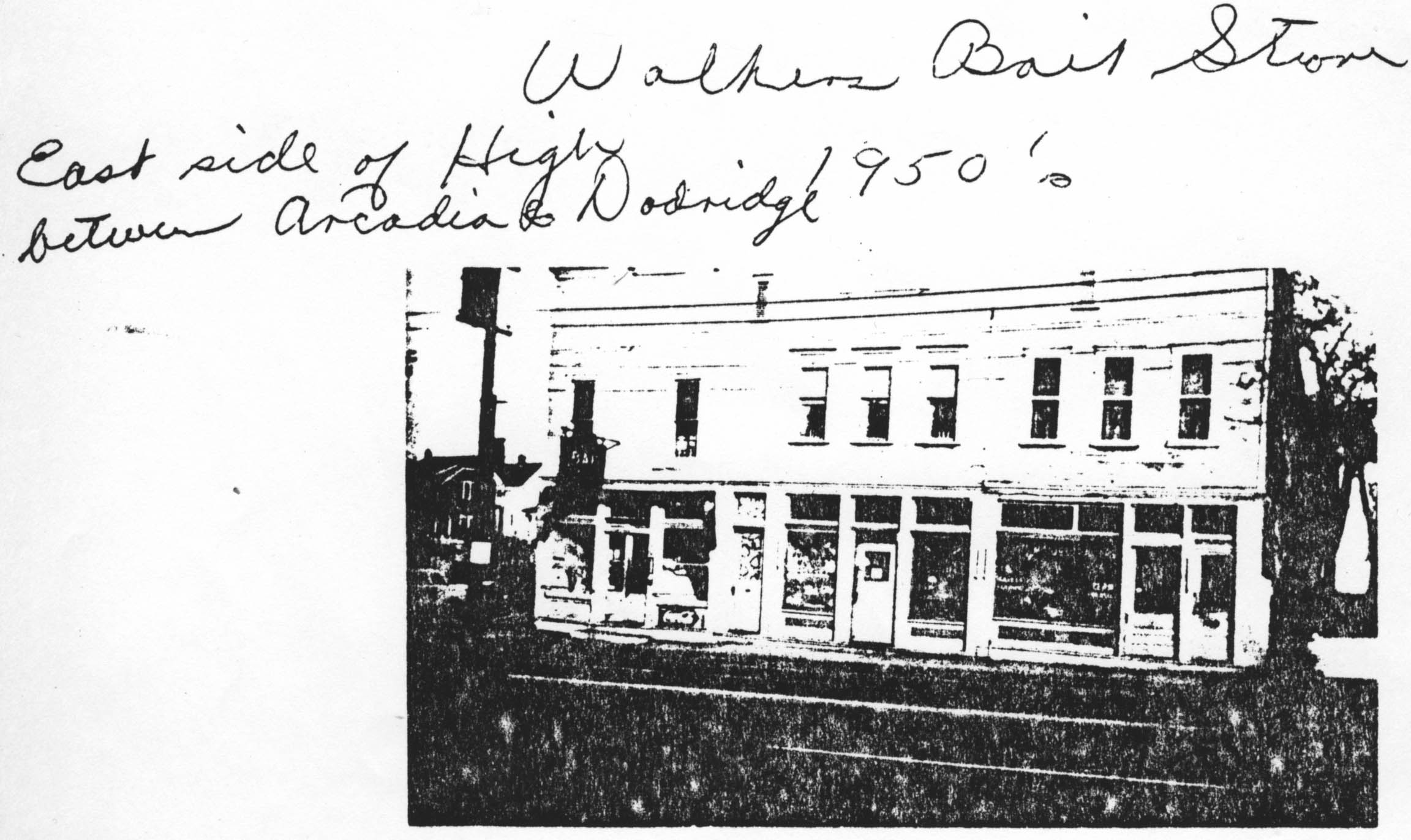
Sorry for the bad image—it’s taken from a photocopy. Walker’s Bait Store was located on the east side of High Street between Arcadia and Dodridge during the 1950s. (Photocopy courtesy of Frank Jones.)
Dispatch holiday contest
 In a previous post, I mentioned that Engine House 19 won the Dispatch’s annual holiday decorating content. This house at on East North Broadway won the contest three years in a row. (Photo coourtesy of Judy Kress)
Through Rose Colored Glasses
 In 1954 Nancy Blanchard, a 16-year-old student at Mifflin High School, became the first winner of Maiden of the Roses competition. The pageant, a yearly event held each June at the Park of Roses and sponsored by North Columbus Civitan, was held from 1954 until 1974. Thanks to Nancy and her cousin Joyce Schatz, we have Nancy’s clippings file from that era, and that newspaper articles are linked to the thumbnail images below as PDFs. [Clippings courtesy of Joyce Schatz.]


Chester Nicodemus
Chester Nicodemus (1901-1990) was a potter, known for his small clay birds fashioned from variously colored, high-iron-content Ohio clays. Several Clintonville residents showed me some of his birds as well as commemorative plates made for the Clintonville Women’s Club. He made teapots and pitchers, robins, eagles, and other wildlife.
Nicodemus earned a degree from Cleveland Art School in 1923 and then taught art at Dayton Art Institute and Wittenberg College. In 1932 he became dean of Columbus Art School, now known as Columbus College of Art and Design. He later taught at Ohio State University and served as president of the Columbus Art League.
Nicodemus lived and had his studio (Nicodemus Ferro-Stone Ceramics) on Clinton Heights Avenue. There he produced more than 1,000 molds in his basement workshop. He had two home-made kilns in the garage, which also housed a showroom. Nicodemus pieces are known for their translucent glaze highlighting the clay’s red tint and producing russet brown undertones. Upon Nicodemus’ death and at his request, all the molds and glazes were destroyed. (Photo courtesy of Darrell Nicodemus)
“Between work and play a midmorning snack is welcomed”
 The Ohio State School for the Blind was built in the 1950s on land that had previously been a renown golf course, Wyandot Country Club also known as the Elks Country Club. This picture and its caption are from a brochure for the school published in the mid 1950s. (Photo courtesy of the Ohio State School for the Blind)
Street Scene
 This photo was probably taken along Olentangy River Road. Note the smudge pots, which were used before the advent of electrical blinking warning signs. I assume this picture was taken around 1953. (Photo courtesy of Franklin County Engineers)
Kiwanis
 I love this picture of the Kiwanis Club of Northern Columbus, the oldest service club in the area, with some members of the Jet League, a baseball team the club sponsored. Over the years Kiwanis has held pancake breakfasts, fish fries, garage sales, peanut sales newspaper sales, and hosted a concession trailer for activities at Whetstone Park. They use the funds to sponsor teams, provide scholarships, sponsor the annual Whetstone Park egg hunt, and to contribute to Easter baskets for Children’s Hospital. One of their largest projects was to raise $50,000 for the lodge at Highbanks MetroPark. (Photo courtesy of Kiwanis of North Columbus)
Kiwanis Cont’d
Here are more pictures showing a few of Kiwanis’ contributions to Clintonville–
World War II memorial to fallen soldiers at Union Cemetery;softball team sponsorship; scholarship program; Easter egg hunt at Whetstone.


ABC Motor Court
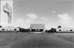 …was located at 5050 North High Street, across from Graceland where Noodles and Company/Petmart now is. (Photo courtesy of Melissa Goodrich)
Third Church of Christ, Scientist
 This is a photograph of the Church of Christ, Scientist at 3989 North High Street, just as its construction was being completed in the early 1950s. (Photo courtesy of Marge Hauer.)
Adeline’s ribbon cutting ceremony
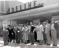 This was probably a ribbon cutting ceremony. It took place at Graceland Shopping Mall in the early 1950s. (Photo courtesy of Casto Corporation)
For additional pictures of Graceland’s early days, check out George Campbell’s online collection of vintage pictures.
Beechwold Hardware
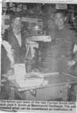 Forrest Smith began Beechwold Hardware in 1944 and 9 years later his son Jack joined him in the business. This photograph shows Forrest Smith and his son Jack around 1960. Jack’s son-in-law now owns the business, but Jack works at the store regularly when he’s not out playing golf. Beechwold Hardware may be the longest-running family-owned business in Clintonville. (Photo courtesy of Jack Smith)
A Rose by Any Other Name…
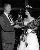 I’m enthralled by pictures of the Maiden of the Roses pageant, held at the Park of Roses each Father’s Day from about 1954 until 1974. The pageants were sponsored by North Columbus Civitan. They evoke an era which is now gone. The celebration included floats, a dance, and the beauty competition, with the award given to the Franklin County girl who “made the greatest contribution to the community and who has worked most in her school.” The 1964 Maiden was Lynn Wilson, from Upper Arlington High School. (Photo courtesy of Glenn Williams)
Maiden of the Roses Theme Song

From 1954 or 1955 until 1974, North Columbus Civitan (along with Columbus Parks & Recreation) sponsored a Maiden of Roses Festival at the Rose Garden. While rummaging through Civitan’s archive for the festival, I came across a written composition of music, clearly intended to be played at the festival and perhaps at the award event. I don’t know who composed it (does the sheet say, “Al Waslon”?). My musician friend and technical advisor Mark Bendig played and recorded the tune for me and now you, too, can listen to it. Click the play button below to stop/play the music. (Access to Civitan’s archive courtesy of Glenn Williams, music courtesy of Mark Bendig.)
Capital City Lumber
During the course of my book, I tried valiantly to get a picture of the Capital City Lumber Company, which used to exist on Indianola where Marzetti’s now stands. Does anyone out there have one?
Boulevard Gardens

 Clintonville residents have always actively gardened. Two views of Boulevard Gardens on Olentangy River Road (or at least I assume this photograph of the Garden Centre on Olentangy Road in 1963 is Boulevard Gardens
(Left photo courtesy of the Franklin County Engineers; right photo courtesy of the Koch family)
 Boulevard Gardens closed down, during the winter of 2008/09. Click on the image to the right for the history of the business from the Columbus Dispatch.
Who Was Bishop Watterson?
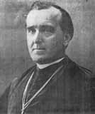 He was the second bishop of Columbus, occupying the episcopacy from 1880-1899. He was born in 1844 in Blairsville, PA and was ordained in 1868. He was president of Mt. St. Mary’s College, Emmitsburg, Maryland when he was selected to become Bishop of Columbus. His special interest was development of parochial schools. (Photo courtesy of Bishop Watterson High School)
Riverside Hospital
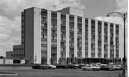 Riverside Methodist Hospital is today a fixture in Clintonville residents’ lives. Prior to 1961, however, it was known as the White Cross Hospital and was located near Goodale Park in Victorian Village. And before that, it was known as Protestant Hospital. Riverside’s first patients were transferred from White Cross Hospital on April 10, 1961. An addition was added in 1970 and an additional expansion began in December, 1990. (Photo courtesy of Melissa Goodrich)
Strings at North
 North High School was a top ranked high school; alumni are rightfully proud of their alma mater. Here is a string ensemble from 1957-58: Tom Lange, first violin; Carol Lowry, second violin; Dorothy Neban, viola; and Mary Anne Brown, cello. (Photo courtesy of Leeann Faust)
Clintonville Auto Repair
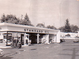 In 1962, Walt Stein leased the Sohio filling station at the Northeast corner of Dunedin and North High Street and named his business Clintonville Sohio (shown here). In 1968 the name was changed to Clintonville Servicenter. The business grew, and in 1970 Stein moved the business to 585 Oakland Park Avenue and changed the name to Clintonville Automotive Repair Service (CARS). In 1982 the adjacent ARCO gas station at 3378 Indianola Ave. was purchased as an annex. (Photo courtesy of Ron Stein)
Clintonville Library 1969
 In 1969, the Clintonville Branch Library moved to 2800 North High Street (from 14 West Lakeview), into quarters built by the Schottenstein Company. This photo shows Virginia Wiltshire, Marge Dersh, and Bob Armour on moving-in day. The library occupied the northwest end of the shopping center, which also had a Kroger and SupeRx drug store. In 1985, the Clintonville and Beechwold branches were merged to become the Whetstone branch library at 3909 North High. (Photo courtesy of the Clintonville Historical Society)
Immaculate Conception Church Neighborhood
An October 15-2010 note from Joe Motil:
There was a large 3 story barn located behind the property across from Immaculate Conception Church. Attached to this barn was also a residence. The name of the family that lived in this residence was “Butts”. This would have been around 1966. I have a photo from my families back yard at 360 Clinton Hts. of the top of the barn. The barn burnt down sometime in the early 80′s or late 70′s I believe. There was also a small barn behind the brick house on the south side and about 3 or 4 house east of Calumet. Sorry I don’t have the address at hand. It was tore down maybe in the late 70′s and a new garage is currently there.
There’s an update to this information here.
Golden Bull
 A great picture of the Golden Bull Restaurant (originally called Beechwold Tavern or Beechwold BBQ) shortly before the Lindquists converted the building, in 1969. It was located at 4784 North High Street
(Photo courtesy of Donna and Nils Lindquist.)
For a companion picture of the building when the Lindquists were moving out, see this post.
Lindy Productions
 In 1989/90, Lindy Productions moved out of the building at 4784 North High Street and The Reserve prepared to move into the building. Nils Lindquist (owner of Lindy Productions) took this photo at the time. (Photo courtesy of Donna and Nils Lindquist.)
For a companion picture of the building when Lindy’s moved in, see this post.
In memorium: Nils Lindquist
Nils I. “Lindy” Lindquist, the owner of Lindy Productions which was in the old Beechwold Tavern building (most recently Cord Camera, at 4784 North High Street), passed away in October. This is another sad loss for the community. Our condolances to his wife Donna and his family. Lindy’s obituary, from the Columbus Dispatch, follows.
LINDQUIST Nils I. “Lindy” Lindquist, age 87, of Columbus, passed away Saturday, October 23, 2010. Lindy was born in Sweden and came to America at the age of six where he lived with his family in Carmel, NY. He was a graduate of Horace Mann School for boys in NYC where he earned his nickname “Lindy”. He joined the Navy and became a Seabee in 1943, the first year the Navel Construction Battalions were established. After WWII, the Navy sent him to Missouri University and Cornell for their NROTC Officers Training Program. He later received a BA from Bowling Green State University, attended the School of Modern Photography in NYC, and received a MA from The Ohio State University. He worked as a photographer for the Columbus Dispatch and worked in the PR department for Nationwide before starting Lindy Productions, Inc in 1966. He then operated three companies: Lindy Productions (a film production company), Ohio Newsfilm (a TV news reporting service) and Magnetic Studios (a sound recording company). Lindy was a writer, photographer, pilot, amateur radio operator, and a film producer; he worked in 34 countries and spoke three languages. He was an honorary lifetime member of the Golden Retriever Club of Columbus, Ohio. His detailed memoirs of the 87th Naval Construction Battalion are now a part of the American Folklife Center in the Library of Congress. Lindy is survived by his wife of 61 years, Donna; daughter, Karen Lindquist Elliott; granddaughters, Colleen Ann McClung, Ph.D., her husband, John Francis Enwright III, Ph.D., and Megan Kathleen McClung, LEED AP; great grandchildren, Evan Michael and Annika Erin Enwright. In keeping with the wishes of the family there will be no visitation. Arrangements by RUTHERFORD-CORBIN FUNERAL HOME, 515 High St., Worthington, OH 43085.
Kroger
 Kroger has had a long presence in Clintonville. In addition to the “drive-in” store described in my book, Kroger built a store at 3559 High Street. From there they moved near Arcadia and High (above). Then, in 1984, Kroger demolished a former Bob Daniels Buick dealership on the northwest corner of North Broadway and High, changed the configuration of Wall Alley, Hennipen Avenue, and Kenworth, and built a Kroger Super Store. (Photo courtesy of Kroger)
Fire! On East North Broadway
About a year ago, Joe Motil sent me some information about a fire on East North Broadway:
There was a large 3 story barn located behind the property across from Immaculate Conception Church. Attached to this barn was also a residence….The barn burnt down sometime in the early 80′s or late 70′s I believe…
I happened to have some friends who had also grown up in that area so I asked them for some additional information. That barn behind the house on E.N. Broadway was indeed located behind the house they lived in, 379 East North Broadway. It burned approximately October 1976. A young doctor’s family lived there. They had photos! which I’m sharing with you here. (Photos courtesy of Kristin Farrell-Logsdon and Mark Logsdon)


Joe Motil then countered with some information and images of his own. In the first photo below, the top of the barn (Cantlon and Farrell families) can be seen. This picture is looking north from the backyard of Joe’s home at 360 Clinton Heights Avenue, and was taken on his dad’s 50th birthday August 12, 1974. The elevation of the property in which the barn sat was higher than that of Joe’s backyard. The snow covered yard and garage picture of Joe’s backyard was taken on March 13, 1958. (Photos courtesy of Joe Motil)


Huntington Bank
 Huntington was a 105 year-old company when it opened its Clintonville office at 3350 Indianola Avenue in 1971. To clear the site for construction of the new building, Huntington demolished 1-2 buildings (shown above). There were “balloons for the kiddies, shopping bags for mother and cigars for the men” at the grand opening on March 18, 1971. (Photo courtesy of Huntington Bank)
Following my Bliss (College)
Another picture that I was unable to acquire for my book was one of Bliss College, which moved to 3770 North High Street Clintonville in September 1973 from 131 N. E. State Street. Today the building is occupied by COVA. Since Bliss College folded, I have been unable to fix on a source for photos of the school while it was in Clintonville. Are any graduates out there?
Henderson Bridge
 The Henderson Bridge was first known as Whip’s Bridge, then Weisheimer Bridge. The present bridge was built circa 1976.
(Photos courtesy of Franklin County Engineers)
Please note: this post was revised on 2021-10-17 to add the 2nd image and to provide larger images when clicking through the thumbnails.
Palmer Miller Nelson Insurance Company
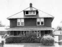 The Kirkpatrick Insurance Company began in 1855 in Adams County, Ohio, moved to downtown Columbus in 1920, and moved to Clintonville in 1954. They remodeled this brick duplex residence at 3215 High Street. In 1973 they demolished the duplex to the north, and expanded the first building. Eventually the name was changed to reflect ownership by Zeke Palmer, his son Daniel, Steven Miller, and Ronald Nelson. It’s one of the oldest independent insurance agencies in Ohio. (Photo courtesy of Palmer Miller Nelson Insurance Company)
Marathon
 The Columbus Marathon began in 1980 and participants ran through Clintonville during its first three years. Runners ran north on Kenny to Henderson, over to the bicycle path then south to Piedmont, east on Piedmont to Calumet, then south toward campus. This picture shows Robert Koch at mile 21 near Arcadia Avenue and Calumet Street. (Photo courtesy of Robert Koch Family)
Clintonville Pharmacy
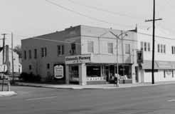 Clintonville Pharmacy at the corner of Dunedin and High was co-owned by pharmacists Charles McCarthy and Gordon Knight, who each also owned McCarthy and Knight’s Pharmacies, respectively. In keeping with the post-World War trend, none of these three pharmacies contained soda fountains, though they had them in an earlier era (when the drugstores were known as Rank’s, at Oakland Park and High, which later became McCarthy’s; as Hooper’s, at the corner of Dunedin and High; and as Cole’s, at Sheffield and High). The co-owned Clintonville Pharmacy closed in the 1980s. (Photo courtesy of Kroger)
Whetstone Library
The Whetstone branch of the Columbus Public Library was originally planned to be between the Recreation Center and the Clintonville Women’s Club. The library would rent the land from the park for $1.00 a year. The plans to build the library were controversial at the time. I did not find records describing why they changed the location, and don’t know what the library pays today. The new library at 3909 North High Street was dedicated in 1985.
Clinton League
In the summer of 1912, a book agent promoted an 11-volume set of books entitled The Foundation for Young People. Buyers were entitled to a Certificate of Membership in the Child Welfare League of America. Twenty-five local women pledged, and 11 of them came to the first local meeting. In the early days they met in the guild room of Saint James Episcopal Church. They held readings and had discussions on predetermined topics. They supported Columbus’ Baby Camp; they held Minstrel shows to benefit the Belgian Relief Fund; they sponsored a hot lunch program in the local schools. Clintonville was outside the city limits in these early days and had no city library service, and so club members established a branch of the state library within Clinton School from 1914-1915, and when that was deemed impractical, they had a lending library at Cummings Drugstore located at Clinton Heights Avenue and North High Street—another idea that proved to be impractical. Eventually a Columbus Public Library 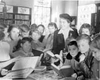 branch was put into Clintonville, and when the local group became aware of the local library’s need for books, they held a “book shower” to bring in book donations. They engaged in war relief work in 1917. They advocated getting rid of some dirty carriage sheds at the Clinton school. In 1915 they were also able to convert two vacant lots owned by J. E. Pierson on Dunedin near Beach Hill Avenue (now Calumet Street) for use as community tennis courts. The club contributed to the community through World War I, the flu epidemic of 1918, the Great Depression, World War II, the Korean War, and the Vietnam War. Over the years their name changed from Clinton Child Welfare League to the Clinton Social Welfare League (1913) to the Clinton Welfare League (1915) to the Clinton League (1925). The group disbanded around 1977. Their papers can be found at the Ohio Historical Society.
From 1945 to 1953, they donated books to the Clintonville Library. In this photograph, Mrs. Miller presents books to the children at the Clintonville Library, on behalf of the Clinton League. (Photo courtesy of the Clintonville Historical Society)
Halloween
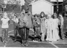 I wonder how long school children have been parading in their costumes on Halloween day. Certainly they were doing so early on at Glenmont Elementary School. In the early days, neighbors probably turned out to watch the parade; nowadays they are more likely to watch from inside their houses. (Photo courtesy of Indian Springs Elementary School)
Schools
Here are a few photographs of schools that I was unable to fit into my book.
 Colerain School, which is located at 499 East Weisheimer Road.

Calumet Elementary School, at 2774 Calumet Street.

Dominion Middle School, located at 330 E Dominion Blvd.
Beechwold Pharmacy
I received a request for additional photos of Beechwold Pharmacy, before the building became a flower shop. Beechwold Pharmacy was located at 4622 North High Street, owned by Arden and Pat Englebach, and had the last soda fountain in Columbus. [Photos courtesy of Arden and Pat Engelbach]


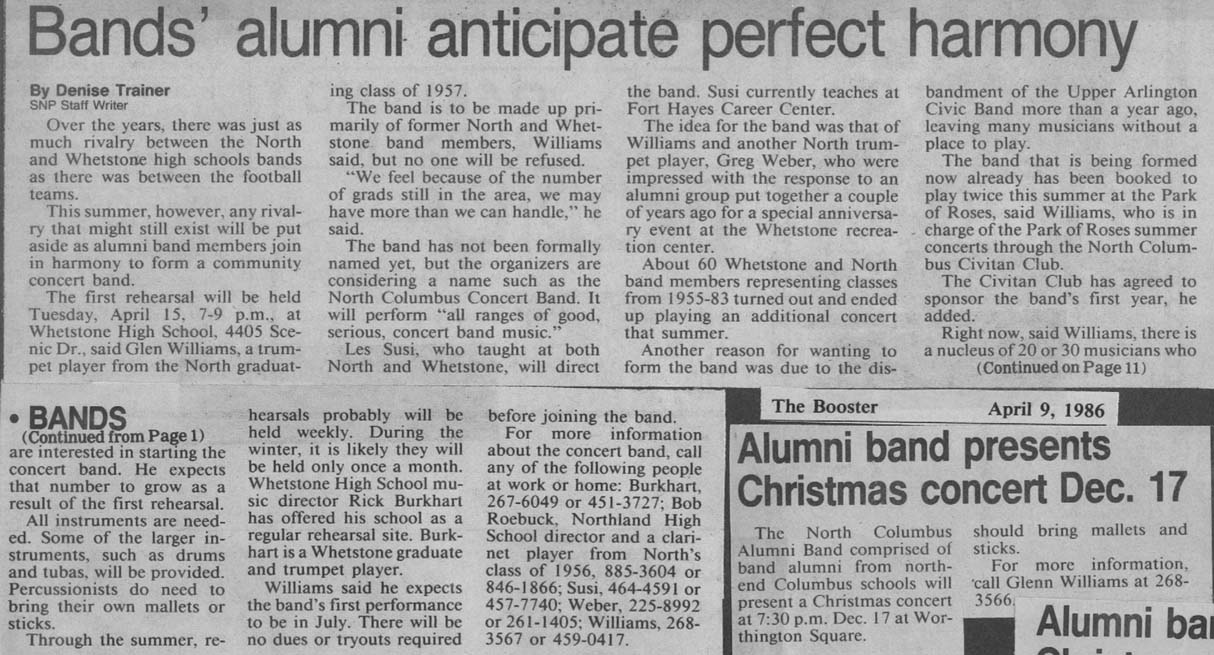
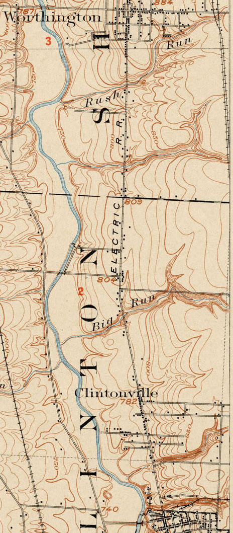
“Private Fun by the Hour”
 Okay, who here remembers the Sunbubble–and is willing to admit it? In 1986 it was located at 4495 North High Street, cost $6 an hour, and offered “a private chance to slip into a hot tub, watch some M-TV or a movie, listen to your favorite radio station or cassette tape and have a good time.” Sunbubble was eventually demolished to make way for the Unitarian Church’s expansion and the overhaul of that section of High Street. And note: this photo shows two models in a promotional photo for the hot-tub facility.
David Schreiner Dies
David H. Schreiner, age 92, died Thursday Feb 19, 2010. From the Columbus Dispatch Obituary:
“Founder and owner of Schreiner Plumbing And Hardware Co in 1946. Veteran, U.S. Army Air Corps, WW II. Member of North High School Alumni and OSU Alumni, where he was the first “Script Ohio” snare drummer for the OSU Marching Band; member, Aladdin Shrine, Drum & Bugle Corp, Royal Order of Jesters Court 8; El Hajj; Kachina Club; Ambassadors Club; Last Man’s Club; Scioto Boat Club. Member, Northwest United Methodist Church.
“Survived by devoted wife of 61 years, Ruth; children, John “Jack” (Gloria) Schreiner, Daniel “Dan” (Glenda) Schreiner of AZ, and Nancy Schreiner; grandchildren, Debi (Jim) Lewis, Cathi (Jeff) Hill, Ben (Lara) Schreiner of GA, Tyson (Laura) Schreiner of WI, Andrew (Britta) Schreiner of NJ; great-grandchildren, Noah and Ethan Schreiner of GA and Ian Schreiner of WI; nieces and nephews.”
Skyline Mural
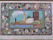 This 9 foot by 15 foot Columbus Skyline Mural is all that’s left of the Savings of America National Savings and Loan that was located from 1987 to 1992 at Graceland Shopping Center. The mural was created for the bank by renowned tile artist Marlo Bartels in the mid-1980s. The Casto Corporation donated it to Clinton Elementary School; it adorned the Gail Paris Discovery Garden for awhile and was moved into the cafeteria after the school’s 2011-2012 renovation. (Photo courtesy of Terry Miller)
Northend Wrench
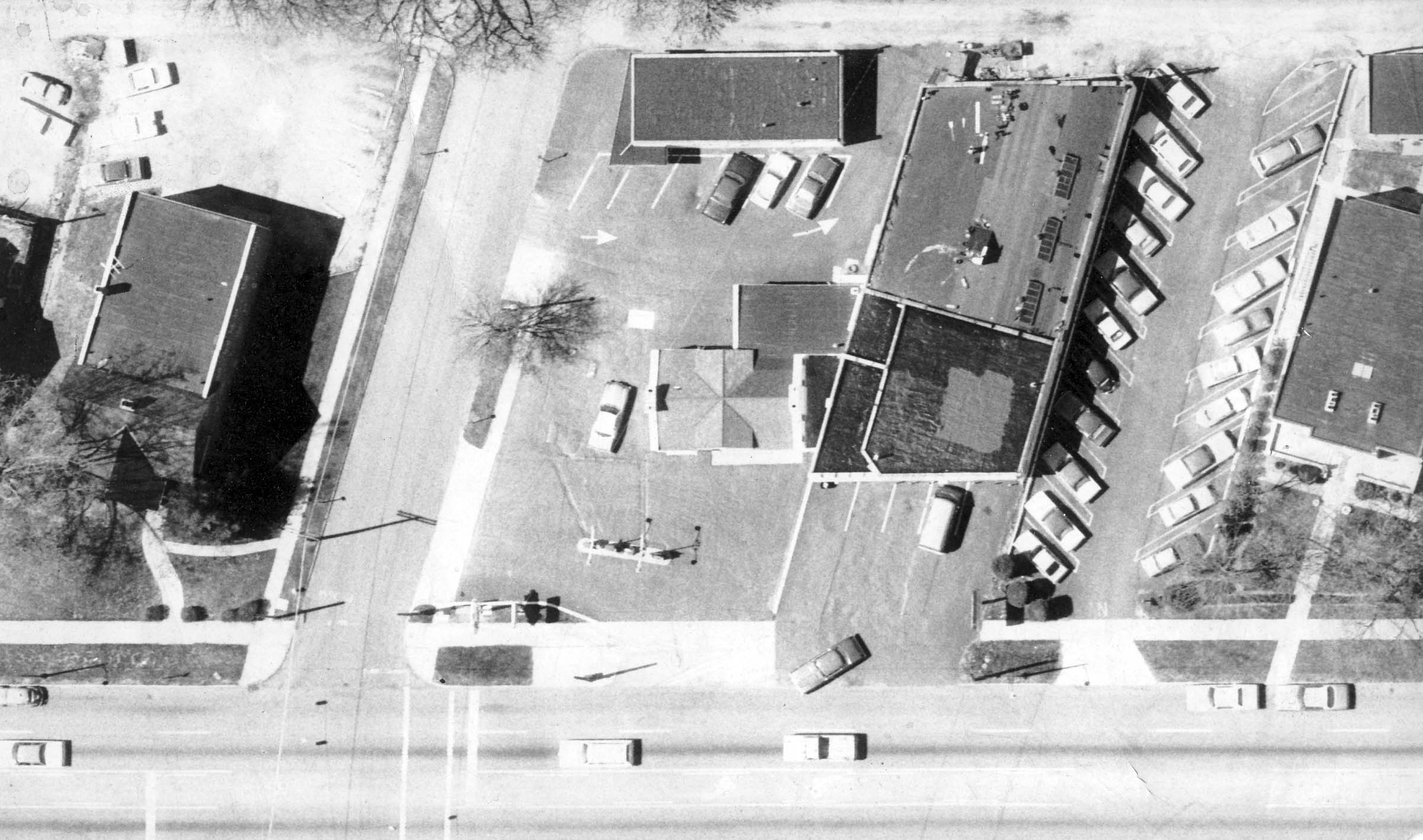 An aerial photo of North High Street. On the top center of the photograph is Northend Wrench before that business moved to Indianola.
(Photo courtesy of David M. Wenger)
Charity Newsies
 Until I worked on this book project, I didn’t know what the Charity Newsies–those guys wearing white jumpsuits asking for donations on street corners in December –did and why they did it. But after becoming acquainted with the organization I am so impressed with the group’s charitable accomplishments. Just in case you are as ignorant as I was about the group, here’s what they do: each year they equip needy schoolchildren—about 14,000 of them– with a wardrobe of new clothes for the school year. Every child in the program receives individual attention from a Charity Newsie member. The organization is totally independent and does not receive government money for their effort; they spend the year collecting money for the endeavor. And, they’ve been doing this for 100 years. This photo shows the Newsies when they first moved their headquarters from South High Street to Indianola Avenue (1995). (Photo courtesy of Charity Newsies)
Clintonville Federal Savings
 Clintonville Federal Savings was located just north of the Northmoor Fire Station until the bank was demolished to make way for the fire station’s expansion. Note the Northmoor addition pillars marking the entry into that housing development, which was opened in 1921. (Photo courtesy of Melissa Goodrich)
Carving out a Niche
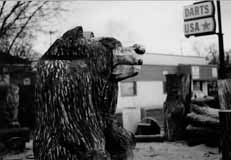 I wish I could have included these pictures of Jerry Devine’s chainsaw sculptures at Como Mower in my book because they are so Clintonville. Unfortunately I had too many pictures and too little space and so I used date (1970s) as a cut-off criteria. Weiland’s has a sculpture as does someone who lives in the vicinity of Northmoor. Note also, in the photograph, the old Darts USA store, which no longer exists. (Photo courtesy of Jerry Devine)
William Gillie
Another prominent Clintonville resident was William and Catherine Gillie. He was a Franklin County Court of Common Please judge for 25 years; by hobby a whittler and ice hockey player, and a contributor to Park of Roses and to many of the area’s senior centers. She was a major force in formation of Columbus’ LifeCare Alliance.
Schreiner’s Hardware

 When David H. Schreiner returned from flying planes in World War II, he had his mind set on opening a hardware store. He convinced his father, master plumber Henry J. Schreiner Sr., to join him, and together they opened the Schreiner Plumbing and Hardware Company in 1946 at 2585 North High Street. After serving Clintonville and North Columbus for 52 years, Dave retired in 1998. These photos were taken in 1998. (The exterior photo shows not only the hardware store but also Artist’s Workshop Art Supply Store, a favorite place for supplies among art students around town.) (Photo courtesy of Ruth and David Schreiner)
Whetstone Prairie
 The Whetstone Prairie was a joint project between the Columbus Recreation and Parks and Columbus Wild Ones, a non-profit community organization that promotes biodiversity and environmentally sound landscaping practices by using native plants to landscape city and suburban yards. They turned about 5 acres of lowland along the river just to the south of Adena Brook into a prairie using flora native to Franklin County. The Columbus Chapter began planning for the Whetstone Prairie in January, 2003. Seeding and planting was done in 2004. In 2005 the prairie bloomed with the spectacular results shown in this photo. In Summer, 2007, Wild Ones turned over the prairie to the management of the Columbus Recreation and Parks Department in a ceremony at the site of the prairie in Whetstone Park. My favorite time in the prairie is in the early morning during summer, when the sun is shining horizontally through the plants. (Photo by Craig Preston, and displayed courtesy of Marilyn Logue. )
Fred Shannon
 Among the many accomplished people of Clintonville is Fred Shannon (1921-2007), a renowned photographer who worked for The Columbus Dispatch. In this picture he is wearing a Mickey Mouse strap given to him by his son. The story goes that Fred was taking pictures of the original Mickey Mouse creators and they were so tickled by the strap he was wearing, they made him cartoon which the Shannon family still has.
Community Band
 The Clintonville Community Band was founded in 1984 by Les Susi for North and Whetstone High School graduates as the North Columbus Community Band. In 1997 the name was changed to reflect participants’ true geographic ties. The Clintonville Community Choir was established 2005. The choir often performs music by Clintonville native John Ness Beck, a prolific composer of choral music. This photograph shows their August 2007 concert. (From the Clintonville Community Band’s web site)
East North Broadway


For the residents of East North Broadway, widening their roadway has been a seemingly endless struggle of defending their property against City Hall. Joyce Schatz–for many years an officer in the East North Broadway Street Association–has kept an archive of the issue, and I’ve linked to it here.
The city claims the right of way is 100 feet. Some research shows that it is 70 feet. Residents’ deeds and surveys are all over the place. Some have 15’ listed, many don’t, including recent purchasers. The majority of the parcels at the end of the street do not have the 15’ easement in their deeds. The deed to Steve and Ann Wilson’s home (one of the three slated to lose their yard), specifically includes the footage and states “…Together with the Fifteen (15) feet off the North Side of East North Broadway vacated by resolution of the County Commissioners of Franklin County, Ohio, on October 7, 1952.”
For those of us who don’t live on East North Broadway, the issue is less “Can the City do it?” but “Should the City do it?’ For the time being, the city is not actively pursuing the widening.
Ravines
In my book, Clintonville and Beechwold, I stated that there are 4 ravines in Clintonville. Today there are 4, but originally there were, oh, perhaps 6. The area around Richards and Granden—which used to be called Richards Woods, before it was developed—has been filled in; and there is a low lying ravine between Clinton Heights Avenue and East North Broadway, which was also filled in quite a long time ago.
Notable people
I had originally planned to include a chapter in my book about notable Clintonville residents. Oddly, I was unable to acquire a balanced set of information about Clintonville’s notables. But here are the names of some of those who were nominated, either renowned for their contribution to Clintonville or because they were renown in their chosen field:
- Armbruster, Mathias (lived at 3100 North High Street where Southwick-Good & Fortkamp Funeral Chapel now stands)
- Barker, Skip, d. 2008
- Breunig, Sarah—civic leader (Glenmont Ave.)
- Dawson, Harold
- Dodge, Mel (201 Girard Ave)
- Dupre, Dallas–landscape architect (whose office was at 3073 North High) who is credited with founding the nation’s system of roadside parks
- Gessaman, Myron–Columbus mayor (he lived at 4206 Fairoaks Avenue and also at 147 Rustic Bridge Road)
- Gillie, William and Catherine
- Gowdy, Harry “Hank” (address listed as 384 Fallis Road)
- Graham, A.B.–founder of 4-H Clubs (lived at 159 Clinton Heights Avenue)
- Herbert, Paul M. (307 Olentangy Blvd.)
- Hollenback, Rand & his son Donal
- Hutchins, Edward F., 1925-2005, Dispatch writer, park director from 1971 – 1990s (5301 North High Street Apt. C)
- Jeffrey, Joseph A.
- Koblentz, Morris
- Koch, Freda Postle–journalist, writer and civic leader (Oakland Park Avenue)
- Marshall, George Sidney, 1869-1956–Columbus mayor
- Martin, James Boyd—architect (East North Broadway)
- Moose, Bill–last of the area’s local Wyandot Indians
- Morrill, Paul–artist
- Murnan, Patrick–owned a horse farm where Graceland Shopping Center now stands
- Nicodemus, Chester–artist (Clinton Heights Avenue)
- Reinhardt, Dana–Columbus mayor
- Rhodes, Jim–Ohio Governor
- Rogers, Carl–psychologist (lived at 4857 Rustic Bridge while a professor at OSU)
- Scott, William H.– president of OSU
- Sensenbrenner, Jack, 1902 – 1991–Columbus mayor
- Shannon, Fred–photographer
- Thomas, Edward Sinclair–naturalist
- Tyack, George E. (69 Croswell Road, in 1960)
There are of course many others and I welcome input on this list
Clintonville’s Historic Inventories
Historic Inventories are brief “snapshot” assessments of buildings to determine whether the buildings are of historic interest. Just 1 or 2 pages in length, an inventory is intended to provide a brief description of the location, background, and architecture of a building, site, structure, or object of architectural or historical significance.
The inventories have been written by students or by dedicated residents such as those in the Old Beechwold area, under the auspices of the Ohio Historical Society Historic Preservation Office. (The Beechwold residents did an especially terrific job of inventorying their neighborhood.) For more information about Ohio Historic Inventory Program, click here.
I’ve made a map of the places in Clintonville that have been inventoried; click on the thumbnail to the right to see it.
Linked below, in PDF format, are the historic-inventories for buildings in Clintonville as of July 2008.
Old Beechwold:
Old Beechwold Historic District Nomination
4765 North High, aka “the Gatekeeper’s House,” and also this version
4475 North High
44 West Jeffrey Place
177 West Jeffrey Place
30 West Beechwold
62 West Beechwold
80 West Beechwold
100 West Beechwold, and also this version
150 West Beechwold
209 West Beechwold
4783 Olentangy Blvd
4793 Olentangy Blvd
4805 Olentangy Blvd
4817 Olentangy Blvd and also this version
4820 Olentangy Blvd
4827 Olentangy Blvd
4831 Olentangy Blvd
4837 Olentangy Blvd
4935 Olentangy Blvd
23 West Riverview Park
75 West Riverview Park
81 West Riverview Park
121 Riverview Park
197 Riverview Park
157 Rustic Bridge
222 Rustic Bridge
4787 Rustic Bridge
4795 Rustic Bridge
4857 Rustic Bridge
4866 Rustic Bridge
4876 Rustic Bridge
4 West Royal Forest
52 West Royal Forest
91 West Royal Forest
115 West Royal Forest
128 West Royal Forest
201 West Royal Forest
North Broadway:
65 East North Broadway
77 East North Broadway
150 East North Broadway
155 East North Broadway
162 East North Broadway
177 East North Broadway
456 East North Broadway
489 East North Broadway
Elsewhere in Clintonville:
3119 North High
3377-3381 North High (Clinton Theatre)
3783 North High
3535 North High
149 East Kelso
45 East Crestview
238 Crestview
129-131 West Weber
259 Walhalla
334 Walhalla
224 East California
91 West Longview
191 West Delphi
314 West Kanawha
163 Kenworth
203 Kenworth
265 Kenworth
285 Kenworth
289 Kenworth
629a Oakland Park
645 Oakland Park
189 Northmoor
3624 Weston Place
214 Arden (a Lustron home)
100 Webster Park
213 Webster Park
7 West Henderson (Maple Grove Church)
45 Weisheimer
239 Weisheimer
286 Weisheimer
And (technically) just south of Clintonville:
100 Arcadia (Old North High School)
Glen Echo United Presbyterian Church
290 Cliffside Dr
17 West Dodridge
44 West Dodridge and 44 West Dodridge
96-98 East Dodridge
Art and Artists in Clintonville
In addition to compiling a list of Clintonville’s “notable people,” I have often wanted to see a list of Clintonville art and artists. My list might include:
Jodi Kushins, artist of Smith’s Deli external mural
Smith’s Deli’s indoor murals as well
Jerry Devine (chain saw art, out of Como Mower Service & Sales on Indianola)
Harlow Ballard (digital art)
Tim George (Etch-a-Sketch artist)
Chester Nicodemus (ceramics)
Mac O. Shaffer (photographer)
Fred Shannon (photographer)
Mathias Armbruster
Art in Clintonville churches
Marlo Bartels’ Skyline mural formerly at Clinton Elementary School
Please add to my list in the Comments below!
Housing Subdivisions
 Paul Bingle created this map of Clintonville housing subdivisions several years ago, and I’ve digitized it for this web site. Click on the thumbnail to the right to bring up the full-sized map, and then put your cursor over each blue number to bring up the name (and when available, the year) of each housing development. You can also click on the thumbnail “key” to see Paul’s original key.
(Research and original map by Paul Bingle.)