Plat of Old Beechwold
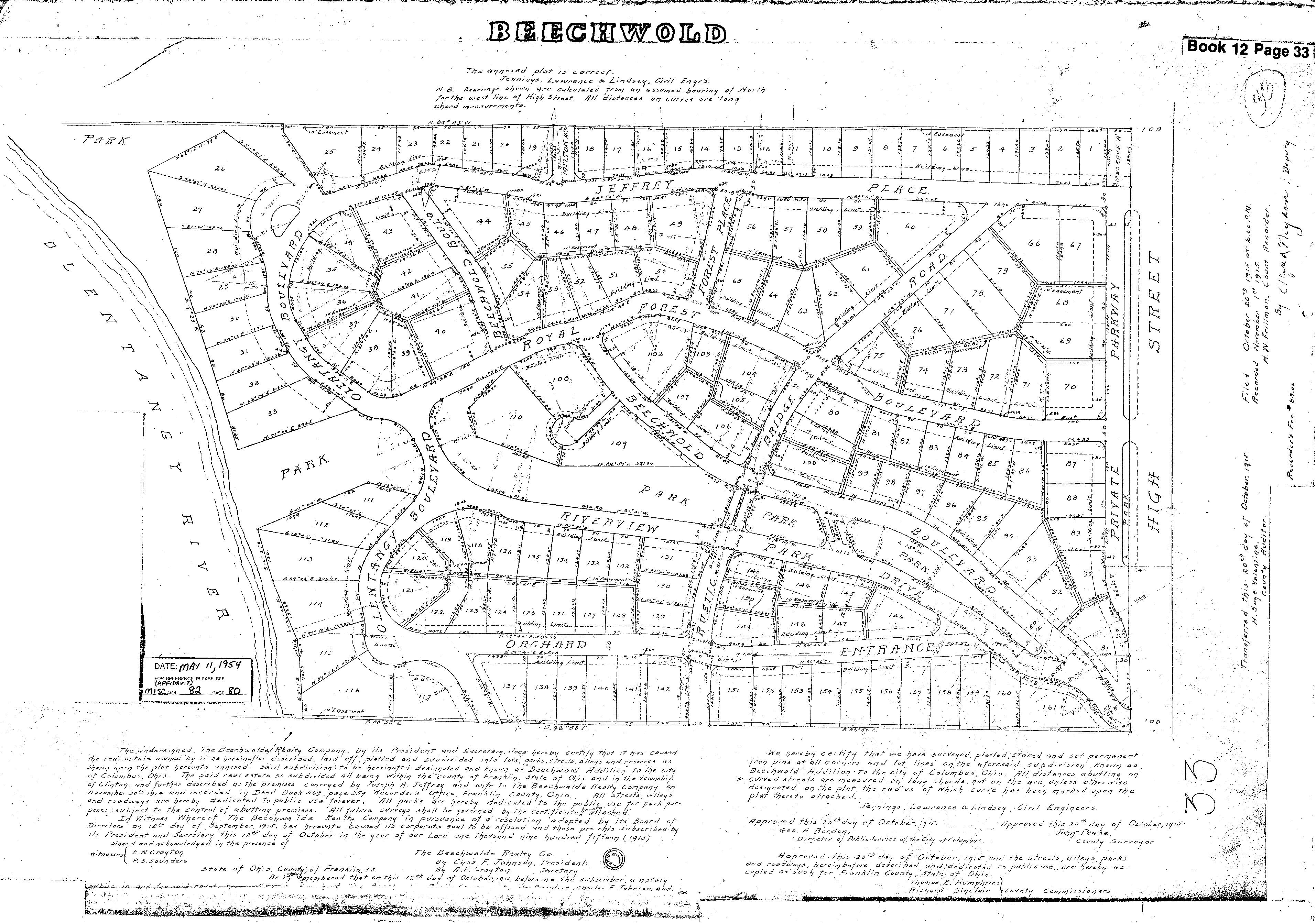 Wendy Bayer sent us this wonderful plat map of Old Beechwold. Plats are maps, usually drawn to scale, of the subdivisions of a piece of land. with lot numbers. [Map courtesy of Franklin County Records via Wendy Bayer]


Wendy Bayer sent us this wonderful plat map of Old Beechwold. Plats are maps, usually drawn to scale, of the subdivisions of a piece of land. with lot numbers. [Map courtesy of Franklin County Records via Wendy Bayer]