Oakland Park & N High, 1922
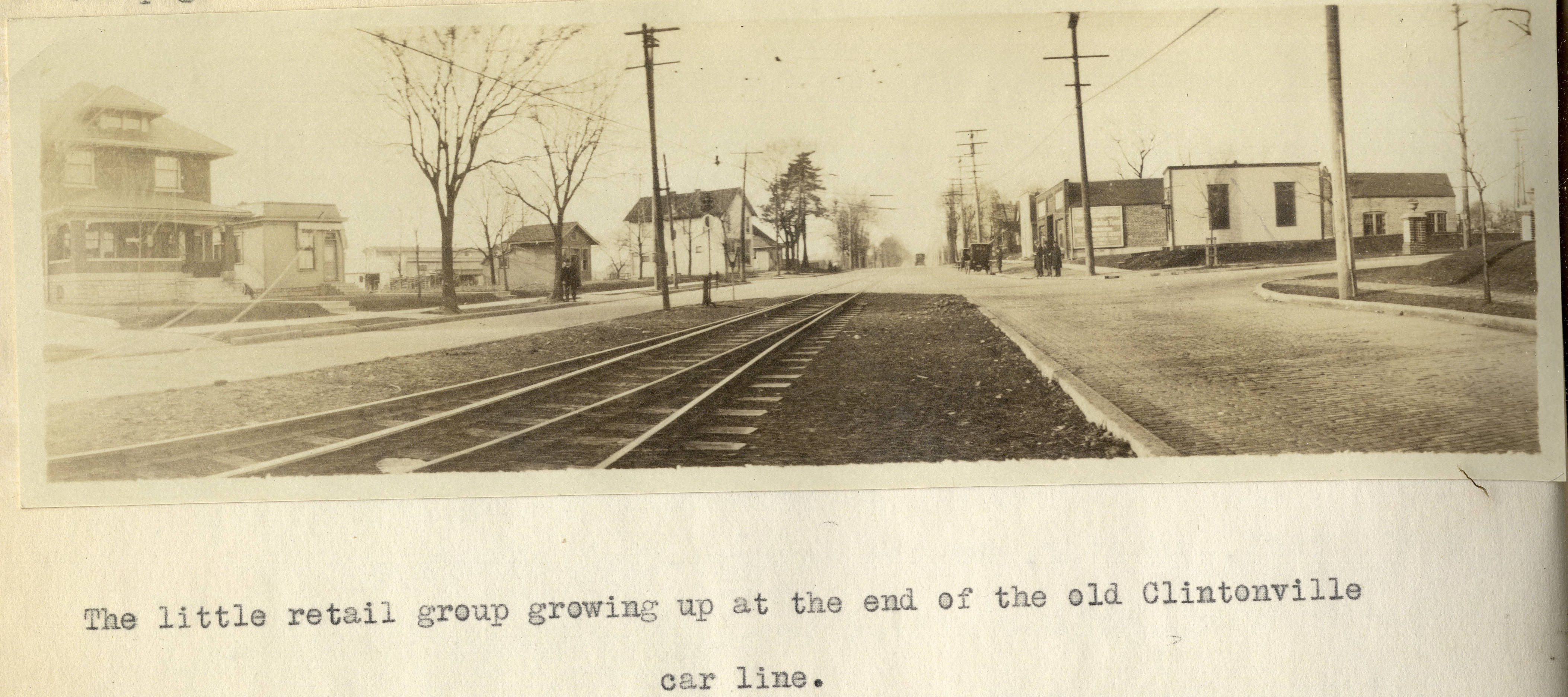
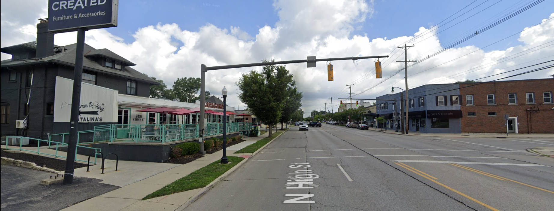
I’ve previously mentioned Forest Ira Blanchard’s wonderful master’s thesis, which is a treasure trove of photos of Columbus in 1922. It contains this old photo of Clintonville at the intersection of Oakland Park and North High in 1922. The house on the left, west, side of North High Street is still with us! Here’s that same intersection today.
Here’s Blanchard’s accompanying text:
Beyond Hudson Street to Arcadia Avenue, High Street is about solidly lined with small, but unattractive store rooms, this being the business section of the old, formerly outlying, hamlet of North Columbus. Here, at the corner of Arcadia and High is located the car barn and the end of the High Street car lines. Until recently, from this corner, through Clintonville, the Clintonville line and the Columbus, Delaware and Marion Interurban cars furnished the transportation service; now, the former line has been superseded by an extension of the Summit Street line. At the center of the former suburban village of Clintonville , where Clinton Heights Avenue joins High Street a small retail center has grown up, which is extending northward on High Street , a short distance . At the end of the Clintonville car service another little business center is coming into existence, incidentally the cross street here, Oakland Park Avenue , is a through one into the country to the east . This point not only ends the city car service out North High Street , but the retail stores as well , which is instructive as to the influence of such transport service upon the location of retail stores.
Such residences as are yet found along the High Street electric lines are not as good, on the whole, as those back of them away from the noise of the cars .
Alex Campbell has kindly provided a bit of background information on the transportation systems mentioned in Blanchard’s document:
When the line north of Arcadia was trackage for the CD&M, up to about 1922, it was single track from Arcadia to Tulane Rd than double track to Kenworth Ave. From Kenworth Ave north, it returned to single track with four passing sidings located between Kenworth Ave and Worthington. Between Tulane and Kenworth, the double track was in the center of High St. separated from the paved road. I’m not sure what you call that – a boulevard?? (I suspect you know all this. I just wanted to be on the same page.)
This drawing of the 1925 CRP&L Co. trackage by BJ Kern is what I am using to back up what I’m describing.
In Blanchard’s photo, the end of the double track is visible, which indicates that we are either at the north or south end of the double track. If it were the south end, you would expect to see more trees and maybe even Olentangy Park in the distance – it’s not the south end. That leaves the north end of the double-track.
Oakland Park tees into High Street from the east. The fancy and inviting brick columns suggest the developers have been busy. Kenworth would come from the west, slightly south of Oakland Park, if it even gets as far as High Street. In either case, it isn’t visible.
Blanchard refers to this photo location as “the end of the old Clintonville car line.” I think he is referring to the predecessor of the CD&M, the Columbus, Clintonville & Worthington Street Railway. The double track section must have been built by the predecessor, not the CD&M. The CC&W was itself the joining of two traction lines, and this is where the two joined.
Thank you Alex!
[Courtesy of Forest Ira Blanchard, An Introduction to the Economic and Social Geography of Columbus, Ohio. Thesis (M.A.), Ohio State University, 1922, page 38. Blanchard lived from 1886 to 1963.]