« Return to Clintonville History home page »

Posts Tagged ‘Olentangy River’

Old Piatt Mill

Monday, September 30th, 2019


This lovely mill was located on the river, just north of the present Dodridge Street bridge. There is another photo of this, in my book.

The original dam and mill were constructed by David Beers in 1810. Beers owned the land on which the mill was located. Darius Wilcox built a sawmill adjacent to the flour mill. The mills later came to be owned by the John James Piatt family. The buildings burned down on June 13, 1902. The area just to the east and north is where Olentangy Amusement Park was located.

[Image courtesy of Galen Gonser]

The River

Friday, July 15th, 2016

I assume this late 1930s picture was taken somewhere along the Olentangy River in the area of Clintonville. Note that both the trees and the stone structure are actually in the water. Does anyone out there recognize the location? [From a North High Memory Book]

Dodridge Bridge

Friday, October 10th, 2008

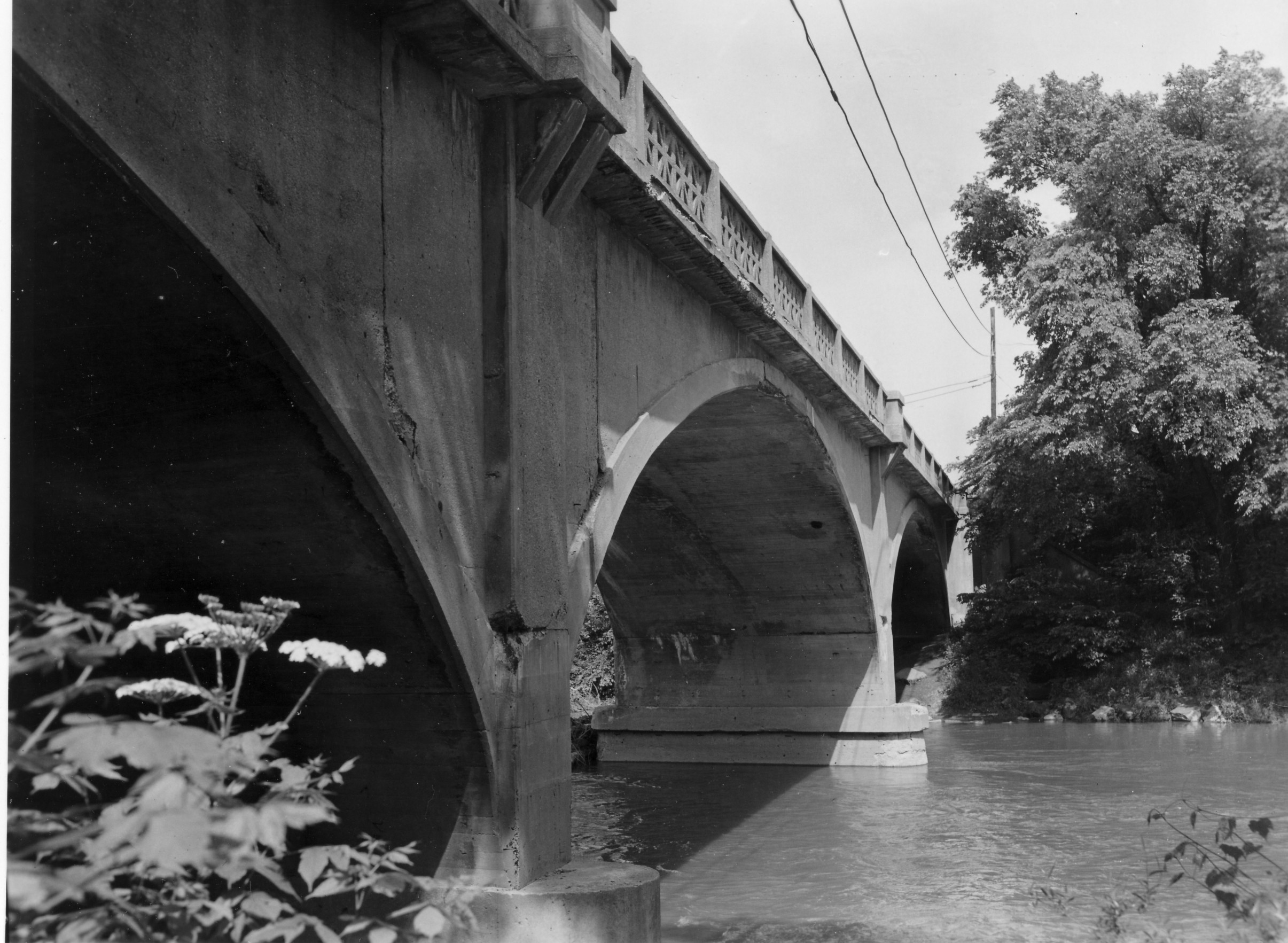
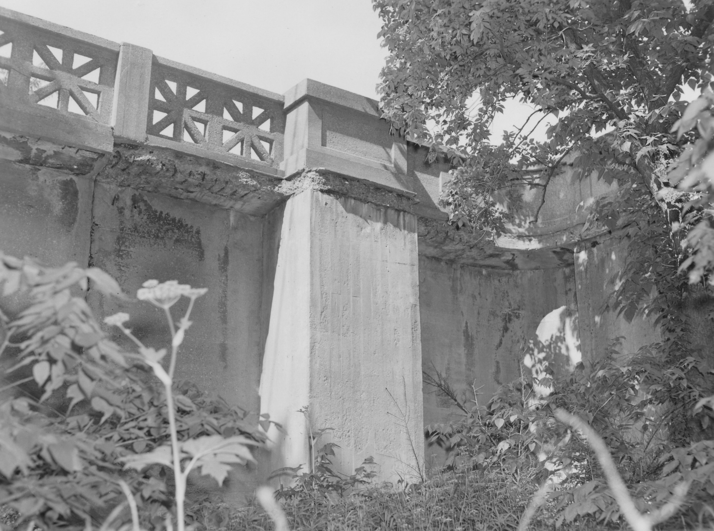
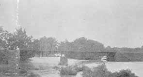
As my book shows, there was once a covered bridge over the Olentangy River at Dodridge Road. The Dodridge covered bridge was replaced by a truss bridge built by the Columbus Bridge Company. This picture shows the replacement bridge in 1890. Fishing from the bridge was a favorite activity for many 20th century Clintonville residents. It was a lovely river, and crappy and small mouth bass abounded. (Photo courtesy of Columbus Metropolitan Libraries)

“It’s Great Fun”

Friday, October 3rd, 2008

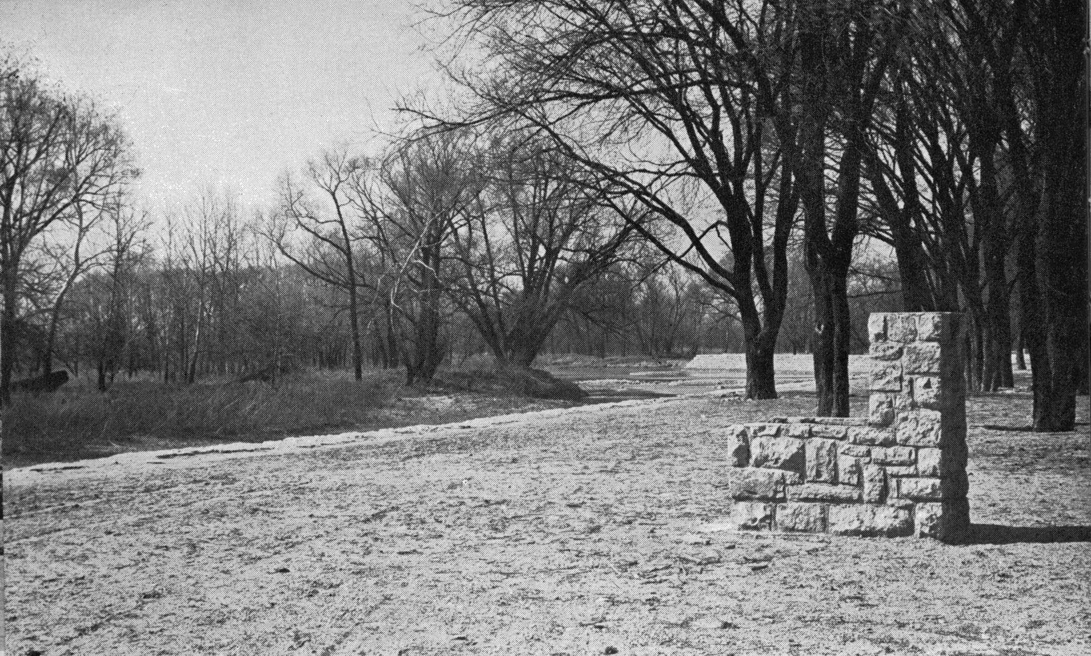
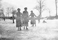
The river was a favorite skating spot in the early part of the century. Children also sledded on East North Broadway, and on “Mooney hill” at 259 Walhalla Road. In the summertime, there was a swimming hole colloquially called Bare-ass Beach in what is now Whetstone Park plus a legendary skinny-dipping spot in the river at the “Holt farm” near the C.D.& M. Interurban line’s Stop 18 around Lincoln and High. (Photo courtesy of Amy Westervelt)

Columbus Canoe Club

Friday, September 26th, 2008

The house that currently stands on the north side of Orchard Lane at the river was once the Columbus Canoe Club. It has had only 4 owners in its lifetime, and the present owner had to do considerable renovation on the building. The club originally had tennis courts; the space is now a swimming pool. Sadly I know of just one photo of the club, which is located at the Ohio Historical Society. The current home owner told me that Bill Arter, an artist who drew and researched Columbus buildings in a Dispatch column called “Columbus Vignettes,” was in the process of writing a column about the club when he passed away.

Robert Ohaver (1937-2009)

Saturday, September 20th, 2008

Robert Ohaver (b. 1920) lived most of his life in Clintonville and on West North Broadway. He had many stories of old Clintonville to share with us. On September 12, 2003, several community members (Ann and Alan Woods, Barbara Hotchkiss, Nancy Kuhel) interviewed him and preserved the conversation on tape. Now you, too, can listen to Mr. Ohaver’s oral history.

Sadly, Bob Ohaver passed away on June 11, 2009. You can find his obituary here. There is another small entry about his aunt on this web site here.

Bob mother was Laura Ohaver and his father was Walter Harvey Ohaver. Bob also had an older brother named Jack Ohaver who lived in Clintonville at 116 E. Dunedin with his wife Clara Ohaver. Clara passed away May 24, 1993, and Jack passed away on June 14, 2000. Jack and Clara had two daughters. Sue Bowman was born May 8, 1940; she passed away January 4, 2000. Sandra Urban born July 30, 1945. [This family information came to me from Jack’s granddaughter and Sandy’s daughter, Lisa Adkins. Thanks, Lisa!]

Each file is about 30 minutes long.

Contents

Track 1.
Brief Ohaver biography; origins of his family moving to West North Broadway; his World War II years; Clinton Theatre; businesses and homes at the interesection of North Broadway and North High Streets; drugstores and candy stores in Clintonville; the house behind 3391 North High Street; Dispatch carrier’s substation; Olentangy Park; the streetcar storage barn at Arcadia.

Track 2.
Olentangy Park cont’d; street fair at North Broadway and High to celebrate Clinton Theatre, the opening of Clinton School pedestrain subway, and the paving of North High Street after a new sewer line had been installed; the Olentangy River; 3 canoe clubs; development of West North Broadway (“the Broadway Extension”) and the Scott farm; development of the area along the adjoining river bank; the Herron [spelling uncertain]/Zinn home at 285 West Kenworth; Bill Moose AKA “Indian Bill”; Chief Leatherlips.
Note: the “Dr. John Scott” is William H. Scott, president of OSU 1883-1895. See my book, page 17, for a photo of his house.

Track 3.
Chief Leatherlips cont’d; house at 273 Erie Road and excavation of nearby gravel pit; the Fuller farm/Whetstone Park; rambling through the woods; Indian Springs golf course; Bill Moose AKA “Indian Bill”; Olentangy Park; North Columbus including the Ramlow Building; Picadilly Theatre; streetcars and interurbans.

Track 4.
Southwick funeral home; Joy Hunt home; Graceland Shopper’s Mart and Patrick Murnan; Clinton Theatre; the Great Depression; Ohaver family; Brighton Road development; Ohaver’s WWII and postwar years.

Track 5.
Ohaver’s return to Columbus from California in 1962; bombing of the Clinton Theatre in the 1930s.

1959 Flood

Friday, September 12th, 2008

On January 21, 1959, Clintonville experienced a 24-hour deluge, with a thaw, that left scores homeless. The flood affected homes from Arcadia to Southington. Newspaper articles of the time state that evacuations were made at the west end of Rosslyn, Kanawha, Westview, from Martindale (on the west side of Olentangy opposite Marburn), and in the vicinity of American Legion Park (today’s Clinton-Como Park) and from countless homes in the path of the swollen and ice-carrying river. Gas and electricity had to be cut off for safety. Several people died. Mayor Sensenbrenner declared a state of emergency in the city of Columbus, and similar action was taken all over the state. [From North High School Polaris, 1959]

Henderson Bridge

Friday, September 5th, 2008

The Henderson Bridge was first known as Whip’s Bridge, then Weisheimer Bridge. The present bridge was built circa 1976.

(Photos courtesy of Franklin County Engineers)

Please note: this post was revised on 2021-10-17 to add the 2nd image and to provide larger images when clicking through the thumbnails.