May 1st, 2025
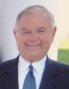
 I was very sorry to recently learn of the death (in February 2025) of Bill Good, former owner of the Southwick-Good & Fortkamp Funeral Chapel. This funeral home, at 3100 N High, was located at the site of Clintonville’s Clinton Chapel, which later became the home of Mathias Armbruster, became a funeral home in 1938, and is currently a day care center.
I met Bill when I was working on my Clintonville and Beechwold book. He was a devoted caretaker of the building in which his funeral practice was located, knowledgeable about its architecture and history, and respectful of the entire property. He even made sure that expert wall builders were called in the rebuild the property’s perimeter wall, at considerable expense. He was always willing to share his knowledge, and was patient even as he had to explain to me what an “adze cut” is. He had civic pride and was pleased that the building served as a polling place each election day. More personally, he graciously advised me in planning for the funeral of my mother-in-law. I am grateful. I remember Bill fondly and extend my condolences to his wife and family.
Posted in 1940-present, Businesses, People | No Comments »
March 26th, 2025
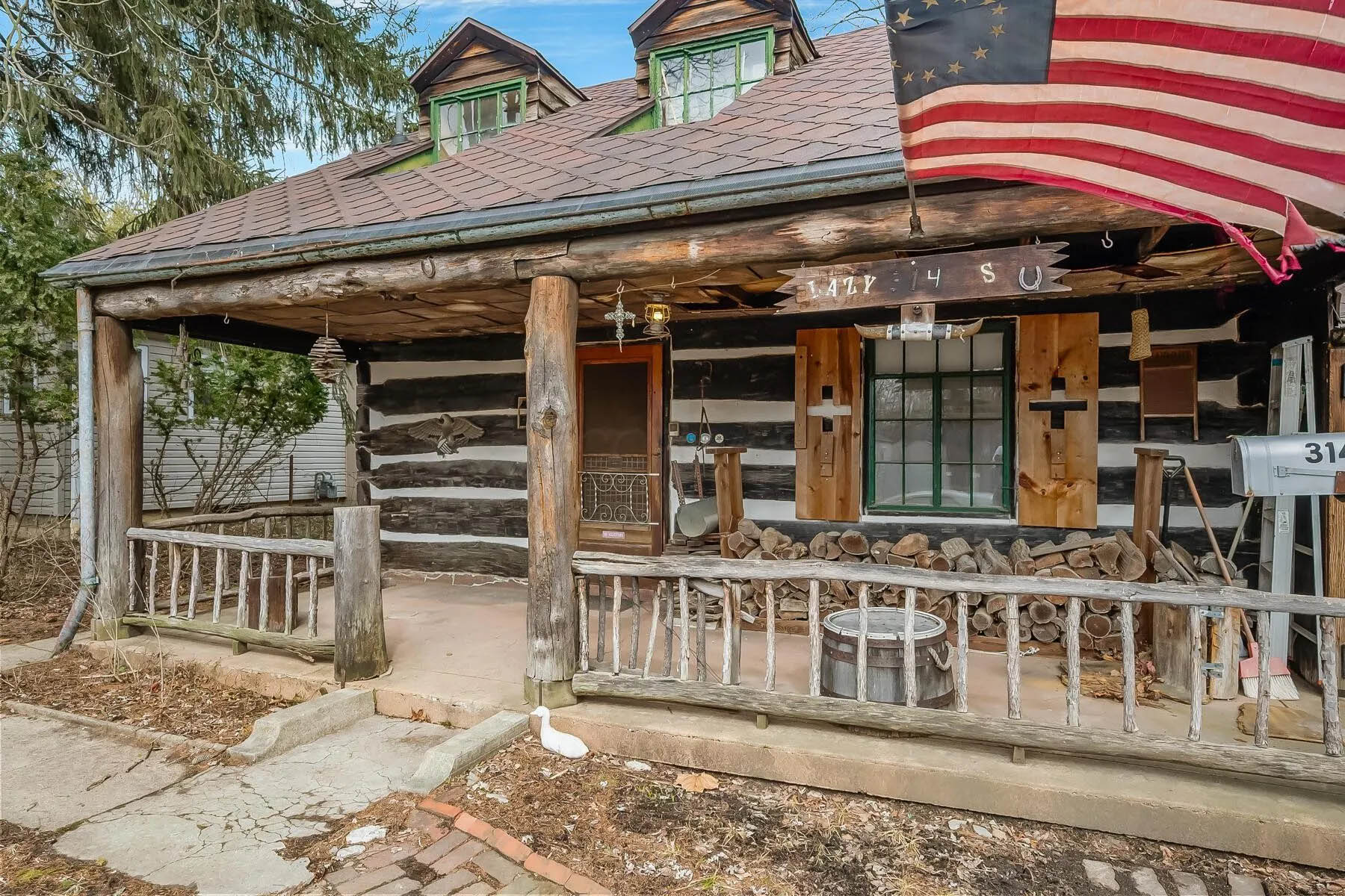
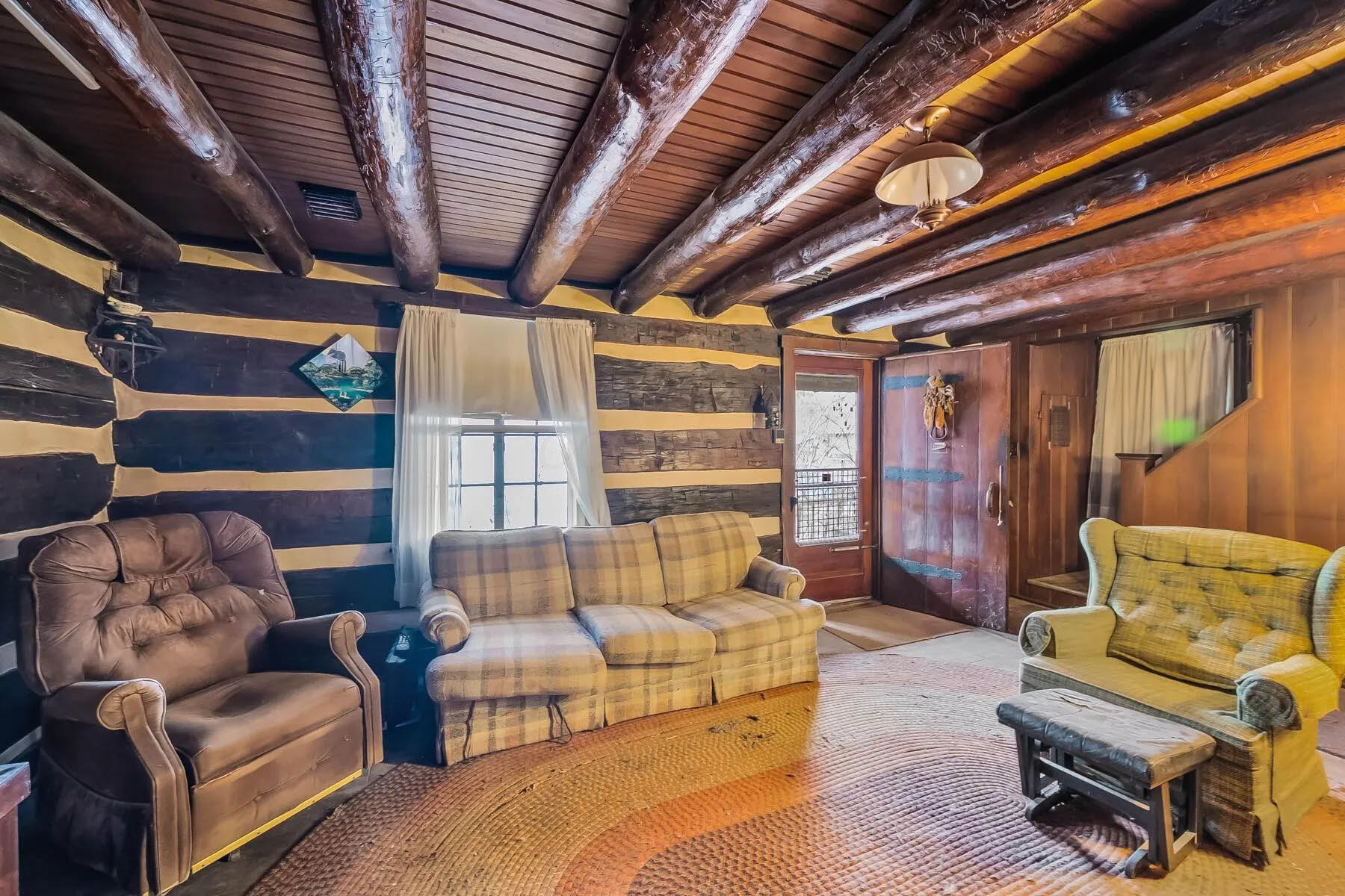
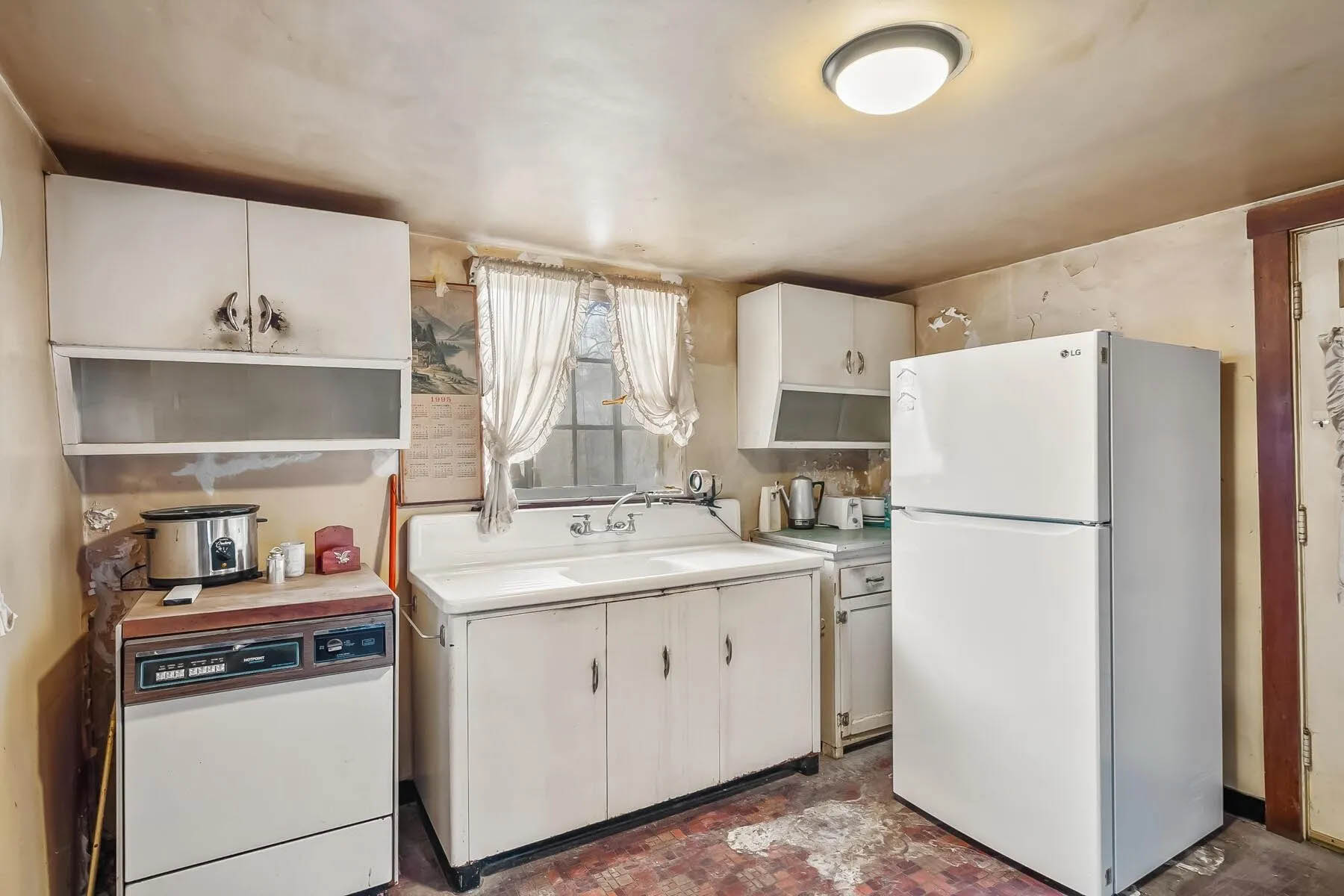
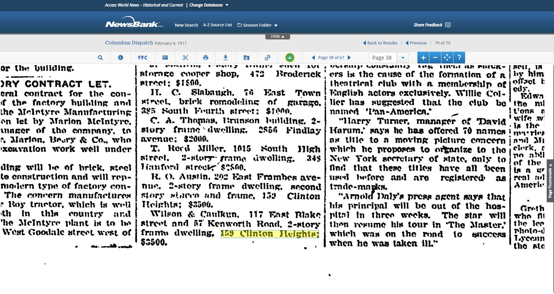
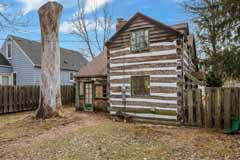
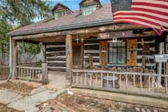 The log home at 314 West Kanawha is up for sale! Wendy Baker alerted us to this auction; the auction starts at $100,000.
Wendy had first told me about this property and the family who developed it; my post is here.
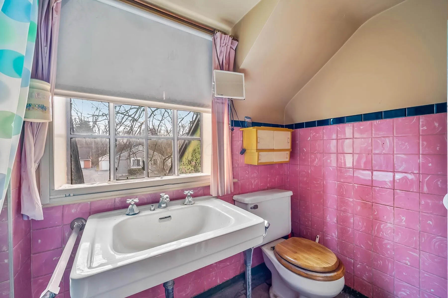
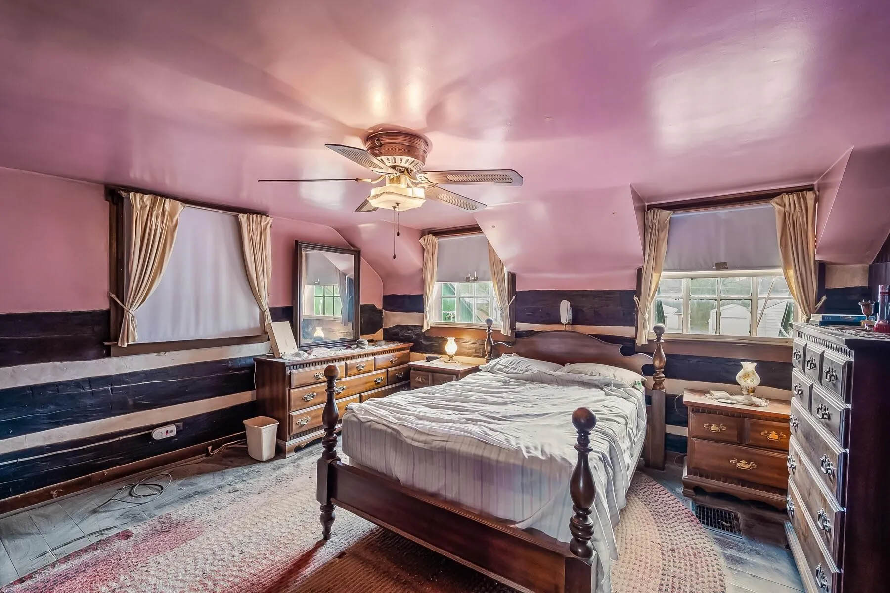
The house has had just 2 owners since the Rorers built it, and the most recent occupant purchased it in 1973. Here’s the current listing, with some pix of the houses’ internal rooms.
The Columbus Dispatch did a nice article about the auction, but does not seem to allow me to provide you with a gift link. Here is the article for those of you with a subscription.
If you’d like to see it, the home will be open from 5 p.m. to 6 p.m. Thursday March 27 and again on April 6, from 1 p.m. to 2 p.m. The auction will end 4 days later.
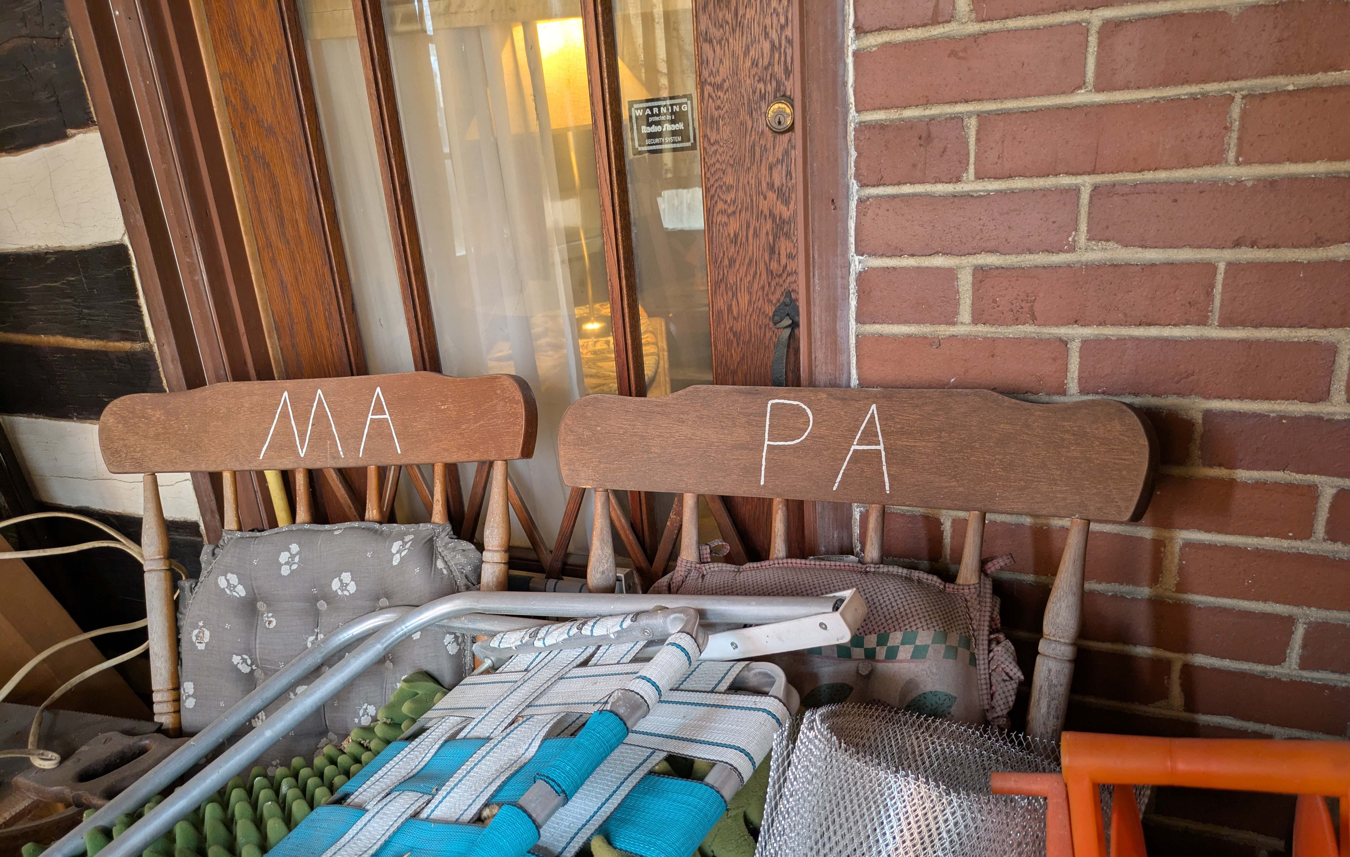
I went to the first open house this past week, and can attest that it needs some loving care. I certainly hope it’s not a “knock down.” And of course, I wonder who “Ma” and “Pa” are.
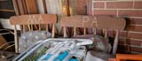
Here are a few more pix courtesy of the realtor’s web site.
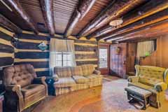
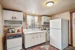


[Photos courtesy of the Realtor.com web site, Brian Johnson & Coldwell Banker Realty.]
Posted in 1940-present, Houses, People, Uncategorized | No Comments »
March 3rd, 2025
 A fun tip for researching your address, from Clintonville Historical Society’s Jeffrey Carter:
–Go to the Columbus Library’s web site.
–Go to Research.
–Find Columbus Dispatch.
–Put in your library card and pin number.
–Enter keyword and search by date. {Shirley suggests: try using your street address in quotes.]
Jeffrey says, “I researched my address and found that during prohibition 3 people were arrested for bootlegging
at 265 Brevoort!”
Posted in Houses, Uncategorized | No Comments »
February 14th, 2025
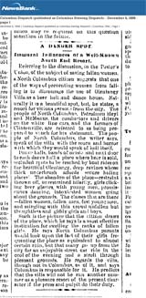
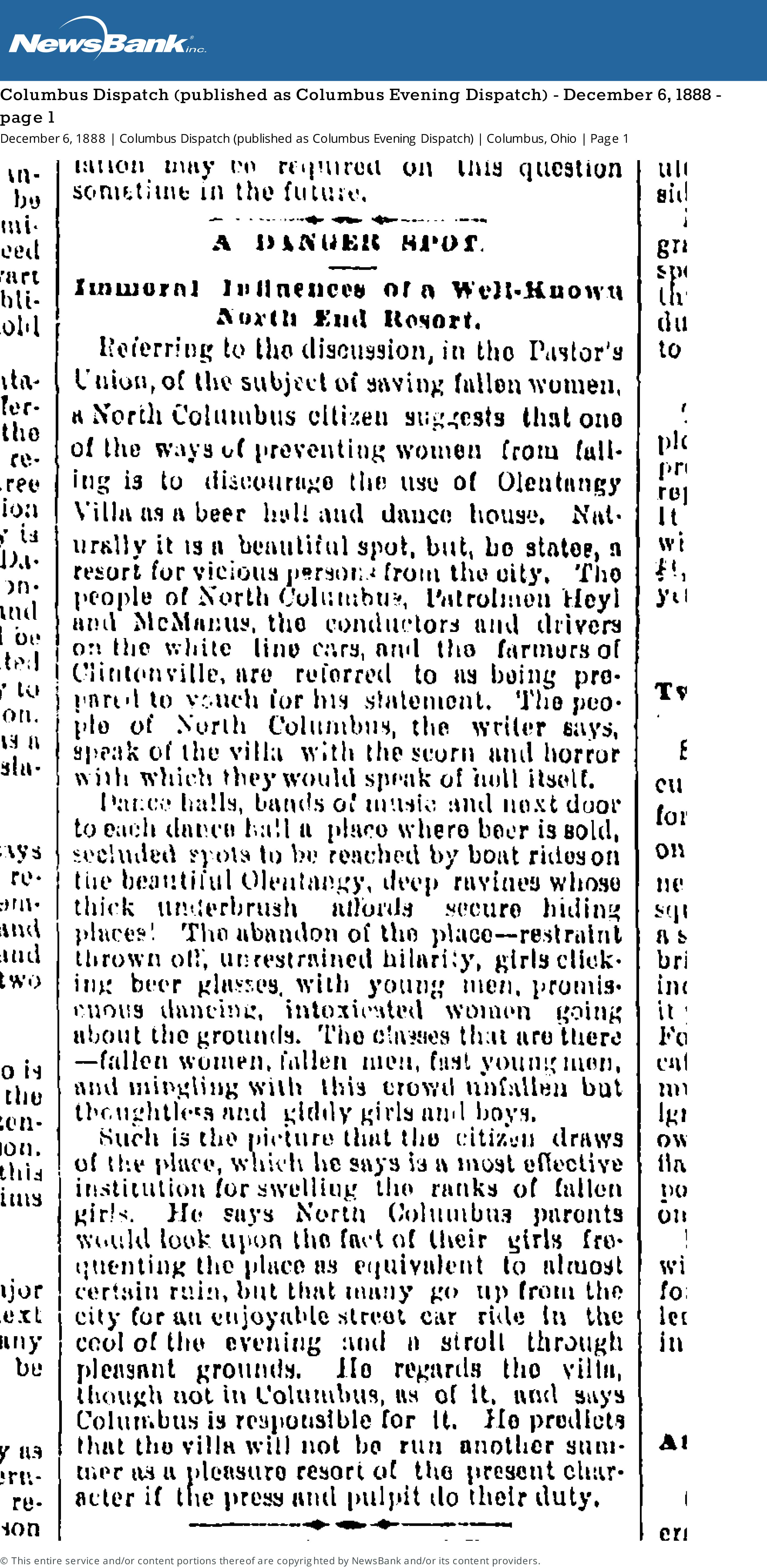
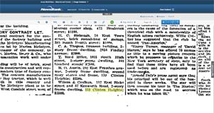
A danger Spot
Immoral Influences of a Well-Known North End Resort
Referring to the discussion, in the Pastor’s Union, of the subject of saving women, a North Columbus citizen suggests that one of the ways of preventing women from falling is to discourage the use of Olentangy Villa as a beer hall and dance house. Naturally it is a beautiful spot, but, he states, a resort for vicious persons from the city. The people of North Columbus, Patrolman Heyl and McManus, the conductors and drivers on the white line cars, and the farmers of Clintonville are referred to as being prepared to vouch for his statement. The people of North Columbus, the writer says, speak of the villa with scorn and horror with which they would speak of hell itself.
Dance halls, bands of music and next door to each dance hall a place where beer is sold, secluded spots to be reached by boat rides on the beautiful Olentangy, deep ravines whose thick underbrush affords secure hiding places! The abandon of the place–restraint thrown off, unrestrained hilarity, girls clicking beer glasses, with young men, promiscuous dancing, intoxicated women going about the grounds. The classes that are there–fallen women, fallen men, fast young men, and mingling with this crowd unfallen but thoughtless and giddy girls and boys.
Such is the picture that the citizen draws of the place, which he says is a most effective institution for swelling the ranks of fallen girls. He says North Columbus parents would look upon the fact of their girls frequenting the place as equivalent to almost certain ruin, but that many go up from the city for an enjooyable street car ride in the cool of the evening and a stroll through pleasant grounds. He regards the villa, though not in Columbus, as of it, and says Columbus is responsible for it. He predicts that the villa will not be run another summer as a pleasure resort of the present character if the press and pulpit do their duty.
[From the Columbus Dispatch (published as Columbus Evening Dispatch) Thursday December 6, 1888 page 1]
Tags: Olentangy Park
Posted in 1800s, Parks & Recreation | No Comments »
January 6th, 2025
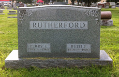
Joe Smith kindly shared this item with me, after discovering it at the Columbus Metropolitan Library. It’s A History of the North Methodist Church, Clinton Chapel, North Columbus by Ruth Ellen (Grove) Rutherford.
Ruth Ellen (Grove) Rutherford [1891-1980], a long-time area resident, wrote the history in 1970. The book includes both some history of the Clinton Chapel Cemetery, some information about the old Beers/Piatt log cabin and its move to 40 E. Norwich Ave, and info about the Underground Railroad activities of Pyrum and Polly Hunt. Joe was pleased to see mentions of his own ancestors including the Hunts–Joe’s grandfather Smith‘s maternal 2nd great-grandparents (page 16)–and his grandfather’s maternal grandparents, Horace and Sarah Theresa Young, and his mother, Minnie Belle Young, who are listed as members of North M.E. Church (page 24) in 1898. Minnie married Joe’s great-grandfather, Roy Ripley Smith, a year later, on 20 Sep 1899.
As Joe says, this is a poignant message how the Clintonville community came together and rallied around a greater cause. It’s a message of inspiration just as relevant 142 years later.
[Courtesy of Joe Smith, and the Rutherford family.]
Posted in Uncategorized | No Comments »
November 1st, 2024
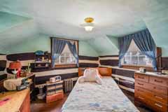
 Ann Conner allowed me to see the inside of her 168 Westwood Road home when I was working on my book. You can get a glimpse of it here, in a 1988 10tv item.
Or here, as an AirBnB listing.
Sadly Ann died in 2018 as did Dale.
Posted in 1900-1940, 1940-present, Houses, People | 2 Comments »
October 15th, 2024
Here are some cool links for old maps:
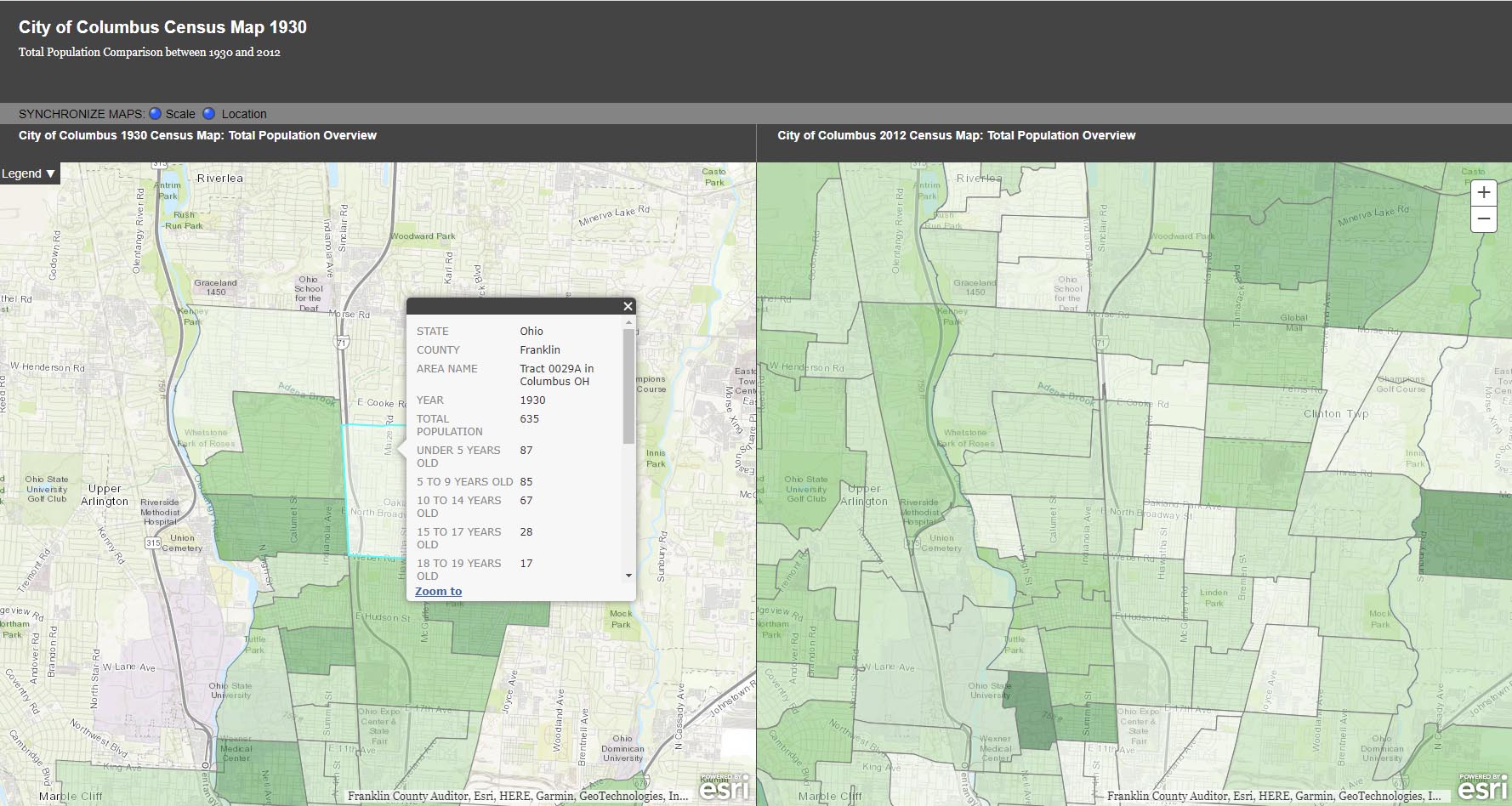
City of Columbus Planning Maps, Historic Maps.

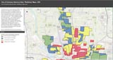
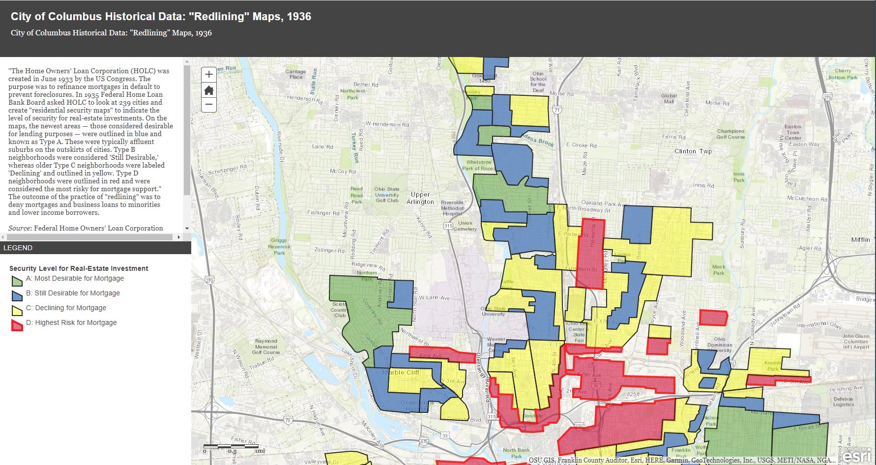
The City of Columbus’ web site gives us plenty of maps and data to play with, from Census demographic changes to despicable redlining and more. Check out especially the “City of Columbus Historic Panoramic Images, 1922,” which is based on a 1922 Ohio State University masters thesis by Forest Ira Blanchard. “Blanchard, inspired by the Chicago School of Sociology, sought to study the racial and ethnic composition of the city, with a particular focus on the role of transportation (railroads, roads) in shaping the urban landscape. Source: Forest Ira Blanchard, An Introduction to the Economic and Social Geography of Columbus, Ohio. Thesis (M.A.), Ohio State University, 1922.”
Columbus Metropolitan Library’s Columbus and Ohio Map Collection. If you haven’t donated to the library yet, now’s the time! It and and it’s staff are such great resources.
Sanborn Maps for Franklin County (scroll down to see Columbus). This is a Library of Congress site.
USGS Historical Topographic Map Explorer allows you to specify a place you want to explore, then click on a location to see its historical maps.
Prolific programmer Randy Majors has produced several products of interest, including his Historical U.S. Counties Map Tool and Auto-Checker Extension. He has also created a couple of video walkthroughs of a couple of the the software tools he has created. I recommend you view them in order, as understanding the Historical U.S. Counties map tool will help you have better success with using the Auto-Checker chrome extension.
Old Maps Online OldMapsOnline.org indexes over 400,000 maps, thanks to the archives and libraries that were open to the idea and provided their online content.
Do you know of other map resources? Let me know and I will add them to this post.
Posted in 1900-1940, 1940-present, Background Info, Houses, People | No Comments »
September 15th, 2024
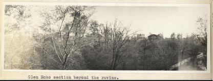
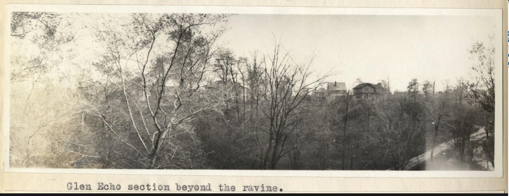
This is a nice photo from a 1922 Ohio State University masters thesis by Forest Ira Blanchard. I believe, based on the metadata, that it was taken at 2734 Indianola Ave. It is captioned, “Glen Echo section beyond the ravine.”
Blanchard, inspired by the Chicago School of Sociology, sought to study the racial and ethnic composition of the city of Columbus, with a particular focus on the role of transportation (railroads, roads) in shaping the urban landscape.
[Courtesy of Forest Ira Blanchard, An Introduction to the Economic and Social Geography of Columbus, Ohio. Thesis (M.A.), Ohio State University, 1922; digital version from City of Columbus Historic Map Collection.]
Posted in 1900-1940, Houses, Transportation | No Comments »
August 8th, 2024
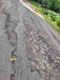
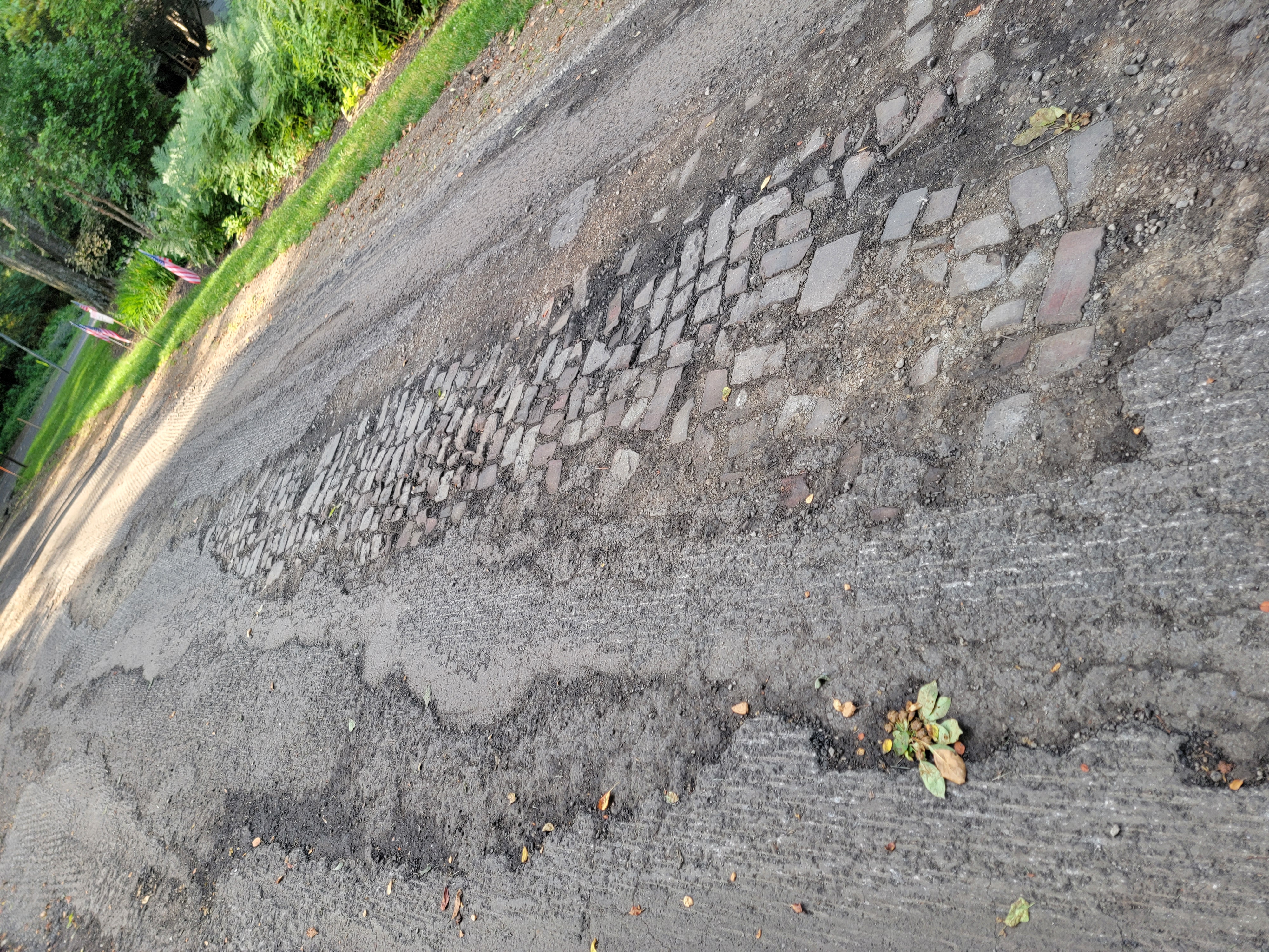
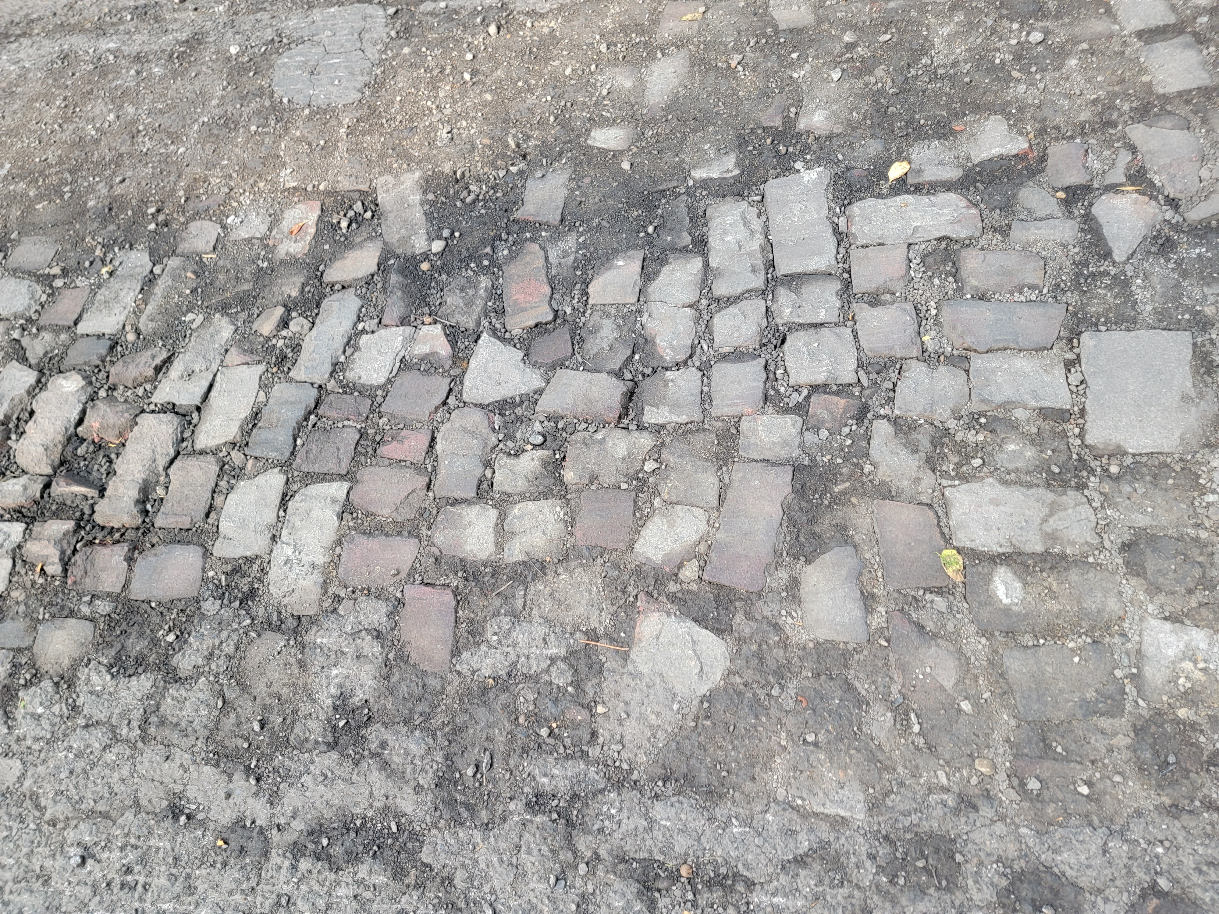
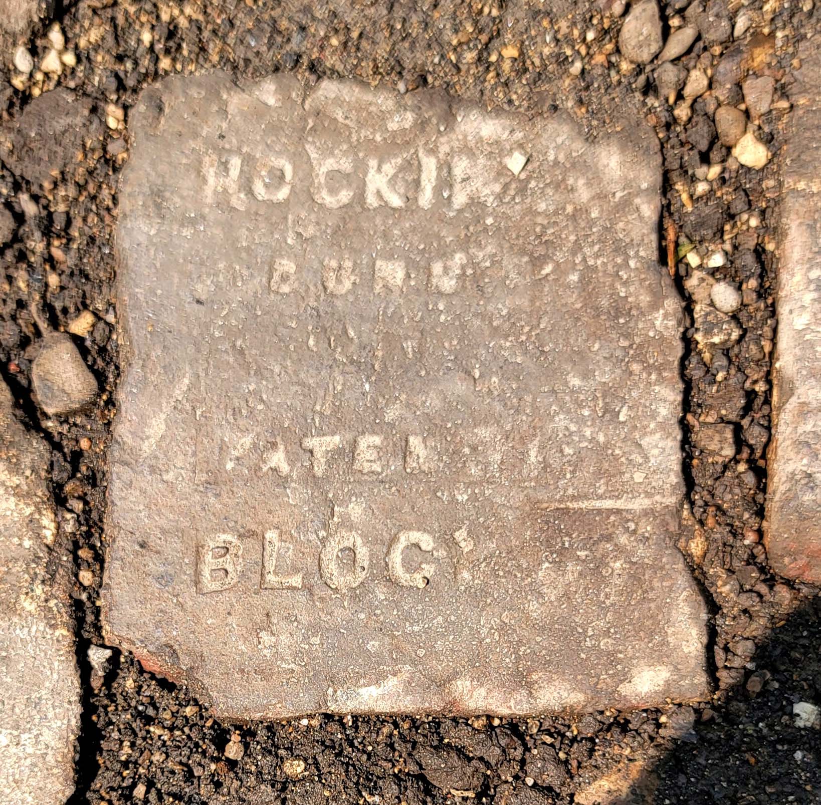
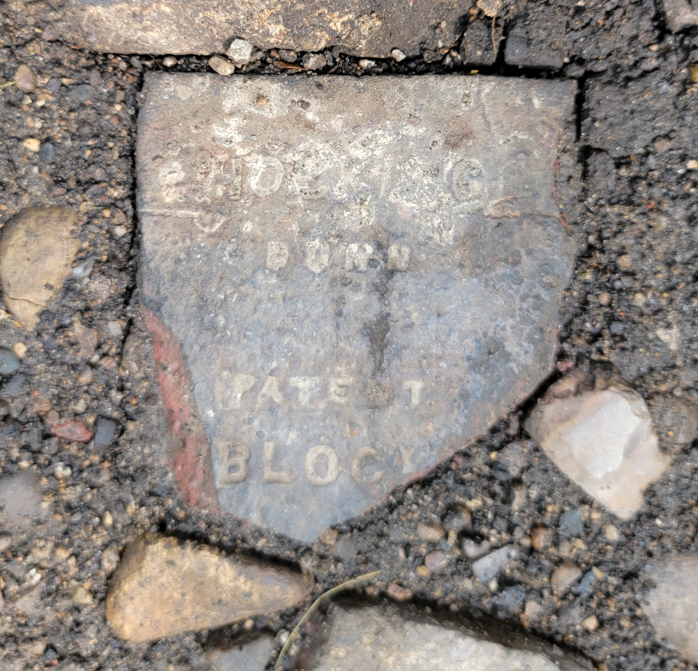
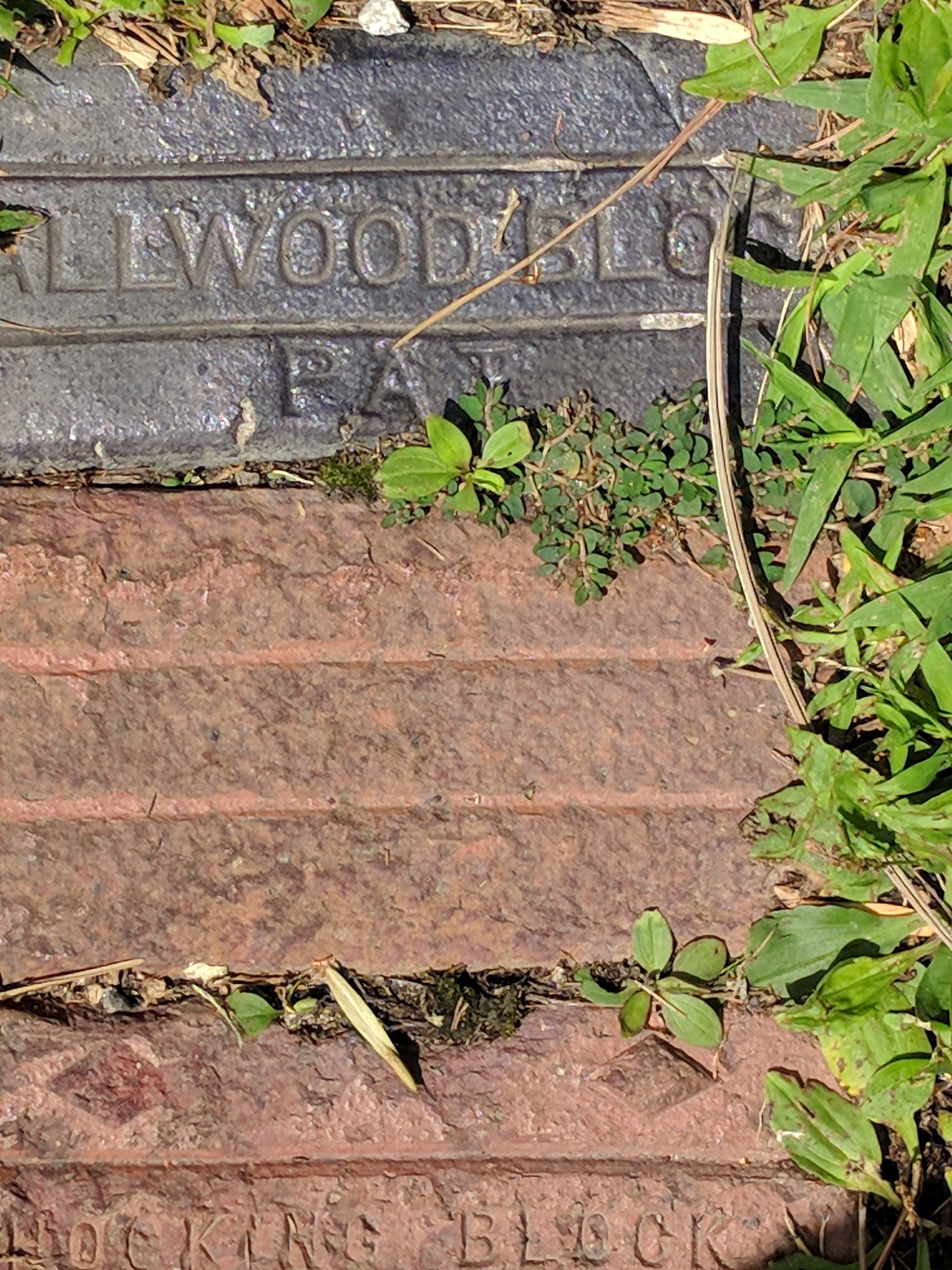
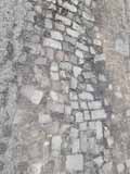 Katie Knostman has shared some photos of the old pavers on Olentangy Blvd at Rustic Place (near the driveway for 4783 Olentangy Blvd), exposed during the recent construction that the residents of Old Beechwold have been enduring.
On close inspection, two of the bricks say Hocking Dunn Patent):
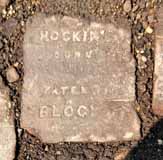
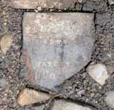
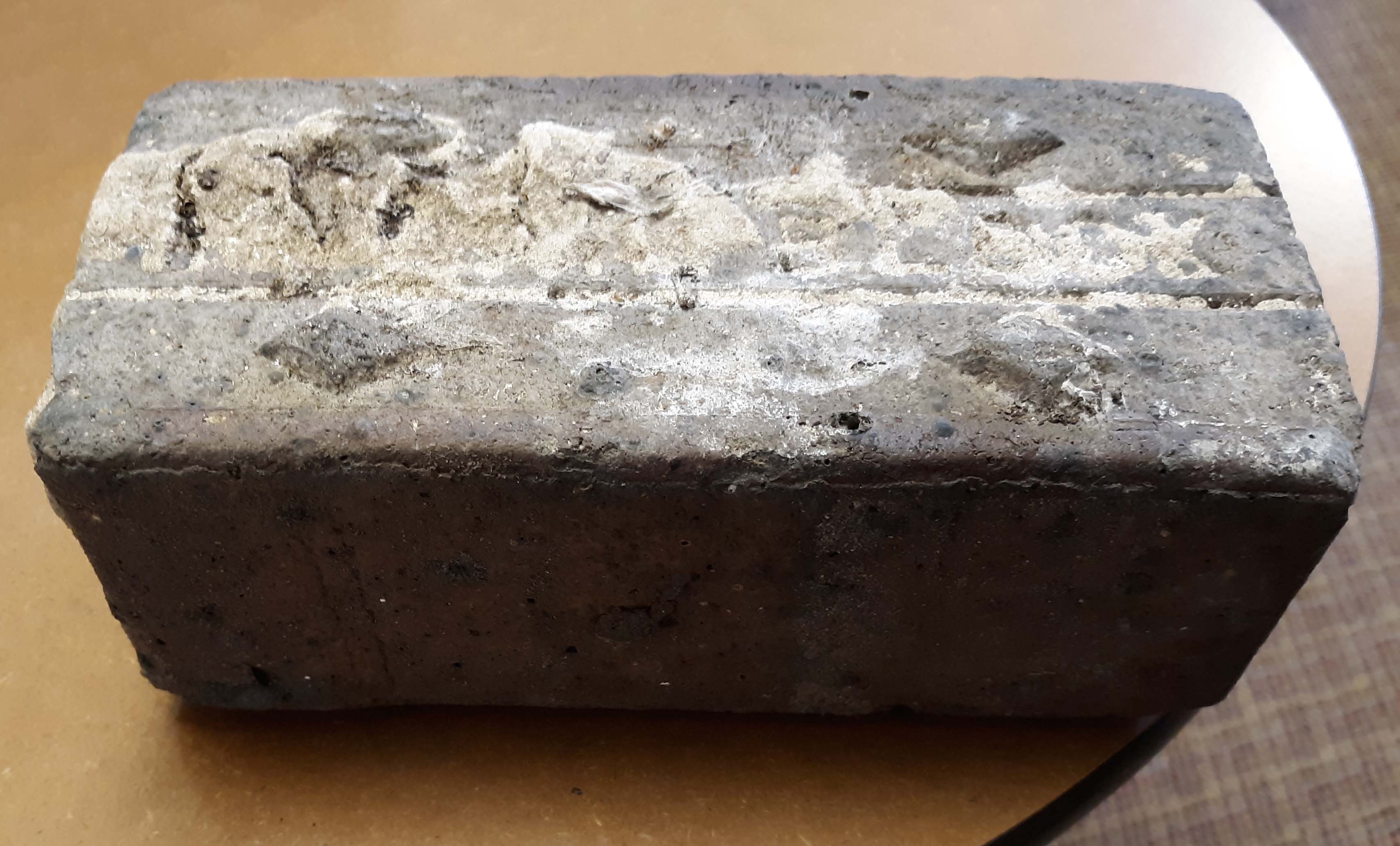
And on the topic of bricks: Here is a photo of a brick that Clintonville Historical Society has in its archive.
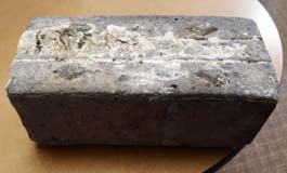
CHS actually has 2 bricks. According to Mary Rodgers: “These are the actual pavers from the street [near American Vitrified Products, which was located on the former site of North High School at Arcadia and Calumet]. The official name of the brick is covered in mortar. You can see the diamonds. Those keep the horses from slipping when the bricks are wet. We might try to remove the mortar from one. It is interesting. They are porous–lighter than I thought…I have seen some articles that are associated with the early use of site. William Wassell seems like an interesting character. They made pipe and bricks. Supposedly, this is one of their bricks. In the late 1800s, they made a fountain for the fairgrounds-all out of pipe. I would love to find a photo of that!” Here’s an article about the fountain.
And finally, a house on East North Broadway has many bricks lining the driveway. These may have come from that roadbed.

[Photos courtesy of Katie Knostman, and Mary Rodgers and the CHS.]
Tags: Beechwold
Posted in 1900-1940, Businesses, Houses, Transportation, Uncategorized | No Comments »
July 3rd, 2024
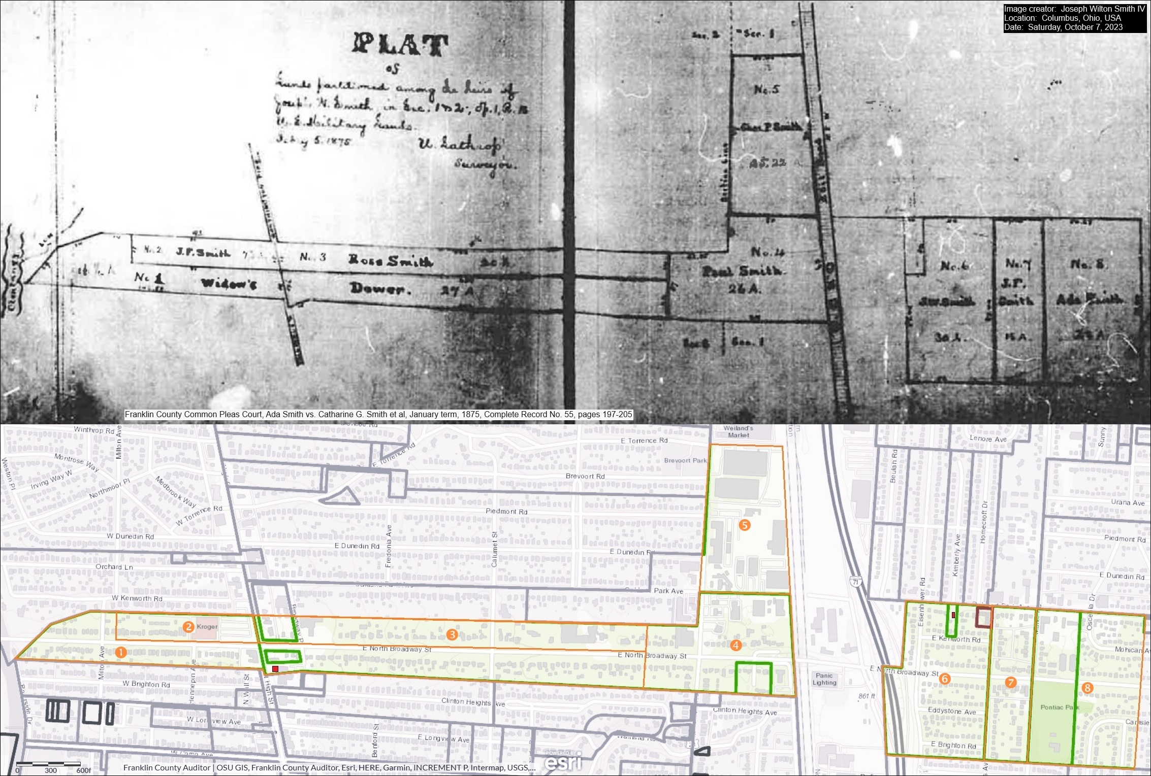
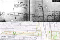 Joseph Wilton Smith IV recently contacted me. Joe’s ancestors owned a house at the southeast corner of East North Broadway and North High Streets, perhaps where the Cochran House was before it was demolished…or–as Mary Rodgers speculated in the May 2020 CHS Newsletter– possibly that very house. Joe has kindly sent along an image that includes several maps:
1) An 1875 map of the legal division of Joseph Wilson Smith’s farmland in Clintonville, Ohio to his heirs
2) A modern map extracted from the website of the Franklin County Auditor that outlines these lands in orange over the current Clintonville area streets. And,
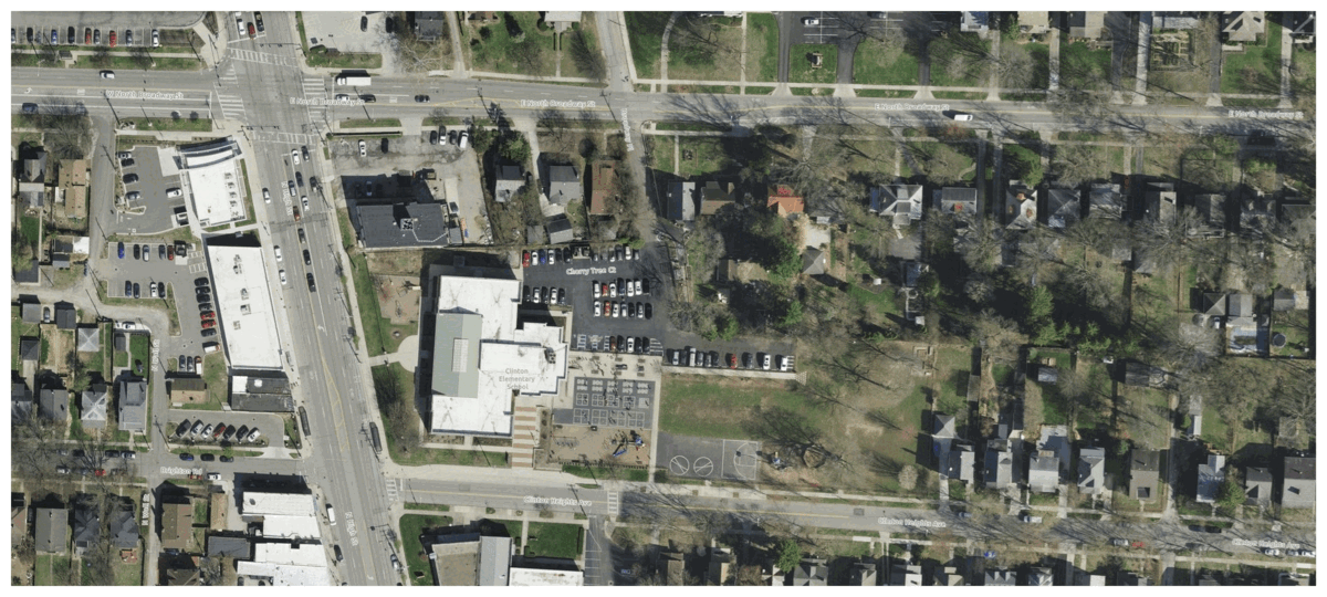
3) The property lines from the 1910 Baist map superimposed on the 2023 satellite view of E.N Broadway and N High.
Joe writes:
I am a direct descendent of three early Clintonville settlers: Thomas Bull, Deacon John Smith, and Pirum Hunt.
I am named after my grandfather, who was named after his grandfather, who was named (sort of) after his father, Joseph Wilson Smith. His wife, Catharine Gray (Piatt) Smith was my third great-grandmother. For the past three months, I have been working closely with Mary Rodgers to sponsor a historical marker honoring my ancestors and their contributions to early Clintonville. My great-grandfather was Roy Ripley Smith, who lived at 145 W. Royal Forest Blvd. in Beechwold. My dad told me Roy also owned a farm that later became part of Highbanks Metro Park.
 In January 2024, Joe Smith gave a presentation to the Clintonville Historical Society about his ancestors, and most especially his ancestor Deacon John Smith. John was a churchman and also an abolitionist in our area. Joe’s presentation is also a great example of what you can do if you set about researching your family’s history.
Joe’s presentation can be found here. The handout for that presentation can be found here.
Thanks Joe!
[Thanks to Joe Smith for sharing his research and his presentation. He welcomes additional information and input on his research, and extends his thanks in advance. Contributors to his research include Sharon Hendershot, Nancy J. Pendleton, Mary Rodgers, Elizabeth Renker, and Kathie Smith Brzoska.]
Posted in 1800s, 1900-1940, People | 1 Comment »
 I was very sorry to recently learn of the death (in February 2025) of Bill Good, former owner of the Southwick-Good & Fortkamp Funeral Chapel. This funeral home, at 3100 N High, was located at the site of Clintonville’s Clinton Chapel, which later became the home of Mathias Armbruster, became a funeral home in 1938, and is currently a day care center.