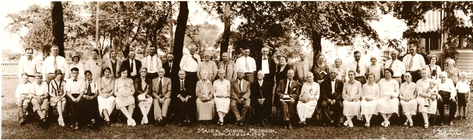
Home
Log Home on Westwood Road
 Ann Conner allowed me to see the inside of her 168 Westwood Road home when I was working on my book. You can get a glimpse of it here, in a 1988 10tv item.
Or here, as an AirBnB listing.
Maps Maps Maps
Here are some cool links for old maps:
City of Columbus Planning Maps, Historic Maps.
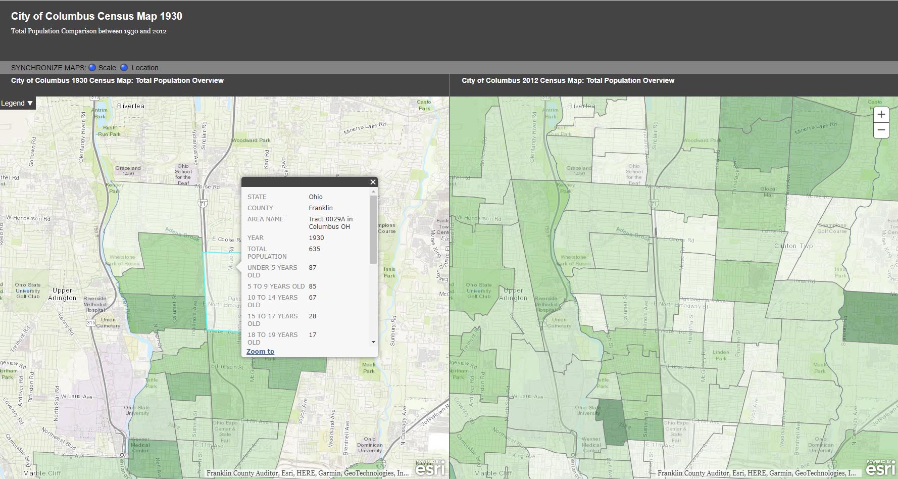
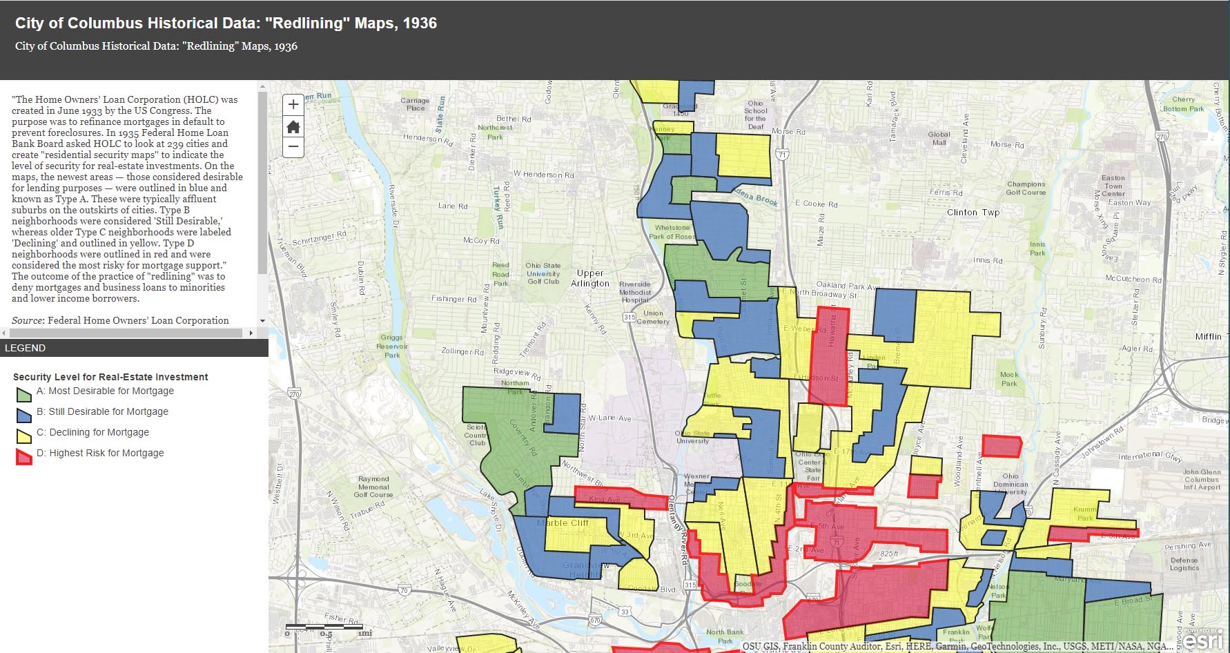
The City of Columbus’ web site gives us plenty of maps and data to play with, from Census demographic changes to despicable redlining and more. Check out especially the “City of Columbus Historic Panoramic Images, 1922,” which is based on a 1922 Ohio State University masters thesis by Forest Ira Blanchard. “Blanchard, inspired by the Chicago School of Sociology, sought to study the racial and ethnic composition of the city, with a particular focus on the role of transportation (railroads, roads) in shaping the urban landscape. Source: Forest Ira Blanchard, An Introduction to the Economic and Social Geography of Columbus, Ohio. Thesis (M.A.), Ohio State University, 1922.”
Columbus Metropolitan Library’s Columbus and Ohio Map Collection. If you haven’t donated to the library yet, now’s the time! It and and it’s staff are such great resources.
Sanborn Maps for Franklin County (scroll down to see Columbus). This is a Library of Congress site.
USGS Historical Topographic Map Explorer allows you to specify a place you want to explore, then click on a location to see its historical maps.
Prolific programmer Randy Majors has produced several products of interest, including his Historical U.S. Counties Map Tool and Auto-Checker Extension. He has also created a couple of video walkthroughs of a couple of the the software tools he has created. I recommend you view them in order, as understanding the Historical U.S. Counties map tool will help you have better success with using the Auto-Checker chrome extension.
Old Maps Online OldMapsOnline.org indexes over 400,000 maps, thanks to the archives and libraries that were open to the idea and provided their online content.
Do you know of other map resources? Let me know and I will add them to this post.
Glen Echo Beyond the Ravine

This is a nice photo from a 1922 Ohio State University masters thesis by Forest Ira Blanchard. I believe, based on the metadata, that it was taken at 2734 Indianola Ave. It is captioned, “Glen Echo section beyond the ravine.”
Blanchard, inspired by the Chicago School of Sociology, sought to study the racial and ethnic composition of the city of Columbus, with a particular focus on the role of transportation (railroads, roads) in shaping the urban landscape.
[Courtesy of Forest Ira Blanchard, An Introduction to the Economic and Social Geography of Columbus, Ohio. Thesis (M.A.), Ohio State University, 1922; digital version from City of Columbus Historic Map Collection.]Brick by Brick
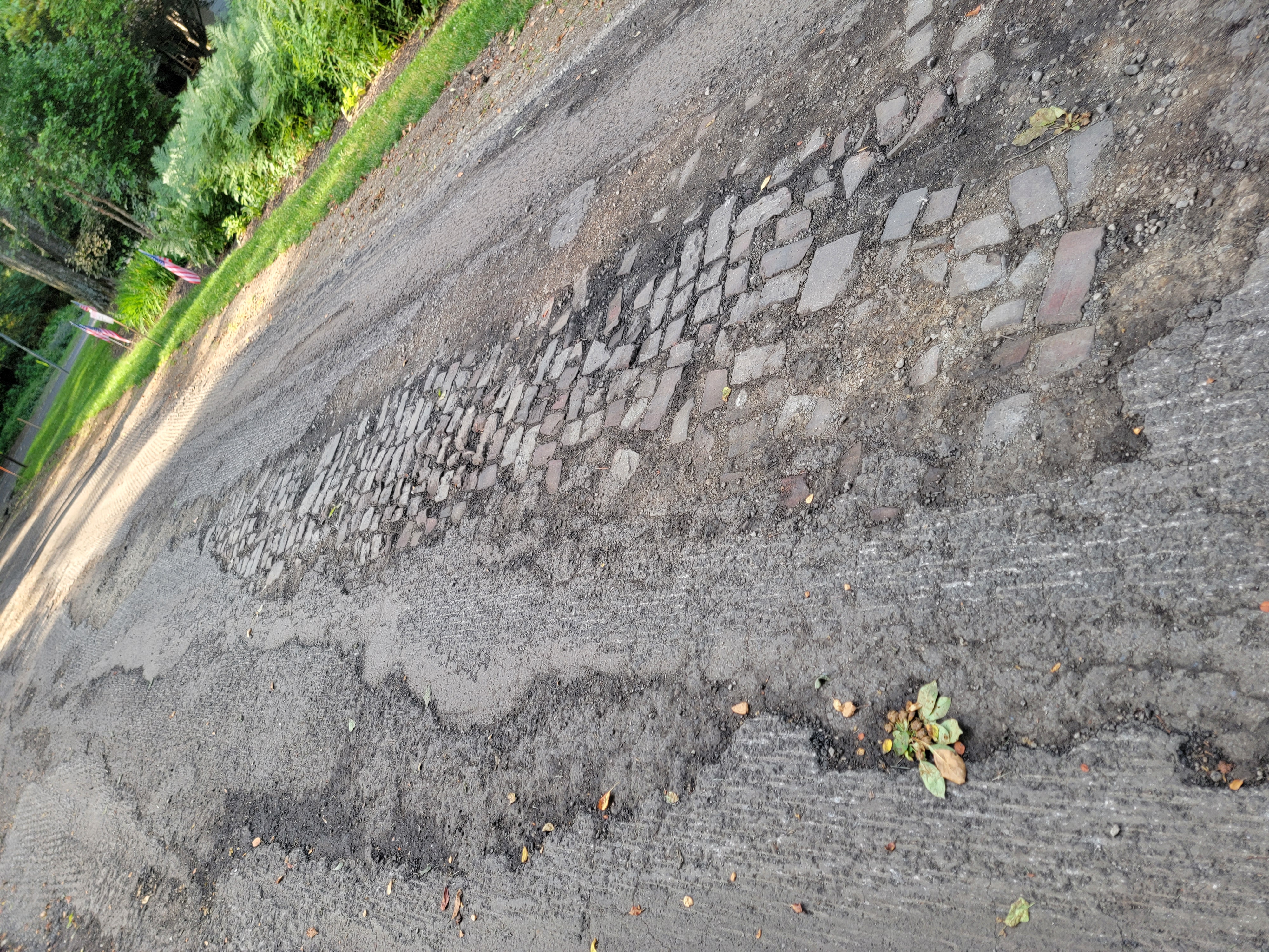
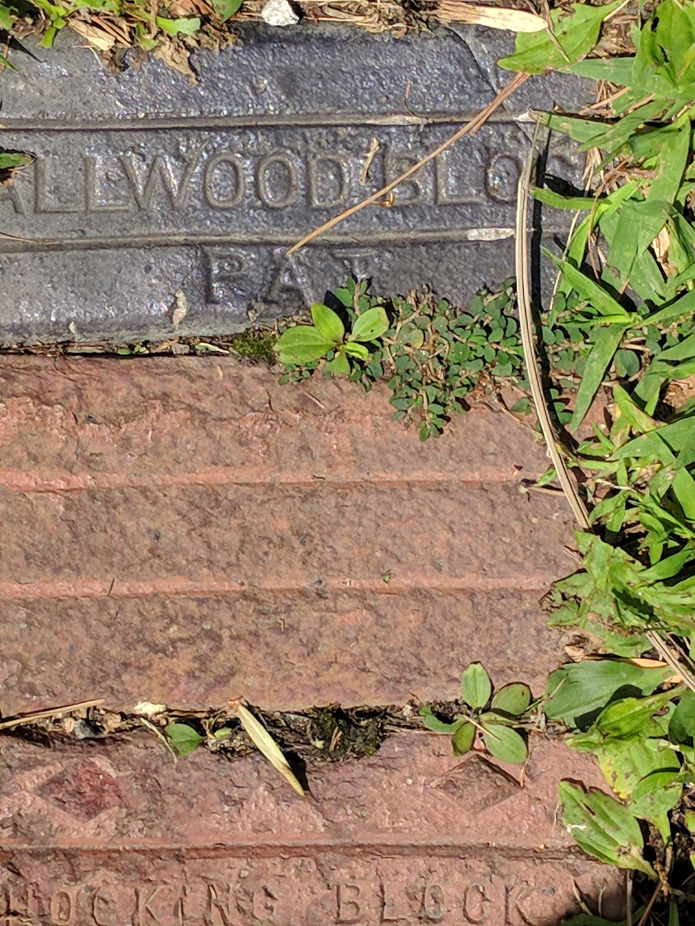
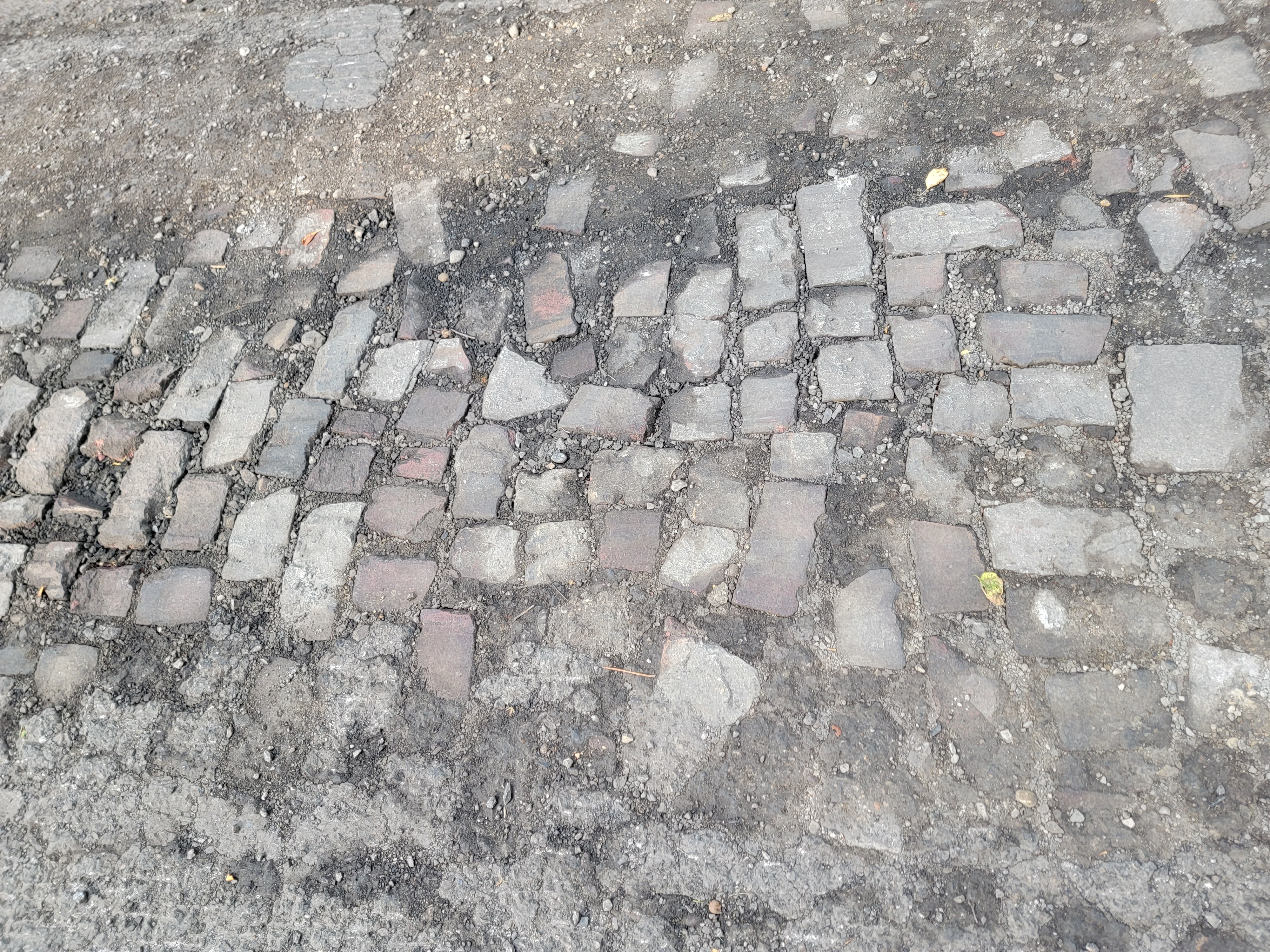 Katie Knostman has shared some photos of the old pavers on Olentangy Blvd at Rustic Place (near the driveway for 4783 Olentangy Blvd), exposed during the recent construction that the residents of Old Beechwold have been enduring.
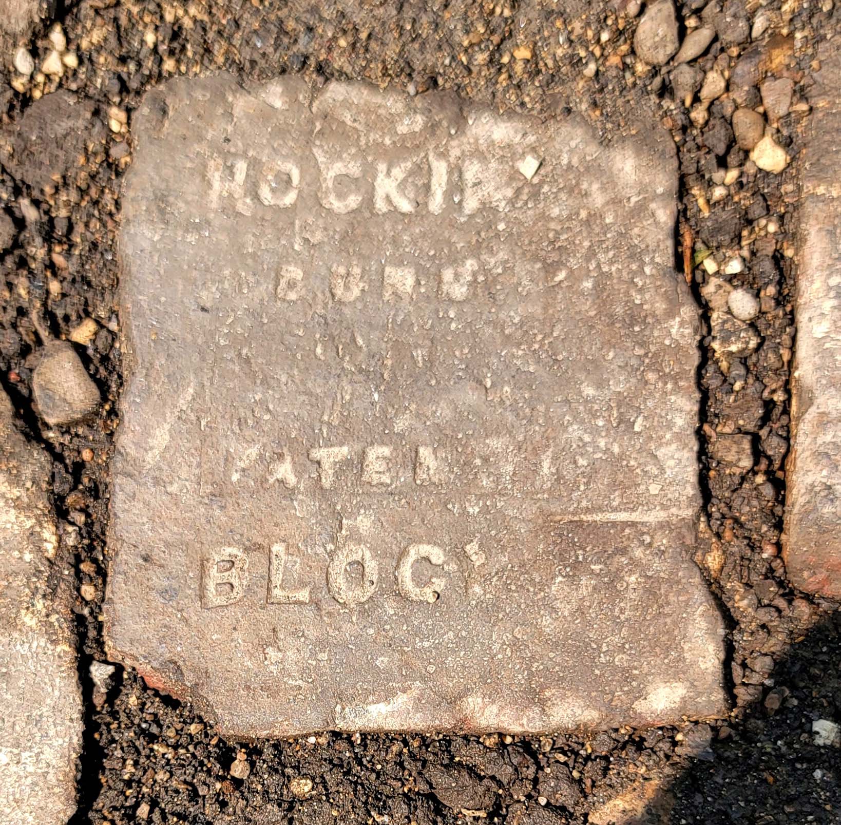
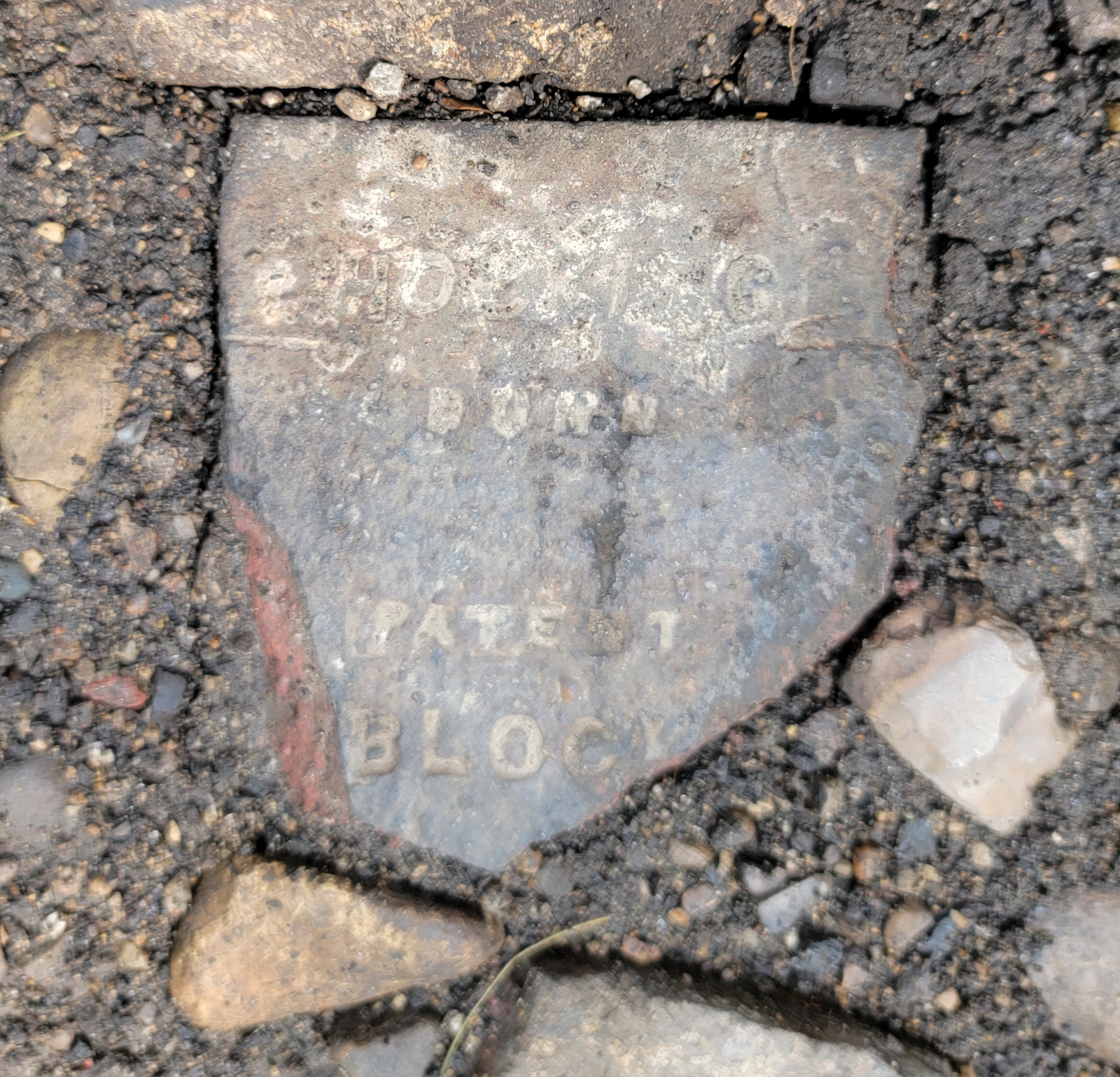
On close inspection, two of the bricks say Hocking Dunn Patent):
And on the topic of bricks: Here is a photo of a brick that Clintonville Historical Society has in its archive.
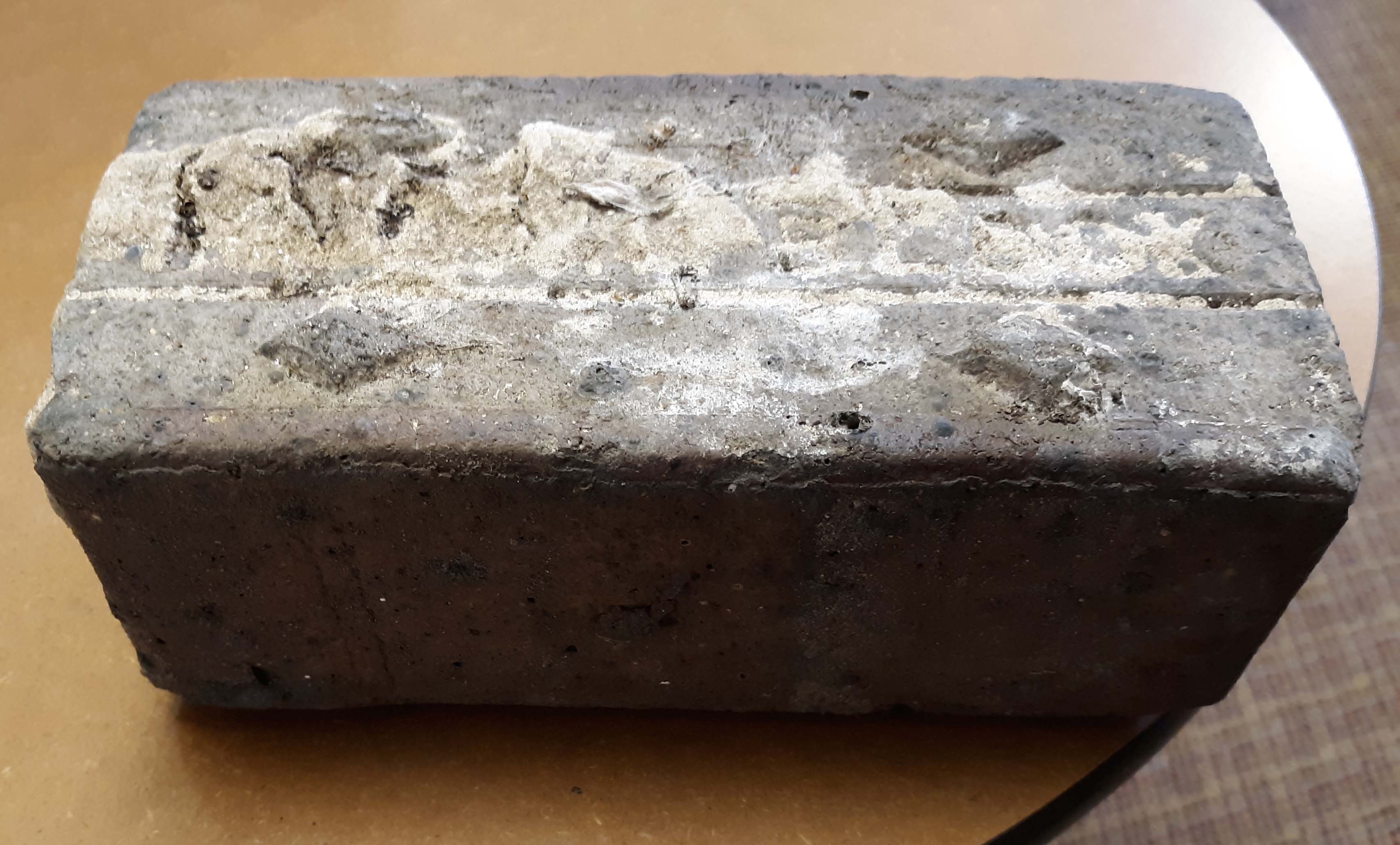
CHS actually has 2 bricks. According to Mary Rodgers: “These are the actual pavers from the street [near American Vitrified Products, which was located on the former site of North High School at Arcadia and Calumet]. The official name of the brick is covered in mortar. You can see the diamonds. Those keep the horses from slipping when the bricks are wet. We might try to remove the mortar from one. It is interesting. They are porous–lighter than I thought…I have seen some articles that are associated with the early use of site. William Wassell seems like an interesting character. They made pipe and bricks. Supposedly, this is one of their bricks. In the late 1800s, they made a fountain for the fairgrounds-all out of pipe. I would love to find a photo of that!” Here’s an article about the fountain.
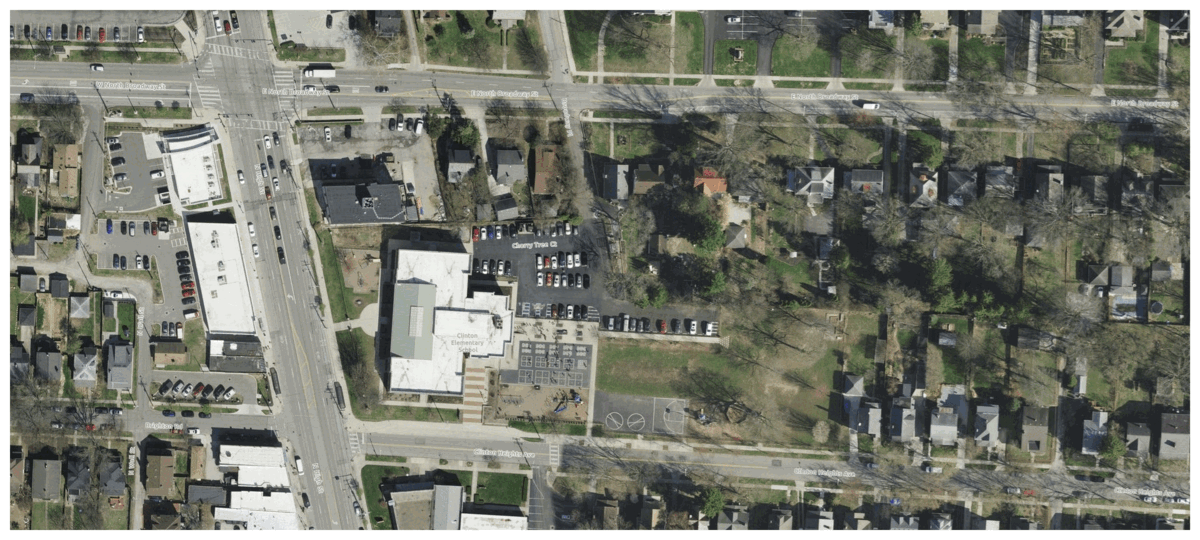
And finally, a house on East North Broadway has many bricks lining the driveway. These may have come from that roadbed.
Joseph Wilton Smith & Ancestors
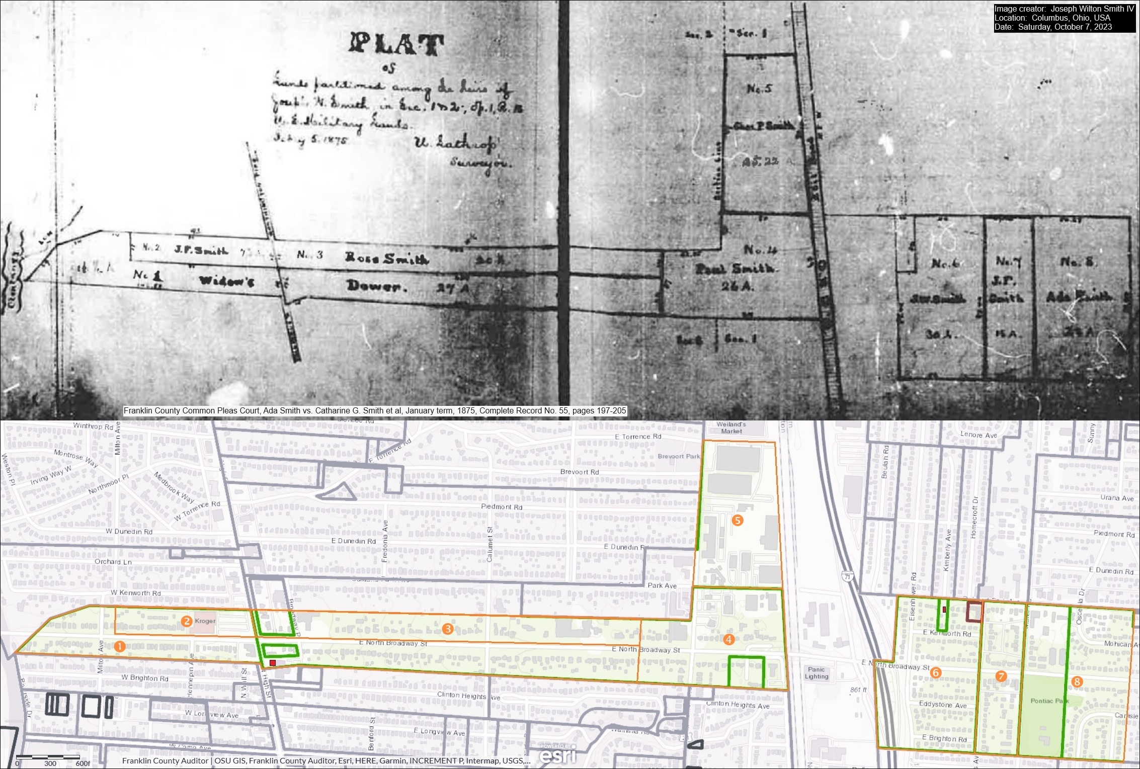 Joseph Wilton Smith IV recently contacted me. Joe’s ancestors owned a house at the southeast corner of East North Broadway and North High Streets, perhaps where the Cochran House was before it was demolished…or–as Mary Rodgers speculated in the May 2020 CHS Newsletter– possibly that very house. Joe has kindly sent along an image that includes several maps:
1) An 1875 map of the legal division of Joseph Wilson Smith’s farmland in Clintonville, Ohio to his heirs
2) A modern map extracted from the website of the Franklin County Auditor that outlines these lands in orange over the current Clintonville area streets. And,
3) The property lines from the 1910 Baist map superimposed on the 2023 satellite view of E.N Broadway and N High.
Joe writes:
I am a direct descendent of three early Clintonville settlers: Thomas Bull, Deacon John Smith, and Pirum Hunt.
I am named after my grandfather, who was named after his grandfather, who was named (sort of) after his father, Joseph Wilson Smith. His wife, Catharine Gray (Piatt) Smith was my third great-grandmother. For the past three months, I have been working closely with Mary Rodgers to sponsor a historical marker honoring my ancestors and their contributions to early Clintonville. My great-grandfather was Roy Ripley Smith, who lived at 145 W. Royal Forest Blvd. in Beechwold. My dad told me Roy also owned a farm that later became part of Highbanks Metro Park.
 In January 2024, Joe Smith gave a presentation to the Clintonville Historical Society about his ancestors, and most especially his ancestor Deacon John Smith. John was a churchman and also an abolitionist in our area. Joe’s presentation is also a great example of what you can do if you set about researching your family’s history.
Joe’s presentation can be found here. The handout for that presentation can be found here.
Thanks Joe!
[Thanks to Joe Smith for sharing his research and his presentation. He welcomes additional information and input on his research, and extends his thanks in advance. Contributors to his research include Sharon Hendershot, Nancy J. Pendleton, Mary Rodgers, Elizabeth Renker, and Kathie Smith Brzoska.]West Kanawha: A “Surcease from City Life”
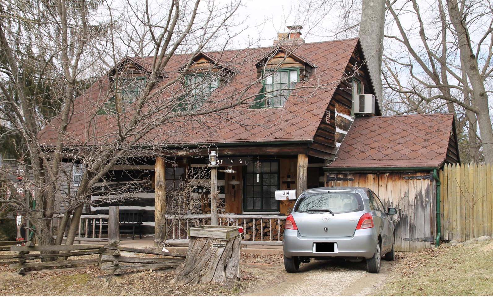
Sometimes a house tells the story of a person, right? In this case the story is about Frank and Bertha Rorer.
This story was sent to me by Wendy Bayer, who writes, “During COVID, I did quite a bit of walking around Clintonville and found myself on West Kanawha one afternoon…I noticed an intriguing house at 314 W Kanawha and did some research on it (naturally! My curiosity is so strong!) I found this great newspaper article from 1939 about the builders and residents; you might find them interesting, too.”
The Rorers bought a tract of undeveloped land on what is now West Kanawha. They took scout troops there, and hiked their property. Their first house on Kanawha was a tiny house constructed from washing machine crates. (Why? because Mr. Rorer was a plumber.) They also built a cave on the property for refrigeration. They initially used this tiny house as a weekend getaway, but Bertha spent more and more time there. Later they built a white clapboard house nearby, and then in the late 1930s they built their dream house at 314 West Kanawha from salvaged walnut-wood logs.
Today there are a cluster of properties along Kanawha formerly affiliated with the Rorers; here are some of their ownership histories:
290 W. Kanawha–nothing
300 W. Kanawha–1922-1937 Rorers owned it. This is where they lived in April 1931.
304 W. Kanawha–1923-1959 Rorers owned it, new house built 1959
310 W. Kanawha–1937-1959 Rorers owned it, new house built 1960
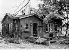
314 W. Kanawha–log home. Rorers owned it 1923?-59
320 W. Kanawha– nothing
Here’s the “Ohio Historic Inventory sheet” for 314 West Kanawha, from the Ohio Historic Preservation Office at Ohio History Connection.
Bertha Rorer died in 1974, her husband Frank Rorer died 1976 (You can click through to read their obituaries.)
[Research courtesy of Wendy Bauer, and inventory courtesy of Nancy Campbell/OHPO.]