Holiday Greetings
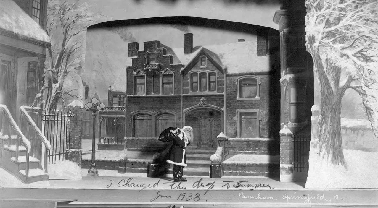
Painting by Mathias Armbruster, courtesy of the Mathias Armbruster Scenic Studio Collection at OSU, and taken from WOSU’s Broad and High clip about Mathias Armbruster’s studio.


Painting by Mathias Armbruster, courtesy of the Mathias Armbruster Scenic Studio Collection at OSU, and taken from WOSU’s Broad and High clip about Mathias Armbruster’s studio.
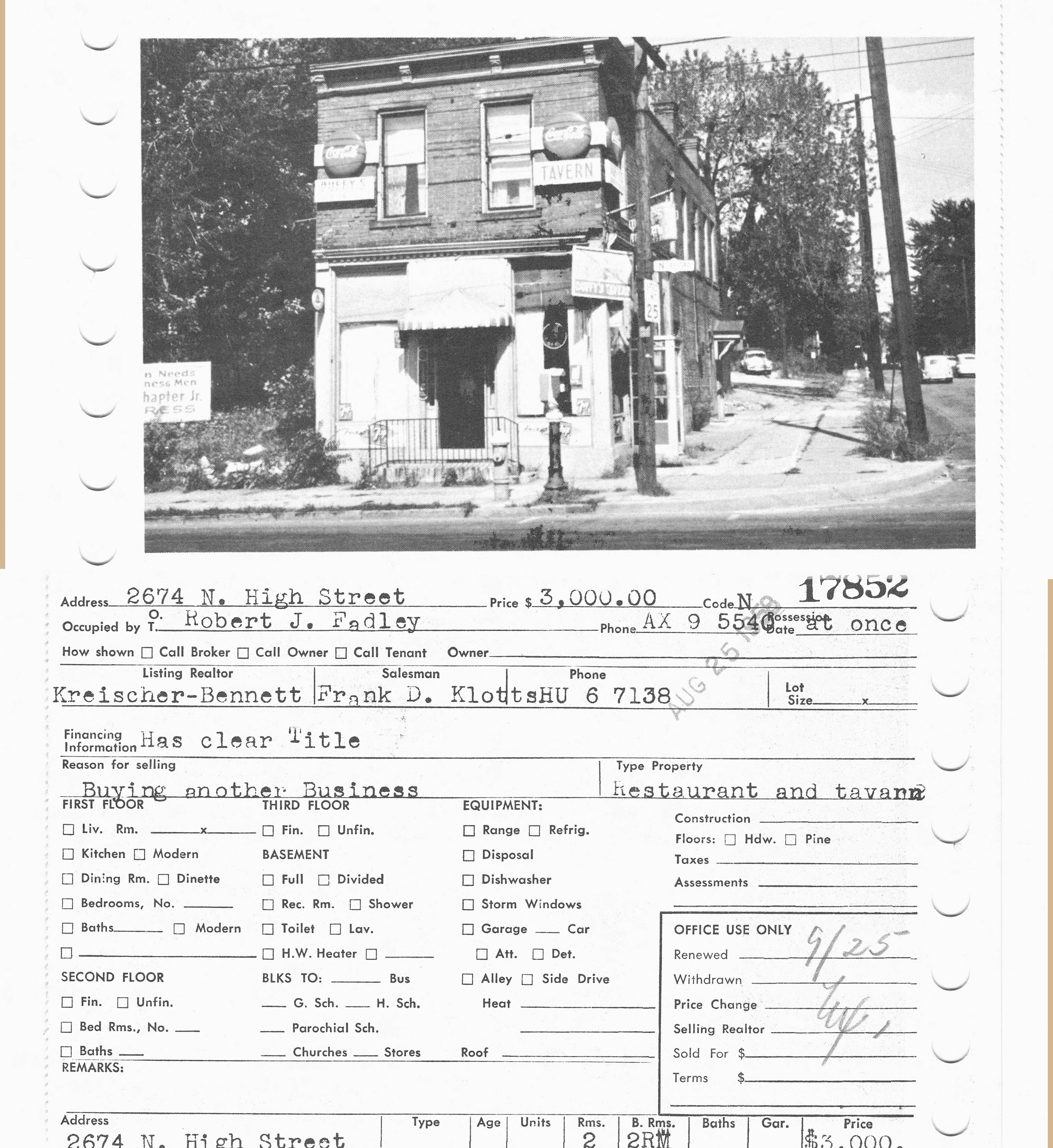
Wow, what a picture of the northeast corner of Dodridge and N High, where CVS Drugstore is today! This photo of 2674 North High was taken in 1959. Duffy’s Tavern had several owners over the years; in 1959 it was owned by Robert J Fadley and in 1947 it was owned by V. G. Hillon. In 1937 it was called Barney’s Grill. I believe it was a restaurant going back to at least 1924, as I found several “waitresses needed” ads in the Columbus Dispatch for the “Crouse American Restaurant” at 2674 North High, in 1924.
When Duffy’s Tavern was sold in 1959, it became a Coin-O-Wash.
I did find some classified ads in the Columbus Dispatch for horses from Kellar stables at this address as well between 1905 and 1911, so the stables probably occupied both east corners of Dodridge and North High.
(Photo courtesy of the Columbus Metropolitan Library’s MLS real estate collection.)
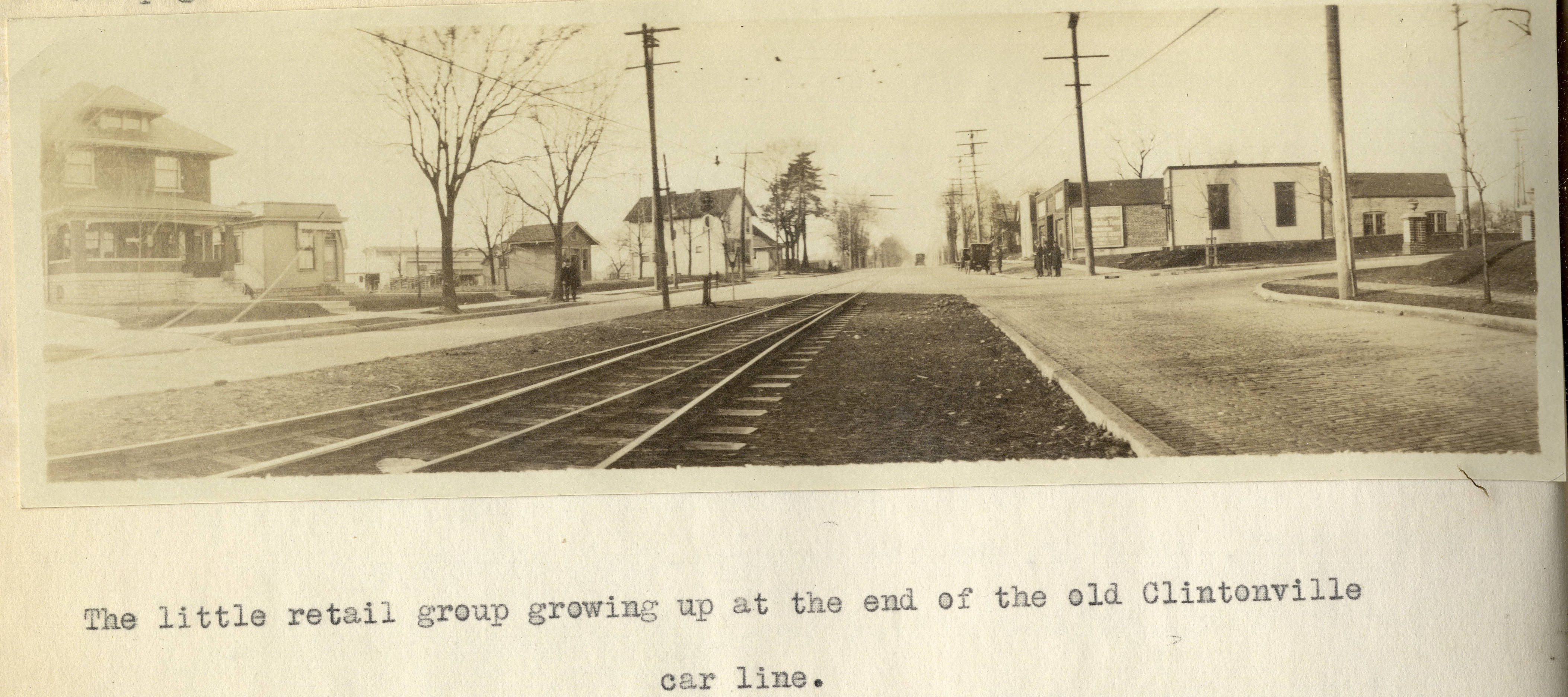
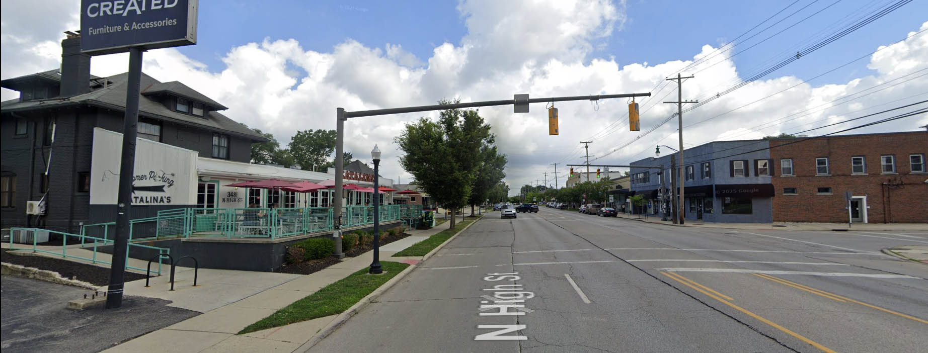
I’ve previously mentioned Forest Ira Blanchard’s wonderful master’s thesis, which is a treasure trove of photos of Columbus in 1922. It contains this old photo of Clintonville at the intersection of Oakland Park and North High in 1922. The house on the left, west, side of North High Street is still with us! Here’s that same intersection today.
Here’s Blanchard’s accompanying text:
Beyond Hudson Street to Arcadia Avenue, High Street is about solidly lined with small, but unattractive store rooms, this being the business section of the old, formerly outlying, hamlet of North Columbus. Here, at the corner of Arcadia and High is located the car barn and the end of the High Street car lines. Until recently, from this corner, through Clintonville, the Clintonville line and the Columbus, Delaware and Marion Interurban cars furnished the transportation service; now, the former line has been superseded by an extension of the Summit Street line. At the center of the former suburban village of Clintonville , where Clinton Heights Avenue joins High Street a small retail center has grown up, which is extending northward on High Street , a short distance . At the end of the Clintonville car service another little business center is coming into existence, incidentally the cross street here, Oakland Park Avenue , is a through one into the country to the east . This point not only ends the city car service out North High Street , but the retail stores as well , which is instructive as to the influence of such transport service upon the location of retail stores.
Such residences as are yet found along the High Street electric lines are not as good, on the whole, as those back of them away from the noise of the cars .
Alex Campbell has kindly provided a bit of background information on the transportation systems mentioned in Blanchard’s document:
When the line north of Arcadia was trackage for the CD&M, up to about 1922, it was single track from Arcadia to Tulane Rd than double track to Kenworth Ave. From Kenworth Ave north, it returned to single track with four passing sidings located between Kenworth Ave and Worthington. Between Tulane and Kenworth, the double track was in the center of High St. separated from the paved road. I’m not sure what you call that – a boulevard?? (I suspect you know all this. I just wanted to be on the same page.)
This drawing of the 1925 CRP&L Co. trackage by BJ Kern is what I am using to back up what I’m describing.
In Blanchard’s photo, the end of the double track is visible, which indicates that we are either at the north or south end of the double track. If it were the south end, you would expect to see more trees and maybe even Olentangy Park in the distance – it’s not the south end. That leaves the north end of the double-track.
Oakland Park tees into High Street from the east. The fancy and inviting brick columns suggest the developers have been busy. Kenworth would come from the west, slightly south of Oakland Park, if it even gets as far as High Street. In either case, it isn’t visible.
Blanchard refers to this photo location as “the end of the old Clintonville car line.” I think he is referring to the predecessor of the CD&M, the Columbus, Clintonville & Worthington Street Railway. The double track section must have been built by the predecessor, not the CD&M. The CC&W was itself the joining of two traction lines, and this is where the two joined.
Thank you Alex!
[Courtesy of Forest Ira Blanchard, An Introduction to the Economic and Social Geography of Columbus, Ohio. Thesis (M.A.), Ohio State University, 1922, page 38. Blanchard lived from 1886 to 1963.]

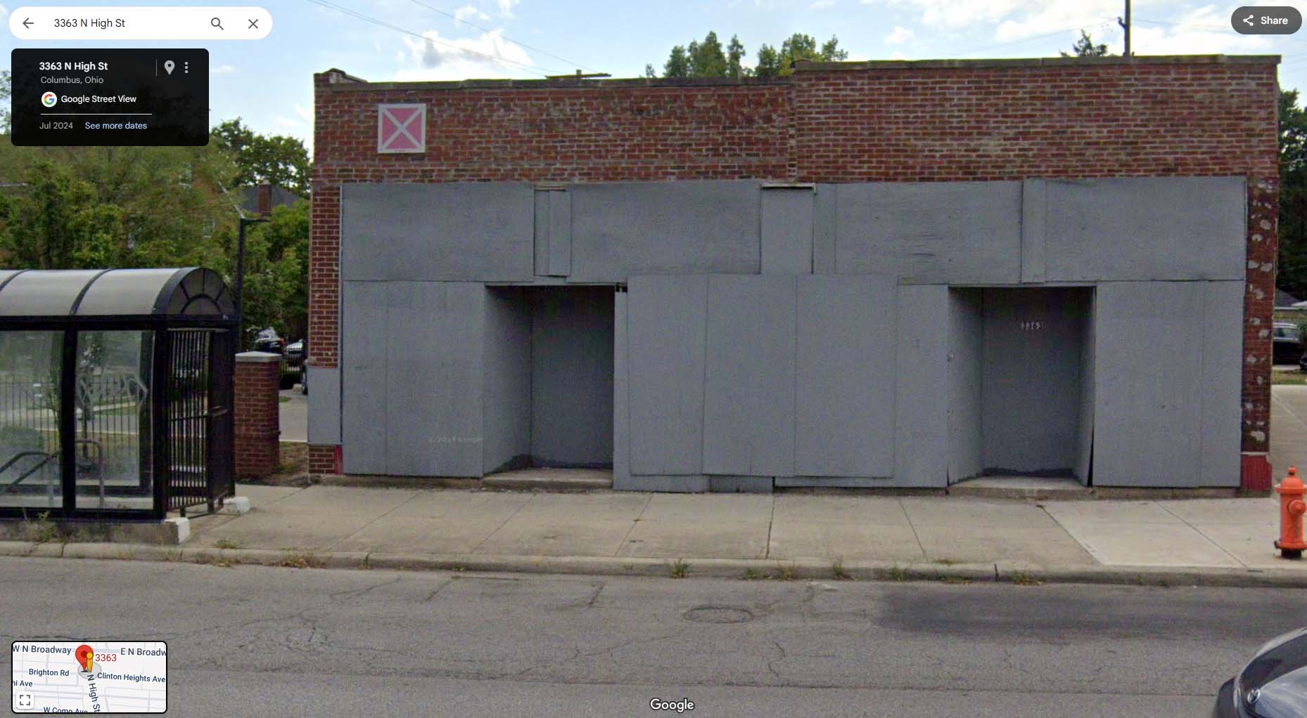
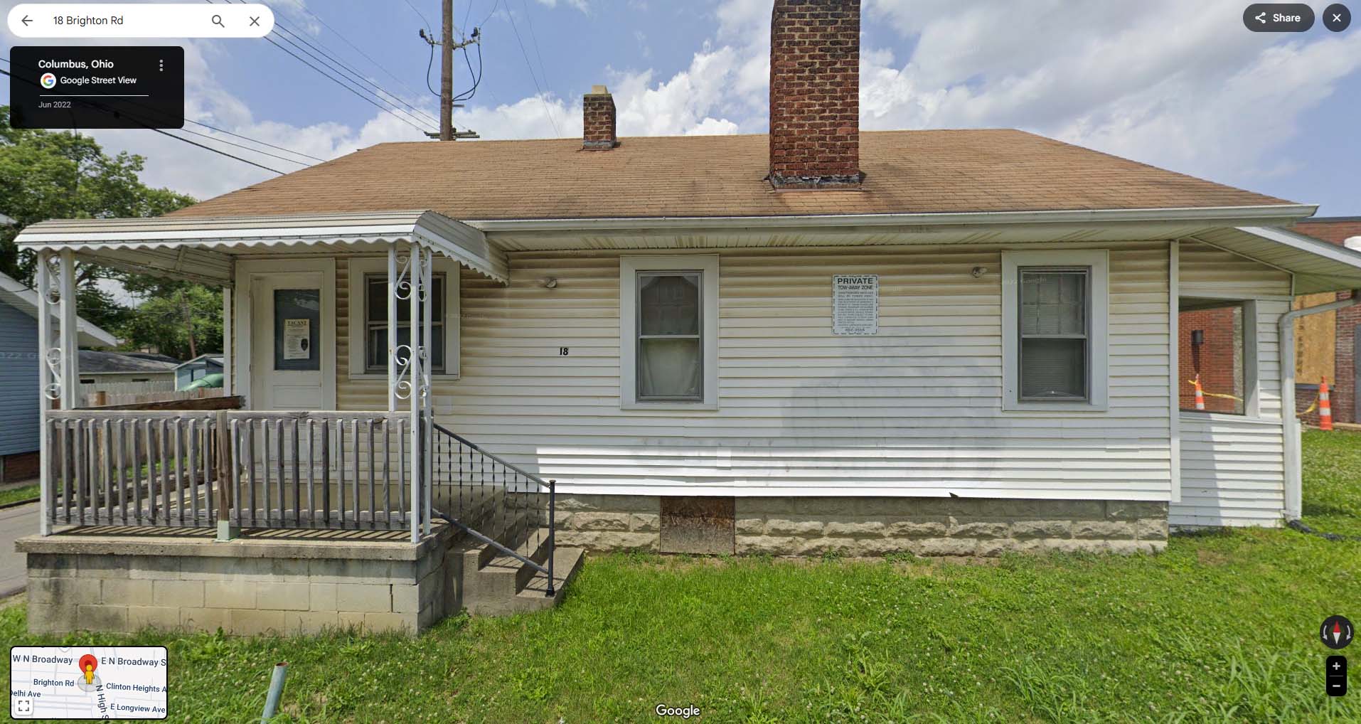
The buildings along North High Street between Brighton and West North Broadway have engendered a lot of interest in recent years…and again recently as the final Clintonville Electric building is slated to come down. Joe Smith created a terrific animated GIF of photos showing how the span of buildings along 3361-3379 North High Street has changed. Click on the image above to watch. Thank you Joe!
[Recent photos courtesy of Google Street View; pre-1980 photos are from the Columbus Metropolitan Library. Animation and all the labor involved are courtesy of Joe Smith.]
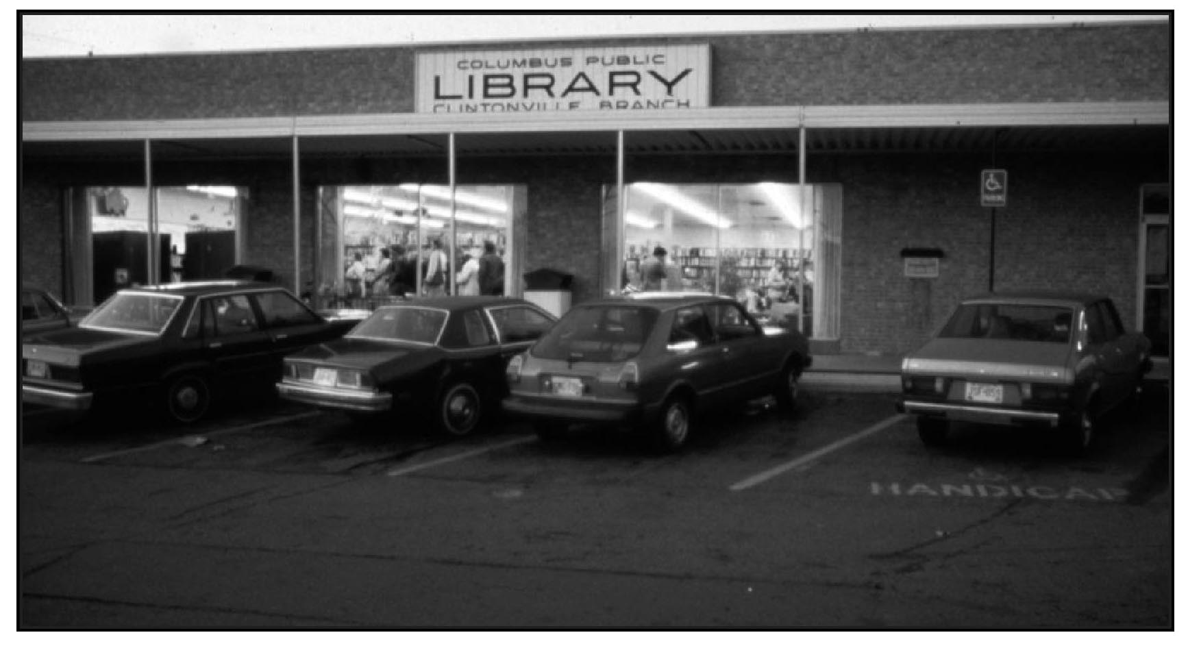 Preston Harmon had a very nice article about the Whetstone Library, in the July 2025 issue of the Clintonville Spotlight. Click here or on the photo above to read the article.
Our library is an exceptional community resource. Don’t forget to donate to it! Happy birthday, library!
[Photo and article courtesy of the Clintonville Spotlight.]

This is a nice photo from a 1922 Ohio State University masters thesis by Forest Ira Blanchard. I believe, based on the metadata, that it was taken at 3141 Silver Drive and the panorama photo is captioned, “Possible industrial sites along C.A. and C.-looking north” [i.e. the Cleveland, Akron & Columbus Railway]. The houses that you see to the left (west) of the railway tracks may well be East North Broadway.
There is a white pole near the tracks on the right side. That would be the whistle sign letting the engineer know it’s time to start his whistling for the crossing ahead.
Blanchard, inspired by the Chicago School of Sociology, sought to study the racial and ethnic composition of the city of Columbus, with a particular focus on the role of transportation (railroads, roads) in shaping the urban landscape.
[Courtesy of Forest Ira Blanchard, An Introduction to the Economic and Social Geography of Columbus, Ohio. Thesis (M.A.), Ohio State University, 1922; digital version from City of Columbus Historic Map Collection.]
 Joe Smith has an intriguing theory about Clintonville’s elusive Rathbone Cemetery. I think it’s interesting; what do you think?
From Joe:
I came across some maps that the Works Progress Administration (WPA) did from 1935-1943, as part of FDR’s “New Deal” programs. One Clinton Township map particularly caught my eye. It was named (by them) the “John Rathbone Cemetery.” There’s is a link to that particular map on an Ohio History Connection affiliated website (link here). To date, I have only found two other websites that make reference to that cemetery by name:
dev.clintonvillehistory.org/ website;
FCGHS website.I have spent the past few days trying to locate this cemetery. It has been confusing, because the WPA listed it at the corner of US-23 and C-93. As you know, today US-23 follows Indianola Avenue starting at Hudson Street. But I believe prior to the 1960s it was actually still North High Street. C-93 is Hudson Street, according to the Franklin County Engineers (link to PDF here). So, using the WPA location (0.9 miles north of Hudson, and 150 feet east of High), we are at Clinton Chapel Cemetery!
I was very impressed by the WPA map drawings, well before computer aided design (CAD) and printers/plotters were available. So, I took their map and made a rough estimate of the dimensions of the “John Rathbone Cemetery,” and it also fits (within an acceptable tolerance) the known dimensions of Clinton Chapel Cemetery! Three of the boundaries are within 5% but the east boundary is off nearly 10%. I think that is due to inaccuracies with the measuring and/or digitization of their maps.
I know everyone likes maps, so I’ve attached the one I created (see above) to support my findings that Clinton Chapel now has at least three alternate names:
North M.E. Cemetery
Armbruster Cemetery
John Rathbone Cemetery
More from Joe:
There were six Clinton Township cemeteries that WPA reported on: Amaranth Abbey Mausoleum, John Rathbone Cemetery, Kempton Cemetery, Mc. Kendree M. E. Church Cemetery, Union Cemetery, and Webster Cemetery. Note, Cooke and Clinton Chapel Cemeteries were not on their list.
Here’s a link to the very cool 1920 Baist Map earlier (it’s here.)
Other general observations:
Both Rathbone and Clinton Chapel cemeteries were of similar orientation, size and shape (0.47 acres vs 0.50 acres). The Clinton acreage is also an estimate. I actually expected Rathbone acreage to be higher, given that each of the borders are slightly larger, but again I think this is more due to issues with precision.
Here is a comparison of the border dimensions (in feet) for each cemetery. The borders for Rathbone were estimated based on pixel counts on the WPA map.
Border Clinton Rathbone North 200.00′ 200.00′ South’ 196.00′ 200.06′ East 97.02′ 107.06′ West 124.00′ 128.30′
What do you think? Talk about an “identity crisis!” Feel free to comment below.
To be sure, there remain some “unknowns”, such as the fact that Ohio Genealogical Society lists both a Rathbone Cemetery in Sharon Township and a John Rathbone Cemetery in Clinton Township. There may have been a family burial plot for the Rathbone/Wetmore family, graves in which were moved to Greenlawn at an unknown past date. I have no facts to back that up! I’m just leaving this possibility on the table until we can find out more. As Joe states, I mention a Rathbone Cemetery in prior posts. I learned about that from Algy McBride, past president of the Clintonville Historical Society and also of the Franklin County Genealogical Society. Algy passed away in 2015 and is greatly missed.
[This entire entry is courtesy of Joe Smith. Thanks Joe!]
 I’m delighted, and also sad, to learn that the derelict building that once housed Clintonville Electric is now in receivership. Why sad? The business most recently in that location was beloved by Clintonville residents; virtually everyone bought their appliances there. The original business owners were good citizens of their community. All that changed when the business changed hands and in 2004 left Clintonville (and subsequently went bankrupt, cheating half-dozen of its customers). Rumor has it that the property owners–who owned the properties from at least 1936 to the present day– simply declined to either sell or to fix up the buildings, yet kept the city from condemning it. I’ve heard that this building’s roof had a hole in it, and the water coming in caused the ground-level floor to collapse into the basement.
The family that owned the Clintonville Electric building owned a handful of other buildings that are so neglected that they affect the neighborhoods in which they are situated. The following Clintonville buildings have been put into receivership:
These following buildings have also been put into receivership. I know nothing about their condition and some have business occupants unrelated to the landlords.
Some legal documents about the case can be found on the Franklin County Court of Common Pleas. Two are linked here and here.
I’ll write about the businesses that occupied this space, in upcoming months.
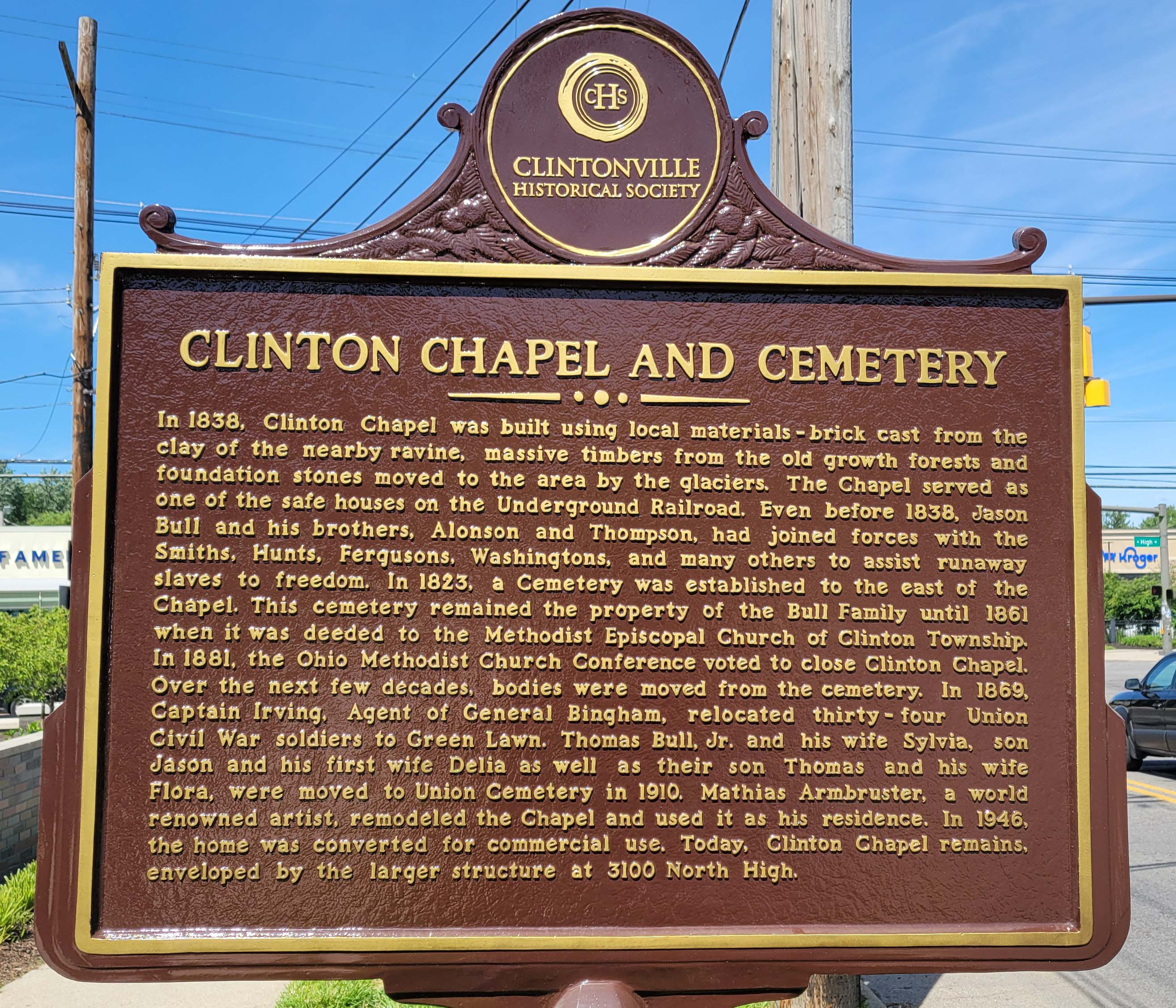
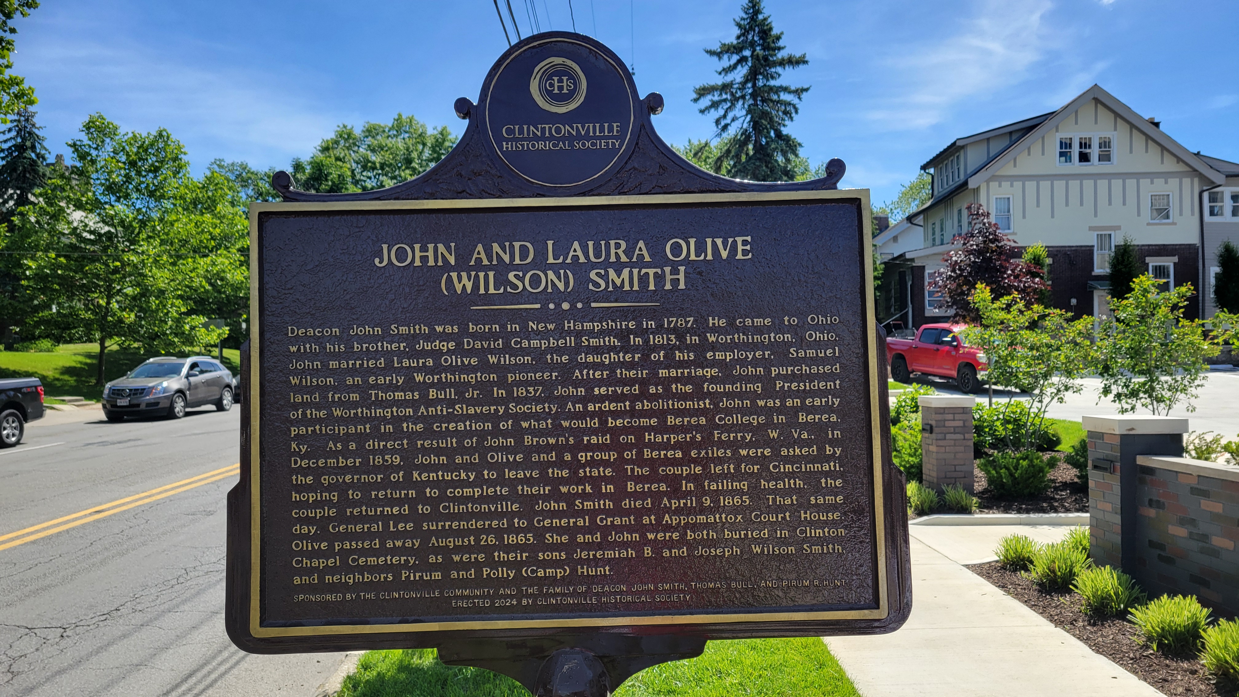
On the bright side: Clintonville Historical Society has erected a new plaque for the Clinton Chapel and for John and Laura Olive (Wilson) Smith near the corner of East North Broadway and North High. It gives us pause to remember slaves and slavery in the Unites States and to give thanks to the people who fought against it.
On the bad news side: it’s very unfortunate, from my perspective, that 12 staff were recently laid off from Ohio’s Historic Preservation Office. The federal government mandates that every state must have this sort of office, and to accompany that mandate they give the offices some money to fulfill their mission. That money was apparently withdrawn by DOGE and so Ohio History Connection had to terminate staff. Here’s a link to a newspaper article about the staff terminations.
[Photos courtesy of Joe Smith.]
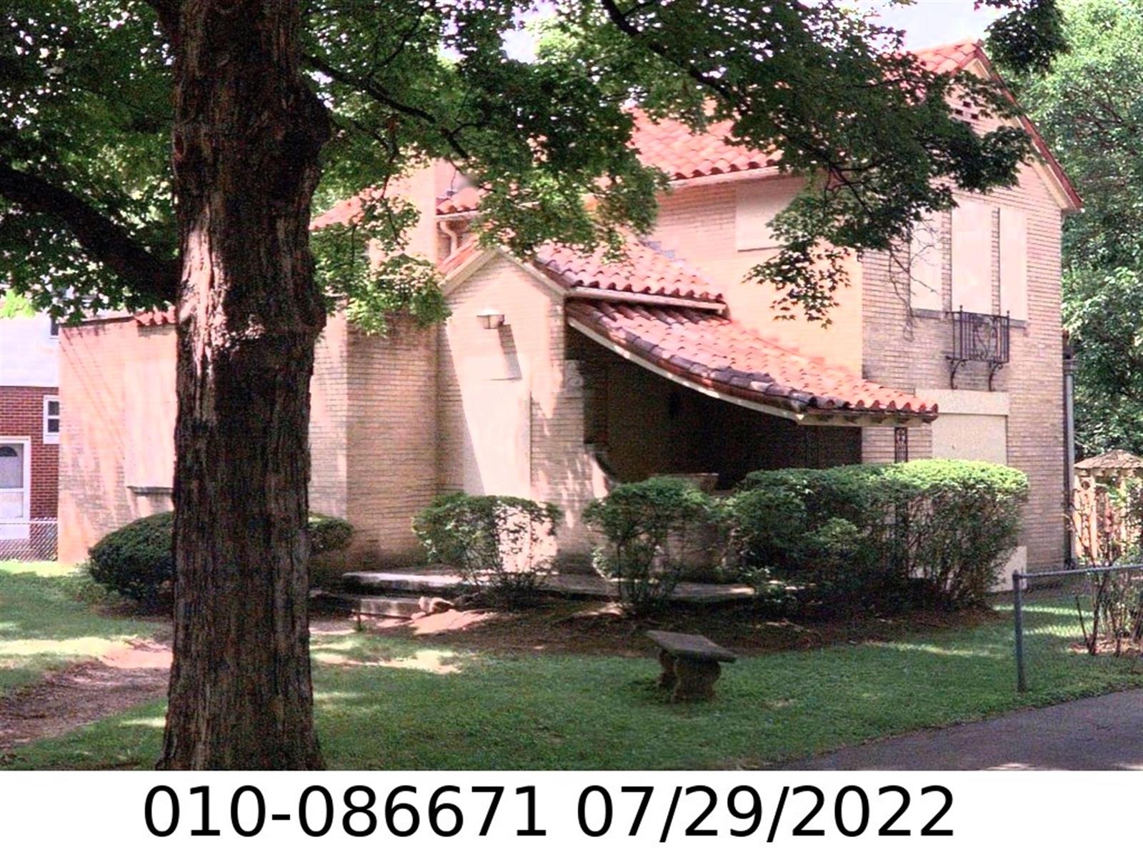
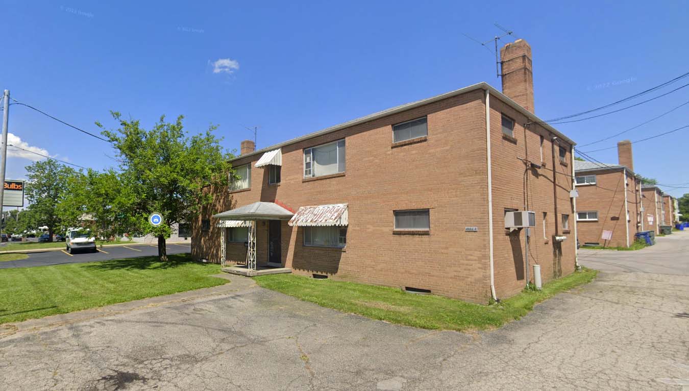
 I was very sorry to recently learn of the death (in February 2025) of Bill Good, former owner of the Southwick-Good & Fortkamp Funeral Chapel. This funeral home, at 3100 N High, was located at the site of Clintonville’s Clinton Chapel, which later became the home of Mathias Armbruster, became a funeral home in 1938, and is currently a day care center.
I met Bill when I was working on my Clintonville and Beechwold book. He was a devoted caretaker of the building in which his funeral practice was located, knowledgeable about its architecture and history, and respectful of the entire property. He even made sure that expert wall builders were called in the rebuild the property’s perimeter wall, at considerable expense. He was always willing to share his knowledge, and was patient even as he had to explain to me what an “adze cut” is. He had civic pride and was pleased that the building served as a polling place each election day. More personally, he graciously advised me in planning for the funeral of my mother-in-law. I am grateful. I remember Bill fondly and extend my condolences to his wife and family.