Home
Spiros Spantithos
 I enjoy immigrant stories so thought I’d share the story of former Clintonville resident and business owner Spiros Spantithos, aka Sam Spandos. I’m piecing this story together from public records, so I may be wrong in the details and would be happy to be corrected or to receive more information!
Spantithos is the original owner of the building(s) that eventually housed Clintonville Electric.
Spantithos was born in Sparta, Greece, on Feb 15, 1884, and came to this country in 1902. In 1912 he returned to Greece and stayed until 1921, during which time he served 8 months (or perhaps 8 years, depending on the source) in the Greek army. Greece was involved in several wars during this time–the Balkan wars with Bulgaria, and a war with Turkey. I’m not sure when Spantithos married, but on this first trip home to Greece he fathered 2 sons and a daughter.
He returned to the States in 1921, and became a naturalized citizen around 1926, at age 42. Spiros names two boys on his 1926 naturalization papers—-George, age 8 [sic], and Demetros, age 6, both in Greece. His naturalization papers do not mention his wife, Nicoleta Sicaras, nor his daughter. Neither his wife nor his daughter seems to have come to the States. (Nicoleta does have a record in the Social Security Applications and Claims Index 1936-2007.) His son George came to the States in 1935 at the age of 19.
Spantithos’ U.S. draft card states he lived at 18 West Brighton (he lived there along with his brother James), and he purchased 3361 N High in November 1936. That is where he and his brother opened the Oakland Park Restaurant. (He got a beer license for his restaurant at 3361 N High in 1933, and he leased the space before he purchased it.) On occasion the 24-hour restaurant, or nightclub, had skirmishes with the law–notably for Sunday dancing (!!) and for serving alcohol after hours. He also leased an adjacent “storeroom.”
In 1938-39, Spantithos returned to Greece for a 7-month visit, and this was the first time he saw his daughter, who was by then 17 years old. I found Spiros’s name on a passenger list for a ship arriving in NY from Italy, 6-Jul 1939, and travelling back to Europe with son George and George’s wife Susan in 1951, but again, no mention of his wife. In the 1940 and 1950 censuses, he is listed as married but his wife Nicoleta isn’t listed in his household.
Spiros died in November 1970.
His son George (born Jan 25, 1920 [sic] in Sparta Greece) assumed ownership of 3361 N High, in 1972 after Spiros died. He and his wife Susan had purchased property at 4469 Rosemary Parkway in 1953 and lived there until George died in February 1994. I believe it was George and Susan who accumulated the additional properties in the Spantithos portfolio, including, for awhile, The Blue Dube.
(Newspaper clippings courtesy of the Columbus Dispatch, accessed through the Columbus Metropolitan Library’s NewsBank database. Detailed citations can be found on each clipping by clicking through their links.)
Holiday Greetings
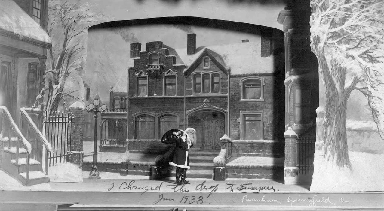
Painting by Mathias Armbruster, courtesy of the Mathias Armbruster Scenic Studio Collection at OSU, and taken from WOSU’s Broad and High clip about Mathias Armbruster’s studio.
Duffy’s Tavern
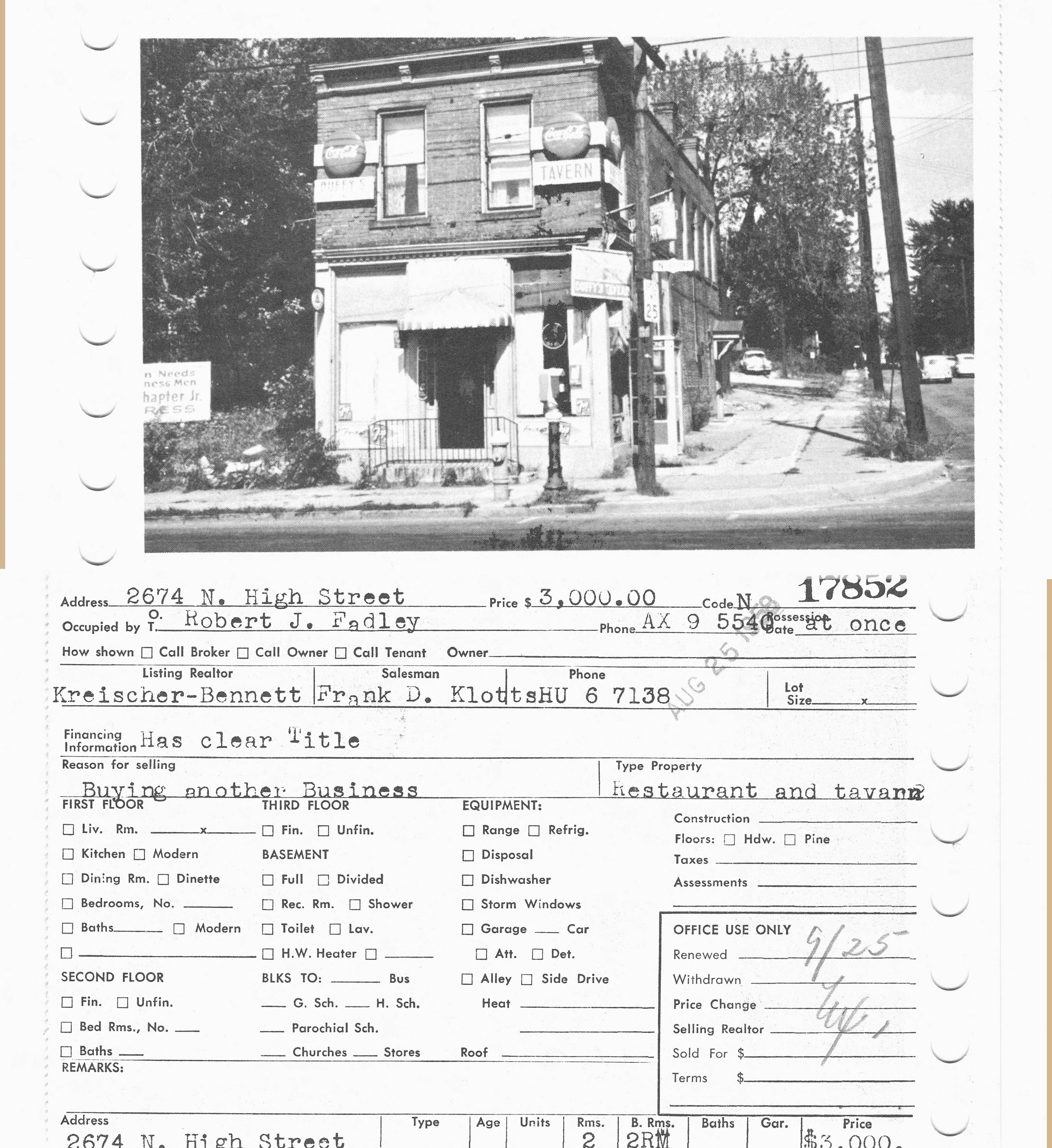
Wow, what a picture of the northeast corner of Dodridge and N High, where CVS Drugstore is today! This photo of 2674 North High was taken in 1959. Duffy’s Tavern had several owners over the years; in 1959 it was owned by Robert J Fadley and in 1947 it was owned by V. G. Hillon. In 1937 it was called Barney’s Grill. I believe it was a restaurant going back to at least 1924, as I found several “waitresses needed” ads in the Columbus Dispatch for the “Crouse American Restaurant” at 2674 North High, in 1924.
When Duffy’s Tavern was sold in 1959, it became a Coin-O-Wash.
I did find some classified ads in the Columbus Dispatch for horses from Kellar stables at this address as well between 1905 and 1911, so the stables probably occupied both east corners of Dodridge and North High.
(Photo courtesy of the Columbus Metropolitan Library’s MLS real estate collection.)
Oakland Park & N High, 1922
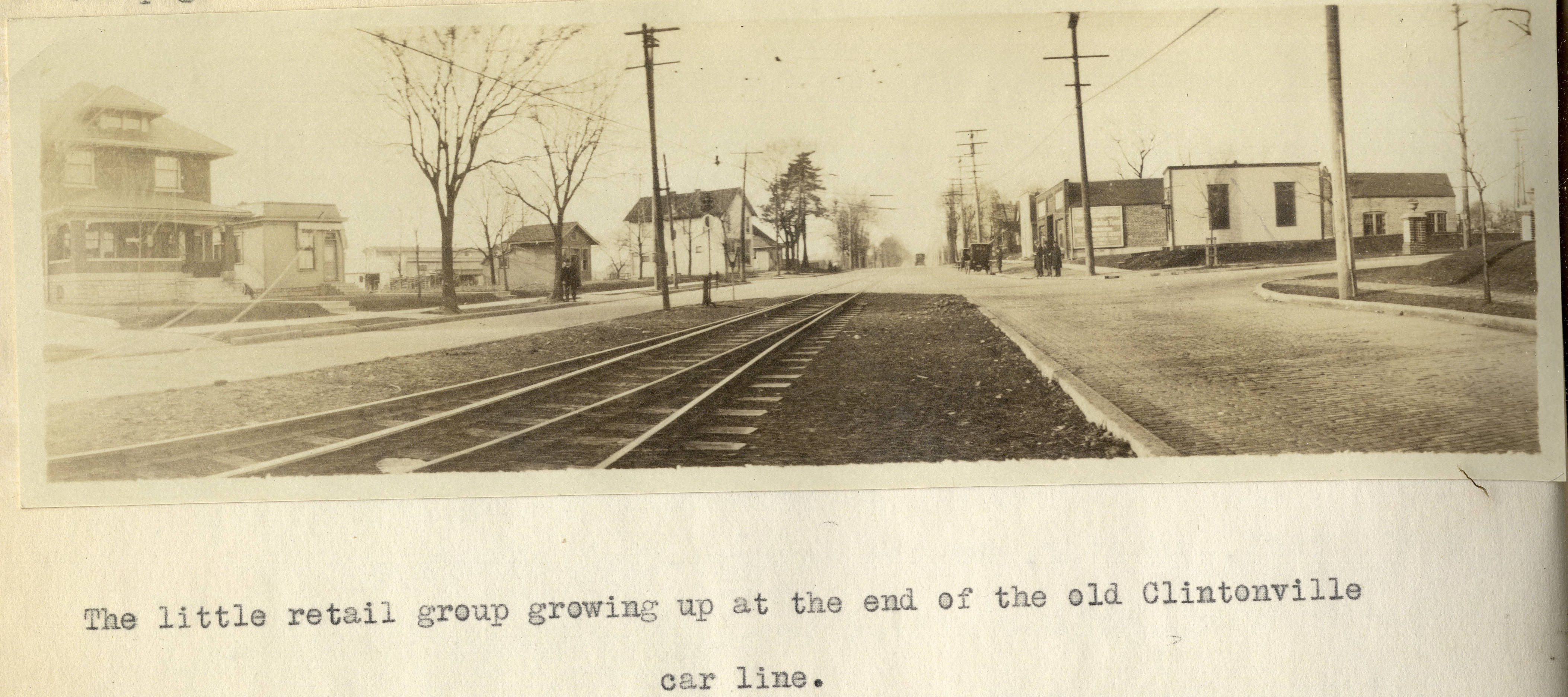
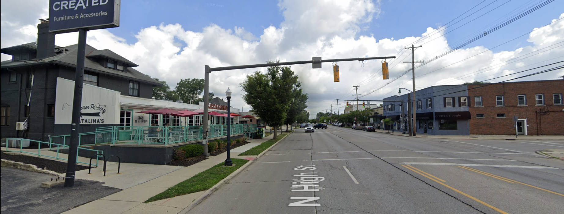
I’ve previously mentioned Forest Ira Blanchard’s wonderful master’s thesis, which is a treasure trove of photos of Columbus in 1922. It contains this old photo of Clintonville at the intersection of Oakland Park and North High in 1922. The house on the left, west, side of North High Street is still with us! Here’s that same intersection today.
Here’s Blanchard’s accompanying text:
Beyond Hudson Street to Arcadia Avenue, High Street is about solidly lined with small, but unattractive store rooms, this being the business section of the old, formerly outlying, hamlet of North Columbus. Here, at the corner of Arcadia and High is located the car barn and the end of the High Street car lines. Until recently, from this corner, through Clintonville, the Clintonville line and the Columbus, Delaware and Marion Interurban cars furnished the transportation service; now, the former line has been superseded by an extension of the Summit Street line. At the center of the former suburban village of Clintonville , where Clinton Heights Avenue joins High Street a small retail center has grown up, which is extending northward on High Street , a short distance . At the end of the Clintonville car service another little business center is coming into existence, incidentally the cross street here, Oakland Park Avenue , is a through one into the country to the east . This point not only ends the city car service out North High Street , but the retail stores as well , which is instructive as to the influence of such transport service upon the location of retail stores.
Such residences as are yet found along the High Street electric lines are not as good, on the whole, as those back of them away from the noise of the cars .
Alex Campbell has kindly provided a bit of background information on the transportation systems mentioned in Blanchard’s document:
When the line north of Arcadia was trackage for the CD&M, up to about 1922, it was single track from Arcadia to Tulane Rd than double track to Kenworth Ave. From Kenworth Ave north, it returned to single track with four passing sidings located between Kenworth Ave and Worthington. Between Tulane and Kenworth, the double track was in the center of High St. separated from the paved road. I’m not sure what you call that – a boulevard?? (I suspect you know all this. I just wanted to be on the same page.)
This drawing of the 1925 CRP&L Co. trackage by BJ Kern is what I am using to back up what I’m describing.
In Blanchard’s photo, the end of the double track is visible, which indicates that we are either at the north or south end of the double track. If it were the south end, you would expect to see more trees and maybe even Olentangy Park in the distance – it’s not the south end. That leaves the north end of the double-track.
Oakland Park tees into High Street from the east. The fancy and inviting brick columns suggest the developers have been busy. Kenworth would come from the west, slightly south of Oakland Park, if it even gets as far as High Street. In either case, it isn’t visible.
Blanchard refers to this photo location as “the end of the old Clintonville car line.” I think he is referring to the predecessor of the CD&M, the Columbus, Clintonville & Worthington Street Railway. The double track section must have been built by the predecessor, not the CD&M. The CC&W was itself the joining of two traction lines, and this is where the two joined.
Thank you Alex!
[Courtesy of Forest Ira Blanchard, An Introduction to the Economic and Social Geography of Columbus, Ohio. Thesis (M.A.), Ohio State University, 1922, page 38. Blanchard lived from 1886 to 1963.]How Clintonville Electric Has Changed!

The buildings along North High Street between Brighton and West North Broadway have engendered a lot of interest in recent years…and again recently as the final Clintonville Electric building is slated to come down. Joe Smith created a terrific animated GIF of photos showing how the span of buildings along 3361-3379 North High Street has changed. Click on the image above to watch. Thank you Joe!
[Recent photos courtesy of Google Street View; pre-1980 photos are from the Columbus Metropolitan Library. Animation and all the labor involved are courtesy of Joe Smith.]Whetstone Library Turns 40
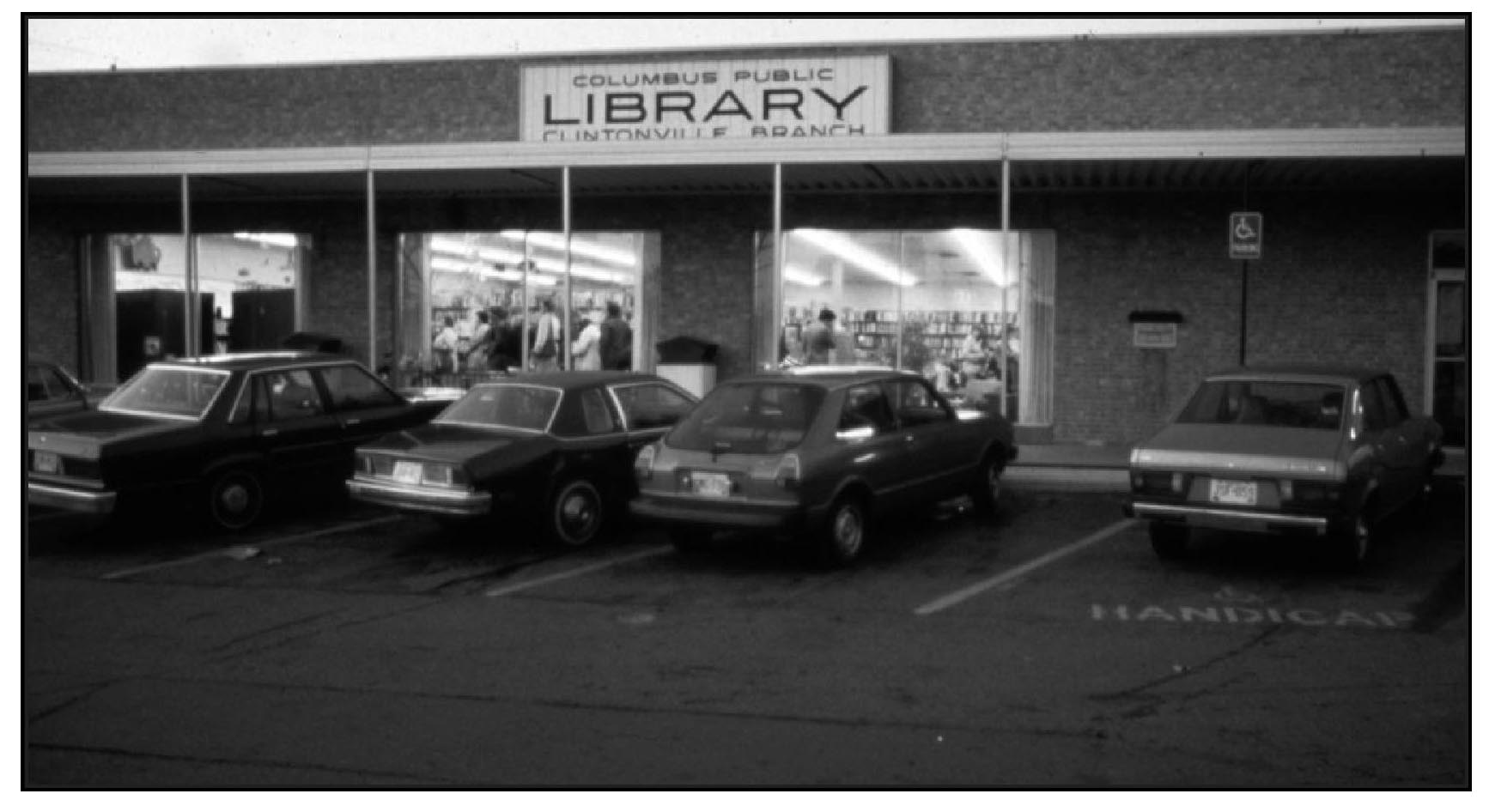 Preston Harmon had a very nice article about the Whetstone Library, in the July 2025 issue of the Clintonville Spotlight. Click here or on the photo above to read the article.
Our library is an exceptional community resource. Don’t forget to donate to it! Happy birthday, library!
[Photo and article courtesy of the Clintonville Spotlight.]