Maps original
What you'll find here are some of my favorite maps, showing the growth and development of Clintonville.

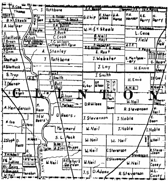
- 1842–from Caldwell's Atlas of Franklin County

- 1856–from Caldwell's Atlas of Franklin County
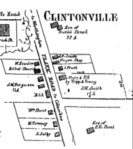
- 1856 pt 2 Downtown Clintonville–from Caldwell's Atlas of Franklin County

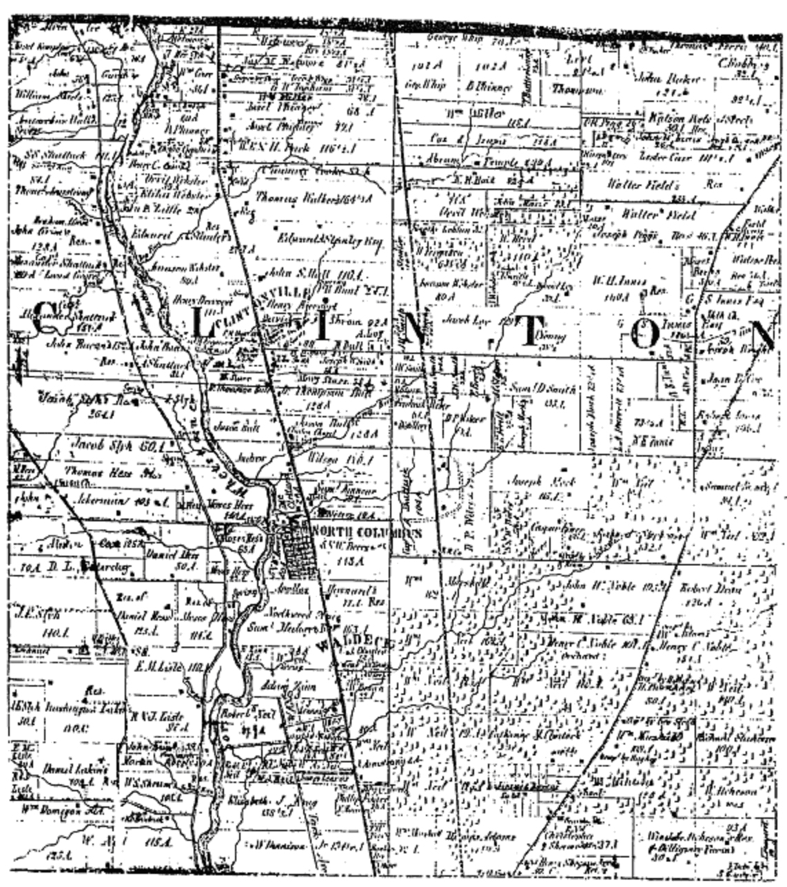
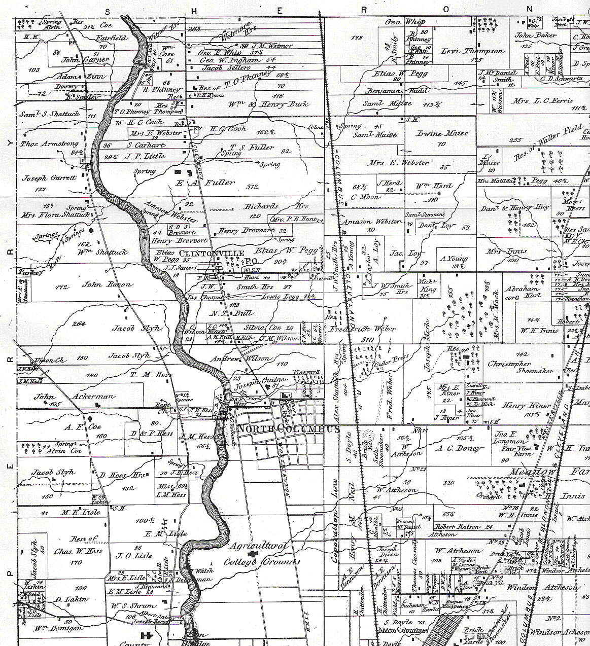
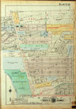
- 1872–from Caldwell's Atlas of Franklin County and of the City of Columbus, Ohio

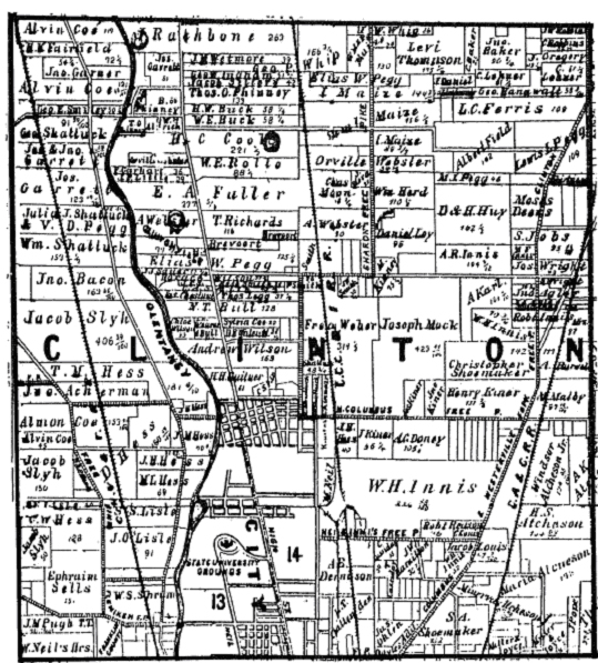
- 1883–from Caldwell's Atlas of Franklin County

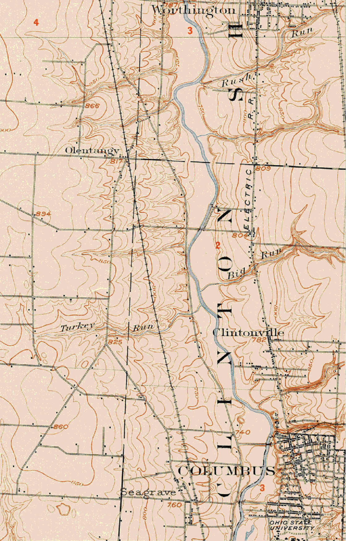
- 1903–from USGS Dublin Quadrangle, detail for Clintonville

- 1910–Clinton Township–from Modie & Kilmer's Folio Atlas of Franklin County

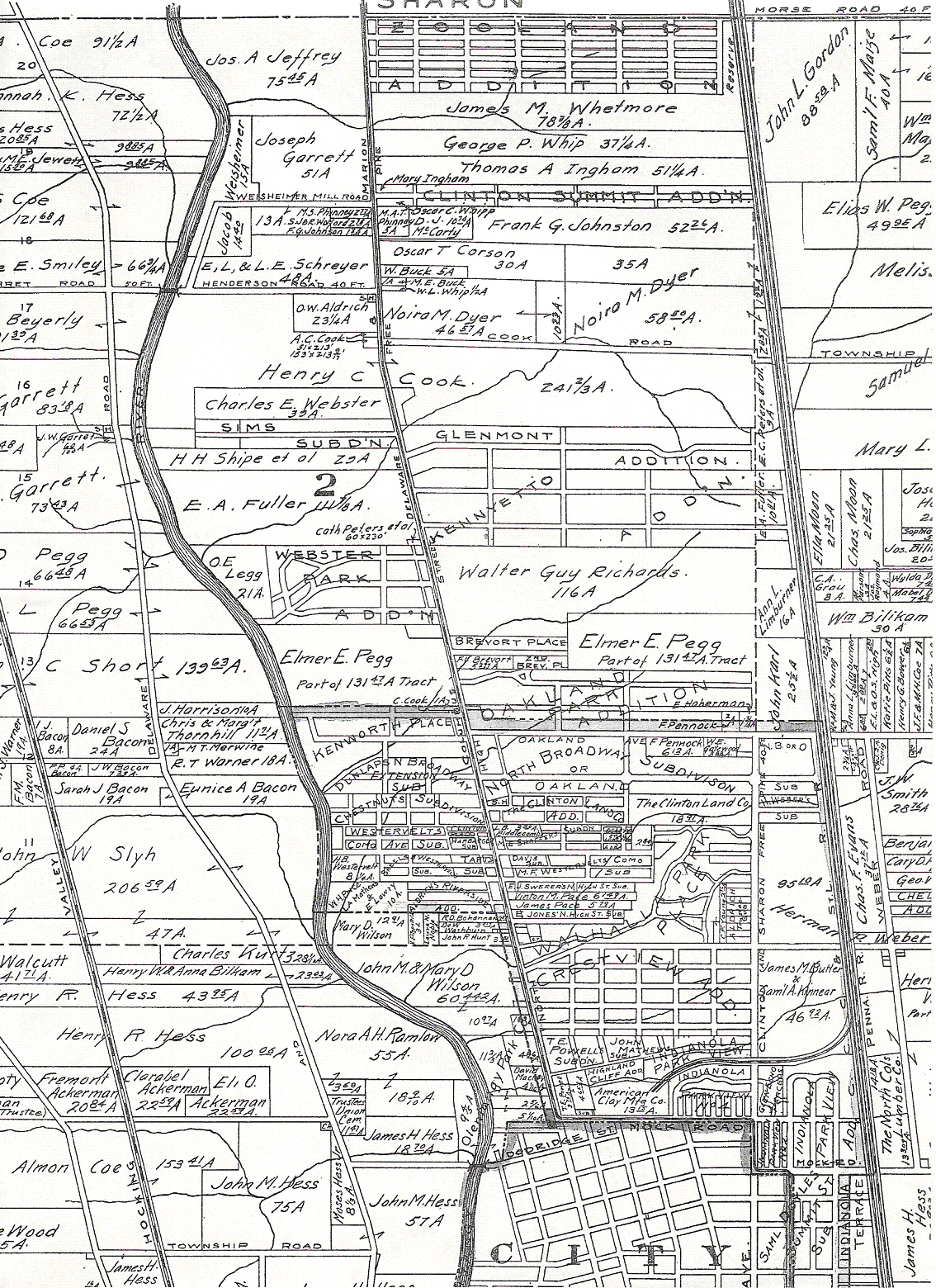
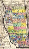
- 1910 pt 2–Clintonville part of Modie & Kilmer's Folio Atlas of Franklin County

- 1910 South Clintonville–from Baist's Atlas [digitized by John Krygier, Ohio Wesleyan University, Mellon Foundation Grant, 2011]

- 1920–from Baist's Atlas [digitized by the City of Columbus]

- 1990s–Map of Housing Developments by Paul Bingle
- 2009–Locations of places mentioned in Hyatt's Clintonville & Beechwold
What you'll find here are some of my favorite maps, showing the growth and development of Clintonville.
- 1842–from Caldwell's Atlas of Franklin County
- 1856–from Caldwell's Atlas of Franklin County
- 1856 pt 2 Downtown Clintonville–from Caldwell's Atlas of Franklin County
- 1872–from Caldwell's Atlas of Franklin County and of the City of Columbus, Ohio
- 1883–from Caldwell's Atlas of Franklin County
- 1903–from USGS Dublin Quadrangle, detail for Clintonville
- 1910–Clinton Township–from Modie & Kilmer's Folio Atlas of Franklin County
- 1910 pt 2–Clintonville part of Modie & Kilmer's Folio Atlas of Franklin County
- 1910 South Clintonville–from Baist's Atlas [digitized by John Krygier, Ohio Wesleyan University, Mellon Foundation Grant, 2011]
- 1920–from Baist's Atlas [digitized by the City of Columbus]
- 1990s–Map of Housing Developments by Paul Bingle
- 2009–Locations of places mentioned in Hyatt's Clintonville & Beechwold