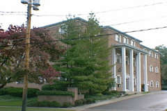
Beth Tikvah in Clintonville
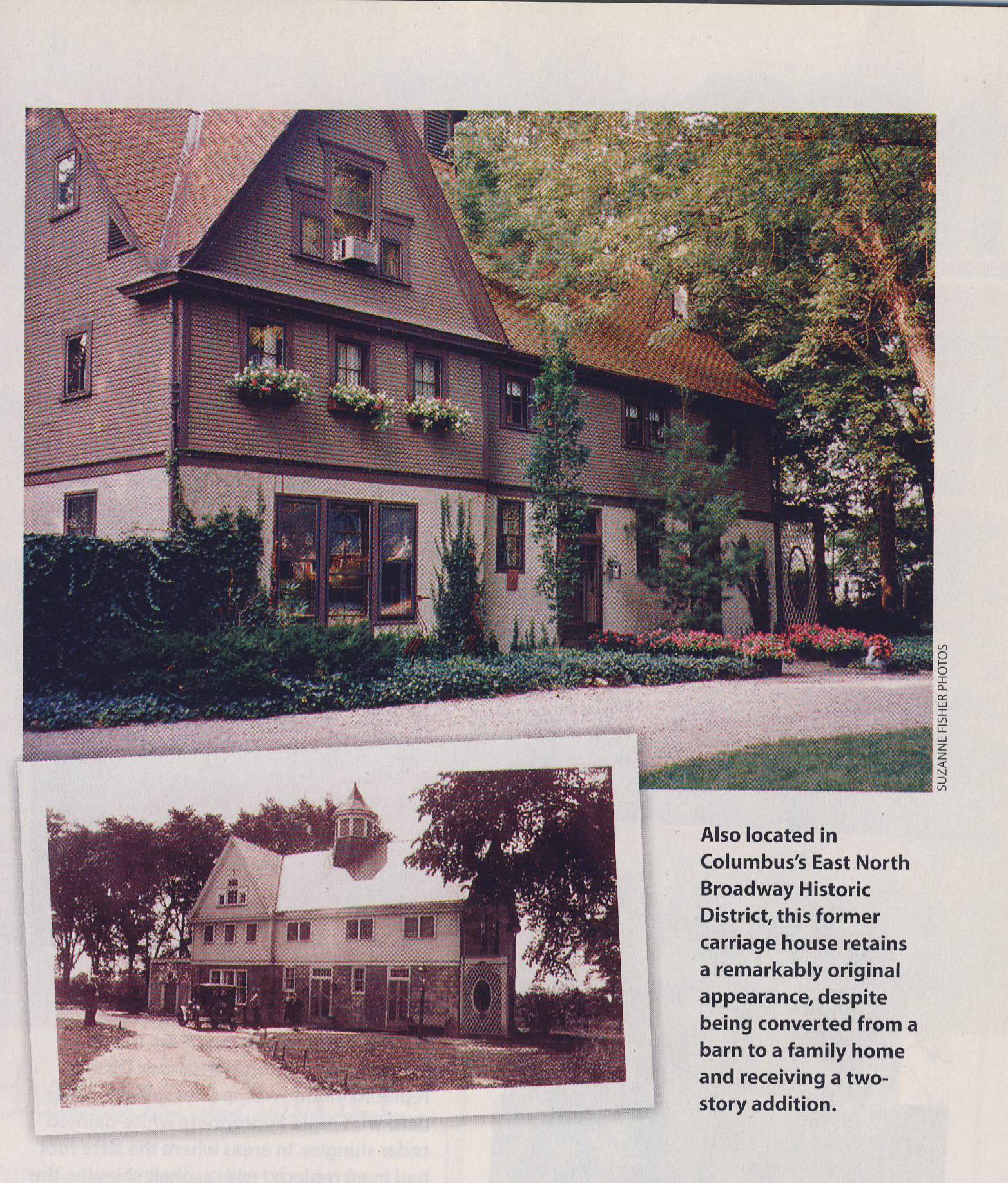
I recently learned that Congregation Beth Tikvah–a synagogue currently located at 6121 Olentangy River Rd in Worthington–was once located at 3392 North High (southeast corner of North High and East North Broadway). The congregation met there from July 1962 until development plans for that corner required that they move. According to this February 1968 news article, they located a building to purchase after much hunting and just in time. In March they moved to 3199 Indianola until they built a new larger synagogue in 1981.
The 3392 N High assembly-house location was a house that was torn down to make way for an office building–this is the current white office building at 3400 N High. I do not have any pictures of the older Beth Tikvah building but would love one!
Here‘s a very nice history of Beth Tikvah written by one of its members and past presidents Marty Seltzer.
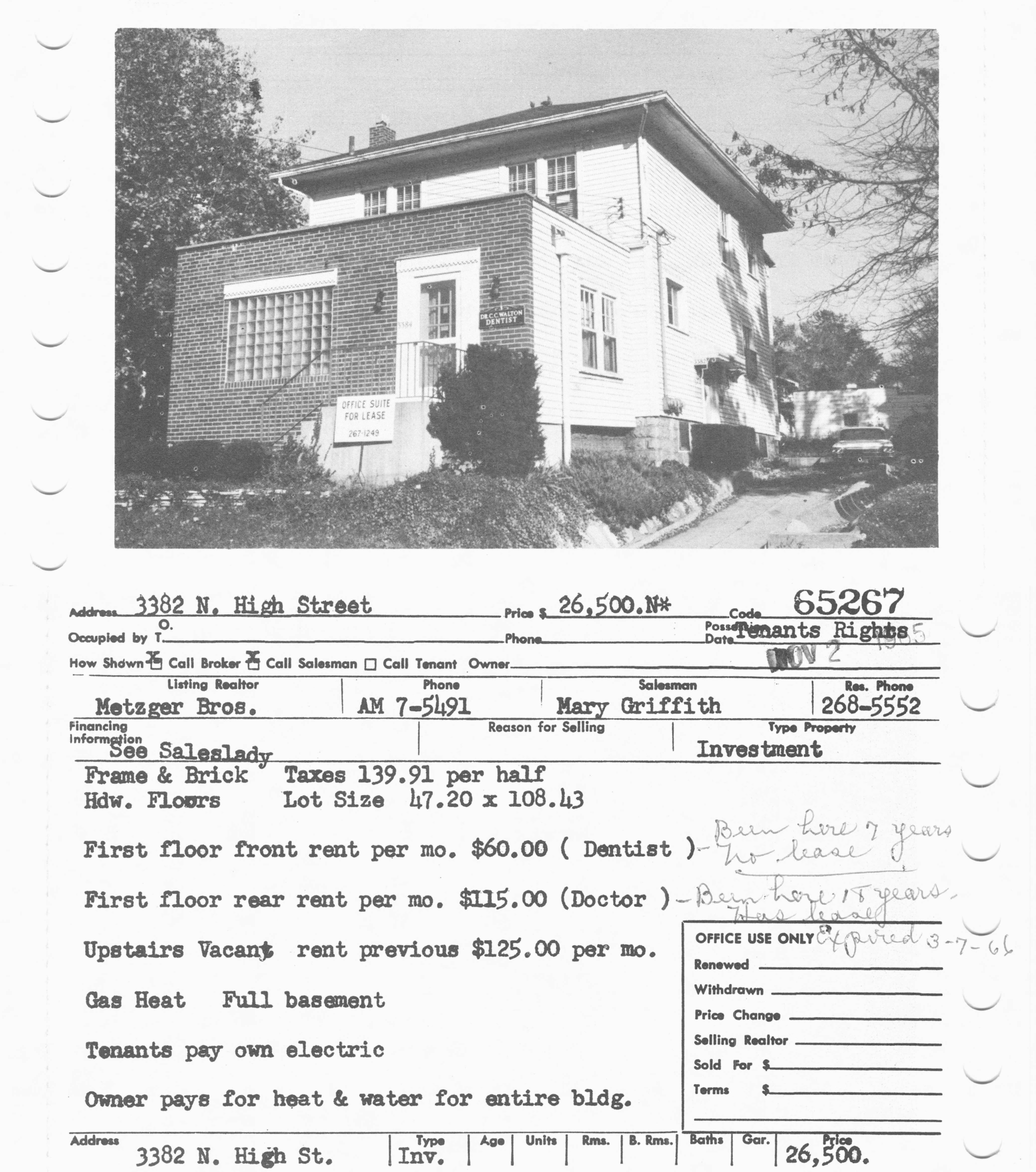 As a small sidenote: this is another location near that corner, probably also torn down to be replaced by the larger white brick building. This is a 1965 picture of a building at 3382-3384 North High, 1 or 2 doors south of the Beth Tikvah assembly house. It housed a dentist in the front, a doctor in the back, and also had space upstairs for another professional.
(Newspaper articles courtesy of the Columbus Dispatch and accessed from the Columbus Metropolitan Library’s NewsBank database. The 3384 N High photo is from the library’s MLS database. The synagogue shared their history with us.)
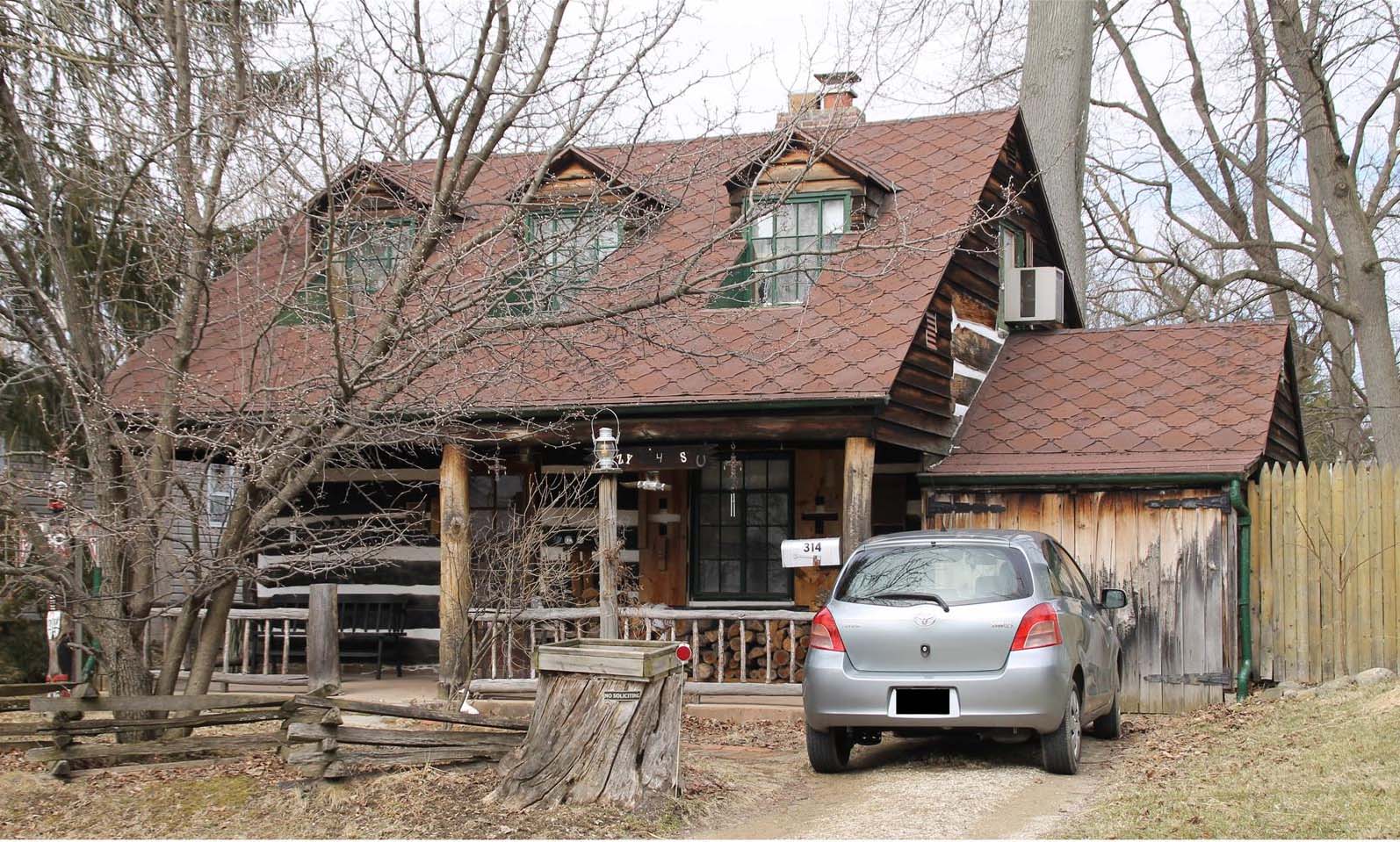
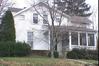
Open House at 314 W. Kanawha
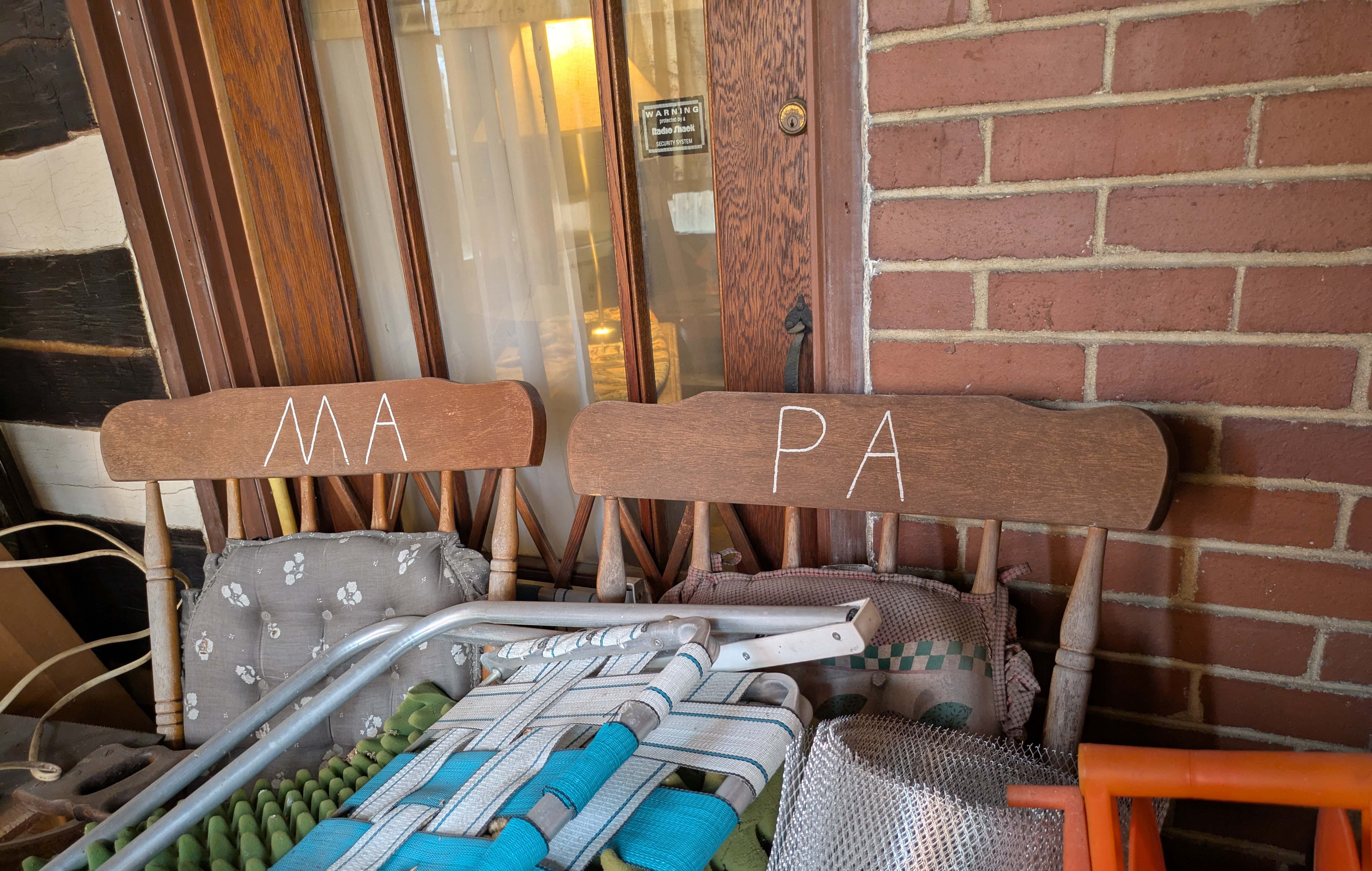
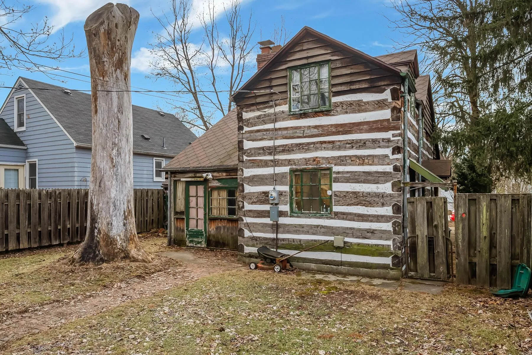
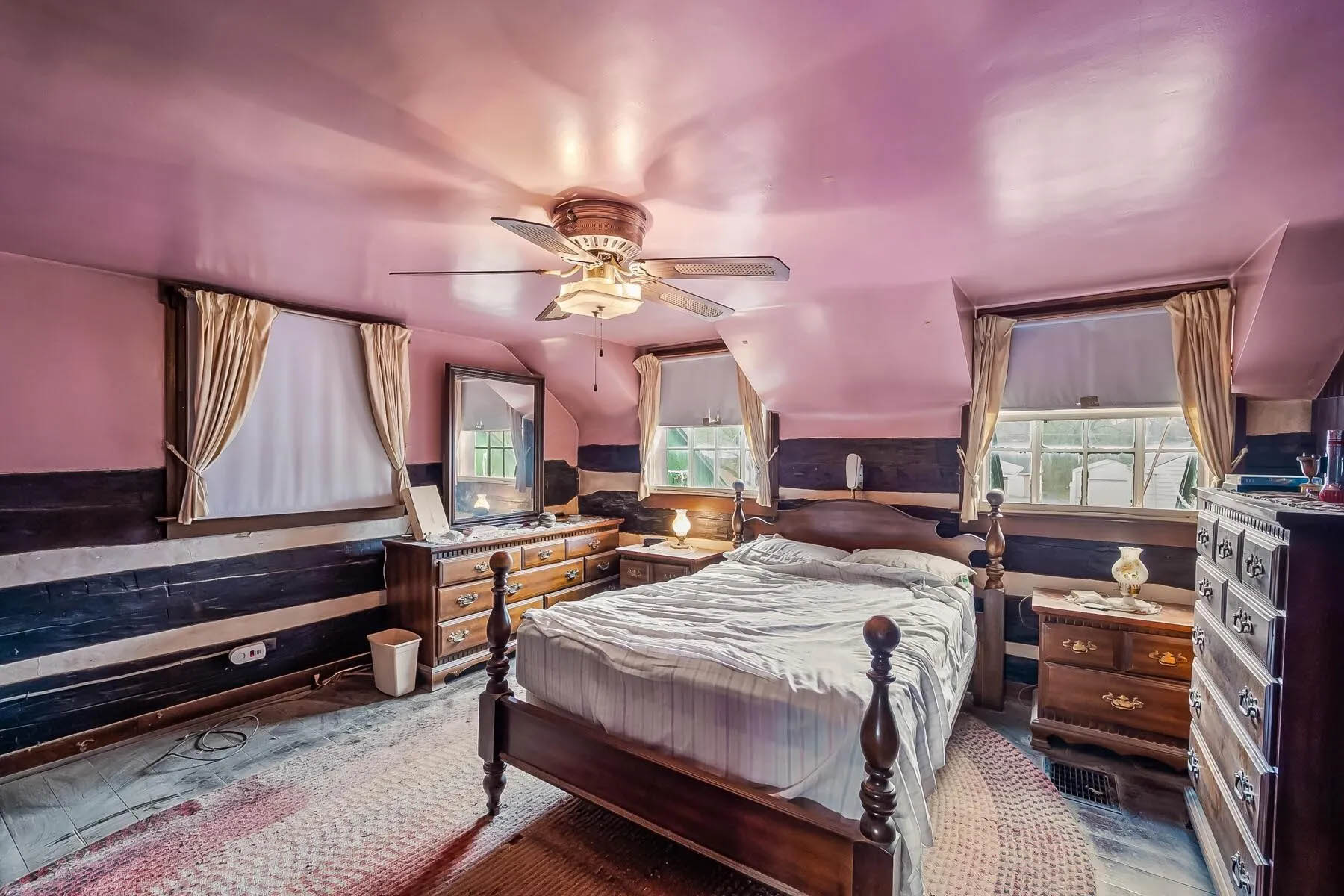
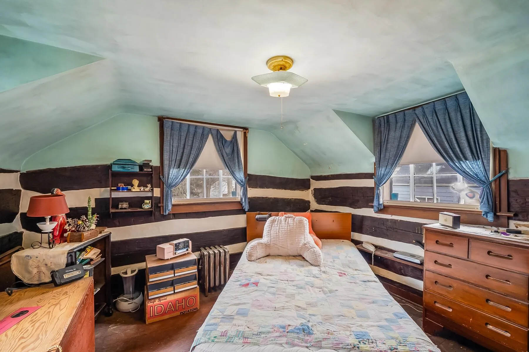
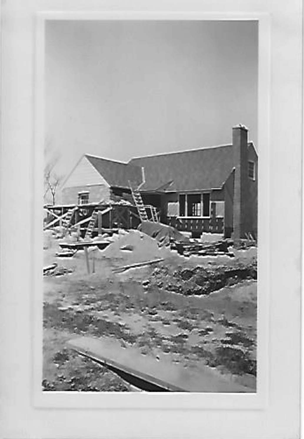
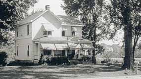
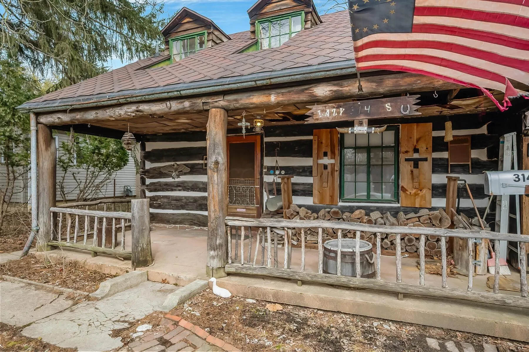 The log home at 314 West Kanawha is up for sale! Wendy Baker alerted us to this auction; the auction starts at $100,000.
Wendy had first told me about this property and the family who developed it; my post is here.
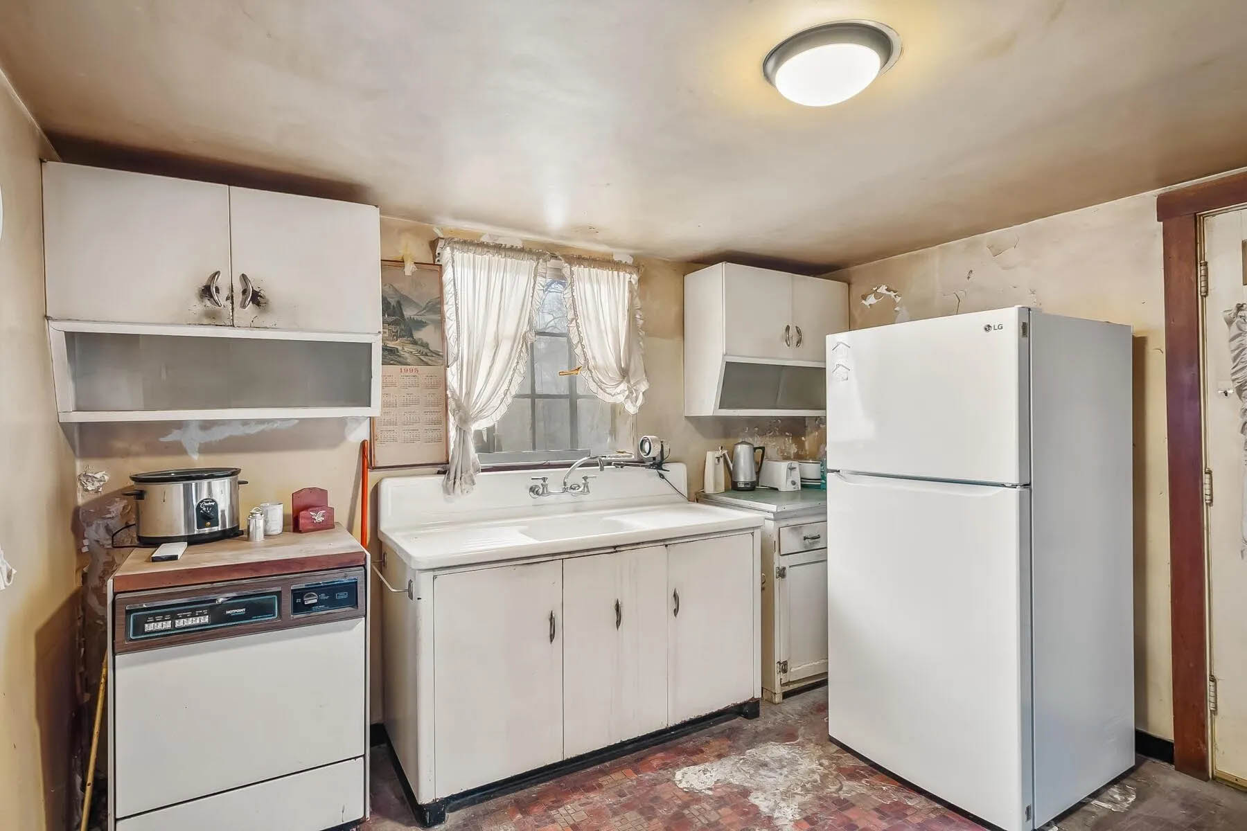
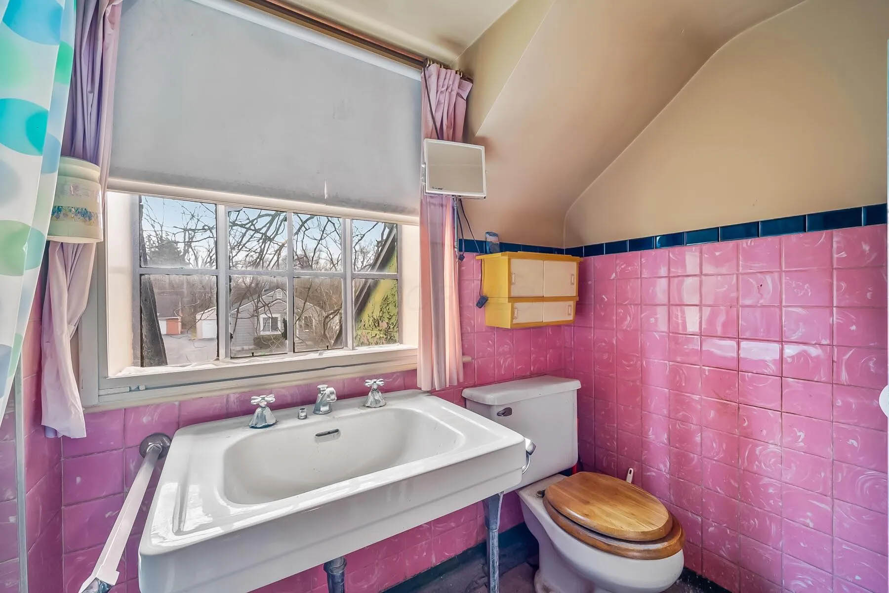
The house has had just 2 owners since the Rorers built it, and the most recent occupant purchased it in 1973. Here’s the current listing, with some pix of the houses’ internal rooms.
The Columbus Dispatch did a nice article about the auction, but does not seem to allow me to provide you with a gift link. Here is the article for those of you with a subscription.
If you’d like to see it, the home will be open from 5 p.m. to 6 p.m. Thursday March 27 and again on April 6, from 1 p.m. to 2 p.m. The auction will end 4 days later.
I went to the first open house this past week, and can attest that it needs some loving care. I certainly hope it’s not a “knock down.” And of course, I wonder who “Ma” and “Pa” are.
Here are a few more pix courtesy of the realtor’s web site.

Researching Your Address
 A fun tip for researching your address, from Clintonville Historical Society’s Jeffrey Carter:
–Go to the Columbus Library’s web site.
–Go to Research.
–Find Columbus Dispatch.
–Put in your library card and pin number.
–Enter keyword and search by date. {Shirley suggests: try using your street address in quotes.]
Jeffrey says, “I researched my address and found that during prohibition 3 people were arrested for bootlegging
at 265 Brevoort!”
Log Home on Westwood Road
 Ann Conner allowed me to see the inside of her 168 Westwood Road home when I was working on my book. You can get a glimpse of it here, in a 1988 10tv item.
Or here, as an AirBnB listing.
Maps Maps Maps
Here are some cool links for old maps:
City of Columbus Planning Maps, Historic Maps.
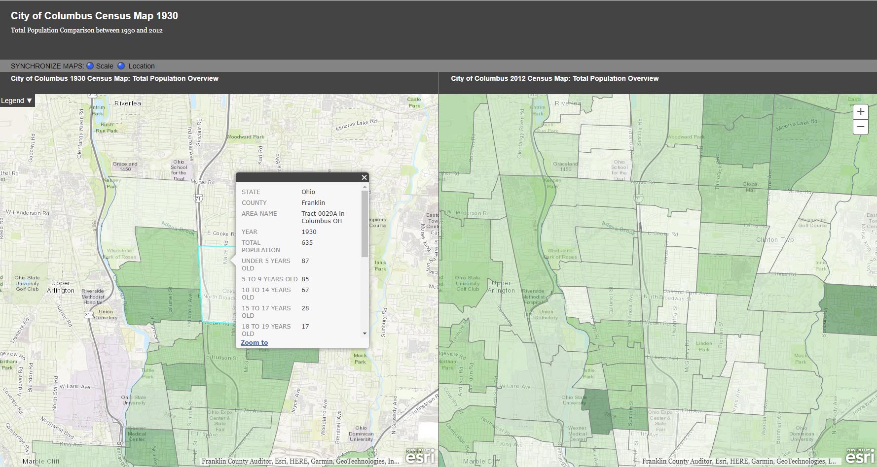
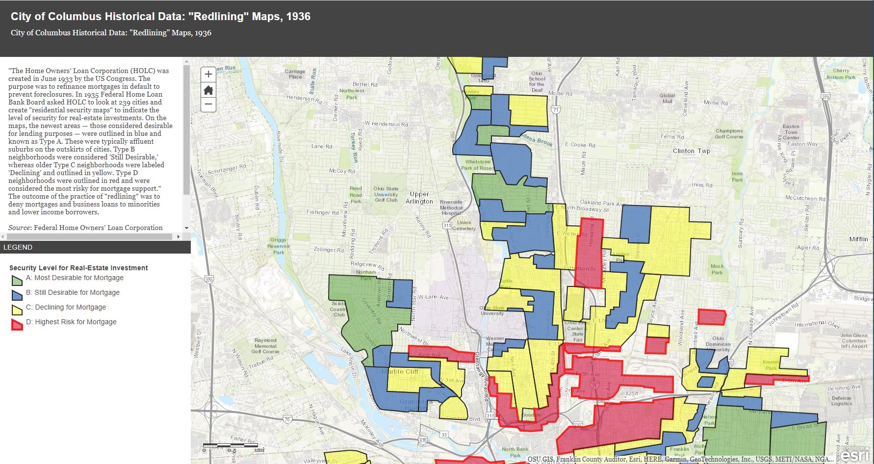
The City of Columbus’ web site gives us plenty of maps and data to play with, from Census demographic changes to despicable redlining and more. Check out especially the “City of Columbus Historic Panoramic Images, 1922,” which is based on a 1922 Ohio State University masters thesis by Forest Ira Blanchard. “Blanchard, inspired by the Chicago School of Sociology, sought to study the racial and ethnic composition of the city, with a particular focus on the role of transportation (railroads, roads) in shaping the urban landscape. Source: Forest Ira Blanchard, An Introduction to the Economic and Social Geography of Columbus, Ohio. Thesis (M.A.), Ohio State University, 1922.”
Columbus Metropolitan Library’s Columbus and Ohio Map Collection. If you haven’t donated to the library yet, now’s the time! It and and it’s staff are such great resources.
Sanborn Maps for Franklin County (scroll down to see Columbus). This is a Library of Congress site.
USGS Historical Topographic Map Explorer allows you to specify a place you want to explore, then click on a location to see its historical maps.
Prolific programmer Randy Majors has produced several products of interest, including his Historical U.S. Counties Map Tool and Auto-Checker Extension. He has also created a couple of video walkthroughs of a couple of the the software tools he has created. I recommend you view them in order, as understanding the Historical U.S. Counties map tool will help you have better success with using the Auto-Checker chrome extension.
Old Maps Online OldMapsOnline.org indexes over 400,000 maps, thanks to the archives and libraries that were open to the idea and provided their online content.
Do you know of other map resources? Let me know and I will add them to this post.
Glen Echo Beyond the Ravine

This is a nice photo from a 1922 Ohio State University masters thesis by Forest Ira Blanchard. I believe, based on the metadata, that it was taken at 2734 Indianola Ave. It is captioned, “Glen Echo section beyond the ravine.”
Blanchard, inspired by the Chicago School of Sociology, sought to study the racial and ethnic composition of the city of Columbus, with a particular focus on the role of transportation (railroads, roads) in shaping the urban landscape.
[Courtesy of Forest Ira Blanchard, An Introduction to the Economic and Social Geography of Columbus, Ohio. Thesis (M.A.), Ohio State University, 1922; digital version from City of Columbus Historic Map Collection.]Brick by Brick
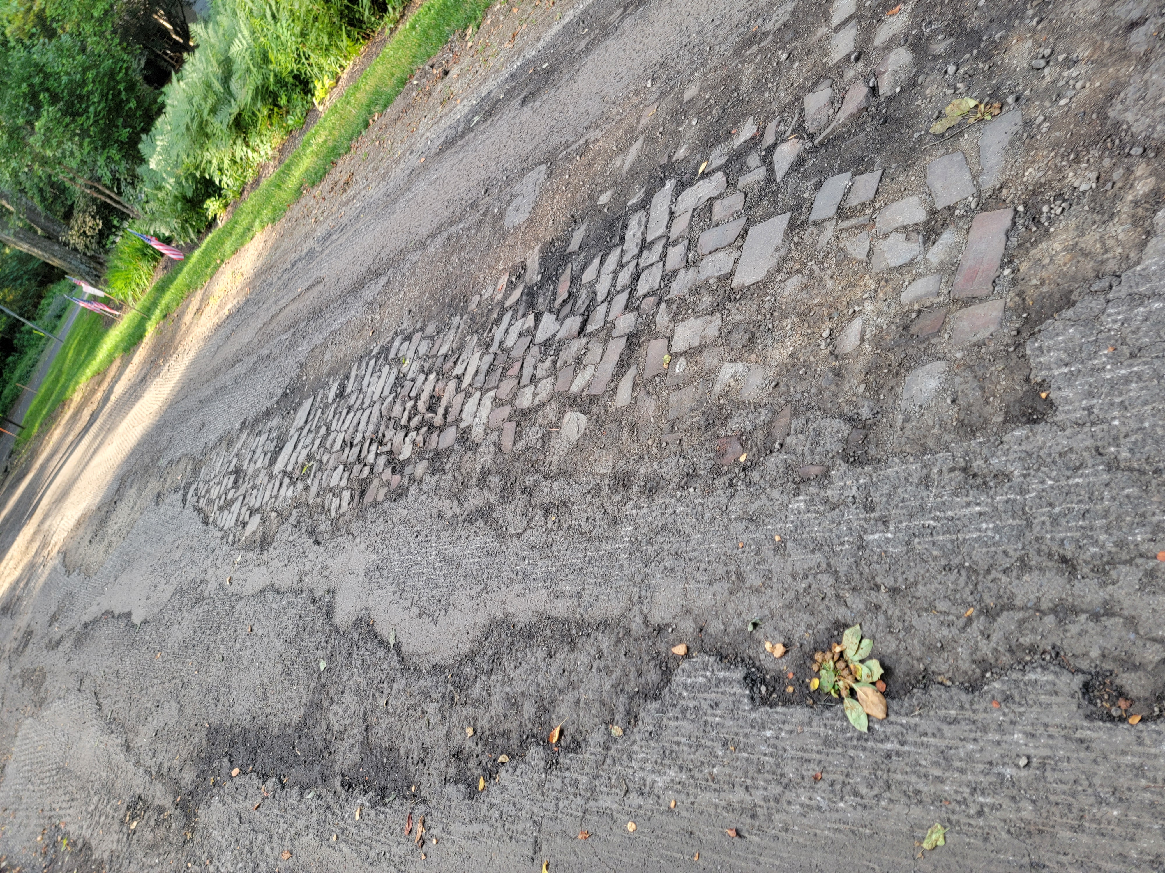
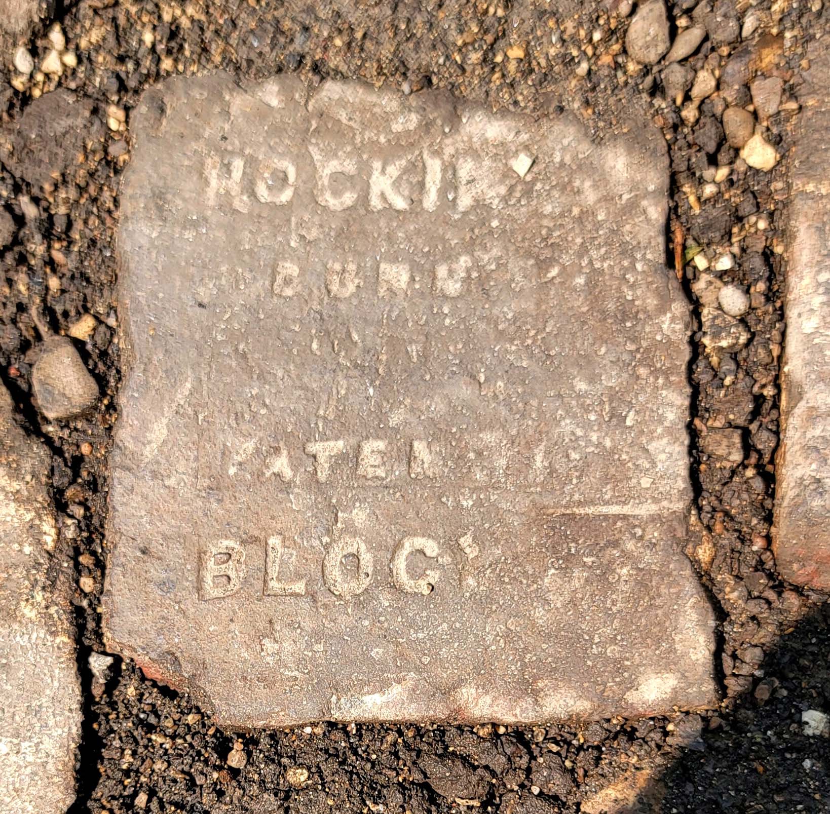
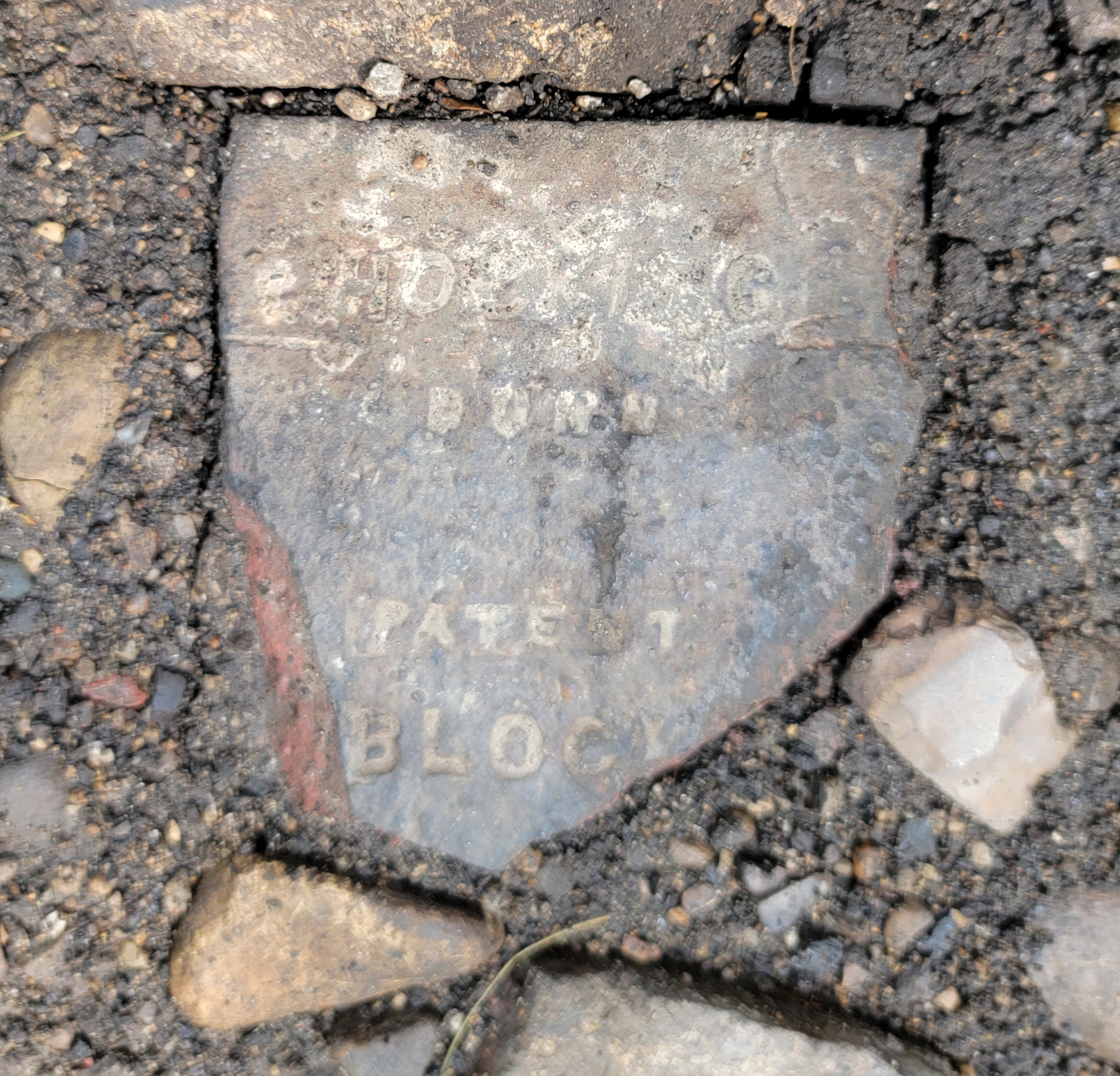
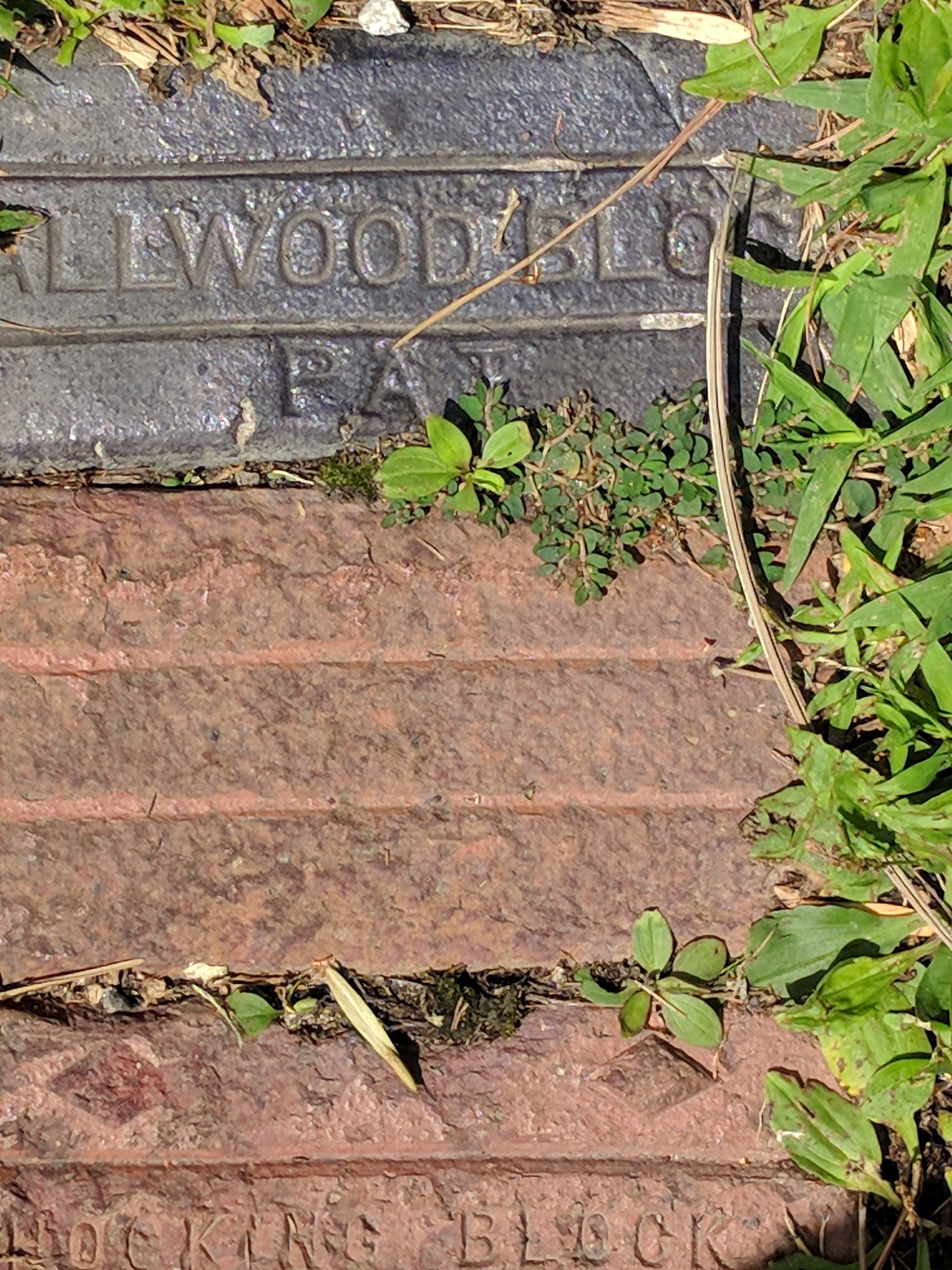
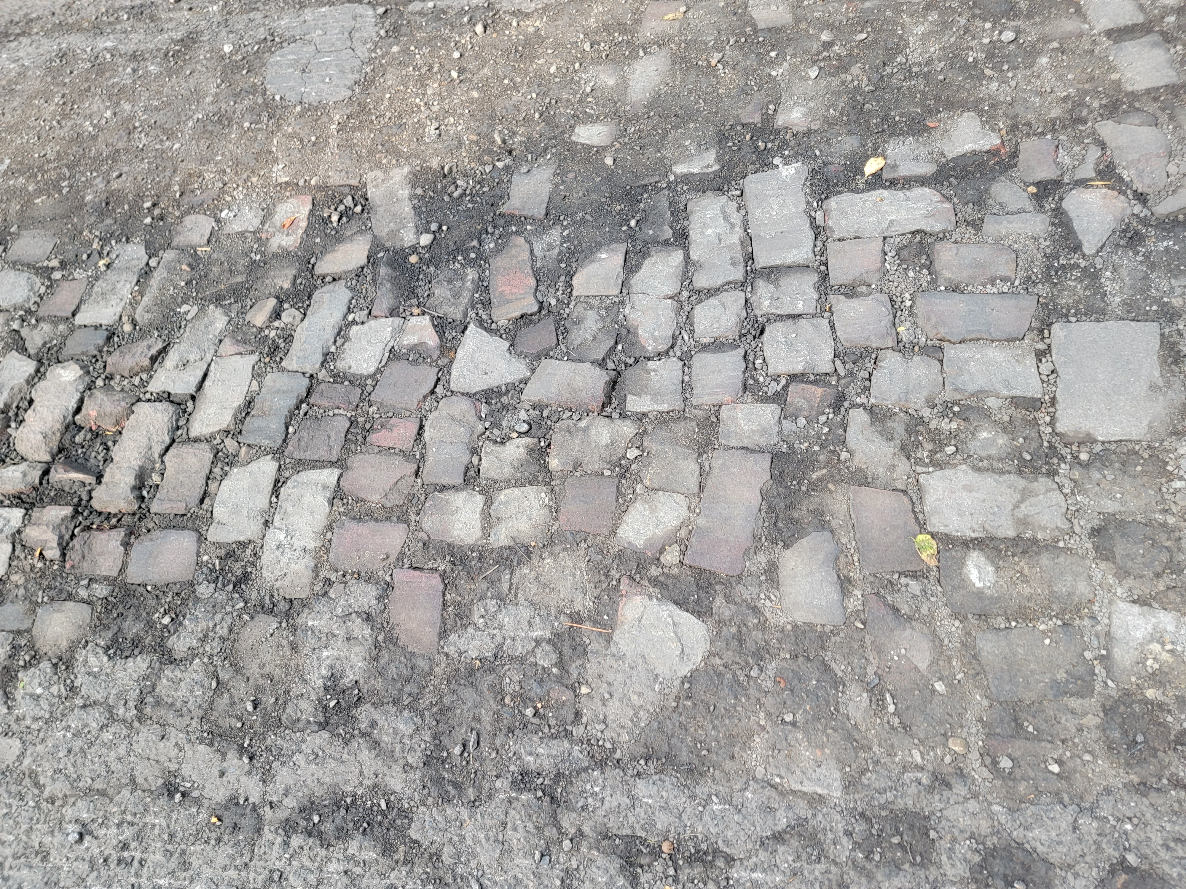 Katie Knostman has shared some photos of the old pavers on Olentangy Blvd at Rustic Place (near the driveway for 4783 Olentangy Blvd), exposed during the recent construction that the residents of Old Beechwold have been enduring.
On close inspection, two of the bricks say Hocking Dunn Patent):
And on the topic of bricks: Here is a photo of a brick that Clintonville Historical Society has in its archive.
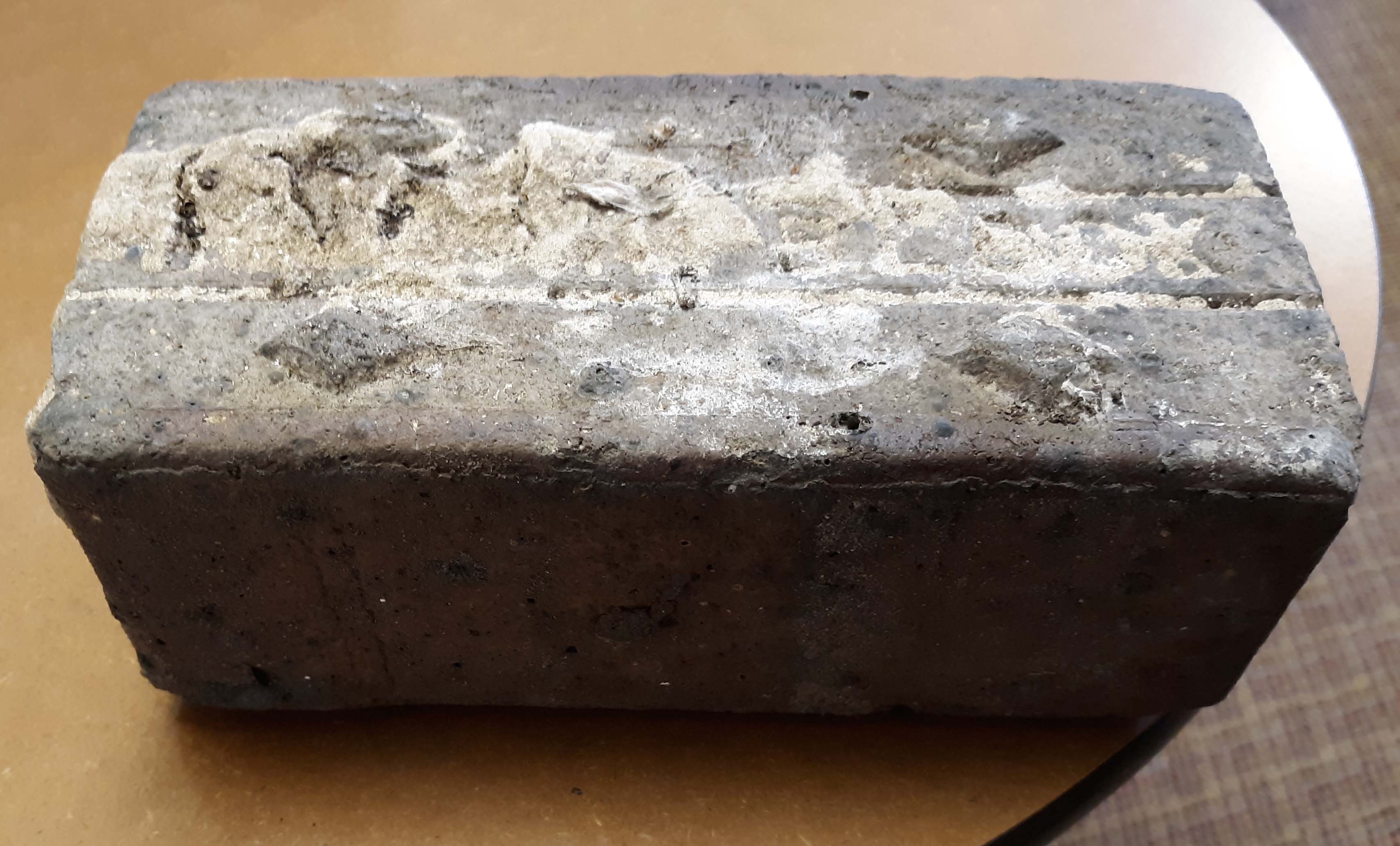
CHS actually has 2 bricks. According to Mary Rodgers: “These are the actual pavers from the street [near American Vitrified Products, which was located on the former site of North High School at Arcadia and Calumet]. The official name of the brick is covered in mortar. You can see the diamonds. Those keep the horses from slipping when the bricks are wet. We might try to remove the mortar from one. It is interesting. They are porous–lighter than I thought…I have seen some articles that are associated with the early use of site. William Wassell seems like an interesting character. They made pipe and bricks. Supposedly, this is one of their bricks. In the late 1800s, they made a fountain for the fairgrounds-all out of pipe. I would love to find a photo of that!” Here’s an article about the fountain.
And finally, a house on East North Broadway has many bricks lining the driveway. These may have come from that roadbed.
West Kanawha: A “Surcease from City Life”
Sometimes a house tells the story of a person, right? In this case the story is about Frank and Bertha Rorer.
This story was sent to me by Wendy Bayer, who writes, “During COVID, I did quite a bit of walking around Clintonville and found myself on West Kanawha one afternoon…I noticed an intriguing house at 314 W Kanawha and did some research on it (naturally! My curiosity is so strong!) I found this great newspaper article from 1939 about the builders and residents; you might find them interesting, too.”
The Rorers bought a tract of undeveloped land on what is now West Kanawha. They took scout troops there, and hiked their property. Their first house on Kanawha was a tiny house constructed from washing machine crates. (Why? because Mr. Rorer was a plumber.) They also built a cave on the property for refrigeration. They initially used this tiny house as a weekend getaway, but Bertha spent more and more time there. Later they built a white clapboard house nearby, and then in the late 1930s they built their dream house at 314 West Kanawha from salvaged walnut-wood logs.
Today there are a cluster of properties along Kanawha formerly affiliated with the Rorers; here are some of their ownership histories:
290 W. Kanawha–nothing
300 W. Kanawha–1922-1937 Rorers owned it. This is where they lived in April 1931.
304 W. Kanawha–1923-1959 Rorers owned it, new house built 1959
310 W. Kanawha–1937-1959 Rorers owned it, new house built 1960
314 W. Kanawha–log home. Rorers owned it 1923?-59
320 W. Kanawha– nothing
Here’s the “Ohio Historic Inventory sheet” for 314 West Kanawha, from the Ohio Historic Preservation Office at Ohio History Connection.
Bertha Rorer died in 1974, her husband Frank Rorer died 1976 (You can click through to read their obituaries.)
[Research courtesy of Wendy Bauer, and inventory courtesy of Nancy Campbell/OHPO.]The John Moses Hess Jr. Homestead
 In April 2024 I wrote that Flora Hess sold her property, a flower shop at the intersection of Dodridge and Olentangy River Road, to the state in 1932. She lived in a house close by at 2637 Olentangy River Road; in 1968 Johnny Jones wrote an article about an antique sale at the Hess homestead.
I believe Flora lived in that house for many years. She ran the property as a trailer park from at least the 1930s until the late 1940s. I found several Columbus Dispatch articles that reported her conviction in 1946 of illegally operating a trailer camp on the property. The county had declined to issue her a permit because the property did not meet sanitary requirements. The trailers were mostly occupied by students. I also found many ads for sales of trailers, so the land may have been a dealership. I would love to have learned her side of this story.
The Ohio State University archives has some aerial photos of the old Hess farm with what Jones described as “part of an old windmill;” there’s a map in the collection’s finding aid and you can see the set of aerials here.
Now here’s the sad, sad, story about this homestead. According to a Hess family historian, Flora’s father John Moses Hess Jr. “received his education in the public schools of Franklin County and later attended Otterbein University. He was a farmer all his life. Uncle Moses was well over six feet tall, quiet and easy going. He always had a well groomed driving horse and took me on several Sunday afternoon drives in the north end of Franklin County, telling the history of the Dublin community. I never saw him when he was not wearing a stiff bosomed white shirt. This was one of his several oddities. Aunt Hannah was very opposite, being small and wiry and a human dynamo, and I always marveled how one so small could turn out so much work. Aunt Hannah died August 17, 1922, being murdered by an irresponsible farm hand who died from self-inflicted wounds the following day. Uncle Moses died December 15, 1923 and both are buried in Union Cemetery across the road from the farm home.” You can read the details of this sad tale of murder and suicide is the Columbus Dispatch here.
Flora died in 1962 (b. 06 Mar 1883, d. 06 Nov 1962) and is buried in Union Cemetery near her parents. Her sister Elizabeth died in 1968 at age 89 (b.30 Sep 1879 d. 5 Dec 1968) and is also buried there.
[Photos courtesy of The Ohio State University Archives. Research help courtesy of Harry Campbell.]Flower Power
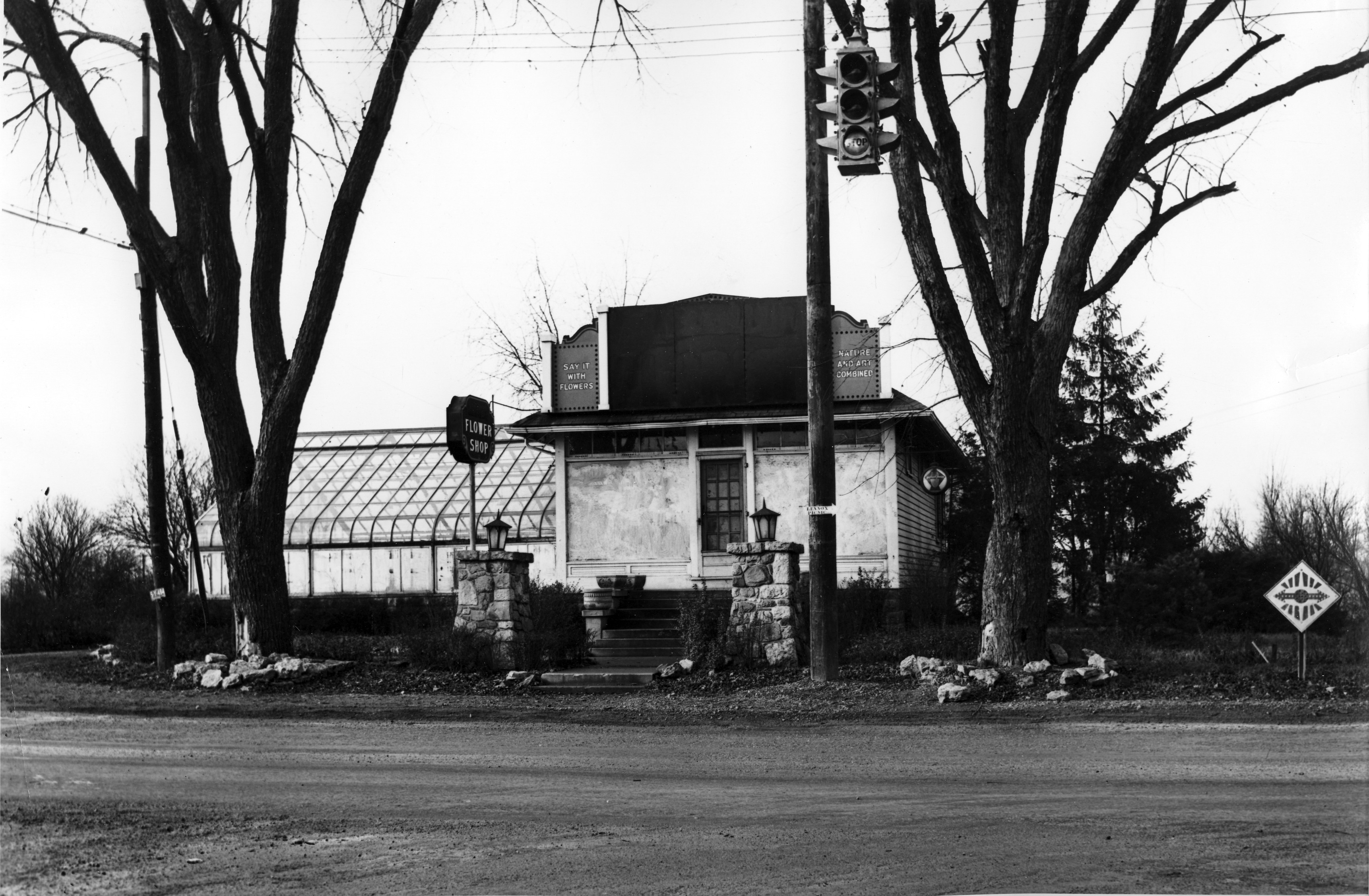 These lovely pictures are of the Albrecht Floral Shop at 2703 River (or Olentangy) Road–the intersection of Dodridge and Olentangy River Road, looking north.
According to librarian Cindy at the Columbus Metropolitan Library, the flower shop went through several hands in the 1930s.
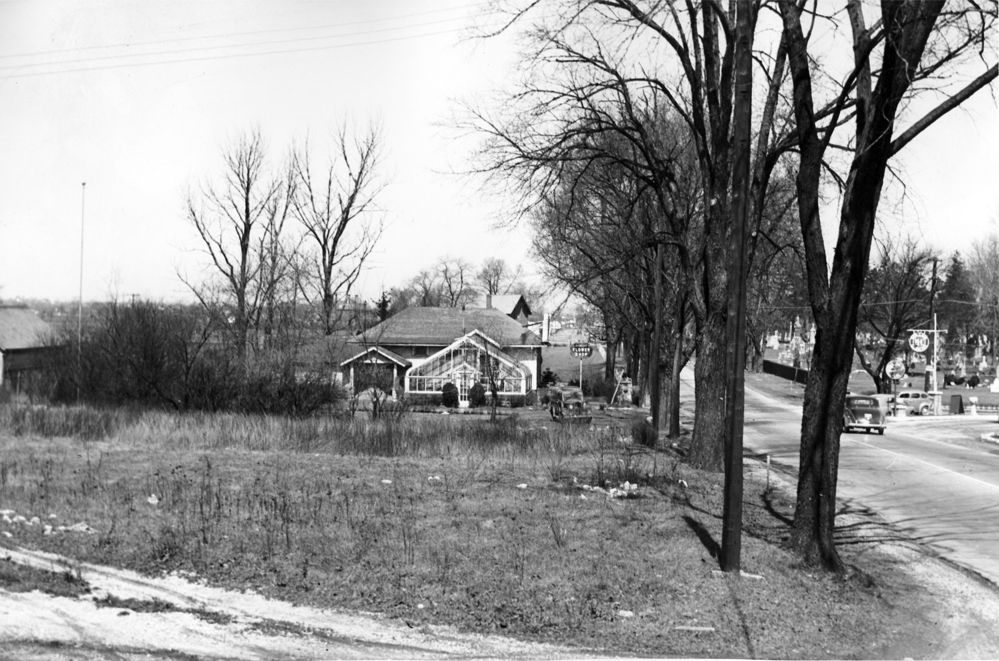
Cindy found a parcel sheet for what she believes is the property in question. The parcel sheet shows the greenhouse listed as well as a brick building.
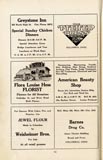 There is an ad for Flora Louise Hess, Florist in a 1925 Columbus Women’s Club cookbook that features an illustration of the building matching these photos.
Flora Hess sold the property to the state in 1932. She lived in a house close by at 2637 Olentangy River Road, however. In 1968 Johnny Jones wrote an article about an antique sale at the Hess homestead.
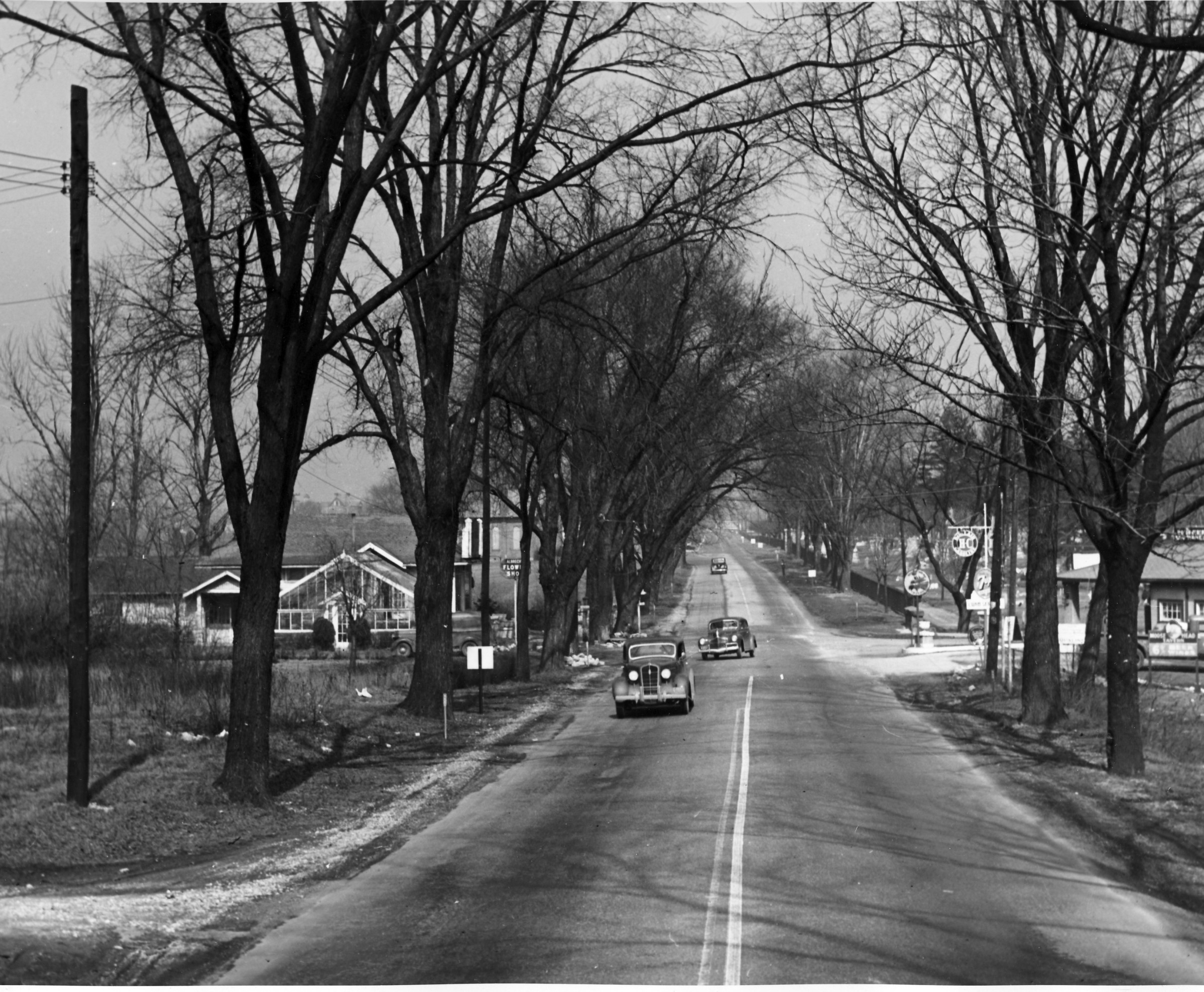 Across the street from the flower shop is a gas station. The Moosehead Filling Station and Moosehead Tavern was across the street at 2696 Olentangy Road as early as 1937. It advertised selling H-C gas; H-C was the first high-octane gasoline. In 1926, Sinclair leapt ahead of most of its competitors with H-C, the industry’s original high-octane premium gasoline for motorcars. The 72-octane auto fuel, developed at its Houston refinery, was better than anything then marketed (Lindbergh’s flight to Paris the following year was on 73-octane gasoline). H-C stood for “Houston Concentrate,” though some advertising men called it “High Compression.”
The Moosewood Tavern was apparently a trouble spot; this Columbus Dispatch newspaper article documents one incident of rowdiness.
[Photos courtesy of the Franklin County Engineers. Articles are from the Columbus Dispatch. Research on these photos and news items mostly came from Cindy at the Columbus Metropolitan Library Local History & Genealogy Desk; thank you Cindy! ]318 Orchard Lane (Columbus Canoe Club)
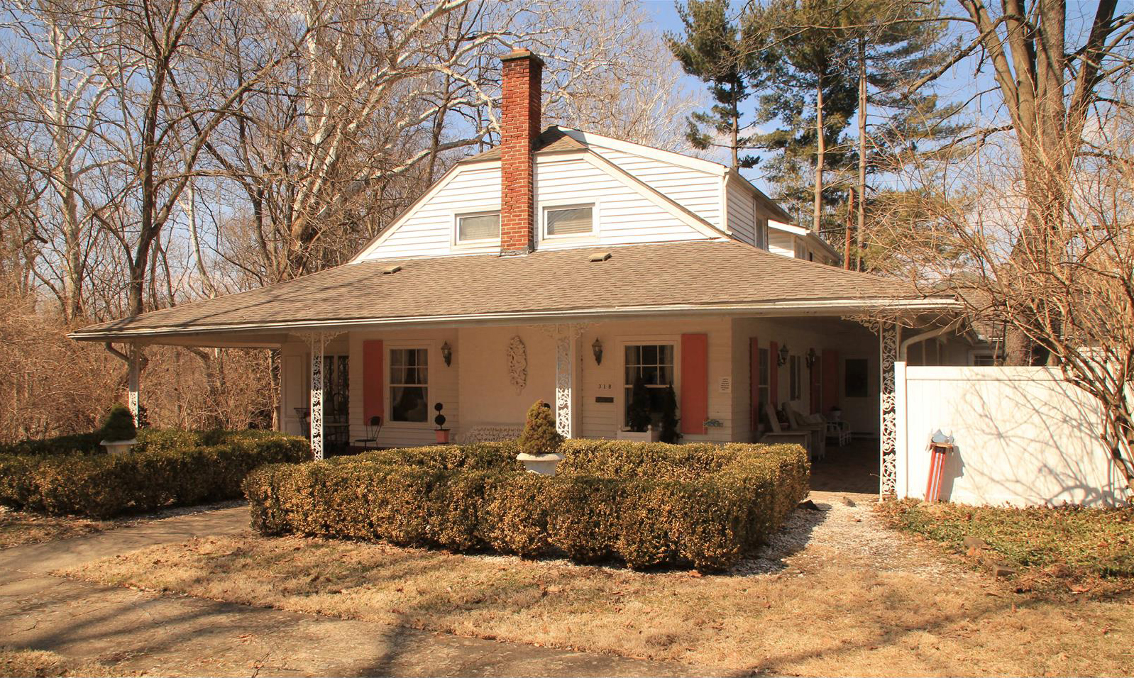 The Columbus Canoe Club–which had been turned into a residence back in 1959–was currently on the market, and you can see the inside of this residence here. It has only had 4 owners since it was built, and long-time owner Donna Hickey had given me a tour of the house back in 2009. So sorry to learn that Donna passed away in 2021.
A bit more info here
(I doubt this link to the realtor post will be up long.)
In Honor of Armistice Day
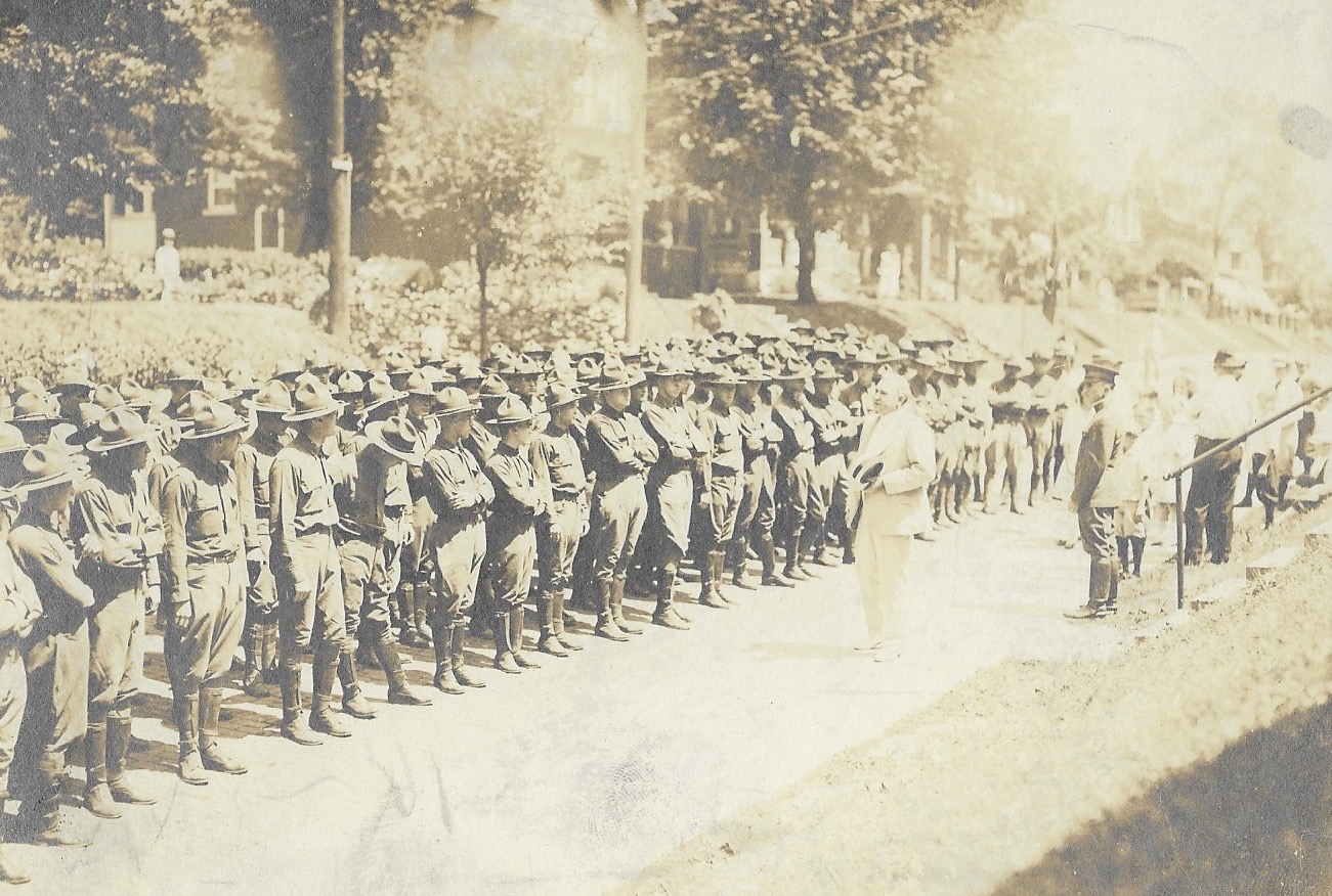 I have no World War I photos of soldiers in Clintonville. But in honor of Armistice Day aka Veterans Day, I am posting this photo of WW I soldiers, being addressed by Norman Barnes Thorp. This might be in front of 180 East Northwood, though I have been unable to confirm that location.
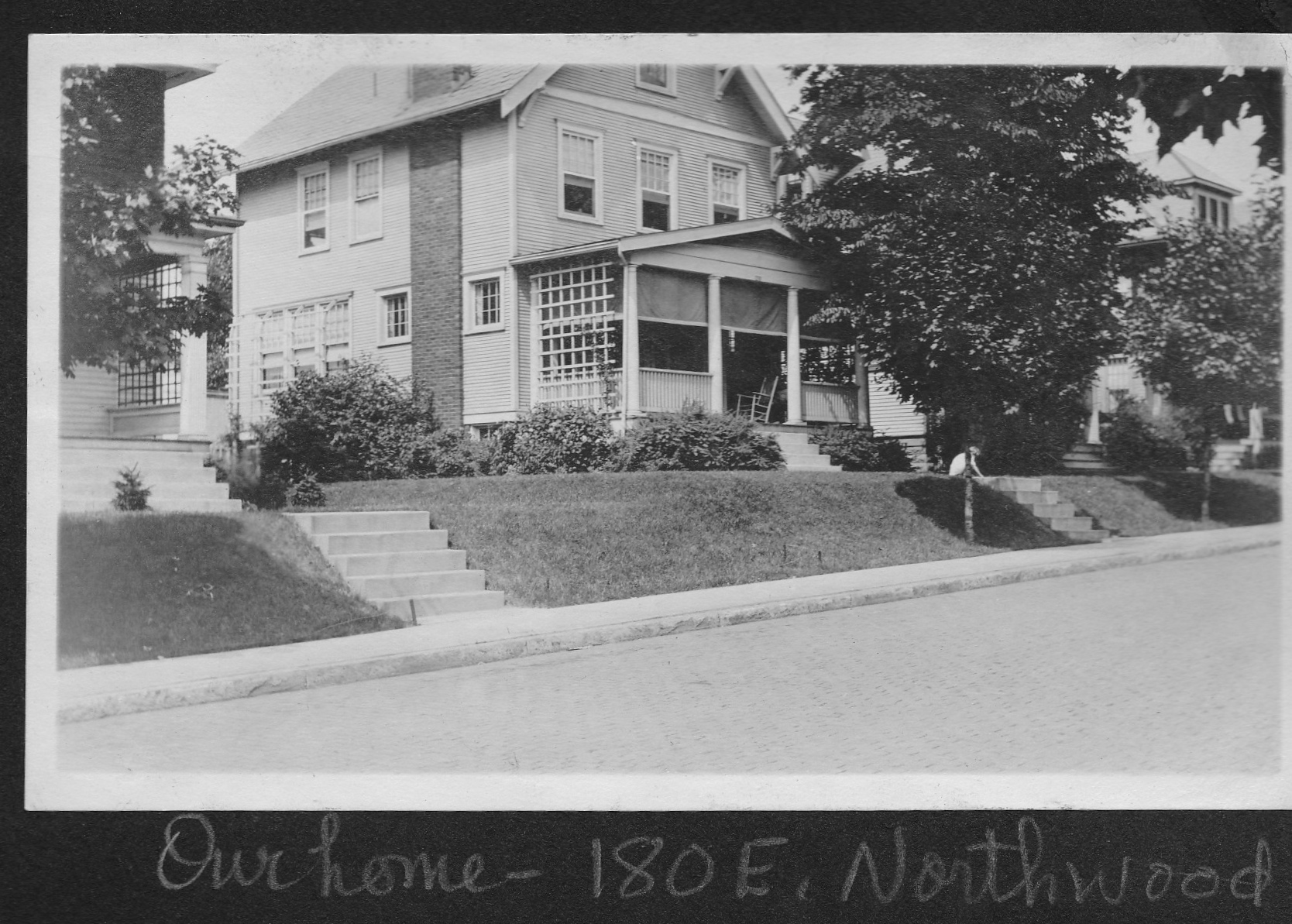 Margaret Nelson, a long time Clintonville resident who has shared many other family pix with us, shared the World War I photo with us. 180 East Northwood was built by Margaret’s grandparents, Johanna Gertrude (Edmondson) (1880-1967) and Norman Barnes Thorp (1867-1934) around 1909, and the house was subsequently owned by the Thorp’s daughter, Norma Thorp Van Ness.
Norman B. Thorp was active in the Northwood Flower and Garden Club, which in turn was active in various ways in the war effort. Of its 60 members, 9 men were in military service and 1 woman was an active nurse.
[Photos courtesy of Margaret Nelson.]Indian Springs 1922
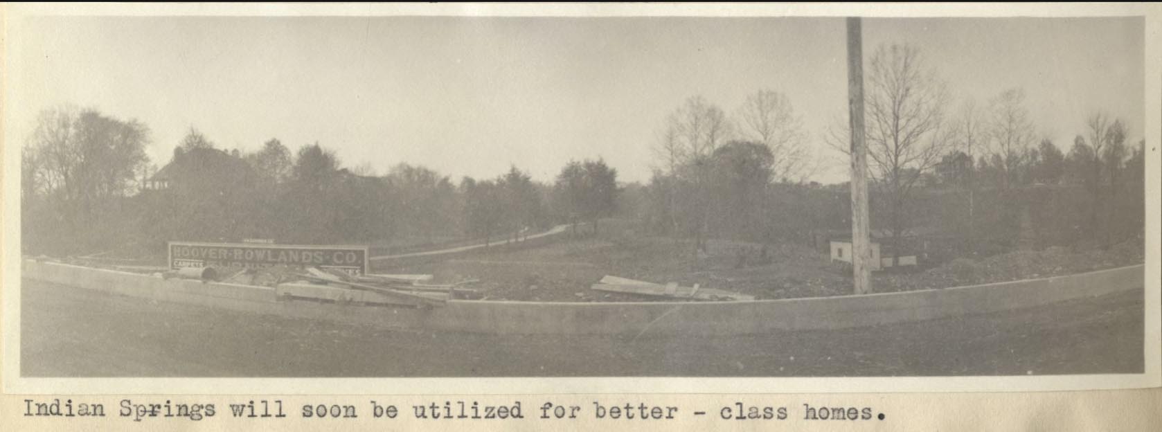
This is a nice photo from a 1922 Ohio State University masters thesis by Forest Ira Blanchard. I believe, based on the metadata, that it was taken at 70 E Henderson Rd. It is captioned, “Indian Springs will soon be utilized for better-class homes.”
It makes me curious about the “class of homes” about to be torn down.
Blanchard, inspired by the Chicago School of Sociology, sought to study the racial and ethnic composition of the city of Columbus, with a particular focus on the role of transportation (railroads, roads) in shaping the urban landscape.
[Courtesy of Forest Ira Blanchard, An Introduction to the Economic and Social Geography of Columbus, Ohio. Thesis (M.A.), Ohio State University, 1922; digital version from City of Columbus Historic Map Collection.]Rosemary & Rosemary South Plat Map 1923
 Here’s a nice plat map from 1923 of the Rosemary housing development.
138 East North Broadway
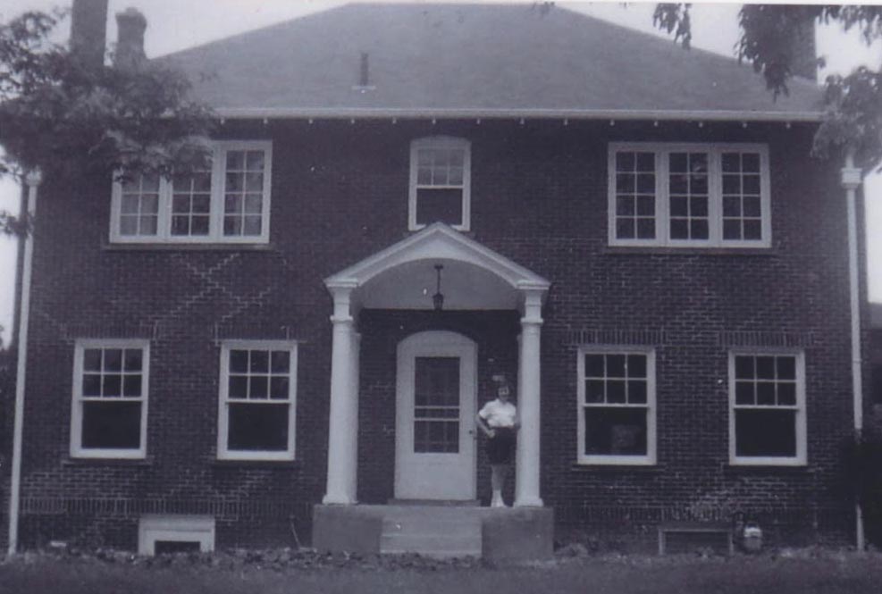
138 East North Broadway. Ralph Taylor Van Ness (1902-1989) and his wife Norma Thorp Van Ness (1910-2000) bought this house from North Broadway Methodist Church in 1960 and remodeled it.
Their daughter Margaret Van Ness (now Margaret Nelson) is shown on the porch.
Margaret writes,
Father dug out the basement and built his office downstairs. We lived next to the warden of the State Penitentiary. One time we bought a set of golf clubs from the warden’s sister. Another time, when my parents found an old safe in the attic of the garage, my father asked the trustees if there were any safe crackers amongst them. The answer: “No, Doc, but maybe next week.” My parents sent the safe to a company that could open it, so, we’ll never know if there was a treasure or a treasure map inside! Living on the other side of us was Arch Heck, a professor at Ohio State University, in charge of the Fulbright program, bringing students from abroad to study at OSU. Thus, my parents became hosts to several students, one from Nepal who, he told them, slept on the floor rather than messing up the bed.
The Van Nesses lived at this address until 1971. It has been significantly remodeled and expanded since the Van Ness time.
[Photos and narrative courtesy of Margaret Van Ness Nelson]25 and 29 Tibet Road
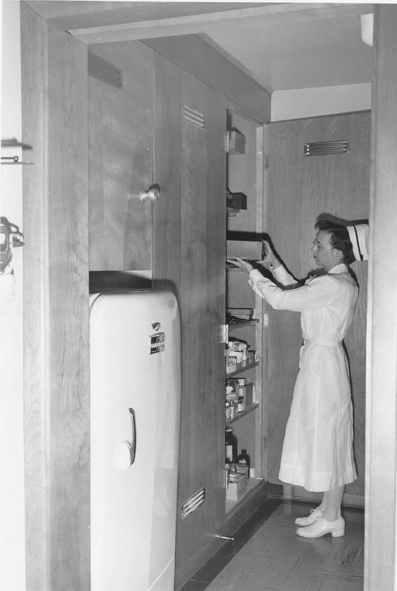
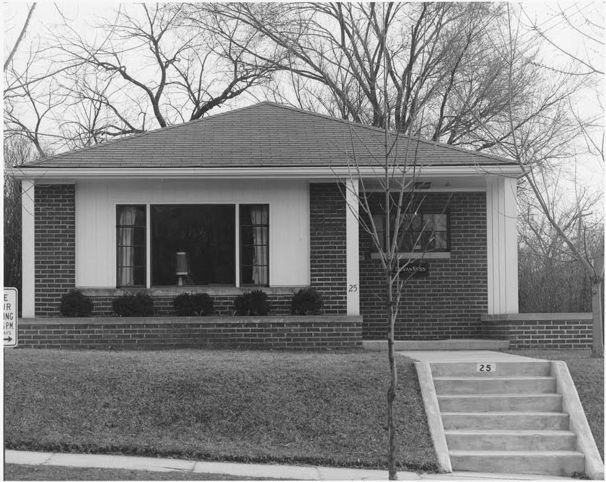 Margaret Nelson grew up in Clintonville and has kindly shared her treasure trove of pix of Clintonville with us. This is the medical office building her father, Dr. Ralph Taylor Van Ness, built in the 1950s at 25 Tibet Road.
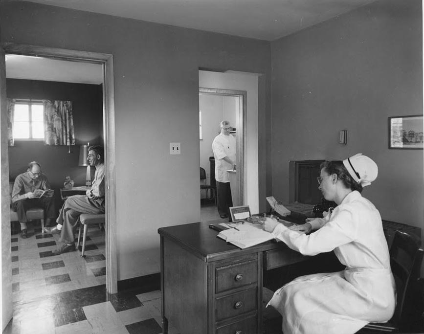
Below is a view of the inside. You can see patients in the waiting room, the nurse, Margaret Deckard, at her desk, and Margaret’s father, Dr. Ralph Taylor Van Ness, in another room. The photo on the right shows Mrs. Deckard in the supply room.
 The Van Ness family lived next door to the medical office, at 29 Tibet Road.
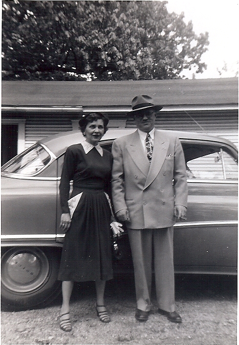
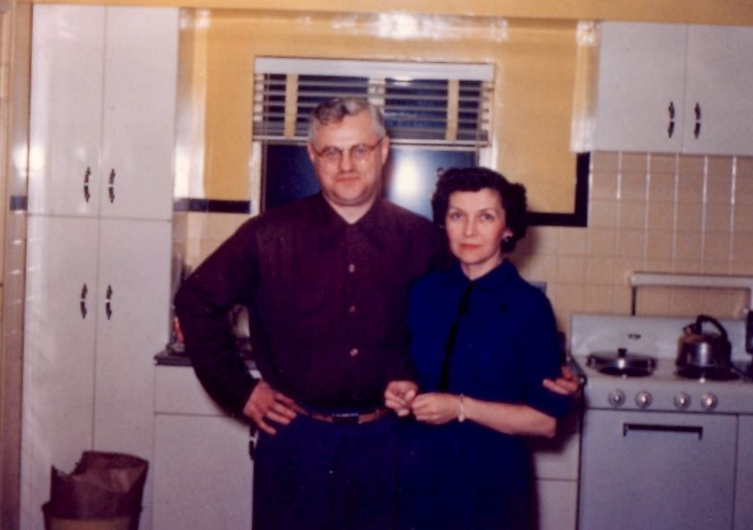 Here are Margaret’s parents in their 1950s kitchen. They sold to Dr. John Gardiner in 1959 and then moved to 138 East North Broadway.
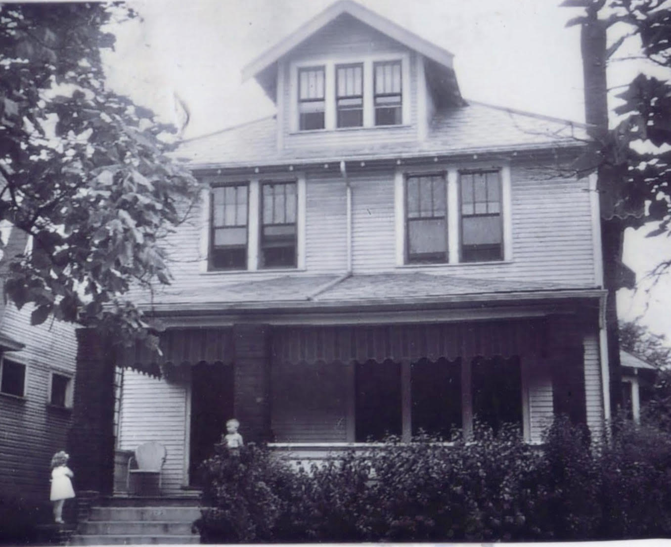
310 East Weber Road
The Van Ness family lived at 310 East Weber from about 1947 to about 1950.
 This is the front of the house with Margaret Van Ness Nelson’s brother John Van Ness standing in front.
Though the house was on the north side of Weber, the building itself faced north toward a right-of-way that was never developed into a street. Or maybe the right of way was partially developed and is now “Iswald Road”?
There were 4 houses between 310 E Weber, and the corner of Weber and Calumet. The current house on that corner hadn’t been built yet when the Van Nesses lived there.
 This is a side view–the east side–of 310 E Weber.
Margaret writes, “Our front yard was a ditch that was supposed to be a street but was never built. We played in the woods. We called it the Hala [after ‘Walhalla’]. There was the first Hala and the second Hala, which is where the white Mooney house still stands. It was sort of scary so we didn’t go near it. On the other side of Hala #2 was where Darien and Jan Mooney lived in a one-story house, which intrigued us with the kitchen on the first floor.”
 The house at 310 Weber was eventually torn down to make a parking lot for Crestview School.
HouseNovel Hopes to Crowdsource Home Histories
According to an article in the TCB web site written by Dan Niepow:
…The idea came to fruition in the form of HouseNovel.com, a website that Zielike describes as one part Zillow and one part Ancestry.com. It essentially operates as a social media platform where users upload historical photos, personal anecdotes, construction dates, and other details about residential properties. It’s designed to show how properties have changed over the years. The site is free to use, but the two aim to generate revenue through a subscription-based advertising model. Advertisers pay a monthly fee starting at $349.
“We’re going after real estate professionals who care about home history, whether that’s real estate agents, architects, general contractors, or any other people in the real estate trade that focus on older homes,” Decker says. “We feel there’s a huge market for that and for those sorts of services.”
The couple worked with Square 1 Group, a California-based web developer focused on real estate websites. In addition to crowdsourced material, HouseNovel is sharing its platform with any interested local historical groups to supplement property information and partner on special projects; the company has already landed a partnership with Edina’s Heritage Preservation Commission and St. Paul-based historic preservation nonprofit Rethos.
As of August, Zielike says there have been more than 18,000 home profile records uploaded to the site, about 10,000 of those in Minnesota. For now, HouseNovel is focusing on residential properties, but eventually it aims to open it up more broadly to commercial real estate.
You can read more here.
The HouseNovel web site may be found here.
175 East Tibet Road
 Margaret Van Ness Nelson has shared many family photos with us; this is the house her parents lived in, at 175 East Tibet Road, from 1942-1947.
 And here’s a nice contemporaneous picture. Margaret writes, “My mother, Norma Thorp Van Ness, 10 April 1946, in our Dodge, parked across from our house at 175 Tibet, back when there was lots of room to park cars.”
[Photos Courtesy of Margaret Van Ness Nelson.]
Tipping the Scales, & Life on the Edge
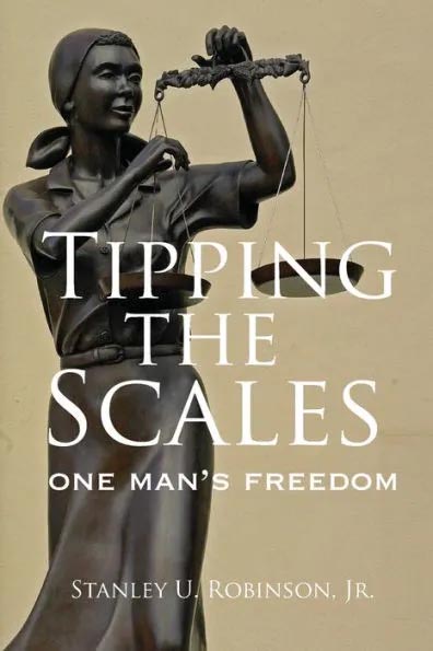
Today is Martin Luther King Jr. Day, and so I thought I’d use this opportunity to write about my most recent “read”. It’s the book Tipping the Scales: One Man’s Freedom, by Stanley U Robinson with revisions and editing by his son David R Robinson. The book is available as an ebook and a print book.
As an historian wrote recently, heroism is neither being perfect, nor doing something spectacular. In fact, it’s just the opposite: it’s regular, flawed human beings, choosing to put others before themselves, even at great cost, even if no one will ever know, even as they realize the walls might be closing in around them. Such heroes did not wake up one morning and say to themselves that they were about to do something heroic. It’s that, when they had to, these people did what was right.
 This book tells the story of some local people who were heroes. In 1954 a Columbus interracial family (Phyllis and Wilson Head and their 2 children) decided to move to an all-white neighborhood. In the racist real estate environment of the time, this was taboo. Though it was decidedly unconstitutional to discriminate on the basis of race, discrimination was rampant. The Heads were represented, for the real estate transaction, by attorney Stanley U. Robinson. They were able to conceal Wilson Head’s Black identity only because the seller, banks, and insurer never bothered to ask about race. Once the sale had gone through and the Heads moved into their new house at 2166 Indianola Avenue, all hell broke loose. Attorney Robinson faced the wrath of the banking and real estate agent community (including a threat of disbarment), and his family was deluged with crank telephone calls from the bigoted new neighbors of the Heads. The Heads themselves faced bigotry, but were physically protected by prearranged police presence and local church members’ vigilance. The Heads “stuck to their principles” and refused to be intimidated or bought out.
 Though this act of segregation-busting was successful, in 1959 the Head family moved to Windsor, Canada “to get [the] children away from a racist society.” Wilson Head had a PhD and was a respected sociologist and civil rights leader, and the Heads’ (understandable!) move was Columbus’ loss. You can read more about Wilson Head here.
Next up on my reading list: Wilson Head’s own book, A Life on the Edge: Experiences in Black and White in North America. University of Toronto Press. ISBN 978-0-9680066-0-3.
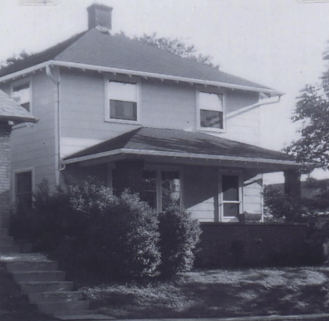
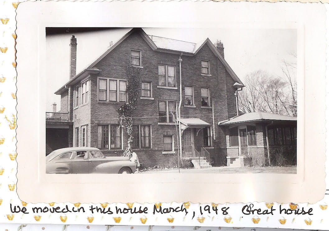
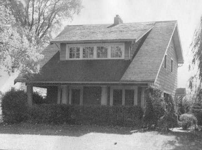
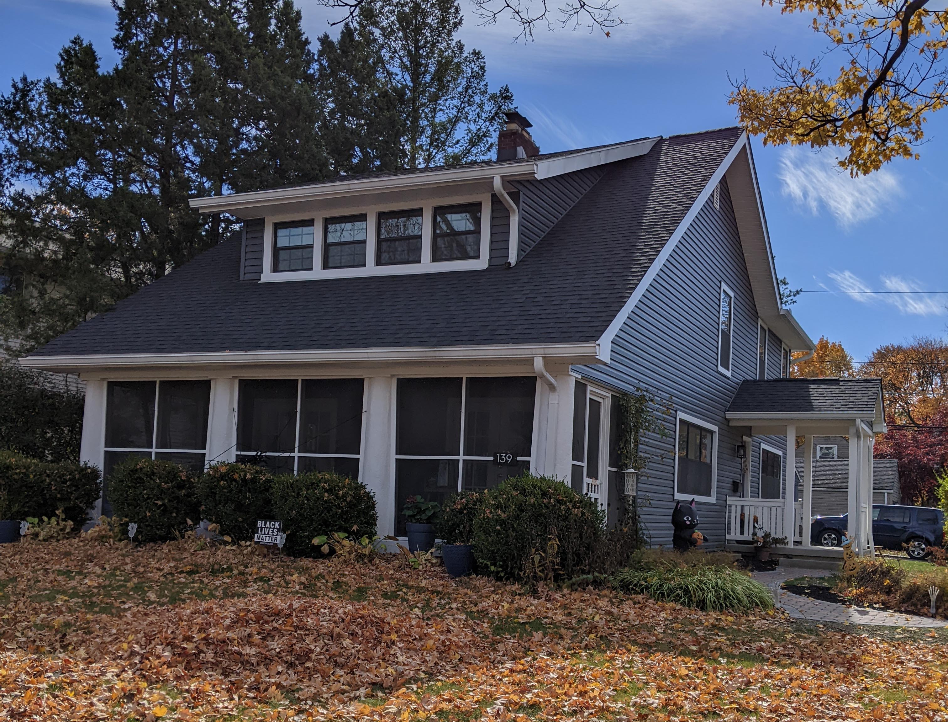
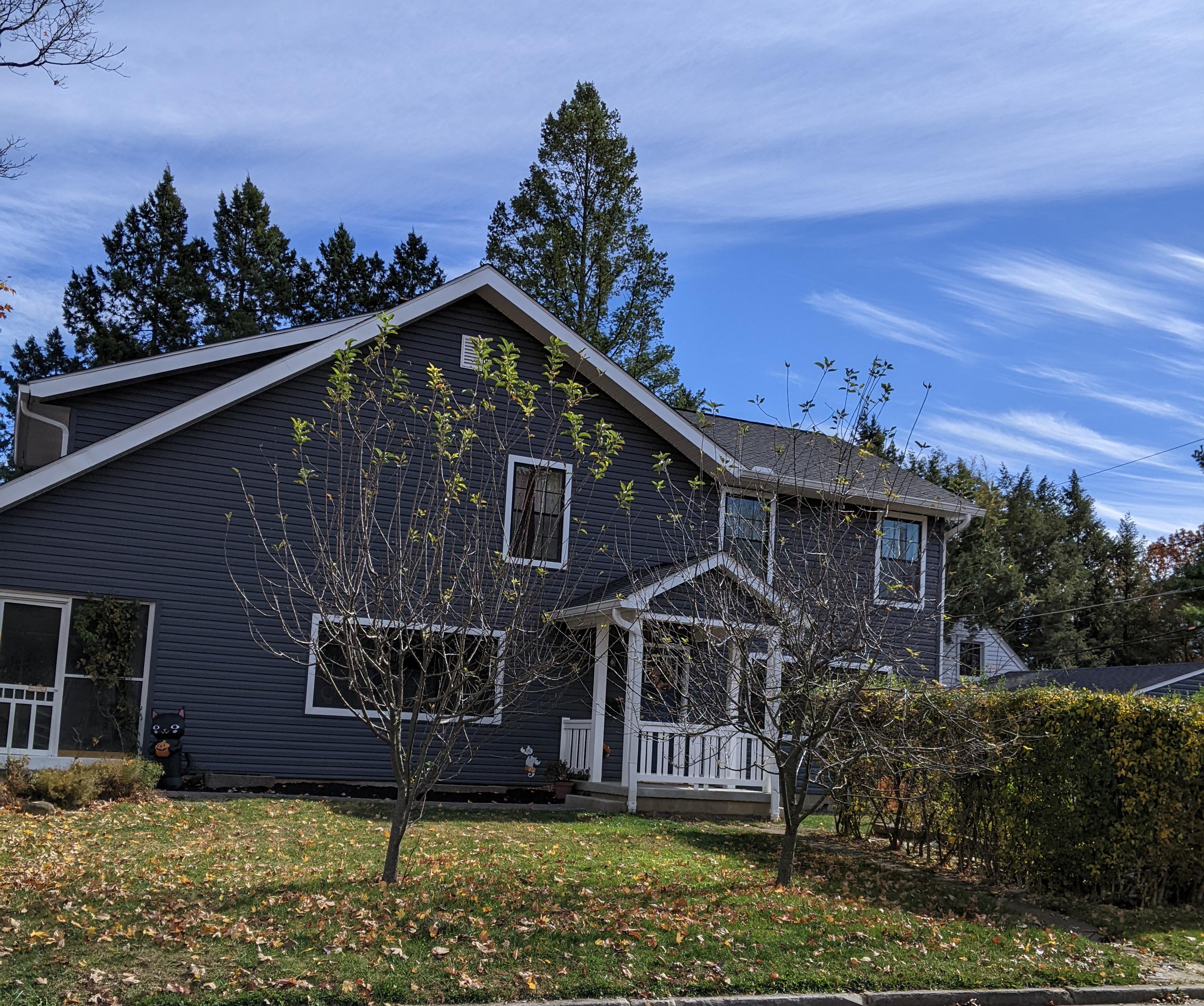
139 West Dunedin Road
Margaret Nelson (née Van Ness) grew up in Clintonville, and has shared some old family photos.
Her family lived at the following addresses:
-
139 W Dunedin, 1939-1941 or 1942
175 E Tibet, 1942-1947
310 E Weber, 1948-1950
29 and 25 Tibet, 1950-1959
138 E N Broadway, 1960-1971
I’ll be sharing these old house photos in the months to come.
This photo is 139 West Dunedin. Ralph Taylor Van Ness (1902-1989) and his wife Norma Thorp Van Ness (1910-2000) bought this house in 1939; it was their first house as a married couple. They lived here until August 1942, when they moved to 175 Tibet Road.
Here’s are some present-day photos; the house has since been screened in and added on to.
A Little Bit of Sewage Goes a Long Way
Last month I provided a glimpse of James Chesnut, who lived at 3338 N. Wall Street. James Chesnut was involved in significant litigation with the North Broadway developers and neighbors. Though last month I said James appears to have been irascible, I’d certainly be that way too if this happened to me. From the Dispatch:
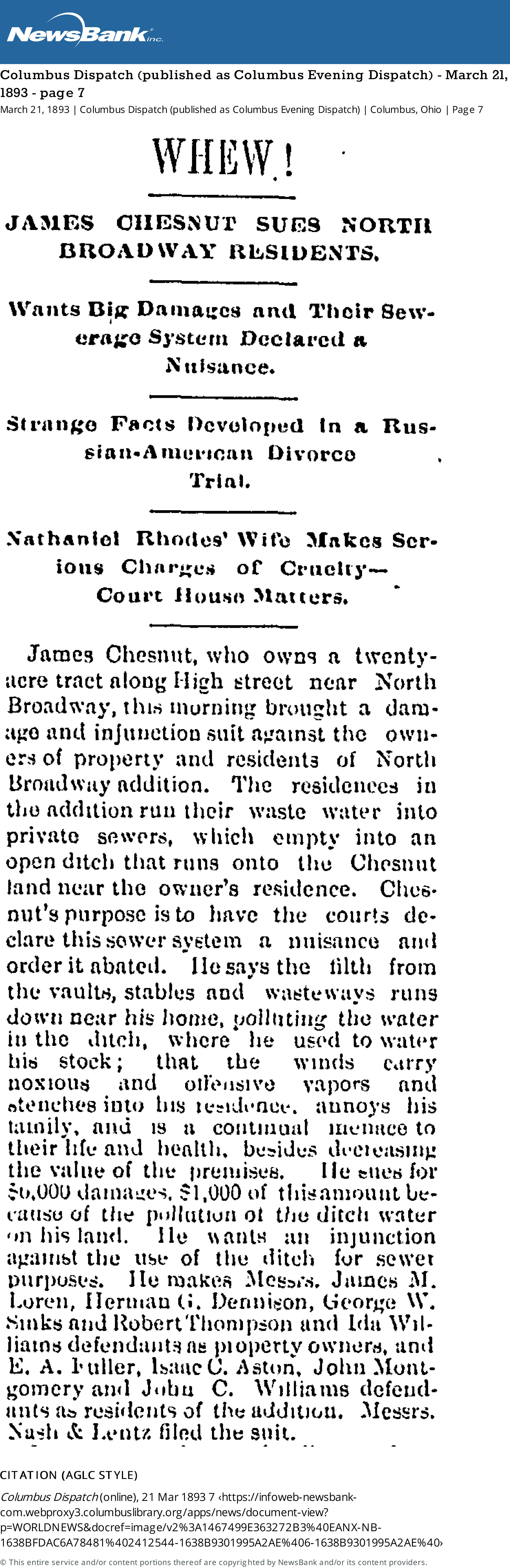
[From Columbus Dispatch (published as Columbus Evening Dispatch) March 21, 1883 page 7.]Whew!
James Chesnut Sues North Broadway Residents
Wants Big Damages and Their Sewerage System Declared a NuisanceJames Chesnut, who owns a 20-acre tract along High Street near North Broadway, this morning brought a damage and injunction suit against the owners of property and residents of North Broadway addition. The residences in the addition run their waste water into private sewers, which empty into an open ditch that runs onto the Chesnut land near the owner’s residence. Chesnut’s purpose is to have the courts declare this sewer system a nuisance and order it abated. He says the filth from the vaults, stables, and wasteways runs down near his house, polluting the water in the ditch, where he used to water his stock; that the winds carry noxious and offensive vapors and stenches into his residence, annoys his family, and is a continual menace to their life and health, besides decreasing the value of the premises. He sues for $6,000 damages, $1,000 of this amount because of the pollution of the ditch water on his land. He wants an injunction against the use of the ditch for sewer purposes…
A couple months later, the North Broadway developers issued a rejoinder:
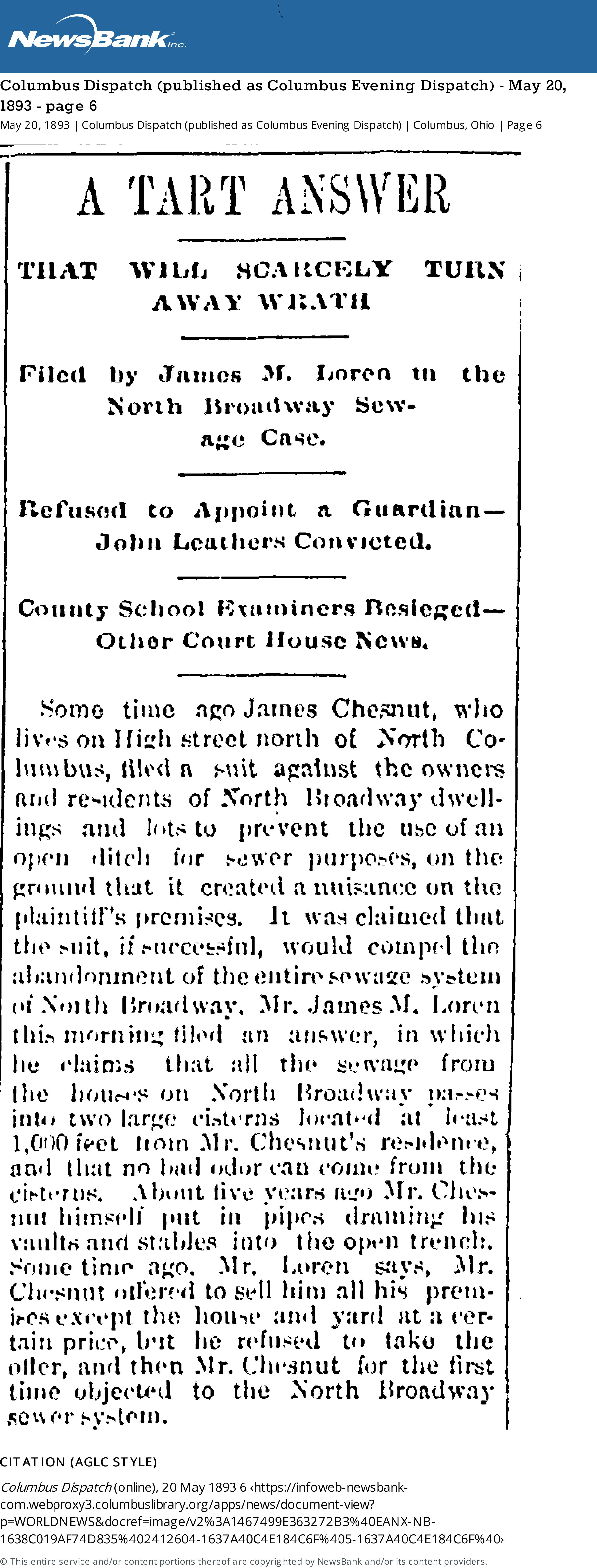
A Tart Answer
That Will Scarcely Turn Away Wrath
Filed by James M. Loren in the North Broadway Sewage CaseSome time ago James Chesnut, who lives on High Street north of North Columbus, filed a suit against the owners and residents of North Broadway dwellings and lots to prevent the use of an open ditch for sewer purposes, on the ground that it created a nuisance on the plaintiff’s premises. It was claimed that the suit, if successful, would compel the abandonment of the entire sewage system of North Broadway. Mr. James M. Loren this morning filed an answer, in which he claims that all the sewage from the houses on North Broadway passes into two large cisterns located at least 1,000 feet from Mr. Chesnut’s residence, and that no bad odor can come from the cisterns. About five years ago, Mr. Chesnut himself put in pipes draining his vaults and stables into the open trench. Some time ago, Mr. Loren says, Mr. Chesnut offered to sell him all his premises except the house and yard at a certain price, but he refused to take the offer, and then Mr. Chesnut for the first time objected to the North Broadway sewer system.
[From Columbus Dispatch (published as Columbus Evening Dispatch) May 20, 1883, page 6.]
Apparently Loren’s response was not accepted by the courts, for this article followed along in 1897:
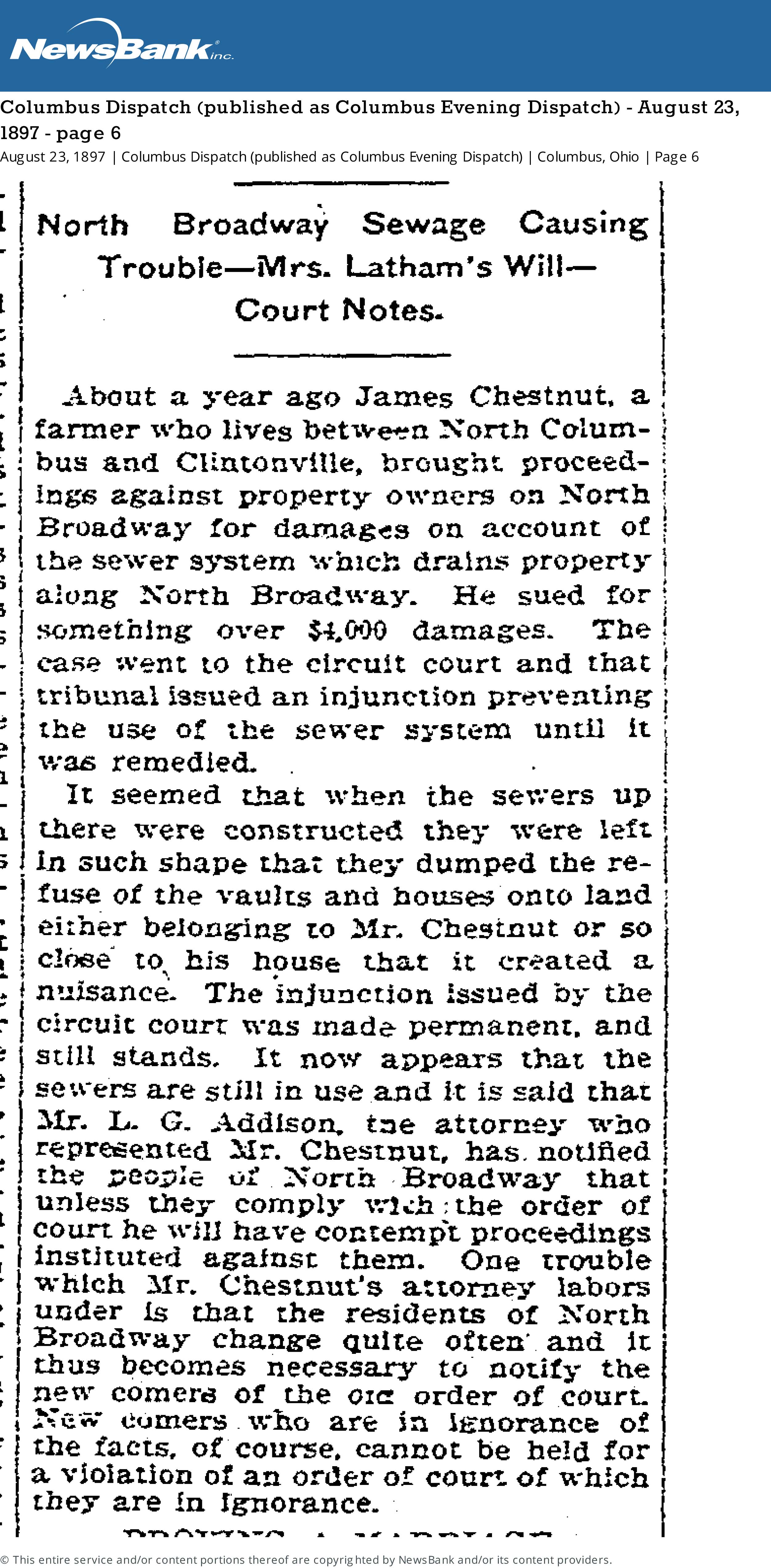
[From Columbus Dispatch (published as Columbus Evening Dispatch) Monday August 23, 1897 page 6.]North Broadway Sewage Causing Trouble
About a year ago James Chestnut, a farmer who lives between North Columbus and Clintonville, brought proceedings against property owners on North Broadway for damages on account of the sewer system which drains property along North Broadway. He sued for something over $4,000 damages. The case went to the circuit court and that tribunal issued an injunction preventing the use of the sewer system until it was remedied.
It seemed that when the sewers up there were constructed they were left in such shape that they dumped the refuse of the vaults and houses onto land either belonging to Mr. Chestnut or so close to his house that it created a nuisance. The injunction issued by the circuit court was made permanent and still stands. It now appears that the sewers are still in use and it is said that Mr. L. G. Addison, the attorney who represented Mr. Chestnut, has notified the people of North Broadway that unless they comply with the order of court he will have contempt proceedings instituted against them. One trouble which Mr. Chestnut’s attorney labors under is that the residents of North Broadway change quite often and it thus becomes necessary to notify the new comers of the […] order of court. New comers who are in ignorance of the facts, of course, cannot be held for a violation of an order of court of which they are in ignorance.
An Old Chestnut…or Rather, Chesnut
 Occasionally, the name of a local figure pops up with frequency, and one forms an image of, well may I say, an irascible neighbor? James Chesnut (often spelled “Chestnut”) is one of those guys; see other posts about him here.
Who was this guy, anyway? James Chesnut was born in Ireland on May 1, 1820, and he died at age 85 on May 26, 1905. Census records say James was a “machine sawyer,” “works in coal factory”, or “foreman and tool shop”. He seems to have owned 20 acres on North High Street. His wife was Christiana McEwan (b. Dec 24, 1825, d. Jul 14 1891). (One source says “Ewing” but I believe that’s wrong.) She is buried with James in Greenlawn Cemetery. Some census records say Christiana was born in England or Ireland, and there’s also a record that says her father lived in Ridgeway, PA.
James and Christiana had a daughter (one census record says “adopted daughter”), Fannie, who was born around 1854/55. She lived with her parents and seems to have remained single. She continued to live in the North High Street (now Wall Street) house through 1910, but by 1914 she’d moved to 2103 Summit Street. She lived there until her death in March 1932; she died at age 78 in University Hospital of injuries suffered when she was hit by a taxi the previous December. (Her obituary also names a sister, Jennie Reid, who lived in Bridgeport Connecticut.)
I love the Chesnut house, still in existence at 3338 N. Wall Street.
Bourguignon House (193 East North Broadway)
Paul-Henri Bourguignon was a talented visual artist, a prolific writer and journalist, a skillful photographer, and an avid observer of the human condition. His wife Erika was a world-renowned anthropologist. They lived at 193 East North Broadway until their deaths in 1988 and 2015 respectively.
Here’s a terrific house tour of their Clintonville home, showcasing their life and collections at 193 East North Broadway before the house was sold.
And here are some links to additional information about each of them:
About Paul-Henri Bourguignon
About Erika Bourguignon
Olentangy River ca 1957 & 1958
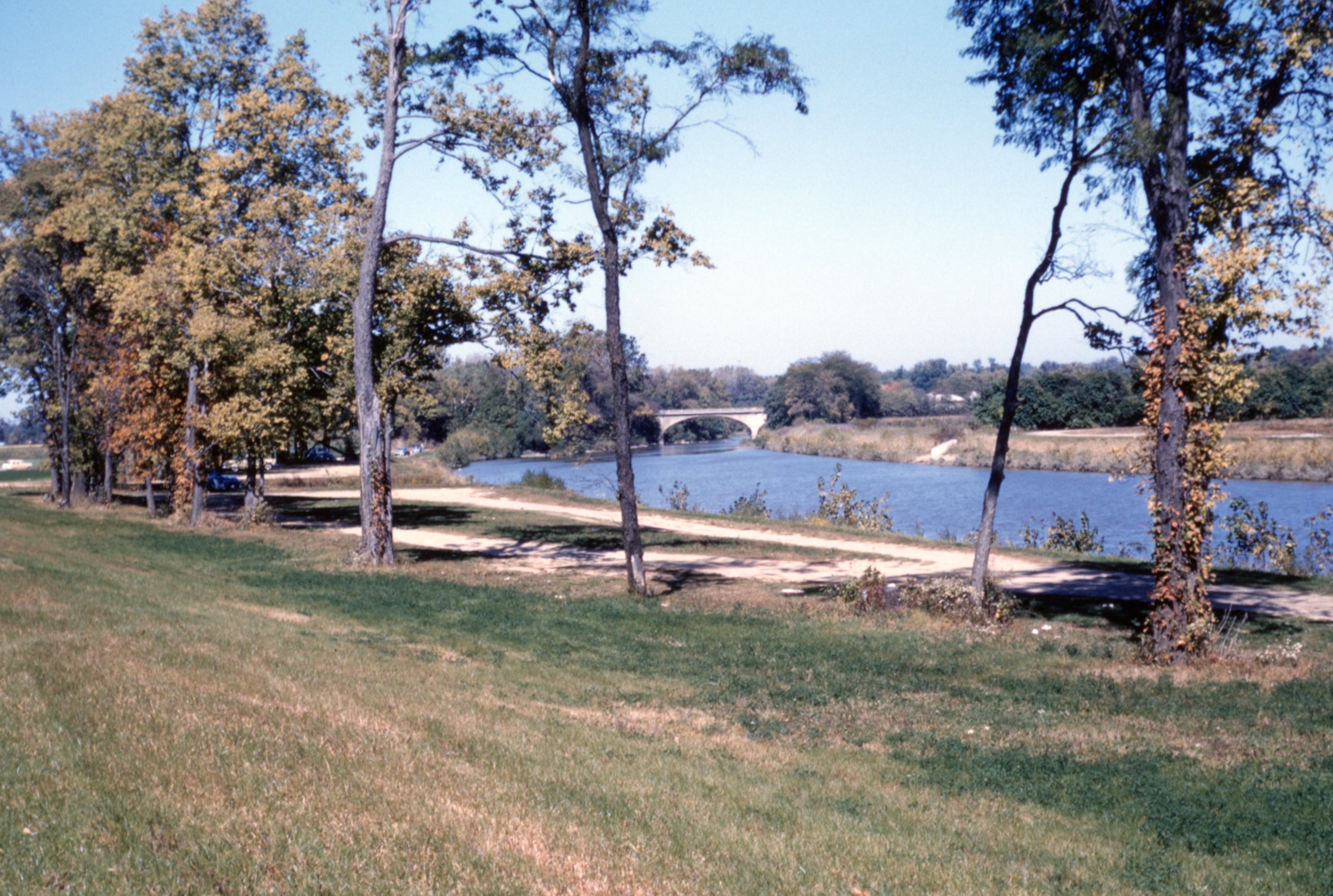
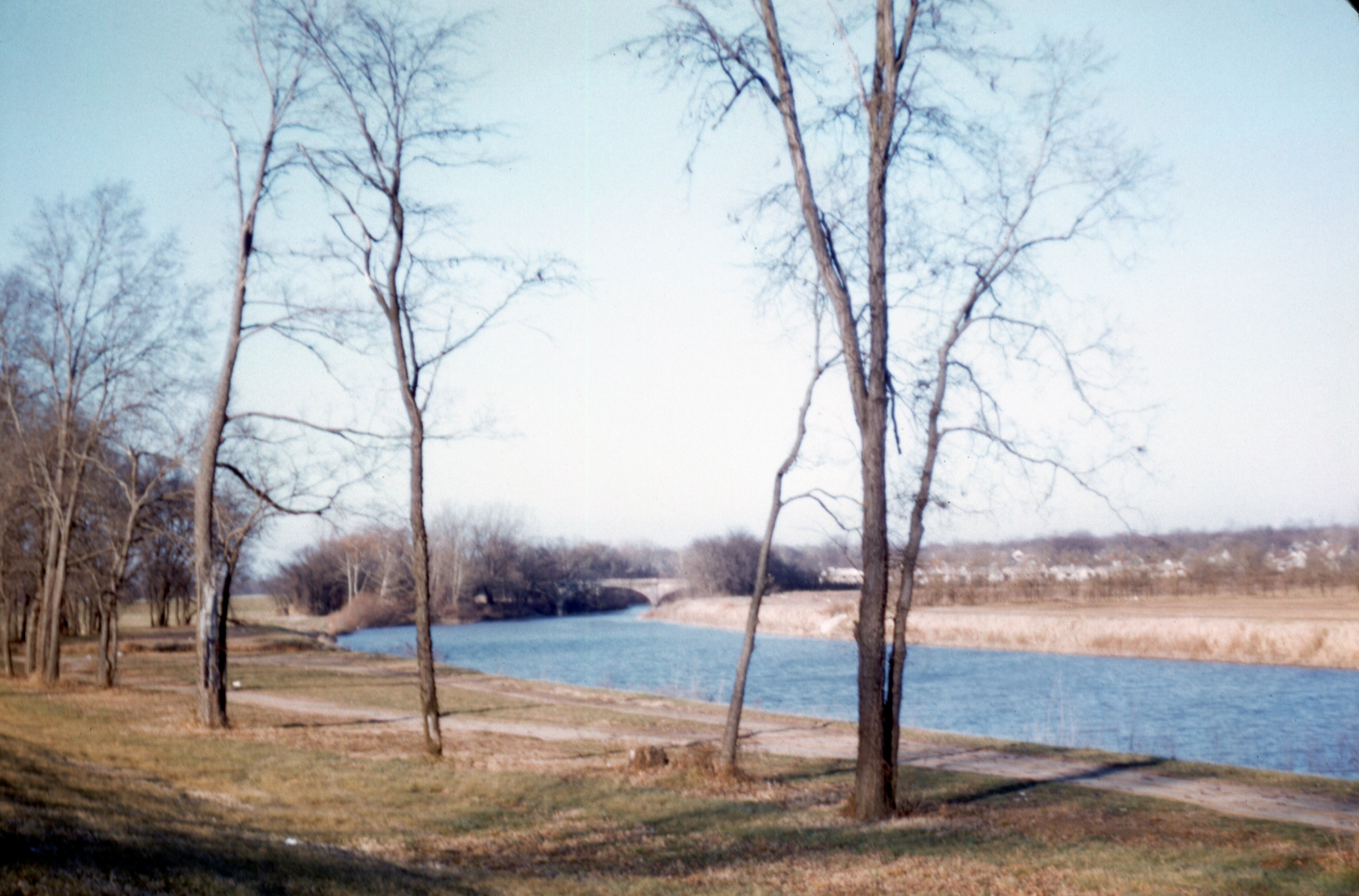
Two nice photos of the Olentangy River in the 1950s.
From Bill Pegues:
[These photos were taken by Frank Pegues and digitized by Jim Pegues, and came to us courtesy of Bill Pegues.]During 1954 my parents moved to Columbus, where my father taught history at Ohio State until 1997. A couple years ago my brother scanned my dad’s slide collection into digital format. My father had documented the location of the scenes in many of them but a fair number lacked any identity. Among these were two shots from an identical point on the Olentangy River in the late ’50s. I spent some time with these and on Google Earth trying to determine where exactly they were taken. Ultimately, I concluded with certainty (based on zooming in on the line of houses visible in the early 1958 photo, and comparing them with the Google Street View of the houses there today, as well as noting the curvature of the river) that they were shot on the west side of the Olentangy just downstream of the old Henderson Road bridge looking north. At the time my parents were renting a house on East Selby Blvd just over the Worthington-Columbus boundary. The preceding photos in the 1957 set were taken at an Ohio State football game that fall, and of the old Lane Avenue bridge as the leaves were beginning to turn. My parents would likely have driven up Olentangy River Road after these games and taken Henderson up to High before driving north to Selby.
The first feature in the 1957 photo that interested me is the parking lot at center-left, indicating that this was a popular spot for people to visit, and probably picnic and stroll around. At the time, SR-315 didn’t yet exist this far north (it wasn’t completed from Ackerman Road north to 270, if I recall correctly, until I was entering high school in 1980) so the only road running along the west side of the river was Olentangy River Road. The second feature of note is that the land on the east side of the river is, accordingly, the open field that would be the location of Whetstone High School (from which my brothers and I graduated in the late ’70s and early ’80s), constructed in 1960-61.
528 Acton Construction
Scott Jones, a professor in the OSU School of Music, kindly shared some terrific photos of the 1947 construction of his house at 528 Acton Road.
The photos came to Scott from Sally Schock (Moore) who grew up in the house and whose father’s brother built the home in 1947.


 The house looks today very much like it did when finished in 1947.
Remembering the Rosemary Neighborhood by Knopf & Near
David Penniman, a resident of the Rosemary neighborhood, sleuthed out a copy of a document penned in 1984-88 by Richard C Knopf and Miriam F Near. The document, entitled Reminiscences: Not Memoirs, is a free-wheeling remembrance of growing up in the neighborhood around Henderson and Rosemary Parkway in the 1920s, 1930s, and 1940s. Dave’s copy came from Ann and Keith Bossard of Dominion Blvd; Dave then digitized the 97 page book and shared it with us. Thanks, Dave!
Both Richard and Miriam are deceased; their obituaries are linked below.
Richard C Knopf, 1/4/1925 – 7/17/2002
Miriam Fowle Near, 6/28/1924 – 12/10/2009
I’m so appreciative of people who preserve local history, as Richard and Miriam, and Dave, have done.
[Digital version of the Knopf and Near typescript courtesy of David Penniman. Knopf obituary came courtesy of the Ashtabula Public Library System based on a search and tip from Nick Taggart, retired librarian par excellence at the Columbus Metropolitan Library.]80 West Cooke Avenue
 This lovely home at 80 West Cooke Rd was originally built in 1925 for Lulu & Carl Cooke. The Cookes owned it for 40 years, and the house has only had 4 owners since it was built. Fortunately the home’s original character and charm has been maintained throughout the years.
I believe I’ve passed the house many times without noticing it, and suspect its lines were obscured by foliage until recently. What a gem it is!
The house is in the Rosemary housing division, developed by Charles Johnson in 1923 and named after his mother.
As a side note, the Mediterranean Revival style–so unusual in Clintonville–reminds me of the old Zimmerman home that used to be located at the NW corner of Henderson and Olentangy River Roads.
There are also examples of that style at 44 West Jeffrey Place (left photo below) and 223 West Beechwold Blvd (right photo below) in Old Beechwold. An historic inventory for 44 West Jeffrey can be found here. 223 West Beechwold seems to have had the address “4923 West Beechwold” and may have been designed by architect Frank Kinzig, according to the Old Beechwold Historic District Nomination.
My friend Nancy Campbell tells me that in the 1920s, there was a lot of interest in exotic styles for houses, usually attributed to the young men who came back from WWI. Having seen more of the world, they were interested in Tudor, Mediterranean, Mission, Chateauesque (French) styles. The Sears and Aladdin kit houses, though offering predominantly Craftsman or “plain” styles, also offered the others. These three houses were more upscale versions of an interesting mix of styles. According to Virginia McAlester’s book, A Field Guide to American Houses: The Definitive Guide to Identifying and Understanding America’s Domestic Architecture, tile roofs were used in Spanish Eclectic, Mission, Italian Renaissance, and Prairie styles. The Cooke Rd. house seems somewhat Tudor, with the “musicians’ balcony” overlooking the living room.
[Real estate listing & photos courtesy of Judy Minister; historic architecture information from Nancy Campbell.]242 East North Broadway
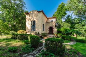
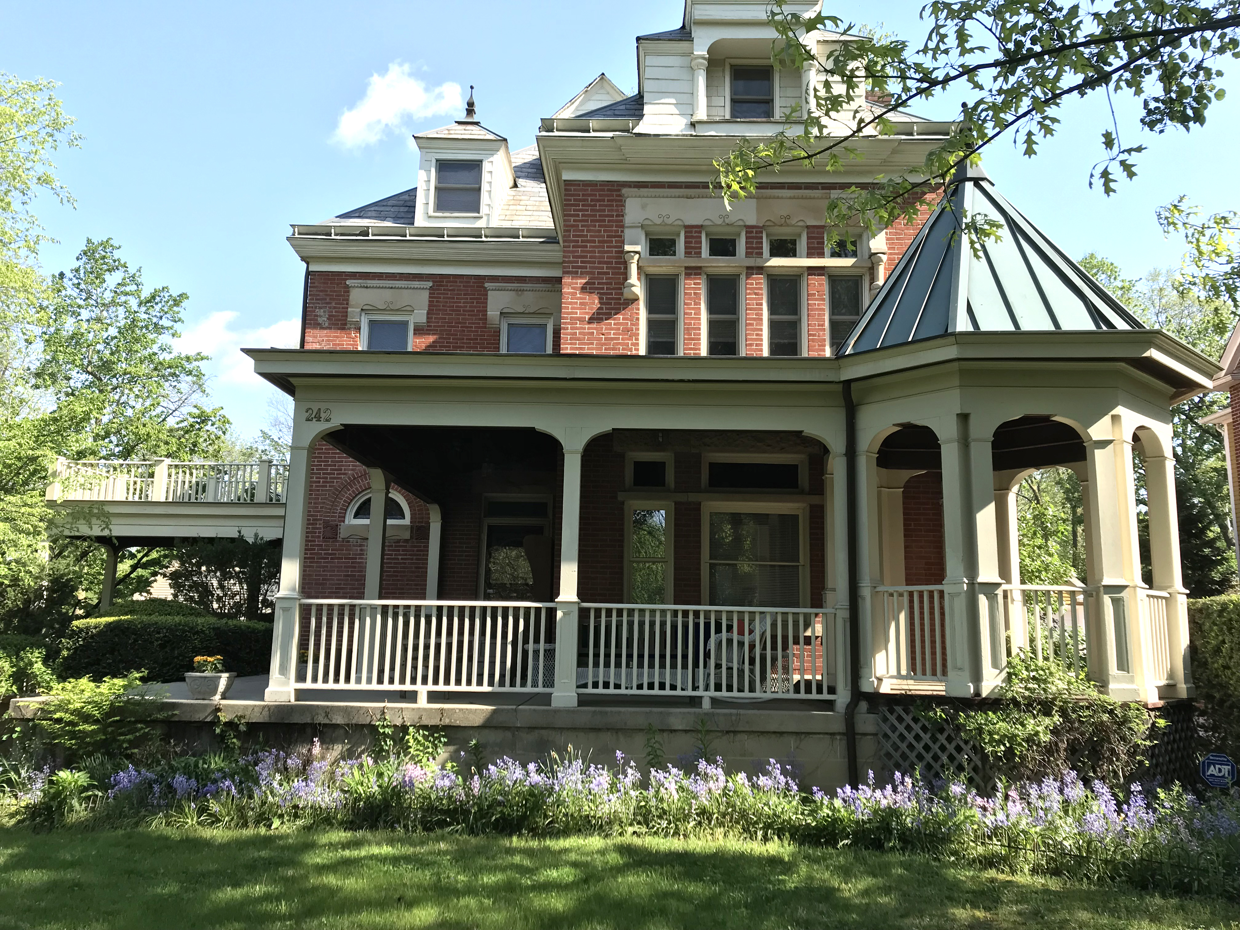
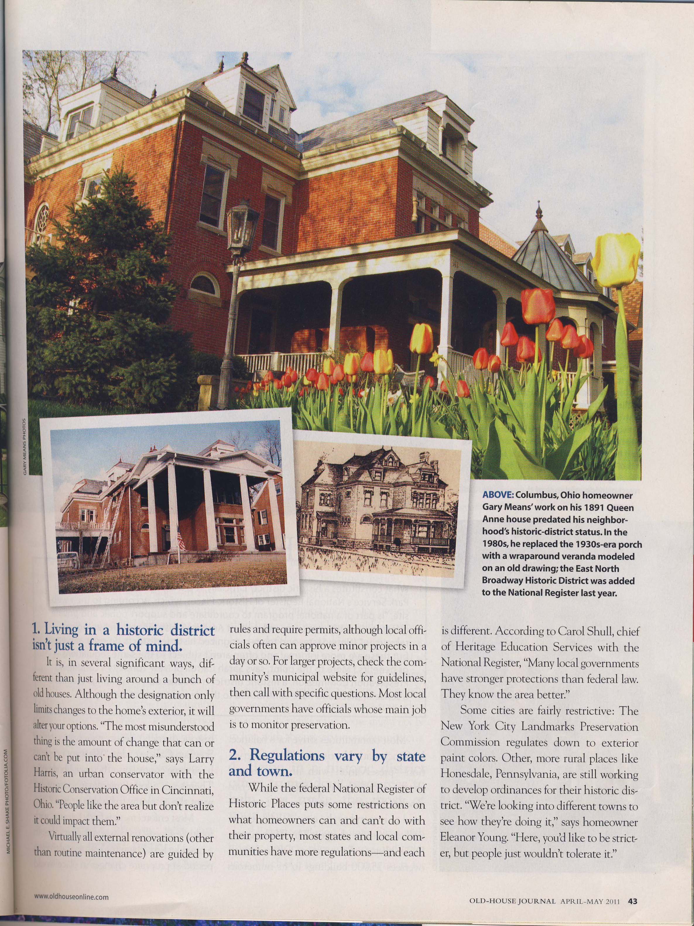 Gary Mean’s stunning restoration effort of 242 East North Broadway was included in Old House Journal, April-May 2011 issue.
Creative Reuse of a Garden House
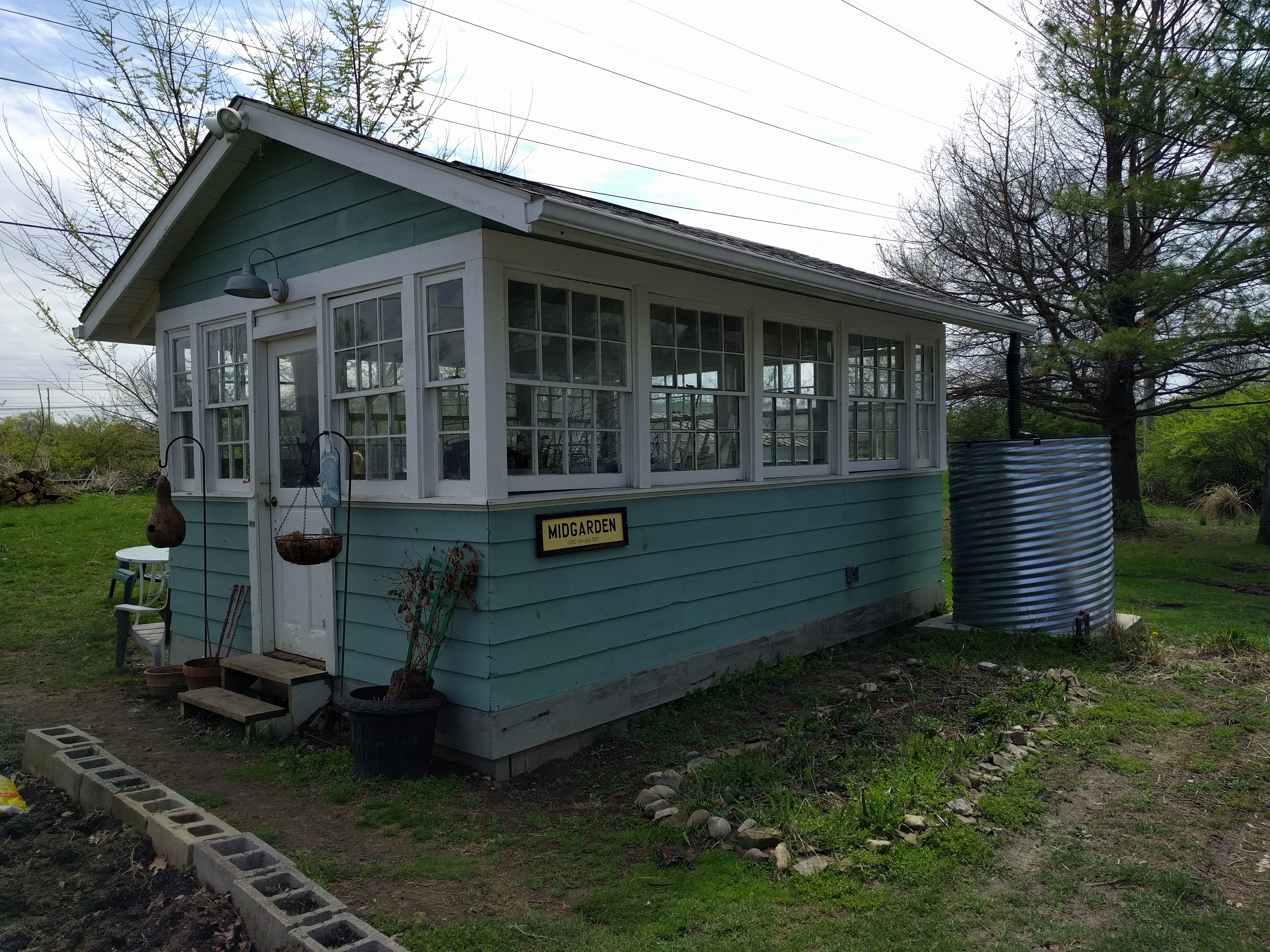 This little gem was once the garden house at Edgewater, summer home of Harvey and Emma Legg Zinn. (Harvey was founder of the Zinn Lumber Company.) It dates to the 1920s. Zinn’s property at the west end of Kenworth was eventually subdivided and several years ago an additional new house was built on the property.
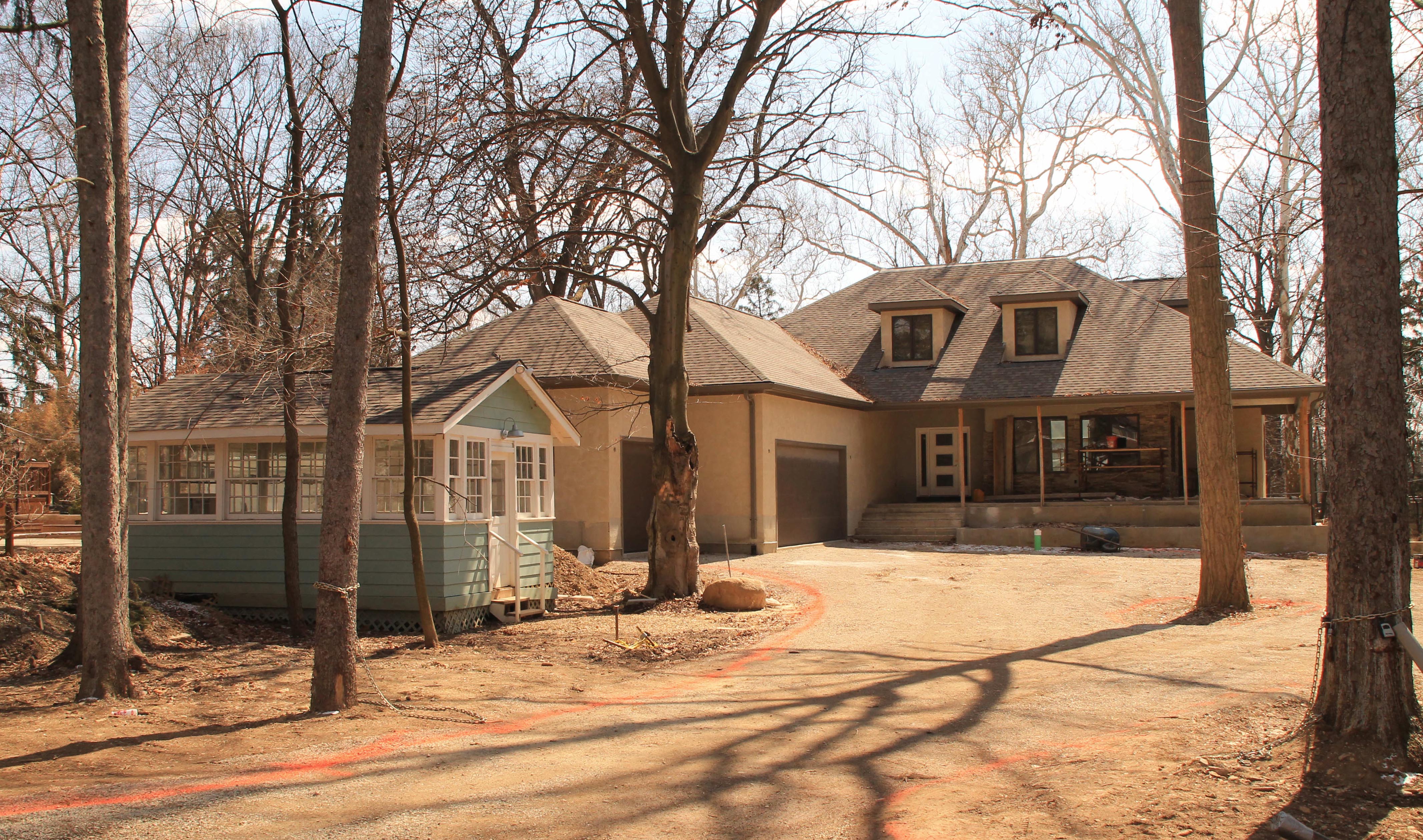 During construction of the new house, the builder, Kevin Clausen, used the garden house as an office for the building project (shown here in 2014).
Upon the house’s completion, the new homeowners, Gary and Kathy Flynn, donated this lovely shed to Clintonville Resource Center (CRC) instead of demolishing it. Thanks to the Clintonville Historical Society, the American Public Gardens Association, builder Kevin Clausen and some hearty volunteers, it was moved to its new home at the CRC Midgard Community Garden (aka Midgarden). The foundation work was completed in 2017 with the help of Tim Beachy and Anderson Concrete.
This building enables CRC staff and volunteers to collect rainwater for irrigation, start new plant seedlings on site, retrieve seeds for new plantings and provide a space for educational and informational gatherings. And of course, it adds a shedful of pretty to the landscape.
Ghosts of Clintonville–Ghostbusted by Google Earth
There are several old residential buildings that have disappeared over the last 12 years–I wish we had photos of them.
![]() The old Hollenback home and The Booster building, located at California and North High Streets. I remember this building setting back over a slight rise from North high Street. This is a Google Earth image from 2004 of the roofs of these buildings.
The old Hollenback home and The Booster building, located at California and North High Streets. I remember this building setting back over a slight rise from North high Street. This is a Google Earth image from 2004 of the roofs of these buildings.
![]() A large Victorian house demolished to make way for the commercial building presently occupied by Lavash Restaurant. This is the Google image from 2004 of the rooftop.
A large Victorian house demolished to make way for the commercial building presently occupied by Lavash Restaurant. This is the Google image from 2004 of the rooftop.
 Another big old residential building, this one located on Weber, one building east from North High Street on the north side of Weber. (Another Google image from 2004.) I’m not sure but believe this building was built for and owned by a member of the Armbruster family, whose patriarch lived in what became Southwick-Good-Fortkamp funeral home. You will find lots of additional information about Mathias Armbruster on my web site.
4 N Broadway Lane
Old House Journal, April-May 2011 issue, included pictures of 4 North Broadway Lane “then and now.” Beautiful!
250 East North Broadway
 Another beautiful house on East North Broadway is on the market: 250 East North Broadway. Here, courtesy of realtor Judy Minister, is a video tour of the house.
According to Mary Rodgers, the house was built in 1927 at an original cost of $8,320. The first owner of the home was Vera Hults Benoy. Her husband Wilbur was an attorney. He graduated from Ohio State University and was admitted to the bar in 1910. He served as City Attorney, County Prosecutor, and as Special Assistant to the Ohio Supreme Court. He had some fairly large legal cases, including the 1926 prosecution of the Mayor of Grove City for race track betting. Later, he maintained an office in the AUI building (now the LeVeque Tower).
Wilbur was raised in Licking Co. His father owned a grocery in Croton. Wilbur’s mother died in a car accident in Columbus in 1921. Vera was born in Delaware, Ohio. Prior to her marriage in 1912, Vera was a school teacher.
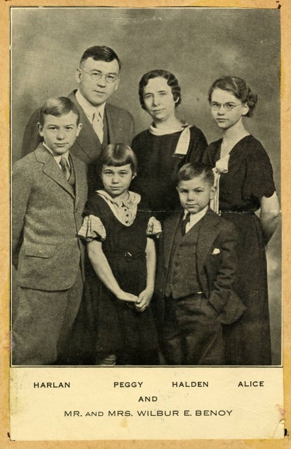 Wilbur and Vera had four children: Alice, Harlan, Ellen (aka Peggy) and Halden. Their daughter Alice was a music teacher.
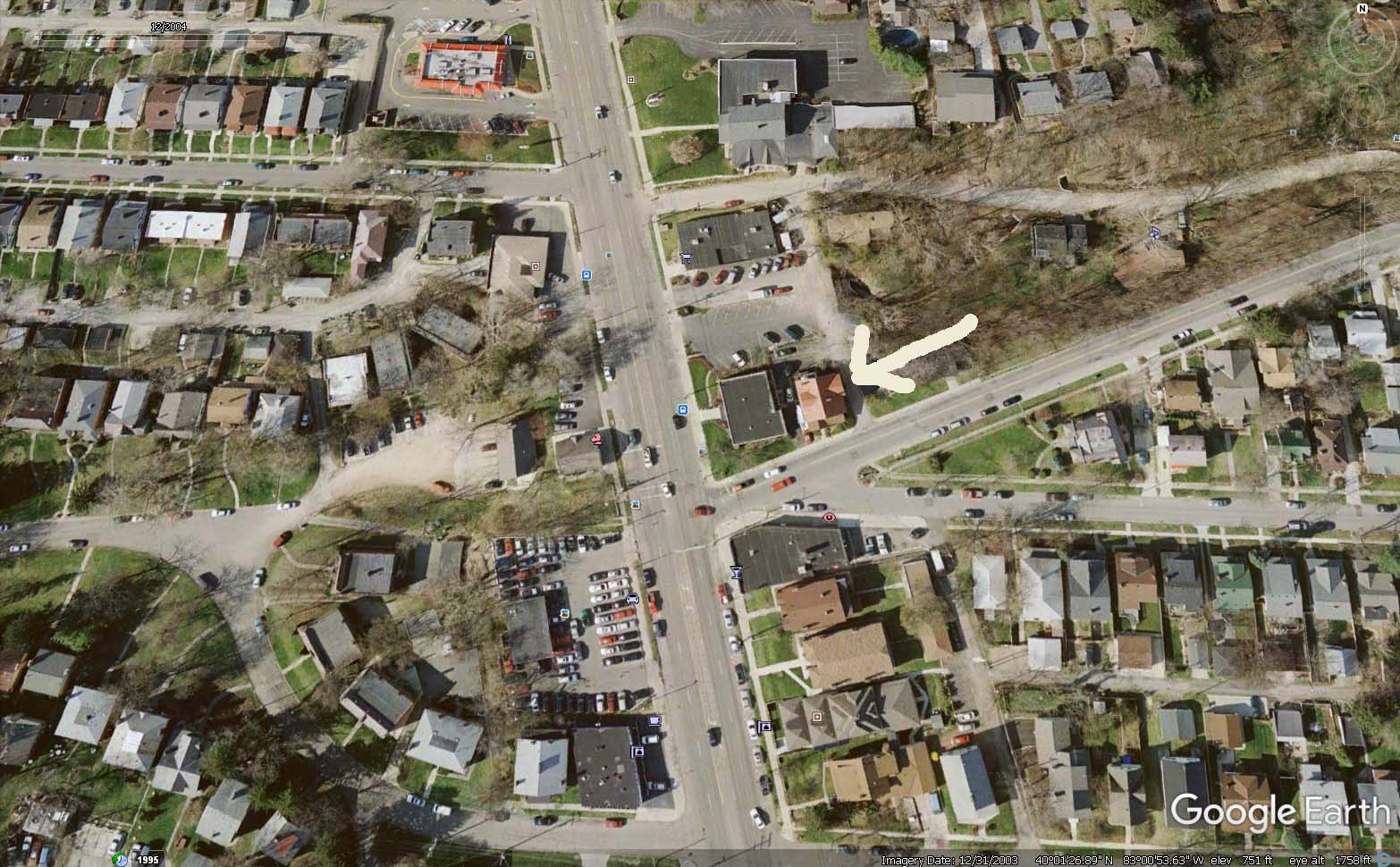
Stable at 242 East North Broadway
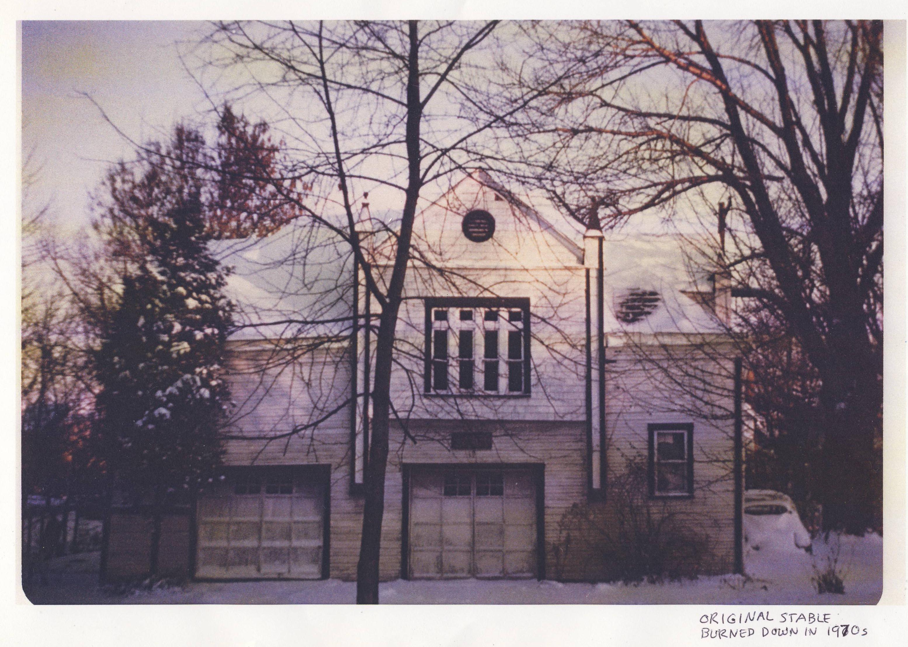
242 East North Broadway used to have a horse stable; it was located behind what is now the garage at that address. The stable stood until the early 1970s, when the then-owner accidentally burned it down.
The story goes that his wife told him not to burn the rubbage so close to the stable! You’ll burn that building down! But her husband did it anyway, and she earned the sad right to say, “I told you so.”
Luckily the current owners have a photograph of that original stable.
[Image courtesy of Gary Means and Jane Hoffelt]Winfield Scott & his House


Two more terrific pictures taken in the old old days of 242 East North Broadway‘s history.
This house was known as the Winfield Scott house, after the owner in the early part of the 1900s. The people in the first photo are Winfield Scott (1848-1934) and his wife Francis Anna Whipple. This homeowner bears no relation to the Civil War general. He is also not the son or brother or nephew of a former OSU President.
There were various Winfield Scotts living at the same time and in the same areas, and it makes for some confusion. There is a Winfield Scott (1846-1916) who was the brother to William Henry Scott, the OSU president; William Henry lived on North High Street a scant block from 242 East North Broadway. (This is confirmed with matching parents’ names, Alexander and Susan Scott, appearing on both of their death certificates, viewed on Familysearch.org.) This Winfield brother was married to someone named Josephine.
The Winfield Scott living at 242 E. N. Broadway was the son of Lancelot and Jane Scott, and he was married to Francis Anna Whipple. He also had a son named Winfield Kenath Scott (spelling based on his death certificate) who lived from 1876-1915. Winfield and Francis had a daughter named Florence May Scott who married Clarence B. Hoover; their daughter was Elizabeth Hoover and Elizabeth lived in the Rosemary Parkway neighborhood of Clintonville. In 1991 she sent a letter to the homeowners of 242 E. N. Broadway and you can find that letter here.
There is a mention on OhioMemory.org, that the Winfield Scott who lived at 242 E N Broadway was the son of the OSU president William Henry Scott. But that is not the case. This Winfield was of the same generation as William Henry Scott and Winfield Scott, so they may have been cousins.
By the way, both of these Scott lines lived in Athens County in the 19th Century, so that adds to the evidence that they may have been related (and also adds to the confusion!
[Thanks to Nick at the Columbus Metropolitan Library Local History and Genealogy Desk for this genealogy information. The photographs came from Elizabeth Hoover and are shared courtesy of Gary Means and Jane Hoffelt.]242 East North Broadway
I’ve written in the past about this stunning house at 242 E. N. Broadway–a beautiful renovation job by the current owner.
This is the oldest existing house on E.N. Broadway. Here are some old and new pix.
Original house:

And today, after years of loving restoration:
Elford Company Develops Beechwold

Elford Inc., a commercial construction company located near Grandview on Dublin Road, celebrated its 100th anniversary in 2010.
To mark the occasion, the company published a 70-page hardcover book detailing Elford’s history, from its founding by Edward “Pop” Elford in 1910 to today. It’s available as a PDF here. The book chronicles the company’s history decade by decade, focusing on the marquee projects of each decade.
From a Clintonville and Beechwold perspective, the following are standouts:
Calumet Street Viaduct
 A nice image of the Calumet Street Viaduct i.e. the Glen Echo / Calumet Street bridge. Elford Company built the bridge around 1924. The photo was taken from the area where the scoreboard on football field of the high school (formerly North High) is located. You can see some houses in the background, which are along Olentangy Street east of Calumet. [Thanks to John Krygier for sending this along to us.]
 And here is the view of those houses today, using September 2016 Google Streetview.
128 Crestview
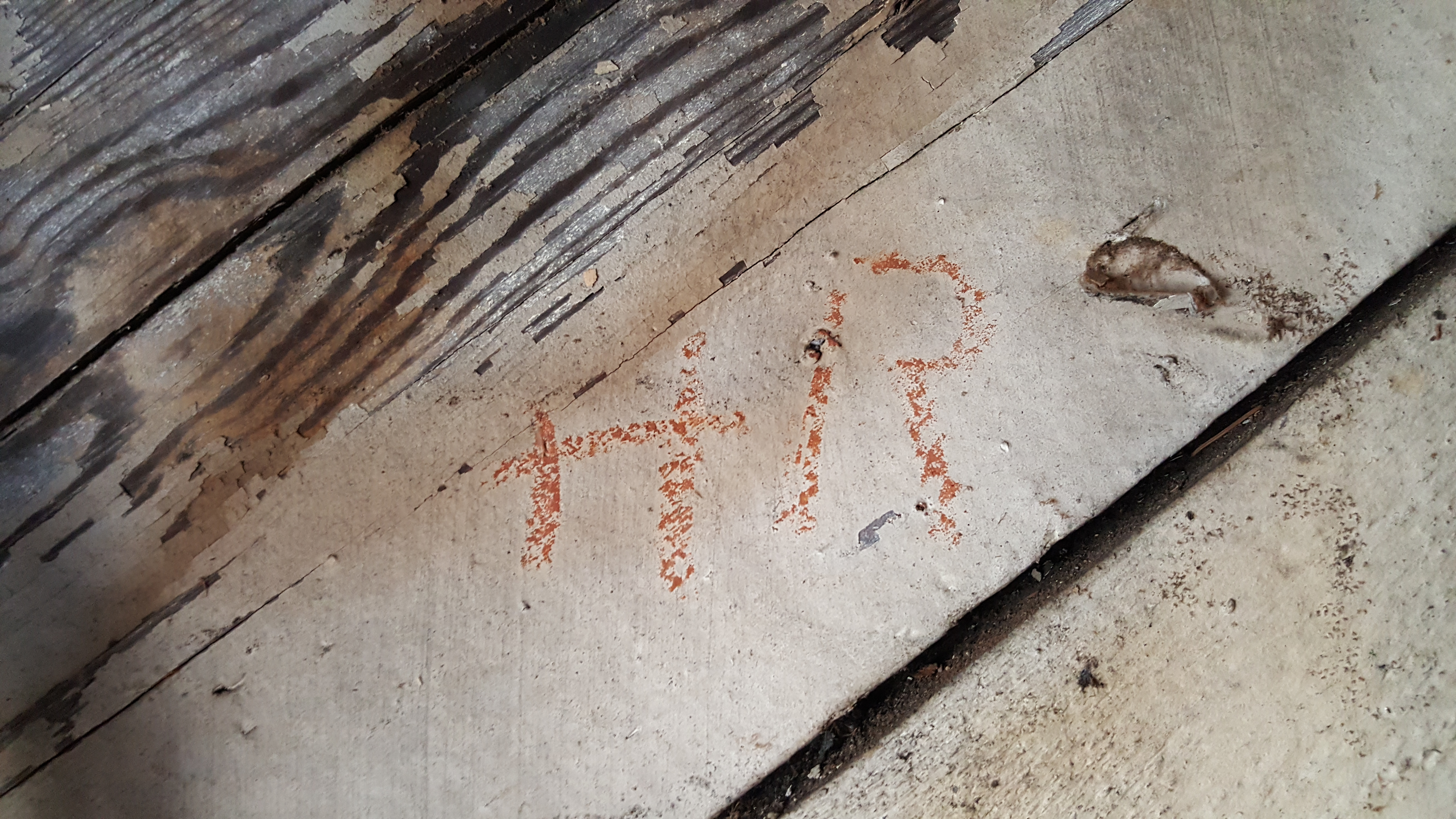
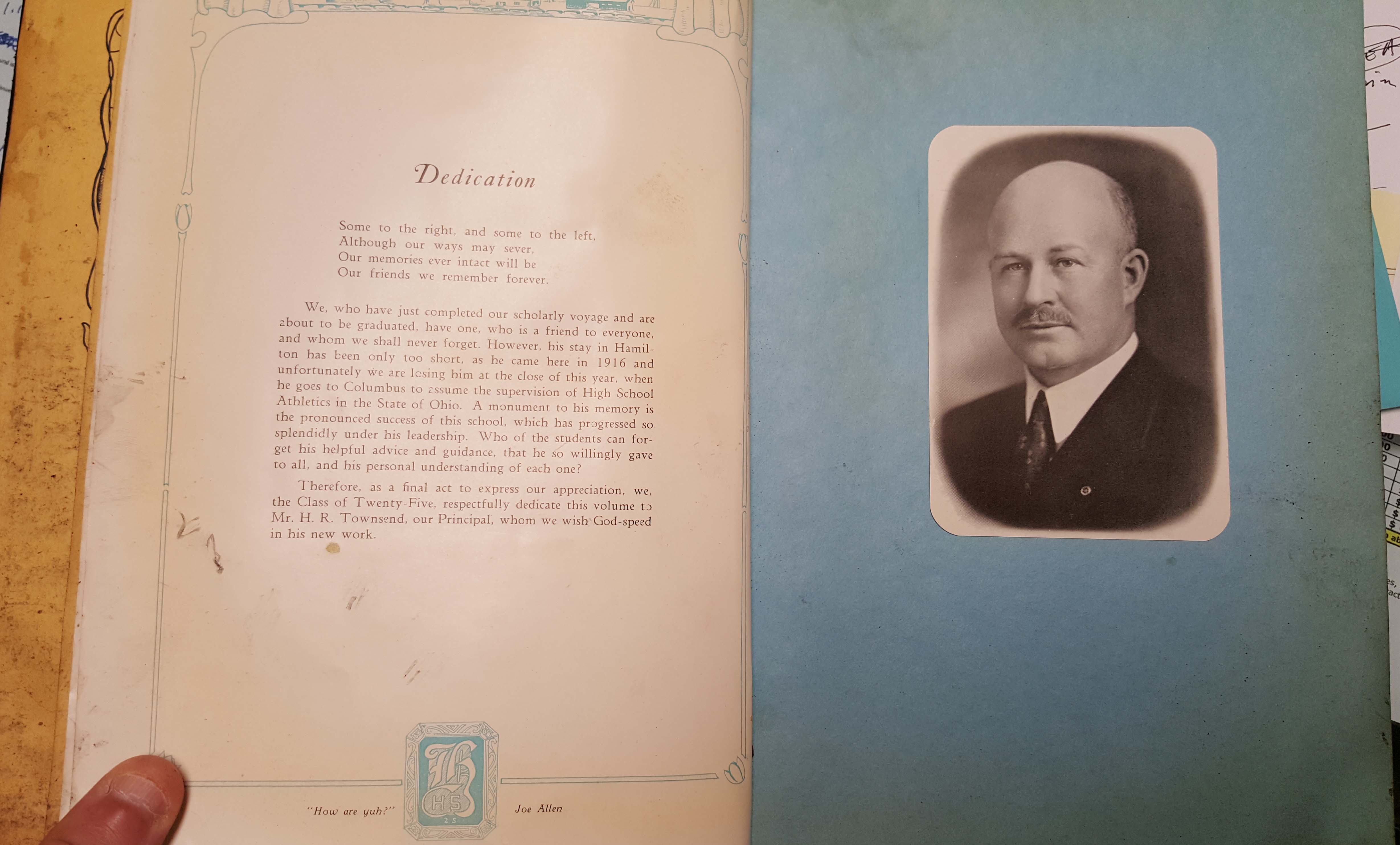 Isn’t it wonderful when you discover that your old house holds a treasure trove of old artifacts from previous owners!? Matt Earley recently found some very old documents in his attic from the original residents of his home at 128 Crestview Rd.
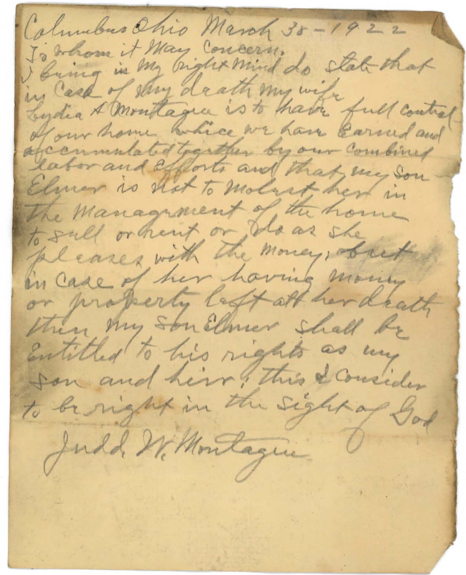 Probably the most interesting thing is this handwritten will directive from the original owner of the home, J.W. Montague. It was written in pencil, and found under a vent pipe in the attic of the house.
The Earleys also found several items from the family who rented the home during the 1930s and early 1940s, the H. R. Townsend Family. The home was a rental during this time period. Matt has spoken with a member of the family of he Townsend family, and she said that the Townsends lived in the home during the school year, but then moved back to a farm they owned near Hamilton, Ohio during the summer months. The gentleman, Horace Raymond (H.R.) Townsend, had been principal of the Hamilton High School until he assumed the full-time position of commissioner of the Ohio High School Athletic Association (OHSAA, which is currently located in Clintonville at 4080 Roselea Place, Columbus, OH 43214). He was the first commissioner of the organization, and held that post from 1925 until his death in 1944.
H.R.’s initials written on the inside of one of the attic walls:
Here is a 1939 Newspaper blurb about an event H.R. Townsend and his wife were hosting at 128 Crestview (“Entertain College Club”, 3rd column).
And, here is a 1936 article about their daughter Esther and her activities (“The Daily Grist”, Column 2).
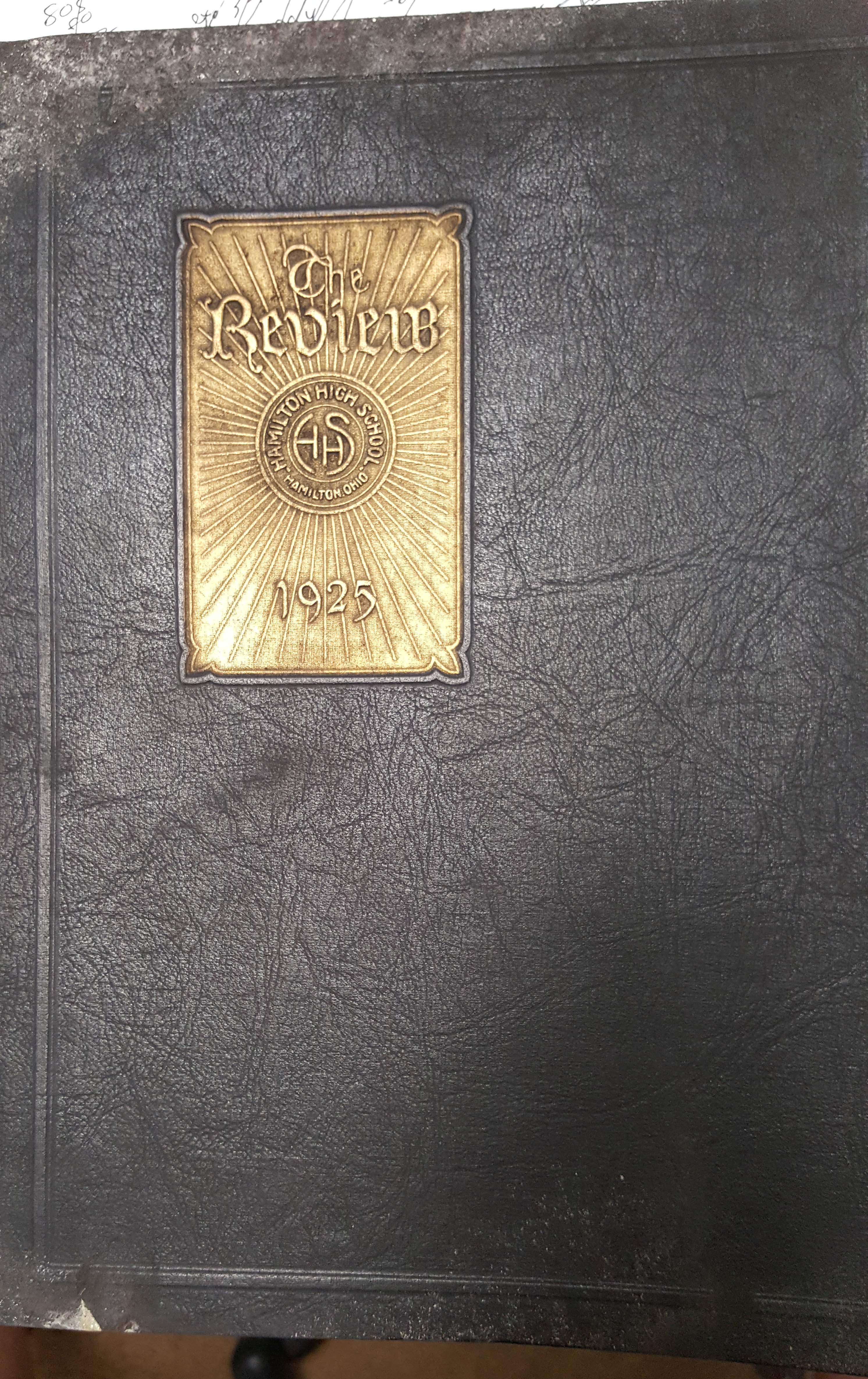
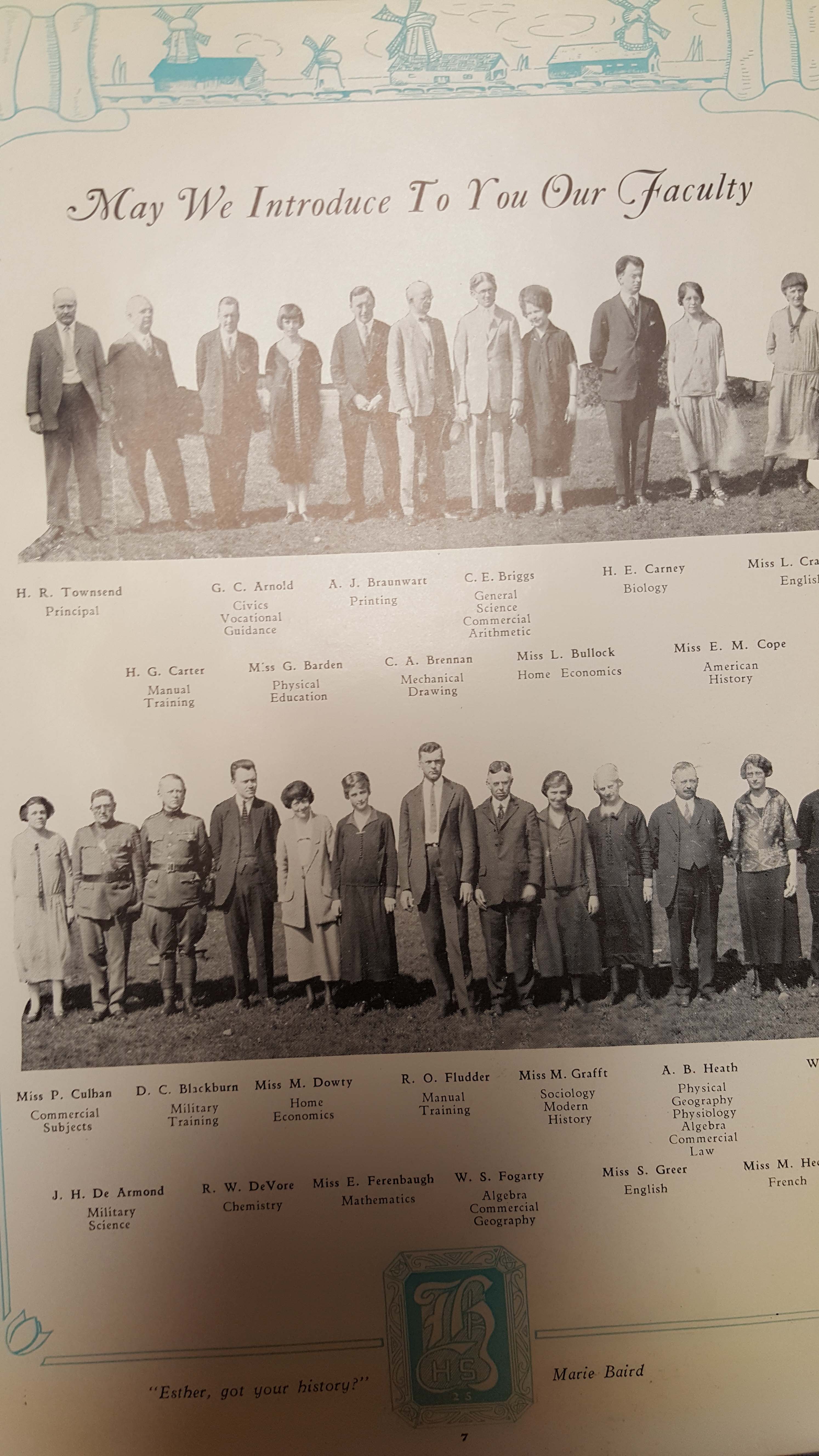
Here are some Hamilton High School yearbook pages from 1925, the last year Townsend was principal:
And a spread of the dedication to H.R. in the yearbook, along with his photo:
This was a photograph randomly inserted into one of the pages of the aforementioned yearbook. The Earleys are not sure who it is, but have confirmed that it is not Mrs. Townsend: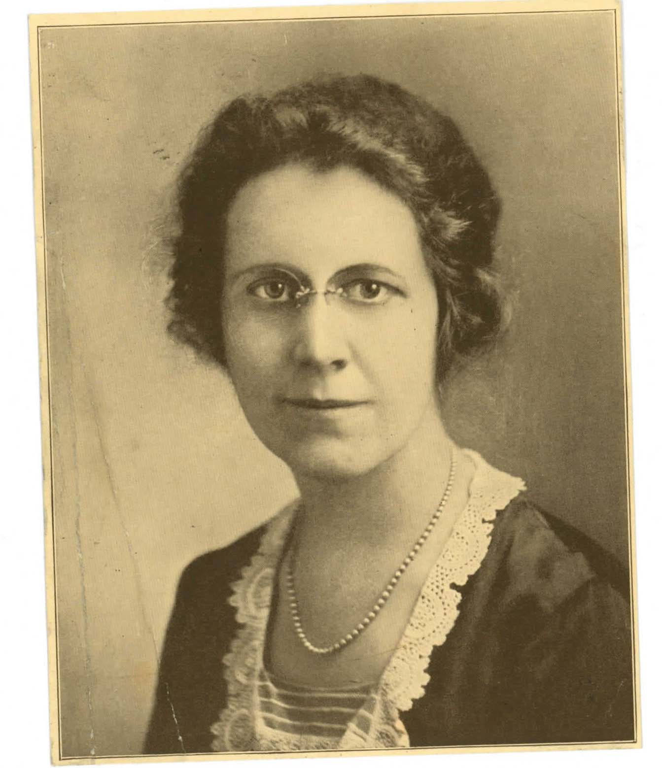
A children’s poetry book found in the attic:

The Earleys found some of their daughters’ (Elizabeth’s and possibly Esther’s) schoolwork in their attic as well, and you can see those here. (I sure hope no one finds my school work 75 years later!)
Matt has done extensive research on the history of the home and its owners, and has spoken with most of the previous owners or their extended families. He is still looking for any photographs of the home from before the 1980s (about the oldest he has been given to date). The King family (of Nancy King fame) was the longest resident of the home, but Matt has not yet obtained any photos of the home from when they lived in it (1957-1979). If anyone happens to stumble upon anything older than that around 1985 at some point, Matt would be very interested in seeing it.
We’re Going to the Zoo Zoo Zoo…
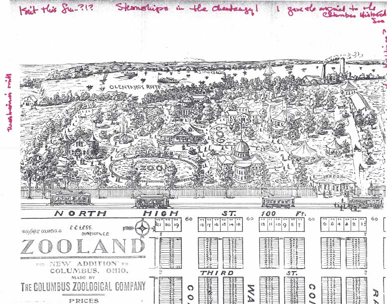 A great picture of the (Beechwold) zoo and partial image of the plat of Zooland, the subdivision on the west side of North High Street. Click on the image to enlarge it.
Steamships in the Olentangy! I guess the zoo picture was mostly, well, aspirational. Rumor has it that the Zooland housing lots were developed to raise funds for the zoo. You can read more about the zoo on my web site here. [Image courtesy of Wendy Bayer]
Moseying with Rick Pfeiffer through Clintonville
 Columbus City Attorney Rick Pfeiffer, who grew up in Clintonville, does a wonderful job giving an informal tour of the Clintonville community. (He has done this for the other neighborhoods of Columbus as well!) Thanks Rick! and we wish you well in your 2017 retirement.
Part One: https://bit.ly/CMosey1
Part Two: https://bit.ly/CMosey2
Plat of Old Beechwold
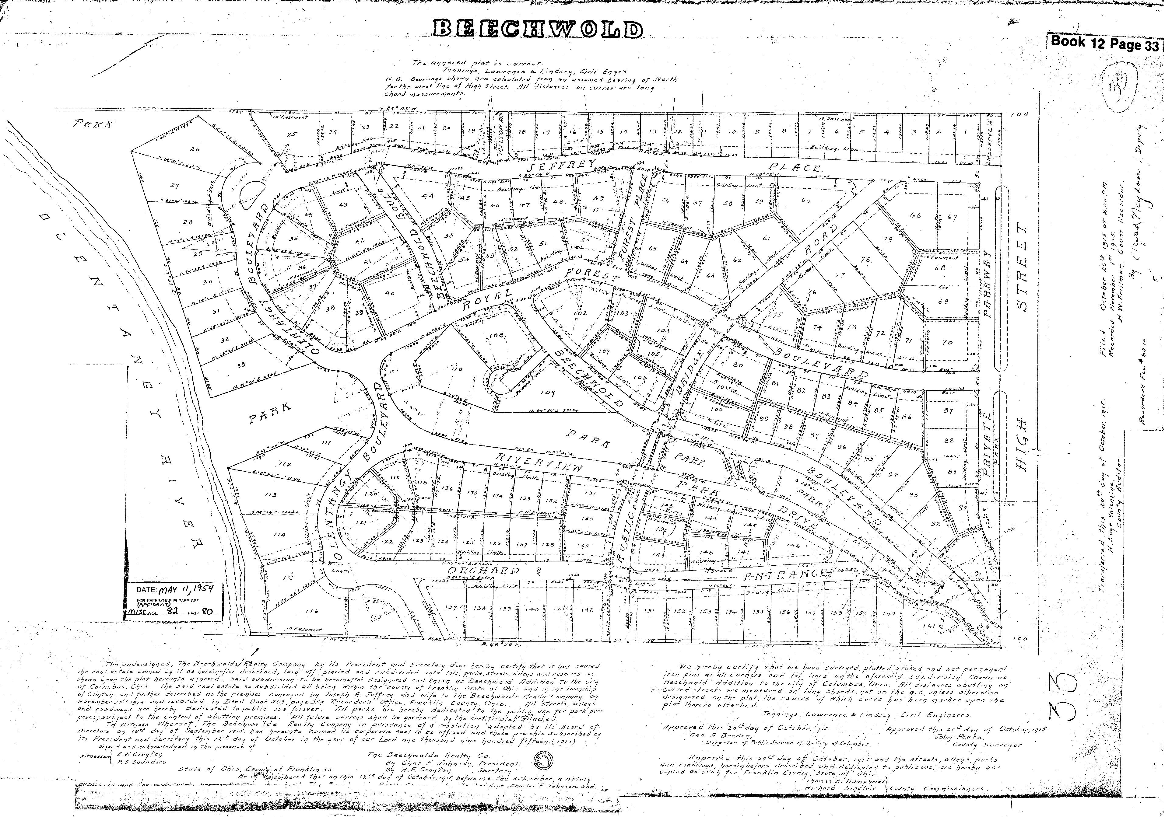 Wendy Bayer sent us this wonderful plat map of Old Beechwold. Plats are maps, usually drawn to scale, of the subdivisions of a piece of land. with lot numbers. [Map courtesy of Franklin County Records via Wendy Bayer]
And More Markers!
Ron Irick recently alerted me to the Historic Marker Data Base. In it are photographs of several additional markers covering Clintonville’s notable people, places and events. The database includes the marker for Rand Hollenback, on Hollenback Drive at Whetstone Park, the Nat’l Register of Historic Places marker for East North Broadway Historic District, and the marker (currently in Powell) for the Grand Carousel which was formerly at Olentangy Olentangy Park.
Ron recently posted the Clinton Township/Clintonville Historic Marker.
Though not in this database, there is also a marker for the Old Beechwold Historical District. I believe there is also some sort of marker for the former home of the Republican Glee Club at 57 Weber Road.
Arcadia Ave. Apartments

I love this picture of the Arcadia Ave. Apartments, located at 73-93 Arcadia Avenue. The building still exists. When they were first advertised, they were described as a two-story brick building of Georgian type, housing up to 8 families. Each apartment consists of a living room, dining room and kitchen on the first floor, to bedrooms and bath on the second, and a basement laundry. The building was constructed by Galbreath and Leonard, Inc. in 1927. [Image courtesy of Stu Koblentz.]
A. B. Graham House
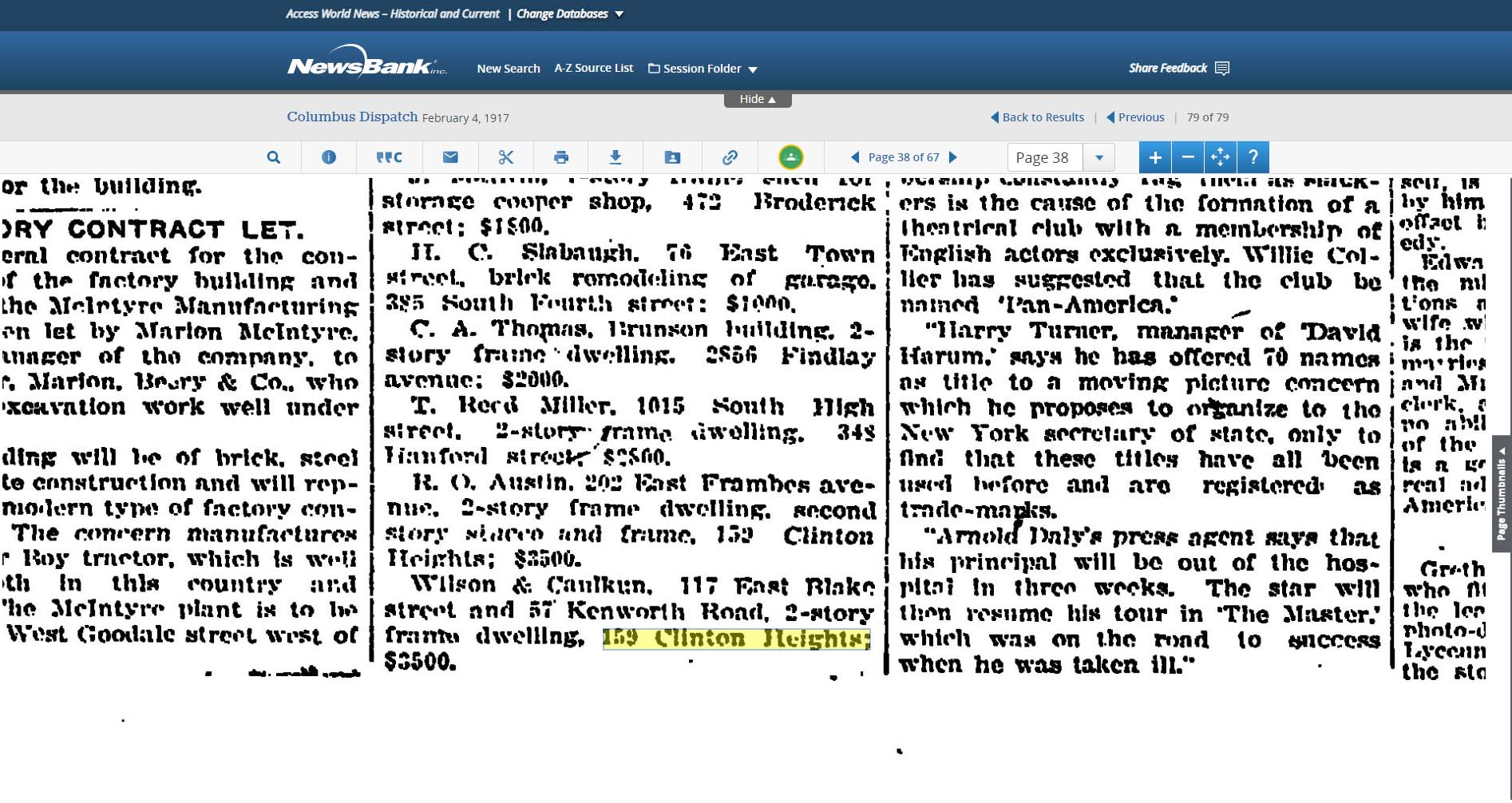
 A. B. Graham (Albert Belmont Graham) was one of the key founders of the 4-H Club, and was also a leader in developing the nation’s county extension services that are still so helpful to farmers and gardeners and cooks. In his retirement years Mr. Graham lived at 159 Clinton Heights Avenue in Clintonville. (His son lived in Clintonville as well.) The Clinton Heights house is the last surviving house known to be associated with Mr. Graham, and on this basis the house has recently been put on the Register of Historic Places.
You can find more information elsewhere on this web site
92 Walhalla
 After reading the entry on this web site about 100 Walhalla, Sarah Ellis contacted me with some information about her own house, 92 Walhalla. She shared the following:
An interesting article from the OSU website, and
An article that appeared in the This Week newspaper in 2009 when 92 Walhalla was on the homes tour.
Thanks Sarah!
Clintonville Looking West at Pacemont and North High
 Looking west from Pacemont and North High in 1904, in the direction where Riverside Hospital is now located. The dairy shown in my book is to the left of this camera angle. [Photo by Clinton Hollenback]
Mathias Armbruster
 Two articles are often mentioned as sources for information about Mathias Armbruster. I thought I’d archive them here.
Leeann Faust wrote this wonderful article about her great grandfather Mathias Armbruster. It was originally published in the Polar Bear ROARS Alumni Association (=North High School) newsletter.
Karl Pauly wrote this column way-back-when, about Walhalla ravine–which Armbruster was instrumental in designing, or at the very least, naming. (First article of Leeann Faust; second article courtesy of the Clintonville Historical Society)
Looking East from 3124 North High St, ca 1904
 This is what the Hollenback homsestead at 3134 North High Street looked like, looking east/southeast.
Flora Armbruster
 Leeann Faust has graciously shared an additional photograph of her family. This photo is of Rosa, Pauline and Flora Armbruster.
Leeann and her cousin David believe the photo was most likely taken at the house at 3100 North High Street but where and what the building–which looks the be rather rough construction–is, is not known. Leeann ponders, “Could it be the barn? That was where the house is that faces California stands today (on the east side of the side driveway). It could also be a storage building. We were looking at the things in the background. If it is the barn it might have been what was north of the house or if they were at the ends east or west. We know the barn faced the house so it couldn’t have be what was south. If it’s not the barn, we don’t know it’s position.”
If anyone has any guesses, please pass them on!
For additional photos, search “3100 North High” or “Armbruster” on this web site.
Graveyard at Armbruster home, AKA Clinton Chapel
 More fabulous pix from Leeann Faust of her ancestors’ home at 3100 North High Street. This was originally the site of Clinton Chapel, subsequently modified to make a residence for Mathias Armbruster; the building then became a funeral home and at the time of this update, the building is a day-care center. These photos show the old graveyard which was behind the house, as well as the lion with Olentangy Park in the distance. The graves were eventually moved, predominately to Union Cemetery.


For additional photos, search “3100 North High” or “Armbruster” on this web site.
(Photos courtesy of Leeann Faust)
David Beers
 David Beers was another early pioneer with an exciting life story of having been captured and released by the Native Americans. Beers came to Ohio in 1802. Descendents of David Beers still live in the area to the present day. (Photo courtesy of Terry Miller)
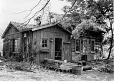
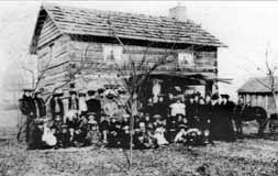 Beers had a log house near the intersection of Dodridge and North High Street. The cabin still exists but has been moved to Norwich Avenue. This photo appeared in the December 29, 1904 Dispatch, on the house’s centennial. The people included friends, relatives, and associates of the cabin’s next owner, Conn Baker, and they were reminiscing with him about early Columbus and marking the 100th anniversary of the cabin after the its move and reassembly to E. Norwich.
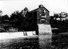 The Beers family operated a mill which existed until the early twentieth century. For many years the father of the well-known poet John James Piatt operated it. The future poet spent his boyhood days playing about the mill, and some say that the impressions made by its surroundings found expression in his work. The mill was considered to be one of the most picturesque spots in Ohio. Built around 1810, the mill burned in 1902.
There are still vestiges of the mill (foundation stones) below North Street, at the river.
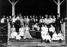 The reason for this gathering is unknown, but it includes several Beers descendants (and likely many who are not related) and was taken about 1905, probably at Olentangy Park. (Photos courtesy of Marty Cottrill)
A Lot of Bull
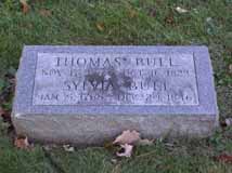 People like to say that the story of Clintonville starts with the story of Thomas Bull Jr., who came to this area in 1812 with his family from Vermont, by way of Worthington. Bull purchased about 680 acres in Clinton Township, and bequeathed land to his children when he died in 1823. Bull and his family were Methodists and abolitionists. The family graves were moved in March 1910 to Union Cemetery, section “new”, lot 176, across from the flagpole. (Despite the section name, this is in the old area of Union Cemetery on the east side of Olentangy River Road.)
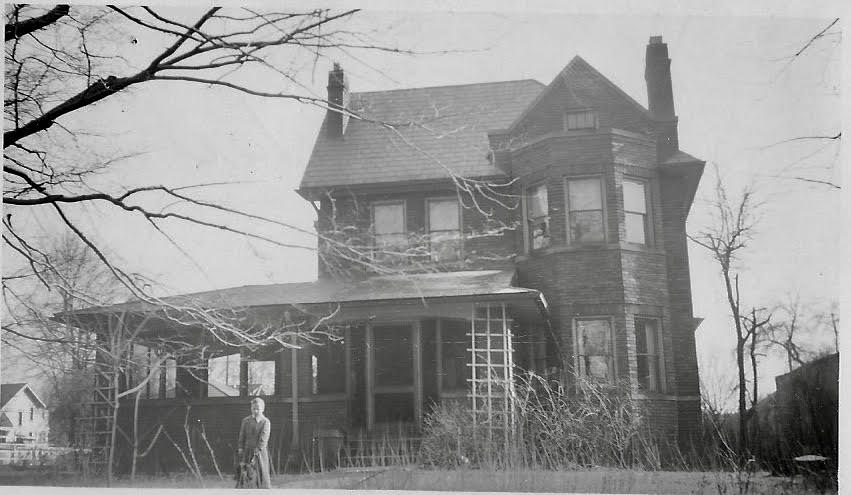
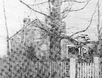 This is the Thomas Bull residence which stood on the east side of High Street between Dunedin and Piedmont. Some of the information about the house is conflicting, but Nancy Pendleton states that Alonson Bull helped to build the house around 1821 and lived there until the mid-1860s. The local Methodist congregation held services in this house until Thomas Bull’s death in 1823. Elias Pegg purchased it, along with its farm, in 1862 and raised his children there. The house was torn down in August 1931. This photo is from the Sunday edition of Cols Dispatch March 5, 1950.
Brevoort & Bull Graves
Thomas Bull’s daughter Chloe came to the area with her husband Isaac Brevoort and son Henry around 1812. Isaac Brevoort was helping build a barn across the Olentangy River and was crossing the flood-swollen river in February 1814 when his boat was swamped and he drowned. He was 23 years old, and was buried just 100 yards from the river. That grave is now someone’s back yard. Some say the grave is behind 247 Kenworth; some sources say it’s behind 253 Kenworth; some sources say that Isaac Brevoort is buried behind 253, and Thomas Bull Senior (father of Thomas Bull Junior) is behind either 247, or 253, or 257.
 Henry Brevoort’s house was built at 3620 North High Street, behind the original Brevoort cabin. The house continued to exist until around the 1970s, when it was torn down. The Brevoorts had an 80 acre farm; Developer Charles Johnson purchased the farm in 1909, and planned the Northmoor neighborhood carefully. He had the idea that vacant space induced people to build a nice house. Accordingly, he platted Northmoor Park and gave it to the city. He also did this with the bird sanctuary that today is known as “the Delta,” at the west end of Webster Park.
An early 1970s article stated that “stones still mark the [Brevoort] cabin” and that “once past the field stone gateposts [which were just wide enough for a carriage], the ancient barn where Frank Brevoort once operated a dairy still stands.” Does any of this still exist?
Bishop Philander Chase
 … is credited with starting Kenyon College somewhere near North High Street and Selby Roads, in a house that has since been razed. An earlier home of Chase still stands at 62 Lincoln Avenue.
Barnabas Phinney (1813-1899)
 Barnabas Phinney (ca. 1813-1899) came to the area in 1838, and purchased 60 acres of land near the northwest corner of today’s Henderson Road and North High Street. In addition to farming, Phinney was an investor in the toll road running from Columbus to Worthington, and in the electric streetcar company. His house was said to be majestic. He and his wife had no children, and after his death most of the property was sold. A bit more biographical information can be found in A Centennial Biographical History of the City of Columbus and Franklin County Ohio (Chicago: The Lewis Publishing Company, 1901) p. 872 excerpted here. His obituary from the Columbus Dispatch January 30, 1899 is here.
Cooke family
 Another one of the first families of Clintonville was the Cooke family. According to the family’s history, Roswell Cooke (1764-1827) came to Ohio with his wife and five children in 1800 from Connecticut. His two eldest sons, Rodney and Chauncey, took up land 6 miles north of the state house, their farms adjoining (in the vicinity of Cooke Road and North High Street). They cleared the land and both erected “houses out of round, unhewn logs, with puncheon floors and primitive fire places, with mud-and-stick chimneys.” The brothers lived the rest of their lives on these farms. Family history states that in 1827 they constructed one of the first grist and saw mills on the Olentangy River, which later became known as the Whipp and then as the Weisheimer Mill. They also operated a distillery. (Photo courtesy of Terry Miller.)
 Rodney’s son, H.C. Cooke, was born in 1825, and took up residence on the old Cooke homestead at 4243 North High Street. Over time H.C. amassed 300 acres. He was a successful businessman, including in the stock business, and then owned the firm Cooke, Grant & Cooke, contractors in the construction of heavy masonry for railroad and other bridges. He was one of the officers of the Worthington & Columbus streetcar line. (You can click on this map to enlarge it.) (Photo courtesy of Carl Cooke.)
Just a bit more background information. The current name of the company Henry C. Cooke founded is the Fritz-Rumer-Cooke Co., Inc. They are still in business. The Secretary of State’s website states that one of their prior names was the Fritz Rumer Cooke Grant Company, changed to Fritz-Rumer-Cooke Co., Inc. in 1918. The company’s website states that it was founded in 1879 and incorporated in Ohio in 1911, and is still managed by descendants of the Cooke family. (This information courtesy of the Columbus Metropolitan Library.)
Never too many Cookes in the kitchen…
 Cooke family members married Buck, Armstrong, Hess, Maize, Webster, and Brown family members. The Cooke family held a series of family reunions from the late 1890s through the first decade of the 1910s, and maintained a log and minutes of their get-together. (Photo courtesy of Carl Cooke)
Armstrong family
 Another noted family in the vicinity of Henderson and High Street was the Armstrong family. Henry C. Cooke’s daughter Flora had married Llewellyn Armstrong. This is their house on the corner of Cooke Lane and High Street. A caption by Lulu Pearle Browne (Ohsner) also states “Clem Cooke [a son of Albert C. Cooke] born here—when first built Al and Lulu Cooke lived here.” (Photo courtesy of the Ron Ohsner family)
Hess Barn
 Alice Cooke (daughter of Henry C. Cooke) married Charles Hess, a great grandson of Clinton Township pioneer Balser Hess. Alice had been a teacher at Clinton School. The Cooke-Hess house and farm were located just south of the corner of Henderson and High between Deland and West Cooke Roads on the west side of High Street, opposite the Ed Cooke home. The house was originally the home of Henry and Abigail Cooke. (Photo courtesy of the Ron Ohsner family)
 The bottom photo is a picture of the Hess family on their farm; Henry is supposedly in the middle. (Photo courtesy of Carl Cooke.)
Orlando Aldrich (b.1840)
 Orlando Aldrich was a prominent lawyer and OSU law professor. Aldrich was the first president of the Worthington, Clintonville & Columbus Street Railway Company and served in this position from 1891 to 1898; he subsequently held an office of the Columbus, Delaware, & Marion Electric Railway. Aldrich had purchased 23 acres of land on the southwest corner of Henderson and North High in 1882; it was a fruit farm called Maple Grove Farm. Aldrich had three great hobbies: horticulture, collecting great art, and collecting rare books about archaeology, and he engaged in these avocations from his lovely house located about where Maple Grove Church parking lot is located today. A bit more biographical information can be found in A Centennial Biographical History of the City of Columbus and Franklin County Ohio (Chicago: The Lewis Publishing Company, 1901) pp. 280-282, excerpted here.
Aldrich home
 The land just south of Henderson and High was originally owned by Asa L. Parker, and was called Maple Grove Farm. Parker had purchased the land at sheriff’s sale in 1875 for $3,144. Judge Orlando W. Aldrich acquired the land from Parker in 1882, for the sum of $10,000. The old Aldrich home was charming, with a tower jutting two stories above the roof of the house. Judge Aldrich had used the tower as a study and a personal art gallery. From it one got a very good view of the Ohio State University buildings and the river valley. (Drawing by Bill Arter)
 The farm remained in the Aldrich family until 1923, when Charles F. Johnson purchased it and sold it in turn to Frank Sweigart. Sweigart remodeled the house, converted it into what has been variably called “Southern Colonial” or “Greek Revival”, and moved it so that it would face Aldrich Road instead of High Street. The house was later demolished to make way for a parking lot.
Frank Sweigart
 Frank Sweigart worked for Charles F. Johnson for eight years. Sweigart was a sales manager, treasurer and then advertising manager under Johnson. He was also on the educational committee of the Columbus real estate board for two years. and a member of the state educational committee. He eventually resigned from Charles Johnson’s employ to become vice president and general manager of J. E. Martindill Inc., and was in charge of Marburn, a country estate development on Olentangy River Rd. This is a picture of him in 1923, given to me by his granddaughter Karen.
 He eventually owned the house which stood just south of the southwest corner of Henderson and High Street. Here’s a picture of his wife, Anna Sweigart, and six of her children on the porch of that house at 22 Aldrich Rd. Her sister is also in the picture. Frank Sweigart is the one taking the photo. (Photos courtesy of Karen Sweigart Longava.)
“Civilized man cannot live without Cook[e]s” –Owen Meredith
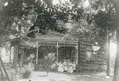 Ed Cooke was one of the sons of H. C. Cooke. This was the house of Ed Cooke; it was located on the east side of High Street where the Beechwold Theatre building—now the Columbus Sports Connection– now stands.
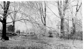 This is a picture taken from Ed Cooke’s yard, looking northwest toward the Webster and Browne homes. According to the picture caption written by Lulu Pearle Browne (Ohsner), the fence at the right divided Ed Cooke’s “dooryard” and “barnyard;” and a hollowed stone watering trough stood under the big tree at the corner of the picket fence to water horses going and coming from the barnyard. The larger figure standing in High Street looking north is Al Cooke. The barn across High Street is the Hess barn. (Photos courtesy of the Ron Ohsner family)
Albert Clement Cooke
 Albert Clement Cooke (shown here) was one of the sons of H. C. Cooke. To the right is a picture of Albert’s house.
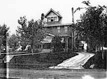
Albert’s land was in modern times rented for a Sandy’s restaurant, which later became a G.D. Ritzy’s ice cream parlor. Albert’s son was the first OSU athlete to participate in the Olympics; he ran in the 1912 Olympics in Stockholm. Albert’s grandsons Carl and Grant Cooke still live in central Ohio (Photos courtesy of Carl Cooke)
George P. Whipp (b. 1817)
George Whipp came to the area with his wife and two sons from Maryland in 1833. His son George P. was 16 years at the time, and initially worked as a carpenter. Son George married Lucinda Smiley, and they had 10 children one of whom was also named George. The family farmed and had two truck stands along North High Street. (Note: Sometimes the family spells its name with one “p”.) A bit more biographical information can be found in A Centennial Biographical History of the City of Columbus and Franklin County Ohio (Chicago: The Lewis Publishing Company, 1901) p. 770 excerpted here.
Schreyer house
How I would love to acquire a picture of the old Schreyer House. This was described as being one of the first high-class homes in its neighborhood. The property was 50 acres, from High Street to the Olentangy River, bounded by Henderson to the south and the “Stewart and Weisheimer farms to the north.” The grand house was built by Barney Phinney (one of the owners of the Worthington Pike) about 1893, and was subsequently sold to G. Schreyer, a Columbus stove and furnace manufacturer.
Two excellent orchards grew on the place. A windbrake of splendid walnut trees protected one orchard and a row of fine maples formed the windbrake for the other. There was also a very good spring just west of what is now Rosemary Parkway. Surrounded by rose gardens and shrubbery, the house was an imposing structure with pointed gables and the interior finished throughout with solid walnut.
Mr. Schreyer died in 1901, and his wife (Ernestine Zeller, after whom Zeller Road was named) moved elsewhere. The old Schreyer house was eventually subdivided into apartments. The house burned down in 1913; the Columbus Fire Department had been called but could not respond, because there were no water lines in that vicinity at the time. The land was purchased by Charles Johnson in 1923 and subdivided into the Rosemary Development.
And as a side note: “Rosemary” was the name of Charles Johnson’s mother.
Broadway House No. 1
 North Broadway was developed by the Loren and Dennison company in 1897; it was intended to be the place to live, and it was. James Loren originally planned to call it the Oakland Addition, but the post office requested he change the name to avoid confusion with another neighborhood. It had a small railroad depot and post office at North Broadway’s east end at the Big Four Railroad track. This house at 510 North Broadway Street was the first house built in the subdivision. It was built around 1890. It was sometimes called Acton Place, for reasons I was unable to discover. By 1894 it was owned by a man named E. Howard Gilkey. The William W. Daniel family purchased it in 1896, and the house remained in that family’s hands until 1961. It burned down in 1966. My Clintonville and Beechwold book has a photograph of the original house; this photograph shows the fire. The spot is now occupied by Columbus Speech and Hearing Center. (Photo from an unnamed newspaper clipping)
The Loren House
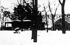 I also found a handwritten history that said that this was the first house built on North Broadway and was lived in, or owned by, someone named Loren. I do not recognize the house—do you? (This very poor image was taken from a photocopy of a microfilm.)
According to the 1896-97 city directory, there was also a Jeremiah C. Loren (motorman) living 1 building north of North Broadway on the east side of North High Street.
Mary Rodgers (resident of East North Broadway who has been researching the houses along East North Broadway) believes this is a picture of 625 East North Broadway, a house which was in the Broadway Villa subdivision and which I have written about here. It was lived in by the MacIntosh family.
Broadway House No. 2
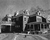 East North Broadway was developed by the Loren and Dennison company in 1897; it was designed to be a posh neighborhood, each house on a 1-acre plot of land. It had a small railroad depot and post office at North Broadway’s east end at the Big Four Railroad track. This house at 242 North Broadway Avenue was the second house built in the subdivision. (From Business First magazine)
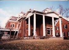 242 East North Broadway was renovated beautifully by owner Gary Means. The care with which he selected materials and kept true to the house’s original design takes my breath away. The house has not always been so lovely. For several years–prior to the present owner–this (to the right) is what it looked like.
On Broadway (…on Broadway)
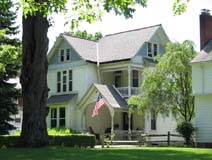 My book, Clintonville and Beechwold, page 19, shows an image of East North Broadway, looking east toward Indianola Avenue in the late 1800s The large house to the right of the photograph (south side of North Broadway) still exists at 489 East North Broadway (top photo).
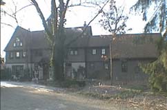
The building just to the left of 489 in the photograph still exists as well, as a private residence; it was originally the carriage house of the large house on the south side of North Broadway in the distance (bottom photo). That large house was formerly 625 East North Broadway in the Broadway Villa subdivision.
Looking West from 3134 North High St, 1896
 This photograph was labeled, “Looking west from 3134 N. High, 1896”. It’s an exciting glimpse of how Clintonville used to look. (Photo courtesy of the Dawson family.)
Bottled water back then?
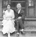 Pearl Fisher lived at 129 West Pacemont for nearly 70 years until her death in 1970 at age 82. [The house has since been torn down.] She moved there as a young girl, when Pacemont (then called Jason Avenue), was a gravel road with houses far apart and the mailman traveled his route in a buggy. There was a spring on the West Pacemont farm which her parents, Mr. and Mrs. Joseph Fisher, owned. They sold this spring water in bottles to residents all over Clintonville, delivering it by horse-drawn wagon. They stored the bottles in a little shed attached to the house. –from The Booster, January 4, 1978.
“One Look Means a Lot”
Fallis Road in the Dominion Park Addition, in 1913, showing office, sidewalks and forms set ready for curb and gutter. –from Dominion Land Company Columbus Home News July 1913, Volume 1 Number 4.
Gatekeeper’s House
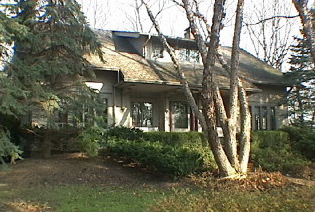
This wonderful arts and crafts-styled home on West Beechwold Boulevard was the gatekeeper’s house for the Columbus Zoo, originally located where Old Beechwold is today. It was renovated in the 1990s in the Arts and Crafts style and still has the original cistern.
Joseph Jeffrey House
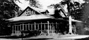
Joseph A. Jeffrey, a Columbus manufacturer, built this house around 1906 as a summer home. The land had previously been a zoo. Jeffrey’s wife called their estate Beechwalde, meaning “beech forest.” Jeffrey sold his property in 1914 to Charles H. Johnson, a Columbus land developer, who changed the name to Beechwold (because it was easier to spell) and sold plots for $1200. (Photo courtesy of the Columbus Metropolitan Libraries)
Jeffrey Outbuilding
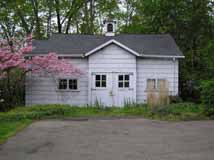 The old barn, an outbuilding of the Columbus Zoo, and eventually the Jeffrey summer home in Beechwalde, still stands and was remodeled, on the request of the homeowners, by students at the Interior Design Institute in 1983 for use as a guest house. (Photo courtesy of Terry Miller)
Beechwalde
The photos you are seeing here are lovely images of the Beechwold area (west side of High Street) before, or as, the land was being developed into the housing subdivision we know today as “Old Beechwold.” Some of these photos were later used in a promotional brochure–a lovely brochure called “Beechwold the Beautiful,” with a dark green heavy paper cover tied with dark green string with engravings by the Bucher Engraving Co., illustrations and text by Stacy G. Taylor, and printed by the Stoneman Press Company. This same brochure has recently been reprinted by the TWIG organization for use as a fundraiser.
Why the spelling change? Previous owners Joseph Jeffrey had named his country estate “Beechwalde,” and it was changed to “Beechwold” for marketing purposes (=easier to spell) when the land was subdivided and sold for housing units by Charles Johnson.
These photographs were given to me by the granddaughter of Frank Sweigart; Frank worked for Charles F. Johnson for eight years. I am mounting the Beechwold photos in several postings to facilitate some comparisons.
(Images courtesy of Karen Sweigart Longava)


Beechwalde Cont’d #1


Compare these two images–a photo (albeit reversed) from the collection of Karen Longava Sweigart (granddaughter of Frank Sweigart), and a watercolor print from the promotional brochure from the early days of Old Beechwold. Did the photo inspire the watercolor? (Images courtesy of Karen Sweigart Longava)
Beechwalde Cont’d #2
Compare these two images of this wooden structure located somewhere on Beechwold property as the property was being subdivided into a housing development. You can click on the thumbnails to see them in a larger format.
 The first photograph shows tire tracks driving right up to the opening between the two sections of the structure. In that photo there are window panes in the windows, and the structure is surrounded by brush and foliage.
 In the second photo, the windows and the foliage are gone. A different photo of the structure during this era is found in my book, Clintonville and Beechwold.
I have been unable to find anyone who remembers the structure first-hand. (The first photo is courtesy of Karen Sweigart Longava; the second photo courtesy of Amy Westervelt.)
Beechwalde Cont’d #3
Compare this watercolor from the promotional brochure for Beechwold, Beechwold the Beautiful, to the image found in my book, Clintonville and Beechwold, on page 26. (Image courtesy of Karen Sweigart Longava.)

The answer to today’s hard economic times
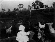
“The Dominion Land Company has purchased the Whipp and Ingham farm containing 90 acres of land, Stop 15 C.D. & M. on North High Street. The ground was purchased by the company to supply numerous customers with large lots where the soil is rich. It is to be platted into extremely large lots and will be sold on easy terms so as to enable a great number of people to follow their regular work in the City and at the same time, have lands where they can have a nice garden and keep a few chickens and thus help the problem of the high cost of living…The name of this sub-division will be Highland Gardens.” –from The Dominion Land Company Columbus Home News, May 1913, Volume 1 Number 2.
(This photo is Louise Corp on Tulane Road, but I’m sure the chickens of Highland Gardens looked much the same. Photo courtesy of the Clintonville Historical Society.)
Who wouldn’t want to live here?
 “The natural beauty of these lands would inspire even one not familiar with the business of platting of allotments. The elevation of this tract is nearly 920 feet above sea level. The middle section of these lands slope both east and west and to the south, thus giving the sunny side of the hill in winter and the shady side in Summer. The view from the top of the hill is the most magnificent and inspiring sight in or around Columbus. The rolling valley of the Olentangy River, dotted with beautiful forest trees, bungalows and other types of homes, show a real masterpiece of Nature’s Handiwork. Back of the beautiful valley the rising hills continue for miles and miles. The view in any direction from this beautiful location is almost without bounds…This new tract will be known as the Dominion Park Addition.” –from The Dominion Land Company Columbus Home News, May 1913, Volume 1 Number 2.
Caption: Dr. D.G. Sanor residence at the entrance to the Indian Springs Addition
Voting
According to a transcript of a WBNS-Radio broadcast salute to Clintonville on May 27, 1959 and reprinted in The Clintonville Historical Society’s January 2009 issue of its newsletter, Clintonville Heritage, Clintonville’s first voting booth was located at the corner of Weber and High, and on Election Day, the Ladies Aid Societies would work all day, serving hot dinners to the farmers who came to vote.
On Como
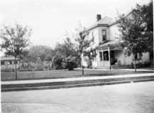 Como has a venerable history. The house of one of the Bull family members was located on Como; the oldest house in Clintonville is reputed to be there; Howard Westervelt (founder of North Broadway Methodist Church) lived there.
This charming house is located at 57 West Como and was built around 1903. The picture was taken sometime before 1926. (Photo courtesy of Verna Rogers)
Mathias Armbruster
Mathias Armbruster was born in Wurtenburg Germany in 1839 and came to the U.S.A. in 1858. He operated Armbruster Scenic Studios in Columbus—he painted scenic theatrical stage sets. Armbruster purchased the area around what is now known as Walhalla Ravine, and converted Clinton Chapel at 3100 North High Street into his private residence. His son Albert’s house was just north of Mathias’ home, where the parking lot for Southwick-Good-Fortkamp funeral home now is. Mathias eventually sold most of the acreage to a real estate developer, and helped name the streets after his beloved Wagner Ring Operas.
Mathias died in Columbus in 1920. Here he is shown looking west from the cupola on his roof. (Photo courtesy of Leeann Faust)
In the center, a view of High Street taken from Armbruster’s cupola; Olentangy Park is in the background. (Photo courtesy of Leeann Faust)
The photo on the right shows Albert Armbruster’s house. (Photo courtesy of Leeann Faust)


Floor Plan–3100 North High Street
The building at 3100 North High Street, originally Clinton Chapel and presently a funeral home, was converted into a residence in the late 1800s by Mathias Armbruster. Leeann Faust’s mother–a descendent of Armbruster–sketched out “before and after” floor plans for 3100 North High Street, from memory. “Before” represents the floor plan when Mathias Armbruster lived there. “After” is the floor plan as modified by subsequent resident Uncle Jack Sullivan ca. 1920. The second floor was converted into apartments. I’m including both Leeann’s mother’s first draft, and her “cleaned up” versions.


These are the floor plans after Jack Sullivan modified the residence. The 2nd story had been converted into apartments and aren’t shown here.


(Photos courtesy of Leeann Faust.)
You can search this site for “3100 North High Street” or “Armbruster” for more pictures of this building.
More Armbruster Photos
Leeann Faust gave me some additional images of the Mathias Armbruster home at 3100 North High Street.
 This photo shows the north side, kitchen door, and the house’s well below the arch. The verso of the photo says “Aunt Flora Armbruster Neilson”.
 The verso of this photo says, “Back of 3100 North High Street [home of Mathias Armbruster] / Steps from Walhalla to Pergola”
 Pauline and Katrina facing west from the kitchen door at 3100 North High Street.
 “Garden and Pergola / North side of [3100 North High Street].”
 This picture shows Albert’s house, located just to the north of 3100 North High Street.
 Another view of Albert’s house taken from the north window of 3100 North High Street.
(Photos courtesy of Leeann Faust.)
Crestview House

This is a wonderful picture of the house that still stands at 253 Crestview. Despite what has been scribbled on the photo, the picture was probably taken around 1908 when the house is estimated to have been built. The people in the photo are standing on the east side of the house; the front is to the right (the side with the dormer). You can click on the image to enlarge it; there is something behind the house looks like a cemetery but is more likely an orchard which would have been in the vicinity of Kelso and Calumet. (Courtesy of Chris Althof)
Orphanage at 218 Jason Avenue / 56 West Pacemont
 Back in 1910, this address served as a home for children.
First of all, in case you are wondering, there is currently no 218 Jason Avenue or 218 W. Pacemont. Pacemont Avenue was originally called Jason Avenue. The area where the orphanage stands was outside of the Columbus City limits in 1910 & 1920, during many of the years when it operated as an orphanage. When the western end of Jason/Pacemont was added as the “the Aldrich’s Riverside addition,” the house numbers were adjusted to compensate for all the new lots. The current address is 56 West Pacemont.
The boarding house/orphanage/nursery was run by Judiah & Mary Ella Throps (sometimes spelled Throp or Throop). Judiah was born in 1844, served in the Civil War, and died in 1913. (His occupation was listed as “Painter” and also, in 1910, as “Nursery.” Mary Ella was born in 1865, and died in 1933. (Her occupation was listed as “Housekeeper” and occasionally “Nurse”.) Both are buried in Union Cemetery.
According to the 1910 Census, the Throps had one 7 year old son living with them (son Ernest Throps). Mary was at the time 45 years old. They also had 12 young boarders living with them, all under the age of 6 and many just babies.
By the 1920 Census, Judiah had passed away. The 1920 census states that Mary (by this time, age 55) had 3 children living with in her household: Earnest Throps (age 16); William Throps (age 9), Mabel Leonard (a servant, age 29) and Glendus Leonard (age 5, listed as a boarder). (I can’t help wondering whether there were additional boarders, not listed by the census taker.)
By the 1930 Census, Mary was 64. By this time she had quite a few extra living companions: William Throps (son, age 19), Richard Throps (adopted son, age 4), Helen Gatewood (servant, age 22), Jeanne Paden (8), Oswin Poletzie (7), Shirley Poletzie (3), Elva Waton (18), Marie Obrien (6), Charles Jordan (6), Mick Tudor (3), Virginia Adkins (2), and Algie Donaldson (2).
This research was conducted by Scott Caputo of the Columbus Metropolitan Library, Main branch, Geneaology, History, & Travel Desk. We are so glad he discovered this history. Scott had a library client who knew that their grandmother had a child out of wedlock in 1910. The grandmother had put the infant in an “orphanage” located at 218 Jason Avenue, where he died shortly afterward. The infant was Harry White and is included in the 1910 census in a list of around a dozen “boarders” at this address. All are under 5 years old.
Here’s a directory of the source material used for the above information, and also linked to above:
Sanborn Maps
Censuses
Business Directories
Death and Civil War Records
Ankroms
The house at 105 Weber was built around 1915, and current residents Tom and Margo Thacker have been researching the house and the family who lived there until 1965, the Ankrom family. The house itself is an Aladdin kit house; the images above are the Aladdin listing. In 1918 Charles Cornell, a machinist, lived in the house.
 Solomon and Lydia Ankrom (shown to the left), their son Lindsey and their daughter Estella lived at 2366 North High Street in early 1918.
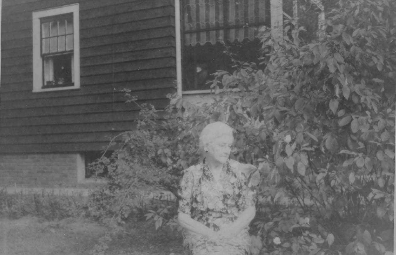 The Ankroms moved to 105 East Weber (shown in the photo on the right) around 1918/19. Solomon (1857-1935) was possibly a blacksmith, and may have been retired by the time he moved to Weber Road. Lydia Dixon Ankrom (1861-1948) was his wife. The family originally hailed from McArthur Ohio. Solomon and the rest of his family are buried in Sunset Cemetery.
After his marriage, son Lindsey (1884-1971) lived with his wife Grace Hafford Ankrom nearby at 100 Walhalla. In the wintertime the two households could probably wave at each other across the ravine. In 1918 he worked at the McDonald Steube Company Grocer Co., located at 60 East Gay Street. He married Grace Hafford Ankrom (1894-1975) in 1927. Prior to marrying Lindsey, Grace lived in the Hafford house at 100 Walhalla with her sister (and, I think, her brother). Grace was a teacher at Clinton School. For a bit more about this family, check my 100 Walhalla entry on this web site.
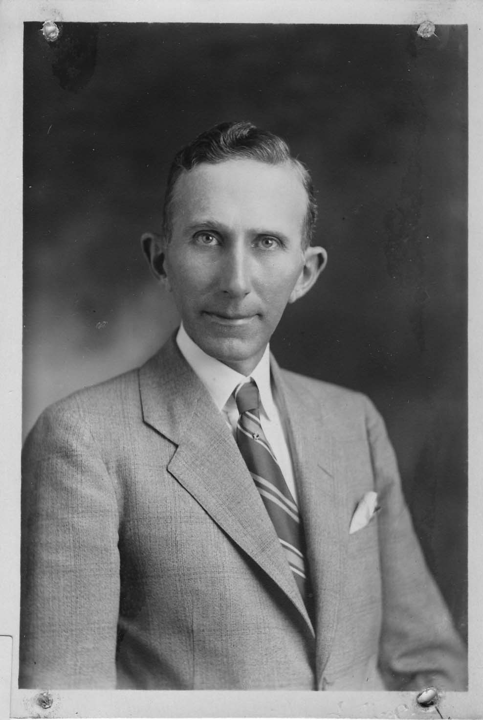
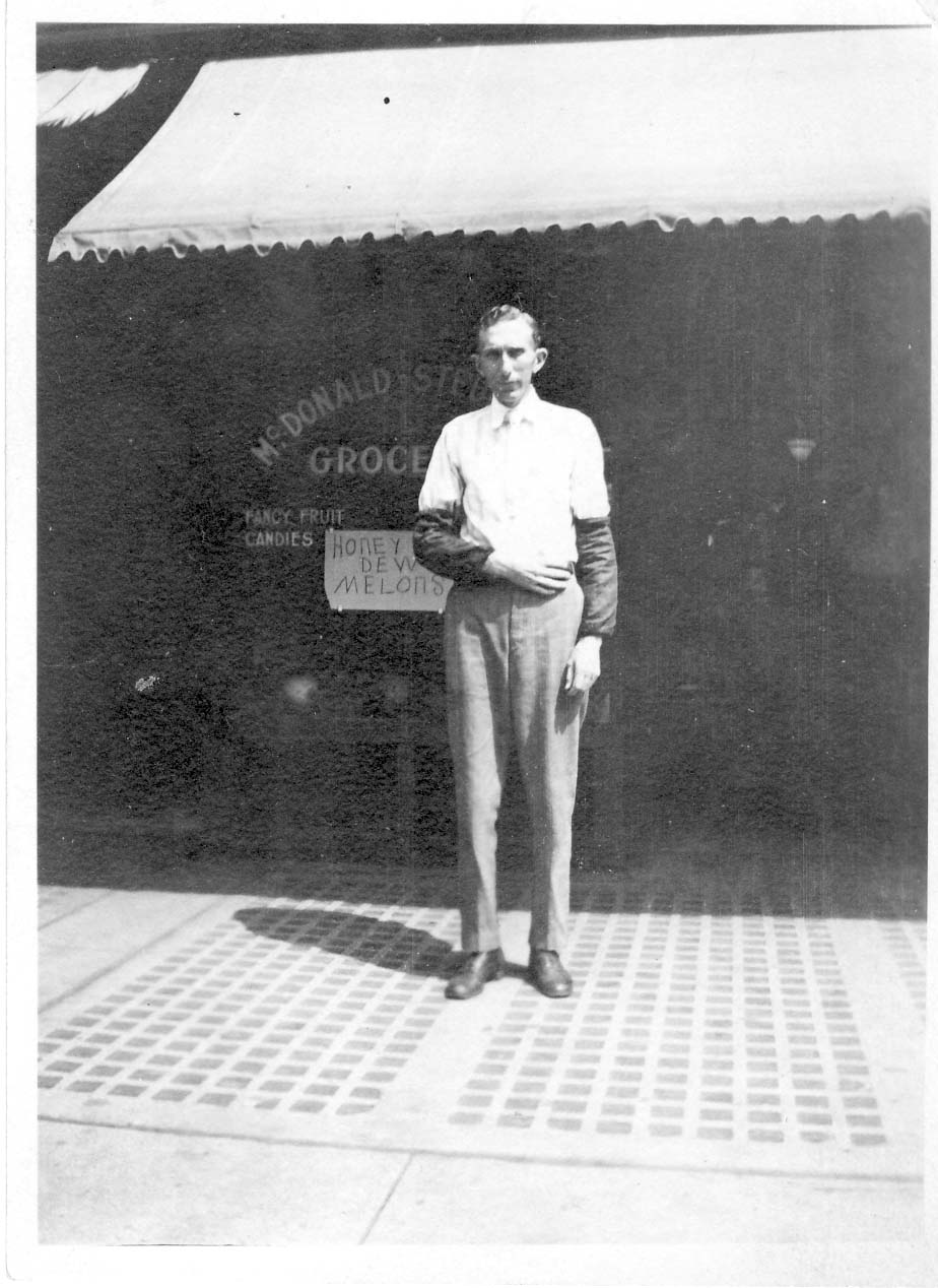
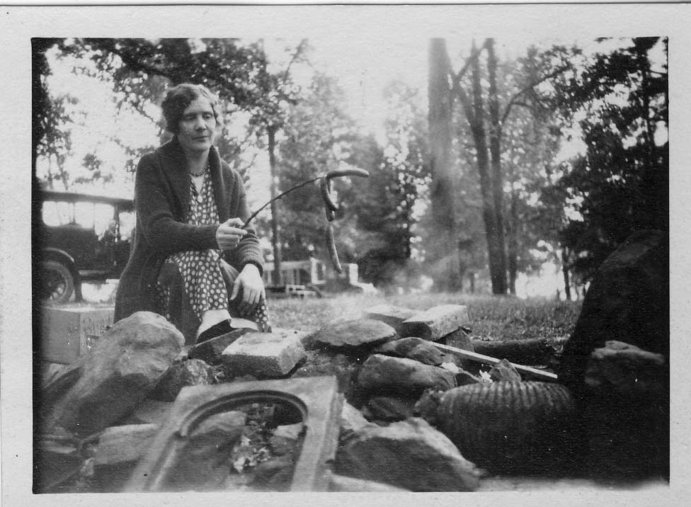
After his marriage, son Lindsey (1884-1971) lived with his wife Grace Hafford Ankrom nearby at 100 Walhalla. In the wintertime the two households could probably wave at each other across the ravine.
Estella (1888-1987) was Solomon and Lydia’s daughter. Estella never married, and probably lived in the 105 East Weber house until her death in 1987. She worked as a bookkeeper for Columbus Pharmacal on 326-336 Oak Street.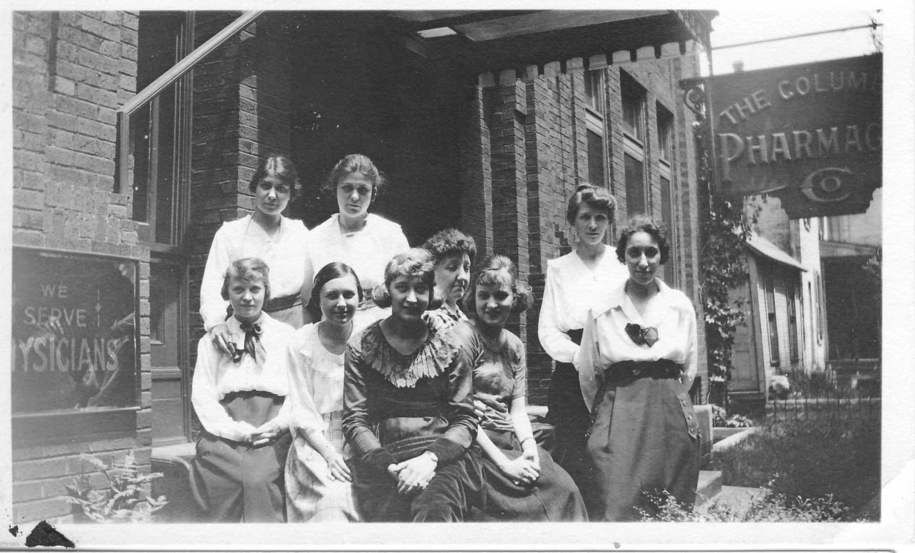
The final member of the Ankrom household was Sunny the cat, life dates unrecorded. Here’s Sunny enjoying Lydia’s lap with Lindsey and possibly Estella.
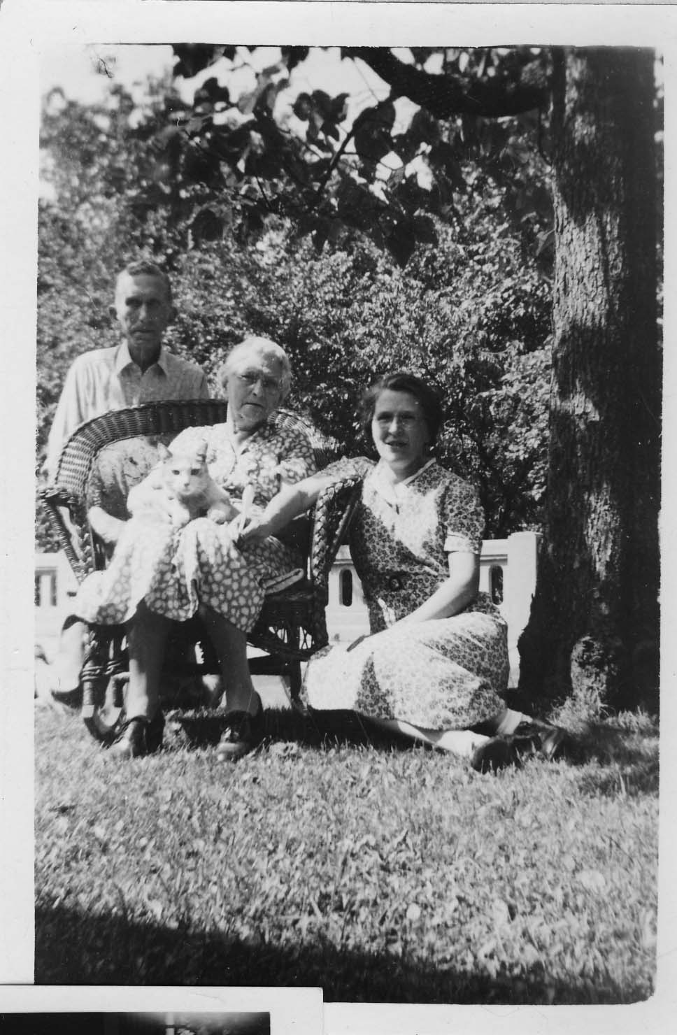
(Photos courtesy of Tom and Margo Thacker.)
100 Walhalla
In another entry on this web site, I mentioned that Lindsey and Grace Hafford Ankrom lived at 100 Walhalla with Grace’s sister Helen. Scott Hawley subsequently sent me some additional photos of the family and their home. Grace Hafford is Scott’s grandfather’s (Howard E. Hawley Jr.’s) aunt.
 This studio picture is Helen Hafford, in 1901. Like her sister Grace, Helen was a school teacher. (Photo courtesy of Scott Hawley.)
 This studio picture of Grace Greenwood Hafford (1883-1975) was taken in Chicago, Illinois in Jan 1909. (Photo courtesy of Albert Muth, Livonia, Michigan.)
 Lindsey and Grace after their wedding, with niece Genevieve Hawley (later Genevieve Muth) serving as flower girl, at 100 Walhalla. (Photo courtesy of Albert Muth, Livonia, Michigan.)

Lindsey in front of 100 Walhalla. (Photo courtesy of Scott Hawley.)

Another picture of Lindsey and Grace, taken in September 1965 at the Howard Hawley Sr farm on Miller-Paul Road in Harlem Township, Delaware, Ohio. (Photo courtesy of Albert Muth, Livonia, Michigan.)

Grace and Lindsey on one of their birthdays, taken in the Hawley home on Piedmont Road. (Photo courtesy of Scott Hawley.)

This photo of the house at 100 Walhalla was taken in 1975 and was used in the advertisement for the sale of the home. (Photo courtesy of Scott Hawley.)

And one more of 100 Walhalla presumably in the 1930s or 1940s. (Photo courtesy of Scott Hawley.)
Never Too Many Cookes…(the article)
I wrote this article for the Clintonville Historical Society newsletter and am reproducing it here for your convenience…
Never Too Many Cookes…
by Shirley Hyatt
© Shirley Hyatt
We often think of Clintonville as having been established in 1847 near the intersection of Orchard Lane and North High Street on Bull family land, but we mustn’t forget that today’s Clintonville extends north to Worthington, and that other families contributed significantly to the development of Clintonville’s northern reaches.
One of the most vibrant little communities was centered near the intersection of today’s Henderson Road and North High Street (or more precisely, Cooke Road and North High Street). In streetcar days this was known as Cooke’s Corners, because it was established by the extended Cooke family.
Roswell Cooke came to Ohio from Connecticut in 1800 with his wife and five children. The two oldest sons, Chauncey and Rodney, took up adjoining land in the vicinity of today’s Henderson Road and North High Street. At the time the land was densely wooded, and the Cookes had to clear the land to establish their farms. By 1827 they operated large productive farms, had built grist and saw mills along the Olentangy River (near Weisheimer Road), and also operated a distillery.
Roswell died in 1827 at the age of 63. Son Rodney (1793-1833), a veteran of the War of 1812, married Laura Cowles and together they had nine children: Esther (married to L. J. Weaver), Roswell (m. Lorinda Skeels), Helen (m. John Good), Rosalia (m. John Webster), Rachel (m. William Buck), Laura (m. Lester Roberts), Rodney Romoaldo (m. Chloe Williams), Demon, and Henry C. (m. Abigail Taylor). Sadly, Rodney died when his youngest child was just 3 months old; wife Laura supported the family by working as a tailor. She herself lived until she was 73 years old.

Genealogies state that Henry C. was born “near Olentangy Park in 1825.” After his marriage to Abigail in 1852, he moved back to the old Cooke family homestead and gradually purchased property from the other Cooke heirs. Eventually he consolidated 300 acres of good productive farmland. Henry and Abigail had seven children: Clara (married to Wellington Webster of Findlay OH), Flora (m. J. L. Armstrong), Albert Clement (m. Lulu Brown), Edwin (m. Ella Haines), Mary (m. David Maize), Alice (m. Charles Hess), and Harry Lester.
Henry C. Cooke worked for awhile as a teacher, then as a farmer. He also went into the stock business (i.e. shipping stock). In 1879 he went into business with A. G. Grant to form Cooke, Grant, and Cooke, which constructed heavy masonry bridges. (This company’s projects may include the present Henderson Road bridge and a few others in the area.) Henry was one of the promoters of the Worthington and Columbus streetcar line. He was prosperous, and built a magnificent house along present-day North High Street at Deland Avenue. (You can see its photo in my book.)

I named the spouses of Henry’s children above to show how tightly knit the community was. The Webster’s family farm was south of the Cookes’ along today’s North High Street. The Armstrongs, the Maizes, and the Bucks, and Albert Clement Cooke, all lived a very short distance from Henry. Daughter Alice—a schoolteacher at the Clinton Heights school—had married one of the great-grandsons of Balser Hess and they lived in Henry’s grand home.
John Buck was one of the early pioneers who received a military land grant in the area; some records state that he sold the original Cookes their land. Descendents of John Buck had a market on North High Street; long-time residents still remember Buck’s market today, and short-time residents may still recall the Buck residence, an Italianate-style house just north of the northeast corner of Henderson and North High. The Bucks were related to the Cookes by marriage.
George Whipp came to the area with his wife and two sons from Maryland in 1833. Whipp had received 160 acres of land in return for military service, and he also purchased the mill property that had been built by the Cookes. (At some point in time the old mill on the river was called “Whipps Mill” and Henderson Road bridge was known as “Whipps Bridge.”) His son George (b. 1817) was initially a carpenter, and was credited with building many of the houses of Clinton Township. Son George married a neighbor named Lucinda Smiley in 1838, and they had 10 children (one of whom was also named George). The family farmed, and though much of the acreage was eventually sold off, the Whipp family continued to own a truck farm in the area. Old timers can still recall the big orange sign for Whipp’s Orange Mill, a fruit stand located at 4588 North High Street featuring fresh squeezed orange or pineapple juice. The Whipps were related by marriage to the Bucks. (Note: sometimes the family spells its name with one “p”.)
An article about this tightly-knit community warrants mention of two other families, the Aldrich family and the Phinney family. Orlando Aldrich (b. 1840) was a prominent judge, lawyer and OSU law professor. Aldrich was the first president of the Worthington, Clintonville & Columbus Street Railway Company and served in this position from 1891 to 1898; he subsequently held an office of the Columbus, Delaware, & Marion Electric Railway. Aldrich had purchased 23 acres of land on the southwest corner of Henderson and North High in 1882; it was a fruit farm called Maple Grove Farm. Aldrich had three great hobbies: horticulture, collecting great art, and collecting rare books about archaeology. He engaged in these avocations from his lovely house located about where Maple Grove Church parking lot is located today. According to artist and local historian Bill Arter, Aldrich had a magnificent view of the river and OSU campus from the turret of his house. This house was moved slightly, rotated, and completely revamped in the 1920s by subsequent resident Frank Sweigart. (For more information, see my web site, www.clintonvillehistory.com.) It’s from this farm that the area around Henderson Road and North High Street and the church get their names today.
Barnabas Phinney (ca. 1813-1899) came to the area in 1838, and purchased 60 acres of land near the northwest corner of today’s Henderson Road and North High Street. In addition to farming, Phinney was an investor in the toll road running from Columbus to Worthington, and in the electric streetcar company. He married Mary Smiley and was probably brother-in-law to George Whip. Their house was said to be majestic. They had no children, and after his death most of the property was sold. At some point (circa 1893) the house was sold to the Schreyer family, and then chopped into apartments. I would love to see a picture of this grand old home. In 1913 a fire broke out; the city fire department was called but there were no water lines that far from the city, and so the building burned to the ground. (Luckily, no one died in the blaze.)

By the early 1900s, this was a tight and thriving community. The houses were handsome. The Cooke family held annual reunions at the Cooke house—old photos show the family eating at long tables arranged in the shape of a “C,” and they kept an ongoing register with names of attendees and minutes. The community held plays to entertain each other, went sledding on today’s North High Street, went horseback riding along Indian Springs Drive, worked and had fun, and worshipped.
The original Cookes were said to be Universalists, but somewhere along the way most of them became Methodists. In 1842 Chauncey Cooke had leased a 32-foot by 99-foot portion of his land on the corner of Henderson and North High to the Clinton Township School district to be used for both education and religious purposes. A school house was built in 1878, and it was used by the Clinton Township School District as well as by local Christian worshippers. When Orlando Aldrich purchased his beloved Maple Grove fruit farm, his tract surrounded the school and church property, and Aldrich expanded the land dedicated for school and church purposes to three-quarters of an acre. In 1919, when the school district had ceased using the building for educational purposes, ownership of the building and land reverted to the Cookes. Family members agreed to sign quit claims, and the property was put into the hands of the Como Avenue Methodist Church until a neighborhood church could be formalized. In 1920 Maple Grove Methodist Episcopal Church officially organized and assumed ownership of the church they had probably long worshipped in.
The Cooke family had a family cemetery located on the southeast corner of Cooke and High. When Bishop Watterson High School was built in 1958, the graves were disinterred and moved to Union or Greenlawn Cemeteries.
Luckily the activities of the neighborhood were documented by Lulu Brown Ohsner–a Cooke family member, neighborhood resident and parishioner of Maple Grove Church who has since passed away—in some presentations to Maple Grove Church about 15 years ago. And, many Cooke and Whipp family members still live in the Columbus area, and have family photos and memorabilia. Henry C. Cooke’s contracting company Cooke, Grant, Cooke is still in existence; the current name of this company is the Fritz-Rumer-Cooke Co., Inc. It incorporated in Ohio in 1911, and still specializes in railroads and other general contracting. Sadly, most (though not all!) of the lovely homes owned by the Cooke family members have been torn down.
Clinton Heights Avenue Trivia
 I recently had the benefit of reading an abstract from one of the north-side-of-Clinton-Heights-Avenue residents.
A couple interesting things from the abstract:
Calumet Street, according to the abstract, used to be called “Oak Hill” before the name was changed to “Beech Hill,” and then changed to “Calumet.”
The alley along the north side of Clinton Heights traversed through the school property and then to North Broadway. I have often wondered about this vacated alley, which runs behind the properties along the north side of Clinton Heights Avenue and the south side of East North Broadway. It’s a recessed, ravine-like greenspace that doubtless has many city services running along its banks. You can see this alley in the 1910 and 1920 maps on my web site. The rumor passed to me by former Clinton Heights neighbors was that the North Broadway residents had petitioned the city to vacate this alley, but when the city approved the request, they gave the alley property to the residents of Clinton Heights Avenue instead of splitting it between the residents of the two streets.
The abstract gave me specifics of the vacating. By ordinance No. 38053 duly passed by the Council of the City of Columbus, Ohio, on May 2, 1927, the first alley north of Clinton Heights Avenue “from Beech Hill Avenue to the west line of lot 68,” 12 feet, wide, was vacated. (No indication in City Council minutes of who actually submitted the petition, and I have not bothered to look.) The City Council minutes are attached <here>.
More about the land that became Clinton Heights Avenue…
Henry Cooke once owned part of the property that was later developed into the Clinton Land Company addition.
I have often read an old anecdote that James Chesnut (sometimes spelled “Chestnut”), who owned the house on Wall Street, had blocked the improvement of North High Street along his property near Brighton and North High Street, because a beloved locust tree would be damaged or removed by the paving. The abstract bore some of this out. In the abstract (relevant pages linked here), the property developers were assessed $5400 for improvements in the Worthington and Columbus Plank Road, but, they said, these improvements were never made, because James Chesnut (and others) “were defendants procuring an injunction perpetually enjoining the making of said improvements along his premises.” The Clinton Land Company owners sued, or perhaps countersued, stating that they had been assessed conditional on improvement of North High Street, which improvements had not been made. Who won: You can read the attached excerpts of the abstract and decide for yourself.
3070 N High Street

Here is an amazing photograph of High Street, given to me by Stu Koblentz, who found this image in an old student thesis by Forest Ira Blanchard. The photo looks north, taken around 3070 North High. On the right (east) side of High Street I believe is the house of Mathias Armbruster, which later became the Southwick Good Fortkamp Funeral Chapel at 3100 North High Street at Weber and High. I’m told that some gravestones from the old burial ground are visible on the right. Check my book, Clintonville and Beechwold, for a better photo of this house. You can click on the image to see it in more detail.
[Citation: Blanchard, Forest Ira. 1922. An introduction to the economic and social geography of Columbus, Ohio. Thesis (M.A.)–Ohio State University, 1922. On January 16, I replaced the grainy version of this image on this web site with a higher quality photo after Joe Smith alerted me to its existence.]Chesnut House

And another amazing old photo of North High Street from Stu Koblentz. This photo also looks north, and was taken just south of the intersection of High and North Broadway. The house on the west (left) behind the little shack (marked “ice”) is the Chesnut house (aka Chestnut house), described in this web site’s “Water for Cookies” entry and also found in my book. The school on the east (right) side of High Street is the old Clinton Township school building, a picture of which is also in my book. You can click on the image to see it in more detail.
Stu’s theory about the Chesnut house is as follows:
The image shows the Chesnut house, facing North High Street, about where it currently stands. The facade that faces Wall Street today is the facade facing High Street. This is verifiable in the chimney placements.
So I went through Joe Testa’s web site and I think I know what happened to the house.
As far as I can tell the house stood approximately at 3327-29 North High Street. In the 1910s, when the house (which appears to have been built in the 1860s or 70s) is pictured, the house had been moved on a pivot to its current location, with its northeast corner remaining close to its original placement. This would account for the front lot build out, the twist in the alley and the sudden reemergence of Wall Street as well as the placement of the house in the picture, and the current location of the house.
What is interesting to me is why did they go to all that trouble, when its fairly common in urban settings to build a street facade onto a house and call it a commercial building. I think that part of the reason is that the house sat further back from High Street, making it too far away to convert to a commercial space commonly found in that era.
Update 2025-08-25 by Shirley–Another possible reason for reorienting this house might be found here.
Water for cookies
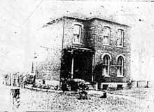 The township school located at Clinton Heights Avenue and North High Street did not, originally, have running water. Every day a child was designated to carry one bucket and dipper across High Street to the Chesnut house (see page 12 in my book, Clintonville and Beechwold) to fetch water that would be shared by the students. Legend has it that there were no lack of volunteers for water duty, as Mrs. Chesnut (or perhaps it was her daughter Fannie) always had cookies for the volunteer. This is a bad, yet significantly older, image of the Chesnut house.
Sears houses


From 1908–1940, Sears, Roebuck and Co. sold “kit” homes through their mail order catalog. Customers chose a house from the catalog, and all the materials–precut lumber, carved staircase, nails, varnish, and instructions–would be shipped by railroad for homeowners to build themselves. The craftsman-style house at 149 Kelso was offered between 1911-1921 as “The Elmwood” in Sears’ catalog. (Photo courtesy of Lynn McNish)
James Boyd Martin
 The North Broadway Methodist Church (built 1924) was designed by architect James Boyd Martin, who also designed his own house at 190 East North Broadway. His home is complete with an architecturally-consistent play house to the rear. Martin’s house was made of Indiana Limestone with green roofing tiles. (The original plans for the church called for limestone as well, but changed to brick for budget reasons.) Martin also built the house at 155 North Broadway as a wedding gift for his daughter. His son, Boyd Gibson Martin, eventually joined the architectural firm (Martin, Orr & Martin) and designed his own house at 256 East North Broadway as well as the Worthington Presbyterian Church (in 1927) and the Worthington and Westerville Libraries. Sadly, the Great Depression put the architectural firm out of business. (Photo courtesy of Lynn McNish)
Mooney house
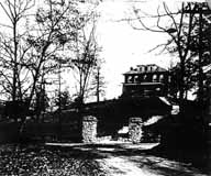
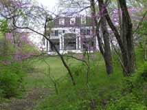
The white house visible from Calumet Street over the Walhalla Ravine bridge has such strong neighborhood presence. It was one of the first houses built along the ravine. It’s now known colloquially as the “Mooney House” after a physician who lived there for many years. Though rumored to have been the site of a tragedy and to be subsequently haunted, the rumor is most definitely false.
Sarah Breunig, community leader
 This house at 200 Glenmont is now gone, but it originally belonged to Sarah Breunig and her husband. Sarah moved to Clintonville as a young wife, before Glenmont was paved and before indoor plumbing. Sarah became one of the original community leaders of the Overbrook area. Sarah was a founding and active member in the Maple Grove Methodist Church, the Glenmont Community Club, Navy Mothers, and the Clintonville Women’s Club. She became the first female president of the Glenmont Community Club in 1968. (Photo courtesy of the Kerchner family)
Stella Wilson house
 The Glenmont Community Club first met on March 2, 1921 at 45 Glenmont to “discuss improvements pertinent to the community.” It met at the Stella Wilson home; Stella was head of the science department of the old High School of Commerce (later known as Central High School) and had purchased the house in 1920 at the age of 58. Miss Wilson served as secretary and remained a primary force in the Glenmont Community Club until her death. Stella’s sister Ida was a physician; Ida acquired the house in the 1930s after Stella died. (Photo courtesy of the Kerchner family)
Patterson House
Novak Funeral Home is today a handsome presence along High Street. The house was built in 1927 by a man named B. F. Patterson, who also built two other near-identical houses on East Dominion for his children—one of brick, and the other a frame colonial house. (Florence Patterson Ruine lived at 27 E Dominion, a Dutch Colonial.) The house’s architect was V.S. Julian. Patterson was politically active and at one time ran for mayor of Columbus. The house was at one time surrounded by a wrought-iron fence. In 1953 the building became Beechwold Nursing Home, an enterprise which was closed in 1980. The building sat empty for 7 years. Novak purchased it and rehabbed the building, an effort requiring 13 months and who-knows-how-much money.
Gordon Brevoort’s Chickentown
 Several years back, Gordon Brevoort gave a wonderful presentation to the Clintonville Historical Society about he and his family’s life in Clintonville. The Brevoorts are one of Clintonville’s oldest families, and some still live in the neighborhood.
Gordon told the listeners about Chicktown, the fantasy land he and his friends played in.

The old Brevoort homestead has been torn down but I liked the old image of it. (There is a picture of it on page 12 of my book). More from or about the Brevoorts here.
(Documents and photo courtesy of Gordon Brevoort)
Gordon Brevoort’s Clintonville
 In another post, I mentioned that Gordon Brevoort had given a presentation to the Clintonville Historical Society on the history of Clintonville. He also made a map of the community as he remembers it in the 1930s.
You’ll find other information on this web site about the Brevoorts by clicking here.
(Map courtesy of Gordon Brevoort and the Clintonville Historical Society)
East Como
 Perhaps the first house to be built on East Como was this house at 71 East Como. The owner from 1908-1926 said he recalled a little brook that ran near the house and a footbridge leading to High Street.
The Zimmerman Family and Olympic Swim Club
Libby Wetherholt recently gave this presentation about the Zimmerman family to the Clintonville Historical Society, and has kindly agreed to share it with us.
—
The Zimmerman Family and Olympic Swim Club
by Libby Weatherholt, March 8, 2016

The History of the Olympic Swim Club starts with Orr Samuel Zimmerman. (Photo courtesy of the Upper Arlington Historical Society)
Orr S. Zimmerman was born in Oakwood, Ohio in 1890 but moved to Columbus with his family when he was a child. He was educated in engineering at Ohio University and transferred his interest in mechanics to a career in the family automobile business.
In 1913, Zimmerman married Ethyle Cather, a native of Athens, Ohio. They moved to this house at 645 Dennison. (Photo courtesy of the Franklin County Auditor’s web site, property ID 010-044708 4/27/2014)

By 1916 the Zimmermans had begun building the house below at 1790 Cambridge Boulevard. (Photo courtesy of the Franklin County Auditor’s web site, property ID 070-000571 4/18/2014)

An historical picture can also be found on the Upper Arlington Historical Society web site.
The birth of their sons Robert Orr Zimmerman and Richard S. Zimmerman followed in 1918 and 1922, respectively.
By 1930, Audrey Ethyle Zimmerman had passed away and Orr had married Alice M. Zimmerman. The family had moved to 4497 Olentangy River Road—a house that remained an important part of the family history. (Photo courtesy of the Franklin County Auditor’s web site, property ID 010-006577 3/17/2014)

Zimmerman built the house in 1929 on what was then a 52-acre estate; at the time, Henderson was a country gravel road and Olentangy a narrow two-lane street. The architect was Thomas Tulley. Interior walls were decorated by a New York artist, with beautiful wooded scenes in both the trophy room and the living room. Two Canadian bear cubs, captured on a hunting trip, were raised in a small house on the property. In 1977 the house was a Decorators’ Show House. The house was destroyed in January, 2016.
Mr. Zimmerman had a special interest in outdoor sports, particularly hunting and fishing. Zimmerman’s hunting expedition in the Canadian Rockies with Upper Arlington founder and resident Ben Thompson was detailed in a November 1920 issue of the Norwester, complete with descriptions of the large game seen and hunted by the pair in British Columbia. Zimmerman submitted his own account of the trip to the Norwester, documenting the geography and vegetation of the region. (The Norwester magazine, published November 1917 through March 1922, chronicled early suburban life in the Upper Arlington, Grandview Heights, and Marble Cliff areas.)
Zimmerman also enjoyed pitching horseshoes and playing baseball. In 1920, he served as captain of the Upper Arlington “Lobsters” who battled the rival “Crabs” in the village baseball tournament. Mr. Zimmerman personally donated the “Zimmerman Cup,” the trophy awarded to the winning baseball team. He was also a member of the Upper Arlington Fishing Club and the president of the Upper Arlington Gymnasium Club, which oversaw the organization of indoor sports such as hand ball and volley ball. He was active in the Kiwanis and Athletic Clubs, and served as director of the Columbus Auto Trade Association.
The 1915 City Directory documents that Orr S. Zimmerman and Walter B. Charles owned Ohio Auto Sales Co. at 772-774-776 North High Street.

On June 30, 1941, Thomas Tully and Orr Zimmerman filed for a patent titled Means for producing formed strips of plastic materials, US 2323862 A. The patent was granted on July 6, 1943.
Richard Zimmerman married Dorothy Rupp, his high school sweetheart. They were parents of three children: Lynda, Ric, and Dan
Richard S. Zimmerman and his father, Orr Zimmerman, purchased the Olympic Beach from Frank Hauf in 1938, the same year it was built. The pool remained under ownership by members of the family until it closed in 2014.
Newt Jones, one of Richard’s grandchildren, purchased the Olympic Swim Club from his grandfather for $325,000 in 2002. Richard died shortly after on October 23, 2002 at the age of 81.
In 2014, Columbus Monthly Magazine staff picked Olympic Swim Pool as Columbus’ “best pool for athletes”:
For athletes: Olympic Swim Club
Built in 1938 and originally known as Olympic Beach, the Olympic Swim Club is a Columbus classic. Ohio State divers and swimmers practiced here in the ’70s and ’80s. Even Buckeyes football players would spend their off days at the club. After 76 summers, though, this is the Olympic’s last. “It was a business decision, but a very emotional and very sad one,” says third-generation owner Newt Jones, who has owned the Olympic for the past 13 years. Don’t miss your last chance to dive off the club’s rare 16-foot diving platform and experience a piece of Columbus history firsthand. “We just want people to come out for the last summer and enjoy it,” Jones says.
The following item comes from Shirley Hyatt’s Clintonville History web site:
Will You Swim in Pure Water?
I love this ad for Olympic Beach in 1939. “Of interest to the ‘bathers’ of Northern Columbus is the care and precaution the management of the Olympic Pool is taking so that our families may swim in perfectly safe water, free from impurities and its dangers…“ Shortly after the pool was built, the Olympic Amusement Corporation, headed by Orr Zimmerman, assumed ownership of the pool. For many years the O.S.U. swimming and diving teams practiced there and many contestants for the summer Olympics came from all over the United States to train at the pool. Several national championships have been held there. Early on, only male lifeguards worked at the pool.
Here, someone does a kamikaze dive off the tallest tower.
(Photos courtesy of the Zimmerman family)
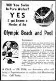 I love this ad for Olympic Beach in 1939. “Of interest to the ‘bathers’ of Northern Columbus is the care and precaution the management of the Olympic Pool is taking so that our families may swim in perfectly safe water, free from impurities and its dangers…“ Shortly after the pool was built, the Olympic Amusement Corporation, headed by Orr Zimmerman, assumed ownership of the pool. For many years the O.S.U. swimming and diving teams practiced there and many contestants for the summer Olympics came from all over the United States to train at the pool. Several national championships have been held there. Early on, only male lifeguards worked at the pool.
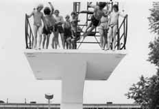
 One of the early reasons for Olympic Pool’s notoriety and draw was its double platform diving board and its dive pool. The double platform survived into the 1990s, at which time the higher platform was removed.
The following images are from the Olympic Swim Club’s Facebook page.


Gilbert Hamilton House
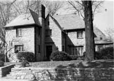 This house was built by Gilbert Hamilton, a real estate developer, in 1927. It sits on Glen Echo Ravine. The Gilbert Hamilton House is a lovely example of a Tudor Revival house, and displays old construction methods and design. The house is on the National Register of Historic Places. (Photo courtesy of the homeowner)
Zimmerman House
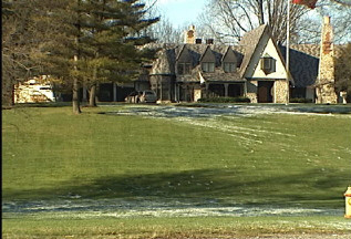 Orr Zimmerman, who owned the Olympic Swimming Pool, owned the Tudor-style house that still stands on the northwest corner of Henderson and Olentangy River Road. Zimmerman built the house in 1929 on what was then a 52-acre estate; at the time, Henderson was a country gravel road and Olentangy a narrow two-lane street. The architect was Thomas Tulley. Interior walls were decorated by a New York artist, with beautiful wooded scenes in both the trophy room and the living room. Two Canadian bear cubs, captured on a hunting trip, were raised in a small house on the property. In 1977 the house was a Decorators’ Show House.
Log houses, log cabins
Don Hutslar, in his book Log Construction in the Ohio Country 1750–1850, differentiates between log cabins, which were intended to be temporary, and log houses, which were intended to serve as a home and were consequently sturdier, larger, perhaps taller. I wonder how many log homes there are in Clintonville, covered by contemporary siding. I have been told that there is one at 232 West North Broadway, on the north side of West North Broadway, east of the river.
Elks Country Club
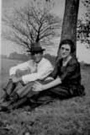 I loved the story of Lawrence Huber (1893-1958) and his wife Eunice Louise Dougherty (1900-1986). Lawrence had applied for a job at the Elks Country Club. They told him they wanted the incumbent to be married, so he asked his girlfriend Eunice to marry him. She accepted and they married in 1922–and remained married the rest of thier lives.
Huber, under the direction of Donald Ross, helped to construct the Elks Country Club golf course, which was located north of Morse Road and east of High Street to Indianola Road. Huber eventually took 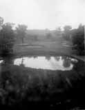 over the position of groundskeeper when the course opened the following year. Lawrence and Eunice, and their three children, lived in a residence on the Elks Country Club property while Lawrence was employed there. Huber was extremely innovative, and invented equipment as needed to cultivate and care for the greens. (Photo courtesy of Betty Huber)
All about the barn
I love the story of the concrete block building near Brighton and Milton just south of West North Broadway. Miles Elmers owned AGI, a business that he situated in this concrete barn during the 1930s. Elmers contracted with Monsanto to test and package a low-sudsing detergent. When Monsanto decided to discontinue the product, Elmers purchased all rights to it, renamed, repackaged and remarketed it…and “All” detergent was born.
There are rumors that the building was once a candy factory, that the owners gave out candy from this location, but I was unable to confirm this. It is presently a private residence.
When the Elmers family owned All, they had to travel to the various plants around the country, and so they worked with the Flexible Bus Company to customize a bus to make their travels more comfortable. People along the way asked them where they got the bus/RV, and asked them to replicate it. The result was a new business for the Elmers family: Custom Coach.
Flora Ohaver
 Flora Ohaver was one of the oldest residents of West North Broadway, and so she was selected to be one of 4 people to cut the ribbon dedicating the new Broadway bridge on December 1, 1939. She and her husband built their house at 263 West North Broadway in 1908. Her nephew Bob returned to live at this address on West North Broadway as well; his oral history is located on this web site. Bob passed away in June 2009.
Robert Ohaver (1937-2009)
Robert Ohaver (b. 1920) lived most of his life in Clintonville and on West North Broadway. He had many stories of old Clintonville to share with us. On September 12, 2003, several community members (Ann and Alan Woods, Barbara Hotchkiss, Nancy Kuhel) interviewed him and preserved the conversation on tape. Now you, too, can listen to Mr. Ohaver’s oral history.
Sadly, Bob Ohaver passed away on June 11, 2009. You can find his obituary here. There is another small entry about his aunt on this web site here.
Bob mother was Laura Ohaver and his father was Walter Harvey Ohaver. Bob also had an older brother named Jack Ohaver who lived in Clintonville at 116 E. Dunedin with his wife Clara Ohaver. Clara passed away May 24, 1993, and Jack passed away on June 14, 2000. Jack and Clara had two daughters. Sue Bowman was born May 8, 1940; she passed away January 4, 2000. Sandra Urban born July 30, 1945. [This family information came to me from Jack’s granddaughter and Sandy’s daughter, Lisa Adkins. Thanks, Lisa!]
Each file is about 30 minutes long.
Contents
Track 1.
Brief Ohaver biography; origins of his family moving to West North Broadway; his World War II years; Clinton Theatre; businesses and homes at the interesection of North Broadway and North High Streets; drugstores and candy stores in Clintonville; the house behind 3391 North High Street; Dispatch carrier’s substation; Olentangy Park; the streetcar storage barn at Arcadia.
Track 2.
Olentangy Park cont’d; street fair at North Broadway and High to celebrate Clinton Theatre, the opening of Clinton School pedestrain subway, and the paving of North High Street after a new sewer line had been installed; the Olentangy River; 3 canoe clubs; development of West North Broadway (“the Broadway Extension”) and the Scott farm; development of the area along the adjoining river bank; the Herron [spelling uncertain]/Zinn home at 285 West Kenworth; Bill Moose AKA “Indian Bill”; Chief Leatherlips.
Note: the “Dr. John Scott” is William H. Scott, president of OSU 1883-1895. See my book, page 17, for a photo of his house.
Track 3.
Chief Leatherlips cont’d; house at 273 Erie Road and excavation of nearby gravel pit; the Fuller farm/Whetstone Park; rambling through the woods; Indian Springs golf course; Bill Moose AKA “Indian Bill”; Olentangy Park; North Columbus including the Ramlow Building; Picadilly Theatre; streetcars and interurbans.
Track 4.
Southwick funeral home; Joy Hunt home; Graceland Shopper’s Mart and Patrick Murnan; Clinton Theatre; the Great Depression; Ohaver family; Brighton Road development; Ohaver’s WWII and postwar years.
Track 5.
Ohaver’s return to Columbus from California in 1962; bombing of the Clinton Theatre in the 1930s.
Weisheimer Mill
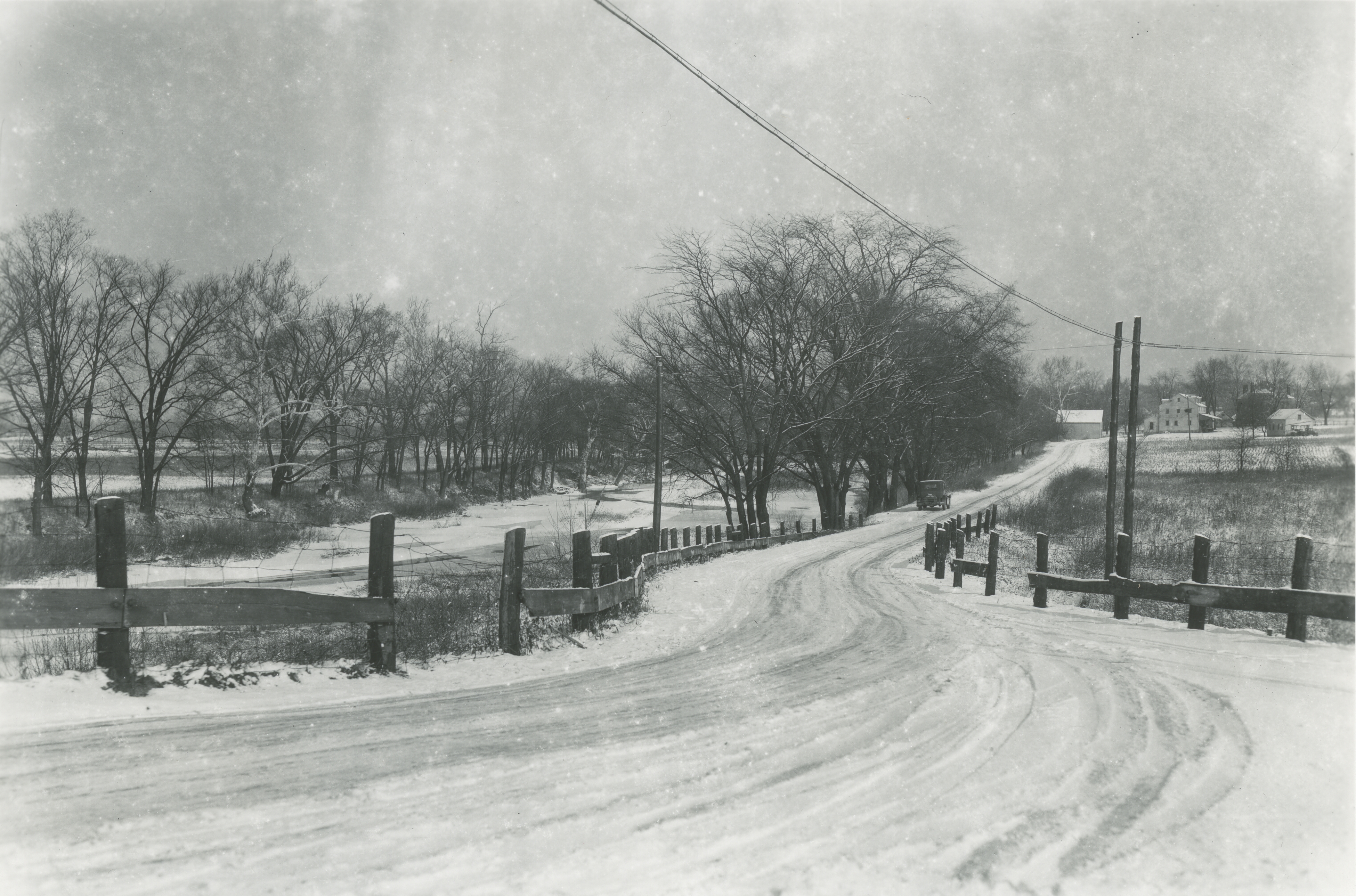 A wonderful picture of the Weisheimer Mill including the Jacob Weisheimer home (which still exists) and other buildings at the mill complex. The photographer would be looking north up Starrett Road to Weisheimer Road. You can click on this image to see the distant details. I show some other images of the mill and Weisheimer homes on pages 21-22 of my book. (Photo courtesy of the Columbus Metropolitan Library.)
Lustron Houses
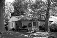 Between 1948 and 1950, the Columbus-based Lustron Company made 2,500 all-steel, prefabricated houses and shipped them nationwide. Unlike the more traditional architecture of Sears homes, Lustron houses offered a sleek, modern aesthetic. They were easy to maintain, and affordable. Despite a backlog of orders, the company went bankrupt in 1950. There are 4 porcelain-steel Lustron homes in Clintonville; this one is located at 272 East Weisheimer. (Photo courtesy of Lynn McNish)
Accident at Overbrook and High Summit and Maynard, 1948
Revised post!
These two photographs were found among the papers of Kenneth Hauer, a local photographer who had a studio on North High Street. The photos were taken in 1948 at the intersections of Summit and Maynard.
 The first photo is taken from the west side of the accident, looking toward the businesses on the northeast corner of the intersection of Summit and Maynard. The building’s address is 2336 Summit Street.
 The second photo is taken from in front of that business building, looking west/northwest.
Now to be clear, in my original post I got it all wrong! Larry L Lower was instrumental in discovering the location of Kenneth Hauer’s accident pictures. (Previously, I’d placed the accident at 4139-4147 North High–though admittedly the buildings there today have significant differences from the old photos–because I couldn’t find any other location and Kenneth Hauer’s studio was at 4139 North High.)
I do not how many hours Larry worked on this but he deserves some sort of prize! He said,
The storefront property in your photo matches an existing building on the northeast corner of Summit and Maynard. Across the street on the northwest corner are two buildings that match the two buildings in your second photo.
The storefront photo shows First National Cleaners in the far left store front. The 1947 Polk city directory showed a business of the same name in the same position of the building at Summit and Maynard, which is 2340 Summit.
Summit and Maynard are one-way in 2012. They were two-way in 1948. That would explain the direction of all of the automobiles in your photos.
Larry undoubtedly got it right; both the building and the houses across from this building match the photos that Kenneth Hauer took exactly. Thanks, Larry! (Note: you can compare the 1948 pictures with the intersection today using Google’s Street View.)
Other readers: Charles (Coryn), Nina, Bob, Terry (Seidel), and Genie (Hoster) also contributed critiques and/or theories of how to solve the puzzle. Without doubt my original post, wrong as it was, garnered more comments than any other post on my web site.
You can click on the photos to see them in more detail. (Photos courtesy of Marge Hauer.)
Original post:
These two photographs were found among the papers of Kenneth Hauer, a local photographer who had a studio on High Street. The photos were taken in 1948 at the intersections of Westwood and Overbrook and North High Street. I have compared the photos with the same location today, and remain puzzled (Note: you can do this online using Google’s Street View.
The first photo is taken from the east side of the accident, looking toward the businesses on the southwest corner of the intersection of Westwood and North High Street.
The second photo is taken from in front of that business building, looking east/southeast. I’m amazed at the houses that are shown on the east side of High Street. Today, these houses are no longer there—and the land where the houses sat does not exist anymore, either. Today, the land falls away steeply into Overbrook Road and Ravine.
Could the land have changed this much?
Another snippet: I’m told that there used to be a “party house”—i.e. a building that could be rented for parties–just south of this location.
You can click on the photos to see them in more detail. (Photos courtesy of Marge Hauer.)
D. H. Bradley, Veterinarian
Jan Bradley Zenisek shared these two family pictures with me. Her father, Dr. D. H. Bradley, operated his veterinary clinic on the ground floor of the home originally built by Henry Cooke and shown in my book and here. The Bradley family lived upstairs.
 The photo on the left shows Jan’s mother, Ellen May Bradley, with Jan in 1941.
 The picture on the right shows Jan’s father (Dr. Bradley) holding Jan’s cousin Neal Cooper, and Jan’s grandfather George Cooper with Jan, outside the clinic/house in 1943. (Photos courtesy of Jan Bradley Zenisek.)
The house was later destroyed to make way for a car dealership. Jan salvaged the lovely arched windows and they now adorn her Riverlea home.
Adena Earthwork
 It breaks my heart to learn about the Overbrook Ravine Earthwork (an Indian Mound) located at the southeast corner of Yaronia and Wynding Drive. The earthwork consisted of two earthen mounds surrounded by a 400-foot diameter circular earthen embankment, built over 2500 years ago. Though the city and developers were glad to build a park around the mounds, residents worried about traffic such a park would draw. In 1953 the mound was destroyed to make way for housing construction. (Map courtesy of Franklin County Engineers)
Dispatch holiday contest
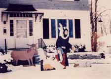 In a previous post, I mentioned that Engine House 19 won the Dispatch’s annual holiday decorating content. This house at on East North Broadway won the contest three years in a row. (Photo coourtesy of Judy Kress)
Immaculate Conception Church Neighborhood
An October 15-2010 note from Joe Motil:
There was a large 3 story barn located behind the property across from Immaculate Conception Church. Attached to this barn was also a residence. The name of the family that lived in this residence was “Butts”. This would have been around 1966. I have a photo from my families back yard at 360 Clinton Hts. of the top of the barn. The barn burnt down sometime in the early 80′s or late 70′s I believe. There was also a small barn behind the brick house on the south side and about 3 or 4 house east of Calumet. Sorry I don’t have the address at hand. It was tore down maybe in the late 70′s and a new garage is currently there.
There’s an update to this information here.
Fire! On East North Broadway
About a year ago, Joe Motil sent me some information about a fire on East North Broadway:
There was a large 3 story barn located behind the property across from Immaculate Conception Church. Attached to this barn was also a residence….The barn burnt down sometime in the early 80′s or late 70′s I believe…
I happened to have some friends who had also grown up in that area so I asked them for some additional information. That barn behind the house on E.N. Broadway was indeed located behind the house they lived in, 379 East North Broadway. It burned approximately October 1976. A young doctor’s family lived there. They had photos! which I’m sharing with you here. (Photos courtesy of Kristin Farrell-Logsdon and Mark Logsdon)


Joe Motil then countered with some information and images of his own. In the first photo below, the top of the barn (Cantlon and Farrell families) can be seen. This picture is looking north from the backyard of Joe’s home at 360 Clinton Heights Avenue, and was taken on his dad’s 50th birthday August 12, 1974. The elevation of the property in which the barn sat was higher than that of Joe’s backyard. The snow covered yard and garage picture of Joe’s backyard was taken on March 13, 1958. (Photos courtesy of Joe Motil)


East North Broadway


For the residents of East North Broadway, widening their roadway has been a seemingly endless struggle of defending their property against City Hall. Joyce Schatz–for many years an officer in the East North Broadway Street Association–has kept an archive of the issue, and I’ve linked to it here.
The city claims the right of way is 100 feet. Some research shows that it is 70 feet. Residents’ deeds and surveys are all over the place. Some have 15’ listed, many don’t, including recent purchasers. The majority of the parcels at the end of the street do not have the 15’ easement in their deeds. The deed to Steve and Ann Wilson’s home (one of the three slated to lose their yard), specifically includes the footage and states “…Together with the Fifteen (15) feet off the North Side of East North Broadway vacated by resolution of the County Commissioners of Franklin County, Ohio, on October 7, 1952.”
For those of us who don’t live on East North Broadway, the issue is less “Can the City do it?” but “Should the City do it?’ For the time being, the city is not actively pursuing the widening.
Clintonville’s Historic Inventories
Historic Inventories are brief “snapshot” assessments of buildings to determine whether the buildings are of historic interest. Just 1 or 2 pages in length, an inventory is intended to provide a brief description of the location, background, and architecture of a building, site, structure, or object of architectural or historical significance.
The inventories have been written by students or by dedicated residents such as those in the Old Beechwold area, under the auspices of the Ohio Historical Society Historic Preservation Office. (The Beechwold residents did an especially terrific job of inventorying their neighborhood.) For more information about Ohio Historic Inventory Program, click here.
I’ve made a map of the places in Clintonville that have been inventoried; click on the thumbnail to the right to see it.
Linked below, in PDF format, are the historic-inventories for buildings in Clintonville as of July 2008.
Old Beechwold:
Old Beechwold Historic District Nomination
4765 North High, aka “the Gatekeeper’s House,” and also this version
4475 North High
44 West Jeffrey Place
177 West Jeffrey Place
30 West Beechwold
62 West Beechwold
80 West Beechwold
100 West Beechwold, and also this version
150 West Beechwold
209 West Beechwold
4783 Olentangy Blvd
4793 Olentangy Blvd
4805 Olentangy Blvd
4817 Olentangy Blvd and also this version
4820 Olentangy Blvd
4827 Olentangy Blvd
4831 Olentangy Blvd
4837 Olentangy Blvd
4935 Olentangy Blvd
23 West Riverview Park
75 West Riverview Park
81 West Riverview Park
121 Riverview Park
197 Riverview Park
157 Rustic Bridge
222 Rustic Bridge
4787 Rustic Bridge
4795 Rustic Bridge
4857 Rustic Bridge
4866 Rustic Bridge
4876 Rustic Bridge
4 West Royal Forest
52 West Royal Forest
91 West Royal Forest
115 West Royal Forest
128 West Royal Forest
201 West Royal Forest
North Broadway:
65 East North Broadway
77 East North Broadway
150 East North Broadway
155 East North Broadway
162 East North Broadway
177 East North Broadway
456 East North Broadway
489 East North Broadway
Elsewhere in Clintonville:
3119 North High
3377-3381 North High (Clinton Theatre)
3783 North High
3535 North High
149 East Kelso
45 East Crestview
238 Crestview
129-131 West Weber
259 Walhalla
334 Walhalla
224 East California
91 West Longview
191 West Delphi
314 West Kanawha
163 Kenworth
203 Kenworth
265 Kenworth
285 Kenworth
289 Kenworth
629a Oakland Park
645 Oakland Park
189 Northmoor
3624 Weston Place
214 Arden (a Lustron home)
100 Webster Park
213 Webster Park
7 West Henderson (Maple Grove Church)
45 Weisheimer
239 Weisheimer
286 Weisheimer
And (technically) just south of Clintonville:
100 Arcadia (Old North High School)
Glen Echo United Presbyterian Church
290 Cliffside Dr
17 West Dodridge
44 West Dodridge and 44 West Dodridge
96-98 East Dodridge
Housing Subdivisions
 Paul Bingle created this map of Clintonville housing subdivisions several years ago, and I’ve digitized it for this web site. Click on the thumbnail to the right to bring up the full-sized map, and then put your cursor over each blue number to bring up the name (and when available, the year) of each housing development. You can also click on the thumbnail “key” to see Paul’s original key.
(Research and original map by Paul Bingle.)