Home
Baseball at the Zoo
 The zoo in Beechwold may have been one of the earliest sites of the Columbus Clippers!
According to Joe Santry, Historian at The Columbus Clippers, “In 1895 the Columbus Statesmen opened the season playing at The Zoo Baseball Grounds. The grounds were owned by the Zoological Garden company. Could this be the old zoo grounds in Clintonville? …The team played at the Zoo Grounds for a couple of months before moving to Recreation Park in German Village…
“In 1895, according to the local papers, Columbus played at ‘the Zoo Grounds’ (May 21), ‘Zoo Baseball Park’ (May 4), ‘Zoo Park’ (May 5). There are stories about temporary grandstands, then a ‘new grandstand’ (May 12).
“By June 1, however, the OSJ reports that the club now ‘holds the lease on the Schiller street grounds’ and the club ‘will play the last game on the Zoo grounds this afternoon and the work of removing the grandstand, bleachers, and fences to Recreation Park’ will follow.
“The problem is how inconsistently the papers reported the games that season. The more I research this the more I think the Zoo Grounds park was in or near some type of amphitheatre on the zoo grounds. The park had other smaller attractions prior to 1905.”
Scott Caputo, librarian at the Columbus Metropolitan Library, found this article in the 8-8-1904 Ohio State Journal. It mentions a drill field and a ball game used by several masonic groups at the Zoo. This, shortly before it closed down.
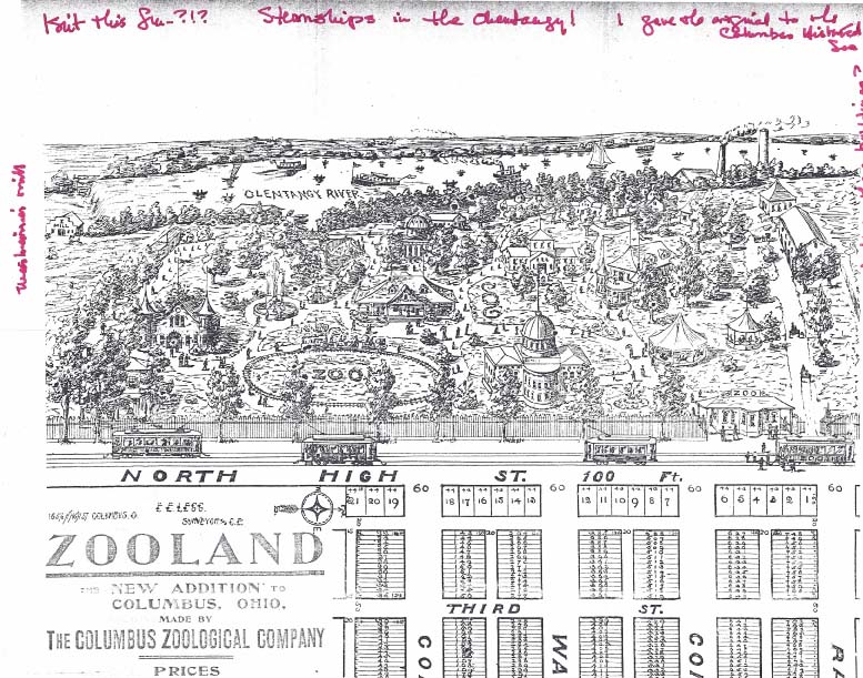
Also linked here is a image/map of the old zoo, courtesy of Mary Rodgers of the Clintonville Historical Society.
New Posts December 2013
 Until today, I’ve arranged material on this web site roughly in chronological order; information about earlier events at the top, and more recent history has been put at the end of this web site. Arranging the listings this was is quite a bit of labor, though, so as of this month, I’m throwing in the towel. From now on, new postings will be put on the front page, willynilly, regardless of their era.
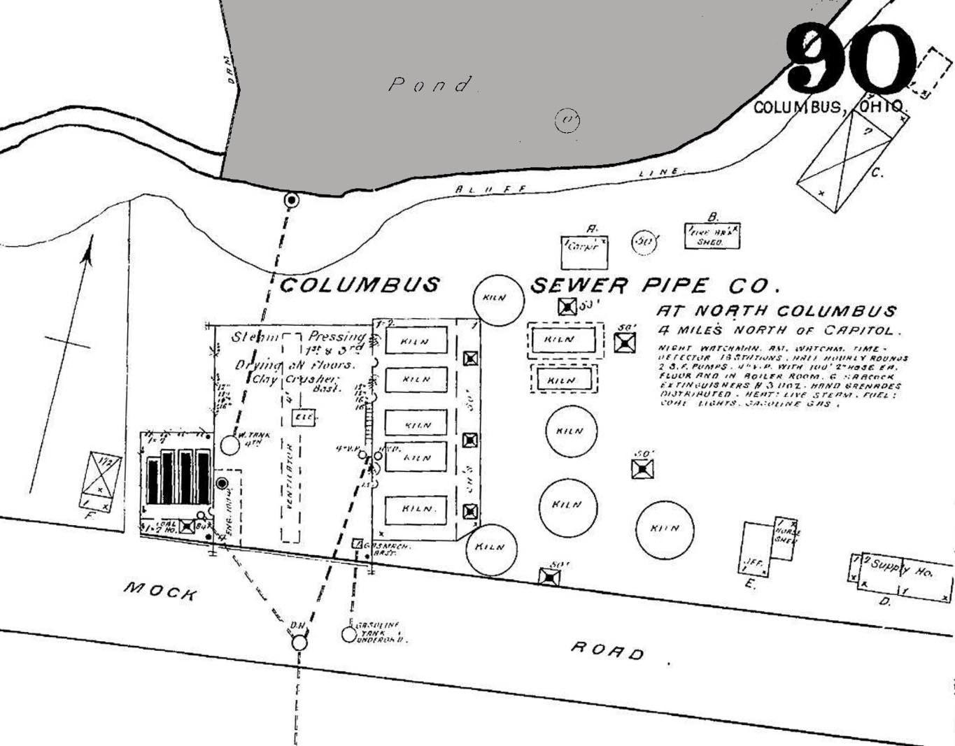
Sewer pipe factory, and The Mystery of the Pond
John Krygier found a few maps that he was kind enough to share with us: 3 Sanborn maps of the sewer pipe factory (and later, brick yard) formerly occupying the area where old North High currently sits at 100 Arcadia. Interestingly, the ravine behind the factory was apparently dammed, making a significant (and the only?) pond in Clintonville (not sure if the one in Whetstone counts). John requests that if anyone knows of any other sources documenting this pond, to let him know. You can do that by commenting on this post and I will send it along to John.
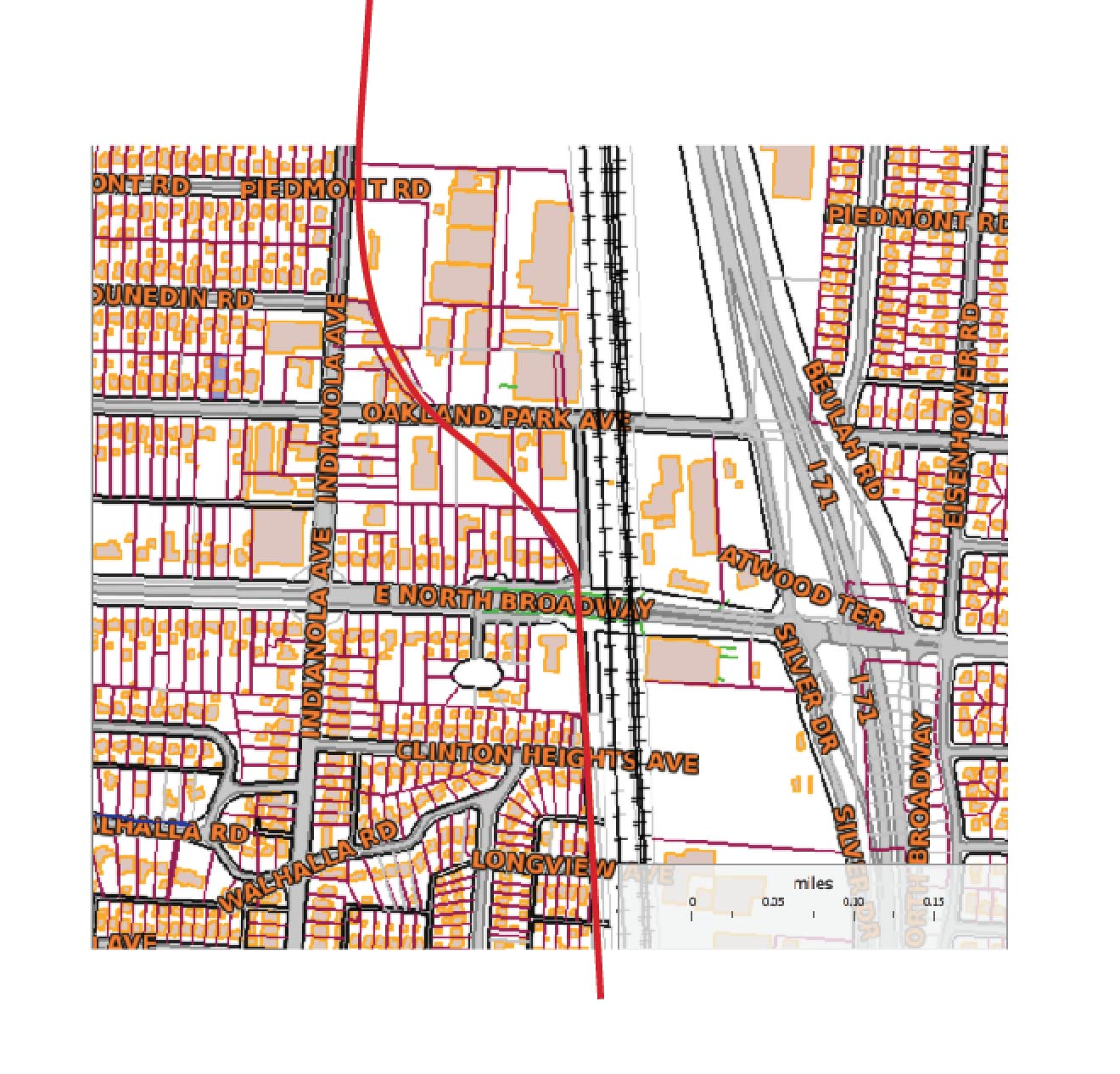
John also found a map showing the rail grade that connected the sewer pipe factory to the main RR line to the east. The interurban (Columbus, Marion and Delaware) used part of that spur (north of Glen Echo Park) as a bypass.
This Worthington Bypass went from Indianola Ave, east along the top of Glen Echo, then north up what is now the alley along the RR track, then curved west at North Broadway over to and running parallel along Indianola. This curve is preserved in some of the lots around Oakland Park–in particular, the odd orientation of the IndiaOak Tavern is the result of it being built on a curved parcel, part of the old RR right of way. A map of current parcels (with the approximate route of the RR grade) is also attached.
There are 7 photos of this Worthington bypass around the time it was built, showing the eastern end of C-ville at the time, at this web site.
Thanks, John!
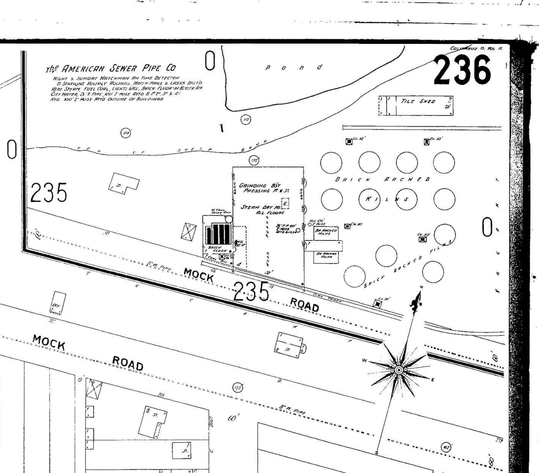
(Photos courtesy of John Krygier)
Flora Armbruster
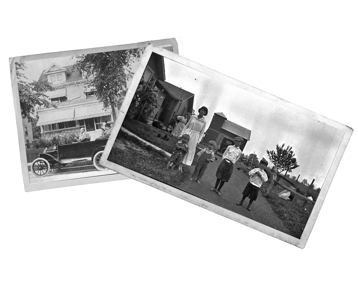
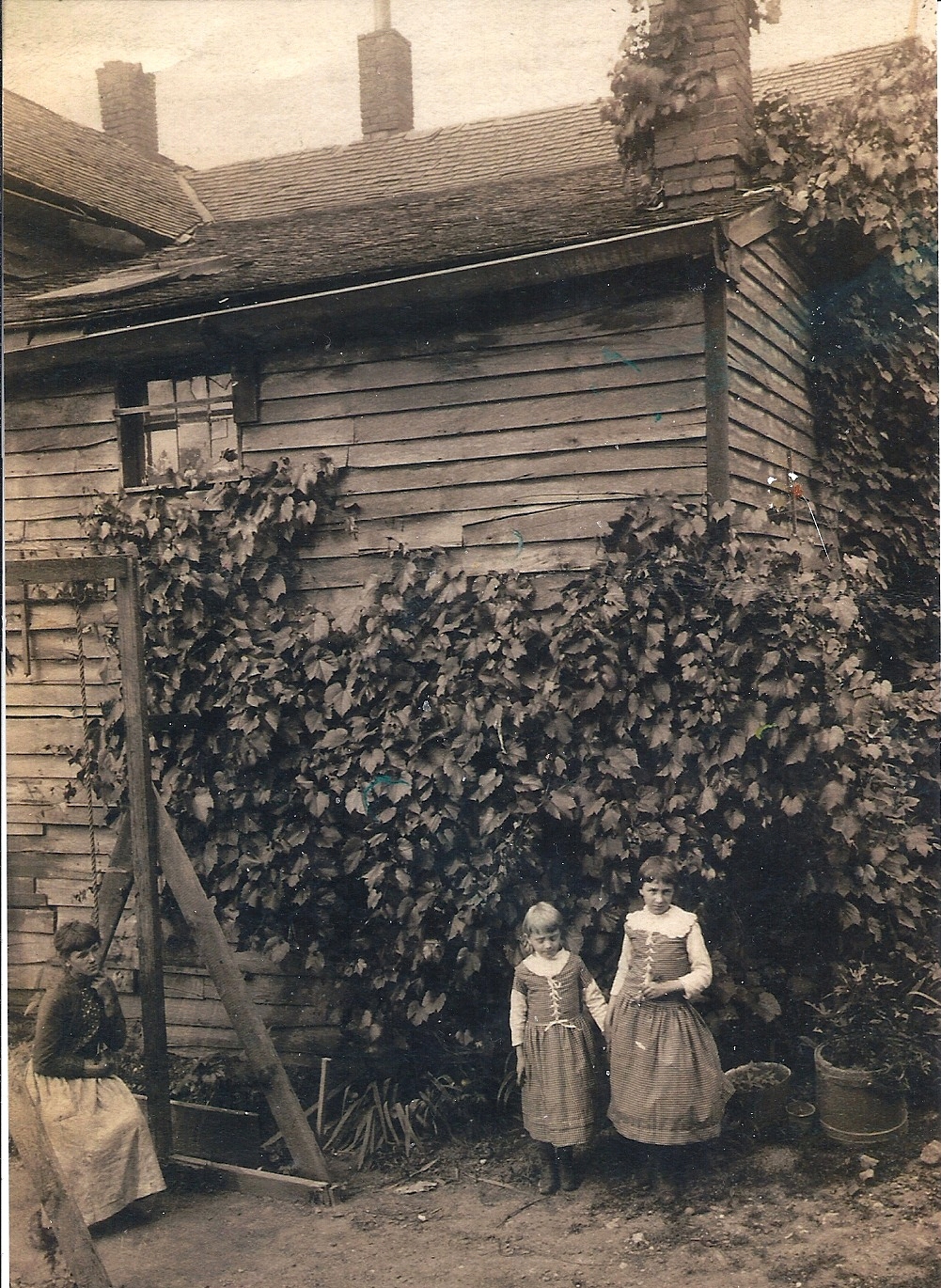 Leeann Faust has graciously shared an additional photograph of her family. This photo is of Rosa, Pauline and Flora Armbruster.
Leeann and her cousin David believe the photo was most likely taken at the house at 3100 North High Street but where and what the building–which looks the be rather rough construction–is, is not known. Leeann ponders, “Could it be the barn? That was where the house is that faces California stands today (on the east side of the side driveway). It could also be a storage building. We were looking at the things in the background. If it is the barn it might have been what was north of the house or if they were at the ends east or west. We know the barn faced the house so it couldn’t have be what was south. If it’s not the barn, we don’t know it’s position.”
If anyone has any guesses, please pass them on!
For additional photos, search “3100 North High” or “Armbruster” on this web site.
Graveyard at Armbruster home, AKA Clinton Chapel
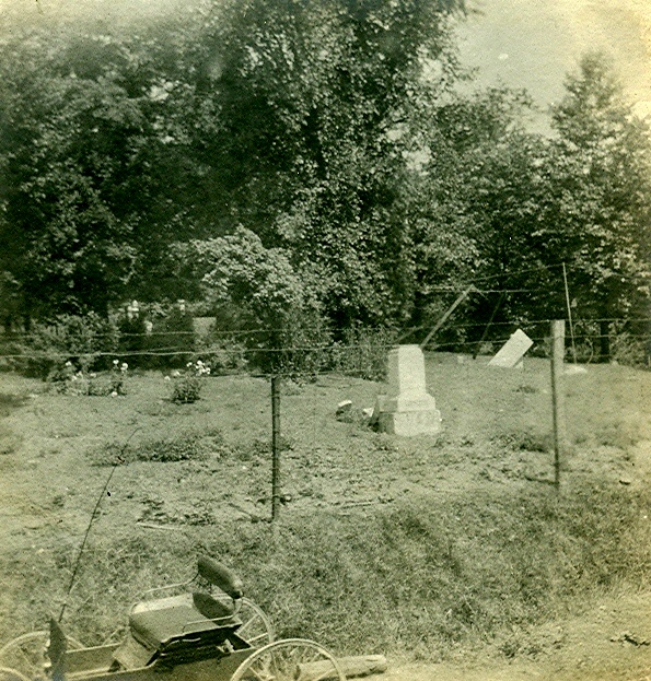 More fabulous pix from Leeann Faust of her ancestors’ home at 3100 North High Street. This was originally the site of Clinton Chapel, subsequently modified to make a residence for Mathias Armbruster; the building then became a funeral home and at the time of this update, the building is a day-care center. These photos show the old graveyard which was behind the house, as well as the lion with Olentangy Park in the distance. The graves were eventually moved, predominately to Union Cemetery.
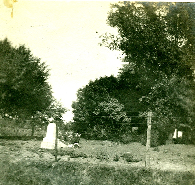

For additional photos, search “3100 North High” or “Armbruster” on this web site.
(Photos courtesy of Leeann Faust)
Old Olentangy Park picture
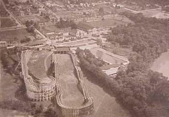 What a terrific picture of Olentangy park, courtesy of Peg Steigerwald. She would like to know what the ride is
at the top left corner of the photo is–not the larger slide water ride, but more of a love canal type covered ride. Anyone know? (Photo courtesy of Peg Steigerwald)