Sewer pipe factory, and The Mystery of the Pond
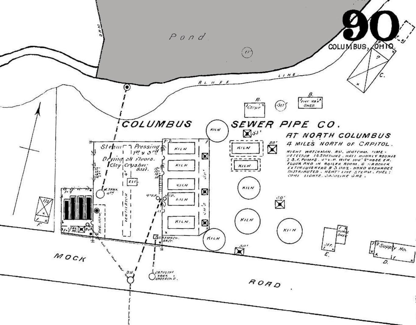
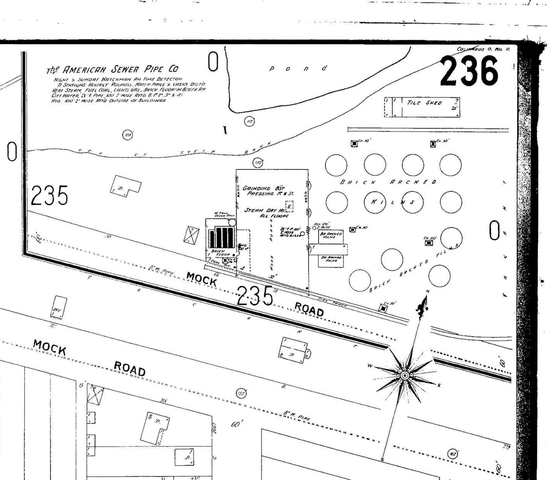
 John Krygier found a few maps that he was kind enough to share with us: 3 Sanborn maps of the sewer pipe factory (and later, brick yard) formerly occupying the area where old North High currently sits at 100 Arcadia. Interestingly, the ravine behind the factory was apparently dammed, making a significant (and the only?) pond in Clintonville (not sure if the one in Whetstone counts). John requests that if anyone knows of any other sources documenting this pond, to let him know. You can do that by commenting on this post and I will send it along to John.
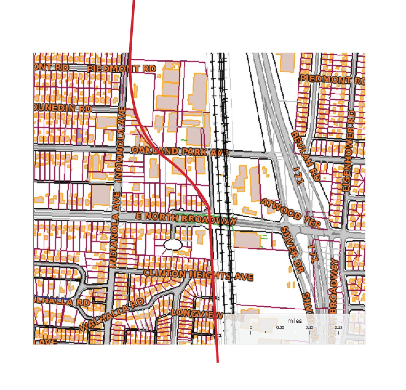
John also found a map showing the rail grade that connected the sewer pipe factory to the main RR line to the east. The interurban (Columbus, Marion and Delaware) used part of that spur (north of Glen Echo Park) as a bypass.
This Worthington Bypass went from Indianola Ave, east along the top of Glen Echo, then north up what is now the alley along the RR track, then curved west at North Broadway over to and running parallel along Indianola. This curve is preserved in some of the lots around Oakland Park–in particular, the odd orientation of the IndiaOak Tavern is the result of it being built on a curved parcel, part of the old RR right of way. A map of current parcels (with the approximate route of the RR grade) is also attached.
There are 7 photos of this Worthington bypass around the time it was built, showing the eastern end of C-ville at the time, at this web site.
Thanks, John!
(Photos courtesy of John Krygier)
Tags: Maps


December 30th, 2013 at 12:19 pm
This is interesting. The church I belong to meets in the school building on this site. I used to live on E. Kelso Rd. when I first moved to Clintonville. I didn’t know that Arcadia used to be Mock Rd. When was it renamed? Thanks!
February 19th, 2016 at 7:41 pm
Detailed studies of old area maps are very revealing. Boundaries were drawn by railroad lines, waterways and major right of ways that have changed significantly over the years.
Often, crossing the railroad , put one in a different Township, thus different road names.
Hudson St. extended from the Olentangy, east to the RR tracks. Mock Rd. Extended east from there, to Sunbury Rd (note the Hudson St. RR viaduct was built at the same time as I-71 in 1957.
Maps also show Rathbone Av west of the RR tracks and Morse Rd. to the east
When I-71 was being built, many changes were made..
Oakland Park was once the main East/West route over the RR.
E. North Broadway never crossed and was extended only after construction of 71 was complete. .
Don,t know for a fact, but it would make sense that routes were simplified…Just to say, imagine exit signs as you travel north on 71…Hudson/Mock, Oakland Pk/E. N. Broadway, Morse/Rathbone…Could’ve been (?)
February 19th, 2016 at 7:53 pm
The mystery of the pond is intriguing. If anyone could recall when the massive concrete culvert behind Tim Hortons was built, that may shed some light. Always water in the creek in Glen Echo park east of Indianola, yet always dry as a bone to the west…I do know from my father’s accounts of the area, that Glen Echo Rd went all the way from Hudson to the south, under Arcadia to the north and ended in the park.