Maps Maps Maps
Here are some cool links for old maps:
City of Columbus Planning Maps, Historic Maps.
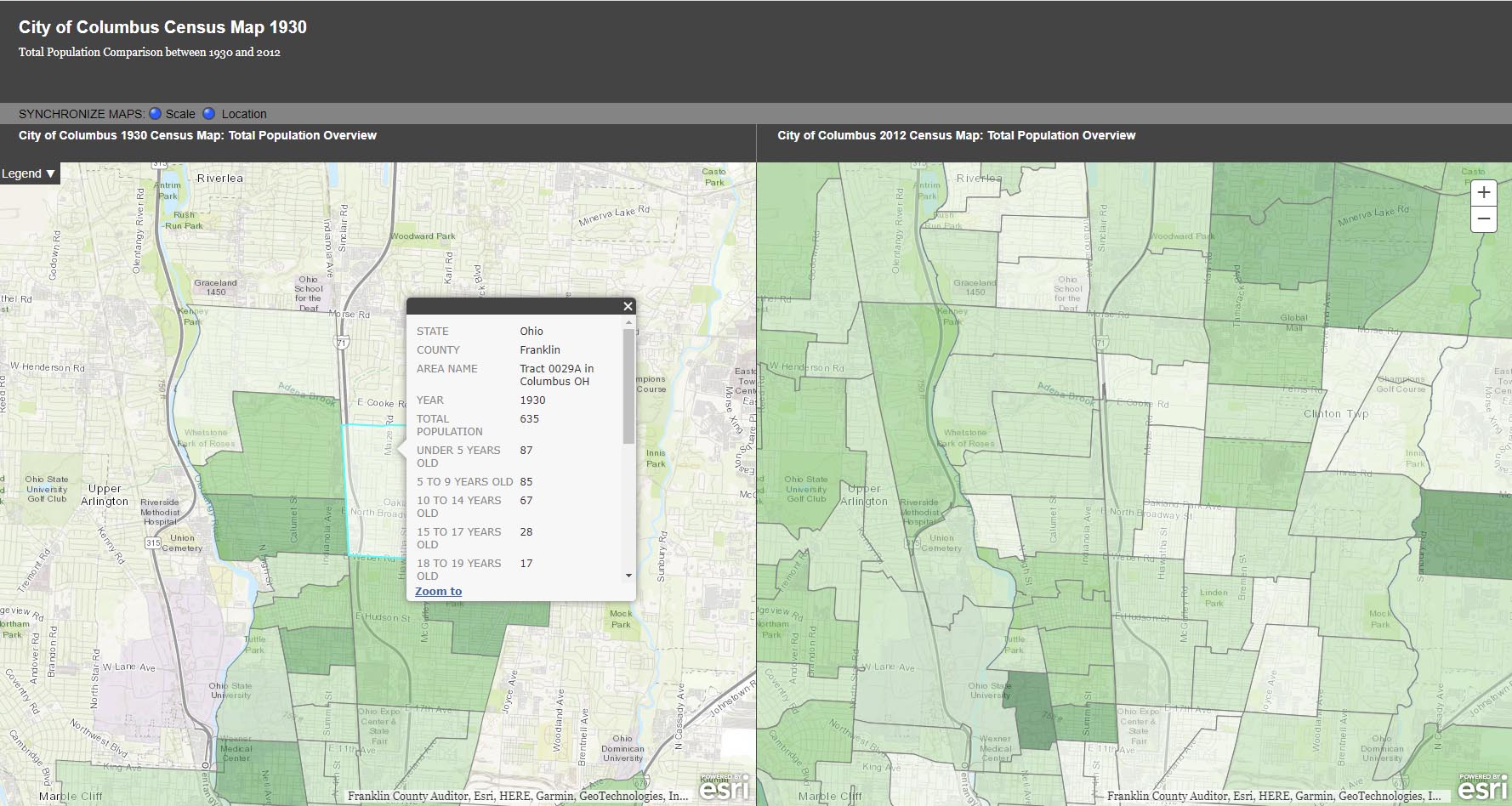
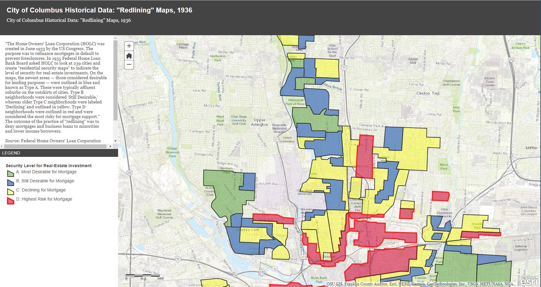
The City of Columbus’ web site gives us plenty of maps and data to play with, from Census demographic changes to despicable redlining and more. Check out especially the “City of Columbus Historic Panoramic Images, 1922,” which is based on a 1922 Ohio State University masters thesis by Forest Ira Blanchard. “Blanchard, inspired by the Chicago School of Sociology, sought to study the racial and ethnic composition of the city, with a particular focus on the role of transportation (railroads, roads) in shaping the urban landscape. Source: Forest Ira Blanchard, An Introduction to the Economic and Social Geography of Columbus, Ohio. Thesis (M.A.), Ohio State University, 1922.”
Columbus Metropolitan Library’s Columbus and Ohio Map Collection. If you haven’t donated to the library yet, now’s the time! It and and it’s staff are such great resources.
Sanborn Maps for Franklin County (scroll down to see Columbus). This is a Library of Congress site.
USGS Historical Topographic Map Explorer allows you to specify a place you want to explore, then click on a location to see its historical maps.
Prolific programmer Randy Majors has produced several products of interest, including his Historical U.S. Counties Map Tool and Auto-Checker Extension. He has also created a couple of video walkthroughs of a couple of the the software tools he has created. I recommend you view them in order, as understanding the Historical U.S. Counties map tool will help you have better success with using the Auto-Checker chrome extension.
Old Maps Online OldMapsOnline.org indexes over 400,000 maps, thanks to the archives and libraries that were open to the idea and provided their online content.
Do you know of other map resources? Let me know and I will add them to this post.