

The Loren House
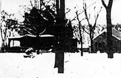 I also found a handwritten history that said that this was the first house built on North Broadway and was lived in, or owned by, someone named Loren. I do not recognize the house—do you? (This very poor image was taken from a photocopy of a microfilm.)
According to the 1896-97 city directory, there was also a Jeremiah C. Loren (motorman) living 1 building north of North Broadway on the east side of North High Street.
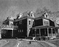
Mary Rodgers (resident of East North Broadway who has been researching the houses along East North Broadway) believes this is a picture of 625 East North Broadway, a house which was in the Broadway Villa subdivision and which I have written about here. It was lived in by the MacIntosh family.
 East North Broadway was developed by the Loren and Dennison company in 1897; it was designed to be a posh neighborhood, each house on a 1-acre plot of land. It had a small railroad depot and post office at North Broadway’s east end at the Big Four Railroad track. This house at 242 North Broadway Avenue was the second house built in the subdivision. (From Business First magazine)
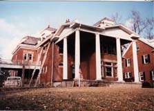 242 East North Broadway was renovated beautifully by owner Gary Means. The care with which he selected materials and kept true to the house’s original design takes my breath away. The house has not always been so lovely. For several years–prior to the present owner–this (to the right) is what it looked like.
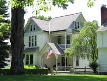 My book, Clintonville and Beechwold, page 19, shows an image of East North Broadway, looking east toward Indianola Avenue in the late 1800s The large house to the right of the photograph (south side of North Broadway) still exists at 489 East North Broadway (top photo).
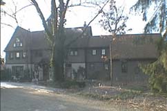
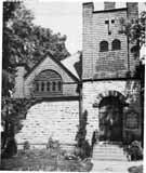 All the literature for St. James Episcopal Church states that it was organized in 1881, and that church members met in local schools before they had their own church building. I admit to being skeptical of that date and believe 1891—when James Loren began developing East North Broadway and donated a lot on Beech Hill Avenue (now called Calumet Street) for the church–is nearer to the mark. Some sundry facts about this, the oldest continually running Clintonville church:

