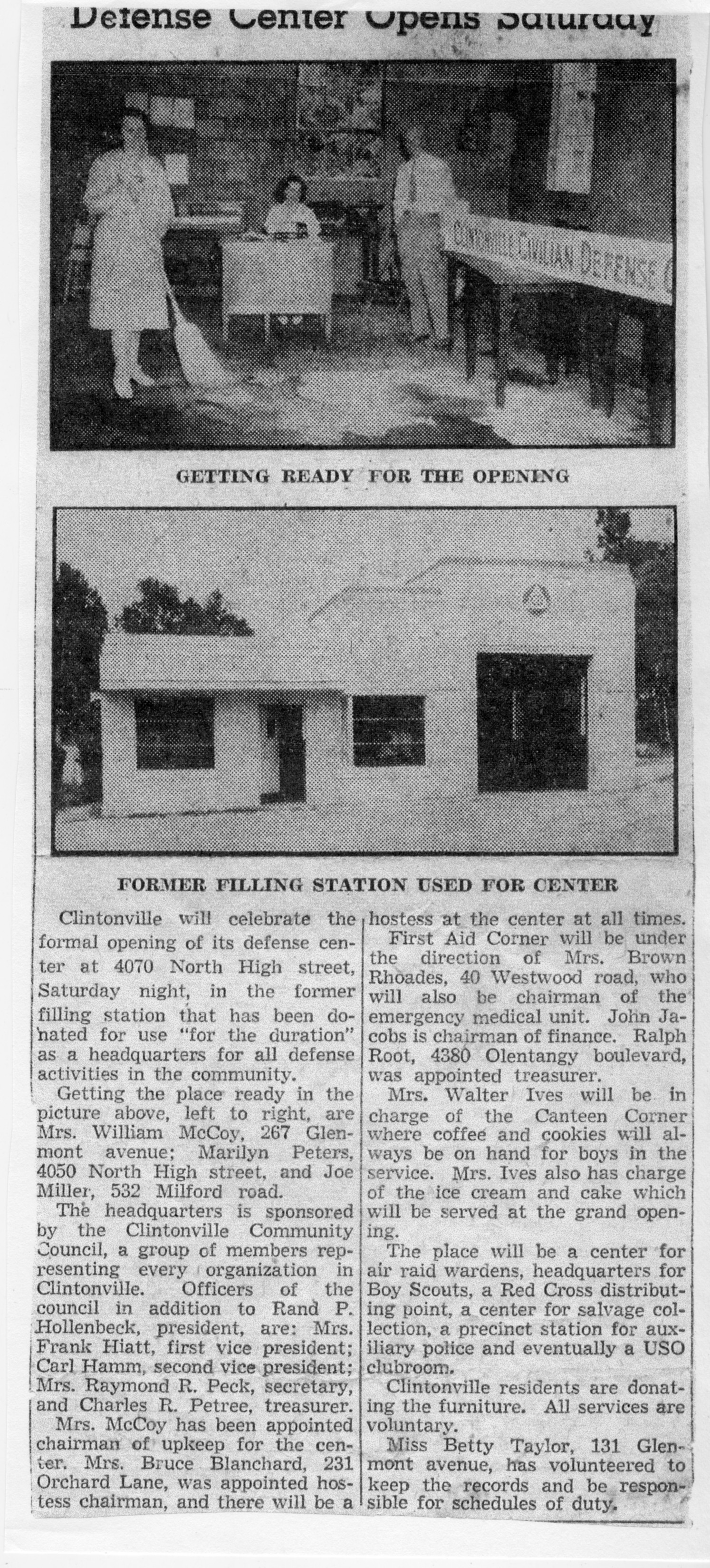
Defense Center
Wednesday, November 11th, 2015At a presentation I gave on the History of Clintonville, someone handed my husband this news item about the opening of the Defense Center in a former filling station at 4070 North High Street at the corner of Glenmont and North High Street in 1942.
 The Clintonville Community Council, a group of members representing every organization in Clintonville, sponsored the center. It was to be a center for air raid services, a headquarters for Boy Scouts, a Red Cross distribution point, a center for salvage collection, a precinct station for auxiliary police and eventually a USO clubroom. It included a first aid corner, and a canteen offering coffee and cookies.

In this picture, Mrs. William McCoy, Marilyn Peters, and Joe Miller are getting the place ready.
There is another photo here.
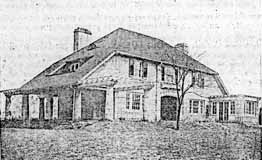 “The natural beauty of these lands would inspire even one not familiar with the business of platting of allotments. The elevation of this tract is nearly 920 feet above sea level. The middle section of these lands slope both east and west and to the south, thus giving the sunny side of the hill in winter and the shady side in Summer. The view from the top of the hill is the most magnificent and inspiring sight in or around Columbus. The rolling valley of the Olentangy River, dotted with beautiful forest trees, bungalows and other types of homes, show a real masterpiece of Nature’s Handiwork. Back of the beautiful valley the rising hills continue for miles and miles. The view in any direction from this beautiful location is almost without bounds…This new tract will be known as the Dominion Park Addition.” –from The Dominion Land Company Columbus Home News, May 1913, Volume 1 Number 2.
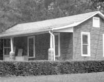 This house at 200 Glenmont is now gone, but it originally belonged to Sarah Breunig and her husband. Sarah moved to Clintonville as a young wife, before Glenmont was paved and before indoor plumbing. Sarah became one of the original community leaders of the Overbrook area. Sarah was a founding and active member in the Maple Grove Methodist Church, the Glenmont Community Club, Navy Mothers, and the Clintonville Women’s Club. She became the first female president of the Glenmont Community Club in 1968. (Photo courtesy of the Kerchner family)
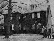 The Glenmont Community Club first met on March 2, 1921 at 45 Glenmont to “discuss improvements pertinent to the community.” It met at the Stella Wilson home; Stella was head of the science department of the old High School of Commerce (later known as Central High School) and had purchased the house in 1920 at the age of 58. Miss Wilson served as secretary and remained a primary force in the Glenmont Community Club until her death. Stella’s sister Ida was a physician; Ida acquired the house in the 1930s after Stella died. (Photo courtesy of the Kerchner family)
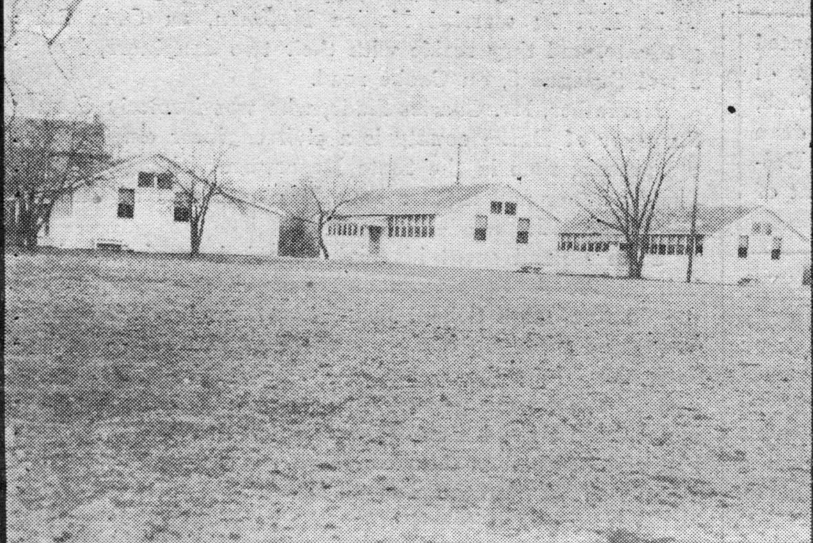
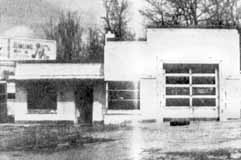 Because of gas rationing during World War II, many gas stations closed. In 1942, Clintonville Community Council (an umbrella group of Clintonville’s organizations) transformed this vacant gas station at
 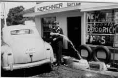 In 1948, the garage on the northeast corner of Glenmont and High that had been used as a World War II Civilian Defense Center was purchased by Joseph Kerchner. His brother George soon joined him. The brothers ran the Sohio Kerchner Brothers garage and filling station from until 1950. (Photo courtesy of the Kerchner family)