« Return to Clintonville History home page »

‘Transportation’ Category

Under Indianola

Friday, June 15th, 2018

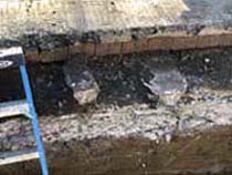
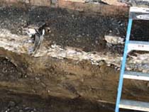
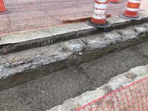
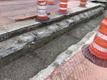
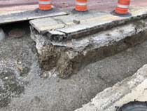
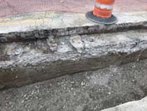
John Krygier recently sent me the following photos (shown across then down), taken May 2018, with accompanying information:


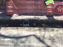
When the City contractor dug down to put the new median (with trees, plants) on Indianola Ave. by Studio35, I took a few photos of the road subsurface and they can be found here.

The construction of the road was rather interesting. Like many other Clintonville streets, Indianola has brick
pavers under the asphalt.

If you look at the photos you will notice that train rails are running perpendicular to the road, and seem to have been used to reinforce the road from below…

I’m wondering if the rails were scrapped from the rail spur that came in from the main line, through Glen Echo (the north side of the ravine) to the old sewer pipe factory (now the site of Columbus International High School).

The cross-section of the roads seems to be (from top down):

    Asphalt (newer)
    Pavers
    Concrete
    Soil

Also, here is a PDF about early 20th century street construction in Cleveland, which seems similar to our city streets constructed at the time.

And here is an article about resurfacing roads in Columbus.

Thanks John!
Calumet Street Viaduct

Thursday, February 15th, 2018

A nice image of the Calumet Street Viaduct i.e. the Glen Echo / Calumet Street bridge. Elford Company built the bridge around 1924. The photo was taken from the area where the scoreboard on football field of the high school (formerly North High) is located. You can see some houses in the background, which are along Olentangy Street east of Calumet. [Thanks to John Krygier for sending this along to us.]

And here is the view of those houses today, using September 2016 Google Streetview.

Bower & Co. General Store & Family

Tuesday, September 15th, 2015

Jim Drake recently contributed these wonderful photos and family histories of the Bower (Weber) family.

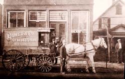
Eda Weber Bower and her spouse, Henry G. Bower owned and operated the Bower & Company General Store at 2643 North High St. The photo to the left shows the store’s delivery wagon and, at the right of the image, a section of the Bower family home at 26 East Duncan Street.

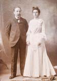
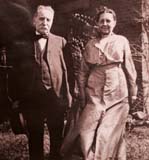
This photo is the 1901 wedding portrait of Eda Weber (1869-1951), of the historic Frederick Weber family, and Henry Bower (1856-1935). They were married on January 1, 1901.

This photo was taken of the Bowers in 1934. In addition to his civic activities, Henry Bower was a founder and principal stockholder in the Northern Savings Bank (which eventually became part of the Huntington Bank system).

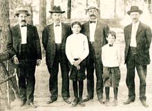
John J. Bower, one of Henry Bower’s brothers, was initially a partner in the general store, but eventually opened a hardware store on the southeast corner of Duncan and High streets. The Bower brothers are shown in this photo (left to right): Ernest E. Bower, Henry G. Bower, Owen Bower (son of Ernest E.), John J. Bower, his son Everett Bower, and Charles Bower.

Although Henry Bower had hoped to have at least one son to inherit the general store, he fathered five daughters instead. After his first daughter, Anna, was born, he pre-selected a male name for each successive child, but in every instance he had to opt for a female form of the name.

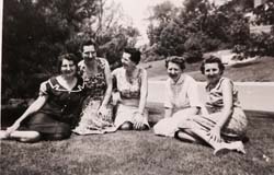
Consequently, “Albert Bower” became “Alice Bower,” “George” became “Georgia” Bower, “Henry” became “Henrietta,” and “Wilbur” became “Wilda” Bower. In this 1960 snapshot, the five daughters are arranged in their birth order from left to right: Anna Bower Mylander, Alice Bower Jesson, Georgia Bower O’Brien, Henrietta Bower Kuntz, and Wilda Bower Drake.

Of the five Bower daughters, Alice (Mrs. Frederick) Jesson had a long and successful career as Director of Restaurants and Cafeterias of the F. & R. Lazarus Company.

(Photos and write-up courtesy of Jim Drake) Note: there is one more image of the Bowers’ cart here.

Sewer pipe factory, and The Mystery of the Pond

Thursday, December 26th, 2013

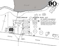
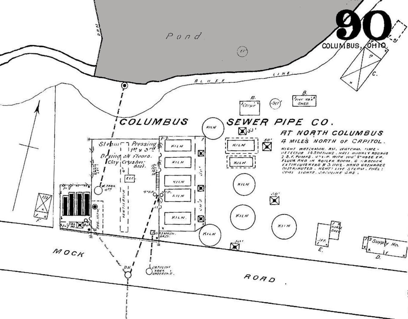
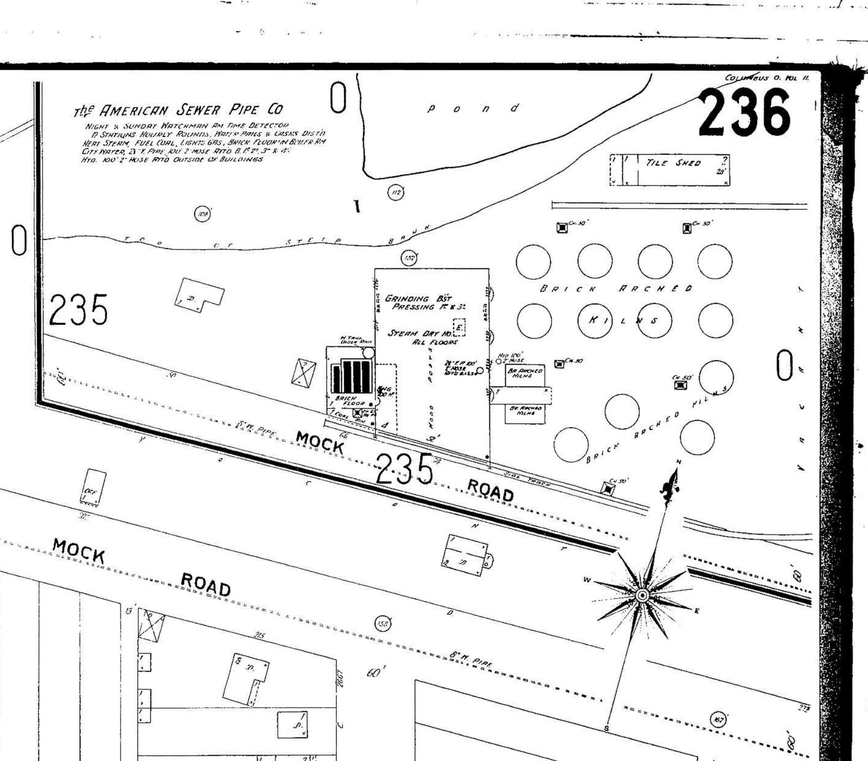
John Krygier found a few maps that he was kind enough to share with us: 3 Sanborn maps of the sewer pipe factory (and later, brick yard) formerly occupying the area where old North High currently sits at 100 Arcadia. Interestingly, the ravine behind the factory was apparently dammed, making a significant (and the only?) pond in Clintonville (not sure if the one in Whetstone counts). John requests that if anyone knows of any other sources documenting this pond, to let him know. You can do that by commenting on this post and I will send it along to John.

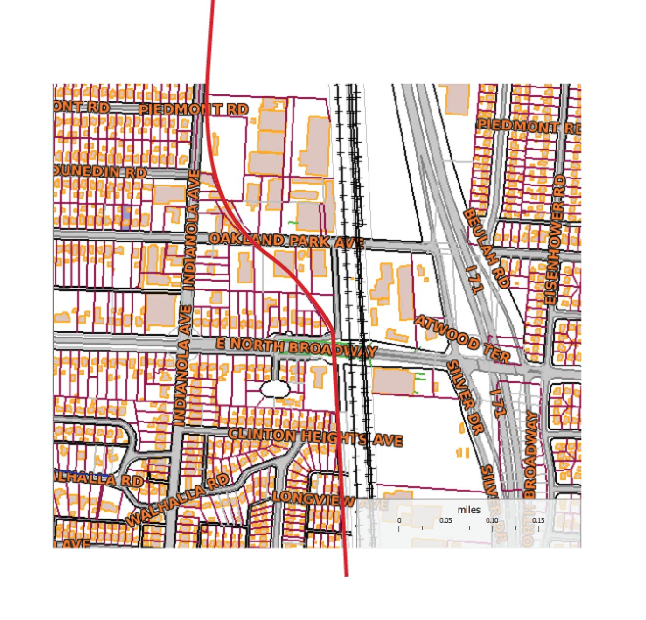
John also found a map showing the rail grade that connected the sewer pipe factory to the main RR line to the east. The interurban (Columbus, Marion and Delaware) used part of that spur (north of Glen Echo Park) as a bypass.
This Worthington Bypass went from Indianola Ave, east along the top of Glen Echo, then north up what is now the alley along the RR track, then curved west at North Broadway over to and running parallel along Indianola. This curve is preserved in some of the lots around Oakland Park–in particular, the odd orientation of the IndiaOak Tavern is the result of it being built on a curved parcel, part of the old RR right of way. A map of current parcels (with the approximate route of the RR grade) is also attached.

There are 7 photos of this Worthington bypass around the time it was built, showing the eastern end of C-ville at the time, at this web site.

Thanks, John!

(Photos courtesy of John Krygier)

Train Wreck

Friday, October 10th, 2008

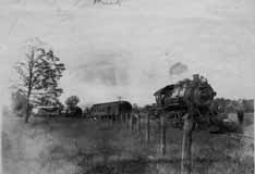
This is a train wreck that occurred in 1880 north of Hudson, at the Big Four Railroad tracks. (Photo courtesy of Judy Cohen)

Dodridge Bridge

Friday, October 10th, 2008

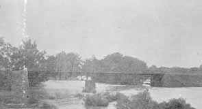
As my book shows, there was once a covered bridge over the Olentangy River at Dodridge Road. The Dodridge covered bridge was replaced by a truss bridge built by the Columbus Bridge Company. This picture shows the replacement bridge in 1890. Fishing from the bridge was a favorite activity for many 20th century Clintonville residents. It was a lovely river, and crappy and small mouth bass abounded. (Photo courtesy of Columbus Metropolitan Libraries)
East North Broadway

Friday, October 10th, 2008

According to a 1999 Booster article by Anne Barry, in 1923, East North Broadway was the only paved street north of Fifth Avenue. It was paved with Hallwood Block, and the sidewalks were paved with brick as well. Old maps show a traffic circle at the intersection of East North Broadway and Beech Hill Avenue/Calumet Street, which appears to have been put there for aesthetic reasons. I believe half of this circle remained as late as 1985.

The Jones’ of North Columbus

Friday, October 3rd, 2008

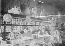
C. F. Jones Grocer used to be located at 2581 North High Street, where Schreiner’s Hardware Store is now. This image was taken around 1904 inside of the Jones Grocery Store. Shown are sons Charles and Clarence with their father Frank Jones.
.

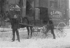
This image of their delivery wagon dates from 1909. Charles Jones is besides the wagon and the young man holding the horse is unknown. They are standing in front of their store.
.

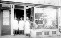
This photo of the C. F. Jones Grocer Co. was taken around 1916. Shown are Charles, Clarence, and their father Frank Jones.
.

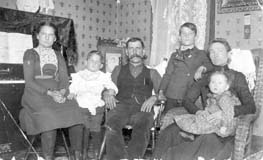
This is a picture of the C. Frank Jones family in their home at 2665 Adams Avenue, Columbus, circa 1900. Bertha May Jones Aurand (1889-1934), Charles M. Jones (1895-1956), C. Frank Jones (1861-1937), Clarence A. Jones (1891-1950), Miriam Tozer Jones (1869-1941), Gladys A. Jones Reiger (1899-1930). (Photos courtesy of Frank Jones.)

Kellar Barns & Livery Stable

Friday, October 3rd, 2008

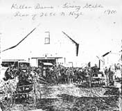
Kellar Barns & Livery Stable, rear of 2650 North High Street, in 1900. (Photocopy courtesy of Frank Jones.)

Topographic Map, 1903

Friday, October 3rd, 2008

This 1903 topographic map shows the road configuration of the intersection of East North Broadway and High Streets. To orient yourself, remember that there were no bridges across the Olentangy River between Dodridge and Henderson, so Dodridge is the southern bridge and Henderson next bridge north of that. Calumet Street did not exist, and many other side streets had as yet to be developed, or were called by different names than they are today.